
Mori Atlas logo
Natural monumentUrbánkův palouk

A vital highland refuge preserving traditional peat meadow ecosystems and historical biodiversity.

Urbánkův palouk Natural Monument: Mapping the Protected Meadow Landscapes of the Vysočina Region

Urbánkův palouk represents a significant natural monument situated within the rolling topography of the Czech-Moravian Highlands. This protected area safeguards rare wet and peat-influenced meadow habitats that remain essential for regional highland flora. By examining the mapped boundaries and local terrain, observers can appreciate how this site functions as a managed gene pool within the broader landscape of Kraj Vysočina.

wet meadowpeat meadowmeadow reservenatural monumentIUCN Category IVVysočina Region
A flat vector illustration of a mountain range with a waterfall flowing down a cliff face, surrounded by pine trees in the foreground and a meadow.

Urbánkův palouk

Natural monument

Park overview

Structured park overview, official facts, and landscape profile for Urbánkův palouk

Urbánkův palouk park facts, protected area profile, and essential visitor context

Review the core facts for Urbánkův palouk, including designation, size, terrain, visitor scale, habitats, and operating context in one park-focused overview.

About Urbánkův palouk

Urbánkův palouk is a diminutive but conservation-significant protected natural monument in the heart of the Czech-Moravian Highlands. Although it spans only about one hectare, the site is a carefully preserved fragment of habitat that has largely disappeared from the surrounding landscape. Its ecological importance lies precisely in what it is not: it is not woodland, not arable field, and not improved grassland, but rather a surviving wet meadow that retains the botanical character that once defined large parts of the region.

The protected area lies on gently undulating highland terrain near the village of Kněžice in the Jihlava district, at an elevation of around 622 to 626 meters. The bedrock consists of biotitic paragneisses and metaquartzites of the Moldanubian geological unit, which weather into hydromorphic soils such as pseudogleys and cambisols. These moisture-retaining soils are central to the site's character, supporting the wet meadow communities that define its protected value. The meadow has long been shaped by human management, and its current biodiversity is closely tied to traditional, low-intensity haymaking rather than purely natural processes.

At a national level, Urbánkův palouk belongs to the Czech system of small protected areas, specifically the category known as přírodní památka (natural monument), which is aimed at preserving locally important natural features. Within the IUCN framework, the site is classed as Category IV, a habitat and species management area. Beyond its formal status, the site also serves a strong educational and community function. It is incorporated into the Forest Nature Trail Chaloupky and has long been cared for by volunteers, continuing a tradition of grassroots conservation that began well before its official designation in 1990.

Quick facts and research context for Urbánkův palouk

Urbánkův palouk is a protected natural monument, corresponding to IUCN Category IV (habitat/species management area), located in the Jihlava district of the Vysočina Region in the Czech Republic. The site sits near the village of Kněžice, on a highland plateau at roughly 622 to 626 meters above sea level, and covers approximately 1 hectare. It was established on 1 October 1990 and is administered by the Regional Authority of the Vysočina Region.

The reserve protects a surviving patch of wet and peat-like meadows belonging to the Calthion alliance, with hydromorphic soils developed over metamorphic rocks of the Moldanubian unit. It also serves as a gene pool area for local meadow biodiversity and is linked to long-running conservation education work by local environmental groups.

Protection and recognition

Documented management scope and official designation metrics

Urbánkův Palouk Protection Status and Terrestrial Conservation Data

Terrestrial protection status and administrative records document the conservation framework governing Urbánkův palouk. Conservation data and official designations establish the baseline metrics for understanding the management scope of the protected area.

Protection details

Protection scope
Terrestrial
Transboundary protection
No
Park context

Deeper park guide and search-rich context for Urbánkův palouk

Urbánkův palouk history, landscape, wildlife, and travel context

Explore Urbánkův palouk through its history, landscape character, ecosystems, wildlife, conservation priorities, cultural context, and seasonal travel timing in a structured park guide built for atlas discovery and search intent.

Why Urbánkův palouk stands out

Urbánkův palouk is best known for preserving a tiny but ecologically valuable fragment of wet and peat-influenced meadows on the Vysočina plateau. Such meadows were once common throughout the region, but most have been lost to drainage, intensification, or abandonment, making surviving examples like this one important references for the original biodiversity of the area. The site is also notable in local conservation circles for its role as a gene pool meadow and for the long-running volunteer management of the site, including seasonal hand mowing that maintains its characteristic species composition.
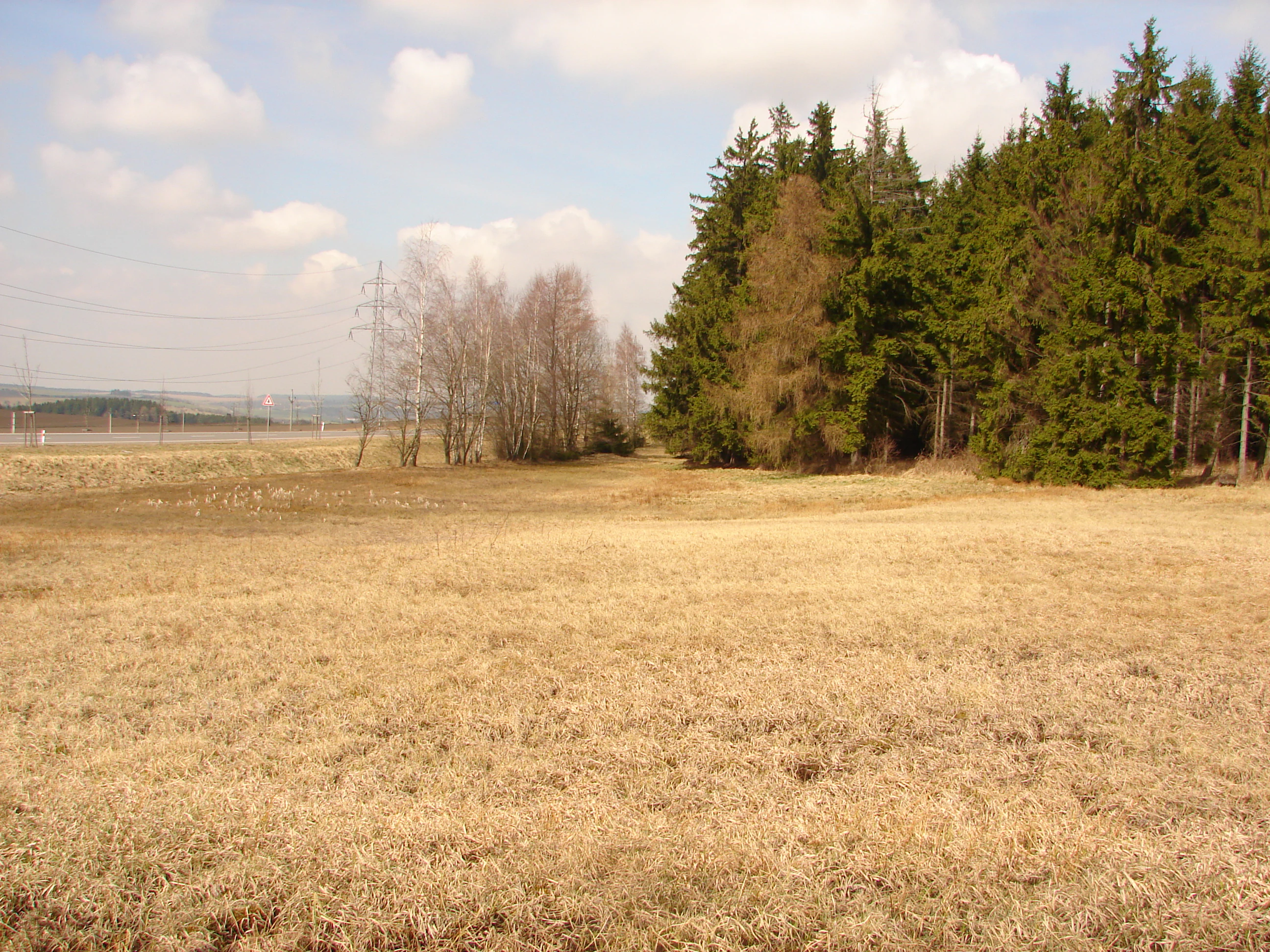
A wide, dry, grassy meadow transitions into a dense edge of coniferous forest, with a line of bare deciduous trees and power pylons visible in the distance under a partly cloudy sky.
A view of the Urbánkův palouk natural monument meadow in early spring.

Urbánkův palouk history and protected-area timeline

The conservation history of Urbánkův palouk predates its formal protection. The Czech Union for Nature Conservation (ČSOP) branch in Kněžice has been managing the meadow since 1984, years before official designation. Their work has focused on traditional hand mowing once a year, a practice that remains central to maintaining the open meadow character and its species composition.

On 7 February 1985, the meadow was formally declared a so-called Laboratory in Nature for the Young Nature Protectors group associated with the primary school in Kněžice, marking its early recognition as an outdoor learning site for local environmental education. The site was officially declared a protected natural monument on 1 October 1990 by the District National Committee in Třebíč, and responsibility for its administration was later taken over by the Regional Authority of the Vysočina Region.

Today, the protected area is part of the Forest Nature Trail Chaloupky, continuing its role as a place where local natural history, volunteer stewardship, and school-based nature education come together.

Urbánkův palouk landscape and geographic character

The landscape of Urbánkův palouk is shaped by the rolling character of the Czech-Moravian Highlands. The protected meadow lies on a highland plateau typical of the Vysočina Region, at a modest elevation of around 622 to 626 meters above sea level. The terrain is gently undulating rather than dramatic, and the protected site itself reads as a small open clearing within a broader matrix of fields, meadows, forest patches, and scattered villages.

Geologically, the area belongs to the Moldanubian unit of the Bohemian Massif. The bedrock is composed of biotitic paragneisses and metaquartzites, which have weathered into hydromorphic soils including pseudogleys and cambisols. These soils hold water for extended periods, creating conditions favorable for wet and peat-like meadow communities rather than dry grassland. The result is a small, soft, moisture-rich meadow landscape rather than a rugged or visually spectacular one, but one that captures a characteristic element of the traditional Vysočina countryside.
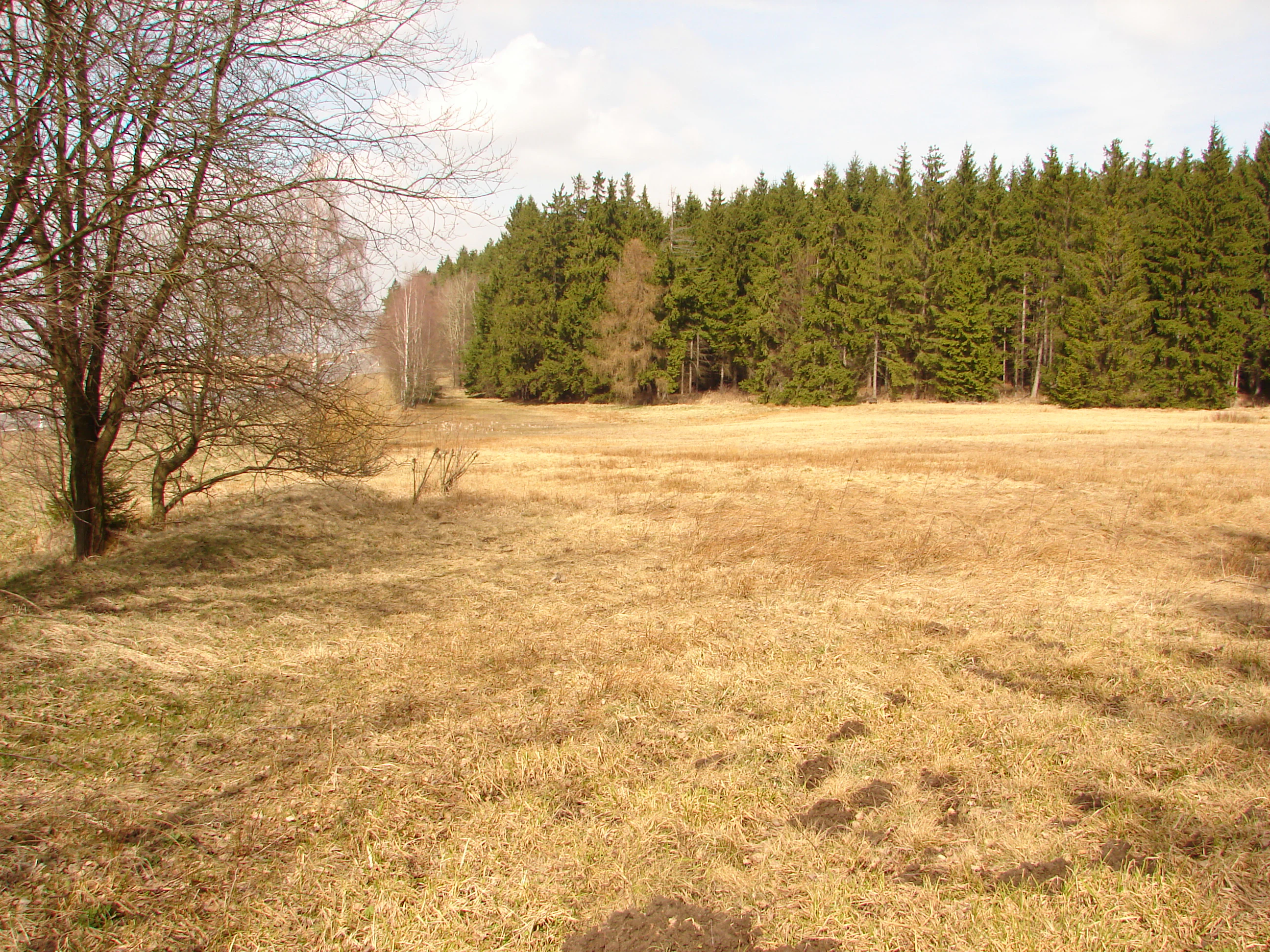
A wide view of a dry, brownish meadow bordered by a dense forest of evergreen trees under a bright sky in early spring.
A view of the open meadow at Urbánkův palouk natural monument during early spring.

Urbánkův palouk ecosystems, habitats, and plant life

Ecologically, Urbánkův palouk is defined by its surviving wet meadows belonging to the Calthion alliance. These one-cut meadows, managed by hand mowing once a year, support vegetation typical of moisture-retentive soils, including sedge-dominated turf, flowering forbs, and grasses adapted to seasonally saturated ground. The combination of hydromorphic soils and traditional low-intensity management has allowed a small but botanically rich community to persist.

Among the characteristic plants of the meadow are marsh marigold (Caltha palustris), two-valved valerian (Valeriana dioica), tufted hair-grass (Deschampsia cespitosa), black sedge (Carex nigra), carnation sedge (Carex panicea), wood anemone (Anemonoides nemorosa), and meadowsweet (Filipendula ulmaria). A particularly important species is the threatened broad-leaved marsh orchid (Dactylorhiza majalis), which is among the key reasons for the site's continued protection.

Because such meadows were once common across the Vysočina but have largely disappeared, Urbánkův palouk now serves as a small-scale refuge and gene pool area for meadow biodiversity, contributing to the long-term conservation of traditional wet meadow habitats in central Europe.
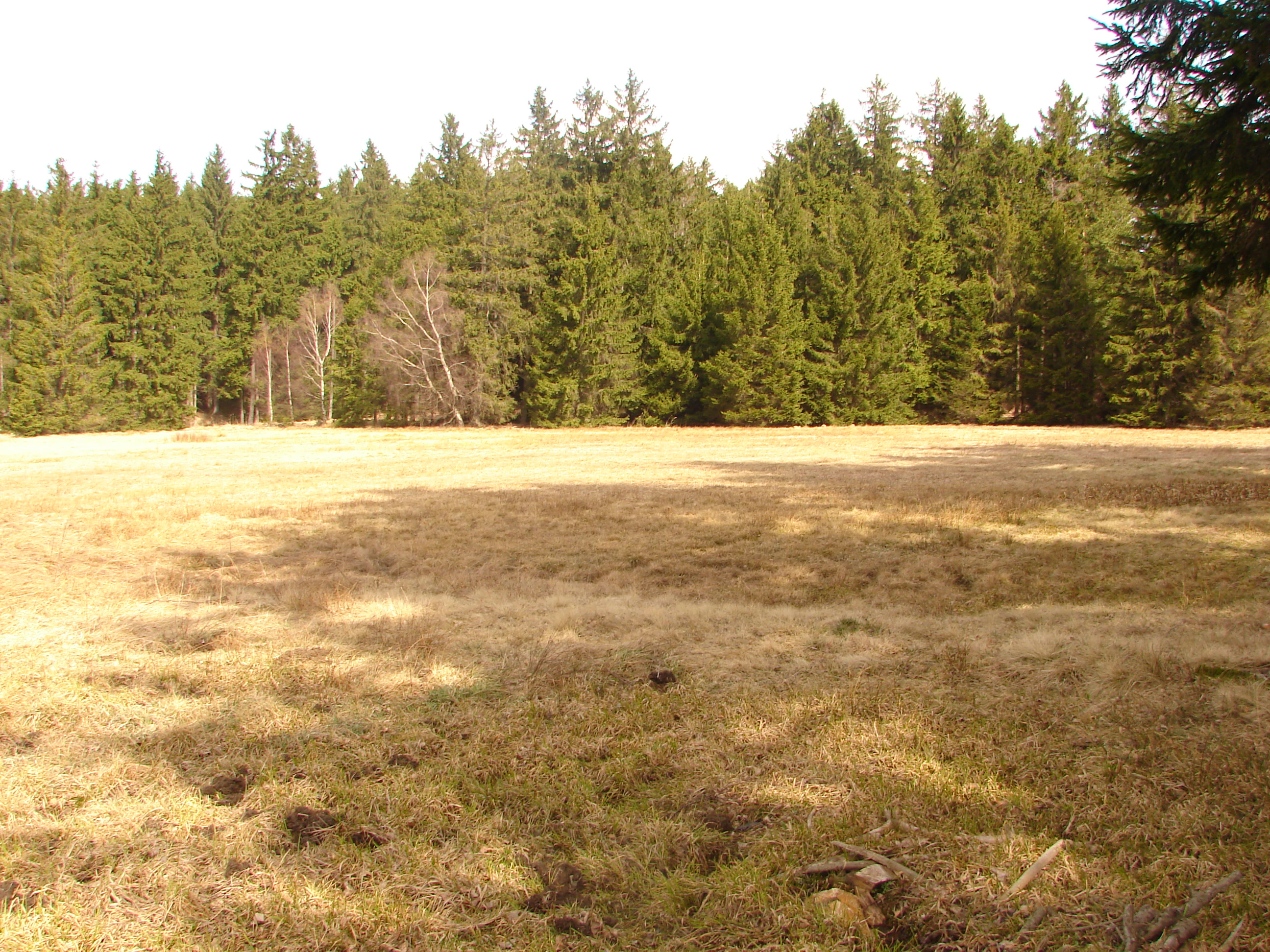
A wide, dry, golden-brown meadow bordered by a dense evergreen forest under a bright sky.
A view of the open meadow at the Urbánkův palouk nature monument in early spring.

Urbánkův palouk wildlife and species highlights

Despite its tiny size, Urbánkův palouk supports a meaningful mix of bird, mammal, and reptile species typical of well-preserved wet meadows in the region. The open, low vegetation and surrounding landscape mosaic create conditions for ground-nesting birds and small mammals that depend on damp grassland.

Birdlife includes breeding meadow pipit (Anthus pratensis), whinchat (Saxicola rubetra), and common rosefinch (Carpodacus erythrinus). According to the on-site information panel, visitors have also recorded common snipe (Gallinago gallinago) and corn bunting (Miliaria calandra), both species closely associated with extensive meadow habitats. Small mammals recorded from the site include the field vole (Microtus agrestis) and the harvest mouse (Micromys minutus), the latter of particular note for its dependence on tall herbaceous vegetation.

Reptiles are represented by the viviparous lizard (Zootoca vivipara), which favors cool and moist open habitats. Unmown sections of the meadow are intentionally retained as refuges for animals, demonstrating how the site's management explicitly balances botanical and wildlife conservation.
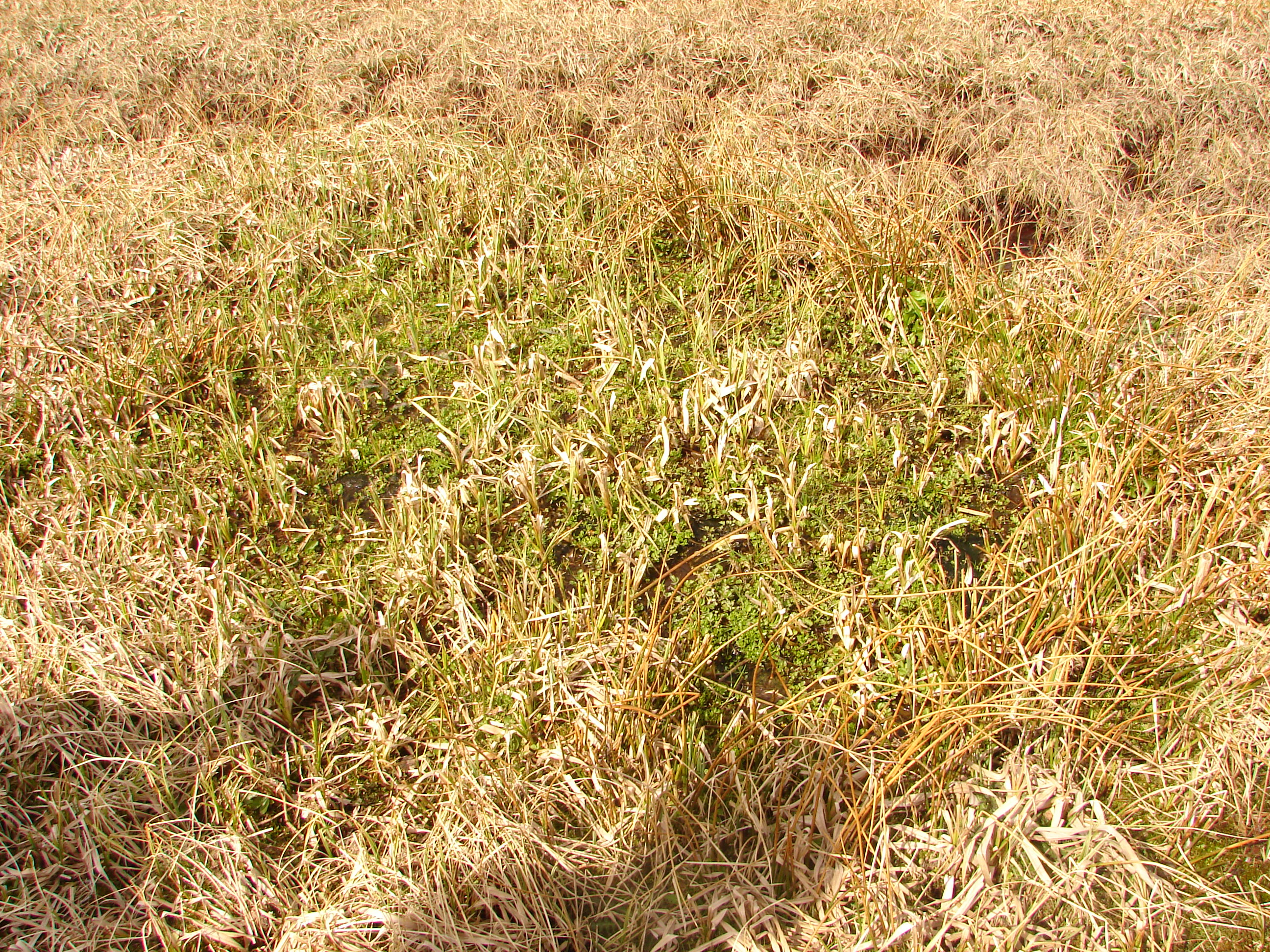
A close up view of dried, yellowed meadow grasses with a patch of vibrant green vegetation in the center, characteristic of a peat meadow.
A detailed view of the peat meadow vegetation at Urbánkův palouk Natural Monument.

Urbánkův palouk conservation status and protection priorities

Urbánkův palouk is a conservation site whose value lies in the preservation of a vanishing habitat type rather than in dramatic scenery or charismatic megafauna. Within the Czech system, it is classified as a přírodní památka (natural monument), and at the international level it falls within IUCN Category IV, recognizing its role as a habitat and species management area. Its principal objective is the long-term preservation of natural stands of peat-like meadow communities and their associated rare and threatened plant species.

Beyond species protection, the site explicitly functions as a gene pool area. By maintaining a continuously managed traditional meadow under low-intensity human use, it safeguards the genetic and ecological resources of meadow communities that dominated the local landscape in earlier centuries but have since been almost entirely lost to drainage and agricultural intensification.

The conservation model at Urbánkův palouk is also notable for the strong role of community-based stewardship, with local volunteers and naturalists having shaped its management since the 1980s, well before and after its formal designation.

Urbánkův palouk cultural meaning and human context

Urbánkův palouk sits within a rural landscape that still carries traces of the traditional Vysočina countryside, where small-scale farming, hay meadows, and forest fragments coexist. The site's history reflects the strong tradition of grassroots nature conservation in the Czech Republic, with local volunteers and school-based groups taking responsibility for its care decades before official protection.

Its role as a Laboratory in Nature for young nature protectors from Kněžice, and its later inclusion in the Forest Nature Trail Chaloupky, place it within a broader Czech heritage of using small protected sites as outdoor classrooms. The annual hand mowing, still practiced at the site, also reflects the cultural value placed on traditional rural land management as part of regional identity.

Top sights and standout views in Urbánkův palouk

Urbánkův palouk stands out as a surviving fragment of the wet and peat-influenced meadows that once defined the Vysočina Region, protecting a small but ecologically dense refuge on the highland plateau near Kněžice. It is recognized for harbor-ing threatened meadow plants such as the broad-leaved marsh orchid, and for supporting meadow-dependent birds and small wetland fauna.

The site is equally notable for its long history of community-led conservation, with volunteers managing the meadow through traditional hand mowing since 1984 and integrating it into local nature education through the Forest Nature Trail Chaloupky.

Best time to visit Urbánkův palouk

Urbánkův palouk is most rewarding to visit in late spring and early summer, when the wet meadow is at its flowering peak and characteristic species such as the broad-leaved marsh orchid, marsh marigold, and meadowsweet are most visible. Late April through early June generally offers the richest display of meadow flora and the chance to observe breeding meadow birds.

Late summer and early autumn visits can also be worthwhile for those interested in seed heads, sedge communities, and the contrast between recently mown and unmown sections. Because the site is small and largely managed on foot, visits at any time of year are best approached as quiet, low-impact nature observation rather than as a high-season destination.

Monthly climate preview

Long-term representative coordinate records for Kraj Vysočina protected terrain

Urbánkův palouk climate normals, monthly temperature and precipitation rhythm

Historical data compiled from NASA POWER measurements outline the measured annual temperature and precipitation rhythm across twelve recorded periods. Detailed monthly comparisons illustrate long-term baseline averages for this representative coordinate without forecasting live meteorological conditions.
Annual mean7 °C
-4 °C18 °C
Jan-4°
Feb-2°
Mar
Apr
May12°
Jun16°
Jul18°
Aug18°
Sep13°
Oct
Nov
Dec-2°
Warmest month
July

18.1 °C

Coolest month
January

-3.6 °C

Wettest month
July

2.9 mm/day

Driest month
February

1.3 mm/day

Park location guide

Geography guide, regional context, and park location map for Urbánkův palouk

Urbánkův palouk park geography, regions, and map view in Czechia

Understand where Urbánkův palouk sits in Czechia through a broader geographic reading of the surrounding landscape, nearby location context, and its mapped position within the national park landscape.

How Urbánkův palouk fits into Czechia

Czech Republic is a landlocked Central European country with a population of approximately 10.9 million people. The nation was established as an independent state on January 1, 1993, following the dissolution of Czechoslovakia. Its capital and largest city is Prague, with other major urban centers including Brno, Ostrava, Plzeň, and Liberec.

Wider geography shaping Urbánkův palouk in Czechia

The Czech Republic is a landlocked country in Central Europe. It is bordered by Germany to the west, Austria to the south, Poland to the northeast, and Slovakia to the southeast. The landscape is predominantly hilly, with the territory covering 78,871 square kilometers.

Map view of Urbánkův palouk

Use this park location map to pinpoint Urbánkův palouk in Czechia, understand its exact geographic position, and read its mapped placement within the surrounding landscape more clearly.

Pigeon | © OpenStreetMap contributors

Location context for Urbánkův palouk

Kraj Vysočina

Explore protected area imagery, highland plateau terrain, and rare wetland flora composition.

Urbánkův Palouk Photos and Landscape Scenery: Visualizing the Vysočina Highland Meadow Habitat

Visual documentation captures the rare wet and peat-influenced meadow habitats preserved across the highland plateau terrain of Urbánkův palouk. Photographic records help researchers examine protected landscape character, soil moisture conditions, and traditional conservation management.

A wide, dry, grassy meadow transitions into a dense edge of coniferous forest, with a line of bare deciduous trees and power pylons visible in the distance under a partly cloudy sky.

A view of a dry, dormant meadow with withered grasses bordered by a line of dark spruce trees in the background.

A wide view of a dry, brownish meadow bordered by a dense forest of evergreen trees under a bright sky in early spring.

A wide, dry, golden-brown meadow bordered by a dense evergreen forest under a bright sky.

A close up view of dried, yellowed meadow grasses with a patch of vibrant green vegetation in the center, characteristic of a peat meadow.

Park atlas

Compare regional meadow reserves and connected protected landscapes across the Vysočina highland terrain.

Exploring Parks Near Urbánkův Palouk and Surrounding Highland Protected Areas

Browse other parks near Urbánkův palouk to evaluate similar wet meadow habitats and regional highland terrain. Expanding the geographic comparison reveals broader protected areas across the surrounding countryside.
Watercolor illustration of a peaceful landscape featuring soft-colored hills, green trees, and an open foreground on a white background.
Natural monumentKraj Vysočina
About 1.4 km away#1 closest

East

Na Kopaninách Natural Monument and Protected Meadow Geography in the Vysočina Region

A vital habitat for rare Bohemian-Moravian grassland flora.

Situated at an elevation of 550 to 570 meters, Na Kopaninách represents a critical fragment of traditional rural landscape. The area consists of a small mosaic of hay meadows and communal pasture, playing a central role in national rescue programs for rare gentian populations. Its north-facing terrain and nutrient-poor soils support a specialized botanical community that highlights the importance of small-scale habitat protection.

Area
0.01 km²
Established
1986
IUCN
IV
Relief
Lowland
Watercolor painting of a forested hillside with evergreen trees and distant rolling purple mountains.
Protected landscapeJihlava District
About 22 km away#2 closest

Northwest

Přírodní park Čeřínek: Map and Protected Landscape Geography of the Jihlava District

Highland forests, granite outcrops, and peatland ecosystems

Located in the Jihlava District, Přírodní park Čeřínek offers a detailed look at the highland terrain of the Křemešnická vrchovina. The area features a mix of dense spruce woodland, prominent rocky outcrops including Přední skála, and the significant Hojkovské rašeliniště peat bog. This protected landscape serves as a regional anchor for understanding the ecological and topographical character of the Czech-Moravian Highlands.

Area
23 km²
Established
1985
Relief
Upland
Climate
Temperate
Watercolor painting of a rolling countryside scene featuring green hills, forest edges, and muted pastel tones on a white background.
Protected landscapeVysočina Region
About 25 km away#3 closest

Northeast

Přírodní park Bohdalovsko: Protected Landscape and Wetland Geography in the Vysočina Region

Highland terrain, fishpond mosaics, and protected natural corridors.

Located in the Czech Republic, Přírodní park Bohdalovsko serves as a primary example of a cultural highland landscape. The area features a remarkable concentration of ponds and peatland pockets that anchor local biodiversity, including rare aquatic species and amphibian strongholds. Its geography is characterized by rolling uplands and varied forest-field mosaics that remain integral to the regional conservation framework of the Bohemian-Moravian Highlands.

Area
60.8 km²
Established
2001
Relief
Upland
Climate
Temperate
A soft watercolor illustration of a landscape with rolling hills, a meandering stream, and wooded areas against a pale sky.
Natural monumentVysočina Region
About 27 km away#4 closest

Northeast

Rasuveň Natural Monument: Protected Forest Terrain in the Czech Vysočina Region

Mapping upland woodland and fir-beech conservation areas

Rasuveň protects a meaningful remnant of fir-beech forest in the Czech-Moravian Highlands. This natural monument, situated in the Vysočina Region, provides a quiet example of mature upland woodland conservation. Its geographic profile is defined by rolling ridges and crystalline bedrock, offering a dedicated space for observing natural forest structures within an increasingly managed agricultural landscape.

Area
0.207 km²
Established
1989
IUCN
IV
Relief
Upland
Nature reserveCzechia
About 29 km away#5 closest

Northwest

Prameniště Jankovského potoka: Protected Wetland Landscapes in the Czech Vysočina Region

An atlas exploration of highland spring-fed meadow ecosystems and conservation corridors.

Prameniště Jankovského potoka acts as a cornerstone for wetland conservation in the Vysočina Region. The site features a mosaic of nutrient-poor peat meadows and spring-fed stream corridors, providing stable habitats for endangered freshwater pearl mussels and unique highland flora. This protected area offers a clear look at the intersection of traditional meadow management and hydrological restoration in the Czech landscape.

Area
0.658 km²
Established
2018
IUCN
IV
Relief
Upland
A soft watercolor illustration of a marshy landscape featuring light green grassy plains, patches of water, and a hazy treeline in the distance.
Nature reserveKraj Vysočina
About 30 km away#6 closest

West

Rašeliniště Kaliště Nature Reserve: Geographic Overview and Mapped Protected Boundaries

Highland wetland habitat in the Kraj Vysočina region

Rašeliniště Kaliště is a compact but ecologically significant nature reserve characterized by its rare meadow-type peat bog habitat. Located in the Czech-Moravian Highlands, it functions as a primary site for protected moss species and wetland preservation, offering valuable geographic insight into the hydrologic features of the Vysočina landscape.

Area
0.119 km²
Established
1982
IUCN
IV
Relief
Lowland
A soft watercolor painting of a serene landscape featuring a calm lake surrounded by trees and gentle rolling hills in the background.
Natural monumentKraj Vysočina
About 35 km away#7 closest

North

Rozštípená skála Natural Monument: Geological Mapping of the Vysočina Gneiss Outcrops

Protected rocky terrain in the Bohemian-Moravian Highlands

Rozštípená skála features a striking gneiss cliff formation split by long weathered fissures. Located in the Vysočina Region, this natural monument provides a focal point for understanding the geological patterns and river valley landscapes that define the mid-altitude terrain of the Czech Republic.

Area
0.008 km²
Established
1974
IUCN
III
Relief
Upland
Natural monumentJihočeský kraj
About 40 km away#8 closest

Southwest

Slavonické rybníky Protected Area: Geography and Wetland Habitat in South Bohemia

Analysis of pond-margin ecosystems and regional borderland terrain

Located near the historic town of Slavonice, Slavonické rybníky encompasses two interconnected fishpond systems that support fragile shoreline vegetation. This nature monument highlights the conservation of traditional Bohemian aquatic habitats and their importance for localized invertebrate populations within the larger mosaic of the Česká Kanada landscape.

Area
0.1 km²
Established
1995
IUCN
III
Water
Major water bodies

Common questions about visiting, size, designation, and location context for Urbánkův palouk

Urbánkův palouk FAQs for park facts, access, geography, and protected area context

Find quick answers about Urbánkův palouk, including protected-area facts, park geography, trail and visitor context, and how the park fits into its surrounding country and regional landscape.
MoriAtlas Explorer

Continue Your Protected Areas Search Across the Global Atlas

Deepen your exploration by continuing the structured search for national parks and protected areas worldwide. Utilize the comprehensive filtering capabilities to compare different conservation landscapes and refine your understanding of global park geography. Discover more about the distribution and characteristics of protected natural areas.

Global natural geography