Mori Atlas logo
Marine protected areaUtwe-Walung Marine Park

Mapping the transition from volcanic mountain ridges to coastal mangrove ecosystems and sheltered island reefs.

Utwe-Walung Marine Park: An Integrated Protected Landscape of Coral Reefs and Tropical Forests in Kosrae

Utwe-Walung Marine Park represents a critical conservation model on the island of Kosrae, protecting an interconnected corridor that stretches from steep, forested volcanic interior ridges down to vibrant fringing coral reefs. This marine protected area preserves an exceptionally intact sequence of habitat zones, including dense mangrove channels and mature rainforests that characterize the southern topography of this Pacific island. By safeguarding these diverse terrestrial and marine terrains, the park serves as a vital anchor for the natural heritage and environmental geography of the Federated States of Micronesia.

marine parkcoral reefmangrove ecosystemtropical rainforestisland conservationcommunity-led conservation

Utwe-Walung Marine Park

Marine protected area

Park overview

Structured park overview, official facts, and landscape profile for Utwe-Walung Marine Park

Utwe-Walung Marine Park park facts, protected area profile, and essential visitor context

Review the core facts for Utwe-Walung Marine Park, including designation, size, terrain, visitor scale, habitats, and operating context in one park-focused overview.

About Utwe-Walung Marine Park

Utwe-Walung Marine Park occupies the southern portion of Kosrae, one of the four states of the Federated States of Micronesia. Kosrae itself is a high, volcanic island ringed by steep coastal slopes and a complex shoreline, and Utwe municipality stretches across much of this southern end, where reef, mangrove, and rainforest habitats meet at the interface of land and sea.

Within this setting, the park protects a continuous gradient of ecosystems, beginning with fringing reef and nearshore waters along the coast, transitioning through extensive mangrove channels, and rising inland into dense tropical forest that climbs toward Kosrae's central ridgelines. This ecological layering, from coral to canopy, gives the reserve both marine and terrestrial conservation value.

The park's founding reflects a blend of ecological urgency and local cultural engagement. A local ecologist recognized the area's exceptional natural condition and worked with the community to channel tourism interest into an environmentally responsible model rather than uncontrolled coastal development. The resulting reserve protects reef systems known for healthy hard corals, broad mangrove stands that stabilize the shoreline, and interior forests considered among the most pristine remaining in Micronesia.

Visitors and researchers value the park not only for its biodiversity but also for the cultural landscape embedded in it. Traditional Kosraean land use, historic settlement patterns, and even remnants of the area's maritime past all coexist within the protected area, giving Utwe-Walung a layered identity that extends beyond its species and habitats.

Quick facts and research context for Utwe-Walung Marine Park

Utwe-Walung Marine Park is located on the island of Kosrae in the Federated States of Micronesia, within the southwestern municipality of Utwe. The park integrates marine, mangrove, and terrestrial forest habitats into a single conservation area.

The reserve is noted for healthy hard coral formations, extensive mangrove ecosystems, and some of Micronesia's most intact rainforest cover. It was established through a community-led initiative supported by a local ecologist recognized for environmental and cultural preservation work in the late 1990s and early 2000s.

Protection and recognition

Documented protection scope and international recognition details for Utwe-Walung Marine Park

Utwe-Walung Marine Park Protection Status and Conservation Recognition Facts

Utwe-Walung Marine Park maintains a documented mixed protection scope alongside designated management frameworks. Official records assemble verified conservation status and international recognition data without external assumptions.

Protection details

Protection scope
Mixed
Transboundary protection
No
Park context

Deeper park guide and search-rich context for Utwe-Walung Marine Park

Utwe-Walung Marine Park history, landscape, wildlife, and travel context

Explore Utwe-Walung Marine Park through its history, landscape character, ecosystems, wildlife, conservation priorities, cultural context, and seasonal travel timing in a structured park guide built for atlas discovery and search intent.

Why Utwe-Walung Marine Park stands out

Utwe-Walung Marine Park is best known for combining outstanding coral reef health with unusually intact mangrove and rainforest ecosystems in a single, contiguous protected landscape. The reef displays hard corals that are widely cited as being in excellent condition, while the inland portion preserves mature tropical forest with minimal disturbance. The park is also known for its strong community foundation, including eco-tourism initiatives that link reef and forest experiences for visitors. This blend of marine and terrestrial conservation, anchored in local stewardship rather than top-down designation, gives Utwe-Walung a distinctive identity among Micronesian protected areas.

Utwe-Walung Marine Park history and protected-area timeline

Utwe-Walung Marine Park was established in the late 1990s as a community-driven conservation initiative on Kosrae, in the Federated States of Micronesia. The reserve grew out of a broader effort to safeguard the southern portion of the island from poorly planned coastal tourism development.

In the late 1990s, a local ecologist, Madison Nena, led a campaign that successfully prevented property developers from constructing a tourist complex without adequate sewage facilities. In place of that development, he initiated an eco-tourism project at Kosrae Village Resort, embedding the marine park within a broader framework of environmentally responsible visitor engagement. His work earned him the 1999 Seacology Prize, awarded annually to an indigenous islander for outstanding achievement in preserving the environment and culture of islands worldwide.

Alongside the marine and mangrove protection work, the founding generation of the park also collaborated with island elders to revitalize traditional Kosraean methods of house construction, linking ecological conservation to the preservation of cultural heritage. The result is a protected area whose history is as much about local leadership and cultural continuity as it is about habitat preservation.

Utwe-Walung Marine Park landscape and geographic character

Utwe-Walung Marine Park is defined by the dramatic southern topography of Kosrae, a high volcanic island where steep forested ridgelines descend toward a narrow coastal plain. The park captures the transition from interior mountains to mangrove-fringed shoreline and out into nearshore reef.

Along the coast, the landscape is shaped by mangrove ecosystems that line sheltered inlets and tidal channels, interspersing dense vegetation with calm water and soft sediment. Beyond the mangroves, the fringing reef drops off into clearer ocean waters, where hard coral formations build structural complexity into the underwater terrain.

Inland from the coast, the park rises into tropical rainforest that covers much of Kosrae's rugged interior. The forest is dense, multi-layered, and largely undisturbed, giving the park a continuous canopy backdrop to its marine fringe. This vertical layering, from reef to mangrove to hillside forest, is one of the defining visual and ecological features of the reserve.

Utwe-Walung Marine Park ecosystems, habitats, and plant life

The ecological character of Utwe-Walung Marine Park is defined by the close integration of three major habitat types: coral reef, mangrove, and tropical rainforest. Each of these ecosystems is well represented and in notably good condition compared with many other Pacific island settings.

The marine portion of the park features hard corals that have been described as exceptionally healthy, with structurally rich reef formations supporting diverse reef-associated communities. The mangrove systems, by contrast, perform a different but complementary ecological role, stabilizing sediment, filtering coastal waters, and providing nursery habitat for a wide range of marine species.

Inland, the rainforest portion of the park protects mature stands of Micronesian broadleaf forest, including some of the most pristine examples remaining in the region. The continuity between reef, mangrove, and forest is one of the park's ecological strengths, allowing nutrient and species exchange across the land-sea boundary and supporting a richer and more resilient ecological network than any single habitat could sustain alone.

Utwe-Walung Marine Park wildlife and species highlights

The wildlife profile of Utwe-Walung Marine Park reflects the diversity of its combined reef, mangrove, and forest habitats. The healthy hard coral reefs support reef-associated fish communities and the broader marine life typical of Micronesian fringing reefs.

The mangrove systems provide nursery and feeding habitat for juvenile fish, crustaceans, and other coastal species, while also serving as refuges for waterbirds and other shoreline fauna. The mature inland forest offers habitat for native bird species, insects, and other forest-dwelling wildlife characteristic of undisturbed Micronesian rainforest.

Because the park combines marine and terrestrial habitats, it supports a particularly broad spectrum of life, even though its appeal is often described through ecological patterns and habitat quality rather than through any single flagship species.

Utwe-Walung Marine Park conservation status and protection priorities

Utwe-Walung Marine Park is significant from a conservation perspective because it protects a rare combination of reef, mangrove, and rainforest in a single, largely intact system. In Micronesia and across the wider Pacific, such integrated coastal and terrestrial reserves are increasingly uncommon, making the park an important reference site for the region.

The reserve was established not through distant administrative designation but through the direct engagement of local communities and a recognized local ecologist. This community-led origin gives the park an unusually strong foundation in local stewardship, with eco-tourism initiatives, traditional construction revitalization, and environmental education all linked to its ongoing management.

Recognition of the park's founding ecologist with the Seacology Prize reflects the wider conservation community's acknowledgement of Utwe-Walung as a model of grassroots island conservation that simultaneously preserves biodiversity and cultural heritage.

Utwe-Walung Marine Park cultural meaning and human context

Utwe-Walung Marine Park is embedded in a cultural landscape shaped by traditional Kosraean life and by the broader Micronesian island heritage. The area has long been home to communities whose livelihoods and identity have been tied to the sea, the mangroves, and the surrounding forest.

The park's development was accompanied by efforts to work with island elders to revitalize traditional methods of Kosraean house construction, linking environmental protection to the continuity of local building knowledge and cultural practice. The surrounding landscape also carries traces of the region's maritime history, with the park's main office lying close to a site associated with the nineteenth-century pirate trader Bully Hayes, including local lore suggesting concealed treasure in the forest interior.

Together, these elements mean that the park is not simply a biological reserve but also a place where ecological and cultural preservation are pursued as mutually reinforcing goals.

Top sights and standout views in Utwe-Walung Marine Park

Utwe-Walung Marine Park is notable for the quality and continuity of its reef, mangrove, and forest habitats, with healthy hard coral reefs, extensive mangrove systems, and some of Micronesia's most pristine rainforest cover all protected within a single reserve.

Its community-led founding and its ongoing links to eco-tourism and traditional cultural practices distinguish it from more administratively driven protected areas, while its dramatic southern Kosrae setting gives it a strong sense of place defined by the transition from reef to mountain forest.

Best time to visit Utwe-Walung Marine Park

Utwe-Walung Marine Park lies in a tropical rainforest climate, with warm temperatures and very heavy rainfall distributed across the entire year. There is no sharply defined dry season, and visitors should generally expect lush conditions, high humidity, and frequent showers regardless of when they travel.

For visitors focused on the marine and mangrove portions of the park, calmer sea conditions and clearer water near the reef can make snorkeling and reef viewing more rewarding at certain times, even though marine conditions remain suitable for exploration throughout much of the year. The rainforest interior is consistently green and biologically active, so forest-focused visits can also be rewarding in any season, with the understanding that heavy rainfall can affect trails and visibility at any time.


Monthly climate preview

Long-term representative temperature and precipitation averages for Kosrae

Utwe-Walung Marine Park Climate Normals and Monthly Weather Patterns

Representative coordinate measurements reveal consistent long-term monthly temperatures alongside fluctuating daily precipitation rates across the year. Reviewing the complete twelve-month record provides deeper clarity on historical thermal ranges and precipitation patterns.
Annual mean28 °C
28 °C28 °C
Jan28°
Feb28°
Mar28°
Apr28°
May28°
Jun28°
Jul28°
Aug28°
Sep28°
Oct28°
Nov28°
Dec28°
Warmest month
December

28.3 °C

Coolest month
July

27.9 °C

Wettest month
April

11 mm/day

Driest month
September

7.4 mm/day

Park location guide

Geography guide, regional context, and park location map for Utwe-Walung Marine Park

Utwe-Walung Marine Park park geography, regions, and map view in Micronesia

Understand where Utwe-Walung Marine Park sits in Micronesia through a broader geographic reading of the surrounding landscape, nearby location context, and its mapped position within the national park landscape.

How Utwe-Walung Marine Park fits into Micronesia

The Federated States of Micronesia (FSM) is a sovereign island nation in the Caroline Islands region of Micronesia, Oceania. Comprising four states spanning nearly 2,700 km across the western Pacific just north of the equator, the federation includes around 607 islands with a land area of approximately 702 km². The capital is Palikir on Pohnpei Island, and the largest city is Weno in Chuuk. The nation achieved independence in 1986 through a Compact of Free Association with the United States.

Wider geography shaping Utwe-Walung Marine Park in Micronesia

The Federated States of Micronesia lies in the western Pacific Ocean, northeast of Indonesia and Papua New Guinea, south of Guam and the Marianas, west of Nauru and the Marshall Islands, and east of Palau and the Philippines. The four states span a longitudinal distance of almost 2,700 km just north of the equator. Each state is centered on volcanic islands with outlying atolls, situated within the Caroline Islands archipelago.

Map view of Utwe-Walung Marine Park

Use this park location map to pinpoint Utwe-Walung Marine Park in Micronesia, understand its exact geographic position, and read its mapped placement within the surrounding landscape more clearly.

Pigeon | © OpenStreetMap contributors

Location context for Utwe-Walung Marine Park

Kosrae
Park atlas

Discover adjacent coastal reserves, mangrove systems, and island conservation landscapes.

Parks Near Utwe-Walung Marine Park and Related Protected Areas to Compare

Browsing other parks near Utwe-Walung Marine Park reveals contrasting tropical forest habitats and marine reserves across the surrounding region. Extending the geographic comparison helps connect individual island ecosystems to broader regional conservation patterns.
Protected areaMarshall Islands
About 572 km away#1 closest

East

Namdrik Atoll Protected Area: Geography and Coastal Ecosystems in the Marshall Islands

A remote Ramsar-recognized coral atoll and marine wetland.

Namdrik Atoll is a distinctive coral atoll within the Ralik Chain of the Marshall Islands, recognized for its exceptional mangrove forests and protected marine ecosystems. This area consists of two wooded islands enclosing a large lagoon without navigable passes, creating an isolated habitat for sea turtles and diverse reef life. Explore the geography of this small, ecologically significant protected land that represents the unique environmental character of the central Pacific.

Area
2.8 km²
Established
2012
Relief
Lowland
Climate
Tropical
Biosphere reservePohnpei
About 579 km away#2 closest

West

And Atoll Biosphere Reserve: A Protected Coral Atoll and Marine Landscape in Pohnpei

Geographic overview of Pohnpei's primary marine biosphere reserve

Trace the geography of And Atoll Biosphere Reserve, a distinct ring-shaped coral formation in Pohnpei, Micronesia. This profile examines the protected marine boundaries, lagoon structure, and forested island islets that sustain green and hawksbill turtle nesting grounds and diverse reef ecosystems.

Area
9.5 km²
Established
2007
Relief
Lowland
Climate
Tropical
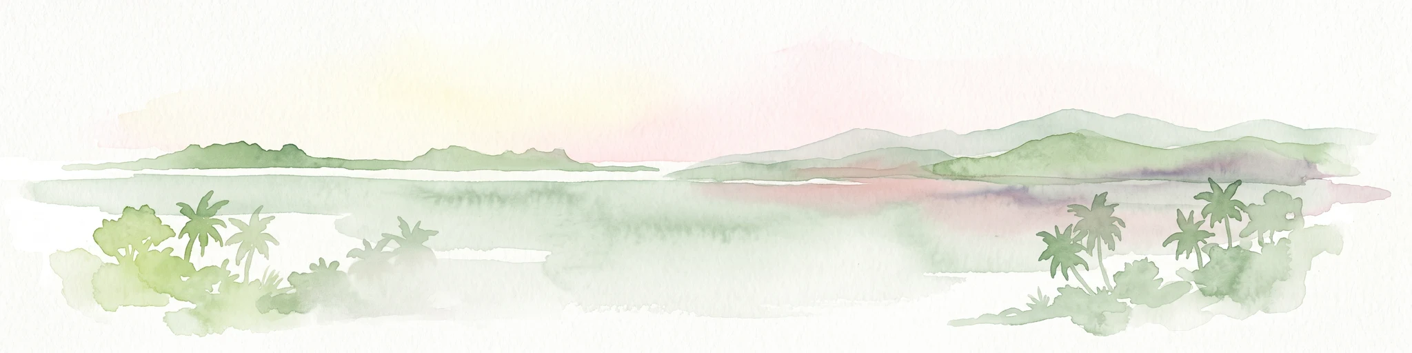
A pale, soft watercolor illustration depicting distant islands or atoll ridges across a calm lagoon, with silhouetted palm trees in the foreground on the left and right.
Protected areaMarshall Islands
About 649 km away#3 closest

Northeast

Kwajalein Atoll Protected Area and Marshall Islands Geographic Landscape Mapping

Pacific coral atoll structure and lagoon geography

Kwajalein Atoll represents a mature coral formation encompassing an immense lagoon within the Ralik Chain. The landscape consists of low-lying islets and interconnected reef structures that define the maritime geography of the Marshall Islands. This assessment provides a focus on the structural, mapped, and physical attributes that distinguish this protected site within the wider Pacific regional context.

Area
16.4 km²
Relief
Lowland
Climate
Tropical
Access
Highly restricted
Nature reserveMarshall Islands
About 743 km away#4 closest

East

Jaluit Atoll Nature Reserve: Protected Coral Landscapes in the Marshall Islands

Coastal reef and lagoon geography of the Ralik Chain

Jaluit Atoll constitutes a sprawling nature reserve in the Marshall Islands, characterized by its kite shaped lagoon and 91 low lying coral islets. As a recognized Ramsar wetland site, this protected area offers a deep look into Pacific atoll structure and the interplay between marine conservation and historical heritage. The atoll remains a central geographic feature of the Ralik Chain.

Area
11.34 km²
Established
2004
Relief
Lowland
Climate
Tropical
Protected areaMarshall Islands
About 748 km away#5 closest

Northeast

Ailinginae Atoll Protected Area: Geographic Overview and Mapped Lagoon Systems

Remote coral atoll landscape in the Marshall Islands

Uncover the geographic structure of Ailinginae Atoll, an uninhabited coral ring in the Marshall Islands characterized by its expansive internal lagoon and narrow island segments. This protected area offers significant insight into the terrain of low-lying Pacific atoll ecosystems and their role within the Ralik Chain geographic framework.

Area
2.8 km²
Relief
Lowland
Water
Water-dominated
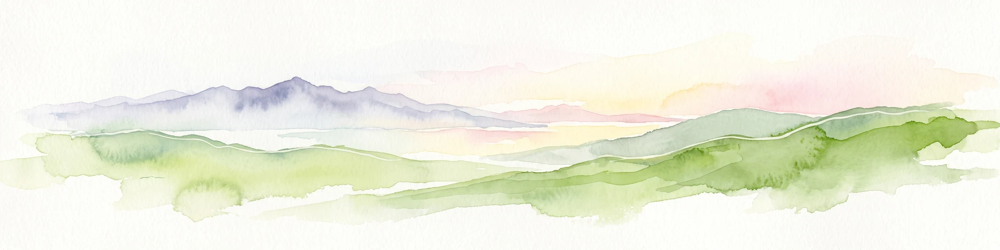
A minimalist watercolor painting featuring soft, light green hills in the foreground and faded, purple-toned mountains in the distant background, all set against a white backdrop.
Protected areaMarshall Islands
About 788 km away#6 closest

Northeast

Rongelap Atoll Protected Area: Geography, Reef Structure, and Marshall Islands Context

Coral atoll terrain in the Pacific Ralik Chain

Located in the Ralik Chain of the Marshall Islands, Rongelap Atoll consists of 61 low-lying coral motus that enclose a lagoon covering 2,600 square kilometers. The atoll serves as a significant geographic study area, known for its distinct reef-built structure and its enduring role in Pacific history. This protected area continues to represent the ecological and cultural complexity of the Micronesian archipelago.

Area
21 km²
Relief
Lowland
Climate
Tropical
Access
Remote access
Protected areaMarshall Islands
About 830 km away#7 closest

Northeast

Rongerik Atoll Protected Area: Mapping the Marshall Islands Coral Landscape

Remote coral atoll geography and lagoon structures in the Ralik Chain.

Rongerik Atoll presents a textbook example of Pacific atoll geography, where a cluster of small islets encloses an expansive lagoon. As a protected area located in the remote Marshall Islands, this site serves as a vital point of study for understanding coral reef systems and the isolated island terrain of the Ralik Chain. The landscape provides clear insights into the physical contrast between narrow coral landmasses and the deep interior waters characteristic of the region.

Area
1.68 km²
Relief
Lowland
Climate
Tropical
Access
Remote access
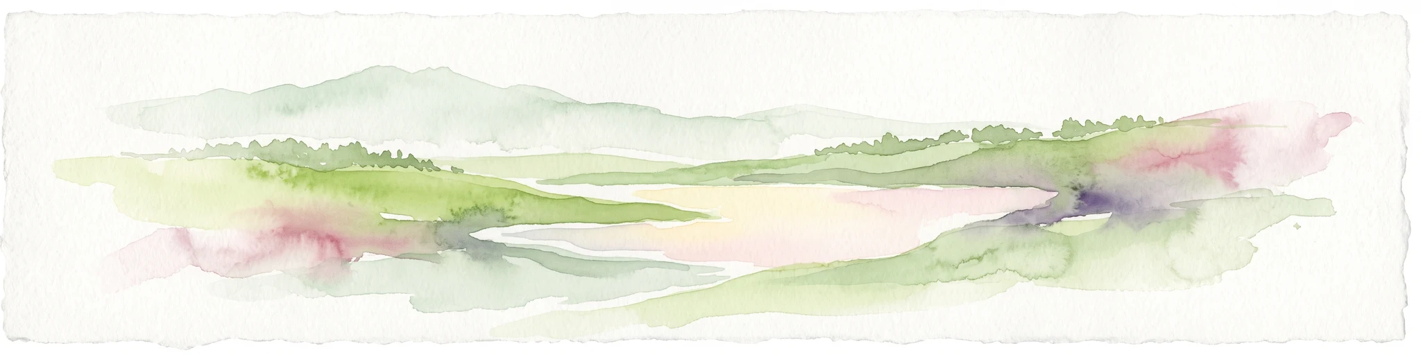
Watercolor painting of a landscape showing a body of water surrounded by green land with trees and distant hills, with soft pink and purple washes on the sides
Protected areaMarshall Islands
About 850 km away#8 closest

Northeast

Likiep Atoll: A Mapped Protected Area in the Marshall Islands Ratak Chain

Coral atoll geography and historical colonial landscape features

Likiep Atoll consists of 65 islands encircling a 424 square kilometer lagoon. As a protected area in the Marshall Islands, it offers insight into low lying atoll topography, unique marine environments, and the cultural remnants of successive colonial administrations.

Area
10.26 km²
Relief
Lowland
Climate
Tropical
Access
Remote access

Common questions about visiting, size, designation, and location context for Utwe-Walung Marine Park

Utwe-Walung Marine Park FAQs for park facts, access, geography, and protected area context

Find quick answers about Utwe-Walung Marine Park, including protected-area facts, park geography, trail and visitor context, and how the park fits into its surrounding country and regional landscape.
MoriAtlas Explorer

Continue Your Protected Areas Search Across the Global Atlas

Deepen your exploration by continuing the structured search for national parks and protected areas worldwide. Utilize the comprehensive filtering capabilities to compare different conservation landscapes and refine your understanding of global park geography. Discover more about the distribution and characteristics of protected natural areas.

Global natural geography