
Mori Atlas logo
Nature reserveVallée de l'Antenne

Mapping the riparian woodlands, meandering river channels, and diverse floodplain ecosystems

Vallée de l'Antenne Nature Reserve: A Protected Alluvial Landscape in Nouvelle-Aquitaine

(Site Natura 2000 de la vallée de l'Antenne (FR5400473))

The Vallée de l'Antenne serves as a vital protected river valley site within the Nouvelle-Aquitaine region of France. Stretching from Fontaine-Chalendray to Cognac, this nature reserve contains a well-preserved alluvial system defined by ash and alder woodlands, seasonal wetlands, and calcareous grasslands. The area is globally recognized for its significant role in sustaining European mink populations, various bat species, and rare insect life like the Rosalia longhorn beetle.

Natura 2000Special Area of Conservationriver valleyalluvial forestriparian woodlandpoplar plantations
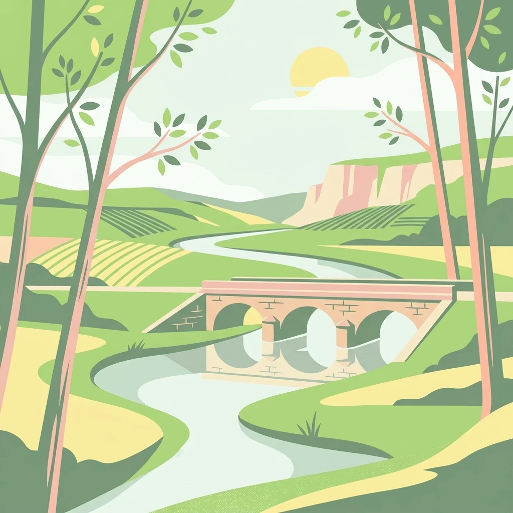
A flat vector-style illustration of a river valley with a stone arched bridge in the midground, framed by stylized trees, with green hills and a gentle sun in the background.

Vallée de l'Antenne

Nature reserve

Park overview

Structured park overview, official facts, and landscape profile for Vallée de l'Antenne

Vallée de l'Antenne park facts, protected area profile, and essential visitor context

Review the core facts for Vallée de l'Antenne, including designation, size, terrain, visitor scale, habitats, and operating context in one park-focused overview.

About Vallée de l'Antenne

The Vallée de l'Antenne occupies a long, narrow corridor of countryside following one of the modest tributaries of the Charente river, in a transitional zone between the coastal lowlands of Charente-Maritime and the inland department of Charente. Although its elevation range is very limited, the valley exhibits the classic morphology of a slow, low-gradient river system: gentle slopes, meanders, cut-off arms, seasonal floodplains and shallow standing water bodies. Approximately ten per cent of the site is made up of running or stagnant freshwater, while about eighty per cent is forested, with a near-even mix of natural deciduous woodland and cultivated poplar stands.

Ecologically, the site stands out for combining several large-scale habitats of Community importance within a relatively compact area. The dominant habitat is an ash and alder alluvial forest, which covers the majority of the protected corridor. Among this woodland, a small but striking stand of evergreen holm oak sits on a limestone terrace at Cherves-Richemont, a remnant of warmer-climate vegetation that adds botanical interest to the valley. Calcareous dry grasslands and semi-natural wet hay meadows contribute additional habitat diversity at a smaller scale.

The valley's importance is also strongly tied to its role for fauna. Abandoned underground quarries at Saint-Sulpice-de-Cognac shelter important bat colonies, and seven bat species listed under the EU Habitats Directive use the site for hunting, hibernation or reproduction. Aquatic species of Community interest, including the bullhead and both river and brook lampreys, are present in the Antenne itself, and the broader mosaic of woodland, marsh and meadow supports a wide variety of breeding birds, reptiles, amphibians and invertebrates.

From a governance perspective, the Natura 2000 designation binds together twenty-nine communes and relies on cooperation between local authorities, river syndicates, the Ligue pour la protection des oiseaux (LPO) as site operator, agricultural chambers, water agencies and local volunteer associations. The active management programme covers river continuity, riparian woodland restoration, grassland maintenance, control of invasive coypu and measures to reduce road mortality of the European mink.

Quick facts and research context for Vallée de l'Antenne

The Vallée de l'Antenne is classified as a Zone spéciale de conservation (Special Area of Conservation) under the European Natura 2000 network, covering about 1,208 hectares across 29 communes in Charente and Charente-Maritime.

It protects the full length of the Antenne river and most of its tributaries, including the Briou, and is one of the best-conserved alluvial complexes in the Nouvelle-Aquitaine region. Designation was driven by the presence of seven Community-interest habitats and nineteen Community-interest species, including priority species such as the European mink and the Rosalia longhorn beetle.

The site is managed under France's Natura 2000 framework, with documents of objectives (DOCOB) and site charters validated in 2004 and 2009 respectively.

Protection and recognition

Documented conservation status, designation year, and official recognition sources

Vallée de l'Antenne Protection Status and International Recognition Data

Vallée de l'Antenne maintains a documented terrestrial protection status established in 2004 alongside recorded Natura 2000 listings. Official designation records and international recognition sources provide verifiable metrics for conservation analysis.

International recognition

Protection details

Protection scope
Terrestrial
Designated year
2004
Transboundary protection
No
WDPA ID
555526227
Park context

Deeper park guide and search-rich context for Vallée de l'Antenne

Vallée de l'Antenne history, landscape, wildlife, and travel context

Explore Vallée de l'Antenne through its history, landscape character, ecosystems, wildlife, conservation priorities, cultural context, and seasonal travel timing in a structured park guide built for atlas discovery and search intent.

Why Vallée de l'Antenne stands out

The valley is particularly noted for its well-preserved alluvial forest of ash and alder, its large colonies of hibernating bats in former underground quarries, and the presence of the endangered European mink, one of the rarest mammals in Europe. It is also recognised as a regionally important refuge for the Rosalia longhorn beetle (Rosalie des Alpes), a priority beetle species that is closely linked to mature broadleaf woodland along rivers. Together, these features make the Antenne valley a small but ecologically rich reference site for lowland river systems in western France.
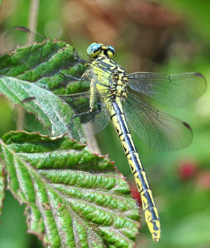
A close-up photograph of a Gomphus graslinii dragonfly with yellow and black striped patterns, resting on a bright green textured leaf.
A dragonfly resting on a green leaf in the Vallée de l'Antenne.

Vallée de l'Antenne history and protected-area timeline

The protection of the Antenne valley originated as part of France's contribution to the European Natura 2000 ecological network. The site was proposed for inclusion in the network in March 1999, initially covering 1,173 hectares, and was formally validated on 12 February 2004 with an expanded area of 1,208 hectares. The procedure was coordinated by the sub-prefecture of Saint-Jean-d'Angély, and the Ligue pour la protection des oiseaux (LPO) at Rochefort was designated as the site operator.

The first formal step in active management was the completion of the site's Document d'objectifs (DOCOB), which sets out conservation goals and was approved on 12 February 2004. A complementary Natura 2000 charter, which landowners and local actors can sign parcel by parcel for five-year commitments in exchange for property-tax exemptions, was adopted on 25 February 2009. The first contracts under this charter framework began to be signed in 2009.

Management has built on a long tradition of human interaction with the river landscape: the Antenne is dotted with old mills and weirs, and several of these structures have been progressively restored to improve fish passage, canoe access and overall river continuity. The site's history also reflects earlier natural-heritage inventories, including a Type I ZNIEFF (Zones naturelles d'intérêt écologique, faunistique et floristique) covering 709.7 hectares across five communes that overlaps the Natura 2000 perimeter.

Vallée de l'Antenne landscape and geographic character

From a physical standpoint, the Vallée de l'Antenne is a textbook example of a low-energy river system. The site descends only forty metres in total, from about 50 metres above sea level near its source at Fontaine-Chalendray down to about 10 metres where the Antenne meets the Charente at Cognac, producing the very gentle gradient that defines its character.

In the upper and middle sections, north of Prignac, the river runs as a relatively narrow, sometimes seasonally dry (assec) channel lined by woodland. Below Prignac, the landscape becomes much more open and dynamic: the river splits into numerous secondary branches, forms meanders and abandoned arms, and is flanked by an extensive floodplain. This lower stretch is repeatedly described as one of the best-conserved alluvial complexes at the regional scale.

Water bodies, including both flowing reaches and naturally eutrophic standing waters, occupy around ten per cent of the site. Forested land dominates the remaining area, with natural deciduous woodland on about forty-eight per cent and cultivated poplar plantations on about thirty-two per cent. Riparian ash and alder woods alternate with poplar stands, reedbeds and small patches of floodplain meadow, creating a finely textured mosaic that defines the visual identity of the valley. Small pockets of dry calcareous grassland on limestone outcrops, including the holm oak grove at Cherves-Richemont, add further topographic and ecological contrast.
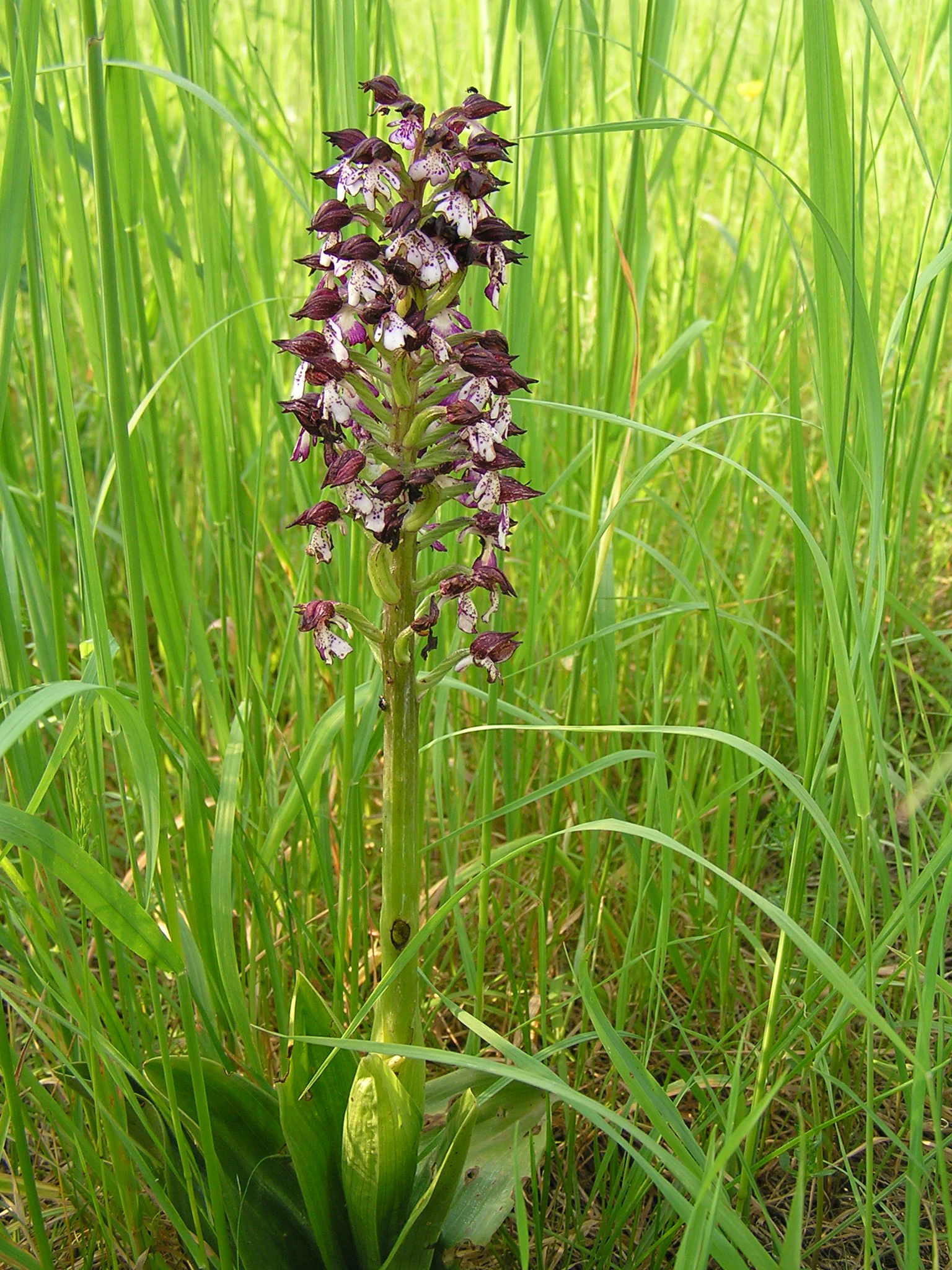
A close-up view of a purple and white lady orchid in bloom, surrounded by tall green grasses.
A Lady Orchid (Orchis purpurea) blooming in a meadow within the Antenne river valley.

Vallée de l'Antenne ecosystems, habitats, and plant life

The Antenne valley hosts a layered mosaic of habitats that reflect the interaction between water, soil and human use. The defining habitat is ash and alder alluvial forest, which occupies roughly half of the site and forms the backbone of the valley's ecological network. A small but ecologically significant stand of holm oak woodland on a limestone terrace near Cherves-Richemont introduces a clearly Mediterranean character into an otherwise Atlantic lowland context.

Open habitats include narrow bands of calcareous dry grassland, where orchids and other lime-loving plants thrive on shallow soils over bedrock, and lowland hay meadows that line the floodplain margins. Reedbeds and small wet prairies occur along the slower-moving stretches of the river, particularly in the lower section where water spreads across the floodplain.

The river itself contributes two formally recognised freshwater habitats: naturally eutrophic lakes and naturally eutrophic ponds, and the running waters of the Antenne. Together, these aquatic habitats support characteristic flora and fauna and are central to the site's designation as a Special Area of Conservation.
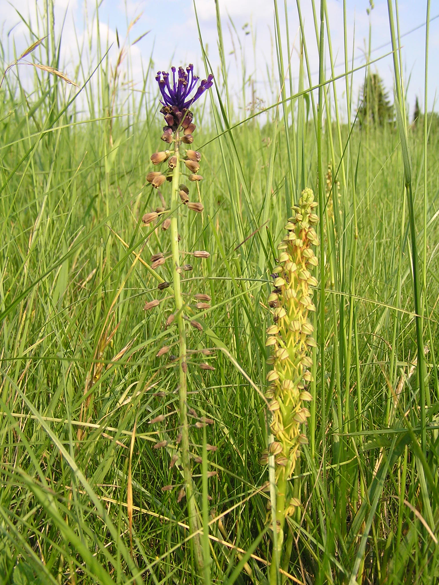
Two slender, tall-stalked wildflowers standing in a field of tall green grass; one has purple-tipped flowers, and the other has yellow-green flowers.
A man orchid (Orchis anthropophora) growing in a grassy meadow.

Vallée de l'Antenne wildlife and species highlights

The Vallée de l'Antenne is particularly notable for its mammal fauna. The European mink (Mustela lutreola), one of the rarest carnivores in Europe, is a permanent resident along the riverbanks and is a central reason for the site's strict protection. Otters are also established, although in smaller numbers. The valley is used by at least ten bat species, with abandoned underground quarries at Saint-Sulpice-de-Cognac serving as important hibernation and breeding sites; winter counts in the late 2000s recorded hundreds of greater horseshoe bats alongside smaller numbers of other Community-interest species.

The birdlife is rich and varied. Official lists include five migratory raptors such as the black kite and the short-toed snake eagle, supplemented by common species like the common buzzard, Eurasian sparrowhawk and common kestrel. Wetland birds along the river include grey heron, purple heron, little egret, great cormorant, white stork and common kingfisher, with regular passage of cattle egret colonies and winter visitors such as the common crane and black-crowned night heron.

The freshwaters host three fish species of Community interest: the bullhead, the river lamprey and the brook lamprey, with trout present in the upper, first-category waters. Reptiles include green and wall lizards plus the Aesculapian snake and the green-and-yellow whip snake, while amphibians are notably diverse, with sympatric populations of the Mediterranean tree frog and the common tree frog alongside midwife toads, natterjack toads and several true frog species, including the marbled newt.

Invertebrate diversity is also high. The Rosalia longhorn beetle (Rosalia alpina), classified as a priority species at the European level, depends on the valley's old broadleaf trees. Several dragonflies and damsels of Community interest, including the Mercury bluet, the orange-spotted emerald and the Goblet-marked damselfly (Gomphus graslinii), breed along the river, and a range of butterflies, among them the large blue and the marsh fritillary, completes the invertebrate picture.
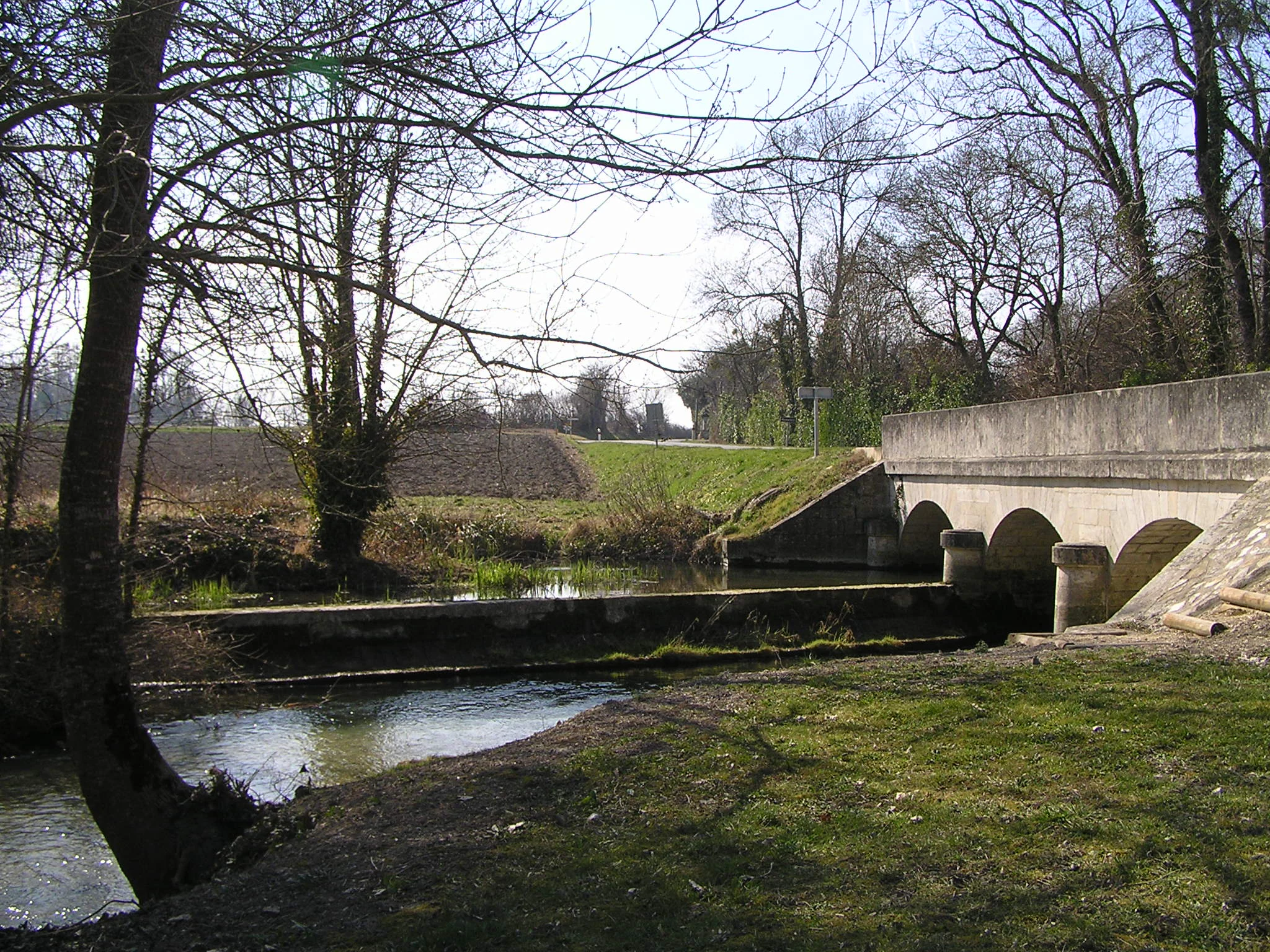
A small stone arched bridge crossing a calm river in a rural, wooded setting during a sunny day.
A stone bridge crossing the confluence of the Antenne and Briou rivers near Prignac.

Vallée de l'Antenne conservation status and protection priorities

From a conservation standpoint, the Antenne valley functions as a small but high-value refuge for species and habitats that are otherwise rare or declining across France and Europe. Its status as a Special Area of Conservation under the EU Habitats Directive reflects the simultaneous presence of seven Community-interest habitats and nineteen Community-interest species, including priority species such as the European mink and Rosalia alpina.

Conservation management is delivered through a combination of regulatory tools and voluntary contracts. The DOCOB outlines priority actions, while site-specific Natura 2000 charters encourage landowners to commit to practices that maintain habitats and species populations in exchange for property-tax relief. Active interventions include the re-establishment of fish passes and canoe passages on old mill structures, replanting of native riparian trees along several kilometres of bank, and targeted maintenance of dry calcareous grasslands through biannual volunteer work.

Specific measures address the European mink: control of invasive coypu is restricted to capture with escape-friendly traps to avoid bycatch, and road-crossing structures are being adapted where the river passes under bridges to reduce vehicle collisions. These actions, combined with broader efforts to restore river continuity, support the long-term viability of one of the most important mink populations in western France.

Vallée de l'Antenne cultural meaning and human context

The Antenne valley sits in a rural part of western France shaped for centuries by small-scale agriculture, river-based milling and modest forestry. The river itself historically powered numerous mills, several of which are still visible as structures along the watercourse and now serve as landmarks for restoration projects that balance heritage with ecological function.

Local ownership of conservation is a defining cultural feature of the site. A pilot committee brings together communes, associations of riparian owners, foresters, anglers and nature-protection groups, and the practical work of habitat management draws heavily on volunteer associations such as Charente Nature and the French orchid society (Société française d'orchidophilie). The valley has also been the focus of community science initiatives, including a department-wide inventory of the patrimonial snake's-head fritillary conducted between 2005 and 2007.
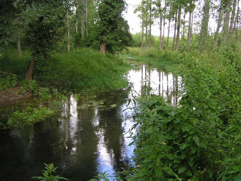
A slow-moving river flows through a dense forest with green trees reflecting on the calm water surface.
The Antenne River flowing through a lush, wooded landscape near Chazotte.

Top sights and standout views in Vallée de l'Antenne

The valley's standout features include its ash-alder alluvial forests, the unusual holm oak woodland at Cherves-Richemont, the underground quarries that shelter important bat colonies, and the river reaches that still sustain bullheads and lampreys. Conservation highlights are the resident population of European mink and the local stronghold of the Rosalia longhorn beetle.

Equally distinctive is the valley's status as one of the better-preserved lowland alluvial complexes in Nouvelle-Aquitaine, where combined action by municipalities, volunteer associations and conservation groups maintains a working landscape of meadows, woodlands, mills and meandering channels.
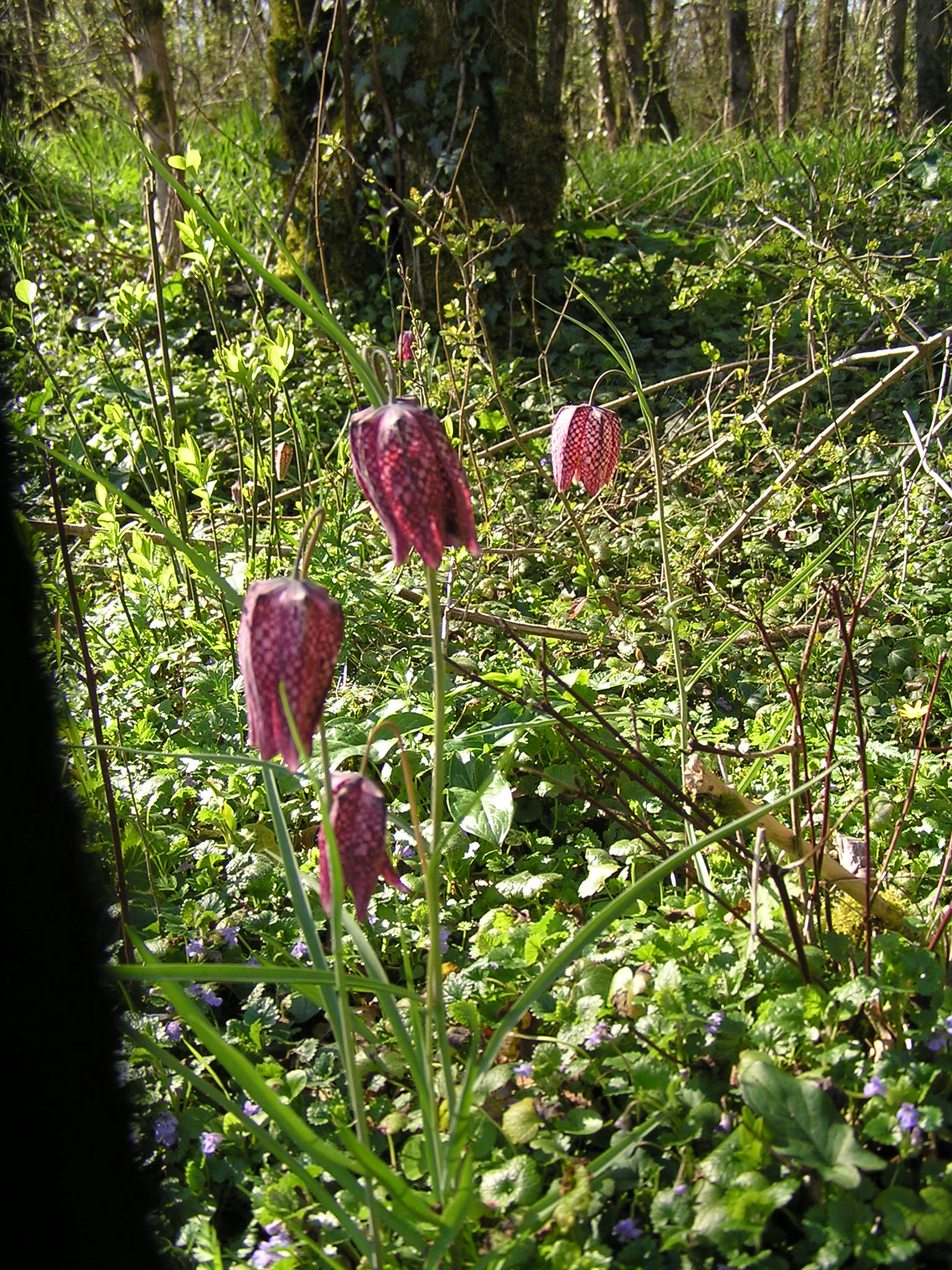
Several purple and white checkered snake's head fritillary flowers growing in a lush, green, sunlit woodland setting.
Snake's head fritillaries blooming in the damp meadows of the Antenne valley.

Best time to visit Vallée de l'Antenne

The Antenne valley is a low-elevation river site in a temperate oceanic climate, with mild winters and warm, relatively dry summers. Spring brings high water levels and fresh green vegetation, ideal for observing amphibians along the floodplain and for the return of migratory birds such as the common crane and the European honey buzzard.

Summer offers good conditions for listening to nocturnal bats and observing dragonflies and damselflies along the river, although reduced flow in the upper sections can expose seasonal dry stretches. Autumn is generally the most suitable period for walking the woods and identifying fungi, while the underground quarries used by bats are best appreciated at a respectful distance during the hibernation season rather than as a tourist destination.
Monthly climate preview

Long-term representative point measurements tracking monthly averages across the protected landscape

Vallée de l'Antenne Climate Normals, Annual Temperature and Precipitation Rhythm

Representative coordinates record measured monthly temperature and precipitation normals, establishing the long-term annual rhythm for Vallée de l'Antenne. Examining the complete twelve-month climatology profile reveals detailed variations in temperature thresholds and precipitation rates across the region.
Annual mean13 °C
5 °C21 °C
Jan
Feb
Mar
Apr11°
May15°
Jun18°
Jul20°
Aug21°
Sep17°
Oct14°
Nov
Dec
Warmest month
August

20.6 °C

Coolest month
January

5.5 °C

Wettest month
November

3 mm/day

Driest month
July

1.5 mm/day

Park location guide

Geography guide, regional context, and park location map for Vallée de l'Antenne

Vallée de l'Antenne park geography, regions, and map view in France

Understand where Vallée de l'Antenne sits in France through a broader geographic reading of the surrounding landscape, nearby location context, and its mapped position within the national park landscape.

How Vallée de l'Antenne fits into France

France is a unitary semi-presidential republic and one of the world's largest economies. It borders Belgium, Luxembourg, Germany, Switzerland, Italy, Monaco, Andorra, and Spain, with a maritime border to the United Kingdom. The country is known for its cultural influence, art, cuisine, and political history spanning centuries.

Wider geography shaping Vallée de l'Antenne in France

France is located in Western Europe. Metropolitan France extends from the Rhine to the Atlantic Ocean and from the Mediterranean Sea to the English Channel and North Sea. The country borders Belgium, Luxembourg, Germany, Switzerland, Italy, Monaco, Andorra, Spain, and has a maritime border with the United Kingdom.

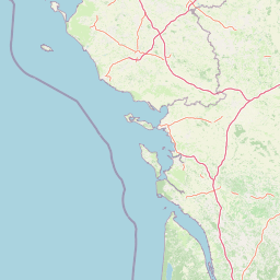
Map view of Vallée de l'Antenne

Use this park location map to pinpoint Vallée de l'Antenne in France, understand its exact geographic position, and read its mapped placement within the surrounding landscape more clearly.

Pigeon | © OpenStreetMap contributors

Location context for Vallée de l'Antenne

Nouvelle-Aquitaine
Recorded earthquake history

Examine Recorded Earthquake History Near Vallée de l'Antenne

Discover a chronological overview of seismic activity recorded in the territory surrounding this Natura 2000 site. MoriAtlas provides a clear, data-driven catalogue of historical events that have occurred within the broader geographic context of the Antenne river valley.

Vallée de l'Antenne Earthquake History

Catalogued events

35 events

Strongest magnitude

Magnitude 4.8

Most recent event

Jun 16, 2023

This history includes earthquakes recorded inside the park or within 50 km of its borders

Visual reference for alluvial forests, river meanders, and protected habitats

Vallée de l'Antenne Photos and Mapped Landscape Scenery

Examine detailed photographs showcasing the protected river valleys, ash and alder woodlands, and lowland wetland habitats of Vallée de l'Antenne. Visual records reveal the gentle gradients, meandering watercourses, and rich ecological mosaic that define the protected landscape.

A close-up photograph of a Gomphus graslinii dragonfly with yellow and black striped patterns, resting on a bright green textured leaf.

A bright blue damselfly with clear, veined wings resting horizontally on a thin, green plant stem against a blurred green background.

A close-up view of a purple and white lady orchid in bloom, surrounded by tall green grasses.

Two slender, tall-stalked wildflowers standing in a field of tall green grass; one has purple-tipped flowers, and the other has yellow-green flowers.

A small stone arched bridge crossing a calm river in a rural, wooded setting during a sunny day.

A calm section of the Antenne river in front of a stone building, identified as the Preziers mill, with a weir visible across the water and bare trees on the riverbank.

A slow-moving river flows through a dense forest with green trees reflecting on the calm water surface.

Several purple and white checkered snake's head fritillary flowers growing in a lush, green, sunlit woodland setting.

A group of evergreen holm oak trees growing on a light-colored rocky limestone bank against a partly cloudy blue sky.

A small, narrow stream winds through a grassy meadow bordered by thin, bare deciduous trees at the source of the Antenne river.

A calm river flowing through a forested valley with leafless trees lining the banks.

A calm, reflective river surrounded by bare trees during a dormant season, with thin branches framing the foreground.

Park atlas

Compare regional river valleys and protected landscapes across western France

Other Protected Areas and Parks Near Vallée de l'Antenne

Browse nearby protected areas and river valley reserves sharing similar alluvial ecosystems and lowland habitats with Vallée de l'Antenne. Continuing across the surrounding regional network reveals broader ecological patterns within Nouvelle-Aquitaine.
Nature reserveNouvelle-Aquitaine
About 42 km away#1 closest

West

Réserve naturelle régionale de la Massonne: Geographic Atlas and Protected Area Map

Mapped ecosystems within the Nouvelle-Aquitaine marshlands

Réserve naturelle régionale de la Massonne serves as a significant ecological corridor in western France, defined by its abrupt transition from coastal Brouage marshes to acidic heath. This atlas entry provides essential data on the reserve boundaries, mapped terrain types, and the structural diversity of its protected wetlands and shrublands, highlighting its role as a sanctuary for diverse nocturnal fauna.

Area
2.023 km²
Established
1997
IUCN
IV
Relief
Lowland
Protected areaNouvelle-Aquitaine
46 km away#2 closest

Southeast

Vallée de la Tude Protected Area: Regional Geography and Alluvial Landscape Map

Exploring the river valley networks of Nouvelle-Aquitaine

The Vallée de la Tude is a significant protected area located in the Charente department of southwestern France. This site features a series of wet meadows, lowland brooks, and woodland fragments that form an essential ecological network. Our atlas entry provides a detailed look at the geographic distribution and landscape composition of this unique alluvial valley.

Area
15.57 km²
Established
2006
Relief
Upland
Climate
Temperate
Nature reserveNouvelle-Aquitaine
About 48 km away#3 closest

North

Réserve naturelle régionale du marais de Galuchet et des boucles de la Sèvre Niortaise Geography and Map

Urban protected wetland in the Nouvelle-Aquitaine region of France

This urban nature reserve protects 151 hectares of diverse wetland habitats along the Sèvre Niortaise. The landscape is defined by river meanders, wet meadows, and riparian corridors, making it a critical site for regional biodiversity and urban ecological connectivity in the Deux-Sèvres department.

Area
1.51 km²
Established
2025
IUCN
IV
Relief
Lowland
Wildlife reserveNouvelle-Aquitaine
About 52 km away#4 closest

South

Terres d'oiseaux Wildlife Reserve: Protected Estuarine Landscape in Nouvelle-Aquitaine

Migratory bird habitat and Gironde estuary geography

Terres d'oiseaux is a significant wildlife reserve positioned within the Blayais marshes of Nouvelle-Aquitaine. The site encompasses a diverse mosaic of estuarine wetlands, including reedbeds and open water, providing critical stopover habitat for migratory birds along the Atlantic flyway. Its geography represents a blend of tidal interaction and controlled natural management, essential for regional avian monitoring and ecological studies.

Area
1.2 km²
Established
2010
IUCN
IV
Relief
Lowland
Nature reserveCharente
55 km away#5 closest

East

Val de Tardoire Nature Reserve: Geography and Protected Area Mapping in Charente

A detailed river valley landscape in Nouvelle-Aquitaine, France.

This protected area centers on the Tardoire river valley, featuring a high density of wet meadows, broadleaf forests, and rocky escarpments. The site represents a crucial node for European-interest habitats and diverse fauna, offering an in-depth look at the natural terrain and ecological composition of the Charente department.

Area
31.49 km²
Established
1999
Relief
Upland
Climate
Temperate
Nature reserveNouvelle-Aquitaine
57 km away#6 closest

Southeast

Vallée de la Nizonne Nature Reserve: Mapped Geography and Protected Wetland Landscapes

A critical river corridor and Natura 2000 conservation zone in Nouvelle-Aquitaine.

Discover the geographic structure of the Vallée de la Nizonne, a protected area shaped by the flow of the Nizonne and Lizonne rivers. This landscape mosaic features peatlands, wet meadows, and alluvial forests that serve as a refuge for rare species. Gain insight into the regional terrain and conservation boundaries that define this important French wetland corridor.

Area
33.91 km²
Established
2016
Relief
Upland
Climate
Temperate
Nature reserveNouvelle-Aquitaine
About 58 km away#7 closest

East

Réserve naturelle régionale de la vallée de la Renaudie Protected Landscape and Map Atlas

A geological crossroads in the heart of Nouvelle-Aquitaine.

Trace the 6 kilometer stretch of the Réserve naturelle régionale de la vallée de la Renaudie. This protected area showcases an unusual geological interface between limestone and granite, creating a compact mosaic of riparian woodland, dry rocky cliffs, and meadows that support significant regional biodiversity.

Area
0.73 km²
Established
2012
IUCN
IV
Relief
Mixed relief
Nature reserveDeux-Sèvres
About 65 km away#8 closest

North

Réserve naturelle régionale du bocage des Antonins: Protected Landscape and Geographic Atlas

Detailed ecological mapping of the Gâtine armoricaine countryside

The Réserve naturelle régionale du bocage des Antonins occupies a distinct space in the Deux-Sèvres department. This protected area serves as a repository for the traditional bocage countryside, featuring a complex arrangement of pollarded trees, wet meadows, and the historic étang des Forges. The site offers a significant look at the structural history of rural western France through its preserved environmental matrix.

Area
0.226 km²
Established
2015
IUCN
IV
Relief
Lowland

Common questions about visiting, size, designation, and location context for Vallée de l'Antenne

Vallée de l'Antenne FAQs for park facts, access, geography, and protected area context

Find quick answers about Vallée de l'Antenne, including protected-area facts, park geography, trail and visitor context, and how the park fits into its surrounding country and regional landscape.
MoriAtlas Explorer

Continue Your Protected Areas Search Across the Global Atlas

Deepen your exploration by continuing the structured search for national parks and protected areas worldwide. Utilize the comprehensive filtering capabilities to compare different conservation landscapes and refine your understanding of global park geography. Discover more about the distribution and characteristics of protected natural areas.

Global natural geography