
Mori Atlas logo
Natural monumentVelký Radechov

Mapping the protected boundaries and biodiversity terrain of a preserved Bohemian upland site

Velký Radechov Natural Monument: A Neovolcanic Landscape in the Central Bohemian Region

(Přírodní památka Velký Radechov)

Velký Radechov represents a distinct protected natural monument situated on the upper slopes of a neovolcanic hill within the Central Bohemian Region. This 22-hectare site preserves a mosaic of sun-drenched grasslands, scrub, and mixed woodland that evolved following historical land use. Through this atlas, identify the varied micro-relief and physical geography that supports a significant concentration of avian species, invertebrates, and reptiles within this compact upland habitat.

grasslandneovolcanic hillbiodiversity hotspotbirdwatchinghabitat mosaicCentral Bohemia
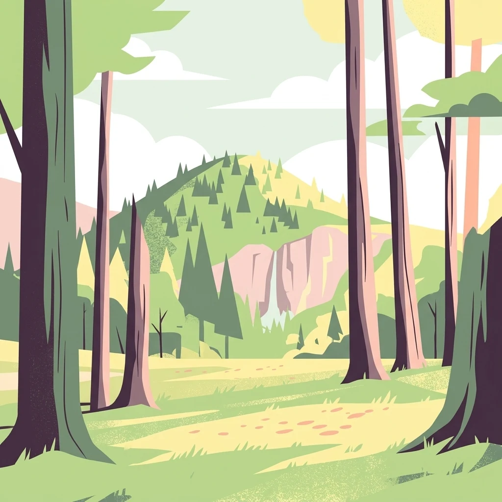
A flat-design, stylized digital illustration depicting a forest clearing with large tree trunks in the foreground, looking toward a forested hill with a small waterfall on a cliff face in the background.

Velký Radechov

Natural monument

Park overview

Structured park overview, official facts, and landscape profile for Velký Radechov

Velký Radechov park facts, protected area profile, and essential visitor context

Review the core facts for Velký Radechov, including designation, size, terrain, visitor scale, habitats, and operating context in one park-focused overview.

About Velký Radechov

Velký Radechov is a protected natural monument located on a neovolcanic hill called Radechov, on the northern periphery of the Jizerská tabule highland in Central Bohemia. The monument was established in 1999 by the former OÚ Mladá Boleslav and today falls under the stewardship of the Středočeský kraj regional authority. It sits above the village of Dolní Krupá, within an agricultural and forested landscape that has been shaped by long human use, including traditional hunting grounds and a 20th-century military training area that occupied the hill until the early 1990s.

The protected territory covers roughly 22 hectares on the upper portion of the hill, where the combination of volcanic substrate, southern exposure, and former disturbance has created a mosaic of dry and mesic grasslands, scrubby edges, and patches of broadleaved and mixed woodland. This variety of habitats in a very compact area is the foundation of the monument's ecological value. Although volcanic in origin, Radechov is not a dramatic peak: elevations within the protected site range from about 344 to 392 meters, but the hill offers varied micro-relief, including sun-facing slopes, shaded gullies, and rockier sections that host characteristic Central European flora.

Botanical inventories across the monument have documented dozens of vascular plant species, and the zoological record is similarly rich for such a small area. Ground beetles, spiders, and butterflies have all been surveyed, while amphibian, reptile, and small mammal records round out a community typical of well-conserved Bohemian hill habitats. The site is particularly valued for its 24 recorded bird species, which include species of conservation concern in the Czech Republic. Together, these features make Velký Radechov a representative example of how even small, formerly used landscape patches can be elevated to protected-area status for their biodiversity and habitat quality.

Quick facts and research context for Velký Radechov

Velký Radechov is a Czech přírodní památka (natural monument) covering about 21.99 hectares on the upper part of the neovolcanic Radechov hill, near Dolní Krupá in the Mladá Boleslav district of Central Bohemia. It was declared on 30 April 1999 by the local authority of Mladá Boleslav and is managed by the Středočeský kraj regional office.

The protected area lies at an elevation between roughly 344 and 392 meters and corresponds to IUCN Category IV, designating it as a habitat and species management area. Botanical surveys have recorded dozens of vascular plant species, while zoological work has documented ground beetles, spiders, butterflies, amphibians, reptiles, small mammals, and at least 24 breeding bird species, including the endangered stock dove.

Park context

Deeper park guide and search-rich context for Velký Radechov

Velký Radechov history, landscape, wildlife, and travel context

Explore Velký Radechov through its history, landscape character, ecosystems, wildlife, conservation priorities, cultural context, and seasonal travel timing in a structured park guide built for atlas discovery and search intent.

Why Velký Radechov stands out

Velký Radechov is best known for the rich birdlife on its grassy, sun-exposed upper slopes, which has produced records of 24 bird species, including the strongly threatened stock dove, a relatively rare breeding bird in the Czech Republic. The site is also distinctive as one of the older Central Bohemian examples of a conserved military-training-ground habitat, where former disturbance and traditional hunting land use have, paradoxically, helped maintain open, sun-loving vegetation that supports a diverse mix of plants, invertebrates, and small vertebrates.
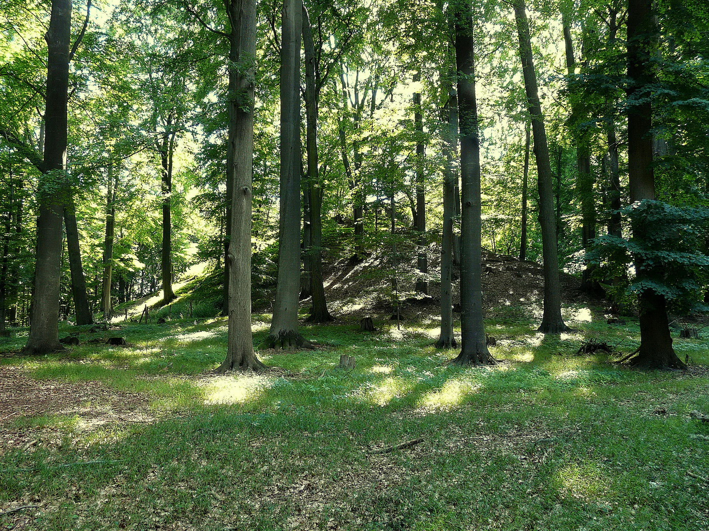
A view of the mature forest floor and tall tree trunks at the southern peak of Radechov hill.
The southern peak of Radechov hill, covered in mature deciduous forest.

Velký Radechov history and protected-area timeline

Until the early 1990s, the upper parts of the Radechov hill that now form Velký Radechov were part of a military training ground. Before that period of military use, the land was managed as a traditional hunting area, or honitba. Both phases of use shaped the vegetation of the hill, maintaining open and semi-open habitats that later proved ecologically valuable.

After the military zone was released, the area came under civil administration and was recognized for its nature conservation importance. The protected natural monument Velký Radechov was formally declared on 30 April 1999 by the local authority of Mladá Boleslav. Since then, the site has been administered under the framework of Czech small-scale protected areas by the regional office of the Středočeský kraj, with ongoing management aimed at preserving the open grassland and woodland mosaic that defines the hill.

Velký Radechov landscape and geographic character

The protected site lies on the upper portion of the Radechov hill, a modest neovolcanic elevation within the broader Jizerská tabule landscape of Central Bohemia. The volcanic origin of the hill gives the terrain a varied substrate and micro-relief, and the combination of southern-facing slopes, level summit areas, and small shaded hollows creates the basic physical setting of the protected area.

Elevations within the monument range from roughly 344 to 392 meters above sea level. The hill is not a sharp peak but a rounded upland, and its landscape character is dominated by a patchwork of grassy openings, low scrub, woodland fragments, and steeper stony sections. Because of its elevation and exposure, the upper hill has an open, windswept feel compared with the surrounding lower agricultural land, and it provides panoramic views across the Mladá Boleslav district toward the Jizerská tabule highland.

Velký Radechov ecosystems, habitats, and plant life

Velký Radechov protects a small but ecologically rich mosaic of habitats developed on the slopes and summit of the Radechov hill. The neovolcanic substrate and long history of disturbance have produced semi-natural dry and mesic grasslands with patches of taller herb vegetation, areas of scrubby woodland edge, and stands of mixed broadleaved forest. Within just over 20 hectares this habitat diversity supports an unusually broad spectrum of plant and animal life.

The botanical character of the site is typical of warm, sun-exposed Bohemian hills: a mixture of common meadow and grassland species typical of disturbed ground, alongside more shade-tolerant woodland flora in the forested patches. The richness of the vegetation transitions, with both open sun-loving plants and forest-floor species sharing the same small territory, gives the monument a layered ecological character that distinguishes it from surrounding purely agricultural or fully forested land.

Ecologically, the site is valuable as a refuge for species that depend on the particular combination of openness, edge habitat, and woodland cover that was created by its military and hunting past. The hill functions as a kind of ecological island in the wider Central Bohemian agricultural landscape, contributing to regional habitat connectivity for birds, small mammals, and invertebrates.

Velký Radechov wildlife and species highlights

The wildlife of Velký Radechov has been the focus of detailed faunal inventories, and despite the small size of the site, the survey work has produced notable records. At least 24 bird species have been documented in the protected area, notably including the strongly endangered stock dove, a species of conservation concern in the Czech Republic whose presence gives the monument particular ornithological significance.

Invertebrate surveys have recorded 8 species of ground beetles, 7 species of spiders, and 21 species of butterflies, including the swallowtail and several other characteristic Bohemian grassland species. The amphibian community includes the alpine newt, smooth newt, agile frog, and common frog, while reptile records feature the sand lizard and the slow worm. Small mammals documented on the hill include the common shrew, the bank vole, and the yellow-necked mouse, and wild boar also use the site. This combination of species groups across forest, edge, and open habitats reinforces the conservation value of the monument.

Velký Radechov conservation status and protection priorities

Velký Radechov was established as a přírodní památka, a Czech small-scale natural monument designation that corresponds to IUCN Category IV, a category reserved for habitats and species management areas. The monument was declared in 1999 specifically to preserve the biodiversity value of the upper Radechov hill, particularly its mosaic of grassland and woodland habitats and the bird community they support.

The conservation significance of the site rests on several factors: the presence of a strongly threatened bird species (the stock dove), an unusually high diversity of recorded fauna for such a small site, and a habitat mosaic created by a particular land-use history that is now rare in the region. Its management falls under the Krajský úřad Středočeského kraje, with the broader goal of maintaining the open and semi-open character of the hill and preserving the ecological conditions on which the documented species depend.

Velký Radechov cultural meaning and human context

The hill at Velký Radechov has a layered cultural past that has directly influenced its ecological character. Before the 1990s, the upper hill functioned as a military training area, and prior to that it was a honitba, a traditional hunting ground with carefully managed game populations. Both forms of use helped keep the upper slopes relatively free of intensive agriculture, which in turn preserved open and semi-open vegetation that is now rare in the surrounding Bohemian landscape.

The broader cultural setting of the monument is rural Bohemian countryside, with the village of Dolní Krupá occupying the lower slopes and the broader Mladá Boleslav district supplying the regional administrative and agricultural context. The site is therefore an example of how historic land management, even when originally oriented toward military or hunting goals, can leave an ecological legacy that later becomes the basis for formal nature protection.

Top sights and standout views in Velký Radechov

A compact but biodiversity-rich protected area on the upper slopes of the neovolcanic Radechov hill in the Středočeský kraj. The monument is distinguished by the exceptional diversity of its habitats, ranging from dry and mesic grasslands through scrubby edges to mixed woodland, all concentrated within roughly 22 hectares. Its most notable single feature is the presence of 24 recorded bird species, including the strongly endangered stock dove, alongside a well-documented fauna of ground beetles, spiders, butterflies, amphibians, reptiles, and small mammals.

Best time to visit Velký Radechov

Velký Radechov is most rewarding in late spring and early summer, when the warm slopes come alive with flowering meadow plants and invertebrate activity is at its peak. This is also the period when bird communities are most active and most easily observed.

Monthly climate preview

Long-term representative point measurements tracking monthly temperature and precipitation cycles

Velký Radechov Climate Normals, Annual Temperature and Precipitation Rhythm

Representative coordinates record mean temperatures ranging from sub-zero winter lows to warm summer highs alongside recorded monthly precipitation rates. Analyzing these long-term averages reveals detailed annual patterns across the protected terrain.
Annual mean8 °C
-3 °C19 °C
Jan-3°
Feb-2°
Mar
Apr
May13°
Jun17°
Jul19°
Aug18°
Sep13°
Oct
Nov
Dec-2°
Warmest month
July

18.7 °C

Coolest month
January

-3.1 °C

Wettest month
July

2.9 mm/day

Driest month
April

1.3 mm/day

Park location guide

Geography guide, regional context, and park location map for Velký Radechov

Velký Radechov park geography, regions, and map view in Czechia

Understand where Velký Radechov sits in Czechia through a broader geographic reading of the surrounding landscape, nearby location context, and its mapped position within the national park landscape.

How Velký Radechov fits into Czechia

Czech Republic is a landlocked Central European country with a population of approximately 10.9 million people. The nation was established as an independent state on January 1, 1993, following the dissolution of Czechoslovakia. Its capital and largest city is Prague, with other major urban centers including Brno, Ostrava, Plzeň, and Liberec.

Wider geography shaping Velký Radechov in Czechia

The Czech Republic is a landlocked country in Central Europe. It is bordered by Germany to the west, Austria to the south, Poland to the northeast, and Slovakia to the southeast. The landscape is predominantly hilly, with the territory covering 78,871 square kilometers.

Map view of Velký Radechov

Use this park location map to pinpoint Velký Radechov in Czechia, understand its exact geographic position, and read its mapped placement within the surrounding landscape more clearly.

Pigeon | © OpenStreetMap contributors

Location context for Velký Radechov

Central Bohemian Region

Explore the terrain, habitat mosaics, and protected environments of Radechov hill.

Velký Radechov Photos and Landscape Scenery: Visualizing Central Bohemia

Visual records capture the distinctive neovolcanic terrain, dry grassland patches, and mixed woodland fragments across the protected upland. Photographic views illustrate the physical habitat structure and elevated character of the Central Bohemian monument.

A view of the mature forest floor and tall tree trunks at the southern peak of Radechov hill.

Park atlas

Compare nearby regional reserves and connected highland habitats

Other Parks Near Velký Radechov and Surrounding Protected Landscapes

Visitors exploring Velký Radechov can browse adjacent protected areas across the surrounding region to compare regional habitat types and neovolcanic terrain. Expanding the search reveals related conservation zones and shared ecological characteristics throughout the broader local landscape.
Natural monumentStředočeský kraj
About 4.3 km away#1 closest

Southeast

Valcha Natural Monument: Mapping Protected Wetland Ecosystems in Středočeský Kraj

A rare mosaic of forest ponds and mire habitats

Situated in the Středočeský kraj region, Valcha Natural Monument protects a distinctive silting pond and marshland ecosystem. This site demonstrates the ecological significance of small, hydrologically active ravine landscapes nestled within the broader Jizerská tabule plateau terrain, providing critical refuge for rare wetland species.

Area
0.024 km²
Established
2013
IUCN
III
Relief
Lowland
A soft watercolor illustration depicting a riverbank with light green trees and a prominent rocky outcrop or cliff face near the water.
Natural monumentCentral Bohemian Region
About 8.7 km away#2 closest

East

Skalní sruby Jizery Natural Monument: Sandstone Landforms and River Geography

Protected riparian sandstone terrain in the Central Bohemian Region

This natural monument protects a rare geological formation along the Jizera River, where lateral erosion has created an extensive sandstone rock shelter. The site showcases advanced pseudokarst weathering and supports a dense concentration of botanical and avian diversity within its two-hectare boundary in the Central Bohemian Region.

Area
0.02 km²
Established
1979
IUCN
III
Relief
Upland
Natural monumentCentral Bohemian Region
About 11 km away#3 closest

East

Vrch Káčov Natural Monument: Mapped Geological Features in Central Bohemia

Volcanic rock formations and regional terrain context

Vrch Káčov is a designated natural monument preserving a unique volcanic hill and rock suk in the Central Bohemian Region. Its landscape is defined by contact metamorphism and porcelanite formations, offering a concentrated look at the geological evolution of the Jičínská pahorkatina hill country. The site provides a valuable reference for analyzing protected Bohemian terrain and its surrounding geographic characteristics.

Area
0.019 km²
Established
1953
IUCN
III
Relief
Upland
A watercolor painting showing a winding river through a green landscape with soft hills in the distance and tall grasses in the foreground.
Natural monumentLiberec Region
About 13 km away#4 closest

Northwest

Meandry Ploučnice u Mimoně: Mapping the Protected River Landscapes of the Liberec Region

Unregulated Bohemian river meanders and wetland habitats

Spanning 49 hectares in the Liberec Region, Meandry Ploučnice u Mimoně preserves a naturally shifting river corridor. The monument protects complex meander lakes and active floodplain dynamics, providing a sanctuary for rare dragonfly, butterfly, and mammal populations within an otherwise developed lowland environment.

Area
0.494 km²
Established
2014
IUCN
IV
Relief
Lowland
Natural monumentLiberec Region
About 15 km away#5 closest

North

Vranovské skály Natural Monument: Protected Sandstone Towers in the Liberec Region

Geographic analysis of sandstone pillars and protected upland forest terrain.

Vranovské skály stands as a significant natural monument in the Liberec Region, preserving a cluster of bright sandstone towers that contrast with the dark forests of the Ralská pahorkatina. This protected area includes several named formations and botanical niches shaped by historical land use. Its geography offers a clear example of sandstone geomorphology and its role in maintaining regional biodiversity within the broader context of northern Bohemia.

Area
0.129 km²
Established
1991
IUCN
IV
Relief
Upland
Natural monumentStředočeský kraj
About 18 km away#6 closest

East

V Dubech Natural Monument: Protected Wetland Landscapes and Geography in Czech Republic

A compact wetland mosaic in the Středočeský kraj region

V Dubech is a protected natural monument situated at the base of the Příhrazské skály sandstone formations in the Czech Republic. This site preserves a valuable wetland mosaic, including base-rich peat meadows and alder woodlands that support rare species. The park provides an essential look at the localized, water-dominated geography within the broader context of the Bohemian Paradise protected landscape.

Area
0.047 km²
Established
1998
IUCN
III
Relief
Lowland
A watercolor painting showing a panoramic view of a wetland area with reeds in the foreground and a forested ridge in the background.
Protected landscapeMladá Boleslav District
About 19 km away#7 closest

Southeast

Přírodní park Chlum: Exploring the Geography of a Protected Czech Woodland Ridge

Mladá Boleslav District protected landscape analysis

Examine the structural character of Přírodní park Chlum, an asymmetric horst ridge in the Czech Republic that serves as a vital ecological corridor. This protected landscape preserves rare forest communities and geological features, providing essential habitat continuity across the surrounding agricultural lowlands of the Mladá Boleslav District.

Area
13.19 km²
Established
2000
Relief
Upland
Climate
Temperate
Natural monumentSemily District
About 21 km away#8 closest

East

Vústra Natural Monument: Mapping the Protected Wetland Landscapes of the Semily District

A concentrated botanical and geological sanctuary in the Bohemian Paradise

Vústra is a highly localized natural monument in the Semily District that preserves a vital wetland complex including a pond and calcareous fen. Surrounded by characteristic sandstone rock towers and alder-spruce forests, the site serves as a vital ecological anchor within the wider Bohemian landscape. This detail page traces the specific boundaries and topographical features that define this protected monument.

Area
0.023 km²
Established
1996
IUCN
IV
Relief
Lowland

Common questions about visiting, size, designation, and location context for Velký Radechov

Velký Radechov FAQs for park facts, access, geography, and protected area context

Find quick answers about Velký Radechov, including protected-area facts, park geography, trail and visitor context, and how the park fits into its surrounding country and regional landscape.
MoriAtlas Explorer

Continue Your Protected Areas Search Across the Global Atlas

Deepen your exploration by continuing the structured search for national parks and protected areas worldwide. Utilize the comprehensive filtering capabilities to compare different conservation landscapes and refine your understanding of global park geography. Discover more about the distribution and characteristics of protected natural areas.

Global natural geography