
Mori Atlas logo
Nature reserveVlčí rokle

Analyzing the geological formations and protected old-growth forest boundaries within central Bohemia

Vlčí rokle: A Deeply Cut Ravine and Ancient Beech Forest Landscape in Středočeský kraj

(Přírodní památka Vlčí rokle)

Vlčí rokle represents a significant protected landscape in Středočeský kraj, defined by its steep ravine and 200-year-old acidophilic beech forest. The area provides a rare glimpse into Carboniferous granite geology, featuring a dramatic stone sea of granodiorite boulders carved by the Vlčín stream. This concise reserve offers an intimate look at the rugged terrain and long-term forest dynamics that define this segment of the Posázaví upland.

acidophilic beech forestold-growth beechboulder fieldstone seagranite bouldersrocky ravine
A stylized digital illustration of a forest floor covered in mossy green granite boulders, surrounded by trees with yellow autumn leaves, with distant hills under a soft sun.

Vlčí rokle

Nature reserve

Park overview

Structured park overview, official facts, and landscape profile for Vlčí rokle

Vlčí rokle park facts, protected area profile, and essential visitor context

Review the core facts for Vlčí rokle, including designation, size, terrain, visitor scale, habitats, and operating context in one park-focused overview.

About Vlčí rokle

Vlčí rokle is a compact but ecologically rich protected natural monument in central Bohemia. Despite its modest size, it preserves a combination of features that are increasingly rare in the Czech landscape: an ancient stand of acidophilic beech forest and a clear example of boulder weathering on Carboniferous-era granite. The protected area lies within the forested upland of the Posázaví region, north of Prosečnice and roughly 1.2 kilometers northeast of the village of Kamenný Přívoz.

The park's defining characteristic is the contrast between the slow biological rhythms of an old beech forest and the dramatic, almost primeval scene of a boulder-strewn ravine floor. Loose and rounded granodiorite boulders, some several meters across, fill the lower part of the ravine and create a true stone sea extending below the steep slopes. Sloping rock outcrops known as Vlčí skály rise above the boulder field, adding a strong vertical element to an otherwise modest, narrow valley. A small stream called Vlčín flows through the ravine, sometimes disappearing beneath the boulder cover and re-emerging to form tiny pools.

Ecologically, the site belongs to the acidophilic beech forest group, with European beech as the dominant species. Scattered individuals of small-leaved lime, Scots pine, hornbeam, spruce, rowan, sessile oak, silver birch, and larch add diversity to the canopy. The understory is sparse, and the herb layer reflects nutrient-poor soils typical of acidophilic conditions, with species such as woodrush, reed grass, wood anemone groundcover, common wood sorrel, and blueberry. Bryophytes thrive on the granite outcrops, alongside the common polypody fern.

The protected area has been shaped by an early protective designation in 1990 and an updated designation in 2007, when the area was slightly enlarged and the most detailed management conditions were set. Management aims to limit human influence and allow natural processes to dominate, while addressing threats from high browsing pressure and the spread of non-natural conifer species. The result is a small but instructive example of how a forest can be conserved in a setting where the underlying geology is itself part of the protected heritage.

Quick facts and research context for Vlčí rokle

Vlčí rokle is a Czech přírodní památka (natural monument) in the Středočeský kraj, located in the forested Posázaví region near Krhanice and Prosečnice. It was first protected in 1990 and redesignated with an expanded area in 2007. The site protects a fragment of old acidophilic beech forest, with some beech individuals more than 200 years old, combined with a boulder-strewn ravine formed from Carboniferous biotite granite. The protected elevation lies roughly between 350 and 430 meters above sea level, and the area covers about 8.5 hectares. The site is accessible year-round on marked footpaths, and is generally valued for its combination of geological and botanical interest rather than for its fauna alone.

Protection and recognition

Terrestrial conservation history and official designation records established in 2007

Vlčí Rokle Protection Status and Protected Area Designation Facts

Vlčí rokle holds a documented terrestrial protection status established in 2007, operating without international recognition sources or transboundary borders. Conservation records provide foundational management data for exploring the legal framework and protected area designation history.

Protection details

Protection scope
Terrestrial
Designated year
2007
Transboundary protection
No
Park context

Deeper park guide and search-rich context for Vlčí rokle

Vlčí rokle history, landscape, wildlife, and travel context

Explore Vlčí rokle through its history, landscape character, ecosystems, wildlife, conservation priorities, cultural context, and seasonal travel timing in a structured park guide built for atlas discovery and search intent.

Why Vlčí rokle stands out

Vlčí rokle is best known for two tightly intertwined features: a surviving fragment of ancient acidophilic beech forest with trees over 200 years old, and a dramatic granite boulder field at the bottom of a small stream-cut ravine. The combination of an old-growth Central European beech habitat on poor, acidic soils, with a landscape shaped by weathering of deep-seated Carboniferous igneous rock, is what gives the site its distinctive appeal. The granite boulders form a classic kamené moře (stone sea), and the small ravine, framed by rock outcrops known locally as Vlčí skály, represents one of the cleanest examples of this type of phenomenon in the region. This pairing of rare forest and locally rare geology is the heart of the site's identity.
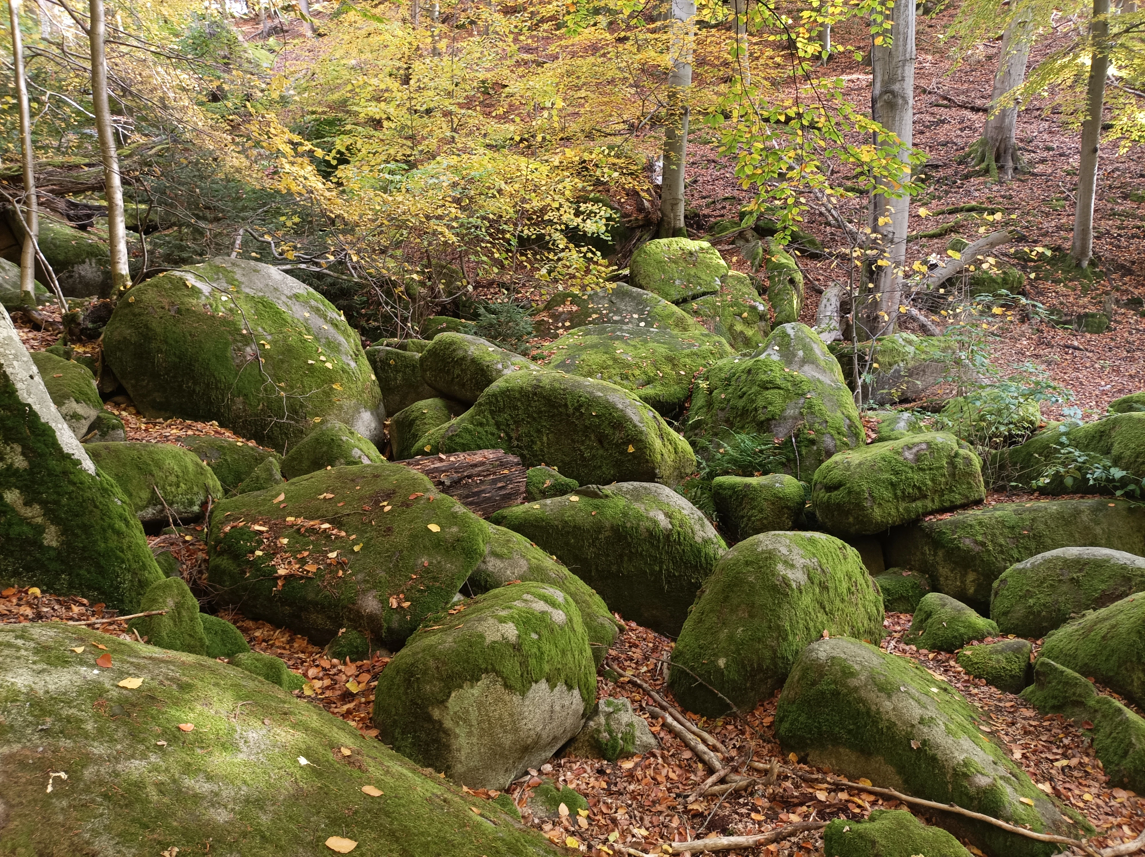
A forest floor covered with numerous large moss-covered granite boulders, interspersed with autumn leaves and surrounding beech trees.
Mossy boulder formations, known as a stone sea, in the Vlčí rokle ravine.

Vlčí rokle history and protected-area timeline

The landscape at Vlčí rokle was created through geological processes spanning hundreds of millions of years. The crystalline basement rock was formed roughly 330 million years ago during the Carboniferous period, when magma crystallized slowly several kilometers below the surface. As it cooled and contracted, it fractured along characteristic joints, leaving the rock predisposed to break into large angular blocks. Subsequent weathering and the erosive action of flowing water rounded these blocks over time, producing the smooth boulders that now fill the ravine floor. In older explanations, the formation of the ravine was sometimes incorrectly attributed to glacial activity.

The ravine itself was cut by the small stream Vlčín, which has gradually eroded the surface and exposed the broken granite beneath. Before the modern conservation era, the surrounding forest was managed as part of the large Dolní Břežany estate, which until 1911 was administered by the Archbishop of Prague. There is evidence of small-scale quarrying of building stone from the area, and the foundations of an unknown structure can still be found within the protected territory. Forest operations have historically shaped the species composition, contributing to the presence of pine and spruce that current management now seeks to reduce.

The stream Vlčín once served as a source of drinking water for a tuberculosis sanatorium at nearby Prosečnice. Remains of small water reservoirs and an abandoned waterworks building can still be traced along the stream; the latter even carries a mature spruce growing from its flat roof, a small but memorable trace of the site's 20th-century history.

Regionally, the area is also associated with old poaching lore. Local writer Jan Morávek described the area's poaching conflicts in his work Divočina, giving Vlčí rokle an additional layer of cultural memory beyond its purely natural significance.

Formal protection began with a designation by the district national committee in Benešov on 1 November 1990, classifying the area as a chráněný přírodní výtvor, with an initial area of about five hectares. In September 2007, the Central Bohemian Region reissued the protection through regulation No. 3/2007, expanding the area to about 8.51 hectares and modernizing the management conditions, without changing the core object of conservation.

Vlčí rokle landscape and geographic character

The landscape at Vlčí rokle is shaped by a single, narrow rock ravine oriented roughly east to west, carved by the small stream Vlčín. The ravine curves like an arch, opening into a broader boulder-strewn mouth where a striking kamené moře (stone sea) extends across the floor. Individual granodiorite boulders, some of them several meters in size, lie jumbled together in the lower section, partially covering the stream and creating a rugged, almost chaotic terrain beneath the otherwise smooth forest slopes.

Rock outcrops along the valley sides, collectively called Vlčí skály, contribute strong vertical and textural relief. These outcrops are formed of the same biotite granite that the boulders below have eroded from, and they expose the jointed structure of the parent rock. Poor soil development over this hard basement material explains the area's distinctive vegetation: forest communities adapted to nutrient-poor, acidic substrates, dominated by ancient beech trees of exceptional age.

The protected area is embedded within the larger forested upland of the Posázaví and the Požárské lesy, between roughly 350 and 430 meters above sea level. Although the surrounding topography is moderate rather than dramatic, the contrast between flat upland forest and the deeply cut, boulder-filled ravine gives Vlčí rokle a sense of concentrated, intimate relief that is unusual in this part of central Bohemia.
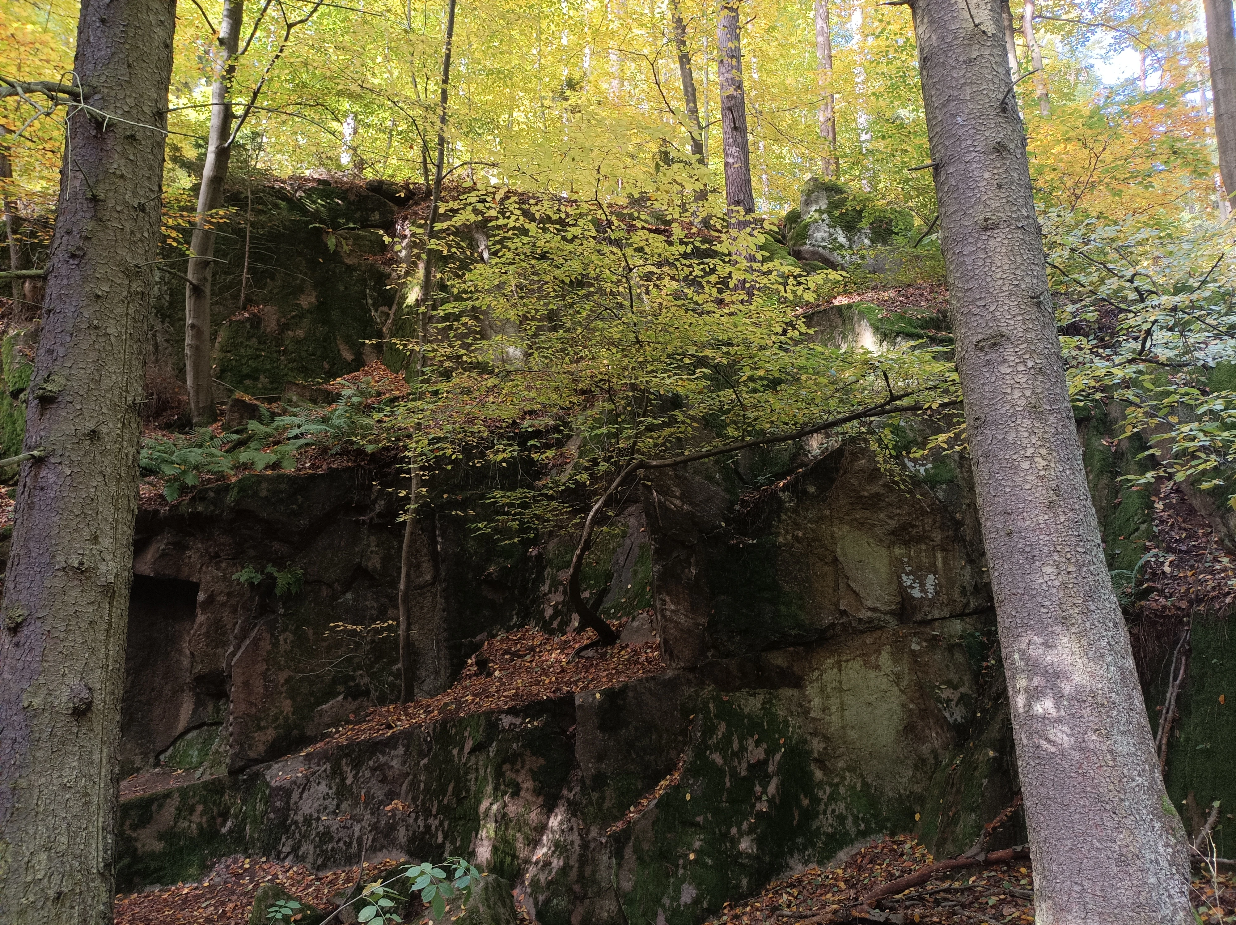
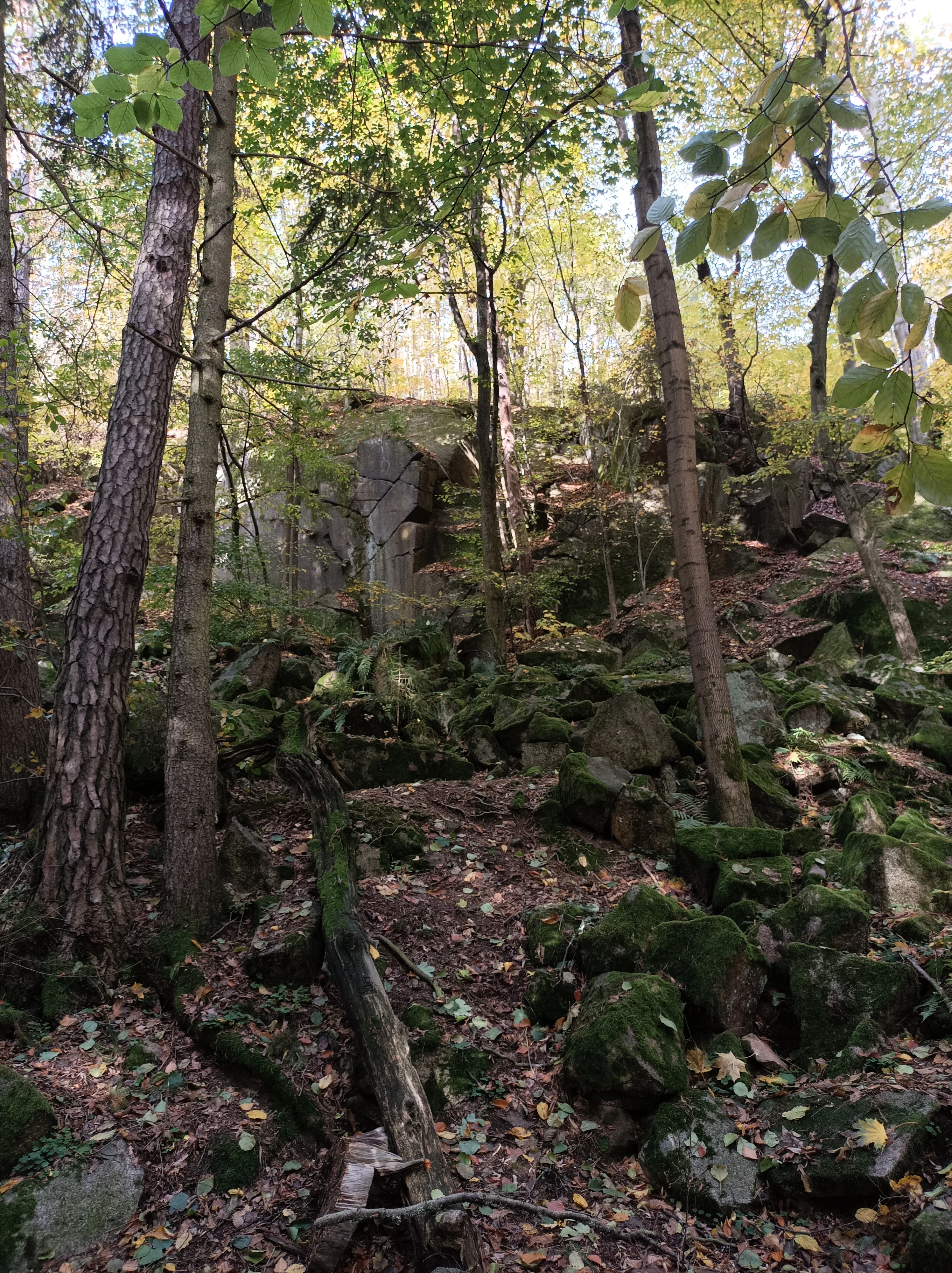
A view of weathered granite rock faces rising from a forest floor covered in autumn leaves, framed by mature tree trunks.
Granite rock formations in the beech forests of Vlčí rokle.

Vlčí rokle ecosystems, habitats, and plant life

The ecological identity of Vlčí rokle rests on its acidophilic beech forest community, a habitat type that is increasingly scarce in the intensively managed forests of central Bohemia. European beech dominates the canopy, with occasional admixture of small-leaved lime, sessile oak, Scots pine, hornbeam, spruce, rowan, silver birch, and larch. Several beech individuals exceed 200 years in age, lending the canopy a genuinely old-growth feel that is uncommon in the region.

The shrub layer is sparse and patchy, limited mainly by the heavy shade and acidic conditions, but it includes black and red elderberry, raspberry, and other brambles, along with natural tree regeneration of the dominant species. The herb layer is correspondingly thin and species-poor, with typical acid-indicator plants such as white wood-rush, reed bentgrass, wavy hair-grass, common wood sorrel, hawkweed species, and bilberry. On exposed granite, bryophyte communities thrive, and the common polypody fern is notably abundant.

These vegetation patterns reflect a harsh, nutrient-limited substrate. The acidic, leached soils developed over biotite granite present a challenging rooting environment, and the species set is therefore relatively conservative, but it is also stable and characteristic. The forest at Vlčí rokle is also an important habitat for organisms that depend on the high volumes of standing and downed dead wood associated with old-growth stands, including a rich community of invertebrates and the potential presence of cavity-nesting species.
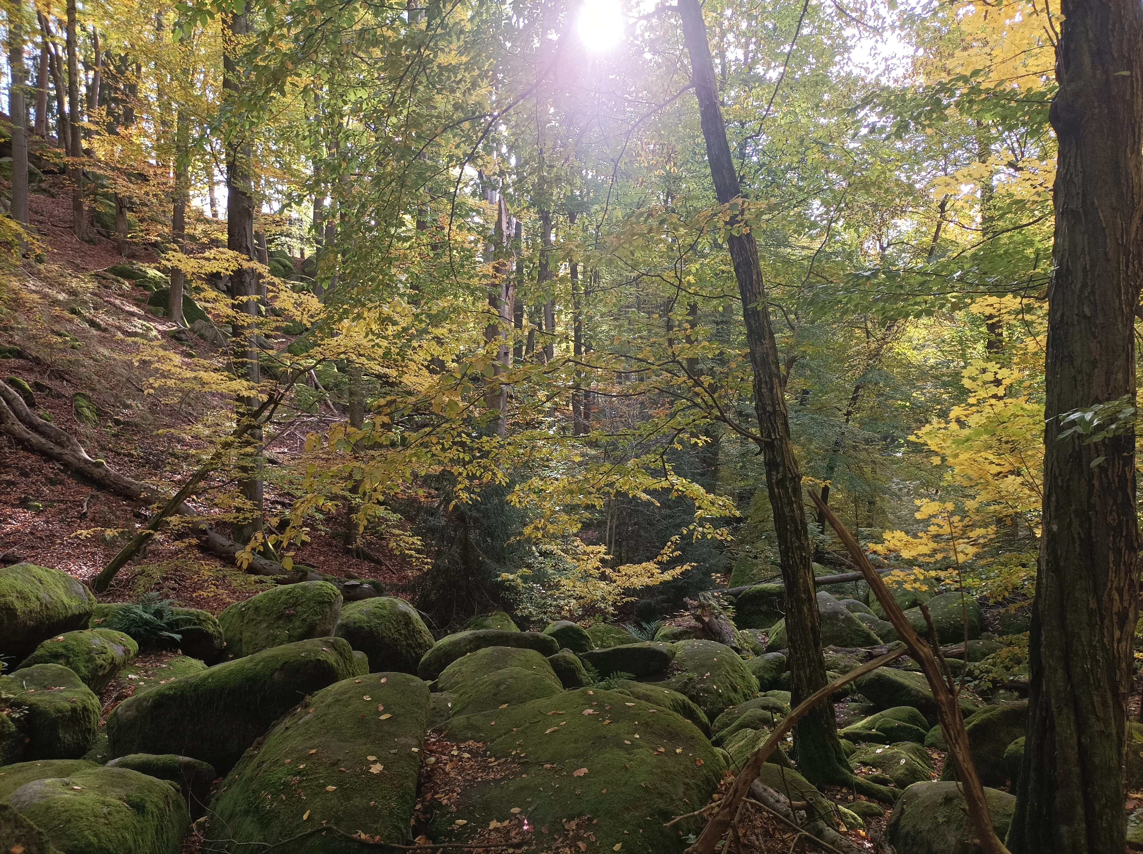
A forest floor covered in mossy granite boulders beneath a canopy of autumn trees with sunlight filtering through.
A stone sea formation surrounded by autumn beech forest in Vlčí rokle.

Vlčí rokle wildlife and species highlights

The wildlife of Vlčí rokle is not itself a primary target of protection; instead, the area has historically been influenced by hunting aimed at controlling pressures from large herbivores on forest regeneration. Browsing by local game is one of the main limiting factors on both natural and artificial regeneration of native tree species, and management responds to this with controlled hunting and, where necessary, protective fencing of young trees.

Nevertheless, the site's combination of ancient forest, abundant dead wood, granite outcrops, and shaded boulder habitat supports a community of invertebrates and smaller vertebrates linked to decaying wood. Beetles, millipedes, and centipedes are among the most easily recognized groups bound to these microhabitats, along with various cavity-nesting birds and small mammals. The site has been identified as a potential habitat for the strongly threatened stock dove, which would naturally benefit from old trees with large cavities.

While the park is not primarily a wildlife destination, the broader mosaic of forest, rock face, and boulder field provides quiet but consistent habitat value for species that require ecological continuity and structural complexity, and the protection of natural processes here indirectly protects wildlife that depends on these conditions to persist.
A forest scene showing moss-covered granite boulders and rocks scattered beneath tall trees with autumnal foliage.
Granite rock formations in the forest of Vlčí rokle.

Vlčí rokle conservation status and protection priorities

The central object of conservation at Vlčí rokle is the combination of an intact fragment of old acidophilic beech forest with a local geological phenomenon: the boulder breakdown of Carboniferous biotite granite. These two values are explicitly protected together, recognizing that the forest canopy and the underlying rock form one landscape identity. The aim of protection is to minimize direct human influence and to allow natural dynamics to shape the site.

Management follows a non-intervention regime in the core area, with intervention allowed only where strictly necessary for safety or ecological restoration. Sanitation cutting is permitted when needed, and selective harvesting is used to reduce the share of pine and spruce in favor of species that match the natural community composition. Where natural regeneration is threatened by over-browsing, enhancement plantings inside protective fences and individual tree protection are planned. To maintain habitat conditions for organisms tied to dying and dead wood, a portion of trees are deliberately left to decay naturally, and parts of felled trunks, windthrows, and stumps are retained within the forest.

The conservation approach at Vlčí rokle reflects a wider shift in central European forest protection: rather than treating the site primarily as a wood-producing forest, it is treated as a place where ecological memory, ancient tree generations, and unusual geology should be allowed to persist together over the long term.

Vlčí rokle cultural meaning and human context

Vlčí rokle carries a layered cultural background that goes beyond its purely ecological character. Before it became a protected site, the surrounding forest was part of the former Dolní Břežany estate, which until 1911 was managed by the Archbishop of Prague. Forestry activity, small-scale quarrying for building stone, and the remains of an unidentified structure in the forest all reflect the long history of practical human use of this landscape.

The stream Vlčín also has its own human chapter: it once supplied drinking water to a tuberculosis sanatorium in Prosečnice, and the remains of small water reservoirs and an abandoned waterworks building can still be found along the ravine. A striking visual trace of that era is a large spruce growing from the flat roof of the old waterworks, a small but evocative intersection of built history, abandonment, and natural regeneration.

The area is also part of local literary memory. Czech writer Jan Morávek drew on the region's poaching traditions in his work Divočina, which depicts the conflicts between poachers and authorities in landscapes very much like the wooded valleys around Vlčí rokle. This kind of regional writing has helped anchor the landscape in area folklore alongside its scientific and ecological importance.
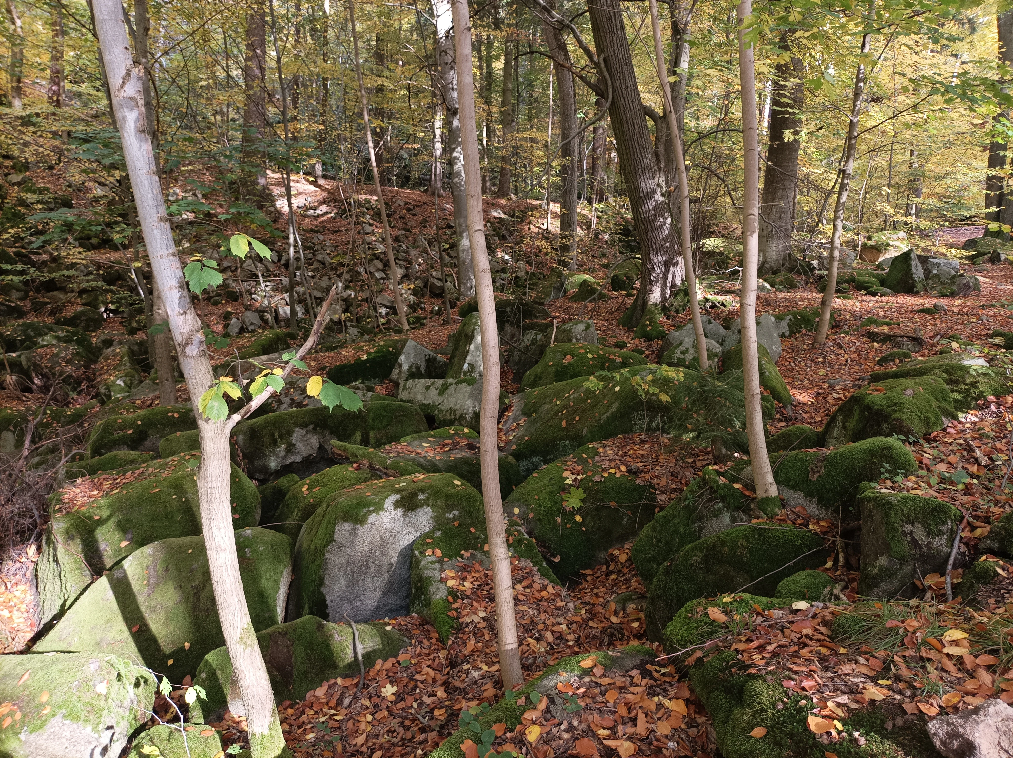
A forest floor covered in large, moss-covered granite boulders scattered under mature beech trees with autumn leaves in Vlčí rokle.
Mossy boulders and beech trees in the Vlčí rokle nature reserve.

Top sights and standout views in Vlčí rokle

Vlčí rokle is a place where the deep time of geology meets the long time of an ancient forest, on a scale that can be explored within a short walk. The combination of beech trees more than 200 years old, a ravine floor filled with rounded granite boulders, and exposed rock walls gives the site a strong sense of layered natural and human history.

Its compact size makes it an unusually approachable place to experience old-growth beech character and a real granite kamené moře in the same setting, while the embedded cultural traces, from the abandoned waterworks with its rooftop spruce to the literary memory of regional poaching songs, add an extra dimension to the visit.
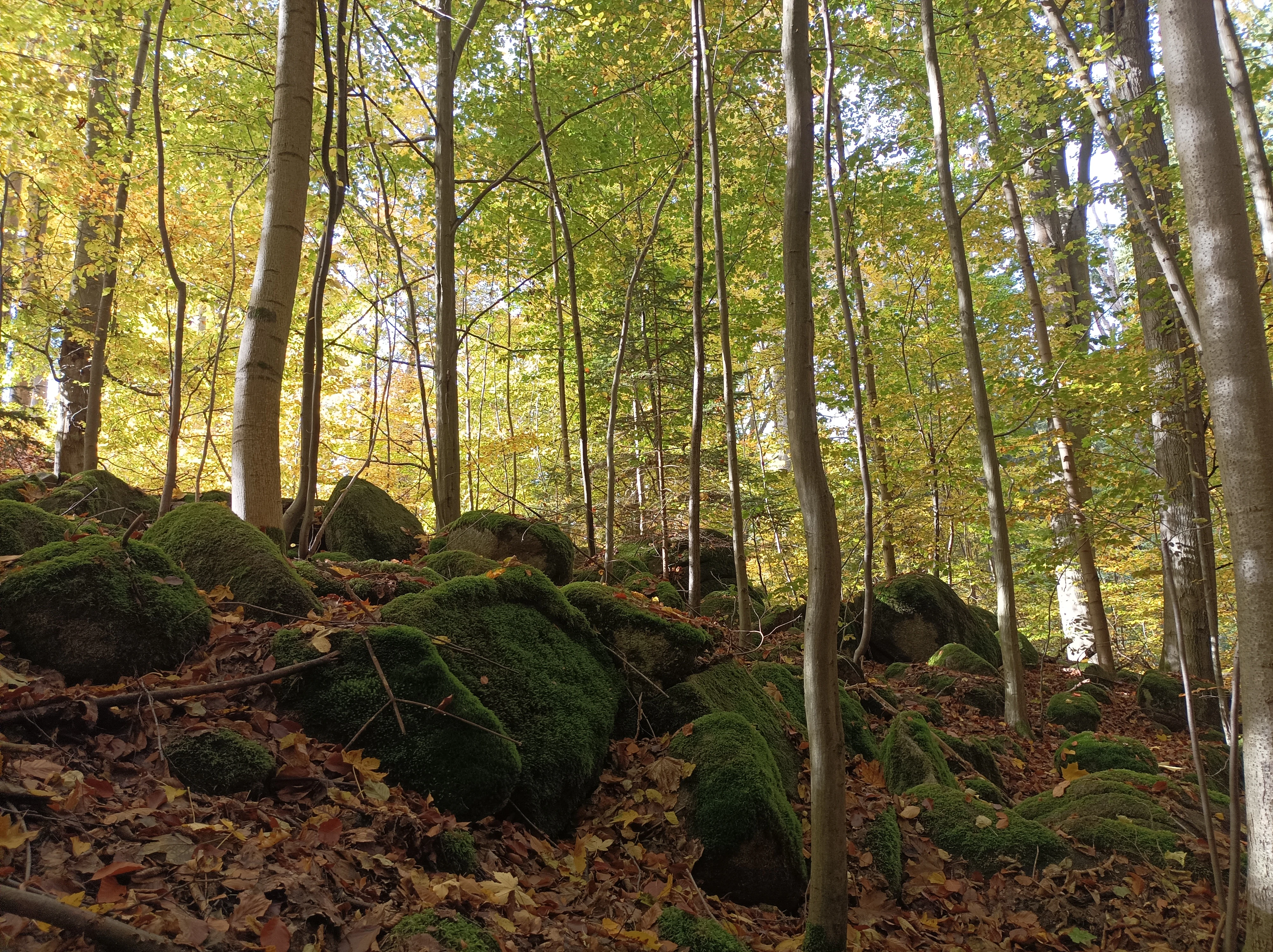
A view inside a forest during autumn, featuring tall trees with yellowing leaves and a forest floor scattered with mossy granite boulders and fallen leaves.
Autumn foliage and moss-covered granite boulders in the Vlčí rokle nature reserve.

Best time to visit Vlčí rokle

Visitors can access Vlčí rokle throughout the year along marked hiking trails, and the site's character shifts noticeably with the seasons. In winter, the open beech canopy exposes the boulder field and rock outcrops, offering the clearest views of the kamené moře and the Vlčí skály formations, with snow often highlighting the structural complexity of the ravine.

In spring and early summer, fresh green foliage and reviving undergrowth soften the rocky terrain and emphasize the contrast between the ancient canopy and the new season of growth. Late summer and autumn bring warmer tones in the beech leaves and intensified activity around water sources along the stream Vlčín, while the rock walls and boulder shadows remain visible year-round. Because the area is small and the trails are short, it is well suited to a focused visit in any season, with no single designated peak period.

Monthly climate preview

Long-term monthly climate patterns and temperature ranges

Vlčí rokle Average Temperature and Precipitation Normals

Representative coordinates record measured monthly temperature extremes alongside precipitation rates across the landscape. Examining the full twelve-month profile reveals complete thermal and moisture trends for Vlčí rokle.
Annual mean9 °C
-2 °C20 °C
Jan-2°
Feb-1°
Mar
Apr
May13°
Jun17°
Jul20°
Aug19°
Sep14°
Oct
Nov
Dec-1°
Warmest month
July

19.7 °C

Coolest month
January

-2.2 °C

Wettest month
June

2.6 mm/day

Driest month
February

1.1 mm/day

Park location guide

Geography guide, regional context, and park location map for Vlčí rokle

Vlčí rokle park geography, regions, and map view in Czechia

Understand where Vlčí rokle sits in Czechia through a broader geographic reading of the surrounding landscape, nearby location context, and its mapped position within the national park landscape.

How Vlčí rokle fits into Czechia

Czech Republic is a landlocked Central European country with a population of approximately 10.9 million people. The nation was established as an independent state on January 1, 1993, following the dissolution of Czechoslovakia. Its capital and largest city is Prague, with other major urban centers including Brno, Ostrava, Plzeň, and Liberec.

Wider geography shaping Vlčí rokle in Czechia

The Czech Republic is a landlocked country in Central Europe. It is bordered by Germany to the west, Austria to the south, Poland to the northeast, and Slovakia to the southeast. The landscape is predominantly hilly, with the territory covering 78,871 square kilometers.

Map view of Vlčí rokle

Use this park location map to pinpoint Vlčí rokle in Czechia, understand its exact geographic position, and read its mapped placement within the surrounding landscape more clearly.

Pigeon | © OpenStreetMap contributors

Location context for Vlčí rokle

Středočeský kraj

Explore detailed imagery of ancient beech forests, rock outcrops, and granite boulder fields.

Vlčí rokle Photos and Landscape Scenery: Visualizing the Protected Ravine

Visual records capture the rugged terrain of the rocky ravine, featuring exposed granite outcrops and centuries-old beech trees across the protected landscape. Examining these field photographs reveals the unique geological and botanical characteristics that define the regional habitat.

A forest floor covered with numerous large moss-covered granite boulders, interspersed with autumn leaves and surrounding beech trees.

A forest clearing filled with large, moss-covered granite boulders, surrounded by tall, bare deciduous trees in late autumn.

A view of weathered granite rock faces rising from a forest floor covered in autumn leaves, framed by mature tree trunks.

A forest floor covered in mossy granite boulders beneath a canopy of autumn trees with sunlight filtering through.

A forest scene showing moss-covered granite boulders and rocks scattered beneath tall trees with autumnal foliage.

A small stream flows through a mossy forest floor in autumn; large granite boulders covered in green moss are scattered along the rocky creek bed, surrounded by fallen leaves and thin beech trees.

A forest floor covered in large, moss-covered granite boulders scattered under mature beech trees with autumn leaves in Vlčí rokle.

A view inside a forest during autumn, featuring tall trees with yellowing leaves and a forest floor scattered with mossy granite boulders and fallen leaves.

A forest scene in autumn featuring mature trees with golden and green leaves and moss covered granite boulders scattered on the forest floor.

A tall, dead, leafless tree stands in the center of a forest during autumn, surrounded by healthy evergreen and deciduous trees with yellow and orange foliage.

Low stone wall ruins set among mossy boulders and tall trees in an autumn forest.

A close up view of a large fallen tree trunk in the foreground, with an autumn forest of beech trees and scattered yellow leaves in the background.

A weathered concrete building, likely a former waterworks facility, partially covered in vegetation and marked with graffiti, situated in a wooded area with autumn foliage.

Park atlas

Compare adjacent forest reserves, rocky ravines, and regional conservation landscapes

Exploring Other Parks Near Vlčí Rokle and Surrounding Protected Natural Areas

Browsing other parks near Vlčí rokle reveals how ancient beech woodland habitats connect with broader geological formations across the surrounding uplands. Extending the geographic comparison into neighboring protected areas provides deeper context on regional terrain and forest dynamics.
Watercolor painting of a pastoral landscape featuring a tree, a large rock, and soft hills in the background with a pale sky.
Natural monumentStředočeský kraj
About 2.4 km away#1 closest

North

Skalsko Natural Monument: Mapped Wetland Landscapes and Protected Meadow Geography

A representative habitat in the Středočeský kraj uplands

Focusing on the conservation of sensitive wet meadow ecosystems, Skalsko serves as a key reference for the biodiversity of the Říčany Plateau. This site showcases a mosaic of flora, including rare orchids, set against the backdrop of the geologically distinct Central Bohemian uplands, providing a structured look at one of the region's most important protected natural monuments.

Area
0.036 km²
Established
2008
IUCN
IV
Relief
Upland
A watercolor painting showing a soft, panoramic landscape with rolling hills, a line of trees, and a small pond or marshy area in the foreground.
Protected landscapeStředočeský kraj
About 4.4 km away#2 closest

East

Hornopožárský les Nature Park: Atlas of Protected Landscapes in Středočeský kraj

Granite Bedrock and Forested Terrains in Central Bohemia

Trace the undulating ridges and rocky outcrops of Hornopožárský les Nature Park, where central Bohemian geography meets historical quarrying heritage. This protected area offers a deep look into the regional forests and river valley ecosystems characteristic of the lower Posázaví landscape.

Area
25 km²
Established
2002
Relief
Upland
Climate
Temperate
Nature reservePrague
About 16 km away#3 closest

Northwest

V hrobech Nature Reserve: A Protected Botanical Island within the Urban Landscape of Prague

Rare dry-grassland habitats in the Kamýk district

V hrobech is a designated nature reserve in Prague featuring 1.3 hectares of southeast-facing slopes and species-rich grassland. This site is home to rare thermophilic plants and represents an important example of intensive conservation management in an urban environment. Its protected boundaries connect with local forest fragments to maintain ecological value amidst the residential developments of Lhotka and Libuš.

Area
0.013 km²
Established
1988
IUCN
IV
Relief
Lowland
A soft, minimalist watercolor painting showing a green treeline against a pale pink and white background, suggestive of wetlands or ponds.
Natural monumentPrague
About 16 km away#4 closest

North

Milíčovský les a rybníky: Protected Landscape and Wetland Map in Prague, Czech Republic

Natural monument geography and forest-wetland habitat atlas

Milíčovský les a rybníky represents a core natural monument in southern Prague, featuring a mature deciduous forest integrated with a managed system of ponds. This protected area serves as a critical refuge for rare wetland and woodland species. Use the mapping tools to trace the terrain, from the dense oak-hornbeam canopy to the extensive reedbeds and aquatic environments that define this unique urban-edge landscape.

Area
1.047 km²
Established
1991
IUCN
III
Relief
Upland
A pale, soft-toned watercolor painting of a rolling landscape featuring a stream in the foreground, scattered trees in the midground, and faint mountains in the distant background.
Protected landscapePraha
About 16 km away#5 closest

North

Přírodní park Botič-Milíčov: Protected Landscape, River Valley, and Forest Map

A preserved green refuge featuring meandering streams and pond networks near Praha.

Přírodní park Botič-Milíčov stands as a significant protected landscape in Praha, defined by the seasonal flooding of the Botič and Pitkovický streams. The park hosts alluvial forests, a series of historic ponds, and archaeological traces of ancient mills. Through map-based exploration, identify the diverse terrain that includes rocky outcrops at Pitkovická stráň and extensive broadleaf woodlands on the edge of urban housing developments.

Area
8.24 km²
Established
1984
Relief
Lowland
Climate
Temperate
A horizontal watercolor illustration of gentle, rolling green hills under a pale sky, with clusters of stylized trees in the foreground and faded distant mountains in the background.
Natural monumentPrague
About 18 km away#6 closest

Northwest

Radotínské skály Natural Monument: Geological Mapping and Protected Landscapes in Prague

Geological profiles and steppe biodiversity near the capital.

Radotínské skály stands as a key protected area in Prague, showcasing an internationally significant stratigraphic record of the Prague Basin. From exposed rock walls to warm-loving forest-steppe communities, the site offers a detailed look at how geological heritage persists alongside urban development, making it an essential destination for those exploring the regional geography of the Czech Republic.

Area
0.277 km²
Established
1988
IUCN
III
Relief
Upland
A soft watercolor painting of a green landscape featuring a small body of water, rolling hills, and trees, painted in a minimalist style on a white background.
Protected landscapePrague
About 19 km away#7 closest

North

Hostivař-Záběhlice Nature Park: Protected Landscape and Mapped Prague Geography

River valleys and reservoir terrain within the capital city.

Hostivař-Záběhlice Nature Park represents a vital natural zone in Prague, characterized by the mature forests and meandering river paths along the Botič stream. This record highlights the park's geographic composition, including its reservoirs, lowland forest patches, and its function as a preserved natural corridor within the city.

Area
4.23 km²
Established
1990
Relief
Lowland
Climate
Temperate
A soft watercolor painting of a winding stream moving through green meadows with distant rolling hills and a light, misty atmosphere.
Natural monumentPrague
About 19 km away#8 closest

North

Meandry Botiče Natural Monument: Mapped Geography and Protected Stream Landscapes in Prague

Analyzing the ecological boundaries and riparian terrain of the Botič stream corridor

Meandry Botiče represents a significant natural monument in Prague, distinguished by its pronounced stream meanders and dense bankside vegetation. This site offers deep insights into urban conservation, documenting the delicate balance between native riparian flora and the pressures of encroaching residential districts within a managed protected environment.

Area
0.067 km²
Established
1968
IUCN
III
Relief
Lowland

Common questions about visiting, size, designation, and location context for Vlčí rokle

Vlčí rokle FAQs for park facts, access, geography, and protected area context

Find quick answers about Vlčí rokle, including protected-area facts, park geography, trail and visitor context, and how the park fits into its surrounding country and regional landscape.
MoriAtlas Explorer

Continue Your Protected Areas Search Across the Global Atlas

Deepen your exploration by continuing the structured search for national parks and protected areas worldwide. Utilize the comprehensive filtering capabilities to compare different conservation landscapes and refine your understanding of global park geography. Discover more about the distribution and characteristics of protected natural areas.

Global natural geography