
Mori Atlas logo
Wildlife reserveVogelschutzgebiet Schlei

Mapping the extensive brackish fjord habitats and protected shorelines of northern Germany

Vogelschutzgebiet Schlei Wildlife Reserve and Coastal Landscape Atlas of Schleswig-Holstein

Vogelschutzgebiet Schlei forms a continuous 40-kilometer protected corridor along the Baltic coast of Schleswig-Holstein, extending from the Schleimünde inlet to the city of Schleswig. This wildlife reserve showcases a complex mosaic of reedbeds, salt marshes, steep moraine cliffs, and offshore mudflats that define the region's unique maritime character. By tracing the fjord's intricate boundary, this atlas entry provides an essential geographic perspective on one of northern Germany's most significant brackish water sanctuaries.

birdsbird sanctuarybirdwatchingcoastal habitatbrackish waterBaltic Sea
A flat-style vector illustration depicting a peaceful river landscape with birch trees, grassy banks, and calm water under a soft, pale sky.

Vogelschutzgebiet Schlei

Wildlife reserve

Park overview

Structured park overview, official facts, and landscape profile for Vogelschutzgebiet Schlei

Vogelschutzgebiet Schlei park facts, protected area profile, and essential visitor context

Review the core facts for Vogelschutzgebiet Schlei, including designation, size, terrain, visitor scale, habitats, and operating context in one park-focused overview.

About Vogelschutzgebiet Schlei

Vogelschutzgebiet Schlei is a long, linear protected landscape on the northern German Baltic coast, following the Schlei fjord for roughly 40 kilometers from the open Baltic near Schleimünde and Maasholm to the historic city of Schleswig. The Schlei is one of four Förden, the long, glacially formed inlets that define the Schleswig-Holstein coastline, and it is both the longest and the narrowest of them.

The protected area reflects the broader character of the fjord landscape. The Schlei separates two ground-moraine peninsulas, Angeln to the north and Schwansen to the south, and its protected waters include wide, lake-like basins as well as narrower stretches bordered by reedbelts and wooded slopes. Offshore, the shallow Baltic flats of the Schleisand extend the protected habitat seaward. Together, these features create a transitional zone where brackish and saltwater conditions meet freshwater inflows from brooks, meadows, and marshes.

What makes the Vogelschutzgebiet Schlei distinctive is the sheer variety of habitats squeezed into its shoreline. Reedbeds give way to sand beaches and low beach ridges, which alternate with steep eroding coastal cliffs, spring-fed fens, wet meadows, salt marshes, poor-quality grasslands, small brook valleys, traditional hedgerow-lined field boundaries, and beech woodlands. This small-scale mosaic supports an unusually broad community of plants, invertebrates, fish, and especially birds.

The area was designated under the European Birds Directive and integrated into the Natura 2000 network in order to maintain breeding, feeding, moulting, resting, and wintering sites for wild bird species, including those listed in Annex I of the directive. It works in tandem with an overlapping Fauna-Flora-Habitat area, giving the site combined bird and habitat protection status. While the sanctuary is primarily recognized for its ornithological importance, it is equally valued for the geomorphological structure and near-natural habitat composition of the fjord coast, both of which are described as unique within Schleswig-Holstein.

Quick facts and research context for Vogelschutzgebiet Schlei

Vogelschutzgebiet Schlei is a European Special Protection Area (SPA) in the German state of Schleswig-Holstein, covering approximately 8,686 hectares along the Schlei fjord between Schleimünde and the city of Schleswig. It was formally established in 1997 as a designated bird protection area under the EU Birds Directive and is part of the pan-European Natura 2000 network of protected sites.

The area is classified as IUCN Category IV (Habitat/Species Management Area) and has a separate Natura 2000 site code of 1423-491. It overlaps with an adjacent Fauna-Flora-Habitat (FFH) area and includes both the narrow and the lake-like basins of the fjord, its reed-fringed shore zones, and the shallow offshore sand and mudflats of the Baltic known as the Schleisand. The sanctuary is recognized as the largest brackish water area in Schleswig-Holstein and as an internationally significant coastal ecosystem.

Protection and recognition

Examine documented conservation data and official protected area records for Vogelschutzgebiet Schlei.

Vogelschutzgebiet Schlei Protection Status and Official Designation Record

Vogelschutzgebiet Schlei conservation records compile verified protection status and administrative designation details into a structured atlas overview. Reference parameters outline official protected area data sources without implying management outcomes or external recognition programs.

Protection details

WDPA ID
555537246
Park context

Deeper park guide and search-rich context for Vogelschutzgebiet Schlei

Vogelschutzgebiet Schlei history, landscape, wildlife, and travel context

Explore Vogelschutzgebiet Schlei through its history, landscape character, ecosystems, wildlife, conservation priorities, cultural context, and seasonal travel timing in a structured park guide built for atlas discovery and search intent.

Why Vogelschutzgebiet Schlei stands out

The Vogelschutzgebiet Schlei is best known for protecting the largest and most varied brackish water landscape in Schleswig-Holstein. The fjord is one of four classic Förden on the state's Baltic coast and is exceptional for the close interweaving of marine and freshwater habitats along a relatively narrow coastal strip. Its richly mixed shoreline environment supports notable breeding, migratory, and wintering bird populations. Species such as avocet, little tern, common tern, Arctic tern, common scoter, red-breasted merganser, whooper swan, white-tailed eagle, marsh harrier, and bluethroat rely on its beaches, salt marshes, reedbeds, and shallow waters. The site's combination of geomorphological diversity, near-natural habitat structure, and ecological complexity makes it a reference location for coastal bird conservation in northern Germany.
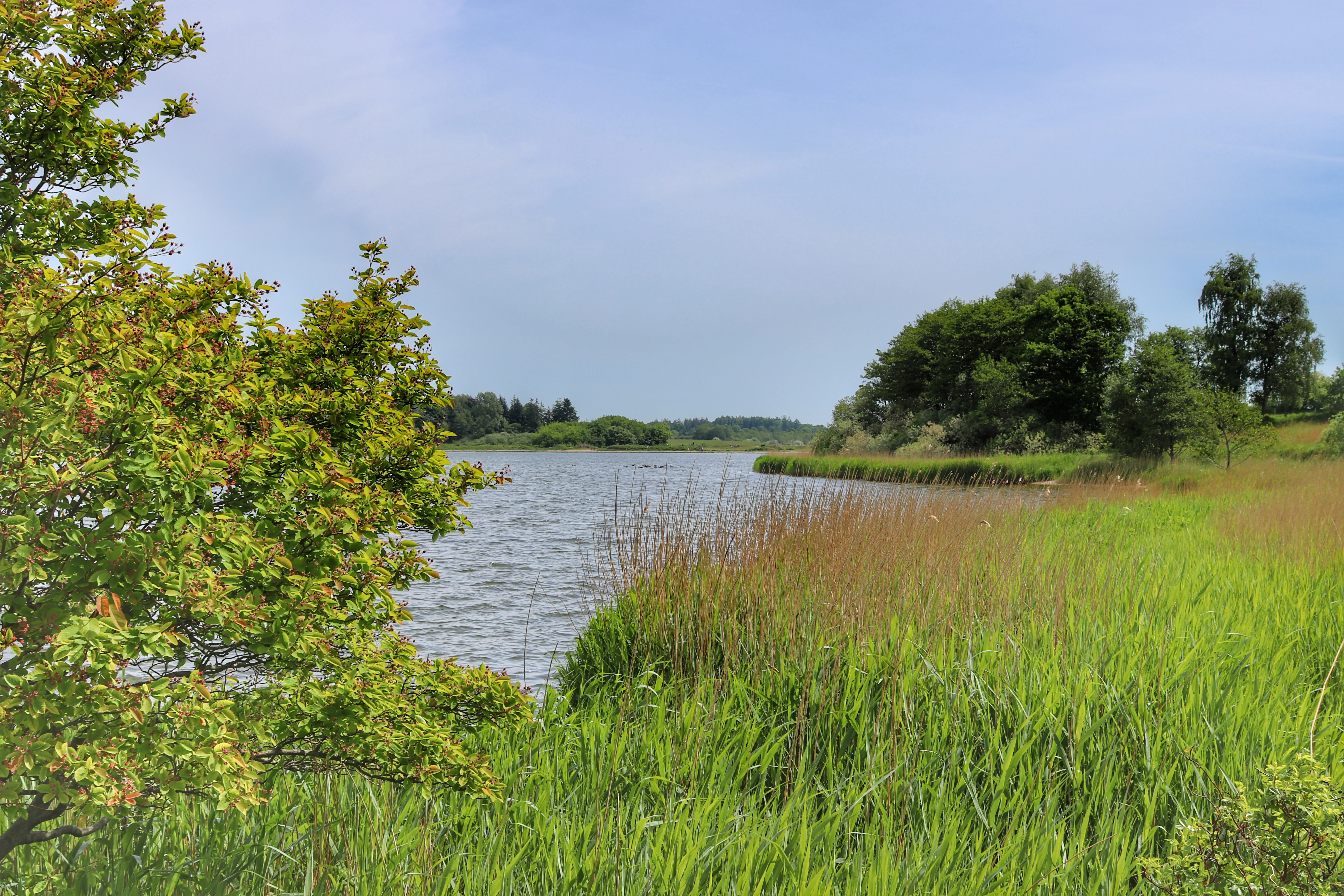
A wide view of the Schlei fjord shoreline with tall green grass, shrubs, and trees along the edge of the calm water.
The shores of the Schlei fjord, featuring lush grasses and calm water.

Vogelschutzgebiet Schlei history and protected-area timeline

The Vogelschutzgebiet Schlei was formally established in 1997 as a European bird protection area under the EU Birds Directive, which obliges member states to designate Special Protection Areas for vulnerable and migratory bird species. It was integrated into the pan-European Natura 2000 network that combines SPAs with Fauna-Flora-Habitat sites, and it works alongside an overlapping FFH area along the same stretch of fjord.

The sanctuary builds on a much older recognition of the Schlei as a special coastal landscape. Long before formal European designation, the fjord's mix of brackish water, reedbeds, salt marshes, steep cliffs, and shallow offshore sand flats had made it locally important for fishing, shipping, and birdlife. Traditional land uses such as low-intensity grazing of coastal meadows, management of hedgerows, and careful stewardship of reed zones shaped the open, structurally rich landscape that the modern protection regime now seeks to preserve.

In more recent years, conservation planning has emphasized maintaining the largely open character of the landscape, allowing controlled natural succession in some places, preserving water quality, and keeping large birds safe from disturbance by excluding wind turbines and high-voltage power lines from sensitive zones. The site's Natura 2000 designation sets population and habitat conservation targets for breeding and resting birds, which continue to guide its management today.

Vogelschutzgebiet Schlei landscape and geographic character

The landscape of Vogelschutzgebiet Schlei is defined by the long, narrow Schlei fjord, which cuts into the Schleswig-Holstein coast between the Angeln peninsula to the north and the Schwansen peninsula to the south. The fjord alternates between narrow, channel-like stretches and wider, lake-like basins, locally called Noore, that are fringed by reeds and gently sloping shores. Offshore, the shallow sand and mudflats of the Schleisand extend the protected scenery into the open Baltic.

Along the shoreline the terrain shifts rapidly from one coastal type to another. There are gently shelving sandy beaches and low strandwalls, vertical eroding cliffs where the moraine meets the water, spring-fed fens where groundwater seeps out at the base of slopes, and wet meadows that flood seasonally. Salt marshes lie alongside species-poor grasslands on sandy soils, while small brook valleys and traditional hedgerow-lined field boundaries add a finer-scale mosaic to the inland edge of the protected zone. Mature beech forest crowns the higher coastal slopes in places, especially where steep cliffs drop directly to the Schlei.

Above all, the protected landscape is notable for the close interweaving of marine and freshwater features within a relatively narrow coastal strip. This creates a geomorphologically rich transitional zone where brackish water tides, freshwater seepage, and Baltic wave action all shape the visible scenery, producing a coastal panorama that is regarded as a reference landscape for the entire Baltic coast of Schleswig-Holstein.
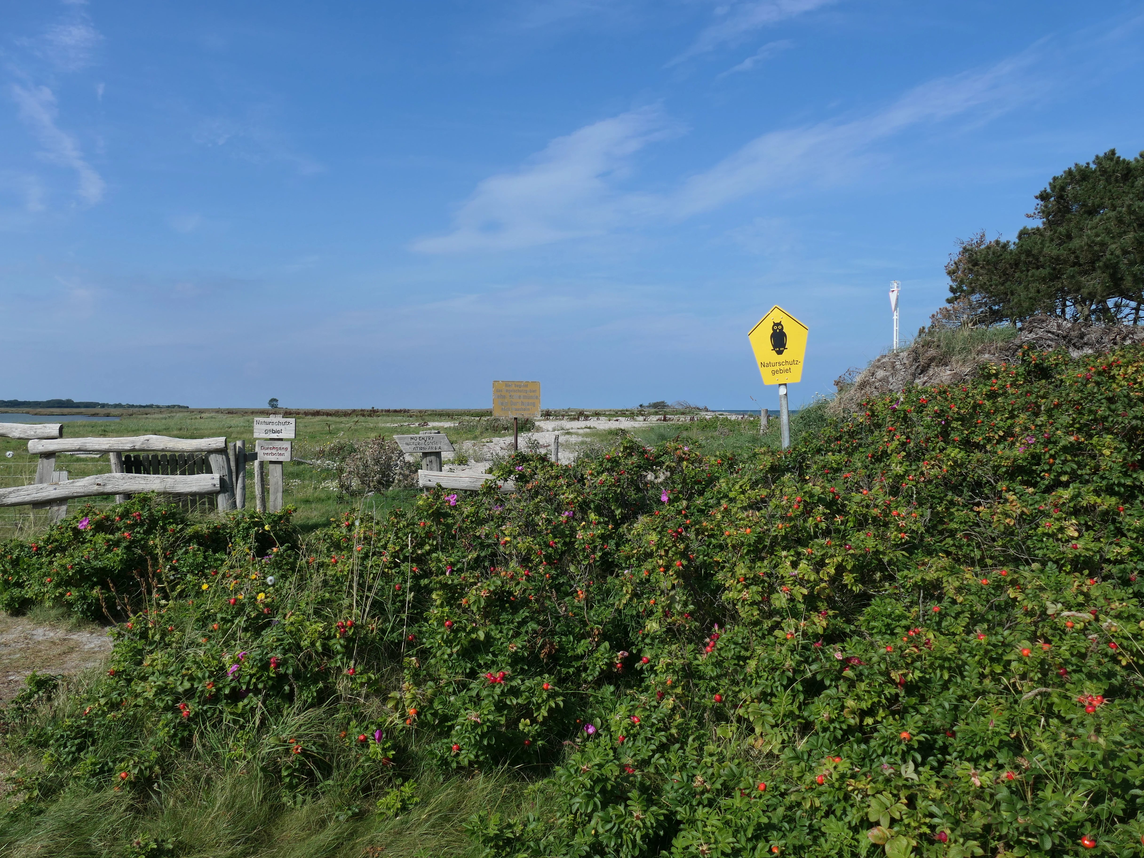
A yellow, pentagonal sign with a black symbol of a bird stands amidst low-lying coastal vegetation and shrubs, with a wooden fence and a flat, grassy landscape visible in the background under a blue sky.
A yellow nature reserve warning sign marks the coastal area of the Schlei bird sanctuary.

Vogelschutzgebiet Schlei ecosystems, habitats, and plant life

Ecologically, Vogelschutzgebiet Schlei is dominated by the unusual brackish character of the Schlei fjord, where Baltic saltwater mixes with freshwater from brooks, fens, and agricultural land. The result is an estuarine-type system that supports both marine and freshwater species and that contains some of the most habitat-rich shoreline in Schleswig-Holstein.

Reedbeds are among the most conspicuous habitats, covering broad areas along the inner fjord and its sheltered bays. They are accompanied by salt marshes on the more exposed outer coast near Schleimünde, wet meadows and fens inland, and nutrient-poor grasslands on sandy substrates. Beech woodland clings to steeper slopes, while hedgerow networks and small woodland patches break up the agricultural landscape further inland. Submerged vegetation in the fjord and extensive mussel beds on the shallows provide crucial food resources, and the offshore Schleisand creates calm, shallow feeding areas.

The overall ecological profile is one of small-scale habitat mosaics that connect directly with the marine environment. This structural richness supports a wide range of breeding, migratory, and wintering species and gives the Vogelschutzgebiet Schlei an ecological value that conservation authorities describe as internationally significant and unique within the state of Schleswig-Holstein.
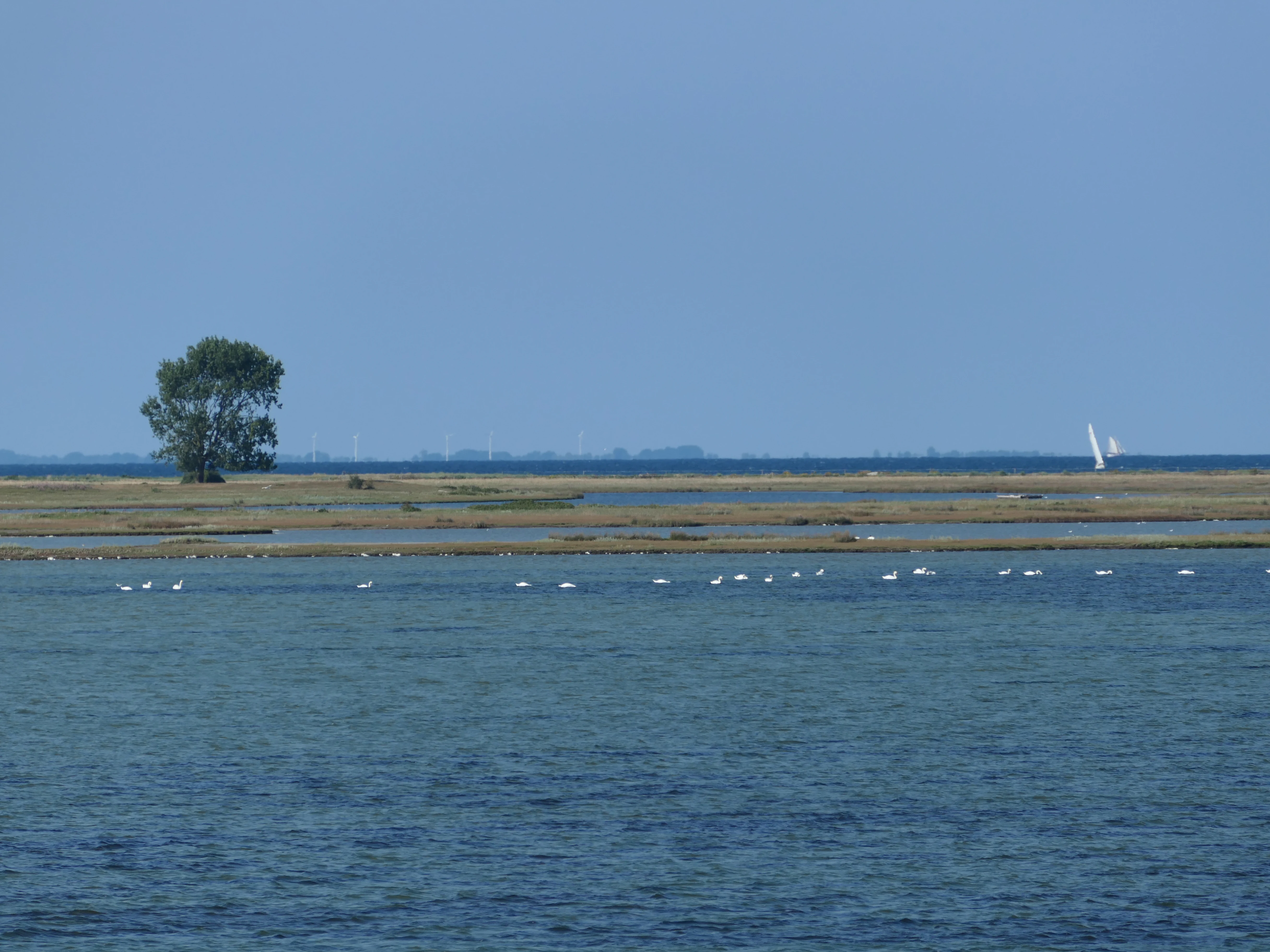
A wide shot of a coastal landscape with a calm blue sea in the foreground and low-lying land with a single tree in the midground; a line of white birds swims near the shore.
A view of the Oehe-Schleimünde bird sanctuary, showing the shoreline and coastal bird habitat.

Vogelschutzgebiet Schlei wildlife and species highlights

Vogelschutzgebiet Schlei is first and foremost a bird sanctuary, and its wildlife profile is shaped by the rich bird community that relies on the fjord's mosaic of habitats. The site supports important numbers of both breeding and migratory waterbirds, as well as raptor and passerine species that use the surrounding fields, marshes, and woodlands.

The coastal flats and salt marshes provide breeding habitat for shorebirds such as avocet, common redshank, lapwing, snipe, and the little, common, and Arctic terns, while the offshore shallows serve as resting, moulting, and wintering areas for diving ducks including common scoter, tufted duck, pochard, and goldeneye. The reedbeds shelter marsh harrier, sedge warbler, and other reedbed specialists, and the combination of open water, wooded cliffs, and adjacent forest provides nesting and hunting habitat for white-tailed eagle, common merganser, smew, and kingfisher. Open fields with hedgerows support red-backed shrike, while wet meadows host corncrake, and migratory passerines including bluethroat, skylark, meadow pipit, whinchat, and various warblers pass through or breed in the area.

Many of the species for which the sanctuary is protected are listed in Annex I of the EU Birds Directive, including smew, whooper swan, little tern, common tern, Arctic tern, marsh harrier, white-tailed eagle, corncrake, avocet, kingfisher, and red-backed shrike. Migratory species such as skylark, meadow pipit, goldeneye, common ringed plover, whinchat, and common redshank add to the site's broader ornithological importance, particularly during spring and autumn passage and in winter.

Vogelschutzgebiet Schlei conservation status and protection priorities

The Vogelschutzgebiet Schlei is a formally protected area under both the European Birds Directive and the EU Habitats Directive, forming part of the Natura 2000 network together with an overlapping Fauna-Flora-Habitat site. It is classified as an IUCN Category IV protected area, reflecting its focus on managing specific habitats and species rather than offering the strictest, reserve-level protection.

Its central conservation goal is the long-term protection of the largest brackish water area in Schleswig-Holstein, including its characteristic geomorphological structure, near-natural habitat composition, and the close ecological interlinking of marine and freshwater features. The site is considered internationally important for waterbirds and uniquely structured within the state, which gives its protection a particularly high profile in regional conservation policy.

Specific management objectives include preserving largely open landscapes with tolerated natural succession in some zones, maintaining the Schleisand and calm fjord waters as breeding, resting, and wintering habitat, protecting mussel beds and underwater vegetation as feeding areas, and ensuring high water quality across the entire area. Large birds are actively protected from disturbance by keeping the most sensitive zones free of wind turbines and high-voltage power lines, while targeted measures aim to maintain favorable conservation status for the populations and habitats of each priority bird group, from coastal and salt-marsh species to reedbed, woodland-edge, and open-water specialists.

Vogelschutzgebiet Schlei cultural meaning and human context

The Schlei has long been part of the cultural landscape of northern Schleswig-Holstein, separating the traditional regions of Angeln and Schwansen and shaping local identity for centuries. Small fishing villages such as Maasholm, scattered farmsteads along the fjord, and the historic city of Schleswig at the inner end of the protected area all reflect a long-standing relationship between local communities and the water.

Traditional land uses, including low-intensity grazing of coastal meadows, careful management of reed zones, and the maintenance of hedgerow field boundaries, gave the landscape much of its open, varied structure. These practices continue to shape the cultural environment of the protected area today and underpin many of the conservation goals related to maintaining cultural landscape character alongside ecological value. The fjord is also an important setting for regional recreation, including sailing, small-scale fishing, and coastal walking, linking natural protection with long-standing maritime heritage.

Top sights and standout views in Vogelschutzgebiet Schlei

Vogelschutzgebiet Schlei stands out among European bird protection areas for its length, spanning roughly 40 kilometers from the open Baltic to the inland city of Schleswig, and for the remarkable ecological complexity of the shoreline it protects. Its mix of brackish water, reedbeds, salt marshes, steep cliffs, beech woodland, and offshore shallows creates a near-complete cross-section of Baltic coastal habitat within a single protected corridor.

The sanctuary's combinations of species diversity is another defining feature: it brings together Annex I species such as white-tailed eagle, kingfisher, and corncrake with classic Baltic shorebirds like avocet and terns, wintering waterfowl, and a wide range of reedbed and farmland passerines. Layered onto this is the cultural coastline of the Angeln and Schwansen peninsulas, with traditional villages, hedgerow landscapes, and active small-scale farming, making the Vogelschutzgebiet Schlei a place where European-scale conservation, coastal scenery, and regional heritage meet.

Best time to visit Vogelschutzgebiet Schlei

Vogelschutzgebiet Schlei offers different experiences across the seasons. Spring is one of the most rewarding periods, when migratory birds return, reedbeds come alive with warblers and marsh harriers, and coastal meadows turn green along the fjord. It is an excellent time for observing breeding species and for enjoying mild weather on foot, by bike, or by small boat.

Summer brings long daylight hours and the peak breeding season for coastal species, with tern colonies active on beaches and sand spits and reedbed song at its fullest. Autumn is a strong season for visible bird migration, with waders and waterfowl concentrating on the shallows and salt marshes. Winter offers a quieter but distinct atmosphere, when the fjord hosts large numbers of wintering ducks, swans including whooper swan, and regular sightings of white-tailed eagle, while the exposed Schleswig-Holstein coast takes on a stark, open character that highlights the area's geomorphology.

Monthly climate preview

Measured monthly temperature ranges and precipitation patterns for Vogelschutzgebiet Schlei

Vogelschutzgebiet Schlei Climate Normals and Long Term Weather by Month

Historical records from 1991 to 2020 establish long term monthly temperature and precipitation averages across representative coordinates in Vogelschutzgebiet Schlei. Detailed climate normals provide month by month meteorological context to examine multi year atmospheric rhythms in depth.
Annual mean9 °C
1 °C18 °C
Jan
Feb
Mar
Apr
May12°
Jun15°
Jul18°
Aug18°
Sep14°
Oct10°
Nov
Dec
Warmest month
August

17.6 °C

Coolest month
January

1.1 °C

Wettest month
August

2.5 mm/day

Driest month
April

1.3 mm/day

Park location guide

Geography guide, regional context, and park location map for Vogelschutzgebiet Schlei

Vogelschutzgebiet Schlei park geography, regions, and map view in Germany

Understand where Vogelschutzgebiet Schlei sits in Germany through a broader geographic reading of the surrounding landscape, nearby location context, and its mapped position within the national park landscape.

How Vogelschutzgebiet Schlei fits into Germany

Germany is a federal republic in Western and Central Europe with a population of over 83 million across sixteen constituent states. It is Europe's largest economy by nominal GDP and a major global exporter and importer. The capital is Berlin, and the country borders Denmark, Poland, Czech Republic, Austria, Switzerland, France, Luxembourg, Belgium, and the Netherlands.

Wider geography shaping Vogelschutzgebiet Schlei in Germany

Germany is located in Western and Central Europe, spanning 357,022 km². It borders Denmark to the north, Poland and the Czech Republic to the east, Austria and Switzerland to the south, and France, Luxembourg, Belgium, and the Netherlands to the west. The country has coastlines on the Baltic Sea and North Sea to the north, with the Alps located in the southern region.

Map view of Vogelschutzgebiet Schlei

Use this park location map to pinpoint Vogelschutzgebiet Schlei in Germany, understand its exact geographic position, and read its mapped placement within the surrounding landscape more clearly.

Pigeon | © OpenStreetMap contributors

Location context for Vogelschutzgebiet Schlei

Schleswig-Holstein

Visual reference of brackish fjords, salt marshes, and coastal habitats

Vogelschutzgebiet Schlei Landscape Photos and Protected Coastal Scenery

Photographic documentation reveals the diverse terrain, shoreline habitats, and protected landscapes defining Vogelschutzgebiet Schlei. Visual exploration of these coastal environments highlights the intricate mosaic of Baltic shallows, reedbeds, and steep coastal cliffs.

A wide view of the Schlei fjord shoreline with tall green grass, shrubs, and trees along the edge of the calm water.

A green forest meeting a steep, eroding coastal cliff that drops down into the water of the Schlei inlet under a bright blue sky.

A yellow, pentagonal sign with a black symbol of a bird stands amidst low-lying coastal vegetation and shrubs, with a wooden fence and a flat, grassy landscape visible in the background under a blue sky.

A wide shot of a coastal landscape with a calm blue sea in the foreground and low-lying land with a single tree in the midground; a line of white birds swims near the shore.

Park atlas

Compare adjacent marine and wetland sanctuaries across northern Germany

Explore Parks Near Vogelschutzgebiet Schlei And Related Coastal Protected Areas

Browse other parks near Vogelschutzgebiet Schlei to examine matching coastal habitats and brackish wetland corridors across the Baltic region. Extending your park comparison reveals broader regional protected landscapes and connected natural geography.
Watercolor illustration of a landscape featuring a winding river through a green valley with rolling purple hills and trees in soft pastel colors
Nature reserveSchleswig-Holstein
About 21 km away#1 closest

Northwest

FFH-Gebiet Wälder an der Bondenau: Nature Reserve Geography and Mapped Forest Landscapes

Protected lowland forest blocks in the Angeln peninsula of Germany

Investigate the protected deciduous woodlands of FFH-Gebiet Wälder an der Bondenau through detailed geographic context. This Natura 2000 site contains historic beech and oak-hornbeam forest stands within a glacial tunnel valley, providing significant habitat conservation and insight into the environmental heritage of Schleswig-Holstein.

Area
1.26 km²
Established
2004
Nature reserveSchleswig-Holstein
About 23 km away#2 closest

West

FFH-Gebiet Wellspanger-Loiter-Oxbek-System und angrenzende Wälder Protected Landscapes

Schleswig-Holstein nature reserve map and geography

This protected area bundles a wide range of priority habitat types, including calcareous springs, inland dunes, and old-growth beech forests. Spanning the Angeln peninsula, the site protects a hydrological backbone of stream systems and rare wet meadows that remain critical for regional biodiversity in Northern Germany.

Area
14.34 km²
Established
2004
Relief
Upland
Climate
Temperate
Nature reserveBrandenburg
About 25 km away#3 closest

Southeast

Tiergarten Nature Reserve: Geography and Protected Habitat Mapping in Brandenburg, Germany

Ancient oak woodland, riparian wetlands, and historic forest trails.

Spanning 158 hectares, the Tiergarten nature reserve serves as an ecologically rich sanctuary of oak-hornbeam forests and wet meadows. This area, formerly a royal hunting ground, offers a dense mosaic of riparian zones along the Staabe river, protecting essential habitats within the broader Brandenburg landscape.

Area
1.58 km²
Established
1995
IUCN
IV
A horizontal watercolor painting depicting a soft, rolling landscape with green trees in the foreground, a light-colored meadow or field in the midground, and distant muted hills in the background.
Protected areaSchleswig-Holstein
About 26 km away#4 closest

Southwest

FFH-Gebiet Wälder der Hüttener Berge: Protected Area and Glacial Moraine Atlas

Ancient beech woodland mosaics in Schleswig-Holstein.

FFH-Gebiet Wälder der Hüttener Berge comprises eleven distinct state forest parcels stretching across northern Germany. This atlas entry details the site's rich habitat structure, including rare Atlantic beech forests, transition mires, and glacial soils, providing essential geographic context for this vital Natura 2000 protected territory.

Area
4.16 km²
Established
2004
Relief
Upland
Climate
Temperate
A watercolor painting showing a flat, marshy shoreline leading to a calm lake, with rolling hills in the background and soft, muted tones of green and yellow.
Protected areaSchleswig-Holstein
About 27 km away#5 closest

South

FFH-Gebiet Wittensee und Flächen angrenzender Niederungen Protected Area Geography

Glacial lake and lowland landscape context in Schleswig-Holstein.

Explore the physical geography of the FFH-Gebiet Wittensee und Flächen angrenzender Niederungen, encompassing the Wittensee glacial basin and its neighboring wetland corridors. This record provides a detailed look at the site's habitat mosaic, including calcareous fens and riparian woodlands situated along the Habyer Au and Schirnauer Au streams.

Area
12.2 km²
Established
2004
Relief
Lowland
Climate
Temperate
Nature reserveSchleswig-Holstein
About 29 km away#6 closest

West

FFH-Gebiet Wald-, Moor- und Heidelandschaft der Fröruper Berge und Umgebung Landscape Profile

Glacial moraine ridges and wetland mosaic in Schleswig-Holstein.

Analyze the protected boundaries and natural terrain of this German nature reserve. The site hosts a rare combination of beech woodland, transition mires, and sandy inland dunes that represent the complex ecological transition within the Obere Treenelandschaft region.

Area
9.4 km²
Established
2004
Relief
Upland
Climate
Temperate
Nature reserveSchleswig-Holstein
About 35 km away#7 closest

Southwest

FFH-Gebiet Übergangsmoor im Kropper Forst: Protected Landscape and Mire Geography

A study of transitional mire habitats in Schleswig-Holstein.

This protected area centers on a treeless mire depression embedded within the coniferous Gehege Kropp forest. Covering 18 hectares of glacial terrain, the site illustrates the delicate balance of mire hydrology and the long-term ecological impact of regional landscape management in northern Germany.

Area
0.18 km²
Established
2004
Relief
Lowland
Climate
Temperate
Nature reserveSchleswig-Holstein
About 39 km away#8 closest

West

Wälder im Süderhackstedtfeld: Protected Nature Reserve and Geest Landscape Atlas

Examining forest habitats in northern Schleswig-Holstein

Trace the boundaries of Wälder im Süderhackstedtfeld, a notable nature reserve in Schleswig-Holstein. This site contains priority atlantic beech and oak forest types within a classic glacial ridge topography, showcasing long-term woodland continuity and structured forest restoration within a compact geographic footprint.

Area
0.76 km²
Established
2004
Relief
Upland
Climate
Temperate

Common questions about visiting, size, designation, and location context for Vogelschutzgebiet Schlei

Vogelschutzgebiet Schlei FAQs for park facts, access, geography, and protected area context

Find quick answers about Vogelschutzgebiet Schlei, including protected-area facts, park geography, trail and visitor context, and how the park fits into its surrounding country and regional landscape.
MoriAtlas Explorer

Continue Your Protected Areas Search Across the Global Atlas

Deepen your exploration by continuing the structured search for national parks and protected areas worldwide. Utilize the comprehensive filtering capabilities to compare different conservation landscapes and refine your understanding of global park geography. Discover more about the distribution and characteristics of protected natural areas.

Global natural geography