
Mori Atlas logo
Natural monumentVranovské skály

A study of geomorphology, forest-embedded rock pillars, and protected site geography.

Vranovské skály Natural Monument: Mapping the Sandstone Towers of the Liberec Region

(Přírodní památka Vranovské skály)

Vranovské skály represents a compact yet visually striking natural monument situated on the southern flank of the Ralsko upland in the Liberec Region. This protected area features a unique cluster of light-toned sandstone towers that rise sharply above surrounding dark coniferous forests. The site contains notable geological formations like the Juliina vyhlídka viewpoint and the Mléčný džbán pillar, which provide insight into the diverse geomorphology and protected botanical habitats found within the northern Bohemian landscape.

sandstone rockssandstone towersnatural monumentLiberec RegionRalská pahorkatinarock viewpoints
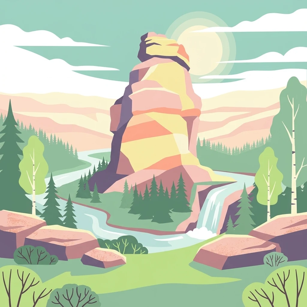
A stylized vector illustration of a central sandstone rock tower surrounded by a pine forest, a flowing stream, and a small waterfall, with a soft sun in the background.

Vranovské skály

Natural monument

Park overview

Structured park overview, official facts, and landscape profile for Vranovské skály

Vranovské skály park facts, protected area profile, and essential visitor context

Review the core facts for Vranovské skály, including designation, size, terrain, visitor scale, habitats, and operating context in one park-focused overview.

About Vranovské skály

Vranovské skály is a modest but distinctive protected natural monument in the northern part of the Czech Republic, in the Liberec Region's Česká Lípa District. It lies on the southern side of the Ralsko hill, separated from the main summit by a small valley, and rises directly above the hamlet of Vranov. Although administratively the rocks are situated in the cadastral area of Svébořice, which belongs to the town of Ralsko, they are perceived locally as part of the landscape of neighboring Vranov and Mimoň, whose name is plainly visible from several of the rock viewpoints.

The protected area covers roughly 12.92 ha between about 350 and 420 meters above sea level. Despite its compact size, the site combines several layers of natural and cultural value. The geomorphology is what first catches the eye: a group of free-standing sandstone towers in colors ranging from near-white and yellow to brick red, set against the darker forested slopes that surround the Ralská pahorkatina. Some of the towers are composed of sandstones of different colors, ages, and compositions, and their bases display numerous fissures where rare and stress-tolerant plant species have found a foothold.

Visitors approaching the rocks encounter a landscape shaped by both natural forces and centuries of human use. Individual towers were named by German-speaking locals in earlier centuries and later given Czech names; some were fitted with carved steps, railings, and viewing platforms. The best-documented example is Juliina vyhlídka, where Count Franz von Hartig had stairs and a wrought balustrade cut into the cliff and a wooden gloriette (a circular lookout pavilion) erected in 1822 for his wife Countess Juliana von Grundemann. The most conspicuous rock, the tall pillar called Džbán (the Milk Jug), is visible from within the hamlet and is the most recognizable single feature of the monument.

Because the surrounding terrain long formed part of the closed Ralsko military training area, the rocks were effectively cut off from public access for decades, and only seventeen climbing routes are currently documented across twelve of the towers. As the area has reopened, the site has gained fresh attention for both its sandstone climbing and its unusual conservation profile, sitting on land administered by the military forests enterprise but protected under Czech nature conservation law.

Quick facts and research context for Vranovské skály

Type: natural monument (přírodní památka), IUCN category IV (habitat/species management area). Country: Czechia. Region: Liberec Region (Liberecký kraj); District: Česká Lípa. Location: within the town of Ralsko, cadastral area of Svébořice, immediately above the hamlet of Vranov (part of Mimoň). Approximate elevation band of the protected rocks: about 350 to 420 m above sea level. Land administration: managed by the state enterprise Vojenské lesy a statky ČR (Military Forests and Estates), with nature conservation oversight by the Agency for Nature Conservation and Landscape Protection of the Czech Republic (AOPK ČR). Geomorphological context: southern slope of the Ralsko hill, belonging to the uplands of Ralská pahorkatina and the larger Zákupská pahorkatina.

Protection and recognition

Documented terrestrial protection history established in 1991

Vranovské skály Protection Status and Designated Area History

Vranovské skály maintains documented terrestrial protection status with an official designation year of 1991. Structured records detail the management scope and recognized conservation boundaries for this protected area.

Protection details

Protection scope
Terrestrial
Designated year
1991
Transboundary protection
No
Park context

Deeper park guide and search-rich context for Vranovské skály

Vranovské skály history, landscape, wildlife, and travel context

Explore Vranovské skály through its history, landscape character, ecosystems, wildlife, conservation priorities, cultural context, and seasonal travel timing in a structured park guide built for atlas discovery and search intent.

Why Vranovské skály stands out

Vranovské skály is best known for its bright sandstone towers rising in striking contrast to the dark coniferous forests of the Ralsko upland. The site is anchored by two signature formations: the Juliina vyhlídka (Julienshöhe) viewpoint, a nineteenth-century lookout commissioned by Count Franz von Hartig for his wife Countess Juliana, and the tall pillar called Džbán (Molkenkrug), one of the most visually prominent towers in the group. Together with several other named rocks (Kazatelna, Kočičí kámen, Luční kámen, Velký liščí kámen, Luční věž, Malý liščí kámen, and Skluzavka), they form a compact and easily understood sandstone ensemble that combines geological character with cultural and climbing heritage. The monument also stands out for its unusual botanical assemblage on sandstone substrate, including dwarf beech, Norway spruce, bearberry, fragrant Solomon's seal, stiff garlic, and a fern notable for its rarity in Central Europe. The locality occupies land historically closed to the public because it lay within the former Ralsko military training area, which adds a layer of inaccessibility and relict character to its conservation profile.
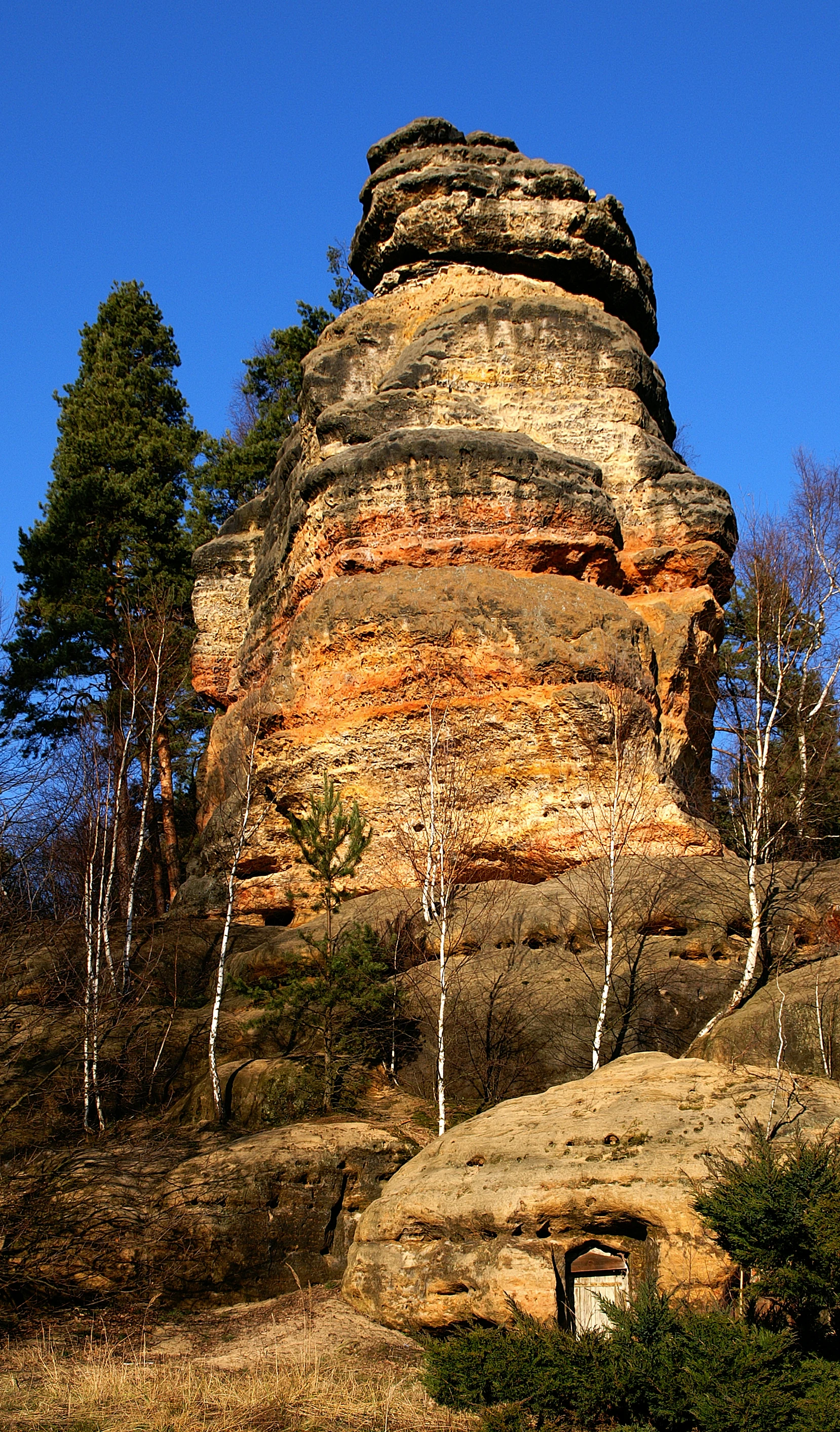
A large, vertically oriented sandstone rock tower with orange, tan, and brown horizontal striations rises against a clear deep blue sky, surrounded by small pine and birch trees.
The prominent Džban sandstone rock formation at Vranovské skály.

Vranovské skály history and protected-area timeline

The rocks of Vranovské skály have attracted local interest for centuries, but their formal recognition is comparatively recent. Individual sandstone towers received their original names during the period of German-speaking settlement in northern Bohemia, before later being given Czech equivalents. The most prominent historical event attached to the site is the construction in 1822 of the Juliina vyhlídka lookout, when Count Franz von Hartig commissioned carved steps, a railing, and a wooden gloriette on the cliff face to mark the thirty-sixth birthday of his wife Countess Juliana, née Grundemann. The viewpoint quickly became a celebrated local landmark; only the carved foundation circle remains today.

Formal protection came much later. The site was designated a přírodní památka (natural monument) on 15 November 1991 by the District National Committee in Česká Lípa and assigned the nature conservation code 1352. Because the locality lay within the broader Ralsko military training area, it was not administered through a protected landscape area (CHKO); instead, oversight passed to the Ministry of the Environment, exercised through the Agency for Nature Conservation and Landscape Protection of the Czech Republic (AOPK ČR).

For much of the second half of the twentieth century the rocks were effectively inaccessible to the public, which interrupted the early climbing tradition of the 1920s (when routes such as Alter Weg on Džbán, documented by Rudolf Kauschka, were established). After the military area was eventually wound down, only a fraction of the older climbing descriptions survived, leaving modern climbers with a limited but active route inventory. Today, the lifting of access restrictions is gradually restoring both recreational use and broader public awareness of the site.

Vranovské skály landscape and geographic character

The defining feature of Vranovské skály is a tight cluster of free-standing sandstone towers perched on the southern flank of the Ralsko hill, separated from the main summit by a short, shallow valley. The rock formations sit on a broad plinth of forested upland, with the hamlet of Vranov at their foot and the town of Mimoň visible in the distance to the south.

The sandstone itself is what gives the landscape its visual signature. The towers range in color from nearly white and pale yellow to a more saturated brick-red, and they catch the light in a way that makes them stand out sharply against the surrounding dark coniferous forests. This contrast is one of the defining landscape impressions of the site and explains why the rocks were individually named and used as viewpoints long before they received formal protection.

Several named rocks structure the local topography. Juliina vyhlídka is a carved lookout point with the remains of the original nineteenth-century gloriette foundation. Džbán, also called the Mléčný džbán (Milk Jug), is the most prominent single pillar, rising behind one of the houses in Vranov. Other named rocks include Kazatelna (Pulpit), Kočičí kámen (Cat Stone), Luční kámen (Meadow Stone), Velký liščí kámen (Big Fox Stone), Luční věž (Meadow Tower), Malý liščí kámen (Small Fox Stone), and Skluzavka (Slide). Together they define a small but well-articulated sandstone skyline within the broader Ralská pahorkatina.

Vranovské skály ecosystems, habitats, and plant life

Ecologically, Vranovské skály is shaped by the unusual combination of sandstone substrate, a relatively harsh upland climate, and a long period of restricted public access due to the surrounding Ralsko military training area. The cliffs, fissures, and rocky slopes support a vegetation community quite different from the surrounding closed forest. Open, sunny rock faces harbor drought-adapted species, while shaded crevices and ledges shelter more delicate woodland plants.

The broader setting belongs to the Ralská pahorkatina and the larger Zákupská pahorkatina uplands of northern Bohemia, dominated by coniferous and mixed forest. Within that matrix, the rocks act as small ecological islands. Stress-tolerant woody species such as dwarf beeches cling to thin soils on the rock surfaces, while Norway spruce is also present around and on the outcrops. The protected monument is explicitly valued for this mosaic of forest and rock vegetation, which combines geomorphological features with a distinctive botanical character in a very compact area.

Vranovské skály wildlife and species highlights

Detailed fauna information for Vranovské skály is relatively limited, and the site's protected status emphasizes its geological and botanical value more than its zoological richness. The kestrel (poštolka obecná, Falco tinnunculus) is mentioned as an irregular nester in the rock area, using the cliffs and towers as nesting habitat. Beyond this, the broader context of coniferous forest surrounding the rocks suggests a typical northern Bohemian upland bird and mammal community, but the available source material does not provide further species-level detail. Because wildlife content is thin in the source, this section is kept intentionally restrained rather than padded.

Vranovské skály conservation status and protection priorities

The conservation significance of Vranovské skály lies in its compact combination of sandstone geomorphology, relict vegetation on rock substrate, and a multi-decade period of restricted public access. The official protection covers the entire rock complex above the hamlet of Vranov, and the designation explicitly lists both the geological features and the associated plant community as subjects of conservation.

Among the protected species are dwarf beech (Fagus sylvatica) growing in stunted form, Norway spruce (Picea abies), bearberry (Arctostaphylos uva-ursi), fragrant Solomon's seal (Polygonatum odoratum), stiff garlic (Allium strictum), pediform sedge (Carex pediformis), and the rare fern Trichomanes speciosum, which is considered notable in a Central European context. Because the area remained within the Ralsko military training zone for decades, its habitats have experienced limited public pressure, leaving the rock vegetation in a comparatively undisturbed state.

Management of the site is unusual. The land is administered by the state enterprise Vojenské lesy a statky ČR (Military Forests and Estates), while nature conservation oversight is provided by the Ministry of the Environment through the Agency for Nature Conservation and Landscape Protection of the Czech Republic (AOPK ČR). This split arrangement reflects the legacy of the military area and gives the monument a distinctive governance profile compared with most other Czech natural monuments of similar size.

Vranovské skály cultural meaning and human context

The cultural fabric around Vranovské skály is shaped by the layered linguistic and noble history of northern Bohemia. The original German names of individual rocks, such as Julienshöhe for Juliina vyhlídka and Molkenkrug for Džbán, reflect an earlier period of German-speaking settlement; these names were gradually replaced by Czech equivalents during the twentieth century. The most concrete piece of cultural heritage on the site itself is the Juliina vyhlídka lookout, whose carved steps, balustrade, and the foundation circle of the original gloriette date to 1822 and the patronage of Count Franz von Hartig and his wife Countess Juliana.

The locality also left a small but recognizable mark on Czech literature. The writer Jaroslav Foglar, a central figure in Czech children's adventure fiction, drew inspiration from the rocks when composing the story Rychlé Šípy v pískových skalách, embedding Vranovské skály into a broader cultural memory of sandstone landscapes in Czech children's reading. Combined with the site's use as a modest early sandstone-climbing area in the 1920s, this gives the rocks a tangible, if compact, place in the regional cultural landscape.

Top sights and standout views in Vranovské skály

Among the most distinctive qualities of Vranovské skály are its pale, multi-colored sandstone towers rising above a dark coniferous upland, the historical Juliina vyhlídka lookout with its surviving carved foundations, and the prominent pillar called Džbán (Mléčný džbán) that defines the silhouette above Vranov. The site also stands out for a plant assemblage that includes dwarf beech, bearberry, fragrant Solomon's seal, stiff garlic, pediform sedge, and the rare Trichomanes speciosum fern, thriving on a thin sandstone substrate that has been largely undisturbed for decades thanks to the area's military past. Its combination of geological, botanical, climbing, and literary heritage within a protected footprint of just under 13 hectares gives it an unusually varied character for a site of its size.

Best time to visit Vranovské skály

Vranovské skály can be appreciated in any season, but spring and early summer tend to bring out the contrast most strongly between fresh green vegetation on the surrounding slopes and the pale sandstone towers. Late spring and early summer are also the best period for observing the cliff-top and crevice vegetation in its most complete form. Autumn offers sharper views through thinning forest cover toward Mimoň and across the Ralská pahorkatina, and can make the colored sandstone bands of the towers particularly visible in low-angle light. Winter visits can be rewarding for the visual drama of white or reddish sandstone against snow, but icy surfaces on carved steps and around the lookout should be approached with care.

Monthly climate preview

Long-term representative point measurements tracking monthly thermal and moisture rhythms

Vranovské skály Climate Normals, Annual Temperature and Precipitation Records

Representative coordinates document monthly temperature variation alongside long-term precipitation values across the regional terrain. Examining complete twelve-month normals provides structured insight into the measured annual rhythm at this protected location.
Annual mean8 °C
-3 °C19 °C
Jan-3°
Feb-2°
Mar
Apr
May13°
Jun17°
Jul19°
Aug18°
Sep13°
Oct
Nov
Dec-2°
Warmest month
July

18.7 °C

Coolest month
January

-3.1 °C

Wettest month
July

2.9 mm/day

Driest month
April

1.3 mm/day

Park location guide

Geography guide, regional context, and park location map for Vranovské skály

Vranovské skály park geography, regions, and map view in Czechia

Understand where Vranovské skály sits in Czechia through a broader geographic reading of the surrounding landscape, nearby location context, and its mapped position within the national park landscape.

How Vranovské skály fits into Czechia

Czech Republic is a landlocked Central European country with a population of approximately 10.9 million people. The nation was established as an independent state on January 1, 1993, following the dissolution of Czechoslovakia. Its capital and largest city is Prague, with other major urban centers including Brno, Ostrava, Plzeň, and Liberec.

Wider geography shaping Vranovské skály in Czechia

The Czech Republic is a landlocked country in Central Europe. It is bordered by Germany to the west, Austria to the south, Poland to the northeast, and Slovakia to the southeast. The landscape is predominantly hilly, with the territory covering 78,871 square kilometers.

Map view of Vranovské skály

Use this park location map to pinpoint Vranovské skály in Czechia, understand its exact geographic position, and read its mapped placement within the surrounding landscape more clearly.

Pigeon | © OpenStreetMap contributors

Location context for Vranovské skály

Liberec Region

Visual reference for the pale sandstone formations, viewpoints, and protected upland habitats of Ralsko

Vranovské skály Photos and Landscape Scenery: Sandstone Towers in Northern Bohemia

Browse detailed photography of the pale sandstone towers and rugged rock formations defining Vranovské skály in northern Bohemia. Visual records capture the distinctive contrast between light stone outcrops and dark coniferous forest canopies across the protected landscape.

A large, vertically oriented sandstone rock tower with orange, tan, and brown horizontal striations rises against a clear deep blue sky, surrounded by small pine and birch trees.

A high angle view from a rocky sandstone overlook with a green metal railing, looking down at a town, green fields, and distant forests under a clear blue sky.

Park atlas

Compare nearby national parks and connected protected landscapes in northern Bohemia

Parks Near Vranovské Skály and Protected Areas Across the Surrounding Region

Continue exploring regional park geography by comparing protected areas adjacent to Vranovské skály. Evaluating surrounding upland terrain and neighboring sandstone formations reveals broader patterns in regional conservation.
A watercolor painting showing a winding river through a green landscape with soft hills in the distance and tall grasses in the foreground.
Natural monumentLiberec Region
About 4.6 km away#1 closest

Southwest

Meandry Ploučnice u Mimoně: Mapping the Protected River Landscapes of the Liberec Region

Unregulated Bohemian river meanders and wetland habitats

Spanning 49 hectares in the Liberec Region, Meandry Ploučnice u Mimoně preserves a naturally shifting river corridor. The monument protects complex meander lakes and active floodplain dynamics, providing a sanctuary for rare dragonfly, butterfly, and mammal populations within an otherwise developed lowland environment.

Area
0.494 km²
Established
2014
IUCN
IV
Relief
Lowland
Natural monumentCentral Bohemian Region
About 15 km away#2 closest

South

Velký Radechov Natural Monument: Geography and Protected Habitat Mapping

Neovolcanic upland terrain within the Central Bohemian Region

Explore the mapped boundaries and natural features of Velký Radechov. This protected site in the Central Bohemian Region serves as an ecological mosaic, showcasing how neovolcanic hill slopes and formerly managed habitats provide refuge for a wide range of flora and fauna in the Czech landscape.

Area
0.22 km²
Established
1999
IUCN
IV
Relief
Upland
A horizontal watercolor painting of a serene pond surrounded by marshy vegetation and small clusters of trees under a soft, light-filled sky.
Nature reserveLiberec Region
About 18 km away#3 closest

West

Manušické rybníky Nature Reserve and Protected Wetland Landscape in Liberec Region

Historic fishpond mosaic and critical amphibian refuge

Manušické rybníky is a well-documented nature monument in the Czech Republic featuring a chain of seven fishponds established in 1575. The site preserves vital lowland peatland fragments and pine-oak woodlands, serving as a significant ecological node for wetland flora and amphibians within the broader landscape of the Liberec Region.

Area
0.143 km²
Established
2012
IUCN
IV
Relief
Upland
Natural monumentStředočeský kraj
About 20 km away#4 closest

South

Valcha Natural Monument: Mapping Protected Wetland Ecosystems in Středočeský Kraj

A rare mosaic of forest ponds and mire habitats

Situated in the Středočeský kraj region, Valcha Natural Monument protects a distinctive silting pond and marshland ecosystem. This site demonstrates the ecological significance of small, hydrologically active ravine landscapes nestled within the broader Jizerská tabule plateau terrain, providing critical refuge for rare wetland species.

Area
0.024 km²
Established
2013
IUCN
III
Relief
Lowland
Natural monumentCentral Bohemian Region
About 20 km away#5 closest

Southeast

Vrch Káčov Natural Monument: Mapped Geological Features in Central Bohemia

Volcanic rock formations and regional terrain context

Vrch Káčov is a designated natural monument preserving a unique volcanic hill and rock suk in the Central Bohemian Region. Its landscape is defined by contact metamorphism and porcelanite formations, offering a concentrated look at the geological evolution of the Jičínská pahorkatina hill country. The site provides a valuable reference for analyzing protected Bohemian terrain and its surrounding geographic characteristics.

Area
0.019 km²
Established
1953
IUCN
III
Relief
Upland
A soft watercolor illustration depicting a riverbank with light green trees and a prominent rocky outcrop or cliff face near the water.
Natural monumentCentral Bohemian Region
About 22 km away#6 closest

Southeast

Skalní sruby Jizery Natural Monument: Sandstone Landforms and River Geography

Protected riparian sandstone terrain in the Central Bohemian Region

This natural monument protects a rare geological formation along the Jizera River, where lateral erosion has created an extensive sandstone rock shelter. The site showcases advanced pseudokarst weathering and supports a dense concentration of botanical and avian diversity within its two-hectare boundary in the Central Bohemian Region.

Area
0.02 km²
Established
1979
IUCN
III
Relief
Upland
A soft watercolor painting of a hilly landscape featuring pine trees and low-lying vegetation in shades of green, yellow, and red, with a pale background.
Natural monumentLiberec Region
About 22 km away#7 closest

Southwest

Martinské stěny Natural Monument: Sandstone Cliff Geography and Protected Landscapes

Geomorphology and sandstone terrain in the Liberec Region

Martinské stěny features a prominent quartz sandstone cliff wall shaped by geological forces in the Bohemian Cretaceous Basin. This natural monument serves as a key protected area for heath and lichen communities, representing the unique cliff-side geography found throughout the Liberec Region in the northern Czech Republic.

Area
0.032 km²
Established
2002
IUCN
III
Relief
Upland
A watercolor illustration of rolling hills and a green landscape with a soft, abstract style.
Nature reserveLiberec Region
About 25 km away#8 closest

West

Ronov Nature Reserve: Protected Volcanic Geography and Scree Forest Ecosystems in Liberec Region

Volcanic landmark with basalt talus slopes and historic ruins

Ronov rises as a distinctively shaped basalt cone from the rolling terrain of the northern Czech Republic. This nature reserve offers significant insight into the geological and botanical character of the Ralská pahorkatina, featuring extensive stone seas and rare plant habitats situated around ancient castle remains.

Area
0.09 km²
Established
1995
IUCN
IV
Relief
Mountain

Common questions about visiting, size, designation, and location context for Vranovské skály

Vranovské skály FAQs for park facts, access, geography, and protected area context

Find quick answers about Vranovské skály, including protected-area facts, park geography, trail and visitor context, and how the park fits into its surrounding country and regional landscape.
MoriAtlas Explorer

Continue Your Protected Areas Search Across the Global Atlas

Deepen your exploration by continuing the structured search for national parks and protected areas worldwide. Utilize the comprehensive filtering capabilities to compare different conservation landscapes and refine your understanding of global park geography. Discover more about the distribution and characteristics of protected natural areas.

Global natural geography