
Mori Atlas logo
Nature reserveVrch Hazmburk

Understanding the geological terrain and protected steppe habitats of this Bohemian monument

Vrch Hazmburk Nature Reserve: A Detailed Atlas of Basalt Landscapes and Regional Geography

(Vrch Hazmburk (přírodní památka))

Vrch Hazmburk rises as a prominent volcanic hill in the Ustecky Region, offering a protected mosaic of basalt outcrops, scree slopes, and forest-steppe microhabitats. This geographic study details the unique terrain and ecological importance of the site, which serves as a stronghold for thermophilic flora and endemic insect species within the Czech Cretaceous Basin. Explore the physical boundaries and geological history of this distinctive natural monument.

steppe habitatforest-steppedry grasslandbasalt outcropsNeovolcanic hillthermo Mediterranean flora
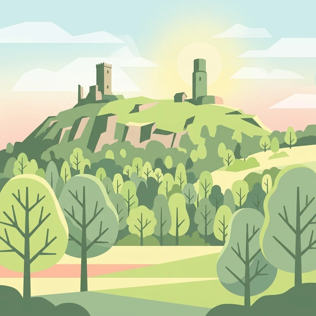
A stylized vector-style illustration of the Hazmburk Castle ruins perched on a hill, surrounded by trees and fields under a soft, sunrise-like sky.

Vrch Hazmburk

Nature reserve

Park overview

Structured park overview, official facts, and landscape profile for Vrch Hazmburk

Vrch Hazmburk park facts, protected area profile, and essential visitor context

Review the core facts for Vrch Hazmburk, including designation, size, terrain, visitor scale, habitats, and operating context in one park-focused overview.

About Vrch Hazmburk

Vrch Hazmburk sits in the rolling lowlands of the Litoměřice district in northern Bohemia, a region better known for its agricultural valleys, historic towns, and fertile orchards along the lower Ohře river. The protected area covers the slopes of a single steep hill rising roughly 414 meters above sea level, deliberately excluding the summit so that the medieval castle ruins above remain outside the formal nature reserve boundary.

The hill is geologically distinctive. It is a Neovolcanic cone formed by the selective erosion of a nepheline-bearing basanite intrusion that once sat within softer Cretaceous marlstones. Over millions of years, the harder volcanic rock was exhumed, leaving behind columnar jointing, frost-shattered cliffs, boulder fields, and exposed basalt outcrops. These hard substrates, together with old quarry scars on the southern slopes, give the hill a strikingly rocky, almost Mediterranean character that contrasts with the surrounding agricultural plains.

Ecologically, the site's position in the warm, dry thermophytic zone of the Czech Republic means it supports steppe and forest-steppe vegetation, including oak-hornbeam woodland on the cooler northern slopes and open steppe grasslands on the south-facing hillsides. Relict old orchards cling to the lower slopes, adding a traditional cultural layer to the natural mosaic. The reserve designation of 2011 aimed to protect these habitats and the rare species they harbor, including a Czech endemic grasshopper subspecies that exists on very few sites in the country. Together with the castle above and the archaeological traces below, the hill forms a compact but layered landscape where geology, biodiversity, and human history meet in a single, easily readable site.

Quick facts and research context for Vrch Hazmburk

Vrch Hazmburk is a přírodní památka (natural monument) located in the Litoměřice district of the Ústecký region, covering about 60 hectares of hillside on a Neovolcanic basalt cone. It was designated on 14 September 2011 by the Regional Authority of the Ústecký Region and is also listed as a European Site of Community Importance. The reserve lies within the Czech Cretaceous Basin and belongs to the warmer, drier thermophytic vegetation zone of the Czech Republic, characteristic of lowland Bohemian landscapes. Its main protective focus is on exposed rock outcrops, scree, steppe and forest-steppe biotopes, old orchards, and a handful of protected plant and invertebrate species, including the endemic subspecies Stenobothrus eurasius bohemicus.

Protection and recognition

Documented terrestrial protection scope and Natura 2000 recognition records

Vrch Hazmburk Protection Status and International Recognition Data

Territorial protection status for Vrch Hazmburk covers documented terrestrial boundaries and official Natura 2000 recognition records. Conservation tracking details examine management scope and designation sources without assuming active management outcomes.

International recognition

Protection details

Protection scope
Terrestrial
Transboundary protection
No
Park context

Deeper park guide and search-rich context for Vrch Hazmburk

Vrch Hazmburk history, landscape, wildlife, and travel context

Explore Vrch Hazmburk through its history, landscape character, ecosystems, wildlife, conservation priorities, cultural context, and seasonal travel timing in a structured park guide built for atlas discovery and search intent.

Why Vrch Hazmburk stands out

Vrch Hazmburk is best known for its unusual concentration of warm-loving steppe and forest-steppe habitats sitting on a Neovolcanic basalt hill in an otherwise temperate Bohemian landscape. The mosaic of bare basalt outcrops, boulder fields, dry grasslands, scrub, and old orchards creates microhabitats that support thermophilic species rarely found elsewhere in the region. The reserve is also notable as a stronghold of the Czech endemic grasshopper Stenobothrus eurasius bohemicus, along with the Jersey tiger moth and a suite of protected vascular plants. These biological values, combined with the dramatic ruin of Hazmburk castle on the summit, give the hill a strong dual identity as both a natural and cultural landmark.
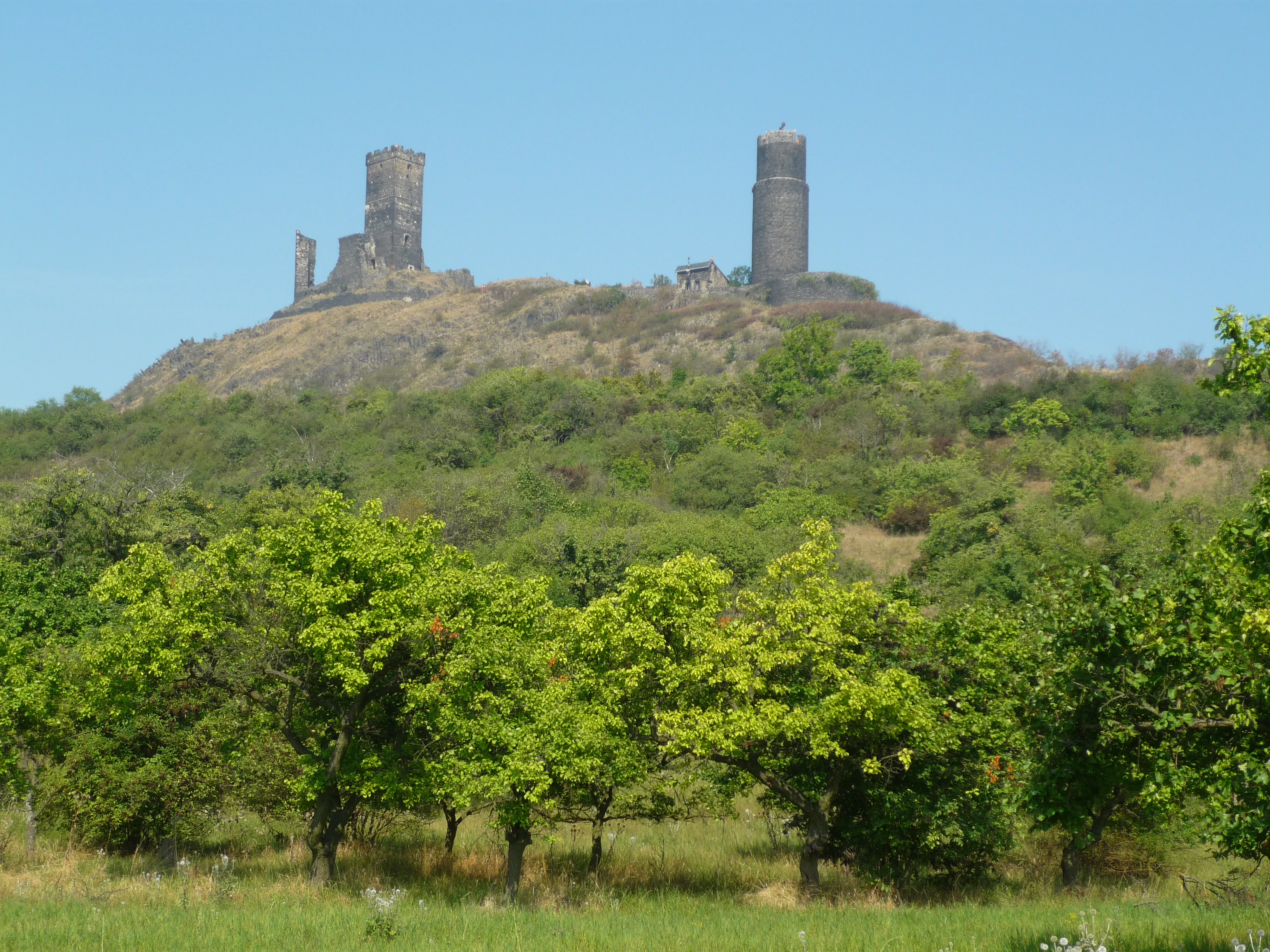
A sunny view looking up at the medieval stone ruins of Hazmburk Castle, which feature a tall tower and crumbling walls, crowning a green hill covered in trees and shrubs.
The ruins of Hazmburk Castle situated atop a prominent hill in the Czech countryside.

Vrch Hazmburk history and protected-area timeline

The hill has been inhabited and used by people for several thousand years, leaving traces that go well beyond the medieval castle. Archaeological finds on its slopes include Neolithic stone tools, a Bronze Age hoard of bronze implements, Hallstatt ceramics, and a bronze needle from the Roman Iron Age, suggesting the prominent hill served as a recognizable landmark and settlement point for prehistoric communities.

The most prominent historical feature is the Hazmburk castle on the summit, originally called Klapý. It was likely founded in the thirteenth or fourteenth century, and in 1335 King John of Luxembourg sold the stronghold to Zbyněk Zajíc of Valdek, who renamed it Hazmburk. The castle fell into ruin over the following centuries, but from 1996 onward the site has been opened to the public and has become a notable destination in its own right.

The natural monument itself is comparatively young. It was officially proclaimed on 14 September 2011 by the Regional Authority of the Ústecký Region, primarily to safeguard its rare steppe habitats and the endemic grasshopper population. At the same time, the area was included in the European Natura 2000 network as a Site of Community Importance, tying its conservation status to the broader European framework for protecting threatened habitats and species.

Vrch Hazmburk landscape and geographic character

Vrch Hazmburk rises as a compact, conical hill from the surrounding lowlands, its silhouette dominated by the bare rock crown and the castle ruin perched at the very top. The protection zone encompasses the slopes themselves rather than the summit, so the landscape character of the reserve is defined by inclined terrain, rocky outcrops, and the transition between distinct hillside microclimates.

At the geological level, the hill belongs to the Czech Cretaceous Basin and is a textbook example of differential erosion. A resistant basanite intrusion once embedded in softer Cretaceous marlstones has been gradually exposed, producing columnar basalt outcrops, frost-shattered cliffs, boulder scree, and patches of older quarrying activity on the warmer south face. Soils here are thin rendzinas and cambisols that support only sparse vegetation, reinforcing the rocky character of the slopes. The hill's geomorfologická position within the Dolnooharská tabule and its modest elevations, ranging roughly from 245 to 414 meters above sea level, place it firmly within the dry, open lowland typology of central Bohemia rather than the forested highlands.

The terrain also bears the mark of long-running geomorphic instability. Between the late nineteenth and early twentieth centuries, major landslides destroyed around one hundred houses of the original village of Klapý, and the hill still carries three zones of potential slope movement and one active landslide area on its northern flank. These dynamic processes, combined with past quarrying, give the slopes a varied surface texture of rock, scree, scrub, and grassland that feels more rugged than the surrounding agricultural plain.
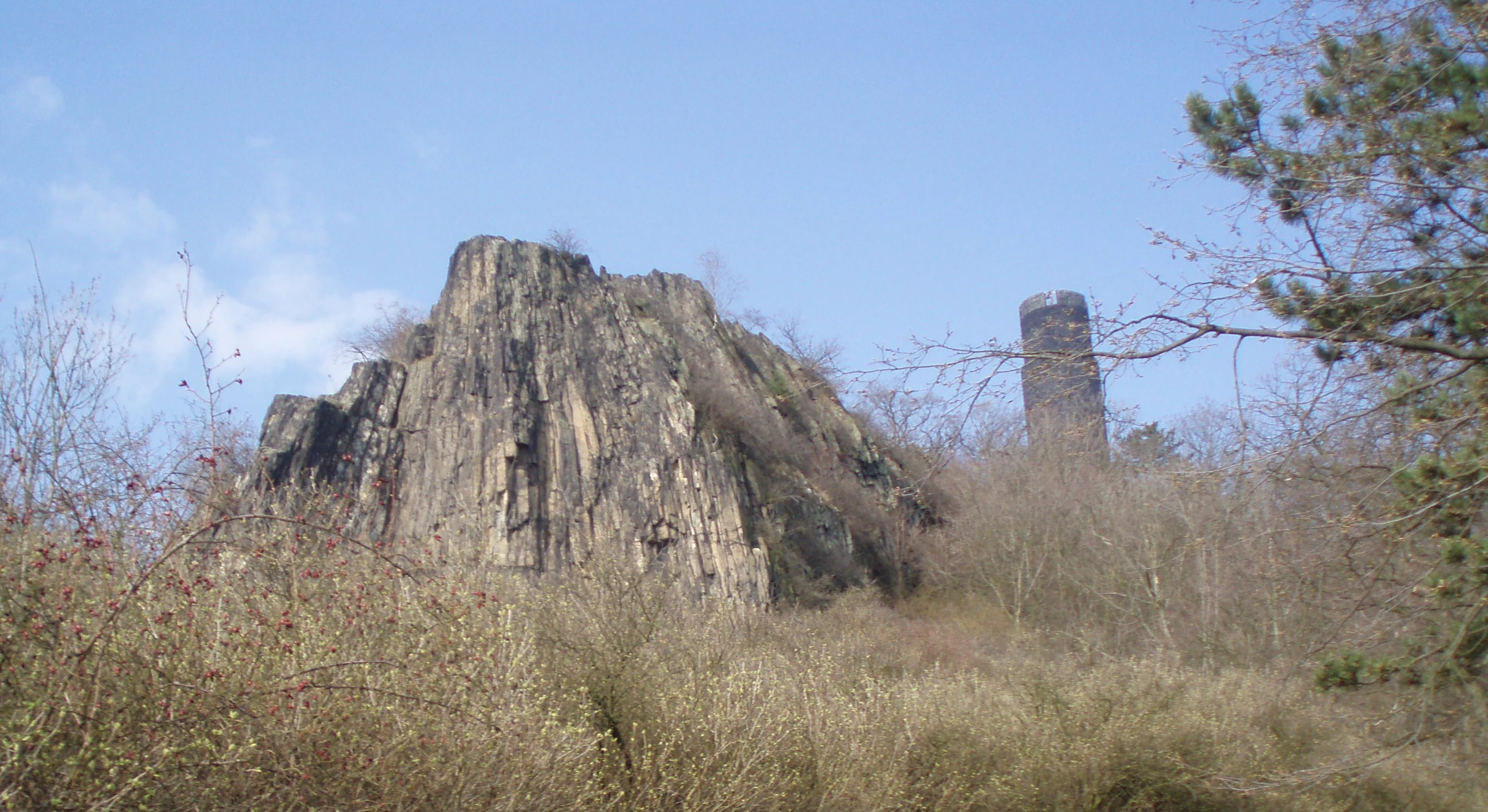
A large basalt rock formation and a stone tower rising above dry, grassy slopes under a clear blue sky.
A rocky outcrop and stone tower on the slopes of Hazmburk Hill.

Vrch Hazmburk ecosystems, habitats, and plant life

Because of its warm, dry microclimate and rocky substrates, Vrch Hazmburk supports an unusually rich concentration of thermophilic steppe and forest-steppe communities for its latitude and size. Vegetation on the cooler, more sheltered northern slopes is dominated by oak-hornbeam woodland interspersed with non-native tree species, while the sun-exposed southern slopes carry open dry grassland, rocky steppe patches, and shrubs tolerant of heat and drought.

The site belongs to the Czech thermophyticum, the warmest and driest vegetation zone in the Czech Republic, more typical of lowland landscapes to the south. This climatic identity is reinforced by the soils: shallow pararendzinas and cambisols on basalt and weathered marlstone that favor drought-adapted plants over mesic forest communities. Around the foot of the hill, abandoned traditional orchards add a secondary but ecologically valuable layer of open, sun-exposed habitat that supports steppe species and associated invertebrates.

Altogether, these landscape elements create a tightly compressed mosaic of habitats: bare basalt outcrops, boulder scree, dry grassland, forest-steppe, oak-hornbeam woodland, and old fruit trees. This habitat diversity, rather than raw species counts, is the main reason the site has ecological significance well beyond its modest area of around 60 hectares.

Vrch Hazmburk wildlife and species highlights

The wildlife of Vrch Hazmburk is shaped by the same warm, dry, rocky habitats that define its vegetation. The invertebrate fauna is particularly distinctive. The endemic Czech subspecies of the rock grasshopper, Stenobothrus eurasius bohemicus, is one of the principal reasons for the site's protected status, and the Jersey tiger moth Euplagia quadripunctaria is also among the targeted conservation species. Other recorded insects include the field bumblebee, hawkmoths, tortrix moths, and a wide variety of other moths and butterflies associated with steppe and orchard habitats.

Reptiles and other small animals use the rocky slopes and warm grasslands as well. The sand lizard and the slow worm are both present, alongside common ant species such as Formica fusca and social wasps. Birds of the site include the Eurasian eagle-owl, while the wooded slopes and orchards support a typical mix of central European passerines such as the common blackbird, several thrushes, great tit, coal tit, and marsh tit. Although the hill is not considered a major ornithological site, the combination of woodland, steppe, and old orchards gives it a varied bird community for such a small area.

Vrch Hazmburk conservation status and protection priorities

Vrch Hazmburk was designated a natural monument primarily to protect a small but ecologically outstanding concentration of European dry grassland and forest-steppe habitats on a Neovolcanic hill. The reserve's formal goals include safeguarding exposed basalt outcrops, boulder scree, steppe and forest-steppe biotopes, and extensively used traditional orchards, along with the protected plant and animal species they support.

Its conservation importance extends beyond the national framework. The site is also classified as a European Site of Community Importance, linking it to the Natura 2000 network and the EU Habitats Directive. This dual designation reflects the international value of its dry grassland habitats and the presence of protected invertebrate species that are priorities for European conservation.

Active management is central to keeping the site in good condition, because abandonment can quickly allow scrub and invasive non-native trees to overrun the open steppe. Conservation work focuses on the mechanical removal of invasive woody species such as black locust, ash, and conifers, the targeted restoration of grazing with sheep and goats, the rehabilitation of old orchards, and active restoration of the steppe biotope itself. These interventions aim to maintain the open, sun-exposed character of the slopes and prevent the loss of the rare species that depend on them.

Vrch Hazmburk cultural meaning and human context

Vrch Hazmburk sits in a landscape shaped by deep human attachment to a single, very visible hill. Prehistoric communities seem to have recognized the prominence of the site well before the medieval castle, with archaeological traces spanning the Neolithic, the Late Bronze Age, the Hallstatt period, and the Roman Iron Age. The hill has therefore functioned for thousands of years as both a landmark and a gathering point for local communities.

The medieval castle of Hazmburk, originally called Klapý, is the single most recognizable cultural feature. Rebuilt and renamed in the fourteenth century under Zbyněk Zajíc of Valdek, it later fell into ruin. Since 1996 the castle has been opened to the public, and the red and yellow hiking trails that climb the hill today reflect a long tradition of using this site for walks, gatherings, and local pride. Even the older local names for the hill, including vrch Klapý, reflect how closely the community's identity has been tied to this single, dominant piece of terrain.

Top sights and standout views in Vrch Hazmburk

Vrch Hazmburk combines Neovolcanic geology, European dry grassland, and a medieval castle ruin within a single hill that rises just over 400 meters above the Bohemian lowlands. Its exposed basalt cliffs, frost-shattered boulder fields, and old quarry scars give the slopes a visual drama far greater than their modest height suggests.

Ecologically, the site stands out for its unusually complete set of steppe and forest-steppe habitats at this latitude, including protected thermophilic plants and a Czech endemic grasshopper subspecies. Add the well-known castle ruin, traditional orchards, sweeping views, and easy access from Klapý and Slatina pod Hazmburkem, and the hill offers a compact yet rich experience of how geology, biodiversity, and cultural history can stack on top of one another in a single protected site.

Best time to visit Vrch Hazmburk

The warmest and driest months of late spring and summer bring out the most distinctive character of Vrch Hazmburk. From roughly May through early autumn, the south-facing steppe slopes are at their most colorful, with thermophilic grasses and flowering plants in peak condition and insects, including grasshoppers and butterflies, most active. Early mornings and evenings during this period offer the richest wildlife encounters and the softest light on the basalt outcrops.

Spring is also appealing for visitors interested in the broader landscape, when the surrounding orchards can be in bloom and the woodland on the cooler north slopes is fresh and green. Winter visits are quieter, with bare structures and snow occasionally highlighting the columnar basalt forms and the silhouette of the castle ruin on the summit; however, anyone exploring the site in colder months should be aware that some steeper paths and rock areas can be slippery, and that access conditions follow general Czech countryside rules.

Monthly climate preview

Long-term representative temperature and precipitation averages across twelve months

Vrch Hazmburk Climate Normals and Monthly Temperature Rhythms

Historical coordinate data records measured monthly temperature swings and daily precipitation patterns for Vrch Hazmburk across a thirty-year climatology period. Analyzing the full monthly climate profile reveals precise long-term thermal averages and precipitation totals for this protected terrain.
Annual mean8 °C
-3 °C19 °C
Jan-3°
Feb-1°
Mar
Apr
May13°
Jun17°
Jul19°
Aug18°
Sep13°
Oct
Nov
Dec-2°
Warmest month
July

18.7 °C

Coolest month
January

-2.6 °C

Wettest month
July

2.5 mm/day

Driest month
February

1.1 mm/day

Park location guide

Geography guide, regional context, and park location map for Vrch Hazmburk

Vrch Hazmburk park geography, regions, and map view in Czechia

Understand where Vrch Hazmburk sits in Czechia through a broader geographic reading of the surrounding landscape, nearby location context, and its mapped position within the national park landscape.

How Vrch Hazmburk fits into Czechia

Czech Republic is a landlocked Central European country with a population of approximately 10.9 million people. The nation was established as an independent state on January 1, 1993, following the dissolution of Czechoslovakia. Its capital and largest city is Prague, with other major urban centers including Brno, Ostrava, Plzeň, and Liberec.

Wider geography shaping Vrch Hazmburk in Czechia

The Czech Republic is a landlocked country in Central Europe. It is bordered by Germany to the west, Austria to the south, Poland to the northeast, and Slovakia to the southeast. The landscape is predominantly hilly, with the territory covering 78,871 square kilometers.

Map view of Vrch Hazmburk

Use this park location map to pinpoint Vrch Hazmburk in Czechia, understand its exact geographic position, and read its mapped placement within the surrounding landscape more clearly.

Pigeon | © OpenStreetMap contributors

Location context for Vrch Hazmburk

Ustecky Region
Recorded earthquake history

Browse the Historical Earthquake Catalogue for Vrch Hazmburk

Examine the record of earthquakes associated by proximity with Vrch Hazmburk. This catalogue offers a clear view of historical seismic events to help understand regional activity patterns through mapped epicenter data and event-specific details provided by MoriAtlas.

Vrch Hazmburk Earthquake History

Catalogued events

13 events

Strongest magnitude

Magnitude 3.8

Most recent event

Nov 15, 2004

This history includes earthquakes recorded inside the park or within 50 km of its borders

Explore protected area views, basalt outcrops, and rare steppe habitats across the reserve slopes.

Vrch Hazmburk Photos and Landscape Scenery: Visualizing the Neovolcanic Hill

Visual documentation reveals the rugged terrain, exposed basalt cliffs, and dry grassland mosaics defining the protected slopes of Vrch Hazmburk. Studying these detailed landscape photographs provides clear insight into the Neovolcanic geology and unique thermophilic habitats of the Bohemian lowlands.

A sunny view looking up at the medieval stone ruins of Hazmburk Castle, which feature a tall tower and crumbling walls, crowning a green hill covered in trees and shrubs.

A high-angle view looking down from a grassy, rocky hillside trail across a hazy landscape of fields and sparse orchards.

A large basalt rock formation and a stone tower rising above dry, grassy slopes under a clear blue sky.

Park atlas

Compare nearby reserves, regional geography, and connected protected habitats.

Exploring Parks Near Vrch Hazmburk and Surrounding Protected Landscapes

Browse other parks near Vrch Hazmburk to examine similar Neovolcanic geology, dry grassland mosaics, and protected lowlands across the surrounding region. Extending beyond a single reserve provides broader geographical context and deeper insight into regional conservation landscapes.
A horizontal watercolor painting depicting a soft-focus landscape with light green trees and low rolling hills under a pale, warm-toned sky.
Protected landscapeLitoměřice District
About 6.5 km away#1 closest

East

Dolní Poohří Nature Park: Protected Landscape and River Geography

A riparian corridor through the Litoměřice District

The landscape of Dolní Poohří Nature Park follows the irregular arc of the lower Ohře River across the Bohemian plain. Its narrow boundaries protect a functional floodplain ecosystem characterized by silted oxbows, gravel banks, and rare forest fragments. This atlas entry details the geographic features, protected status, and the interplay between the active river channel and the historic townscapes found along its banks.

Area
40 km²
Established
2001
Relief
Lowland
Climate
Temperate
Natural monumentÚstecký kraj
7.8 km away#2 closest

South

V hlubokém Natural Monument: Protected Calcareous Landscapes and Terrain in Ústecký kraj

A study of rare sesleria grasslands and opuka slope geography

V hlubokém serves as a significant protected site in the Czech Republic, encompassing twenty hectares of hillside defined by soft calcareous opuka rock. This natural monument is recognized for its rare sesleria grasslands and thermophilic plant assemblages that contrast with the surrounding woodland. The protected area forms a critical link in the broader geography of the Débeř valley, offering a clear example of localized botanical diversity supported by unique alkaline substrate conditions.

Area
0.202 km²
Established
1947
IUCN
III
Relief
Upland
A horizontal watercolor illustration depicting a soft, rolling landscape with green hills, a small winding stream, and meadow vegetation on a white background.
Natural monumentÚstecký kraj
10 km away#3 closest

Southeast

Na Dlouhé stráni Natural Monument: Regional Protected Area and Botanical Landscape

A conservation-focused look at the Mšenský potok valley slope

Na Dlouhé stráni is a designated natural monument in the Czech Republic, renowned for its concentration of thermophilous grassland flora. This protected area, located near Mšené-lázně, preserves a specific slope habitat that supports declining plant species. The site offers an important look at regional conservation efforts and the mapping of small-scale protected habitats within the diverse Ústecký kraj geography.

Area
0.126 km²
Established
2012
IUCN
IV
Relief
Lowland
Natural monumentLitoměřice District
10 km away#4 closest

Southeast

Vrbka Natural Monument: Exploring Protected Limestone Habitats and Bohemian Lowland Geography

A rare botanical reserve in the Litoměřice District of the Czech Republic

Vrbka Natural Monument protects a significant 15.5-hectare expanse of warm limestone slopes and dry meadows. This geographic landmark serves as an essential repository for rare orchid species and diverse insect populations, functioning as a representative habitat patch within the intensively cultivated landscapes of the surrounding region.

Area
0.155 km²
Established
2013
IUCN
IV
Relief
Upland
A soft watercolor illustration of rolling green hills with distant mountain peaks under a light sky.
Natural monumentÚstecký kraj
11 km away#5 closest

Northeast

Radobýl Natural Monument: Basalt Formations and Volcanic Geography in Ústecký kraj

A protected volcanic landmark with steppe ecosystems and ridge views.

Radobýl stands as a distinctive volcanic remnant in the Ústecký kraj, featuring profound columnar basalt jointing and frost-weathered cliffs. This protected natural monument shelters rare dry grassland habitats and rocky terrain, while offering expansive views across the Litoměřice basin and the surrounding Bohemian landscape.

Area
0.063 km²
Established
1966
IUCN
IV
Relief
Mountain
A horizontal watercolor illustration showing a soft-toned landscape with green trees in the foreground, rolling yellow-green fields in the midground, and faint mountains in the background.
Natural monumentStředočeský kraj
19 km away#6 closest

Southwest

Smradovna Natural Monument: Geography and Protected Habitats in Central Bohemia

A protected stream valley system within the Stredocesky kraj region.

Smradovna preserves a unique concentration of lowland habitats, including calcareous beech forests and rare alkaline fens. This protected natural monument, located near Bilichov, is defined by its characteristic travertine springs and continuous stream-corridor ecosystem. Gain insight into the regional geography and botanical significance of this tightly knit protected landscape through our structured mapping and data.

Area
1.556 km²
Established
2014
IUCN
IV
Relief
Upland
A horizontal watercolor painting showing rolling green hills in the distance and colorful, stylized vegetation in the foreground.
Nature reserveÚstí nad Labem Region
About 21 km away#7 closest

North

Rač Nature Reserve: Volcanic Slopes and Protected Habitats in Ústí nad Labem

Geomorphology and ecological succession in the České středohoří range

Rač Nature Reserve is a landmark for volcanic ecology, preserving a mosaic of trachyte rock formations and open grassland on the slopes of Hradiště u Habří. This protected area serves as a vital refuge for rare steppe-like flora and a high concentration of thermophilic insect species, offering a concentrated look at natural land recovery and geological history in northern Bohemia.

Area
0.154 km²
Established
1953
IUCN
IV
Relief
Mountain
Watercolor illustration of a peaceful, open landscape with gentle hills in the background and clusters of trees in the foreground.
Nature reserveStředočeský kraj
About 22 km away#8 closest

South

Na Pilavě Nature Reserve: A Detailed Botanical Atlas of the Středočeský kraj Landscape

Mapping protected orchid habitats and forest flora in the Džbán highland.

Na Pilavě is a specialized nature reserve in the Kladno District, valued for its dense concentration of rare woodland orchids and the critically endangered black false hellebore. Set within the forested slopes of the Pilavské údolí, this protected area serves as a vital refuge for thermophilic plant communities and ancient deciduous forest flora.

Area
0.031 km²
Established
1969
IUCN
IV
Relief
Upland

Common questions about visiting, size, designation, and location context for Vrch Hazmburk

Vrch Hazmburk FAQs for park facts, access, geography, and protected area context

Find quick answers about Vrch Hazmburk, including protected-area facts, park geography, trail and visitor context, and how the park fits into its surrounding country and regional landscape.
MoriAtlas Explorer

Continue Your Protected Areas Search Across the Global Atlas

Deepen your exploration by continuing the structured search for national parks and protected areas worldwide. Utilize the comprehensive filtering capabilities to compare different conservation landscapes and refine your understanding of global park geography. Discover more about the distribution and characteristics of protected natural areas.

Global natural geography