
Mori Atlas logo
Protected landscapeWacholderheide Dissenhorn

A preserved mosaic of juniper heath and mixed coniferous forest within the Alb Foothills

Wacholderheide Dissenhorn: Mapping the Protected Landscape and Juniper Heath of Baden-Württemberg

Wacholderheide Dissenhorn serves as a significant landscape protection area situated on the Dissenhorn hillside in the Rottweil district of Baden-Württemberg. This site preserves a rare semi-open juniper heath habitat defined by its distinct Middle Keuper geological layers, which create a natural boundary between open slopes and surrounding coniferous woodlands. The area exemplifies a carefully managed cultural landscape within the Southwestern Alb Foothills that continues to provide vital geographic and ecological context for the region.

juniper heathWacholderheidelandscape protection areaLandschaftsschutzgebietAlb foothillsSüdwestliches Albvorland
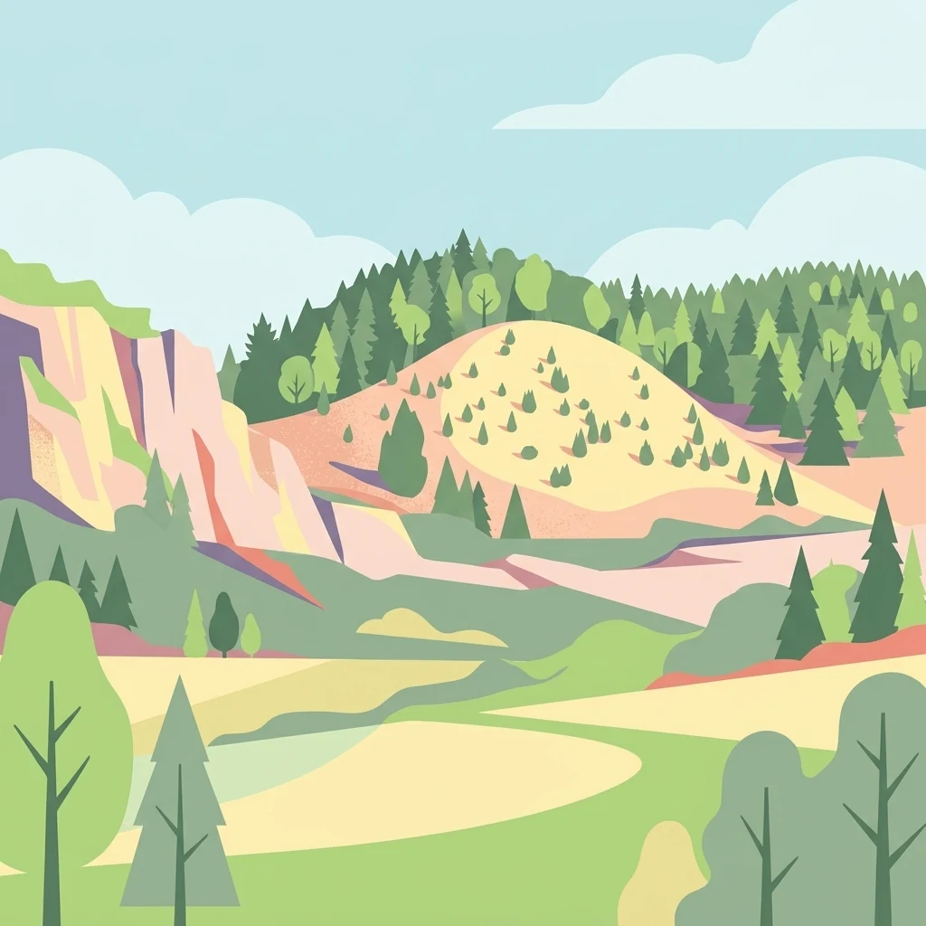
A flat vector illustration of a rolling natural landscape with a prominent sandy colored hill dotted with sparse conifer trees, set against a background of dense forest and a light blue sky with stylized clouds.

Wacholderheide Dissenhorn

Protected landscape

Park overview

Structured park overview, official facts, and landscape profile for Wacholderheide Dissenhorn

Wacholderheide Dissenhorn park facts, protected area profile, and essential visitor context

Review the core facts for Wacholderheide Dissenhorn, including designation, size, terrain, visitor scale, habitats, and operating context in one park-focused overview.

About Wacholderheide Dissenhorn

Wacholderheide Dissenhorn is a compact landscape protection area in the Rottweil district of Baden-Württemberg, situated just outside the Göllsdorf district of the town of Rottweil. Created as a Landschaftsschutzgebiet on 1 February 1953, it safeguards roughly 10 hectares of hillside landscape that includes one of the characteristic juniper heaths of the region.

The Dissenhorn itself is a projecting slope rising above the surrounding terrain, partly covered by the juniper heath that gives the protected area its name. Around this open juniper area, mixed coniferous forest blankets the rest of the slope, creating the classic contrast of open heath and dense forest that defines the visual character of the site. The juniper-dominated open ground is a relatively unusual habitat in modern southwestern Germany, where centuries of agricultural intensification have largely eliminated such culturally maintained landscapes.

The protected area lies within the Southwestern Alb Foothills natural region, on geological layers from the Middle Keuper period. The upper slope belongs to the Löwenstein Formation, while the lower slope transitions into the Grabfeld Formation, giving the slope a stratified structure that influences both soil conditions and vegetation patterns. This geological context is typical of the Alb Foothills and helps explain why juniper heaths like Dissenhorn historically developed here.

Beyond its landscape and ecological interest, the area also carries layered protection status. The Dissenhorn is recognized as a natural monument (Naturdenkmal), and the broader surrounding landscape falls within the Prim-Albvorland FFH site, part of the European network of protected habitats. Together, these designations place Wacholderheide Dissenhorn within a connected framework of nature conservation in the northern Schwarzwald-Baar region.

Quick facts and research context for Wacholderheide Dissenhorn

Wacholderheide Dissenhorn is a protected landscape (Landschaftsschutzgebiet) of about 10.1 hectares, located in the Rottweil district of Baden-Württemberg, Germany. It was established by ordinance of the Rottweil district office on 1 February 1953 and is administered at the district level.

The area lies within the Southwestern Alb Foothills natural region and is characterized by Middle Keuper geology, stretching from the Löwenstein Formation at the upper slope to the Grabfeld Formation at the lower slope. The Dissenhorn hill itself is additionally designated as a natural monument, and the wider area overlaps with the Prim-Albvorland FFH (Habitats Directive) site.

Protection and recognition

Structured documentation of conservation boundaries and international recognition records

Wacholderheide Dissenhorn Protection Status and Designated Area Record

Wacholderheide Dissenhorn brings together verified protection status, management scope, and official designation history within structured records. Conservation datasets provide baseline tracking for protected areas without assuming specific management outcomes or external program statuses.

Protection details

WDPA ID
325488
Park context

Deeper park guide and search-rich context for Wacholderheide Dissenhorn

Wacholderheide Dissenhorn history, landscape, wildlife, and travel context

Explore Wacholderheide Dissenhorn through its history, landscape character, ecosystems, wildlife, conservation priorities, cultural context, and seasonal travel timing in a structured park guide built for atlas discovery and search intent.

Why Wacholderheide Dissenhorn stands out

Wacholderheide Dissenhorn is best known for its juniper heath (Wacholderheide) growing on a projecting hillside (Dissenhorn) within the Alb Foothills, surrounded by mixed coniferous forest. The site is valued as a preserved example of a culturally maintained juniper heath landscape, a habitat type that has largely disappeared from much of southern Germany. The combination of open juniper slopes with adjacent woodland creates a distinctive mosaic that defines the protected landscape's character.
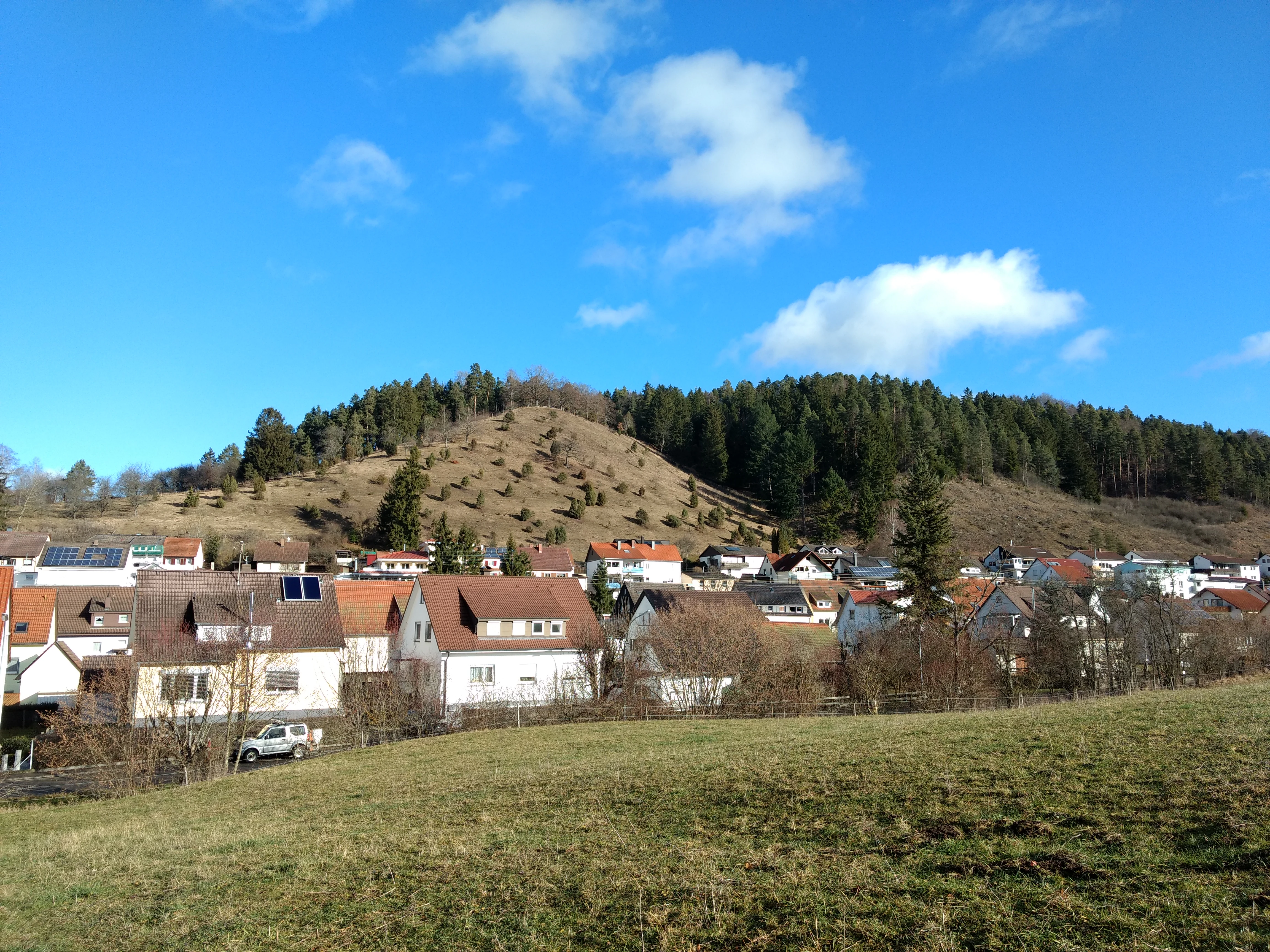
A green hillside slope dotted with small conifer trees, rising above a residential town under a bright blue sky with white clouds.
The Dissenhorn hillside featuring juniper heath vegetation, viewed from the town.

Wacholderheide Dissenhorn history and protected-area timeline

Wacholderheide Dissenhorn was formally designated as a landscape protection area by ordinance of the Rottweil district office on 1 February 1953. Like many of the protected landscapes in the Rottweil district, its designation reflects the post-war German effort to systematically identify and safeguard culturally shaped landscapes that had been maintained for generations through grazing and other traditional uses.

The site itself is a remnant of that older land-use pattern. Juniper heaths like this one were historically maintained as part of a mixed agricultural landscape, where livestock grazing kept woody encroachment in check and preserved the open juniper stands. Over recent decades, abandonment of grazing caused parts of the heath to become overgrown. According to local records, the southern portion of the area had become overgrown through neglect of traditional use and was only recently reopened, demonstrating ongoing management efforts to restore the open heath character that originally defined the protected area.

Wacholderheide Dissenhorn landscape and geographic character

The landscape of Wacholderheide Dissenhorn is defined by the projecting mountainside of the Dissenhorn, a slope that rises out of the otherwise rolling terrain around Göllsdorf. The hillside faces outward from the Alb Foothills and creates a visually prominent feature in the local area.

Geologically, the slope is composed of Middle Keuper formations, with the Löwenstein Formation characterizing the upper slope and the Grabfeld Formation defining the lower slope. This layered geology produces a transition between different soil types across a relatively short distance, which in turn supports the contrast between open juniper heath and surrounding mixed coniferous forest that defines the protected area.

The scenery is shaped by the interplay of open and wooded ground. The juniper heath occupies part of the slope as a semi-open expanse of juniper shrubs, while the surrounding areas are covered by mixed coniferous woodland. Where the southern portion of the heath had become overgrown, recent management reopening has begun to restore the balance between open heath and forest edge that characterizes the site's intended landscape quality.

Wacholderheide Dissenhorn ecosystems, habitats, and plant life

The ecological character of Wacholderheide Dissenhorn is shaped by the contrast between juniper-dominated open heath and surrounding mixed coniferous forest. This combination produces a transitional habitat mosaic that supports species associated with both open shrubland and woodland edges.

The heath itself is part of a broader regional tradition of Wacholderheiden, or juniper heaths, that have developed in parts of southwestern Germany through centuries of extensive grazing and low-intensity land use. Juniper is a hardy, slow-growing shrub tolerant of thin, stony soils, and it often forms extensive stands on slopes where cultivation is difficult but grazing pressure keeps competing tree species from dominating. Around the Dissenhorn, this open juniper habitat is bordered by mixed coniferous forest, resulting in a clear ecotone between open and forested ground.

The site's geological context, with its shift from the Löwenstein Formation on the upper slope to the Grabfeld Formation below, contributes to varying soil conditions that support the vegetational diversity. Its inclusion within the broader Prim-Albvorland FFH (Habitats Directive) site suggests that the habitats present, including juniper heath and the forest transition zones, are considered of European conservation interest as part of the wider network of protected natural areas in the Alb Foothills.

Wacholderheide Dissenhorn conservation status and protection priorities

Wacholderheide Dissenhorn holds conservation significance as one of the remaining juniper heaths of the Southwestern Alb Foothills, a habitat type that has become rare throughout much of southern Germany. The site's protected landscape status, in place since 1953, is intended to preserve the traditional open juniper heath character and the surrounding forest environment.

The Dissenhorn is also recognized as a natural monument (Naturdenkmal), providing an additional layer of protection for the landform and its vegetation. Furthermore, the immediate surrounding area overlaps with the Prim-Albvorland FFH site, part of the Natura 2000 network linking the protected landscape to broader European habitat conservation efforts. The recent reopening of overgrown portions of the heath highlights the active management required to maintain such culturally shaped landscapes against natural succession.

Because juniper heaths depend on continued low-intensity use or active management to prevent woody encroachment, the conservation value of Wacholderheide Dissenhorn lies not only in the habitat itself but also in the ongoing effort to keep its open character intact within an increasingly forested regional landscape.

Wacholderheide Dissenhorn cultural meaning and human context

Wacholderheide Dissenhorn is an example of a culturally maintained landscape feature. Juniper heaths in southwestern Germany are products of centuries of extensive agricultural use, particularly grazing by sheep and other livestock, which suppressed tree growth and allowed juniper shrubs to dominate.

The site reflects the regional heritage of the Alb Foothills, where marginal slopes not suited to cultivation were traditionally managed through grazing rather than being abandoned to forest. The recent need to reopen overgrown parts of the heath underscores the cultural dependence of such landscapes on continued human stewardship and the challenge of preserving them in modern land-use conditions.

Top sights and standout views in Wacholderheide Dissenhorn

The key feature of Wacholderheide Dissenhorn is its juniper heath on the projecting slope of the Dissenhorn, a landscape type rarely preserved at this scale in the modern Alb Foothills. The protected area combines an open juniper expanse with surrounding mixed coniferous forest, creating a clear and visually distinctive habitat mosaic along the hillside above Göllsdorf.

Beyond its primary feature, the site carries layered protection status as both a landscape protection area and a designated natural monument, and it sits within the broader Prim-Albvorland FFH site. Its long protection history, dating to 1953, and its recent reopening of overgrown heath make it a small but meaningful example of landscape conservation in the Rottweil district.

Best time to visit Wacholderheide Dissenhorn

Wacholderheide Dissenhorn is a small, accessible protected area near Rottweil and can be visited at any time of year. Late spring and early summer typically offer the best conditions for experiencing the juniper heath, as warmer weather brings out the green tones of the shrubs and the surrounding forest. Autumn colors in the mixed coniferous woodland and open heath contrast can also be appealing. In winter, the evergreen junipers and the surrounding conifers retain structure and visibility, though access may be affected by weather conditions on the hillside.

Monthly climate preview

Long-term monthly temperature averages and precipitation measurements for Wacholderheide Dissenhorn

Wacholderheide Dissenhorn Climate Normals and Annual Temperature Rhythm

Wacholderheide Dissenhorn experiences a measured annual temperature and precipitation rhythm derived from NASA coordinate records between 1991 and 2020. Opening the complete twelve-month profile reveals detailed monthly climate variations across the protected landscape.
Annual mean8 °C
-2 °C17 °C
Jan-2°
Feb-1°
Mar
Apr
May12°
Jun15°
Jul17°
Aug17°
Sep13°
Oct
Nov
Dec-1°
Warmest month
July

17.2 °C

Coolest month
January

-1.7 °C

Wettest month
June

3.7 mm/day

Driest month
February

1.9 mm/day

Park location guide

Geography guide, regional context, and park location map for Wacholderheide Dissenhorn

Wacholderheide Dissenhorn park geography, regions, and map view in Germany

Understand where Wacholderheide Dissenhorn sits in Germany through a broader geographic reading of the surrounding landscape, nearby location context, and its mapped position within the national park landscape.

How Wacholderheide Dissenhorn fits into Germany

Germany is a federal republic in Western and Central Europe with a population of over 83 million across sixteen constituent states. It is Europe's largest economy by nominal GDP and a major global exporter and importer. The capital is Berlin, and the country borders Denmark, Poland, Czech Republic, Austria, Switzerland, France, Luxembourg, Belgium, and the Netherlands.

Wider geography shaping Wacholderheide Dissenhorn in Germany

Germany is located in Western and Central Europe, spanning 357,022 km². It borders Denmark to the north, Poland and the Czech Republic to the east, Austria and Switzerland to the south, and France, Luxembourg, Belgium, and the Netherlands to the west. The country has coastlines on the Baltic Sea and North Sea to the north, with the Alps located in the southern region.

Map view of Wacholderheide Dissenhorn

Use this park location map to pinpoint Wacholderheide Dissenhorn in Germany, understand its exact geographic position, and read its mapped placement within the surrounding landscape more clearly.

Pigeon | © OpenStreetMap contributors

Location context for Wacholderheide Dissenhorn

Baden-Württemberg

Visual exploration of juniper heath habitats and protected hillside terrain

Wacholderheide Dissenhorn Photos and Landscape Scenery

Photographic records capture the distinctive juniper heath and mixed coniferous woodland of Wacholderheide Dissenhorn across the Alb Foothills. Visual documentation reveals the protected slope terrain and rare habitat mosaic that define the regional landscape character.

A green hillside slope dotted with small conifer trees, rising above a residential town under a bright blue sky with white clouds.

Park atlas

Compare regional park geography and adjacent protected areas across the Alb Foothills

Explore Parks Near Wacholderheide Dissenhorn and Surrounding Protected Landscapes

Browse protected areas and natural reserves located near Wacholderheide Dissenhorn to compare surrounding regional landscapes. Examining adjacent terrain helps place local juniper heath habitats within the broader conservation geography of the district.
Protected landscapeBaden-Württemberg
About 8.7 km away#1 closest

Southwest

Hänge mit Wald und Hecken im Neckartal und Mückenbachtal Protected Landscape and Valley Map

Geographic study of the upper Neckar valley and Mückenbachtal terrain

Investigate the layered landscape of Hänge mit Wald und Hecken im Neckartal und Mückenbachtal, where open grassland plains meet steep, forest-covered valley walls. This protected area provides a clear look at regional river-valley morphology and the integration of natural habitats near the A 81 corridor within the Baden-Württemberg state boundaries.

Area
0.223 km²
Established
1953
IUCN
V
Relief
Upland
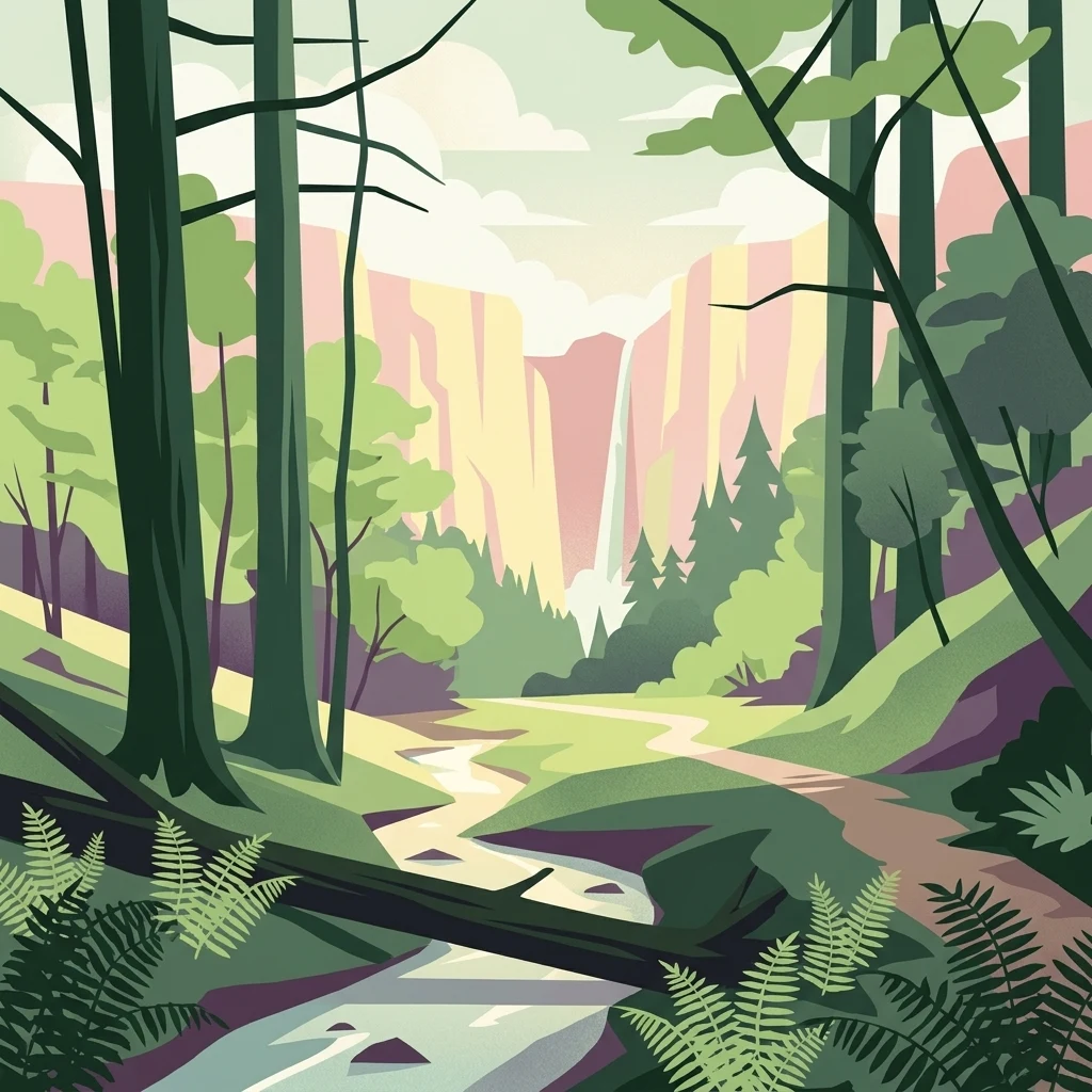
A graphic illustration of a deep forest gorge featuring a winding stream in the foreground, tall trees on both sides, and a cascading waterfall against high cliff walls in the background.
Protected landscapeBaden-Württemberg
About 9.8 km away#2 closest

North

Waldenbachtal Protected Landscape: A Geographic Profile of a Sandstone Gorge in Baden-Württemberg

Forested Klingen valley and stream-carved terrain mapping

Waldenbachtal serves as an ecologically significant protected landscape within the Rottweil district of Baden-Württemberg. Its map profile highlights a narrow gorge incised into Stubensandstein, defined by a distinct coniferous forest cover and linear stream drainage. This site provides a clear view into the region's Middle Keuper geological history and valley-based conservation patterns.

Area
0.149 km²
Established
1982
IUCN
V
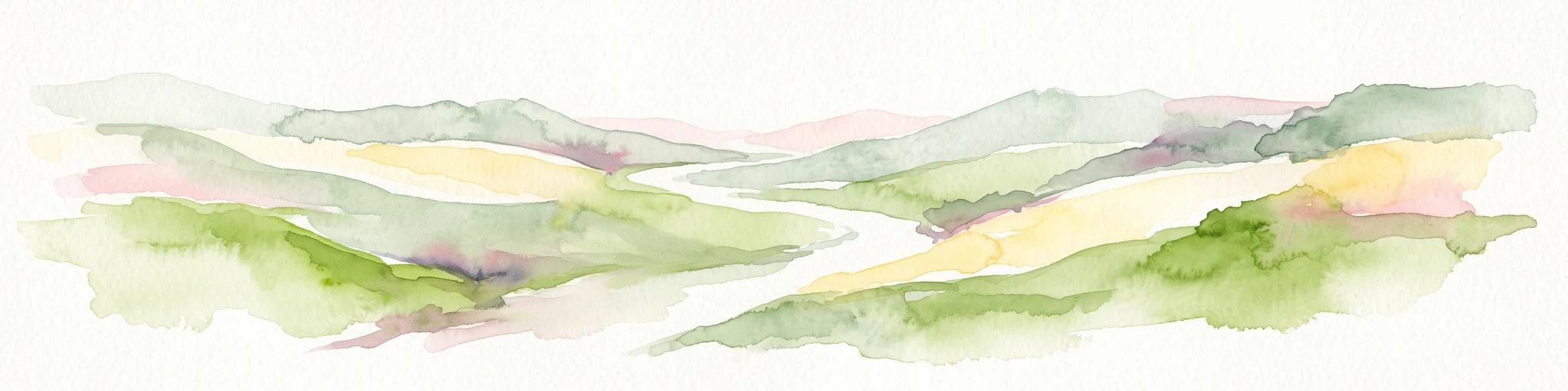
Abstract watercolor illustration of rolling green hills with soft yellow and pink washes and a winding path through a valley
Protected landscapeBaden-Württemberg
About 11 km away#3 closest

Northwest

Neckartal mit Seitentälern von Rottweil bis Aistaig Protected Landscape Map and Regional Context

Protected river valleys and plateau topography in Baden-Württemberg

This protected landscape in Baden-Württemberg features a sequence of twenty dramatic meander loops where the Neckar river cuts 140 meters into the bedrock. The protected area offers a complex geography of steep valley slopes, incised tributary notches, and historic castle-crowned ridges that reveal the evolution of the Obere Gäue terrain.

Area
16.05 km²
Established
1953
IUCN
V
Protected landscapeBaden-Württemberg
About 11 km away#4 closest

Northwest

Heckengelände im Gewand Kaltenberg: Protected Landscape and Farmland Mosaic in Baden-Württemberg

Examining traditional hedgerow patterns and regional Muschelkalk geology

Heckengelände im Gewand Kaltenberg offers a window into the Obere Gäue natural region, preserving a unique structural mosaic of agricultural fields and woody hedgerow bands. Established in 1953, this protected landscape demonstrates the historical land management and geological diversity found where the Black Forest meets the Swabian Alb.

Area
0.202 km²
Established
1953
IUCN
V
Relief
Upland
Protected landscapeBaden-Württemberg
About 11 km away#5 closest

West

Teufenbachtal Protected Landscape: Mapping the Valleys of Baden-Württemberg

Stream valley geography and forest-meadow mosaic analysis

Discover the geographic layout of Teufenbachtal, a designated protected landscape in Germany. This site analyzes the valley's corridor structure, featuring mixed forest slopes, open meadows, and the distinct Teufensee landmark, situated within the Baden-Württemberg regional geography.

Area
1.292 km²
Established
1989
IUCN
V
Relief
Upland
Nature reserveGermany
About 12 km away#6 closest

East

Hintere Harrasbachtalwiesen Nature Reserve: Swabian Alb Valley and Meadow Geography

A mapped protected landscape in Baden-Wurttemberg, Germany

Hintere Harrasbachtalwiesen is a protected valley landscape in the Tuttlingen district, characterized by its stream network and distinctive forest-encircled wet meadows. This compact reserve provides a clear example of local Swabian Alb topography, linking small-scale riparian corridors to the extensive regional Natura 2000 protected land network.

Area
0.08 km²
Established
1944
Relief
Upland
Climate
Temperate
Protected landscapeBaden-Württemberg
About 13 km away#7 closest

East

Schafweiden im Unteren Bäratal bei Reichenbach: Regional Landscape and Protected Area Atlas

Baden-Württemberg cultural landscape and valley topography

This protected area captures the traditional sheep-grazed character of the Hohe Schwabenalb. The landscape mosaic consists of contrasting valley slopes that support rare orchid populations, mature forest fringes, and ancient pasture trees, providing deep insight into the regional conservation geography of the lower Bära valley.

Area
0.327 km²
Established
2019
IUCN
V
Protected landscapeBaden-Württemberg
About 14 km away#8 closest

Northwest

Heckengelände zwischen Dunningen und Seedorf: Protected Landscape and Regional Geography

Hedgerow network and agricultural mosaic of Baden-Württemberg

Defined by its dense system of historical field hedgerows, this protected landscape in the Rottweil district maintains a unique ecological mosaic across an undulating plateau. The area features a complex interaction of loess-loam overlays, sedimentary hollows, and open farmland, representing a preserved traditional agricultural landscape within the broader context of Baden-Württemberg.

Area
7.53 km²
Established
1993
IUCN
V
Relief
Upland

Common questions about visiting, size, designation, and location context for Wacholderheide Dissenhorn

Wacholderheide Dissenhorn FAQs for park facts, access, geography, and protected area context

Find quick answers about Wacholderheide Dissenhorn, including protected-area facts, park geography, trail and visitor context, and how the park fits into its surrounding country and regional landscape.
MoriAtlas Explorer

Continue Your Protected Areas Search Across the Global Atlas

Deepen your exploration by continuing the structured search for national parks and protected areas worldwide. Utilize the comprehensive filtering capabilities to compare different conservation landscapes and refine your understanding of global park geography. Discover more about the distribution and characteristics of protected natural areas.

Global natural geography