Mori Atlas logo
Nature reserveWadrilltal

A detailed look at the mapped boundaries, floodplain forests, and wetland terrain within this regional Hochwald habitat corridor.

Wadrilltal Nature Reserve: Protected Stream Valley and Mosaic Landscapes in Saarland Germany

(Naturschutzgebiet Wadrilltal)

Wadrilltal functions as a vital nature reserve and protected valley system along the Wadrill stream in the northwestern Hochwald uplands of Saarland. The landscape encompasses a complex mosaic of floodplain forests, eutrophic ponds, and diverse grassland habitats including wet meadows and calcareous fescue slopes. Through its connection to cross-border protected lands, this reserve serves as an important ecological habitat corridor within the southwestern German landscape.

nature reservestream valleyfloodplain forestwet meadowsgrassland habitatsNatura 2000

Wadrilltal

Nature reserve

Park overview

Structured park overview, official facts, and landscape profile for Wadrilltal

Wadrilltal park facts, protected area profile, and essential visitor context

Review the core facts for Wadrilltal, including designation, size, terrain, visitor scale, habitats, and operating context in one park-focused overview.

About Wadrilltal

Wadrilltal is a designated nature reserve in the western Hochwald region of Saarland, in southwestern Germany. Situated in the municipality of Wadern, the protected area follows the course of the Wadrill, a small tributary of the Prims river, capturing both the valley floor and the adjoining slopes. The reserve combines two distinct sections: a southern area north of the town of Wadern that extends westward toward Wedern and Gehweiler, and a northern section that runs along the Wadrill northwest of the village of Wadrill up to the border with Rhineland-Palatinate near the historic Burg Grimburg.

The valley belongs to the rolling uplands at the western edge of the Hunsruck, where streams have carved modest but ecologically rich valleys into the local substrate. Within this setting, the reserve preserves a structurally diverse habitat mosaic that includes floodplain forests and naturally eutrophic open water bodies, alongside a notable range of grassland types. These include Pfeifengras (Molinia) meadows on calcareous soils, species-rich montane Borstgras (mat-grass) swards, nutrient-poor lowland hay meadows, and tall-herb forb communities.

Ecologically, the reserve is significant because it links aquatic, wetland, and grassland habitats along a single watercourse. The Wadrill and its associated standing waters provide habitat for species such as brook lamprey, bullhead fish, yellow-bellied toad, and Eurasian beaver. The surrounding meadows and tall-herb vegetation support breeding and foraging populations of wetland and grassland birds, while the broader habitat complex sustains invertebrate species of conservation concern.

The reserve is integrated into the European Natura 2000 network, a designation that underscores its cross-border ecological importance. The continuation of the protected valley on the Rhineland-Palatinate side reinforces Wadrilltal's role as a regional corridor for stream- and meadow-associated species along the state boundary.

Quick facts and research context for Wadrilltal

Wadrilltal is a nature reserve of approximately 167 hectares located in the Landkreis Merzig-Wadern in Saarland, Germany. The reserve lies within the municipality of Wadern and covers parts of the cadastral areas Gehweiler, Wadern, Wadrill, and Wedern.

The site was placed under formal nature protection on 18 November 2016 and is registered as Natura 2000 site N 6407-302. The southern main section (152 hectares) had been protected since 2005 under the earlier designation Wadrilltal bei Wedern before being incorporated into the enlarged reserve. The valley forms a continuous protected landscape that continues across the border into Rhineland-Palatinate near Burg Grimburg.

Protection and recognition

Documented terrestrial designation history and Natura 2000 records

Wadrilltal Protection Status and International Recognition Data

Terrestrial protection status for Wadrilltal established in 2016 outlines documented designation history and administrative management scope. Imported records feature official Natura 2000 recognition to detail the protected landscape framework.

International recognition

Protection details

Protection scope
Terrestrial
Designated year
2016
WDPA ID
555632892
Park context

Deeper park guide and search-rich context for Wadrilltal

Wadrilltal history, landscape, wildlife, and travel context

Explore Wadrilltal through its history, landscape character, ecosystems, wildlife, conservation priorities, cultural context, and seasonal travel timing in a structured park guide built for atlas discovery and search intent.

Why Wadrilltal stands out

Wadrilltal is best known for its near-natural stream valley along the Wadrill river, characterized by a mosaic of floodplain forests, eutrophic ponds, wet meadows, calcareous fescue meadows, and species-rich montane mat-grass swards.

Wadrilltal history and protected-area timeline

The southern section of today's nature reserve was first placed under protection in 2005 under the earlier designation "Wadrilltal bei Wedern" (NSG-116), covering 152 hectares. This earlier designation established the foundational protection for the valley's meadows, floodplain forests, and stream habitats around Wedern.

On 18 November 2016, the Saarland authorities formally designated the enlarged Wadrilltal nature reserve, integrating the former Wedern area with additional sections of the valley, including a northern area that follows the Wadrill toward the Rhineland-Palatinate border near Burg Grimburg. The new designation brought the total protected area to approximately 167 hectares and unified the management framework for the valley.

Wadrilltal landscape and geographic character

The landscape of Wadrilltal is shaped by the upper course of the Wadrill stream, a tributary of the Prims that has carved a modest valley into the western Hochwald uplands. The reserve captures the valley floor, the immediate stream margins, and portions of the surrounding slopes, with the main southern area extending from north of the town of Wadern westward toward Wedern and Gehweiler, and a separate northern area continuing northwest along the river toward the Rhineland-Palatinate border.

Topographically, the area represents a transitional upland valley where forest stands, open meadows, and small wet depressions interlock along the watercourse. The valley character, combined with the varied slope orientations and small-scale relief, creates the diversity of microhabitats that supports the reserve's ecological richness.

Wadrilltal ecosystems, habitats, and plant life

The Wadrilltal nature reserve protects a near-natural stream valley with a particularly diverse biotope complex. Floodplain forests line the Wadrill and its small tributaries, while naturally eutrophic ponds and standing waters add open-water elements to the habitat mosaic. These aquatic and wetland zones are embedded in a wider network of grasslands that includes Calcareous fescue (Pfeifengras) meadows on base-rich soils, species-rich montane mat-grass swards, lowland hay meadows of conservation value, and tall-herb communities along the field margins.

The combination of running water, floodplain forest, and structurally varied meadows gives the valley both vertical and horizontal habitat diversity. This mosaic supports a wide range of plant communities and provides crucial connectivity between aquatic and terrestrial habitats, a structural feature that is increasingly rare in intensively used agricultural landscapes in the region.

Wadrilltal wildlife and species highlights

The reserve supports a notable range of animal species tied to its stream, wetland, and meadow habitats. In and along the Wadrill and its associated waters, species of conservation interest include brook lamprey, bullhead, yellow-bellied toad, and Eurasian beaver. These species depend on clean, structurally rich streams and intact riparian vegetation, both of which the reserve maintains.

Among invertebrates, the large copper butterfly (Lycaena dispar) is a particular focus of conservation effort. The reserve's meadows and shrubby margins also support breeding and foraging populations of characteristic bird species, including kingfisher, red-backed shrike, lapwing, common snipe, meadow pipit, and whinchat, all of which benefit from the combination of wet grassland, tall herb vegetation, and adjacent scrub or forest edges found in the valley.

Wadrilltal conservation status and protection priorities

Wadrilltal is designated as a nature reserve under Saarland law and is part of the European Natura 2000 network (site code N 6407-302). Its conservation objectives focus on maintaining, restoring, and developing a favorable conservation status for the local flora and fauna, and on securing the spatial connectivity of their habitats across the landscape.

A central goal is the protection and stewardship of the near-natural stream valley and its biotope complex of floodplain meadows, wet meadows, and nutrient-rich wet grasslands. By integrating formerly separate protection efforts into a single management framework, the 2016 designation strengthened the conservation of grassland habitats and aquatic species along the Wadrill. The cross-border continuation of the protected valley into Rhineland-Palatinate further enhances the reserve's role in regional habitat connectivity.

Top sights and standout views in Wadrilltal

The reserve's defining feature is its near-natural stream valley along the Wadrill, which combines floodplain forests, naturally eutrophic ponds, and a rare mosaic of calcareous, montane, and lowland grassland types. Its designation as part of the Natura 2000 network and its cross-border extension into Rhineland-Palatinate highlight its importance as a regional habitat corridor.

Monthly climate preview

Track representative monthly temperature ranges and precipitation averages across the year.

Wadrilltal Climate Normals, Long Term Temperature and Precipitation Patterns

Long term representative measurements for Wadrilltal record mean monthly temperatures shifting from negative winter lows to warm summer maximums alongside steady precipitation. Opening the complete monthly dataset provides a detailed breakdown of historical averages across all twelve periods.
Annual mean9 °C
0 °C19 °C
Jan
Feb
Mar
Apr
May12°
Jun16°
Jul19°
Aug18°
Sep14°
Oct
Nov
Dec
Warmest month
July

18.6 °C

Coolest month
January

-0.2 °C

Wettest month
December

2.9 mm/day

Driest month
April

1.7 mm/day

Park location guide

Geography guide, regional context, and park location map for Wadrilltal

Wadrilltal park geography, regions, and map view in Germany

Understand where Wadrilltal sits in Germany through a broader geographic reading of the surrounding landscape, nearby location context, and its mapped position within the national park landscape.

How Wadrilltal fits into Germany

Germany is a federal republic in Western and Central Europe with a population of over 83 million across sixteen constituent states. It is Europe's largest economy by nominal GDP and a major global exporter and importer. The capital is Berlin, and the country borders Denmark, Poland, Czech Republic, Austria, Switzerland, France, Luxembourg, Belgium, and the Netherlands.

Wider geography shaping Wadrilltal in Germany

Germany is located in Western and Central Europe, spanning 357,022 km². It borders Denmark to the north, Poland and the Czech Republic to the east, Austria and Switzerland to the south, and France, Luxembourg, Belgium, and the Netherlands to the west. The country has coastlines on the Baltic Sea and North Sea to the north, with the Alps located in the southern region.

Map view of Wadrilltal

Use this park location map to pinpoint Wadrilltal in Germany, understand its exact geographic position, and read its mapped placement within the surrounding landscape more clearly.

Pigeon | © OpenStreetMap contributors

Location context for Wadrilltal

Saarland
Recorded earthquake history

Explore Recorded Earthquake History and Seismic Data for Wadrilltal

Browse the recorded seismic history associated with the Wadrilltal nature reserve to review historical event data within the regional Hochwald landscape. This MoriAtlas catalogue provides structured access to proximity-calculated seismic records, supporting geographic exploration and historical data analysis for the region.

Wadrilltal Earthquake History

Catalogued events

223 events

Strongest magnitude

Magnitude 4.5

Most recent event

Sep 28, 2008

This history includes earthquakes recorded inside the park or within 50 km of its borders

Park atlas

Compare adjacent river valleys and regional protected areas in the Hochwald uplands.

Exploring Parks Near Wadrilltal and Surrounding Protected Natural Landscapes

Browsing other protected areas near Wadrilltal reveals connected stream valleys and diverse upland habitats across the surrounding regional terrain. Comparing adjacent nature reserves provides deeper insight into the ecological patterns of southwestern Germany.
Nature reserveSaarland
5.1 km away#1 closest

South

Wiesenlandschaft bei Überroth: Nature Reserve Geography and Mapped Meadow Habitats

Essential protected land analysis in the Saarland region of Germany

Wiesenlandschaft bei Überroth functions as a core protected area for species-rich meadows in southwestern Germany. This detailed entry maps its two-part configuration and explains its role within the regional Saarland habitat network, providing a clear geographic perspective on its conservation status and semi-natural terrain characteristics.

Area
2.87 km²
Established
2015
IUCN
IV
Relief
Lowland
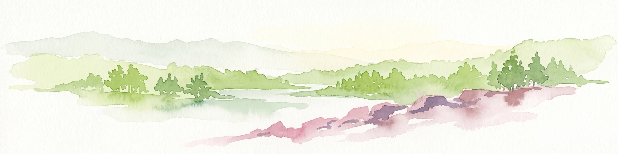
Watercolor painting of a forested landscape with rolling hills and distant mountains under a pale sky
National parkSaarland
6.7 km away#2 closest

Northeast

Hunsrück-Hochwald National Park: Saarland Protected Area Atlas and Landscape Context

Explore the mapped terrain and protected geography of this German national park.

Delve into the specific geography and protected landscape of Hunsrück-Hochwald National Park in Saarland. This detail page provides an atlas-centric view of the park's mapped boundaries, regional context, and its role as a national park. It serves as a foundational point for understanding the park's landscape features and its placement within the broader geographic atlas.

Area
100 km²
Established
2015
IUCN
II
Relief
Mountain
Watercolor painting of rolling green hills, small forest patches, and rocky outcrops under a soft, white background.
National parkRheinland-Pfalz
6.7 km away#3 closest

Northeast

Nationalpark Hunsrück-Hochwald: An Atlas and Geographic Overview of Protected Lands

Upland forest ecosystems and quartzite mountain terrain

The Hunsrück-Hochwald region showcases the transition of industrial-era forests toward near-natural wilderness. Its mapped territory integrates significant beech wood blocks with smaller wetland systems, reflecting a commitment to long-term biodiversity within the German uplands. Explore the structural composition and landscape features that define this protected zone.

Area
101.2 km²
Established
2015
IUCN
II
Relief
Mountain
Nature reserveSaarland
11 km away#4 closest

Northeast

Wiesenkomplex bei Eisen Nature Reserve: Geography and Protected Habitat Mapping in Saarland

A mosaic of meadow and riparian stream ecosystems

Located in northern Saarland, Wiesenkomplex bei Eisen protects a mosaic of traditionally managed wet and semi-dry grasslands. The reserve, centered on the Krippbach stream, supports essential floodplain gallery forests and diverse meadow types. This mapping of four non-contiguous sites underscores the role of structured management in preserving remnant cultural landscape habitats within the region.

Area
0.9 km²
Established
2016
IUCN
IV
Relief
Lowland
Nature reserveSaarland
12 km away#5 closest

East

Südteil des Nohfeldener Rhyolith-Massivs: Saarland Nature Reserve and Volcanic Highland Terrain

Protected montane grasslands and rare bog woodland habitats.

This nature reserve protects 73 hectares of critical habitat within the Saarland uplands. Defined by the rhyolite massif geology between Losenberg and Leißberg, the protected area maintains rare montane mat-grass swards and fragile bryophyte communities. The site serves as a vital example of volcanic landscape conservation, highlighting the intersection of acidic silicate soils and specific ecological biodiversity in Germany.

Area
0.73 km²
Established
2017
IUCN
IV
Nature reserveSaarland
18 km away#6 closest

West

Steilhänge der Saar Nature Reserve: Mapped Protected Landscapes and River Valley Geography

Protected river slopes and forested terrain in Saarland

The Steilhänge der Saar nature reserve encompasses steep, wooded hillsides rising above the Saar river valley. This consolidated protected area features complex ecological gradients between rocky, sun-exposed upper slopes and shadowed tributary streams, serving as a critical habitat zone and a defining feature of the regional Saarland landscape.

Area
10.86 km²
Established
2017
IUCN
IV
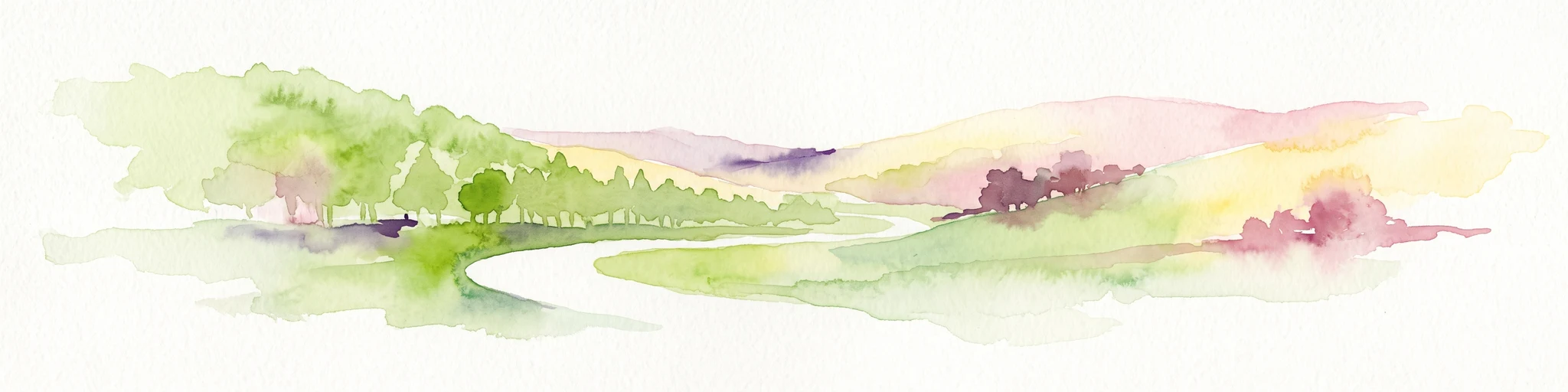
Watercolor painting of a rolling green forest landscape with a winding path and soft, abstract hills in the background.
Nature reserveRhineland-Palatinate
19 km away#7 closest

Northwest

Mattheiser Wald Nature Reserve: A Protected Forest Landscape in Rhineland-Palatinate

Ecological mapping of urban forest and valley terrain

Mattheiser Wald represents a vital nature reserve and Natura 2000 site in the Trier region. The area is characterized by high-value oak and hornbeam woodland, abandoned military disturbance zones that host rare wildlife, and an intricate stream valley system. This atlas entry provides a detailed look at the reserve's topography and its status as a critical conservation landscape within an urban environment.

Area
4.47 km²
Established
2003
Relief
Upland
Climate
Temperate
Nature reserveSaarland
About 21 km away#8 closest

Southeast

Täler der Ill und ihrer Nebenbäche: Nature Reserve and River Valley Geography in Saarland

Protected riparian landscapes and stream corridor networks.

Täler der Ill und ihrer Nebenbäche preserves the interconnected valley ecosystems of the Ill river and its tributaries in central Saarland. This nature reserve maps a chain of riverine habitats that follow the natural course of the watercourses across the hill country. The landscape displays the relationship between formal protected areas and the surrounding regional geography, emphasizing the preservation of wetland corridors and riparian environments.

Area
10.45 km²
Established
2005
IUCN
IV

Common questions about visiting, size, designation, and location context for Wadrilltal

Wadrilltal FAQs for park facts, access, geography, and protected area context

Find quick answers about Wadrilltal, including protected-area facts, park geography, trail and visitor context, and how the park fits into its surrounding country and regional landscape.
MoriAtlas Explorer

Continue Your Protected Areas Search Across the Global Atlas

Deepen your exploration by continuing the structured search for national parks and protected areas worldwide. Utilize the comprehensive filtering capabilities to compare different conservation landscapes and refine your understanding of global park geography. Discover more about the distribution and characteristics of protected natural areas.

Global natural geography