
Mori Atlas logo
Wildlife reserveWainuiomata Water Collection Area

Understanding the mapped boundaries and natural catchment terrain of this southern New Zealand wildlife reserve.

Wainuiomata Water Collection Area: Geographic Overview of Wellington's Protected Native Forest Landscapes

The Wainuiomata Water Collection Area serves as a critical protected landscape at the southern tip of New Zealand's North Island. This catchment represents the largest expanse of pristine lowland native forest remaining in the lower North Island, characterized by steep river valleys, mature southern rata, and an intact canopy of hinau, kamahi, and tree ferns. Beyond its primary role in supplying fresh water to the Wellington urban area, the reserve functions as a flagship site for ecological recovery, predator control, and native species reintroduction within the broader Wellington Region.

water catchmentlowland forestnative bushpredator controlwildlife reintroductionriver catchments
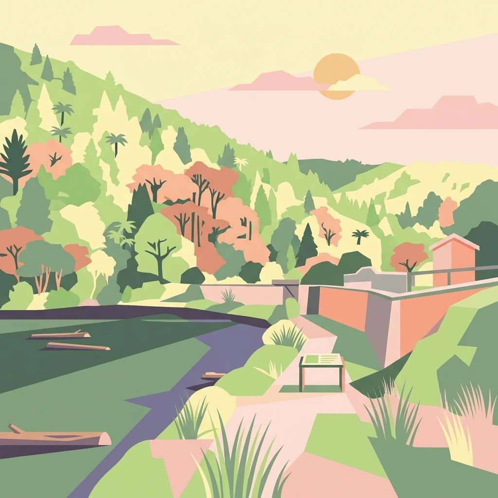
A stylized digital illustration featuring a reservoir at the base of lush, forested hills. In the foreground, a path leads to an information sign near the water, which contains several floating logs. A small structure sits near the water edge under a soft sunrise or sunset.

Wainuiomata Water Collection Area

Wildlife reserve

Park overview

Structured park overview, official facts, and landscape profile for Wainuiomata Water Collection Area

Wainuiomata Water Collection Area park facts, protected area profile, and essential visitor context

Review the core facts for Wainuiomata Water Collection Area, including designation, size, terrain, visitor scale, habitats, and operating context in one park-focused overview.

About Wainuiomata Water Collection Area

The Wainuiomata Water Collection Area is a substantial reserve in the southern Wellington Region of New Zealand, near the town of Wainuiomata in Lower Hutt. Covering the catchments of the Wainuiomata River and the Ōrongorongo River, it functions as both a critical urban water source and one of the most important lowland forest strongholds in the lower North Island.

The landscape is shaped by steep forested valleys, clear-running rivers, and a mosaic of beech and podocarp-broadleaf forest. Southern rata tower above a layered canopy of hinau, kamahi, rewarewa, and tree ferns, while black beech occupy drier sites and silver beech crown the high ridge-tops. This continuous native cover, combined with strict access controls tied to the area's protected water supply status, has kept the bush largely untouched compared with many surrounding lowland forests.

Managed by Wellington Regional Council and operated exclusively by Wellington Water, the reserve sits within a wider ecological network that includes Remutaka Forest Park to the east and Wainuiomata Regional Park to the west. This network supports ongoing predator control, native bird reintroductions, and biodiversity monitoring. The 2022 Puketahā feasibility study, led by conservationist Jim Lynch, reinforced the area's broader significance, suggesting that the catchment could also host a major fenced wildlife sanctuary to extend conservation gains already visible across the region.

Quick facts and research context for Wainuiomata Water Collection Area

The Wainuiomata Water Collection Area is administered by Wellington Regional Council and operated exclusively for water supply by Wellington Water. It protects the catchments of the Wainuiomata River and the Ōrongorongo River and supplies a meaningful share of Wellington's urban water.

The reserve is closed to the general public, though guided tours and hunting ballots are available with permission. It adjoins Remutaka Forest Park and Wainuiomata Regional Park, forming part of a larger contiguous block of native forest that supports intensive predator control, vegetation monitoring, and species reintroductions.

Park context

Deeper park guide and search-rich context for Wainuiomata Water Collection Area

Wainuiomata Water Collection Area history, landscape, wildlife, and travel context

Explore Wainuiomata Water Collection Area through its history, landscape character, ecosystems, wildlife, conservation priorities, cultural context, and seasonal travel timing in a structured park guide built for atlas discovery and search intent.

Why Wainuiomata Water Collection Area stands out

The reserve's defining identity is its scale of largely unmodified lowland native forest, described as the largest and most pristine in the lower North Island. Mature southern rata emerge above a canopy of hinau, kamahi, rewarewa, and tree ferns, while black beech dominate drier slopes and silver beech crown the high ridges. Equally distinctive is the strategic combination of water supply protection and conservation management. Intensive predator control, kiwi and robin reintroductions, and the proposed Puketahā wildlife sanctuary have positioned the catchment as a flagship landscape for native species recovery in the Wellington region.
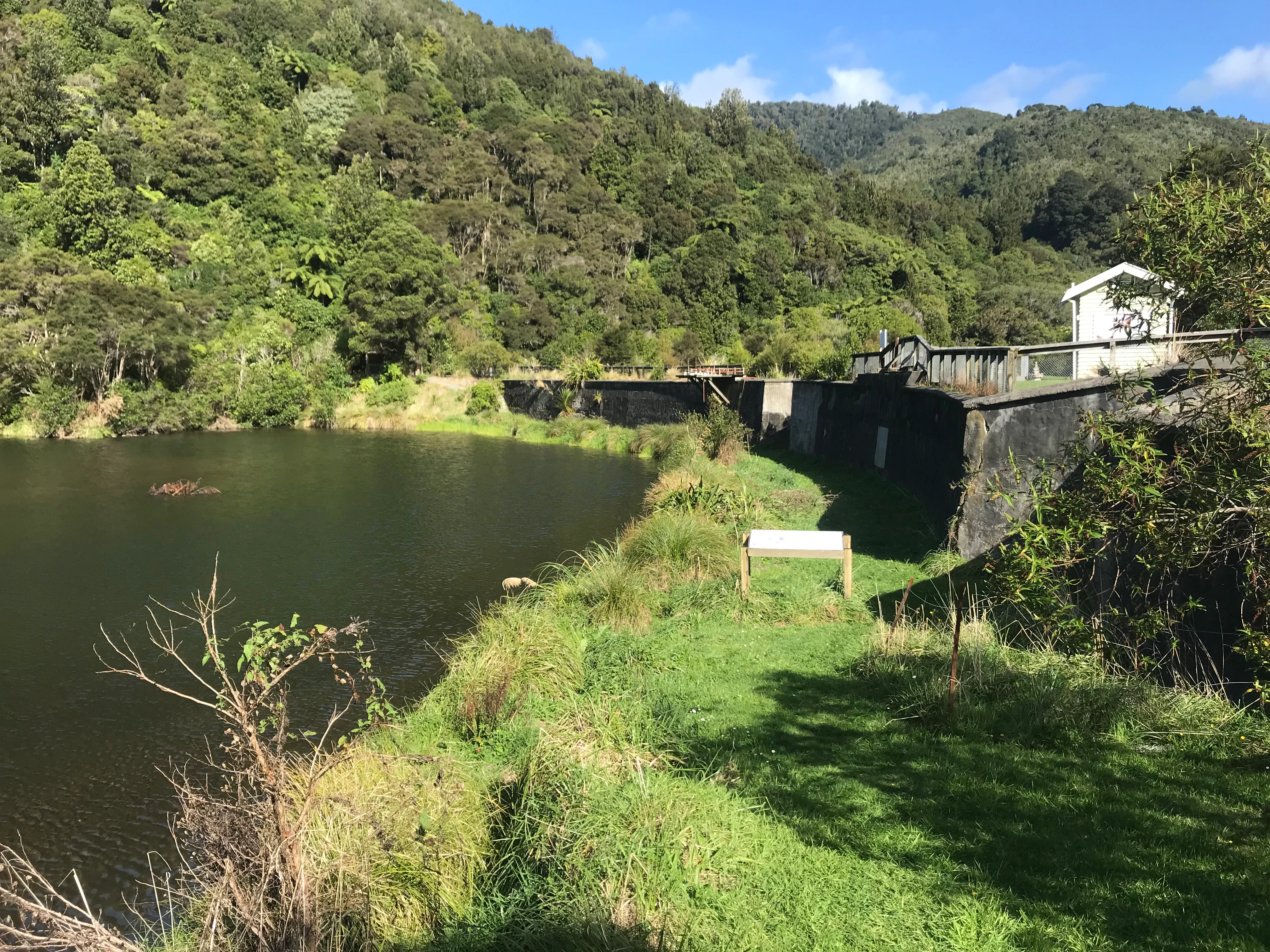
A historic stone dam structure next to a calm reservoir in a lush, green, forested valley.
The historic Lower Dam structure on the Wainuiomata River, surrounded by lush native forest.

Wainuiomata Water Collection Area history and protected-area timeline

European settlers recognized the water supply potential of the Wainuiomata area during the 19th century. An earth dam was built on the Wainuiomata River in 1880, and a pipeline was laid to Wellington, complementing the country's first public water supply dam, which had been completed at Karori two years earlier.

The early infrastructure was expanded with the construction of the Morton Dam between 1908 and 1911, followed by a weir and pipeline from the Ōrongorongo Catchment in 1924. The original capture system was eventually decommissioned and emptied in the late 1980s, when a new treatment plant was built to take water directly from weirs on both rivers. This plant can produce up to around 60 million litres of treated water a day, supplying roughly fifteen percent of the water used across the Wellington urban area.

Conservation history developed alongside the water infrastructure. A kiwi reintroduction program in neighboring Remutaka Forest Park, beginning in May 2006, eventually led to kiwi migrating into the collection area. North Island robins were re-introduced from September 2016, and a major pest control operation using 1080 was carried out in October 2019 to suppress rat numbers and protect native fauna.

In 2022, Wellington Regional Council commissioned Jim Lynch, founder of Zealandia, to evaluate whether the catchment could host a fenced wildlife sanctuary. The study concluded that such a project was technically and practically feasible, and the proposed sanctuary became known as Puketahā. In May 2025, a wild population of the nationally vulnerable parasitic flowering plant Dactylanthus taylorii was rediscovered in the reserve, after being thought extinct in the Wellington Region for more than a century, prompting a new management plan to protect the find.

Wainuiomata Water Collection Area landscape and geographic character

The landscape of the Wainuiomata Water Collection Area is dominated by steep, deeply incised river valleys and a continuous cover of mature native forest. The Wainuiomata and Ōrongorongo rivers run through the reserve, with their catchments shaping a terrain of forested ridges, clear streams, and remote interior valleys that have remained largely unmodified.

Vegetation patterns vary with elevation and exposure. Lower slopes and valley interiors support a dense canopy of hinau, kamahi, rewarewa, and tree ferns, beneath emergent southern rata. Drier sites carry stands of black beech, while the upper ridge-tops are crowned with silver beech, producing a layered forest mosaic typical of Wellington's hill country.

The reserve's location against the Remutaka Range, with affinities to Remutaka Forest Park and surrounded forest reserves, frames a forested backdrop that visually defines the southern edge of the Hutt Valley. Clear, unpolluted rivers and the absence of roads across much of the catchment reinforce the sense of an enclosed, intact lowland forest landscape.

Wainuiomata Water Collection Area ecosystems, habitats, and plant life

Ecologically, the reserve represents one of the most important lowland native forest remnants in the lower North Island. Continuous cover of podocarp-broadleaf forest, rata-dominated emergent canopy, and beech on the drier ridges and high crests give the area a layered habitat structure that supports a wide range of native flora and fauna.

Beyond the forest structure itself, the catchment functions as a refuge because of its protected water supply status. Public access is restricted, and intensive predator control targets possums, rats, stoats, deer, pigs, and goats. This management has allowed native plant communities to recover and supported the return of forest birds that have declined elsewhere in the region.

The catchment mosaic extends into neighboring protected areas, including Remutaka Forest Park and Wainuiomata Regional Park, increasing the effective ecological footprint for forest-dependent species. The combination of intact vegetation, clean water, active pest management, and reintroductions has helped position the area as a working example of integrated water and biodiversity management in New Zealand.

Wainuiomata Water Collection Area wildlife and species highlights

The reserve supports an increasingly diverse native fauna, helped by ongoing predator control and deliberate reintroductions. North Island brown kiwi have established in the area, having migrated across from Remutaka Forest Park following the 2006 reintroduction program there. North Island robins became the focus of a separate reintroduction beginning in September 2016, adding another forest-bird species to the recovering community.

Native forest birds more broadly benefit from intensive management of introduced predators, with regular monitoring of bird and animal numbers informing ongoing pest control. In May 2025, the rediscovery of a wild population of Dactylanthus taylorii, a nationally vulnerable parasitic flowering plant thought extinct in the Wellington Region for over a century, highlighted the area's importance for lesser-known native species as well.

Fish and invertebrate life in the clear catchments, paired with the surrounding native vegetation, complete a freshwater and terrestrial wildlife profile that is unusual for lowland Wellington. The proposed Puketahā sanctuary would extend this profile further by enabling larger-scale, multi-species recovery inside a fenced landscape.

Wainuiomata Water Collection Area conservation status and protection priorities

The reserve's conservation significance stems directly from the protections put in place around its water supply role. Because public access is restricted and the forest has been allowed to develop largely without intervention for over a century, the catchment retains an unusually intact native canopy for lowland Wellington.

Conservation management is proactive. Wellington Regional Council oversees ongoing pest control targeting possums, rats, stoats, deer, pigs, and goats, and uses tools including 1080 operations to protect native fauna. This has been followed by deliberate introductions of kiwi and robins, regular vegetation and bird monitoring, and targeted protection of rare species such as the rediscovered Dactylanthus taylorii population.

The 2022 Puketahā feasibility study, led by Jim Lynch, marked a new phase by concluding that a fenced wildlife sanctuary within the catchment was technically and practically feasible. If established, Puketahā would formalize the area's role as a flagship conservation landscape, complementing broader biodiversity efforts across the Wellington Region and the adjoining Remutaka and Wainuiomata regional parks.

Wainuiomata Water Collection Area cultural meaning and human context

The area has limited but meaningful cultural context tied to its role in Wellington's settlement history. Recognized by European settlers in the 19th century as a reliable water source for the growing capital, the catchment became the site of some of New Zealand's earliest municipal water supply infrastructure, including the 1880 earth dam on the Wainuiomata River and the Mort​on Dam built between 1908 and 1911.

In te reo Māori, the proposed sanctuary carries the name Puketahā, reflecting an intent to anchor contemporary conservation planning in local language and identity. The catchment's broader cultural significance is also connected to its forested setting on the margins of the Remutaka Range, where Māori and early European histories of land and water use converge.

Top sights and standout views in Wainuiomata Water Collection Area

The catchment's standout quality is its scale of unmodified lowland native forest, frequently described as the largest and most pristine in the lower North Island. A canopy of southern rata, hinau, kamahi, rewarewa, and tree ferns rises above clear, undisturbed rivers that feed a modern treatment plant supplying a significant share of Wellington's urban water.

Active conservation work, including kiwi and robin reintroductions and intensive predator control, layers restoration over an already-intact forest base. The 2025 rediscovery of Dactylanthus taylorii in the reserve and the 2022 Puketahā feasibility study both point to the area's growing role as a flagship site for native species recovery in the Wellington Region.

Best time to visit Wainuiomata Water Collection Area

Because the reserve is closed to general public access, seasonal advice focuses less on tourism convenience and more on the character of the landscape. The cooler, wetter months typically highlight the lush green canopy of the lowland forest and the swelling of the Wainuiomata and Ōrongorongo rivers, while drier periods offer clearer views across the valleys and ridge-tops that frame the catchment.

Wildlife interest is relatively consistent across the year, with kiwi, robins, and other native birds most reliably encountered during early morning and late afternoon hours, when forest bird activity tends to peak. Interested visitors are limited to guided tours and hunting ballots, both of which require prior permission from Wellington Regional Council or Wellington Water.
Monthly climate preview

Long-term representative point measurements of temperature and precipitation rhythm

Wainuiomata Water Collection Area Climate Normals and Annual Weather Patterns

Historical data recorded at a representative coordinate tracks average monthly temperatures ranging from 9.71 degrees Celsius to 17.01 degrees Celsius alongside consistent precipitation rates. Examining the full twelve-month statistical record reveals the complete annual cycle of thermal and moisture conditions across the protected terrain.
Annual mean13 °C
10 °C17 °C
Jan17°
Feb17°
Mar16°
Apr14°
May12°
Jun11°
Jul10°
Aug10°
Sep11°
Oct12°
Nov13°
Dec15°
Warmest month
February

17 °C

Coolest month
July

9.7 °C

Wettest month
June

3.1 mm/day

Driest month
January

1.8 mm/day

Park location guide

Geography guide, regional context, and park location map for Wainuiomata Water Collection Area

Wainuiomata Water Collection Area park geography, regions, and map view in New Zealand

Understand where Wainuiomata Water Collection Area sits in New Zealand through a broader geographic reading of the surrounding landscape, nearby location context, and its mapped position within the national park landscape.

How Wainuiomata Water Collection Area fits into New Zealand

New Zealand is an island nation in the southwestern Pacific Ocean comprising two main islands and numerous smaller islands. Located east of Australia across the Tasman Sea, it features varied topography with the Southern Alps running along the South Island and volcanic terrain on the North Island. The country was settled by Maori people between 1280 and 1350, followed by European exploration beginning in 1642, and became a Dominion in 1907 before gaining full independence in 1947.

Wider geography shaping Wainuiomata Water Collection Area in New Zealand

New Zealand lies in the southwestern Pacific Ocean, east of Australia across the Tasman Sea. The country consists of two main islands, the North Island and South Island, plus over 600 smaller islands. The North Island features volcanic plateaus and hills while the South Island is dominated by the Southern Alps mountain range. The country has a long coastline and is surrounded by the Pacific Ocean.

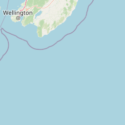
Map view of Wainuiomata Water Collection Area

Use this park location map to pinpoint Wainuiomata Water Collection Area in New Zealand, understand its exact geographic position, and read its mapped placement within the surrounding landscape more clearly.

Pigeon | © OpenStreetMap contributors

Location context for Wainuiomata Water Collection Area

Wellington Region

Visualizing the pristine lowland forest canopy, river catchments, and rugged terrain of New Zealand

Wainuiomata Water Collection Area Photos and Protected Landscape Scenery

Visual documentation captures the continuous native forest canopy, steep river valleys, and protected habitats defining the Wainuiomata Water Collection Area. Photographic records reveal the dense lowland vegetation and remote terrain that remain hidden from public access roads.

A historic stone dam structure next to a calm reservoir in a lush, green, forested valley.

Park atlas

Compare regional forest reserves and connected conservation areas across the southern Wellington hill country.

Explore Parks Near Wainuiomata Water Collection Area and Surrounding Protected Landscapes

Browsing other protected areas near Wainuiomata Water Collection Area reveals the broader ecological network spanning the southern Wellington region. Examining adjacent forest reserves provides valuable context for understanding local river catchments and native lowland forest preservation.
Regional parkWellington Region
About 2.8 km away#1 closest

Southwest

Wainuiomata Regional Park: Geography and Protected Area Atlas

River valley terrain in the Wellington Region

Wainuiomata Regional Park is a protected river valley setting featuring significant lowland native forest, historic water infrastructure, and restored wetland habitats. This landscape provides a critical link in the conservation geography of the Wellington Region, connecting to extensive forest remnants and supporting a variety of native ecosystems within the Wainuiomata catchment.

Relief
Mixed relief
Water
Major water bodies
A soft watercolor painting of a rolling forested landscape featuring distant mountains and a calm body of water in the foreground.
Protected landscapeWellington Region
About 11 km away#2 closest

South

Remutaka Forest Park: Protected Landscape and Regional Hill Country Geography

A rugged forested reserve spanning the Wellington Region.

Covering extensive territory across the Remutaka Range, this protected landscape is defined by its dramatic ridges and deep river valleys. The area functions as a vital refuge for native bush and birdlife, offering a layered environment that stretches from accessible valley floors to remote upland slopes in the southern North Island.

Area
220 km²
Established
1972
IUCN
V
Relief
Mountain
Protected landscapeWellington Region
About 21 km away#3 closest

Northwest

Whitireia Park: Coastal Headland and Protected Landscape in the Wellington Region

Explore mapping of coastal terrain, forests, and harbour boundaries.

Whitireia Park is a prominent coastal reserve in the Wellington Region that balances deep Ngāti Toa cultural significance with a unique geological history shaped by centuries of earthquake uplift. The headland features open grasslands, remnant kohekohe forest, and ongoing wetland restoration that offers a layered view of New Zealand's natural and social history across its accessible harbour-edge geography.

Area
1.8 km²
Established
1976
Relief
Upland
Climate
Temperate
Nature reserveWellington
About 26 km away#4 closest

West

Te Kopahou Reserve: Nature Reserve Geography and Coastal Landscapes in Wellington

A rugged intersection of forested hills, ridgelines, and coastal cliffs.

Situated on the southern edge of Wellington, Te Kopahou Reserve offers a diverse protected landscape ranging from the summit of Hawkins Hill to the iconic red rocks of the Cook Strait shoreline. This nature reserve provides a critical geographic transition, hosting regenerating native bush, exposed ridgeline trails, and vital habitats for local wildlife, making it a prominent example of regional conservation land on the North Island of New Zealand.

Area
6 km²
Relief
Mountain
Climate
Temperate
Access
Easy access
A horizontal watercolor painting showing a calm river winding through green banks with coniferous trees in the background, set against a soft, light-filled sky.
Nature reserveWellington Region
About 31 km away#5 closest

Northeast

Hutt Water Collection Area: Protected Mountain Nature Reserve in the Wellington Region

Forested catchment geography and mountain wilderness

The Hutt Water Collection Area covers 8,900 hectares of steep ridge and valley terrain in the southern Tararua Range. This nature reserve serves as a essential water catchment for the Wellington Region, protecting a diverse environment of native forest, alpine tussock, and sub-alpine bogs. Explore the mapped geography of this critical protected landscape and its role as a sanctuary for rare plant species and native birds.

Area
89 km²
Established
1951
Relief
Mountain
Climate
Temperate
A soft watercolor painting of a rolling green landscape with distant hills and foreground vegetation on a plain white background.
Nature reserveWairarapa
About 51 km away#6 closest

Northeast

Fensham Reserve: Protected Lowland Forest Geography and Conservation Mapping in Wairarapa

An essential lowland sanctuary for ancient podocarp and swamp forest ecosystems

Fensham Reserve preserves 48 hectares of significant native forest in the southern North Island of New Zealand. This nature reserve provides essential landscape context for rare kahikatea and pukatea associations, while serving as a crucial wetland refuge for endangered species like the brown mudfish. The area remains a key reference point for understanding regional forest restoration and the protection of long-standing ecological fragments.

Area
0.48 km²
Established
1957
Relief
Lowland
Climate
Temperate
Protected landscapeNew Zealand
About 58 km away#7 closest

Northeast

Tararua Forest Park: Protected Landscape Geography and Mapped Natural Terrain

Defining the rugged mountain spine of New Zealand's southern North Island

Covering the core of the Tararua Range, this protected landscape represents a vital ecological corridor in New Zealand. The terrain offers a diverse gradient of native forests, steep river valleys, and windswept alpine ridges. It serves as a primary example of forest conservation and complex mountain geography within the island nation's larger network of protected lands.

Area
1,149.93 km²
Established
1954
Relief
Mountain
Climate
Temperate
Marine protected areaMarlborough Region
About 61 km away#8 closest

West

Long Island-Kokomohua Marine Reserve: Mapped Geography and Protected Reef Systems

Explore marine boundaries in the Marlborough Region

Located at the entrance to Queen Charlotte Sound, Long Island-Kokomohua Marine Reserve encompasses significant island and submerged reef features. This protected area serves as an essential site for understanding coastal ecosystem restoration, featuring varied terrain from shallow near-shore reefs to deeper rocky pinnacles that support diverse marine populations.

Area
6.19 km²
Established
1993
Relief
Lowland
Climate
Temperate

Common questions about visiting, size, designation, and location context for Wainuiomata Water Collection Area

Wainuiomata Water Collection Area FAQs for park facts, access, geography, and protected area context

Find quick answers about Wainuiomata Water Collection Area, including protected-area facts, park geography, trail and visitor context, and how the park fits into its surrounding country and regional landscape.
MoriAtlas Explorer

Continue Your Protected Areas Search Across the Global Atlas

Deepen your exploration by continuing the structured search for national parks and protected areas worldwide. Utilize the comprehensive filtering capabilities to compare different conservation landscapes and refine your understanding of global park geography. Discover more about the distribution and characteristics of protected natural areas.

Global natural geography