
Mori Atlas logo
Nature reserveFFH-Gebiet Wälder bei Bergenhusen

Examining the ecological boundaries and historical woodland mosaics within the Eider-Treene-Sorge lowland

FFH-Gebiet Wälder bei Bergenhusen: A Detailed Atlas of Protected Forest Landscapes and Geest Ridge Terrain

FFH-Gebiet Wälder bei Bergenhusen serves as a significant Natura 2000 protected site situated on the Stapelholm geest ridge of Schleswig-Holstein, Germany. This mapped area encompasses a complex mosaic of beech, oak-hornbeam, and alder-ash forest habitats that have maintained historical continuity since the seventeenth century. Users can analyze the structural characteristics of these two distinct parcels, which span diverse elevation gradients and integrate important archaeological megalithic burial fields into the protected landscape.

Natura 2000FFH areaSchleswig-HolsteinStapelholmgeest ridgedeciduous forest
A flat-design illustration of a natural scene featuring a large tree in the center, a waterfall cascading down rocky cliffs in the background, and a field in the foreground.

FFH-Gebiet Wälder bei Bergenhusen

Nature reserve

Park overview

Structured park overview, official facts, and landscape profile for FFH-Gebiet Wälder bei Bergenhusen

FFH-Gebiet Wälder bei Bergenhusen park facts, protected area profile, and essential visitor context

Review the core facts for FFH-Gebiet Wälder bei Bergenhusen, including designation, size, terrain, visitor scale, habitats, and operating context in one park-focused overview.

About FFH-Gebiet Wälder bei Bergenhusen

The FFH-Gebiet Wälder bei Bergenhusen is a compact but ecologically significant European protected area in northern Germany, designed to conserve a representative set of forest habitats on the Stapelholm geest ridge of Schleswig-Holstein. Located within the Eider-Treene-Sorge lowland landscape, it lies between the communities of Wohlde to the north and Bergenhusen to the south, in the Kreis Schleswig-Flensburg district, an area historically shaped by glacial deposits, low-lying wetlands, and long-established woodlands.

The protected area comprises two separate forest parcels. The larger northern part stretches across the geest between Wohlde and Bergenhusen and includes the named forest areas Hohenhorst, Sickert, Lehmholz, Luisenholz, and Tivoli. The smaller southern part lies on a slope east of the Brunsholm settlement, on the southern edge of the same geest ridge, and is centered around a water-filled former clay pit that counts as a protected standing water habitat.

The site's ecological profile is built around several Annex I habitat types of the EU Habitats Directive: nutrient-rich natural and near-natural standing waters with pondweed or frogbit communities; Hainsimsen beech forests; Waldmeister beech forests; Sternmieren oak-hornbeam forests; and alder-ash plus softwood floodplain forests. More than three quarters of the area has received an overall good conservation assessment in the EU Standard Data Form, but the site also illustrates common challenges of post-war Central European forests, including a relatively young age structure, limited old-growth character, and the impact of high roe deer browsing pressure on natural regeneration outside fenced plots.

Quick facts and research context for FFH-Gebiet Wälder bei Bergenhusen

This Natura 2000 site lies in northern Germany in the state of Schleswig-Holstein, within the Kreis Schleswig-Flensburg, and forms part of the broader Eider-Treene-Sorge lowland region. The protected area covers approximately 145 hectares and consists of two separate forest parcels on the Stapelholm geest ridge. It was proposed as a Site of Community Importance in August 2000, confirmed by the European Union in December 2004, and designated as a national special area of conservation in January 2010. The reported EU habitat types include nutrient-rich standing waters, Hainsimsen-Buchenwälder, Waldmeister-Buchenwälder, Sternmieren-Eichen-Hainbuchenwälder, and alder-ash floodplain forests.

Protection and recognition

Explore the documented terrestrial conservation history and designation details

FFH-Gebiet Wälder bei Bergenhusen Protection Status and Designation Records

Documented protection records outline the formal terrestrial designation history and management scope established for FFH-Gebiet Wälder bei Bergenhusen in 2010. Structured conservation facts provide verified administrative parameters and international recognition data for the protected area.

Protection details

Protection scope
Terrestrial
Designated year
2010
Transboundary protection
No
WDPA ID
555517848
Park context

Deeper park guide and search-rich context for FFH-Gebiet Wälder bei Bergenhusen

FFH-Gebiet Wälder bei Bergenhusen history, landscape, wildlife, and travel context

Explore FFH-Gebiet Wälder bei Bergenhusen through its history, landscape character, ecosystems, wildlife, conservation priorities, cultural context, and seasonal travel timing in a structured park guide built for atlas discovery and search intent.

Why FFH-Gebiet Wälder bei Bergenhusen stands out

The site is best known for its mosaic of beech-dominated forest habitat types of European conservation importance, including Hainsimsen beech forest, Waldmeister beech forest, and Sternmieren oak-hornbeam forest, complemented by patches of alder-ash softwood floodplain woodland and a small nutrient-rich standing water. It is also notable as a long-standing historical woodland location, with forest cover documented on early modern maps of the Duchy of Schleswig from 1680. Two large megalithic grave fields add important archaeological value, one with 14 graves in the Lehmholz area and a larger one with 38 graves near Brunsholm.
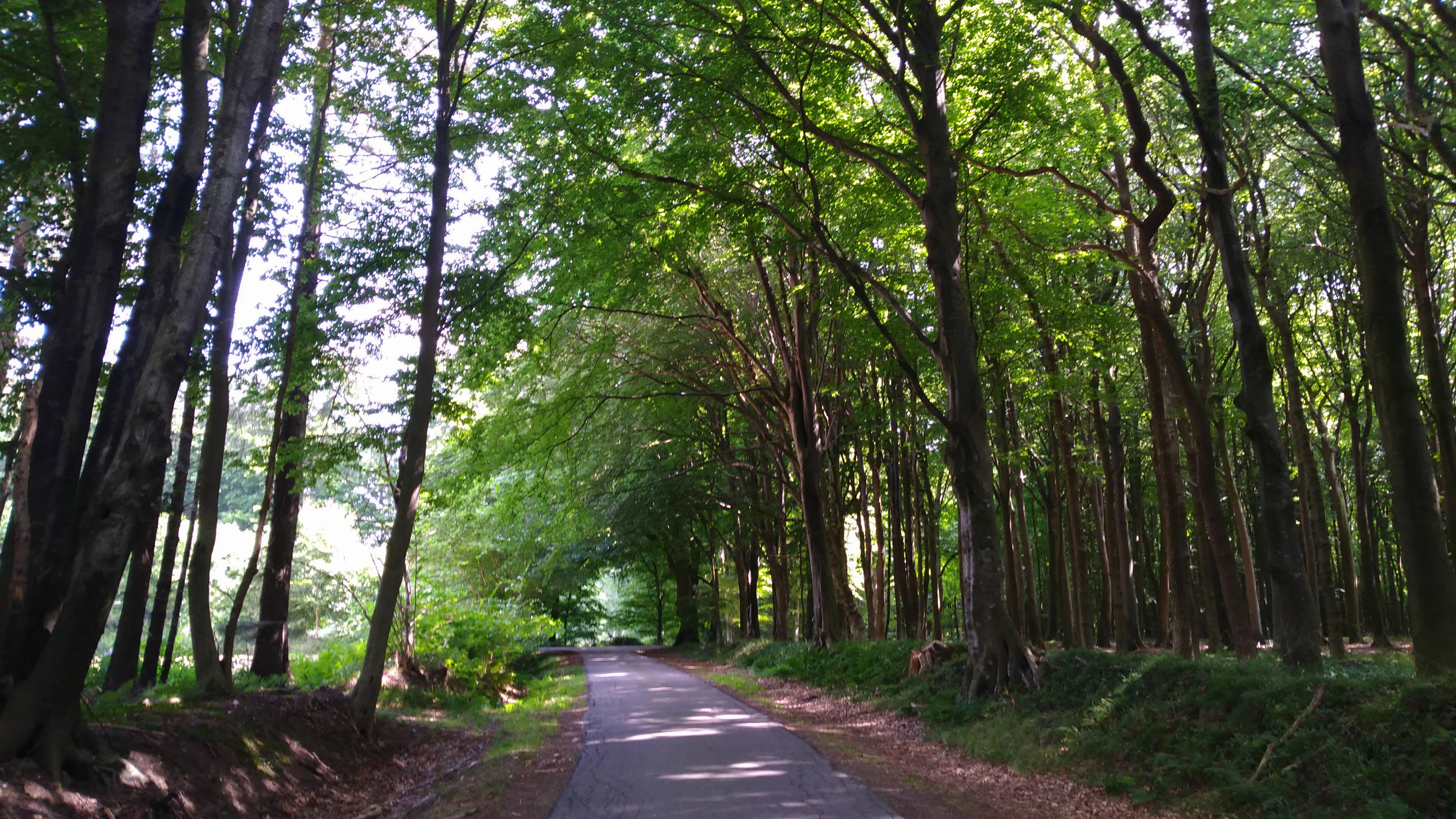
A narrow paved path stretches into the distance, lined by tall, dense deciduous trees that form a green canopy overhead.
A shaded path leading through the historical forest stands of the FFH-Gebiet Wälder bei Bergenhusen.

FFH-Gebiet Wälder bei Bergenhusen history and protected-area timeline

The forest landscape around Bergenhusen has a documented history going back several centuries. The wooded area is already shown on the map of the Duchy of Schleswig by Janssonius van Waesberge and Moses Pitt from 1680, and again on the Danish General Staff map from 1852, confirming it as a long-standing woodland location rather than a recent planting.

In the modern conservation era, the Natura 2000 Standard Data Form for the area was prepared by the forestry division of the Landwirtschaftskammer Schleswig-Holstein in November 1999. The site was proposed as a Site of Community Importance in August 2000, confirmed at the EU level in December 2004, and then designated nationally under §32 paragraphs 2 to 4 of the Federal Nature Conservation Act in conjunction with §23 of the Schleswig-Holstein State Nature Conservation Act in January 2010. A formal management plan for the FFH area was published in October 2006 by the same forestry body.

The site's recent forest history includes significant post-Second World War clearance and subsequent replanting, which has left a relatively small share of old trees and a still-developing age structure. Ownership is highly fragmented: over 90 percent of the area belongs to 88 private landowners, with a smaller share held by the Stiftung Naturschutz Schleswig-Holstein, and willingness to sell to the foundation has historically been limited. Monitoring of the site has been carried out through periodic cartridge surveys, with follow-up monitoring in 2008 showing shifts in the classification of acid versus mesophilic deciduous forest.

FFH-Gebiet Wälder bei Bergenhusen landscape and geographic character

The site sits within the Eider-Treene-Sorge lowland, one of the characteristic wetland-rich regions of northern Schleswig-Holstein. Its terrain rests on the Stapelholm geest ridge, a sandy and partly elevated landform produced by glacial processes that contrasts with the surrounding lower-lying marshland. Elevations in the protected area range from about 1 meter above sea level at the lowest northeastern edge of the northern parcel, near the Hohenhorst forest, up to about 37 meters at the highest point along the southern border of the northern parcel, in the Tivoli forest area.

The northern parcel forms the core of the protected forest landscape and stretches roughly 3.55 kilometers in its longest north-south dimension. It includes a sequence of named woodland areas that together define its visual character: the Hohenhorst forest at the northern end, the Sickert forest between the Kellweg and Sickertweg roads, the Lehmholz forest west of the Kirchweg, the Luisenholz forest adjoining it to the south, and the Tivoli forest further south near the district road K8. Such named wooded patches separated by lanes, meadows, and agricultural fields give the site a traditional, patchy rural-forest appearance.

The smaller southern parcel lies on a slope on the southern edge of the geest ridge, east of the Brunsholm settlement. It is visually distinct from the northern area because of its hillside position and because of a centrally located standing water body, a former clay pit now filled with water, that introduces an open-water element into the otherwise forested site.
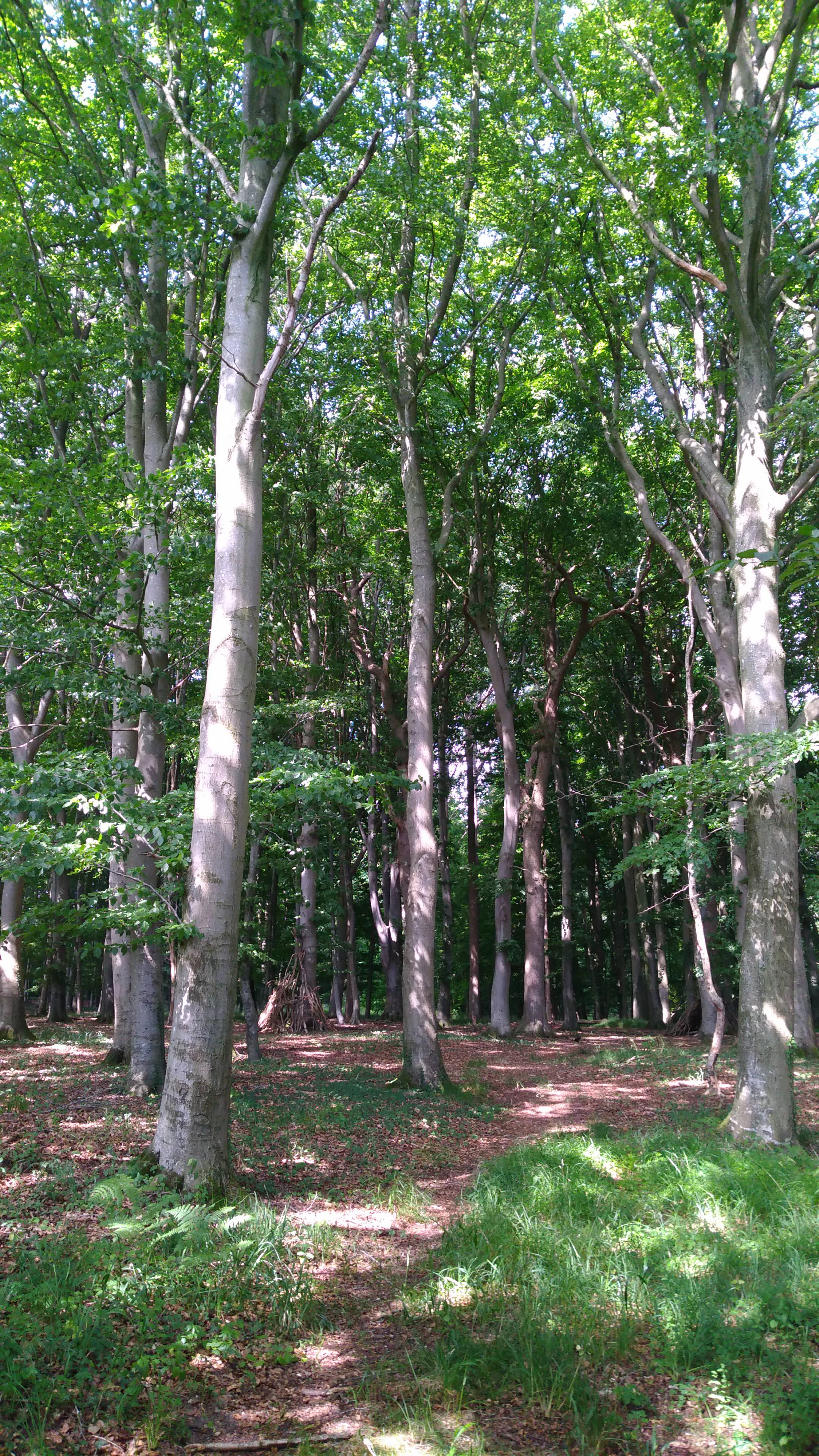
A bright, sunny view looking into a lush, mature deciduous forest with tall, smooth-barked trees, likely beeches, and a forest floor covered in patches of green grass and fallen leaves.
A view into the dense, mature beech forest stands of FFH-Gebiet Wälder bei Bergenhusen.

FFH-Gebiet Wälder bei Bergenhusen ecosystems, habitats, and plant life

Ecologically, the area is dominated by deciduous and mixed forest habitat types that are characteristic of the northwest German lowlands. The site protects several distinct beech forest communities: Hainsimsen beech forest on more acidic soils, Waldmeister beech forest on mesophilic sites, and Sternmieren oak-hornbeam forest on more nutrient-rich ground. Together they reflect the gradient from acidic to richer substrates within the geest landscape.

Alder-ash and softwood floodplain woodland also occurs, particularly in the moister and formerly wetter parts of the area, contributing a small floodplain forest component that is otherwise rare in this intensively drained landscape. The water-filled former clay pit in the southern parcel adds a small but valuable standing water habitat, classified as a nutrient-rich natural or near-natural water body with pondweed or frogbit communities. Natural regeneration of the forests is constrained locally by high roe deer populations, so successful regeneration is largely limited to fenced enclosures, while broad-scale forest conversion from planted conifer stands toward typical deciduous mixed forest is expected to take 50 to 100 years.
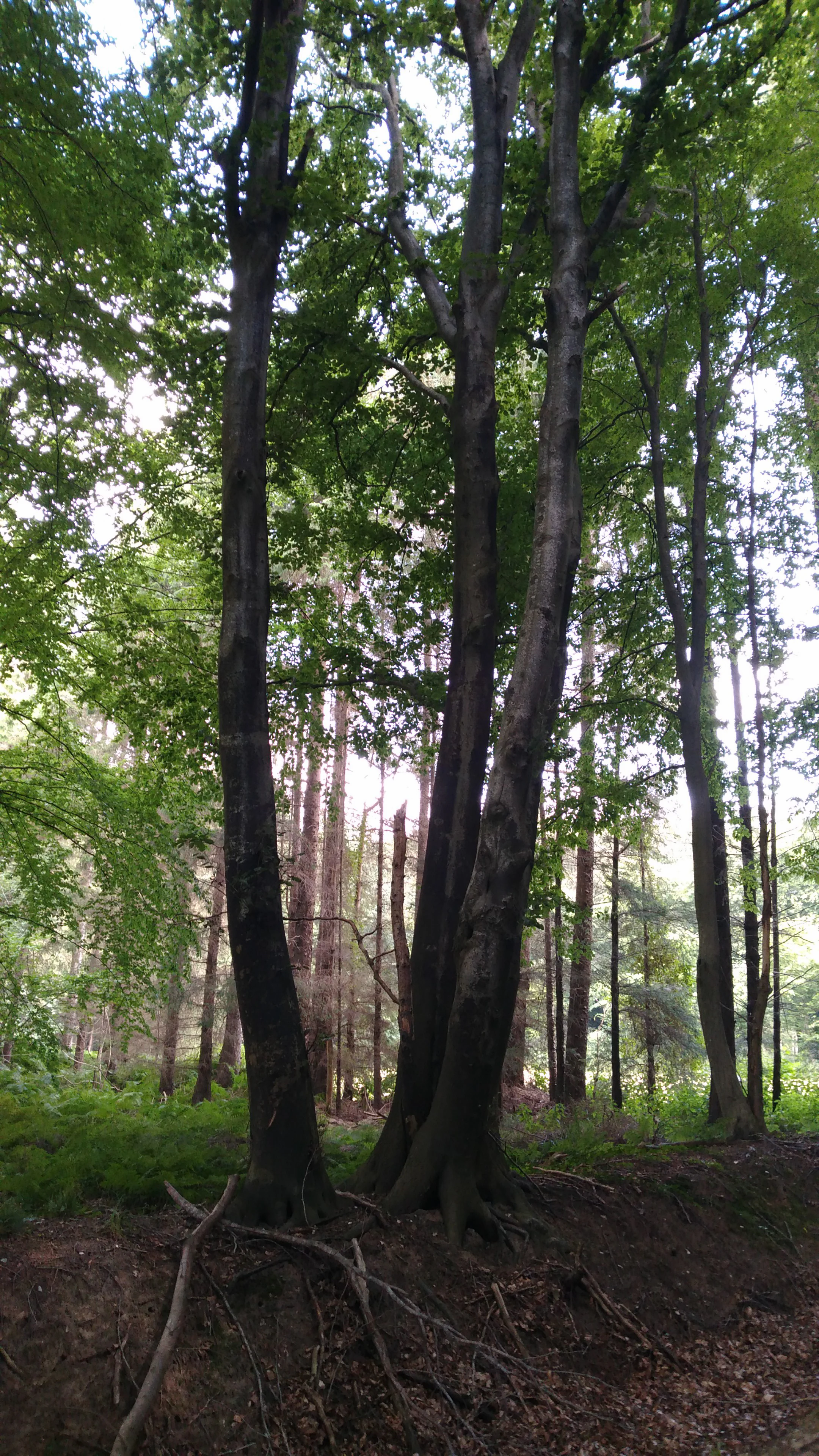
A view of tall, mature deciduous trees with dark bark and green canopy, standing in a forest with exposed roots and low green vegetation.
Mature deciduous trees in the protected Wald bei Bergenhusen.

FFH-Gebiet Wälder bei Bergenhusen wildlife and species highlights

The site's wildlife profile is shaped primarily by its forest character. Roe deer are explicitly mentioned as a key ecological factor, because their high browsing density limits natural regeneration of trees outside fenced areas and influences the long-term development of the woodland.

The mosaic of beech, oak-hornbeam, and alder-ash forest together with a nutrient-rich standing water body supports the kind of forest and pond-associated fauna typical of this part of northern Germany, including woodland bird assemblages associated with mature deciduous stands, amphibians linked to the still water body, and invertebrates tied to deadwood and old trees. The water body itself, being a former clay pit filled with standing water, adds aquatic habitat for amphibians and aquatic invertebrates within an otherwise forest-dominated setting.
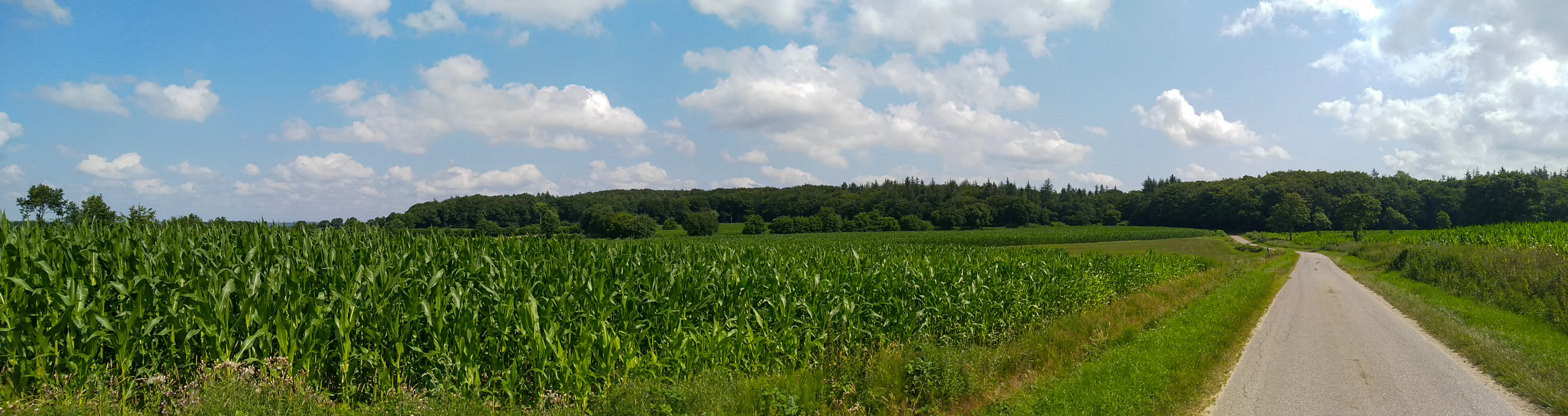
A panoramic view of a green cornfield beside a narrow paved road, with a line of dense forest in the distance under a blue sky with white clouds.
A view of the agricultural landscape bordering the protected forest area in Bergenhusen.

FFH-Gebiet Wälder bei Bergenhusen conservation status and protection priorities

The site is part of the European Natura 2000 network and is designated primarily to maintain and develop a coherent set of forest habitat types listed under Annex I of the EU Habitats Directive, including Hainsimsen beech forest, Waldmeister beech forest, Sternmieren oak-hornbeam forest, and alder-ash floodplain forest, together with one standing water habitat type. Its conservation significance lies in representing these habitat types within the Stapelholm geest and contributing to the broader European network of protected forest sites in northern Schleswig-Holstein.

More than three quarters of the area has received an overall good conservation assessment in the EU Standard Data Form, but conservation priorities are strongly shaped by forest history and current pressures. The relatively young age structure, limited deadwood, post-war clearings, and heavy roe deer browsing pressure all constrain natural regeneration. The management plan therefore emphasizes gradual forest conversion away from non-typical coniferous stands toward deciduous mixed forest, retention of remaining old-tree stands in two northeastern parcels, possible rewetting of drained forest areas, and cessation of active maintenance of drainage systems, with rewetting seen as desirable but not fully implemented. Monitoring of the site has taken place through periodic cartridge-based habitat surveys, with the most recent follow-up dating from 2009.

FFH-Gebiet Wälder bei Bergenhusen cultural meaning and human context

Beyond its natural conservation role, the area carries important prehistoric cultural-heritage value. The Lehmholz forest contains a protected megalithic grave field with 14 graves at the southern edge of the forest within the community of Wohlde, while a second large megalithic field near Brunsholm in the southern part of the FFH area contains 38 graves, making it one of the archaeological features of the protected landscape.

The site's broader regional context is shaped by the Eider-Treene-Sorge lowland, a historically wetland-rich cultural landscape of Schleswig-Holstein, and by the Stapelholm region, where small woodland patches like Hohenhorst, Sickert, Lehmholz, Luisenholz, and Tivoli have long coexisted with farmland, meadows, and rural settlements. The naming of individual woods and the persistence of forest cover since at least 1680 reflect a strong local tradition of distinct, named forest areas that remain recognizable in the landscape today.
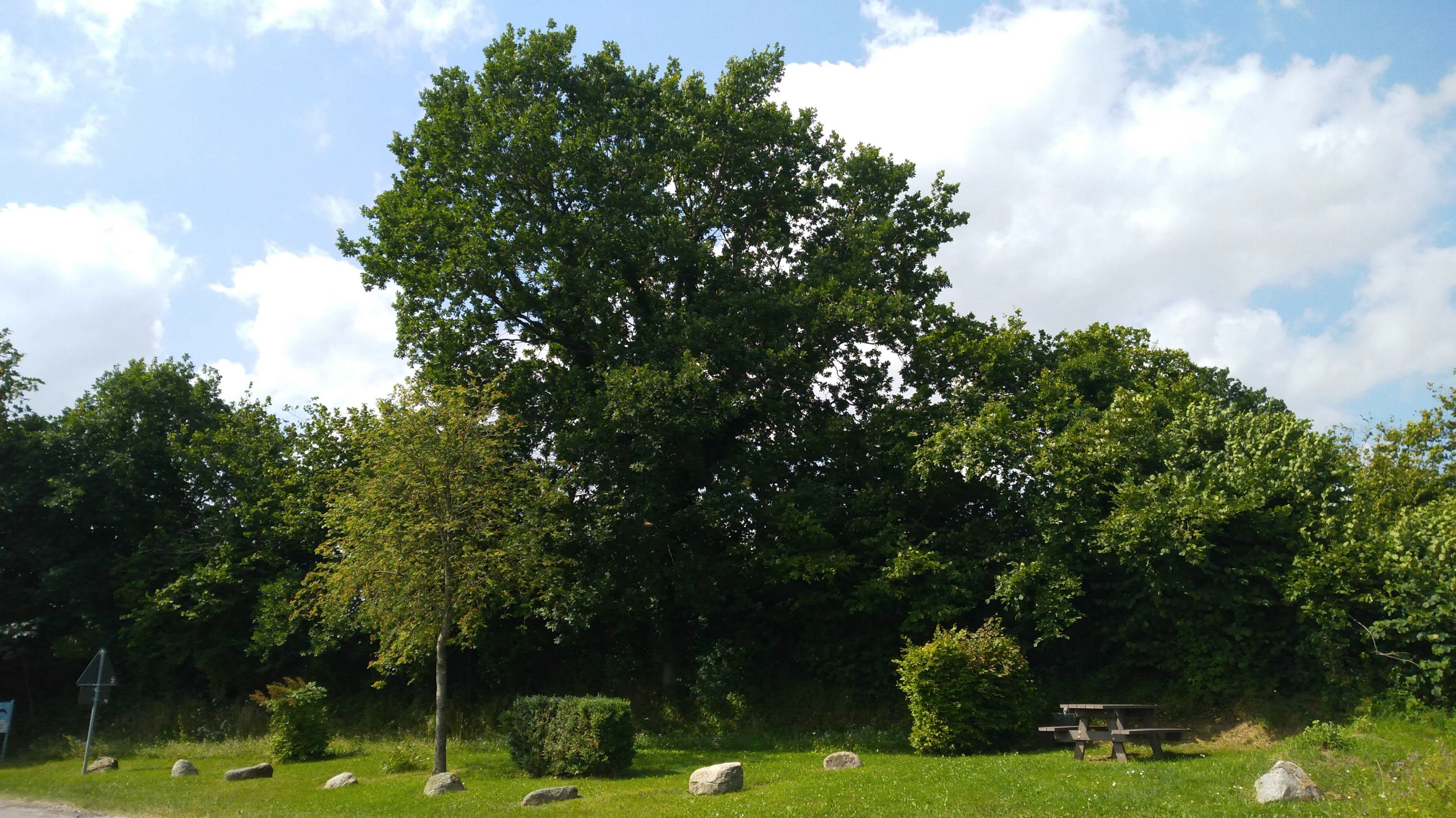
A green grassy clearing with a picnic table and scattered stones in front of a dense, leafy deciduous forest under a cloudy blue sky.
A peaceful clearing at the edge of the forest in the FFH-Gebiet Wälder bei Bergenhusen.

Top sights and standout views in FFH-Gebiet Wälder bei Bergenhusen

A compact Natura 2000 site that combines well-preserved deciduous forest habitat types with long historical woodland continuity and significant megalithic archaeology. Highlights include the mosaic of beech and oak-hornbeam forest habitats, a small but ecologically valuable nutrient-rich standing water body in the southern parcel, the long documented forest history going back to 1680, the large Brunsholm megalithic grave field with 38 graves near the southern woodland area, and the step-by-step forest conversion toward deciduous mixed forest that is expected to shape the area over the coming decades.
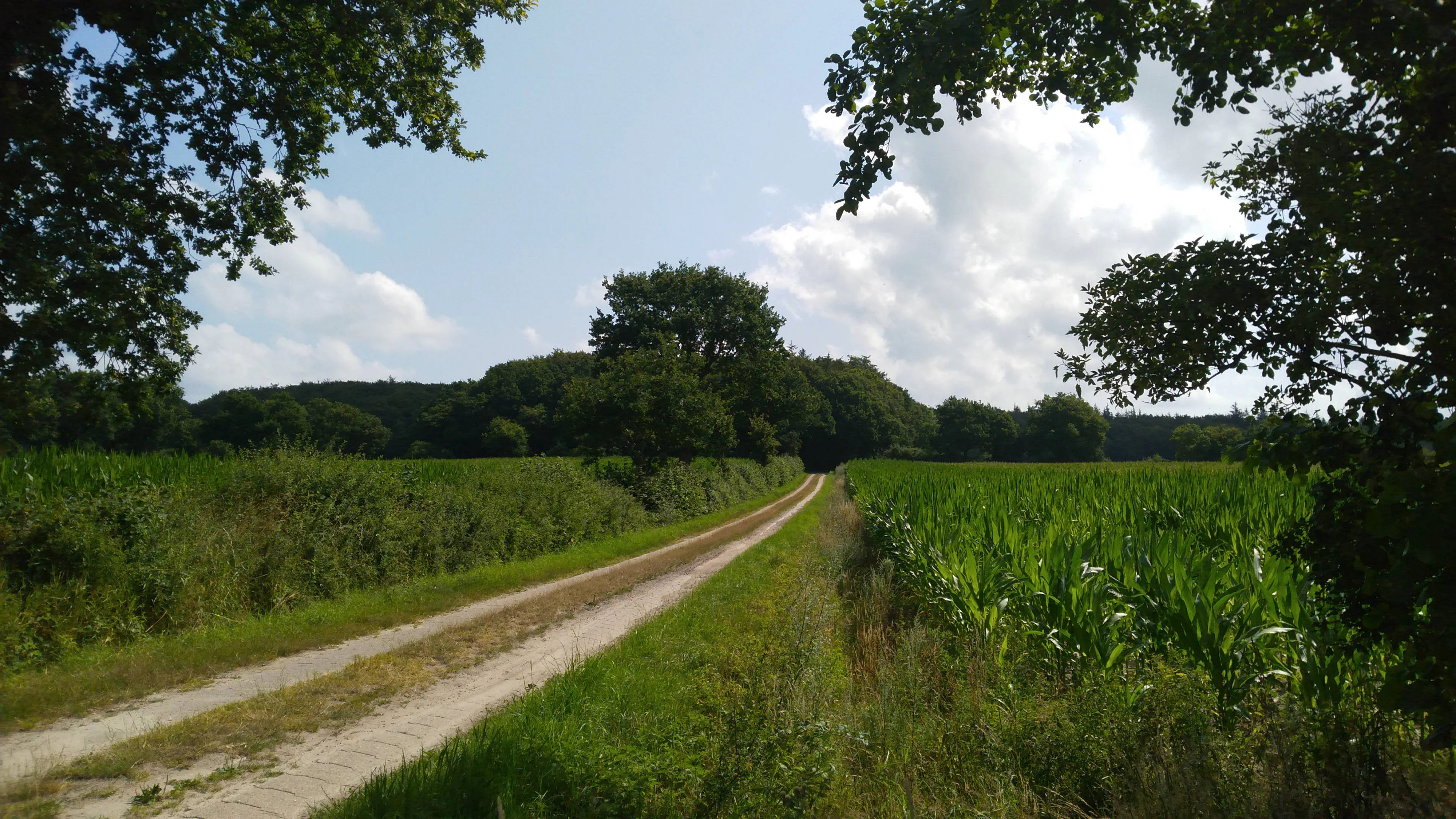
A dirt trail stretches through agricultural fields toward a line of mature trees in the distance, framed by overhanging branches in the foreground.
A dirt path leading toward the forest stands in the protected area near Bergenhusen.

Best time to visit FFH-Gebiet Wälder bei Bergenhusen

Because this is a quiet, working rural forest landscape in northern Germany rather than a major visitor attraction, timing of a visit is more about woodland atmosphere than seasonal peaks. Late spring and early summer bring fresh green canopy, active bird presence, and easier walking along forest lanes such as the Leischweg, while autumn highlights the beech and oak-hornbeam leaf colors and the contrast between forest and surrounding farmland. Winters are typically mild in this low-lying landscape but offer the most open visibility through the deciduous stands, making the named woodland areas such as Hohenhorst and Tivoli easier to read on the ground.

Monthly climate preview

Long-term monthly temperature and precipitation rhythm for Schleswig-Holstein protected terrain

FFH-Gebiet Wälder bei Bergenhusen Climate Normals and Temperature Patterns

Representative coordinate records show average monthly temperatures ranging from 1.27 degrees Celsius to 17.4 degrees Celsius alongside steady precipitation distributions throughout the year. Reviewing the complete twelve-month climatology profile provides deeper analytical context for long-term meteorological patterns across the park coordinate.
Annual mean9 °C
1 °C17 °C
Jan
Feb
Mar
Apr
May12°
Jun15°
Jul17°
Aug17°
Sep14°
Oct10°
Nov
Dec
Warmest month
August

17.4 °C

Coolest month
January

1.3 °C

Wettest month
August

2.7 mm/day

Driest month
April

1.4 mm/day

Park location guide

Geography guide, regional context, and park location map for FFH-Gebiet Wälder bei Bergenhusen

FFH-Gebiet Wälder bei Bergenhusen park geography, regions, and map view in Germany

Understand where FFH-Gebiet Wälder bei Bergenhusen sits in Germany through a broader geographic reading of the surrounding landscape, nearby location context, and its mapped position within the national park landscape.

How FFH-Gebiet Wälder bei Bergenhusen fits into Germany

Germany is a federal republic in Western and Central Europe with a population of over 83 million across sixteen constituent states. It is Europe's largest economy by nominal GDP and a major global exporter and importer. The capital is Berlin, and the country borders Denmark, Poland, Czech Republic, Austria, Switzerland, France, Luxembourg, Belgium, and the Netherlands.

Wider geography shaping FFH-Gebiet Wälder bei Bergenhusen in Germany

Germany is located in Western and Central Europe, spanning 357,022 km². It borders Denmark to the north, Poland and the Czech Republic to the east, Austria and Switzerland to the south, and France, Luxembourg, Belgium, and the Netherlands to the west. The country has coastlines on the Baltic Sea and North Sea to the north, with the Alps located in the southern region.

Map view of FFH-Gebiet Wälder bei Bergenhusen

Use this park location map to pinpoint FFH-Gebiet Wälder bei Bergenhusen in Germany, understand its exact geographic position, and read its mapped placement within the surrounding landscape more clearly.

Pigeon | © OpenStreetMap contributors

Location context for FFH-Gebiet Wälder bei Bergenhusen

Schleswig-Holstein

Visualizing the deciduous forest habitats and Stapelholm geest terrain

FFH-Gebiet Wälder bei Bergenhusen Photos and Landscape Scenery

Visual records capture the mosaic of beech forests, oak-hornbeam stands, and open water bodies defining the protected terrain of FFH-Gebiet Wälder bei Bergenhusen. Examining field photography helps researchers interpret the historical woodland continuity, slope variations, and regional ecology across the reserve.

A narrow paved path stretches into the distance, lined by tall, dense deciduous trees that form a green canopy overhead.

A sandy hiking trail curves through a lush green forest with thick canopy and ferns in Schleswig-Holstein, Germany.

A bright, sunny view looking into a lush, mature deciduous forest with tall, smooth-barked trees, likely beeches, and a forest floor covered in patches of green grass and fallen leaves.

A view of tall, mature deciduous trees with dark bark and green canopy, standing in a forest with exposed roots and low green vegetation.

A panoramic view of a green cornfield beside a narrow paved road, with a line of dense forest in the distance under a blue sky with white clouds.

A wide outdoor view of a green field of tall vegetation framed by trees on the left and right, with a dense forest line in the background under a cloudy sky.

A green grassy clearing with a picnic table and scattered stones in front of a dense, leafy deciduous forest under a cloudy blue sky.

A dirt trail stretches through agricultural fields toward a line of mature trees in the distance, framed by overhanging branches in the foreground.

Park atlas

Compare nearby regional forests, lowland habitats, and protected natural areas

Parks near FFH-Gebiet Wälder bei Bergenhusen and Surrounding Protected Landscapes

Browsing other protected areas near FFH-Gebiet Wälder bei Bergenhusen reveals complementary forest types across the surrounding regional terrain. Expanding the search helps connect individual woodland sites to broader conservation patterns throughout northern Germany.
Protected areaSchleswig-Holstein
About 5.4 km away#1 closest

North

Wälder der Ostenfelder Geest: Geographic Mapping of Protected Forests in Northern Germany

A twelve-parcel woodland mosaic in the Schleswig-Holstein Geest.

Wälder der Ostenfelder Geest serves as a prime example of lowland conservation. This protected area connects diverse forest types across a glacial landscape, providing a stable habitat for beech and oak woodland communities while preserving the historic character of the Bredstedt-Husumer terrain.

Area
7.33 km²
Established
2004
Relief
Lowland
Climate
Temperate
Nature reserveSchleswig-Holstein
About 13 km away#2 closest

East

FFH-Gebiet Übergangsmoor im Kropper Forst: Protected Landscape and Mire Geography

A study of transitional mire habitats in Schleswig-Holstein.

This protected area centers on a treeless mire depression embedded within the coniferous Gehege Kropp forest. Covering 18 hectares of glacial terrain, the site illustrates the delicate balance of mire hydrology and the long-term ecological impact of regional landscape management in northern Germany.

Area
0.18 km²
Established
2004
Relief
Lowland
Climate
Temperate
Nature reserveSchleswig-Holstein
About 17 km away#3 closest

Southeast

Wald östlich Hohn Nature Reserve: Ancient Broadleaf Forest Geography and Mapped Boundaries

Protected glacial moraine woodland in Schleswig-Holstein

Spanning roughly twelve hectares near Hohn, this nature reserve safeguards centuries-old broadleaf forest communities including beech and oak-hornbeam stands. The site is a significant protected area within the Schleswig-Holstein Geest, illustrating how ancient wooded islands persist amid intensive modern agricultural landscapes through formal Natura 2000 conservation status.

Area
0.118 km²
Established
2004
Relief
Lowland
Climate
Temperate
Nature reserveBrandenburg
About 19 km away#4 closest

Southeast

Tiergarten Nature Reserve: Geography and Protected Habitat Mapping in Brandenburg, Germany

Ancient oak woodland, riparian wetlands, and historic forest trails.

Spanning 158 hectares, the Tiergarten nature reserve serves as an ecologically rich sanctuary of oak-hornbeam forests and wet meadows. This area, formerly a royal hunting ground, offers a dense mosaic of riparian zones along the Staabe river, protecting essential habitats within the broader Brandenburg landscape.

Area
1.58 km²
Established
1995
IUCN
IV
Protected areaGermany
About 20 km away#5 closest

South

FFH-Gebiet Wald westlich Wrohm: Protected Forest and Geographic Mapping

Examining historic woodland remnants in the Dithmarschen district.

FFH-Gebiet Wald westlich Wrohm represents an intact matrix of native broadleaf forest within an open agricultural mosaic. This site preserves rare habitat types on a historic geest ridge, acting as a protected island for forest ecology in Northern Germany. Explore the mapped boundaries, floodplain brooks, and characteristic hedgerow landscape that define this important conservation area.

Area
0.26 km²
Established
2004
Relief
Upland
Climate
Temperate
Nature reserveSchleswig-Holstein
About 21 km away#6 closest

North

Wälder im Süderhackstedtfeld: Protected Nature Reserve and Geest Landscape Atlas

Examining forest habitats in northern Schleswig-Holstein

Trace the boundaries of Wälder im Süderhackstedtfeld, a notable nature reserve in Schleswig-Holstein. This site contains priority atlantic beech and oak forest types within a classic glacial ridge topography, showcasing long-term woodland continuity and structured forest restoration within a compact geographic footprint.

Area
0.76 km²
Established
2004
Relief
Upland
Climate
Temperate
Watercolor illustration of a landscape with green hills, a body of water, and grassy foregrounds
National parkSchleswig-Holstein
About 21 km away#7 closest

West

Schleswig-Holstein Wadden Sea National Park: Germany's Largest Protected Tidal Landscape

Explore the mapped geography of this vital North Sea national park.

Schleswig-Holstein Wadden Sea National Park is a monumental protected area, recognized globally as a UNESCO World Heritage Site for its extraordinary tidal wetland ecosystem. This page offers detailed insights into its geographic scope, from the North Frisian Islands to the Elbe estuary, highlighting the dynamic interplay of mudflats, salt marshes, and coastal terrain. Discover the park's critical role as a migratory bird flyway and marine nursery, providing rich data for geographic and atlas exploration of this unique North Sea protected landscape.

Area
4,410 km²
Established
1985
IUCN
II
Visitors
1.7M annual
A horizontal watercolor painting depicting a soft, rolling landscape with green trees in the foreground, a light-colored meadow or field in the midground, and distant muted hills in the background.
Protected areaSchleswig-Holstein
About 23 km away#8 closest

East

FFH-Gebiet Wälder der Hüttener Berge: Protected Area and Glacial Moraine Atlas

Ancient beech woodland mosaics in Schleswig-Holstein.

FFH-Gebiet Wälder der Hüttener Berge comprises eleven distinct state forest parcels stretching across northern Germany. This atlas entry details the site's rich habitat structure, including rare Atlantic beech forests, transition mires, and glacial soils, providing essential geographic context for this vital Natura 2000 protected territory.

Area
4.16 km²
Established
2004
Relief
Upland
Climate
Temperate

Common questions about visiting, size, designation, and location context for FFH-Gebiet Wälder bei Bergenhusen

FFH-Gebiet Wälder bei Bergenhusen FAQs for park facts, access, geography, and protected area context

Find quick answers about FFH-Gebiet Wälder bei Bergenhusen, including protected-area facts, park geography, trail and visitor context, and how the park fits into its surrounding country and regional landscape.
MoriAtlas Explorer

Continue Your Protected Areas Search Across the Global Atlas

Deepen your exploration by continuing the structured search for national parks and protected areas worldwide. Utilize the comprehensive filtering capabilities to compare different conservation landscapes and refine your understanding of global park geography. Discover more about the distribution and characteristics of protected natural areas.

Global natural geography