Mori Atlas logo
Nature reserveWälder im östlichen Solling

A detailed geographic exploration of beech forest ecosystems and protected valley corridors

Wälder im östlichen Solling Nature Reserve in the Lower Saxony Low Mountain Range

Wälder im östlichen Solling represents a vital protected landscape within the eastern Solling mountain range of Lower Saxony. This nature reserve preserves extensive Hainsimsen beech forest complexes, historical wood-pasture structures, and near-natural stream habitats along the Wolfsbach and Lummerke valleys. The area functions as a core ecological zone within the broader Solling Bird Protection Area, showcasing the complex interplay between acidic upland terrain and diverse forest communities.

beech forestlow mountain rangesollinglower saxonynature reserveFFH site

Wälder im östlichen Solling

Nature reserve

Park overview

Structured park overview, official facts, and landscape profile for Wälder im östlichen Solling

Wälder im östlichen Solling park facts, protected area profile, and essential visitor context

Review the core facts for Wälder im östlichen Solling, including designation, size, terrain, visitor scale, habitats, and operating context in one park-focused overview.

About Wälder im östlichen Solling

Wälder im östlichen Solling is a recently designated nature reserve in Lower Saxony that protects one of the larger connected forest complexes of the eastern Solling. The Solling itself is a low mountain range of the Weser-Leine uplands, traditionally used for forestry and controlled grazing, and the new reserve brings a significant share of its eastern woodlands under formal habitat protection.

The protected area covers about 1,479 hectares and lies inside the Naturpark Solling-Vogler, between the regional centers of Holzminden to the west and Göttingen to the south. It overlaps almost completely with a Habitats Directive (FFH) site of about 1,458 hectares and lies within the broader Solling bird protection area, giving it a role in both the EU Natura 2000 network and national conservation planning.

Ecologically, the reserve is defined by Hainsimsen beech forest, an acid-tolerant beech community typical of the Solling's siliceous substrates. Beech dominates, with admixed oak, birch, rowan, ash, and sycamore, while the ground layer includes woodrushes, wavy hair-grass, bilberry, and various forest herbs and mosses. Embedded within this matrix are smaller areas of spruce-free oak wood-pasture with veteran open-grown trees, two long-established natural forest reserves at Limker Strang and Grasborner Bruch, and locally alder-ash spring and stream forests along three near-natural brooks that feed into the Ilme and ultimately the Leine river system.

The reserve holds particular value for forest-dwelling wildlife. Lynx and wildcat are present, along with several bat species including the greater mouse-eared bat. Birdlife includes black stork, red kite, Eurasian pygmy owl, boreal owl, black woodpecker, grey-headed woodpecker, middle spotted woodpecker, and Eurasian woodcock. The streams support bullhead and brown trout, while small standing waters sustain amphibians such as the great crested newt, alpine newt, and palmate newt.

Quick facts and research context for Wälder im östlichen Solling

Wälder im östlichen Solling is a Lower Saxony nature reserve of about 1,479 hectares, designated in October 2020 and administered by the Landkreis Northeim. It lies within the Naturpark Solling-Vogler, between the towns of Holzminden and Göttingen, and is almost entirely surrounded by the former Solling landscape protection area.

The site coincides with a 1,458-hectare Habitats Directive (FFH) area and forms part of the Solling Bird Protection Area. Its core habitat type is Hainsimsen beech forest on acidic soils, complemented by spring mires, alder-ash gallery forests, historical wood-pasture structures, and small stillwaters. The reserve also includes the long-established Limker Strang and Grasborner Bruch natural forest reserves.

Protection and recognition

Examining documented protected area records and international recognition sources

Wälder im östlichen Solling Protection Status and Natura 2000 Recognition

Wälder im östlichen Solling maintains documented conservation records through official Natura 2000 designations and registered database identifiers. Reviewing these verified entries clarifies the established administrative framework supporting the protected forest landscape.
Park context

Deeper park guide and search-rich context for Wälder im östlichen Solling

Wälder im östlichen Solling history, landscape, wildlife, and travel context

Explore Wälder im östlichen Solling through its history, landscape character, ecosystems, wildlife, conservation priorities, cultural context, and seasonal travel timing in a structured park guide built for atlas discovery and search intent.

Why Wälder im östlichen Solling stands out

The reserve is best known for its large, continuous stands of Hainsimsen beech forest, a habitat type characteristic of the acidic upland soils of the Solling. Within this beech matrix, scattered oak wood-pasture remnants preserve open, historically grazed forest structures that are rare in modern central European woodland. Equally distinctive are the alder-ash spring forests and near-natural stream corridors along the Wolfsbach, Lummerke, and Riepenbach, with their flushing water vegetation and adjoining tall herb communities. The combination of mature beech high forest, old-growth natural forest plots, and intact valley-bottom habitats gives the site a layered character unusual even for a well-wooded low mountain range.

Wälder im östlichen Solling history and protected-area timeline

The area's conservation history predates the 2020 designation. In 1972, two natural forest reserves, Naturwald Limker Strang and Naturwald Grasborner Bruch, were established within what is now the reserve to allow long-term, unmanaged forest development. The Limker Strang area was reduced to its current size of about 20.5 hectares in 1987, while the Grasborner Bruch reserve was originally about 6.7 hectares and was expanded to 10.8 hectares in the year 2000.

These early natural forest designations sat within the broader Solling landscape protection area, which covered the wider region including the present nature reserve. On 15 October 2020, the core woodland area was placed under formal nature reserve (Naturschutzgebiet) status as NSG BR 168, replacing the landscape protection regime over this specific zone and bringing it fully into the Natura 2000 framework through its overlap with the FFH site and the Solling bird protection area. The responsible authority is the Landkreis Northeim.

Wälder im östlichen Solling landscape and geographic character

The reserve occupies the rolling, forested terrain of the eastern Solling, a low mountain range formed on largely acidic, siliceous rocks. Elevations and relief are modest by alpine standards but produce a varied topography of broad ridges, gentle slopes, and incised valleys that channel small brooks through the woodland.

The dominant landscape element is closed broadleaf forest, primarily beech high forest stretching across the ridges and slopes. The valley bottoms are more mosaic-like: scattered springs create small flushes and anmoored seepage zones, while the Wolfsbach, Lummerke, and Riepenbach trace shallow, meandering courses lined by alder-ash gallery forest, tall-herb fringes, and rush- and bulrush-dominated reed stands. Small near-natural ponds and patches of well-developed grassland add further diversity to an otherwise forested setting.

Wälder im östlichen Solling ecosystems, habitats, and plant life

Ecologically, the site belongs to the Hainsimsen beech forest type, a beechwood community adapted to nutrient-poor, acidic soils that is widespread across the low mountain ranges of central Germany but not common as a continuous, structurally rich stand. The canopy is overwhelmingly beech, with oak, birch, rowan, ash, and sycamore contributing structure and species mix.

The ground flora reflects the acidic substrate and shaded conditions: pill sedge, wavy hair-grass, angular Solomon's seal relatives such as the twin-leaved shade flower, wood sorrel, chickweed wintergreen, bilberry, blue moor grass, wood melick, and several mosses including Dicranella heteromalla. In wetter, spring-influenced areas, the community shifts dramatically to alder-ash forests with black alder and ash, supporting a different set of indicators such as yellow sedge, opposite-leaved golden saxifrage, tufted hair-grass, wood horsetail, and large-flowered touch-me-not along the streams.

Small pockets of rush and bulrush reed, near-natural stillwaters, and species-rich grassland further broaden the habitat spectrum. The presence of old-growth natural forest reserves at Limker Strang and Grasborner Bruch adds a further dimension, providing reference areas where natural forest dynamics such as deadwood accumulation and gap-phase regeneration can proceed without forestry intervention.

Wälder im östlichen Solling wildlife and species highlights

The reserve's mature beech and oak forests support a notable community of forest-dependent mammals, including the Eurasian lynx and the European wildcat, which use the connected woodland of the eastern Solling as part of their wider range in central Germany. Several bat species are recorded, with the greater mouse-eared bat highlighted as a species of particular interest.

Birdlife is a major conservation focus, underlined by the site's inclusion in the Solling bird protection area. Characteristic species include the black stork, red kite, Eurasian pygmy owl, boreal (Tengmalm's) owl, black woodpecker, grey-headed woodpecker, middle spotted woodpecker, and Eurasian woodcock. The deadwood-rich stands and veteran trees of the natural forest reserves play an important role for hole-nesting and bark-foraging species.

The streams and small standing waters host distinctive aquatic and amphibian communities. The Wolfsbach, Lummerke, and Riepenbach provide habitat for bullhead and brown trout, while the stillwaters sustain amphibians including the great crested newt, alpine newt, and palmate newt.

Wälder im östlichen Solling conservation status and protection priorities

The reserve's conservation significance operates at several levels. Nationally, it is a designated Naturschutzgebiet (nature reserve) under Lower Saxon law, with the strictest level of habitat protection available in the German system. This status, formalized on 15 October 2020, replaced an earlier landscape protection regime over the same zone.

At the European level, the site coincides with an FFH (Habitats Directive) area of about 1,458 hectares and lies within the Solling Special Protection Area under the Birds Directive, giving it a central role in Germany's Natura 2000 network. The Hainsimsen beech forest habitat type, the alder-ash stream forests, and the protected mammal and bird species all contribute to the site's Natura 2000 value.

Local conservation measures include the two natural forest reserves at Limker Strang and Grasborner Bruch, which serve as unmanaged reference areas for the surrounding managed forest and as reservoirs for deadwood-dependent species. The protection of near-natural stream sections and their flushing vegetation also supports aquatic habitat connectivity within the Solling-Vogler Nature Park.

Wälder im östlichen Solling cultural meaning and human context

The Solling has a long forestry tradition, and the historical presence of wood-pasture (Hutewald) structures with old, open-grown oak trees reflects centuries of controlled grazing within otherwise forested terrain. These relict open-forest elements are preserved within the reserve and represent an important intersection of local land-use history and present-day habitat conservation.

The area sits within the Naturpark Solling-Vogler, a regional landscape framework that links forest protection with traditional recreational and cultural uses of the Solling hills.

Top sights and standout views in Wälder im östlichen Solling

A large, formally protected Hainsimsen beech forest complex in the eastern Solling, buffered by Natura 2000 designations under both the Habitats and Birds Directives.

Old-growth reference stands at Limker Strang and Grasborner Bruch, together with surviving wood-pasture oak features, give the reserve a visible timeline of forest use.

Near-natural stream forests and springs along the Wolfsbach, Lummerke, and Riepenbach create ecologically rich valley corridors that connect the site to the broader Ilme-Leine river system.

Best time to visit Wälder im östlichen Solling

The reserve is primarily a woodland landscape and a working part of the Naturpark Solling-Vogler, so its character shifts mainly with the seasons of the temperate central European forest. Late spring and early summer bring the freshest canopy and most active ground flora, when bilberry, golden saxifrage, and tall-herb communities along the streams are at their most visible. Late summer and early autumn highlight bilberry foliage and the changing colors of beech and oak, while often drawing more attention from wildlife observers as birds become more vocal at the edges of the season. Winter offers a quieter, more austere atmosphere in which the structure of the forest, deadwood features, and tracks of lynx, wildcat, and deer are easier to perceive.

Monthly climate preview

Long-term representative point measurements tracking monthly averages and climate trends

Wälder im östlichen Solling Climate Normals, Annual Temperature and Precipitation Rhythm

Representative point records for Wälder im östlichen Solling capture measured monthly temperature swings from sub-zero winter lows to warm summer maximums alongside consistent daily precipitation. Reviewing the complete twelve-month climatology profile provides deeper analytical context for long-term regional weather patterns.
Annual mean8 °C
-1 °C18 °C
Jan-1°
Feb
Mar
Apr
May12°
Jun16°
Jul18°
Aug18°
Sep14°
Oct
Nov
Dec
Warmest month
July

18 °C

Coolest month
January

-0.6 °C

Wettest month
July

2.5 mm/day

Driest month
April

1.5 mm/day

Park location guide

Geography guide, regional context, and park location map for Wälder im östlichen Solling

Wälder im östlichen Solling park geography, regions, and map view in Germany

Understand where Wälder im östlichen Solling sits in Germany through a broader geographic reading of the surrounding landscape, nearby location context, and its mapped position within the national park landscape.

How Wälder im östlichen Solling fits into Germany

Germany is a federal republic in Western and Central Europe with a population of over 83 million across sixteen constituent states. It is Europe's largest economy by nominal GDP and a major global exporter and importer. The capital is Berlin, and the country borders Denmark, Poland, Czech Republic, Austria, Switzerland, France, Luxembourg, Belgium, and the Netherlands.

Wider geography shaping Wälder im östlichen Solling in Germany

Germany is located in Western and Central Europe, spanning 357,022 km². It borders Denmark to the north, Poland and the Czech Republic to the east, Austria and Switzerland to the south, and France, Luxembourg, Belgium, and the Netherlands to the west. The country has coastlines on the Baltic Sea and North Sea to the north, with the Alps located in the southern region.

Map view of Wälder im östlichen Solling

Use this park location map to pinpoint Wälder im östlichen Solling in Germany, understand its exact geographic position, and read its mapped placement within the surrounding landscape more clearly.

Pigeon | © OpenStreetMap contributors

Location context for Wälder im östlichen Solling

Lower Saxony
Recorded earthquake history

Explore Historical Earthquake Records for Wälder im östlichen Solling

Examine the seismic catalogue associated with the Wälder im östlichen Solling nature reserve. This curated collection allows for detailed review of past earthquake events, magnitudes, and epicentre locations, providing clear insights into the regional seismic history maintained through the MoriAtlas geography database.

Wälder im östlichen Solling Earthquake History

Catalogued events

1 event

Strongest magnitude

Magnitude 3

Most recent event

Mar 30, 1995

This history includes earthquakes recorded inside the park or within 50 km of its borders

Park atlas

Compare regional low mountain terrain, beech forests, and connected conservation areas.

Other Parks Near Wälder im östlichen Solling and Surrounding Protected Landscapes

Browse nearby national parks and protected areas sharing the forested upland topography of the Solling region. Comparing adjacent nature reserves reveals broader patterns in regional broadleaf woodland distribution and valley stream ecosystems.
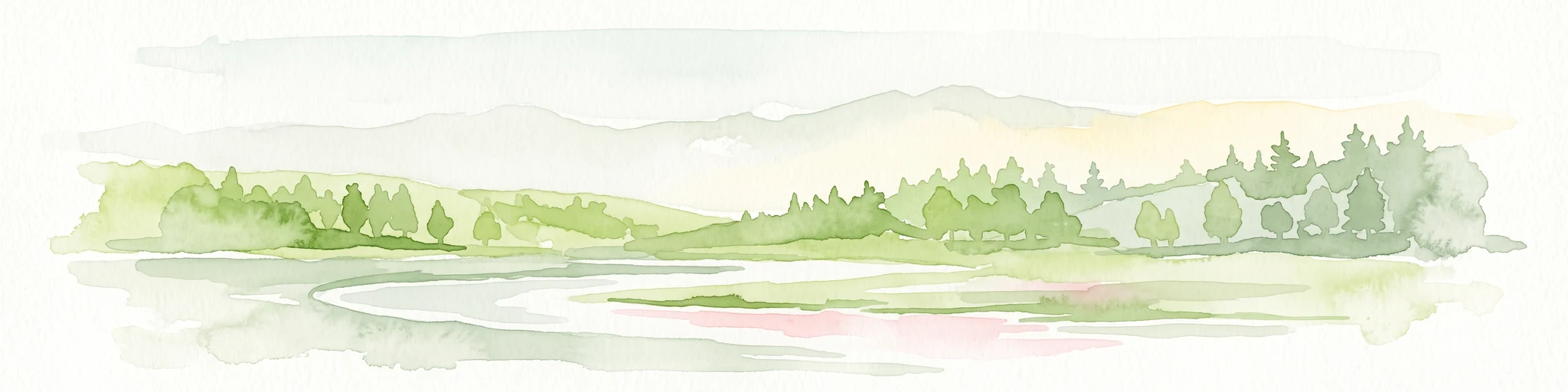
A soft watercolor painting depicting a gentle, winding river flowing through a forested landscape with rolling hills in the background.
Protected landscapeLower Saxony
About 1.5 km away#1 closest

West

Naturpark Solling-Vogler Protected Landscape: Regional Geography and Mapped Terrain

Extensive forested low-mountain region in Lower Saxony

Naturpark Solling-Vogler acts as a core protected region within the Weserbergland of Lower Saxony. This atlas entry details its dual landscape identity, bridging the wide upland Solling plateau with the sharp, narrow Vogler ridge. Explore the mapped river valleys and woodland habitats that define this important German nature park.

Relief
Mountain
Climate
Temperate
Scope
Terrestrial
Water
Major water bodies
Nature reserveLower Saxony
2.8 km away#2 closest

Southeast

Wald am Großen Streitrodt bei Delliehausen: Protected Beech Forests of Lower Saxony

Geographic overview of the eastern Solling upland nature reserve

The Wald am Großen Streitrodt bei Delliehausen nature reserve protects a rich, near-natural beech woodland matrix in the eastern Solling. Spanning gentle ridges and slopes, the area features significant deadwood habitats and a distinct southeastern meadow mosaic carved by the Kobbeke headwaters. This record details the park landscape and ecological boundaries within the broader forested context of southern Lower Saxony.

Area
228 km²
Established
2020
Nature reserveLower Saxony
3.3 km away#3 closest

Northeast

Wälder im Solling bei Lauenberg Nature Reserve: Geographic and Landscape Analysis

Protected oak pasture remnants in the Lower Saxony Solling

Analyze the mapped parcels of Wälder im Solling bei Lauenberg. This protected site integrates old growth oak forest with open meadows and brook corridors, showcasing the unique cultural and ecological legacy of the Solling region in southern Lower Saxony.

Area
3.22 km²
Established
2020
Nature reserveLower Saxony
About 5.1 km away#4 closest

East

Weper, Gladeberg und Aschenburg Protected Nature Reserve and Hilltop Mosaic

Calcareous grassland and forest network in Lower Saxony

Explore the geographic composition of the Weper, Gladeberg und Aschenburg nature reserve in Lower Saxony. This protected area encompasses a series of hill fragments and slopes characterized by sun-exposed calcareous grasslands and dense deciduous forest stands, providing essential habitat connectivity in the regional uplands.

Area
2.67 km²
Established
2020
Relief
Upland
Scope
Terrestrial
Nature reserveNiedersachsen
7.4 km away#5 closest

West

Wälder im südlichen Solling Nature Reserve: A Detailed Atlas of German Protected Woodlands

Ecological mapping of Niedersachsen's southern Solling forest complexes.

Navigate the protected boundaries and landscape character of Wälder im südlichen Solling. This nature reserve provides an essential study in forest conservation, highlighting the intersection of traditional wood-pasture management and steep, near-natural slope forest ecosystems within the Solling-Vogler upland.

Area
10.16 km²
Established
2020
Relief
Upland
Climate
Temperate
Nature reserveLower Saxony
About 9 km away#6 closest

South

Wälder am Schäferstein und am Hohen Rott bei Verliehausen: Protected Nature Reserve Landscape

Ancient woodland geography in the Southern Solling uplands

A significant nature reserve in Lower Saxony, these forest tracts at Schäferstein and Hohen Rott protect near-natural beech and oak stands. The site is characterized by an exceptional density of deadwood and historical relict oak pastures, serving as a vital sanctuary for specialized saproxylic beetles and cavity-nesting birds within the broader Solling ridge system.

Area
1.02 km²
Established
2020
Relief
Mountain
Climate
Temperate
Nature reserveLandkreis Holzminden
About 11 km away#7 closest

Northwest

Teiche am Erz- und Finkenbruch im Solling: Protected Nature Reserve and Wetland Geography

Mapped forest ponds and bog-margin habitat in Landkreis Holzminden

Teiche am Erz- und Finkenbruch im Solling comprises a network of forest ponds and peat-moss communities protected within a two-zone nature reserve. Its sheltered position in the Solling range preserves critical habitat for rare dragonfly populations, serving as an essential wetland segment within the larger Solling-Vogler landscape protection area.

Area
0.03 km²
Established
2016
Nature reserveLower Saxony
14 km away#8 closest

East

Wahrberg Nature Reserve: Geographic Mapping of Limestone Hilltop Protected Landscapes

Examining the ecological terrain within the Weser-Leine hill country of Lower Saxony

Wahrberg is a protected nature reserve defined by its limestone bedrock and rare calcareous dry grassland habitats. This site serves as a vital ecological refuge, showcasing a mosaic of open slopes, shrub transitions, and broadleaf woodland near the Leine valley. Explore the mapped boundaries and natural terrain characteristics that distinguish this important German nature reserve.

Area
0.25 km²
Established
1991
IUCN
IV

Common questions about visiting, size, designation, and location context for Wälder im östlichen Solling

Wälder im östlichen Solling FAQs for park facts, access, geography, and protected area context

Find quick answers about Wälder im östlichen Solling, including protected-area facts, park geography, trail and visitor context, and how the park fits into its surrounding country and regional landscape.
MoriAtlas Explorer

Continue Your Protected Areas Search Across the Global Atlas

Deepen your exploration by continuing the structured search for national parks and protected areas worldwide. Utilize the comprehensive filtering capabilities to compare different conservation landscapes and refine your understanding of global park geography. Discover more about the distribution and characteristics of protected natural areas.

Global natural geography