
Mori Atlas logo
Protected areaWälder und Wiesen bei Burbach und Neunkirchen

Mapping the beech forests, mountain meadows, and avian habitats of this central German upland area

Wälder und Wiesen bei Burbach und Neunkirchen: A Protected Landscape in the High Westerwald Region

(EU-Vogelschutzgebiet Wälder und Wiesen bei Burbach und Neunkirchen)

The Wälder und Wiesen bei Burbach und Neunkirchen protected area encompasses 47 square kilometers within the High Westerwald natural region. Defined by basaltic terrain and steep stream valleys, this landscape preserves a complex mosaic of near-natural beech forests and traditionally managed mountain hay meadows. These habitats serve as an essential refuge for rare woodland and open-land bird populations, representing a significant ecological transition zone near the tri-border of North Rhine-Westphalia, Hesse, and Rhineland-Palatinate.

EU Bird DirectiveSpecial Protection AreaNorth Rhine-WestphaliaHigh Westerwaldbeech forestmountain meadow
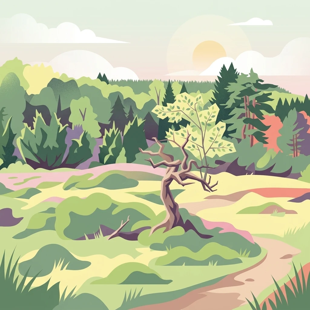
A flat digital illustration of a serene forest landscape featuring rolling green hills, a winding path, dense woods, and a solitary gnarled tree at the center under a soft sunrise.

Wälder und Wiesen bei Burbach und Neunkirchen

Protected area

Park overview

Structured park overview, official facts, and landscape profile for Wälder und Wiesen bei Burbach und Neunkirchen

Wälder und Wiesen bei Burbach und Neunkirchen park facts, protected area profile, and essential visitor context

Review the core facts for Wälder und Wiesen bei Burbach und Neunkirchen, including designation, size, terrain, visitor scale, habitats, and operating context in one park-focused overview.

About Wälder und Wiesen bei Burbach und Neunkirchen

Wälder und Wiesen bei Burbach und Neunkirchen is a designated European Bird Directive site in the High Westerwald, on the southern edge of North Rhine-Westphalia. The protected area combines extensive near-natural forests with traditionally managed mountain meadows, and although it is primarily classified as a bird protection area under the EU Birds Directive, its habitat diversity also links it to a broader network of Habitats Directive sites in the region.

The area lies within the Siegerland-Westerwald uplands, spanning parts of the Siegen-Wittgenstein district in North Rhine-Westphalia and reaching into adjacent Hessian and Rhineland-Palatinate territory near the Rabenscheid corner point. The terrain is shaped by basalt weathering, producing block-rich soils, steep slopes, ravine features, and small stream valleys that drain into tributaries of the region's larger river systems. Human settlement is sparse inside the protected zone, and the surrounding towns of Burbach and Neunkirchen provide regional context without dominating the landscape character.

Ecologically, the protected area is notable for the way forest and open land interlock. Beech forests in the Luzulo-Fagetum and Asperulo-Fagetum syntaxa cover a large share of the area, often transitioning into slope and ravine mixed forests on steeper ground where ash, maple, and sycamore become more prominent. Between these forest blocks lie extensive montane hay meadows, species-rich mesophilic grasslands, juniper heath fragments, and small boggy flushes along the streams. Although plantation forest occupies a substantial portion of the area as well, the breadth of habitat types is what gives the site its ecological weight.

The designation under the Birds Directive reflects an unusually complete set of habitat requirements for woodland, forest-edge, and open-ground breeding birds. Conservation objectives have been drawn up for species spanning forest interiors, forest edges, open meadows, wet flushes, juniper heath, and hedgerow landscapes. This integrated approach makes the protected area a meaningful reference point for upland bird conservation in central Germany.

Quick facts and research context for Wälder und Wiesen bei Burbach und Neunkirchen

Wälder und Wiesen bei Burbach und Neunkirchen is an EU Special Protection Area (SPA) under the European Birds Directive, designated in 2001 and administered by the Arnsberg regional government in North Rhine-Westphalia. The site identifier is DE-5214-401, with the corresponding Natura 2000 code DE5214401 and a recorded size of approximately 47 square kilometers.

Geographically, the area lies in the High Westerwald and overlaps the tri-border zone of North Rhine-Westphalia, Hesse, and Rhineland-Palatinate, anchored by the communities of Burbach and Neunkirchen in the Siegen-Wittgenstein district. Forest cover dominates the land use, with beech-dominated woodland accounting for around 36 percent of the area and plantation forests a further 39 percent, while species-rich meadows, heath fragments, and stream corridors make up much of the remainder.

Protection and recognition

Examine documented terrestrial protection metrics and administrative recognition sources.

Wälder und Wiesen bei Burbach und Neunkirchen Protection Status and Recognition

Terrestrial protection records for Wälder und Wiesen bei Burbach und Neunkirchen outline the documented conservation scope and administrative parameters. Systematic geographic profiles provide transparent access to verifiable protected area data without speculative management claims.

Protection details

Protection scope
Terrestrial
Transboundary protection
No
WDPA ID
555537625
Park context

Deeper park guide and search-rich context for Wälder und Wiesen bei Burbach und Neunkirchen

Wälder und Wiesen bei Burbach und Neunkirchen history, landscape, wildlife, and travel context

Explore Wälder und Wiesen bei Burbach und Neunkirchen through its history, landscape character, ecosystems, wildlife, conservation priorities, cultural context, and seasonal travel timing in a structured park guide built for atlas discovery and search intent.

Why Wälder und Wiesen bei Burbach und Neunkirchen stands out

Wälder und Wiesen bei Burbach und Neunkirchen is best known as a stronghold for two bird species of high conservation concern in North Rhine-Westphalia: the whinchat, whose breeding population here is the largest in the entire state, and the hazel grouse, which still maintains one of its last confirmed breeding occurrences in North Rhine-Westphalia within this landscape. Equally defining is the habitat mosaic that supports these birds: extensive near-natural beech forests, mixed ravine and slope woodlands, residual low-forest (coppice) stands, and traditionally managed mountain hay meadows interlaced with basalt-block-strewn stream valleys. This combination of montane forest character and surviving extensive grassland use is what distinguishes the area from more ordinary upland forest landscapes in the region.

A Boreal owl with spotted wings flying in front of dark foliage with yellow-tinted autumn leaves, carrying a small mouse in its talons.
A Boreal owl in flight, captured while carrying a small mammal as prey in the forest.

Wälder und Wiesen bei Burbach und Neunkirchen history and protected-area timeline

The protected area "Wälder und Wiesen bei Burbach und Neunkirchen" was formally designated as a European Special Protection Area under the EU Birds Directive by regulation of the Arnsberg regional government in 2001, with site code DE-5214-401. The designation responded to the obligation under European Union law to conserve wild bird species listed under the Birds Directive and the habitats on which they depend.

Beyond the formal SPA designation, the area's conservation profile was actively developed through a pilot project on the hazel grouse in the Siegerland during the late 1990s, documented by Ewers, Schmidt, and Weiss in the forestry journal Forst und Holz (1999). This work highlighted the area as one of the last refuges for the species in North Rhine-Westphalia and informed later protection measures. In 2005, the state agency LANUV published a bird conservation measures plan for the SPA, formalizing habitat management goals for the site's key breeding birds. The area also overlaps with a range of previously designated Habitats Directive sites and nature reserves, indicating a longer history of habitat-level protection preceding its formal bird-area status.

Wälder und Wiesen bei Burbach und Neunkirchen landscape and geographic character

The landscape of Wälder und Wiesen bei Burbach und Neunkirchen belongs to the High Westerwald natural region, a section of the central German uplands characterized by rolling plateaus, dissected valleys, and slopes shaped by volcanic and basaltic geology. Much of the terrain is shaped by basalt weathering, producing soils rich in rock debris and blocks that contribute to slope instability, ravine formation, and locally steep relief. Small to medium-sized stream valleys cut through the area, draining into the broader Siegerland and Westerwald drainage network.

Forest cover dominates the surface, particularly on slopes and stream edges, while flatter upland areas and valley floors carry most of the surviving grassland. The transition from closed beech woodland on slopes to species-rich mountain meadows in open valleys is one of the landscape's defining visual and ecological patterns. The protected area lies south of the Altenseelbach area near Neunkirchen and is bordered on the east by the A45 motorway corridor, with state borders to Hesse and Rhineland-Palatinate defining the southern edge of the site.
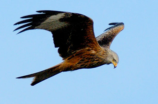
A red kite bird seen in profile while flying against a clear blue sky.
A red kite in flight over the protected area.

Wälder und Wiesen bei Burbach und Neunkirchen ecosystems, habitats, and plant life

Ecologically, the protected area is defined by a mosaic of near-natural forest types and traditionally managed open habitats. The principal forest communities are Luzulo-Fagetum beech forests on more acidic sites and Asperulo-Fagetum (woodruff) beech forests on richer soils, supplemented by Tilio-Acerion slope and ravine mixed forests, alder-ash gallery forests along streams, and remnants of historically managed coppice woodland. Several of these forests share ground with older plantation stands, which are a significant component of the wooded area.

In the openland layer, the area features montane hay meadows, mesophilic and wet grasslands, juniper heath formations, small flushes and boggy depressions, and fragments of dry grassland. A network of small brooks lined with alder-ash woodland threads through the site, while basalt block fields and rocky debris support specialized microhabitats. This combination of acidic and richer beech forest communities, slope woodlands, wet meadows, juniper heath, and stream valley habitats gives the area a habitat diversity uncommon for a single upland protected area.
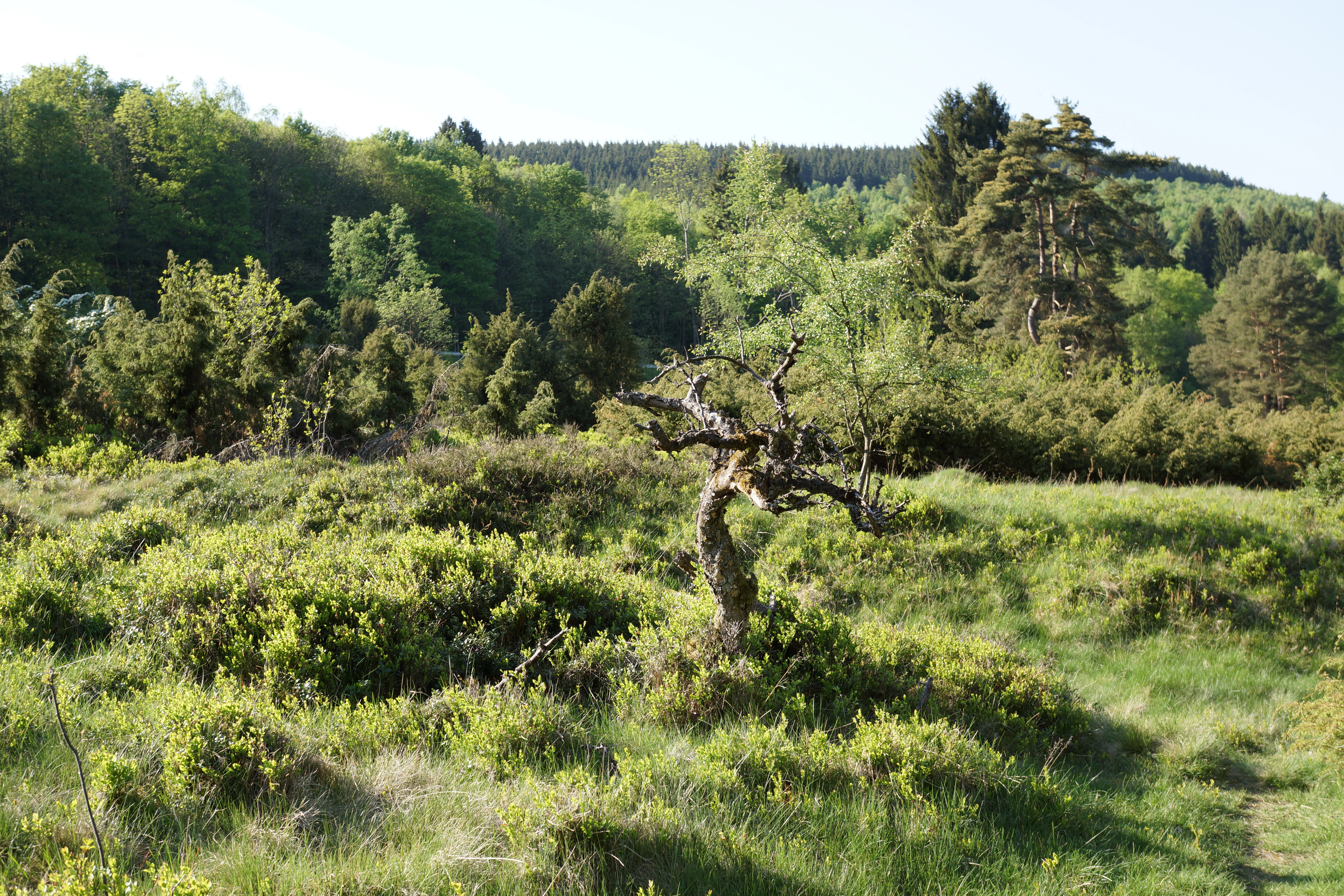
A lone, stunted, gnarled tree stands in the middle of a grassy meadow, with a dense forest rising in the background under a clear sky.
A characteristic scene with a gnarled tree amidst the meadows and forests of the Gambach area.

Wälder und Wiesen bei Burbach und Neunkirchen wildlife and species highlights

The site is recognized first and foremost for its breeding birds, which were the explicit reason for its designation under the EU Birds Directive. It hosts North Rhine-Westphalia's largest breeding population of the whinchat, a meadow-breeding species dependent on extensively mown grasslands with insects, perches, and late-season unmown refuges. It is also one of the last confirmed breeding areas for the hazel grouse in the state, a forest species that requires structurally rich, multi-layered woodlands with edges, young successional stages, and abundant insect food for chicks.

In addition, the protected area holds important breeding populations of several forest and open-ground specialists. These include black woodpecker, grey-headed woodpecker, middle spotted woodpecker, Eurasian pygmy owl, Tengmalm's owl, and black stork in the woodland and stream-valley habitats, alongside red kite and honey buzzard over the broader landscape. Open-ground species such as red-backed shrike, great grey shrike, Eurasian stonechat, and corncrake rely on the meadow, heath, and hedge mosaic, while meadow pipit and European golden plover use the wetter openland areas. The combination of breeding, foraging, and sheltering habitat for all of these species in one continuous landscape is the area's main wildlife significance.

Wälder und Wiesen bei Burbach und Neunkirchen conservation status and protection priorities

The site's conservation significance lies in its role as a designated EU Special Protection Area under the Birds Directive, with formal species-specific conservation objectives for a wide range of breeding birds. Designated in 2001 and managed under the Arnsberg regional government, it forms part of Germany's Natura 2000 network and is one of several SPAs in the Arnsberg administrative district with a focus on upland bird communities.

The conservation strategy emphasizes the maintenance and development of near-natural mixed and beech forests with substantial amounts of old and dead wood, the preservation of montane hay meadows and wet grasslands through extensive mowing and grazing, and the protection of structural diversity in juniper heath, hedges, and stream corridors. Specific management measures include delaying grassland mowing until mid-July in whinchat areas, reducing disturbance at breeding sites, maintaining large old trees and cavity trees for woodpeckers and owls, retaining unhazardous fencing and avoiding new wind turbines in hazel grouse territory, and protecting open wetland complexes for black stork. The area also overlaps with multiple Habitats Directive sites (FFH-Gebiete) and nature reserves such as Gambach, Mahlscheid, and Weier- und Winterbach, reinforcing its role in the regional conservation network.

Wälder und Wiesen bei Burbach und Neunkirchen cultural meaning and human context

Although the protected area is presented primarily through its ecological and ornithological significance, its landscape carries a long history of human use. Coppice woodland, montane hay meadows, and juniper heath are not natural relics but products of centuries of low-intensity forest and grassland management. The names of surrounding places such as Oberdresselndorf, Altenseelbach, and Liebenscheid reflect the small-scale, dispersed settlement pattern typical of the High Westerwald, where villages have traditionally been embedded in working woodland rather than separated from it.

The late-1990s hazel grouse pilot project in the Siegerland is also a cultural-historical note of relevance: it represented a focused regional effort to retain a species emblematic of the traditional mixed woodland landscape at a time when the broader forestry sector was moving toward more uniform management. The protected area can therefore be read as much as a working cultural landscape as a purely natural one.

Top sights and standout views in Wälder und Wiesen bei Burbach und Neunkirchen

Among the protected area's strongest distinguishing features are its combination of large, near-natural beech and mixed forest complexes with intact montane hay meadow systems on the High Westerwald plateau, and its overlap with the tri-border zone of three German federal states. Its designation as an EU Bird Directive site simultaneously protects the state's largest whinchat breeding population and one of its last hazel grouse breeding sites.

The forest composition, including significant Tilio-Acerion slope and ravine woodland and alder-ash gallery forests, is a further highlight, as is the broad array of bird species for which specific conservation objectives have been drawn up, ranging from woodpeckers and owls to open-country shrikes and ground-breeding waders such as the corncrake and black stork.

Best time to visit Wälder und Wiesen bei Burbach und Neunkirchen

The protected area's ecological value is tied strongly to the breeding season, when meadow-breeding birds such as whinchat, stonechat, and corncrake are present and active on the extensively managed grasslands, and when forest specialists like woodpeckers, owls, and hazel grouse are most easily detected in the woodlands. Late spring through mid-summer is broadly the most rewarding period for birdwatching interest.

For broader landscape enjoyment, late spring and early summer also bring flowering montane hay meadows and full leaf cover in the beech forests, while early autumn can offer more open visibility in the meadows as the hay is cut. Winter visits emphasize the structural character of the beech forests, juniper heath, and stream valleys, though breeding bird activity is then largely absent.

Monthly climate preview

Long-term temperature ranges and monthly precipitation distributions across representative coordinate elevations

Annual Climate Normals and Monthly Weather Patterns for Wälder und Wiesen bei Burbach und Neunkirchen

Representative coordinates track twelve-month temperature swings alongside steady daily precipitation averages at a 317-meter elevation. Analyzing the complete monthly climate record clarifies long-term thermal rhythms across the protected landscape.
Annual mean9 °C
0 °C19 °C
Jan
Feb
Mar
Apr
May12°
Jun16°
Jul19°
Aug18°
Sep14°
Oct
Nov
Dec
Warmest month
July

18.5 °C

Coolest month
January

-0.4 °C

Wettest month
December

2.5 mm/day

Driest month
April

1.6 mm/day

Park location guide

Geography guide, regional context, and park location map for Wälder und Wiesen bei Burbach und Neunkirchen

Wälder und Wiesen bei Burbach und Neunkirchen park geography, regions, and map view in Germany

Understand where Wälder und Wiesen bei Burbach und Neunkirchen sits in Germany through a broader geographic reading of the surrounding landscape, nearby location context, and its mapped position within the national park landscape.

How Wälder und Wiesen bei Burbach und Neunkirchen fits into Germany

Germany is a federal republic in Western and Central Europe with a population of over 83 million across sixteen constituent states. It is Europe's largest economy by nominal GDP and a major global exporter and importer. The capital is Berlin, and the country borders Denmark, Poland, Czech Republic, Austria, Switzerland, France, Luxembourg, Belgium, and the Netherlands.

Wider geography shaping Wälder und Wiesen bei Burbach und Neunkirchen in Germany

Germany is located in Western and Central Europe, spanning 357,022 km². It borders Denmark to the north, Poland and the Czech Republic to the east, Austria and Switzerland to the south, and France, Luxembourg, Belgium, and the Netherlands to the west. The country has coastlines on the Baltic Sea and North Sea to the north, with the Alps located in the southern region.

Map view of Wälder und Wiesen bei Burbach und Neunkirchen

Use this park location map to pinpoint Wälder und Wiesen bei Burbach und Neunkirchen in Germany, understand its exact geographic position, and read its mapped placement within the surrounding landscape more clearly.

Pigeon | © OpenStreetMap contributors

Location context for Wälder und Wiesen bei Burbach und Neunkirchen

Nordrhein-Westfalen

Visualizing the beech forests, mountain meadows, and basalt uplands of the protected area

Wälder und Wiesen bei Burbach und Neunkirchen Photos and Landscape Scenery

Photographic documentation reveals the distinct habitat mosaic, near-natural forest cover, and open meadow systems defining the terrain. Visual exploration provides deeper insight into the protected landscape character, topography, and upland environment supporting local wildlife.

A Boreal owl with spotted wings flying in front of dark foliage with yellow-tinted autumn leaves, carrying a small mouse in its talons.

A great grey shrike, a songbird with gray and white plumage and a distinctive black eye mask, perched on a frost-covered thorny branch with a small mammal prey item impaled on a thorn.

A red kite bird seen in profile while flying against a clear blue sky.

A lone, stunted, gnarled tree stands in the middle of a grassy meadow, with a dense forest rising in the background under a clear sky.

Park atlas

Compare surrounding upland landscapes, forest reserves, and regional habitats

Other Parks and Protected Areas Near Wälder und Wiesen bei Burbach und Neunkirchen

Browsing other protected areas near Wälder und Wiesen bei Burbach und Neunkirchen reveals broader ecological patterns across the central German uplands. Comparing adjacent forest reserves and mountain meadows provides essential geographic context for regional conservation landscapes.
Protected areaNordrhein-Westfalen
About 8 km away#1 closest

Northeast

Wildebach Protected Area: Mapping the Stream Valley Landscape of Nordrhein-Westfalen

Protected natural terrain and creek corridor geography

Wildebach represents a preserved 20-hectare stretch of valley habitat within the Siegerland region. This protected area offers a clear look at a natural stream course and damp meadows set against the backdrop of the Rothaargebirge foothills. Use this atlas resource to trace the park boundaries, stream morphology, and the microtopography that characterizes this segment of the Heller watershed.

Area
28.94 km²
Relief
Upland
Climate
Temperate
Scope
Terrestrial
A watercolor illustration of a forest edge with trees, mossy rocks, and ferns, featuring a soft, bright, and airy color palette.
Nature reserveHessen
About 8.7 km away#2 closest

Southeast

Rabenscheider Holz Nature Reserve: Protected Landscapes and Stream Valleys in Hessen

Westerwald upland terrain and diverse woodland habitats

Rabenscheider Holz preserves a vital cross-section of Westerwald habitats, integrating mature broadleaf forests and traditionally managed grasslands. This nature reserve serves as an ecological anchor within the Ketzerbach stream valley, maintaining important woodland and meadow biodiversity in the state of Hessen.

Area
0.573 km²
Established
1994
IUCN
IV
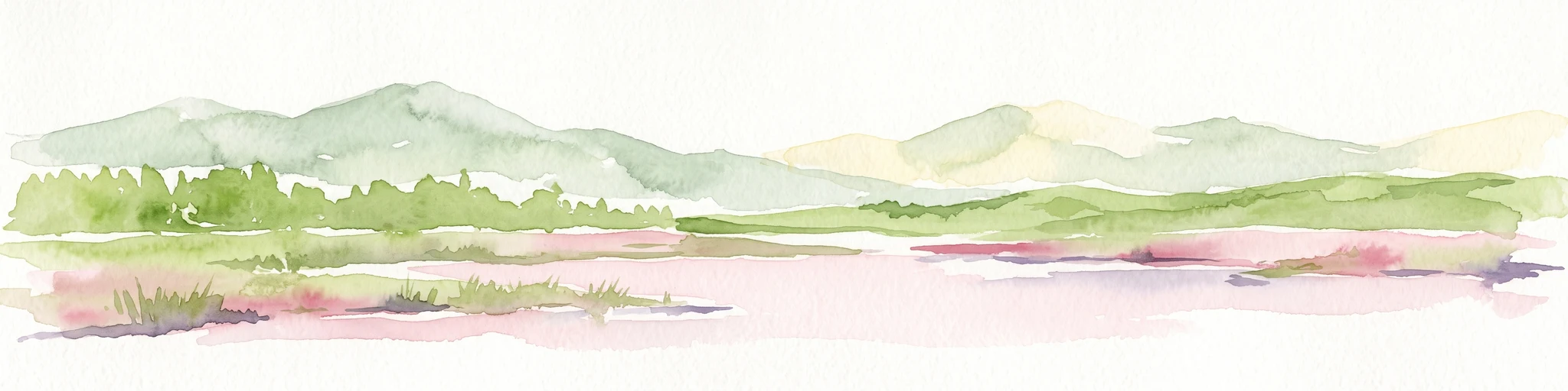
A soft watercolor painting showing green rolling hills in the foreground and faded purple and yellow mountain silhouettes against a white background.
Nature reserveRhineland-Palatinate
About 9.8 km away#3 closest

Southeast

Fuchskaute Nature Reserve: Topographic Atlas and Protected Landscape Overview

Highland basalt summit of the Westerwald range in Rhineland-Palatinate

Fuchskaute represents a primary geographic landmark and nature reserve in the Hoher Westerwald. The site features an ancient, erosion-resistant basalt cap that supports rare upland heaths and species-rich meadows, distinct from the surrounding Devonian sediments. Our atlas data tracks its complex overlapping conservation status and provides a clear view of its summit plateau and surrounding hydrographic networks.

Area
0.402 km²
Established
1984
Relief
Mountain
Climate
Temperate
A soft, painterly watercolor illustration of a rolling green landscape with a gentle stream or wetland area in the foreground and rounded hills in the background.
Nature reserveHessen
About 9.8 km away#4 closest

Southeast

Aubachtal bei Rabenscheid Nature Reserve: Mapped Geography and Protected Area Data

A primary stream-valley habitat within the Hessen region

Aubachtal bei Rabenscheid offers a detailed look at a high-quality nature reserve in the Lahn-Dill-Kreis area of Hessen. The landscape is defined by the narrow valley of the Aubach, which supports a complex mosaic of wet meadows, alder swamp woodlands, and sedge mires. This site functions as a significant ecological refuge, contributing to the broader European network of protected areas through its distinct biodiversity and clean-water stream ecosystems.

Area
0.63 km²
Established
1984
IUCN
IV
Relief
Upland
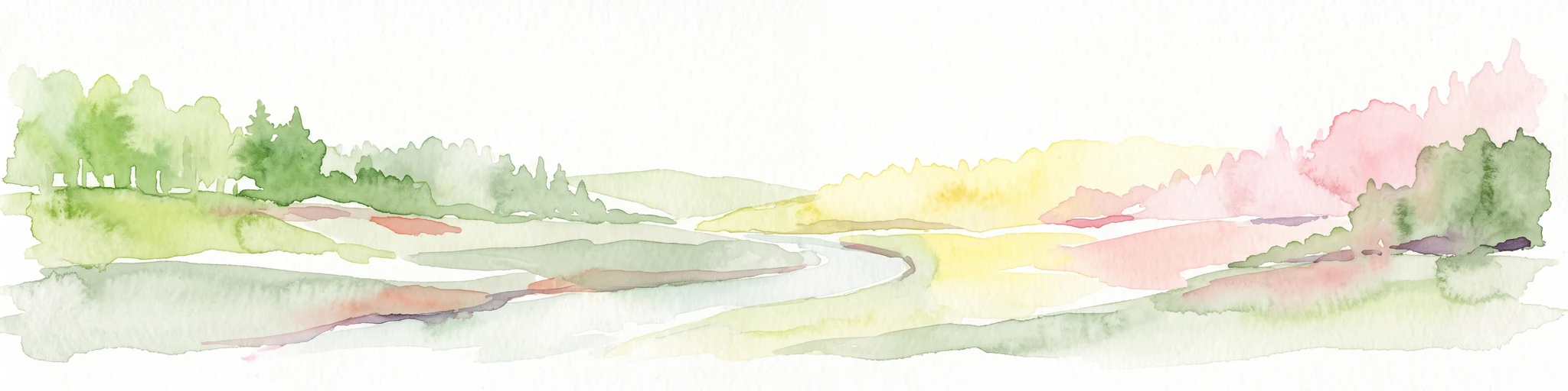
A horizontal watercolor painting depicting a soft, impressionistic landscape with rolling hills in the background and a line of green trees and meadow in the foreground.
Nature reserveHessen
About 10 km away#5 closest

Southeast

Feuerheck bei Waldaubach Nature Reserve: Upland Forest and Habitat Geography in Hessen

Protected broadleaf woodland landscapes and high-elevation habitat patterns.

Located in the German central highlands of Hessen, Feuerheck bei Waldaubach stands as a meticulously protected 24-hectare nature reserve. The site features a sophisticated interplay of deciduous woodland and moist meadow clearings, driven by high annual rainfall and varied soil conditions. This atlas entry provides essential data on the reserve's topography, forest management status, and its role as a key habitat for specialized invertebrates and woodland birds.

Area
0.244 km²
Established
1984
IUCN
IV
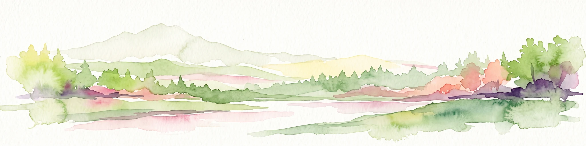
A horizontal watercolor painting depicting a soft, scenic landscape of a park with rolling hills, a central body of water, and surrounding trees.
Nature reserveWesterwaldkreis
About 11 km away#6 closest

Southwest

Bacher Lay Nature Reserve: Basalt Quarry Landscapes in Westerwaldkreis, Germany

Protected landscape with significant geological geotope features

Bacher Lay provides an informative look at a compact nature reserve formed within a former basalt quarry. Featuring the striking Pfaffenmal columnar basalt formation and a mosaic of river valley habitats, the site serves as a vital protected area in the Westerwaldkreis region for studying habitat succession and geological formations.

Area
0.447 km²
Established
1996
IUCN
IV
Relief
Upland
Watercolor painting of a soft, hazy landscape featuring rolling green hills, distant mountains, and water in the foreground.
Nature reserveWesterwaldkreis
About 12 km away#7 closest

South

Breitenbachtalsperre Nature Reserve: Geography and Protected Habitat Mapping in Westerwaldkreis

Managed wetland and reservoir landscape in western Germany

Breitenbachtalsperre protects an important reservoir ecosystem, including shallow margins and wet meadows near Waigandshain. This nature reserve provides a focused look at habitat management in the Westerwald, where stream-fed waters sustain diverse plant societies and wildlife in a compact, protected basin.

Area
0.47 km²
Established
1988
IUCN
IV
Watercolor painting of a soft, hazy landscape featuring gentle green hills, clusters of trees, and open fields against a white background.
Nature reserveHessen
About 13 km away#8 closest

Southeast

Bermershube bei Heisterberg Protected Area: Geography and Landscape Atlas

Nature reserve in the Hoher Westerwald region of Hessen

Located in the Lahn-Dill district, Bermershube bei Heisterberg represents a concentrated mosaic of upland natural features. The protected landscape combines deciduous slope forests with spring-fed wetlands and meadows, creating an essential ecological corridor within the Hoher Westerwald plateau. Detailed geographic insights reveal the interplay between the Amdorf brook drainage and the surrounding undisturbed forest ecosystems.

Area
0.449 km²
Established
1984
IUCN
IV
Relief
Upland

Common questions about visiting, size, designation, and location context for Wälder und Wiesen bei Burbach und Neunkirchen

Wälder und Wiesen bei Burbach und Neunkirchen FAQs for park facts, access, geography, and protected area context

Find quick answers about Wälder und Wiesen bei Burbach und Neunkirchen, including protected-area facts, park geography, trail and visitor context, and how the park fits into its surrounding country and regional landscape.
MoriAtlas Explorer

Continue Your Protected Areas Search Across the Global Atlas

Deepen your exploration by continuing the structured search for national parks and protected areas worldwide. Utilize the comprehensive filtering capabilities to compare different conservation landscapes and refine your understanding of global park geography. Discover more about the distribution and characteristics of protected natural areas.

Global natural geography