
Mori Atlas logo
Protected landscapeWallowa-Whitman National Forest

A detailed look at protected mountain landscapes, river corridors, and diverse forest terrain.

Wallowa-Whitman National Forest: Mapping the Alpine Ranges and Deep Gorges of Eastern Oregon

Wallowa-Whitman National Forest encompasses over two million acres of diverse terrain spanning the Wallowa and Elkhorn mountain ranges in northeastern Oregon. This protected landscape features the glaciated peaks of the Eagle Cap Wilderness, the dramatic depth of the Hells Canyon gorge, and extensive river networks. Understanding these geographic boundaries offers insight into one of the most significant wilderness networks in the Pacific Northwest interior.

national-forestalpine-wildernessold-growthriver-gorgemountain-rangeswildlife-habitat
A stylized, flat-design illustration showing layered green and purple mountains under a pale sun, with a small waterfall on a distant slope and rocky, arid foreground with twisted wood.

Wallowa-Whitman National Forest

Protected landscape

Park overview

Structured park overview, official facts, and landscape profile for Wallowa-Whitman National Forest

Wallowa-Whitman National Forest park facts, protected area profile, and essential visitor context

Review the core facts for Wallowa-Whitman National Forest, including designation, size, terrain, visitor scale, habitats, and operating context in one park-focused overview.

About Wallowa-Whitman National Forest

The Wallowa-Whitman National Forest is one of the most geographically varied national forests in the Pacific Northwest, combining high alpine country, rolling Blue Mountains foothill ridges, and the deeply cut Snake River canyon in a single federal management unit. Located in the northeastern corner of Oregon and spilling across the state line into Idaho, it stretches across Wallowa, Baker, Union, Grant, and Umatilla counties, with headquarters in Baker City and ranger districts serving La Grande, Joseph, and Baker City.

The forest takes its dual name from two very different sources. The Wallowa half honors the Wallowa band of the Nez Perce people, who have lived in this region for centuries and whose traditional homeland centers on the Wallowa Valley. The Whitman half commemorates Marcus and Narcissa Whitman, Presbyterian missionaries who established a settlement just to the north in 1836 and whose story is woven into the long history of Euro-American contact in the inland Pacific Northwest.

Geographically, the forest divides into several large sections. In the east, it covers the Wallowa Mountains south of Joseph, Oregon, including the upper drainages of the Wallowa, Minam, and Imnaha rivers and the alpine Eagle Cap Wilderness at its heart. A separate northern section follows Joseph Canyon down toward the Snake River, where it joins the Hells Canyon National Recreation Area, a stretch of the Snake protecting the deepest gorge in North America. In the west, the national forest wraps around the Elkhorn Mountains west of La Grande and Baker City, including the upper John Day and Grande Ronde basins and smaller wilderness areas such as the Monument Rock Wilderness and the North Fork John Day Wilderness, which are jointly managed with adjacent national forests.

Ecologically, Wallowa-Whitman is unusually rich for an inland forest of its size. Its elevation range sweeps from low grasslands and ponderosa pine forests up through Douglas-fir, white fir, western larch, and lodgepole pine to Engelmann spruce, mountain hemlock, subalpine fir, and whitebark pine at the highest elevations. That vertical span supports an equally broad mix of wildlife, from pikas and marmots in the alpine zone to black bears, cougars, and the rare wolverine whose occasional sightings have been documented since the 1990s. The forest also maintains roughly 173,000 acres of old-growth habitat, a significant legacy in a region shaped by logging and grazing.

Today, the national forest is a major recreational anchor for northeastern Oregon, with 52 developed campgrounds, miles of summer and snowmobile trails, the Anthony Lakes Ski Area, and culturally important gathering sites connected to the Nez Perce Tribe of Idaho and the Confederated Tribes of the Umatilla Indian Reservation. Visitors come for hiking, camping, fishing, hunting, rafting on the Snake River, and winter sports, while the Eagle Cap Extreme Dog Sled Race and the Wallowa Lake Tramway add distinctive regional events to the forest's identity.

Quick facts and research context for Wallowa-Whitman National Forest

Wallowa-Whitman National Forest is a U.S. National Forest located primarily in northeastern Oregon, with small portions extending into Idaho, and administered by the U.S. Forest Service from headquarters in Baker City, Oregon.

The forest spans roughly 2.4 million acres across five Oregon counties, Wallowa, Baker, Union, Grant, and Umatilla, and touches Nez Perce and Idaho counties in Idaho. About 600,000 acres of the total area fall within designated wilderness, including the large Eagle Cap Wilderness at the core of the Wallowa Mountains and parts of the Hells Canyon Wilderness along the Snake River.

It also manages the Hells Canyon National Recreation Area on behalf of neighboring national forests and hosts the Anthony Lakes Ski Area, extensive developed campgrounds, and an extensive trail network used for hiking, horseback riding, and winter recreation.

Protection and recognition

Examine the documented management scope and official protection status framework.

Wallowa-Whitman National Forest Protection Status and Terrestrial Scope

Wallowa-Whitman National Forest maintains a documented terrestrial protection scope within its designated conservation boundaries. Structured factual records summarize the recognized management framework and administrative status for public reference.

Protection details

Protection scope
Terrestrial
Transboundary protection
No
Park context

Deeper park guide and search-rich context for Wallowa-Whitman National Forest

Wallowa-Whitman National Forest history, landscape, wildlife, and travel context

Explore Wallowa-Whitman National Forest through its history, landscape character, ecosystems, wildlife, conservation priorities, cultural context, and seasonal travel timing in a structured park guide built for atlas discovery and search intent.

Why Wallowa-Whitman National Forest stands out

Wallowa-Whitman is best known for the Eagle Cap Wilderness, a rugged alpine area centered in the Wallowa Mountains, and for its role managing the Hells Canyon National Recreation Area along the Snake River, where Hells Canyon forms the deepest gorge in North America. The forest is also recognized for its extensive stands of old-growth forest, its strong populations of Shiras moose and Rocky Mountain elk, and its deep cultural ties to the Nez Perce people, including the Wallowa band whose traditional homeland gives the forest part of its name.
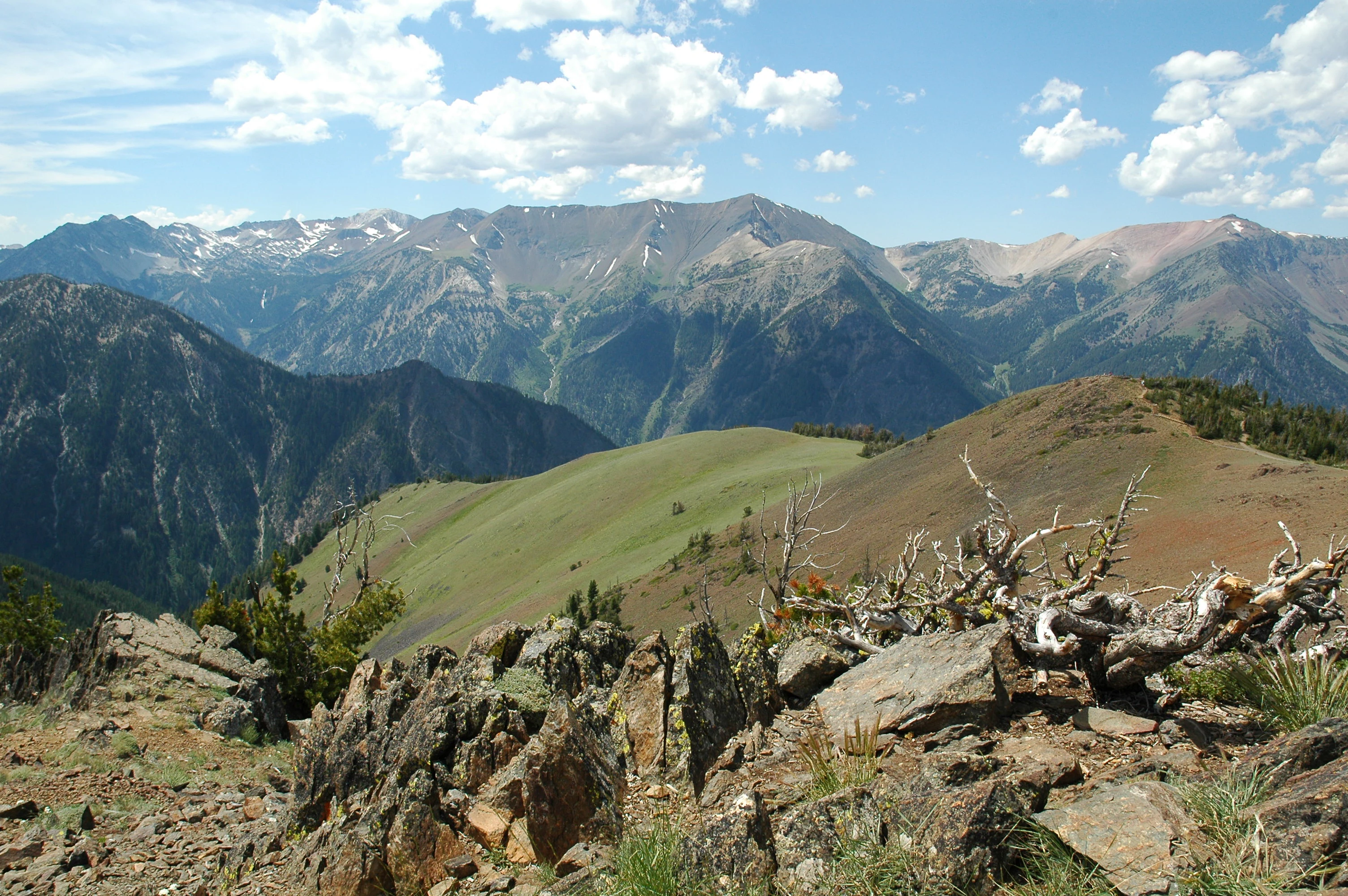
A wide, eye-level mountain landscape showing a series of jagged, rocky peaks against a blue sky with light clouds, looking over a foreground of rocky soil and a dried, weathered tree stump.
A panoramic view of the Wallowa Mountains in Wallowa-Whitman National Forest, highlighting the rugged alpine terrain.

Wallowa-Whitman National Forest history and protected-area timeline

The lands of today's Wallowa-Whitman National Forest have been inhabited since around 1400 CE, when the Nez Perce people first established a presence in what is now northeastern Oregon. The Wallowa Valley and the surrounding mountains were the summer home of the Joseph Band of the Nez Perce, and the Cayuse, Shoshone, and Bannock peoples also moved through the region over time, hunting deer, elk, and bighorn sheep in the high country.

The first European-American settlers reached the Wallowa Valley in 1860. The region experienced violence and upheaval in the following decades, including the 1887 killings of Chinese miners along the Snake River at what is now remembered as Chinese Massacre Cove. Federal reservation of forest land began in 1905, when President Theodore Roosevelt established the Wallowa Forest Reserve and the Chesnimnus Reserve. Those reserves were combined in 1907 to form the Imnaha National Forest, which was renamed the Wallowa National Forest in 1908.

The Whitman National Forest, established the same year from parts of the older Blue Mountains National Forest, remained a separate unit until 1954, when it was administratively merged with the Wallowa to create the present Wallowa-Whitman National Forest. Additional land was added in 1920 from the Minam National Forest.

Wilderness protection came in stages. The Eagle Cap primitive area was established in 1930 and redesignated as wilderness in 1940, then formally entered the National Wilderness Preservation System under the Wilderness Act of 1964. Eagle Cap was enlarged by more than 73,000 acres in 1972 and by roughly 67,700 acres in 1984, growing to its current size of about 350,000 acres. The forest's iconic Wallowa Mountains Visitor Center and district office, a large log building in Enterprise, was destroyed by fire in 2010.

In the modern era, the U.S. Forest Service manages the forest in close coordination with the Nez Perce Tribe of Idaho and the Confederated Tribes of the Umatilla Indian Reservation on cultural and natural resources issues, reflecting the continuing significance of the region to indigenous communities.

Wallowa-Whitman National Forest landscape and geographic character

Wallowa-Whitman encompasses a remarkable sweep of Pacific Northwest terrain within a single management boundary. In the east, the Wallowa Mountains rise sharply south of Joseph, Oregon, with deep glacial valleys carved by the Wallowa, Minam, and Imnaha rivers giving way to rugged alpine ridges and high cirques. The Eagle Cap Wilderness occupies the heart of this range, where elevations climb high enough to support Engelmann spruce, mountain hemlock, subalpine fir, and whitebark pine forests above subalpine meadows.

North of Enterprise, the forest narrows along Joseph Canyon, a long, steep-walled trench that links the Wallowa section of the forest to the Snake River corridor. This stretch descends into the Hells Canyon National Recreation Area, where the Snake River slices through Hells Canyon, the deepest gorge in North America. The Hells Canyon Scenic Byway follows Forest Service Road 39 through this dramatic terrain, and rocky bluffs along the canyon support unusual vegetation, including prickly pear cactus and poison ivy.

In the western part of the forest, the Elkhorn Mountains form a sub-range of the broader Blue Mountains, with rolling forested ridges, granite outcrops, and the upper watersheds of the John Day and Grande Ronde rivers. The historic gold mining town of Sumpter sits entirely surrounded by national forest land, and the landscape here transitions between montane forest and dry, open rangeland. Several smaller wildernesses, including Monument Rock Wilderness and North Fork John Day Wilderness, extend this western character into jointly managed areas shared with the Malheur and Umatilla national forests.

Wallowa-Whitman National Forest ecosystems, habitats, and plant life

The ecological identity of Wallowa-Whitman is shaped by its dramatic elevation range, which carries plant communities from dry lowland grasslands all the way to true alpine tundra. Low-elevation slopes carry ponderosa pine forests and open grasslands, while mid-elevation forests are dominated by Douglas-fir, white fir, western larch, and lodgepole pine. Higher in the Wallowa Mountains and the Elkhorns, Engelmann spruce, mountain hemlock, subalpine fir, and whitebark pine take over, often giving way to alpine meadows and rocky summit zones.

Wildflower displays add seasonal color across much of this range. Indian paintbrush, larkspur, shooting star, bluebell, clarkia, sego lily, and elephanthead are among the flowering plants documented in the forest, while Hells Canyon's dry rocky bluffs support prickly pear cactus, demonstrating how sharply ecological conditions can change across the forest.

Forest Service ecologists estimate that roughly 173,000 acres of old-growth forest remain in Wallowa-Whitman, a substantial legacy that supports species dependent on mature canopy conditions. The forest also manages its landscape actively, using controlled burns before fire season to reduce fuel loads and maintain the ecological balance between dense forest and open meadow.

Wallowa-Whitman National Forest wildlife and species highlights

Wallowa-Whitman supports an exceptionally broad wildlife community for an inland national forest, with documented populations of 36 fish species, more than 230 bird species, over 90 mammal species, and roughly 26 reptile and amphibian species spread across its varied terrain.

Large mammals are a defining feature of the forest. Shiras moose, a subspecies found primarily in the northern Rockies and surrounding ranges, roam the wetlands of the Wallowa Mountains, joined by Rocky Mountain elk, Rocky Mountain bighorn sheep, mountain goats, white-tailed deer, mule deer, and American black bears. Predators include the Northwestern wolf, the North American cougar, and bobcats, and rare wolverine sightings have been recorded since the 1990s. Smaller mammals such as the American pika, American marten, American badger, American mink, North American beaver, North American river otter, and several marmot species occupy different ecological niches throughout the elevation range.

The forest's birdlife is similarly rich, with raptors such as the peregrine falcon, bald eagle, golden eagle, ferruginous hawk, and northern goshawk nesting along cliffs and in old forest stands. Forest and alpine species include the pileated woodpecker, gray-crowned rosy finch, American dipper, great gray owl, and chukar partridge. Rivers and creeks sustain steelhead and trout populations that anchor the forest's fishing tradition.

Wallowa-Whitman National Forest conservation status and protection priorities

Wallowa-Whitman's conservation significance lies in the size and continuity of its protected landscape, the persistence of large old-growth forest stands, and its role sheltering species at the edge of their range in the inland Pacific Northwest. The protection of the Eagle Cap Wilderness, the Hells Canyon Wilderness, Monument Rock Wilderness, and North Fork John Day Wilderness, together accounting for hundreds of thousands of acres, preserves some of the most intact alpine and canyon country in the region.

The forest plays a particularly important role for wide-ranging carnivores and ungulates. Its populations of Shiras moose, Rocky Mountain elk, Rocky Mountain bighorn sheep, and the occasional wolverine depend on large, connected landscapes that only expansive federal forest units can provide. Roughly 173,000 acres of old-growth habitat support species tied to mature forest structure, including the pileated woodpecker and the northern goshawk.

Active management is part of the forest's conservation approach. The Forest Service uses controlled burns before wildfire season to reduce natural fuel buildup, balancing the needs of fire-adapted ecosystems with surrounding communities. The forest also collaborates with the Nez Perce Tribe of Idaho and the Confederated Tribes of the Umatilla Indian Reservation on cultural and natural resources issues, an increasingly important dimension of conservation work in the region.

Wallowa-Whitman National Forest cultural meaning and human context

The cultural landscape of Wallowa-Whitman is deeply shaped by its indigenous heritage. The Nez Perce people have lived in what is now the national forest since around 1400 CE, and the Wallowa Valley and surrounding mountains served as the summer homeland of the Joseph Band of the Nez Perce. The forest itself takes its Wallowa name from this band, a recognition that is carried alongside the Whitman name honoring missionaries Marcus and Narcissa Whitman, who settled just to the north in 1836.

The Cayuse, Shoshone, and Bannock peoples also moved through the region, hunting deer, elk, and bighorn sheep in the same landscapes that today define the recreational appeal of the forest. Euro-American settlement came later, with the first settlers arriving in the Wallowa Valley in 1860 and a darker chapter recorded at Chinese Massacre Cove along the Snake River in 1887, where 34 Chinese miners were killed.

In the present day, the U.S. Forest Service works in formal partnership with the Nez Perce Tribe of Idaho and the Confederated Tribes of the Umatilla Indian Reservation on cultural and natural resources management, reflecting the ongoing importance of these lands to the tribes whose ancestors have occupied them for centuries.

Top sights and standout views in Wallowa-Whitman National Forest

The Eagle Cap Wilderness anchors the Wallowa Mountains section of the forest, offering more than 350,000 acres of alpine lake country, glaciated cirques, and high trails at the heart of northeastern Oregon. The Hells Canyon National Recreation Area, managed by Wallowa-Whitman on behalf of neighboring forests, preserves the deepest gorge in North America along the Snake River, while the Hells Canyon Scenic Byway gives visitors a dramatic road-based experience of the same canyon system.

The Elkhorn Mountains west of La Grande and Baker City provide a quieter, forested counterpoint, with the historic gold mining town of Sumpter encircled by national forest land and the upper watersheds of the John Day and Grande Ronde rivers flowing through jointly managed wilderness areas. Across the forest, particularly in its old-growth stands and alpine zones, visitors encounter populations of Shiras moose, Rocky Mountain elk, mountain goats, and occasional wolverines, making the forest one of the most wildlife-rich national forests in the Pacific Northwest interior.

Best time to visit Wallowa-Whitman National Forest

Visitors commonly plan around the forest's strong seasonal contrasts. Summer, from roughly late May through October, is the most accessible season, when most of the 52 developed campgrounds are open, hiking trails through the Eagle Cap Wilderness and the Elkhorn Mountains are largely snow-free, and the high meadows carry their best wildflower displays.

Winter shifts the forest's character toward the Anthony Lakes Ski Area, groomed cross-country and snowshoe trails, and miles of designated snowmobile routes, including the terrain used for the annual Eagle Cap Extreme Dog Sled Race, whose finishers qualify for the Iditarod and Yukon Quest. Spring and fall tend to be quieter shoulder seasons marked by rapidly changing conditions at higher elevations, with snow lingering in the high country well into early summer and early snowfall occasionally closing high passes by mid-autumn.
Monthly climate preview

Long-term representative monthly temperature and precipitation data patterns

Wallowa-Whitman National Forest Climate Normals and Temperature Rhythms

Wallowa-Whitman National Forest records measured long-term temperature swings alongside distinct monthly precipitation averages at a representative coordinate elevation of 1355 meters. Analyzing the complete twelve-month climate profile provides deeper context for examining sustained meteorological variations across the protected landscape.
Annual mean6 °C
-5 °C19 °C
Jan-5°
Feb-3°
Mar
Apr
May10°
Jun14°
Jul19°
Aug19°
Sep14°
Oct
Nov
Dec-5°
Warmest month
July

19 °C

Coolest month
January

-5 °C

Wettest month
December

2.7 mm/day

Driest month
August

0.6 mm/day

Park location guide

Geography guide, regional context, and park location map for Wallowa-Whitman National Forest

Wallowa-Whitman National Forest park geography, regions, and map view in United States of America

Understand where Wallowa-Whitman National Forest sits in United States of America through a broader geographic reading of the surrounding landscape, nearby location context, and its mapped position within the national park landscape.

How Wallowa-Whitman National Forest fits into United States of America

The United States of America is a federal presidential republic and one of the world's largest countries by area and population. It consists of 50 states across a vast territory spanning multiple time zones, with its capital in Washington, D.C. and largest city in New York City. The nation has a diverse economy, influential political system, and significant cultural and military presence globally.

Wider geography shaping Wallowa-Whitman National Forest in United States of America

The United States occupies a vast territory in North America, bordered by Canada to the north and Mexico to the south. The 48 contiguous states stretch from the Atlantic to the Pacific Ocean, while Alaska occupies the northwestern region and Hawaii is an archipelago in the Pacific. The country encompasses diverse terrain including the Rocky Mountains, Appalachian Mountains, Great Plains, and extensive river systems.

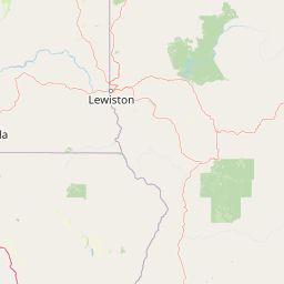
Map view of Wallowa-Whitman National Forest

Use this park location map to pinpoint Wallowa-Whitman National Forest in United States of America, understand its exact geographic position, and read its mapped placement within the surrounding landscape more clearly.

Pigeon | © OpenStreetMap contributors

Location context for Wallowa-Whitman National Forest

IdahoOregon
Natural feature types

Browse Named Natural Features in Wallowa-Whitman National Forest

Navigate the complex landscape of Wallowa-Whitman National Forest through this focused geographic collection. MoriAtlas provides a clear structure for tracing mountain ranges, deep canyons, and diverse forest terrain found across this significant protected area.
Recorded earthquake history

Explore Recorded Earthquake History for Wallowa-Whitman National Forest

Browse the historical catalogue of seismic activity associated with the mountainous geography of Wallowa-Whitman National Forest. MoriAtlas provides transparent access to recorded event dates and magnitude data to support deeper study of the region.

Wallowa-Whitman National Forest Earthquake History

Catalogued events

42 events

Strongest magnitude

Magnitude 4.3

Most recent event

Mar 8, 2023

This history includes earthquakes recorded inside the park or within 50 km of its borders

Visual reference of mountain terrain, river gorges, and alpine habitats

Wallowa-Whitman National Forest Photos and Protected Landscape Scenery

Visual documentation captures the diverse terrain and ecological zones spanning the Wallowa Mountains and Hells Canyon. Photography reveals the protected-area character through glacial valleys, forested ridges, and deep river canyons.

A wide, eye-level mountain landscape showing a series of jagged, rocky peaks against a blue sky with light clouds, looking over a foreground of rocky soil and a dried, weathered tree stump.

A rustic wooden picnic table situated in a forested clearing with a lake visible in the background under a clear sky.

Park atlas

Compare regional mountain ranges, river canyons, and connected wilderness landscapes.

Other Parks Near Wallowa-Whitman National Forest and Surrounding Protected Areas

Browse nearby national forests and protected landscapes sharing the rugged mountain terrain of the Pacific Northwest. Comparing adjacent conservation areas reveals the broader regional spread of alpine wilderness and river gorges.
A horizontal watercolor painting depicting a soft-focus mountain range in shades of purple and pink behind a green forest and a calm blue lake.
Wildlife reserveOregon
Park boundaries overlap#1 closest

West

Eagle Cap Wilderness: Map and Protected Area Overview in Northeastern Oregon

High elevation terrain, glacial valleys, and mountain ecosystems

Spanning over 350,000 acres, Eagle Cap Wilderness defines the high-altitude geography of the Wallowa Mountains. This protected area is characterized by sharp granite ridges, more than 60 named alpine lakes, and deeply carved U shaped glacial valleys. It acts as a primary water source for the region, hosting the headwaters of several major rivers while supporting diverse wildlife populations in a preserved backcountry environment.

Area
1,462.72 km²
Established
1940
IUCN
Ib
Relief
Mountain
A watercolor painting of a wide, rolling landscape with green hills, a winding path or river, and soft mountains in the background against a white background.
Protected landscapeUnited States of America
Park boundaries overlap#2 closest

Northeast

Hells Canyon National Recreation Area: Geologic Boundaries and Snake River Corridor Atlas

Deep canyon terrain and archaeological heritage in the American Northwest

This protected landscape encompasses the profound depth of the Snake River gorge, featuring rugged basalt cliffs and diverse forested uplands. The area serves as a significant intersection of natural history and ancient cultural presence, providing a detailed look at the topographic complexity defining the Oregon and Idaho boundary region.

Area
2,641 km²
Established
1975
Relief
Mountain
Climate
Temperate
A horizontal watercolor painting showing a panoramic view of layered green and purple mountains under a pale sky, with coniferous trees in the foreground.
Protected landscapeOregon
Park boundaries overlap#3 closest

Southwest

Malheur National Forest: Exploring Oregon's Vast Protected Mountain and Desert Landscape

A geographic study of the Blue Mountains and high desert terrain

Spanning over 1.4 million acres, Malheur National Forest represents a complex protected landscape in eastern Oregon. Its geography is defined by a central spine of the Strawberry Mountains, creating a transition zone between arid high desert ecosystems and dense coniferous forests. Known for large wilderness areas and extensive old growth stands, this forest serves as a vital point for understanding the interplay between topographic elevation and regional climate in the Pacific Northwest.

Area
5,929.81 km²
Established
1908
Visitors
242K annual
Relief
Mountain
Protected landscapeIdaho
Park boundaries overlap#4 closest

Southeast

Payette National Forest: Geographic Overview of Idaho's Rugged Mountain Wilderness

Protected granite landscapes and glacial basin geography

Encompassing a vast portion of central Idaho, Payette National Forest represents a significant protected wilderness corridor. The forest geography transitions from granite-based alpine peaks and deep river gorges to dense coniferous slopes, providing essential habitat and extensive trail connectivity throughout the Northern Rockies.

Area
9,419.55 km²
Established
1944
Relief
Mountain
Access
Access unknown
Protected landscapeOregon
About 16 km away#5 closest

West

Umatilla National Forest: A Comprehensive Atlas of Blue Mountains Protected Landscapes

Explore mountain terrain, wilderness areas, and river-carved geography

Spanning over one million acres, Umatilla National Forest encompasses a complex array of river-cut canyons, high-country ridges, and substantial old-growth woodlands. This protected landscape offers a deep look into the ecological and physical character of the Blue Mountains, from the remote reaches of the Wenaha-Tucannon Wilderness to the headwaters of the Umatilla River.

Area
5,694 km²
Established
1908
Visitors
703K annual
Relief
Mountain
A horizontal watercolor illustration depicting a winding river flowing through a forested valley surrounded by soft, hazy mountain silhouettes.
Wildlife reserveIdaho
37 km away#6 closest

East

Frank Church, River of No Return Wilderness: Idaho Protected Mountain and River Landscapes

Discover massive roadless geography and river-carved mountain terrain.

Spanning over 2.3 million acres in central Idaho, the Frank Church, River of No Return Wilderness represents one of the most significant intact roadless landscapes in the lower 48 states. This protected area features a complex mosaic of coniferous forests, high-altitude alpine ridges, and the steep, jagged canyons of the Salmon River, creating a unique geographic profile for regional exploration.

Area
9,578.21 km²
Established
1980
IUCN
Ib
Relief
Mountain
Protected areaOregon
90 km away#7 closest

West

Ochoco National Forest: Mapping the Rugged Canyons and High Desert of Central Oregon

A vast protected area defined by rimrock plateaus and pine-forest watersheds.

Located in the heart of the Ochoco Mountains, this protected landscape offers a study in ecological contrast. From its dense ponderosa pine groves to the exposed volcanic ridges of the high desert, the forest acts as a critical habitat corridor for mule deer and elk, while protecting the headwaters of the North Fork Crooked River within a diverse, multi-terrain framework.

Area
3,444.01 km²
Established
1911
Visitors
575K annual
Relief
Mountain
Soft watercolor illustration of a rolling mountain landscape with a forested foreground and faded, distant peaks.
Protected landscapeIdaho
98 km away#8 closest

East

Salmon, Challis National Forest: Geography and Protected Land Map in Central Idaho

Extensive alpine ridges and wild river corridors

Spanning over 4.2 million acres, Salmon, Challis National Forest is a foundational protected landscape in Idaho. This area includes the highest peaks in the state, such as Borah Peak, and holds the majority of the Frank Church, River of No Return Wilderness. Utilize this atlas resource to examine the intricate mountain topography, expansive river systems, and the contiguous wild corridors that define this significant portion of the northern Rockies.

Area
17,142.2 km²
Established
1908
Relief
Mountain
Climate
Temperate

Common questions about visiting, size, designation, and location context for Wallowa-Whitman National Forest

Wallowa-Whitman National Forest FAQs for park facts, access, geography, and protected area context

Find quick answers about Wallowa-Whitman National Forest, including protected-area facts, park geography, trail and visitor context, and how the park fits into its surrounding country and regional landscape.
MoriAtlas Explorer

Continue Your Protected Areas Search Across the Global Atlas

Deepen your exploration by continuing the structured search for national parks and protected areas worldwide. Utilize the comprehensive filtering capabilities to compare different conservation landscapes and refine your understanding of global park geography. Discover more about the distribution and characteristics of protected natural areas.

Global natural geography