
Mori Atlas logo
Protected landscapeWeilheim an der Teck auf Gemarkungen Weilheim und Hepsisau

A transitional hill zone featuring volcanic outcrops between the Alb foreland and the Swabian Alb

Weilheim an der Teck auf Gemarkungen Weilheim und Hepsisau Protected Landscape and Regional Geography

(Landschaftsschutzgebiet "Weilheim an der Teck auf Gemarkungen Weilheim und Hepsisau")

The Weilheim an der Teck auf Gemarkungen Weilheim und Hepsisau protected landscape functions as an ecological bridge between the lowlands of the Schwäbisches Keuper-Lias-Land and the upland plateaus of the Swabian Alb. This region encompasses a mosaic of forested slopes, open agricultural valleys, and the prominent volcanic hills of Limburg and Egelsberg. Its geography creates a visually varied terrain that serves as a vital environmental buffer near the Stuttgart conurbation.

landscape protection areaLandschaftsschutzgebietSwabian Alb foothillsMittlere KuppenalbMittleres Albvorlandvolcanic hills
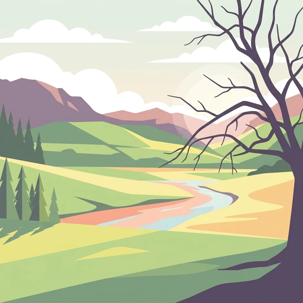
A flat-style digital illustration showing a winding river flowing through a green valley towards distant rolling mountains, framed by a leafless tree in the foreground.

Weilheim an der Teck auf Gemarkungen Weilheim und Hepsisau

Protected landscape

Park overview

Structured park overview, official facts, and landscape profile for Weilheim an der Teck Landscape Protection Area

Weilheim an der Teck Landscape Protection Area park facts, protected area profile, and essential visitor context

Review the core facts for Weilheim an der Teck Landscape Protection Area, including designation, size, terrain, visitor scale, habitats, and operating context in one park-focused overview.

About Weilheim an der Teck Landscape Protection Area

Weilheim an der Teck auf Gemarkungen Weilheim und Hepsisau is a regional landscape protection area that conserves one of the more varied transitional landscapes along the edge of the Swabian Alb. Although it is not a national park or large-scale nature protection area, it plays an important role in preserving the ecological and visual character of the area where southern Germany's central uplands meet their foothills. The protected zone wraps around the town of Weilheim an der Teck and almost entirely encloses the smaller district of Hepsisau on its southern and eastern sides, making it a defining feature of the local geography.

The landscape is shaped by the contrast between two major natural regions. Part of the protected area lies in the Mittlere Kuppenalb, a gently rolling division of the Schwäbische Alb with characteristic dome-like hills, while the rest extends into the Mittleres Albvorland, part of the larger Schwäbisches Keuper-Lias-Land. This positioning gives the area a layered scenery of rounded summits, scarp slopes, valleys, and forested hill belts that shift in character as the land rises toward the Alb plateau.

Among the most notable landscape elements are the Limburg and the Egelsberg, two hills of volcanic origin that rise above the surrounding terrain. Their geology, relief, and ecological conditions warrant particular attention, and they are explicitly singled out in the protection order. Beyond their geological interest, these hills also support bird communities of high ornithological value, making the area significant both for landscape conservation and for birdlife protection.

Although the landscape protection area has gradually been reduced in size as dedicated nature protection areas have been established within it, it remains an important buffer around Weilheim an der Teck and Hepsisau. Its role extends beyond pure conservation: situated close to the densely populated Stuttgart metropolitan region, it functions as a regional compensation space for ecosystems and as a nearby recreation landscape for residents of the surrounding urban area.

Quick facts and research context for Weilheim an der Teck Landscape Protection Area

Weilheim an der Teck auf Gemarkungen Weilheim und Hepsisau is a German landscape protection area with the official designation number 1.16.006, located in the Landkreis Esslingen in Baden-Württemberg. It was established on 23 January 1979 and is administered by the district administration of Esslingen. The area spans parts of two adjoining natural regions: the Mittlere Kuppenalb within the Schwäbische Alb and the Mittleres Albvorland within the Schwäbisches Keuper-Lias-Land.

Protection and recognition

Examine documented protected area records and management data for Weilheim an der Teck.

Weilheim an der Teck auf Gemarkungen Weilheim und Hepsisau Protection Status

Certified protected area records for Weilheim an der Teck auf Gemarkungen Weilheim und Hepsisau outline official conservation frameworks and registry identifiers. Verified database entries compile verified protection statuses and administrative designations without speculative claims.

Protection details

WDPA ID
325724
Park context

Deeper park guide and search-rich context for Weilheim an der Teck Landscape Protection Area

Weilheim an der Teck Landscape Protection Area history, landscape, wildlife, and travel context

Explore Weilheim an der Teck Landscape Protection Area through its history, landscape character, ecosystems, wildlife, conservation priorities, cultural context, and seasonal travel timing in a structured park guide built for atlas discovery and search intent.

Why Weilheim an der Teck Landscape Protection Area stands out

The protection area is best known for safeguarding a richly structured hill zone where the foothills of the Swabian Alb rise sharply from the surrounding countryside. Within its boundaries stand the Limburg and the Egelsberg, two prominent hills of volcanic origin that shape the local skyline and carry special protection because of their ornithological value. The interplay of forested slopes, open agricultural land, and dramatic geological features defines the character of the protected landscape around Weilheim an der Teck.
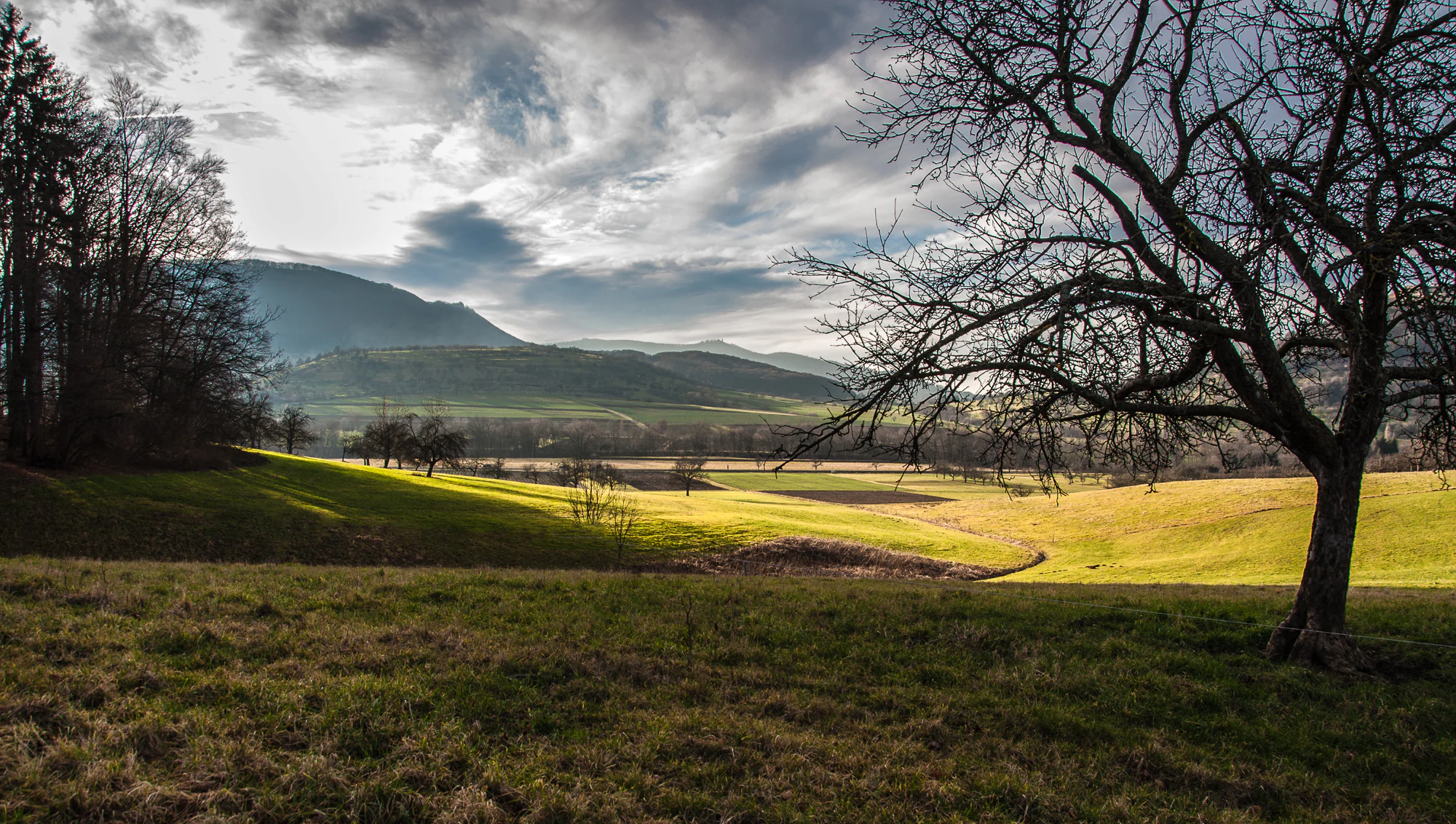
A wide, rolling green meadow with a large bare-branched tree in the foreground, looking toward distant hills and mountains under a cloudy sky.
A view overlooking the landscape conservation area towards the Swabian Alb foothills.

Weilheim an der Teck Landscape Protection Area history and protected-area timeline

The landscape protection area Weilheim an der Teck auf Gemarkungen Weilheim und Hepsisau was formally established on 23 January 1979 as part of the broader effort to conserve distinctive landscapes in Baden-Württemberg. It was registered under the official designation 1.16.006 in the state's catalog of protected areas, and placed under the administration of the Landkreis Esslingen.

Over time, the original extent of the protected area has changed. While it originally encompassed roughly 1,620 hectares, subsequent designations of stricter nature protection areas within its boundaries reduced its overall extent to about 1,407 hectares. This evolution reflects a layered conservation approach, in which the landscape protection area provides a wider protective envelope around smaller, more strictly regulated nature protection areas. Despite this reduction in size, the landscape protection area continues to serve as the principal zone of landscape-level protection for the area around Weilheim and Hepsisau.

Weilheim an der Teck Landscape Protection Area landscape and geographic character

The landscape of the Weilheim an der Teck protection area is defined by its position along the dramatic transition zone between the lowlands of the Schwäbisches Keuper-Lias-Land and the upland plateaus of the Schwäbische Alb. The terrain rises from gentler foothills into a hilly zone of distinctive relief, where forested slopes alternate with open valley landscapes and agricultural land.

Part of the area lies in the Mittleres Albvorland, a natural region characterized by undulating terrain formed on Keuper and Lias deposits, while the southern and higher portions fall within the Mittlere Kuppenalb, where the rounded summits and dome-like hills typical of the central Swabian Alb begin to dominate. This combination produces a visually varied scenery, with smooth ridges, abrupt scarp slopes, small valleys, and expansive views toward the Alb plateau.

The two most prominent landscape features within the protected area are the Limburg and the Egelsberg. Both are hills of volcanic origin that rise distinctly above the surrounding terrain and give the area its recognizable profile near Weilheim an der Teck. Their geological character, combined with the steep topography in which they are set, makes them some of the most important landscape elements protected under the designation.

Weilheim an der Teck Landscape Protection Area ecosystems, habitats, and plant life

Ecologically, the Weilheim an der Teck protection area reflects the transitional character of its geography. Because it bridges two major natural regions, the area supports a combination of habitats typical of the Alb foreland and of the central Swabian Alb. Forested hills, partly wooded slopes, and open agricultural land together create a mosaic of habitats that supports diverse plant and animal communities.

The volcanic hills of Limburg and Egelsberg are particularly important ecologically. Their exposed slopes, varied geology, and structural diversity create conditions that differ from those of the surrounding countryside, and the protection order specifically notes their ecological significance. These hills contribute to the area's role in supporting special habitat conditions alongside more widespread forest and farmland habitats.

The protection area's broader ecological value also lies in its function as an open, semi-natural landscape close to a major urban region. By maintaining a connected mosaic of habitats rather than intensively used land, it contributes to ecological balance in the greater Stuttgart area and provides continuity between stricter nature protection areas within its boundaries and the surrounding countryside.

Weilheim an der Teck Landscape Protection Area wildlife and species highlights

Wildlife in the Weilheim an der Teck landscape protection area is closely tied to the varied terrain around the Limburg and Egelsberg, whose slopes and exposed rock environments support bird communities of notable ornithological value. The protection order specifically highlights the importance of these volcanic hills for birds, making birdlife one of the recognized wildlife values of the area.

Beyond the volcanic hills, the mixed landscape of forest patches, valley habitats, and agricultural land provides living space for the typical wildlife communities of the Swabian Alb foothills. The mosaic of habitats supports species associated with woodland edges, open fields, and the transitional zones between lowland and upland Swabian environments. The area's ecological continuity, through its proximity to and overlap with dedicated nature protection areas, further strengthens its importance for regional wildlife.

Weilheim an der Teck Landscape Protection Area conservation status and protection priorities

From a conservation standpoint, Weilheim an der Teck auf Gemarkungen Weilheim und Hepsisau plays a layered protective role. As a landscape protection area under IUCN Category V, it provides a protective framework for a richly structured hill zone where the foothills of the Swabian Alb rise toward the central uplands. Its main purpose, as stated in the original protection order, is to preserve the diversity, character, and beauty of this landscape, including its partly forested hills and the distinctive volcanic outcrops of Limburg and Egelsberg.

The area also carries explicit conservation importance for birdlife, particularly on the volcanic hills, which are singled out for their ornithological value. In addition to its ecological function, the protection area is recognized for its role as a near-urban ecological compensation zone and recreational landscape in the vicinity of the Stuttgart metropolitan region. By maintaining a large, semi-natural zone close to dense settlement, it helps offset the environmental pressures of urbanization while offering accessible natural surroundings for local residents.

Weilheim an der Teck Landscape Protection Area cultural meaning and human context

Although the protection area does not center on a specific cultural monument, its landscape carries long-standing regional significance. Weilheim an der Teck and the district of Hepsisau have been shaped by centuries of agricultural land use and settlement in the foothills of the Swabian Alb, and the protected hills surrounding the town are part of the everyday environment for local communities. The Limburg in particular is associated with the cultural landscape of the Alb edge and is a well-known landmark in the region.

Top sights and standout views in Weilheim an der Teck Landscape Protection Area

A landscape protection area that preserves the scenic transition from the Swabian Alb foreland to the central Swabian Alb, defined by forested hills, volcanic outcrops, and open countryside. The Limburg and Egelsberg stand out as protected hills of volcanic origin that combine geological interest with valuable birdlife. Located close to the Stuttgart urban region, the area functions both as a conservation zone and as a nearby landscape for ecological compensation and outdoor recreation.

Best time to visit Weilheim an der Teck Landscape Protection Area

Because the landscape protection area is a working countryside mosaic of fields, woodlands, and hill country rather than a single visitor attraction, its character changes meaningfully with the seasons. Spring and early summer highlight the mixture of flowering meadows, fresh foliage, and active birdlife on the slopes of Limburg and Egelsberg, while summer offers broad views across the Alb foreland and open agricultural land. Autumn brings warm tones to the forested hills, and winter emphasizes the dramatic relief of the volcanic hills against the surrounding plain.

Monthly climate preview

Long-term representative monthly temperature and precipitation rhythms across twelve recorded periods

Climate Normals and Annual Temperature Range in Weilheim an der Teck auf Gemarkungen Weilheim und Hepsisau

Representative coordinate measurements reveal the multi-year temperature fluctuations and precipitation patterns across Weilheim an der Teck auf Gemarkungen Weilheim und Hepsisau. Examining the complete monthly climate normals offers detailed historical baseline data for analytical comparisons.
Annual mean8 °C
-1 °C18 °C
Jan-1°
Feb
Mar
Apr
May13°
Jun16°
Jul18°
Aug18°
Sep14°
Oct
Nov
Dec
Warmest month
July

18.2 °C

Coolest month
January

-1.1 °C

Wettest month
July

3.2 mm/day

Driest month
February

1.7 mm/day

Park location guide

Geography guide, regional context, and park location map for Weilheim an der Teck Landscape Protection Area

Weilheim an der Teck Landscape Protection Area park geography, regions, and map view in Germany

Understand where Weilheim an der Teck Landscape Protection Area sits in Germany through a broader geographic reading of the surrounding landscape, nearby location context, and its mapped position within the national park landscape.

How Weilheim an der Teck Landscape Protection Area fits into Germany

Germany is a federal republic in Western and Central Europe with a population of over 83 million across sixteen constituent states. It is Europe's largest economy by nominal GDP and a major global exporter and importer. The capital is Berlin, and the country borders Denmark, Poland, Czech Republic, Austria, Switzerland, France, Luxembourg, Belgium, and the Netherlands.

Wider geography shaping Weilheim an der Teck Landscape Protection Area in Germany

Germany is located in Western and Central Europe, spanning 357,022 km². It borders Denmark to the north, Poland and the Czech Republic to the east, Austria and Switzerland to the south, and France, Luxembourg, Belgium, and the Netherlands to the west. The country has coastlines on the Baltic Sea and North Sea to the north, with the Alps located in the southern region.

Map view of Weilheim an der Teck Landscape Protection Area

Use this park location map to pinpoint Weilheim an der Teck Landscape Protection Area in Germany, understand its exact geographic position, and read its mapped placement within the surrounding landscape more clearly.

Pigeon | © OpenStreetMap contributors

Location context for Weilheim an der Teck Landscape Protection Area

Baden-Württemberg

Visual exploration of protected hill zones, volcanic outcrops, and Swabian Alb transition terrain.

Weilheim an der Teck auf Gemarkungen Weilheim und Hepsisau Photos and Landscape Scenery

Visual documentation captures the varied topography, forested slopes, and volcanic hills that define the protected landscape around Weilheim an der Teck auf Gemarkungen Weilheim und Hepsisau. Examining these field photographs reveals the distinctive geological features and habitat mosaics bridging the Alb foreland and the central plateau.

A wide, rolling green meadow with a large bare-branched tree in the foreground, looking toward distant hills and mountains under a cloudy sky.

Park atlas

Compare surrounding protected landscapes and regional terrain variations

Exploring Other Parks Near Weilheim an der Teck auf Gemarkungen Weilheim und Hepsisau

Continue investigating protected areas near Weilheim an der Teck auf Gemarkungen Weilheim und Hepsisau by browsing adjacent regional nature reserves. Comparing these neighboring conservation zones reveals broader geological patterns across the Swabian Alb transition belt.
A soft watercolor illustration showing a rolling landscape with gentle hills, grassy fields, and tree lines in shades of green, yellow, and faint pink.
Protected landscapeBaden-Württemberg
About 3.3 km away#1 closest

East

Oberes Filstal-Gemeinde Gruibingen: Protected Landscape and Regional Geography

Swabian Alb terrain within the Göppingen district

Oberes Filstal-Gemeinde Gruibingen forms a crucial ecological envelope around specialized nature reserves on the Swabian Alb. The landscape is defined by its characteristic kuppen hill-and-basin topography, featuring ridge slopes, stream-cut valleys, and traditional agricultural land that supports high floristic diversity within the Baden-Württemberg region.

Area
1.71 km²
Established
1984
IUCN
V
A soft watercolor painting depicting rolling green hills and meadows against a white background.
Protected landscapeBaden-Württemberg
About 4.1 km away#2 closest

South

Neidlinger Tal Protected Landscape: Regional Geography and Mapped Boundaries

A study of the Swabian Alb and Alb foreland transition terrain

The Neidlinger Tal protected landscape represents a vital intersection of natural regions in Baden-Württemberg. Its boundaries encompass a mosaic of forest and farmland, providing a comprehensive look at how historical land use patterns coexist with modern conservation efforts within the Swabian Alb, including various bird and habitat protection designations.

Area
10.959 km²
Established
1975
IUCN
V
Relief
Upland
A minimalist watercolor painting depicting a soft-focus landscape with rolling hills, distant ridgelines, and scattered trees across a meadow, rendered in muted greens, purples, and pinks on a white background.
Protected landscapeBaden-Württemberg
About 4.3 km away#3 closest

Northwest

Ohmden-Holzmaden Protected Landscape: Swabian Alb Foothill Mapping

A diverse mosaic of traditional orchards and stream valleys

Ohmden-Holzmaden encompasses a vital protected landscape in the Esslingen district, defined by the Trinkbach, Seebach, and Aubach valleys. This geography of traditional orchards, meadows, and hedgerows maintains an open, structured rural habitat that serves as a critical refuge within the broader Swabian Alb foothill region of Germany.

Area
3.111 km²
Established
1993
IUCN
V
Relief
Upland
Watercolor illustration of rolling green hills, trees, and wildflowers, with a soft, bright, and light aesthetic.
Protected landscapeBaden-Württemberg
About 6.2 km away#4 closest

Southeast

Oberes Filstal-Stadt Wiesensteig: Protected Landscape and Regional Geography Mapping

An atlas overview of the Mittlere Kuppenalb landscape mosaic

Covering roughly 171 hectares around Wiesensteig, this protected area serves as a vital component of the central Swabian Alb geography. The site features an undulating karst terrain characterized by a dense forest mosaic, hedgerows, and historic pastoral features. Through its alignment with local Natura 2000 sites, it forms a cohesive ecological bridge between the upper Fils valley and the surrounding high plateau.

Area
1.71 km²
Established
1985
IUCN
V
Relief
Highland
Protected landscapeBaden-Württemberg
About 6.5 km away#5 closest

Northeast

Wolfschlugen Protected Landscape: Geography and Atlas of the Filder Plateau

Mapped protected lands in Baden-Württemberg Germany

Wolfschlugen stands as a significant protected area in the Esslingen district, preserving traditional orchard meadows and open agricultural plains. The area offers a detailed study of regional land use, featuring a mosaic of meadow habitats and stream-side wetlands essential to the Filder plateau landscape character.

Area
0.51 km²
Established
1985
IUCN
V
Protected landscapeBaden-Württemberg
About 7.2 km away#6 closest

Southeast

Oberes Filstal-Gemeinde Mühlhausen im Täle: Protected Landscape Geography and Map Data

Swabian Alb regional landscape and habitat mosaic

Analyze the protected landscape of Oberes Filstal-Gemeinde Mühlhausen im Täle through its unique physical terrain and ecological structure. This area in the Göppingen district features a complex interplay of river valleys and plateau uplands, creating a habitat corridor that links the Fils valley with the wider Swabian Alb, supporting diverse flora and traditional land-use patterns.

Area
5.13 km²
Established
1983
IUCN
V
Protected landscapeBaden-Württemberg
About 9 km away#7 closest

Northwest

Notzingen Protected Landscape: Mapping the Voralb Foothills and Swabian Alb Terrain

Regional protected area analysis in Landkreis Esslingen

Notzingen represents a coherent protected landscape composed of three parcels near the Swabian Alb foothills. The area is defined by a delicate intersection of stream-side riparian habitats and traditional Streuobstwiesen orchard meadows. This atlas-focused entry provides spatial context for understanding how these protected lands maintain the character of the southern German countryside.

Area
3.15 km²
Established
1989
IUCN
V
Relief
Upland
A pale watercolor landscape illustration showing rolling green hills and meadows under a soft yellow sky.
Protected landscapeBaden-Württemberg
About 10 km away#8 closest

West

Owen Protected Landscape: A Geographic Analysis of Orchard Meadows and Teckberg Terrain

Baden-Württemberg protected area and regional landscape map

Examine the detailed landscape composition of the Owen protected area, a vital reserve in the Mittleres Albvorland. This atlas entry focuses on the interaction between traditional orchard meadow mosaics, hedgerows, and the abrupt topographical shift toward the Teckberg peak, providing a clear geographic context for this protected natural region.

Area
5.67 km²
Established
1974
IUCN
V

Common questions about visiting, size, designation, and location context for Weilheim an der Teck Landscape Protection Area

Weilheim an der Teck Landscape Protection Area FAQs for park facts, access, geography, and protected area context

Find quick answers about Weilheim an der Teck Landscape Protection Area, including protected-area facts, park geography, trail and visitor context, and how the park fits into its surrounding country and regional landscape.
MoriAtlas Explorer

Continue Your Protected Areas Search Across the Global Atlas

Deepen your exploration by continuing the structured search for national parks and protected areas worldwide. Utilize the comprehensive filtering capabilities to compare different conservation landscapes and refine your understanding of global park geography. Discover more about the distribution and characteristics of protected natural areas.

Global natural geography