
Mori Atlas logo
Nature reserveWeiße Moor

Examining the ecological boundaries and terrain of this rare coastal marshland peat dome

Weiße Moor Nature Reserve: A Protected Raised Bog Landscape in Schleswig-Holstein, Germany

(FFH-Gebiet Weißes Moor)

Weiße Moor represents a distinctive protected landscape within the Dithmarschen district of Schleswig-Holstein. As the last remaining coastal marsh raised bog in the region, this protected area features a unique peat dome that rises above the surrounding flat agricultural plains. The geography encompasses a transition from open bog and wet heath to scrub, documenting the site's ongoing restoration as a critical wetland reference point.

raised bogpeatlandmarsh bogNatura 2000FFH sitewetland
A graphic illustration showing a winding river through a grassy valley framed by pine trees in the foreground, with steep rocky mountains and a waterfall in the background.

Weiße Moor

Nature reserve

Park overview

Structured park overview, official facts, and landscape profile for Weißes Moor

Weißes Moor park facts, protected area profile, and essential visitor context

Review the core facts for Weißes Moor, including designation, size, terrain, visitor scale, habitats, and operating context in one park-focused overview.

About Weißes Moor

Weißes Moor sits in the low-lying Dithmarscher Marsch, part of the broader Schleswig-Holstein Marsch and North Sea Islands natural region, just inland from the Eider estuary and the North Sea coast. The site lies within the municipalities of Neuenkirchen, Hemme, and Stelle-Wittenwurth, where it is bordered to the east by the Bundesstraße 5. Despite the surrounding region's generally low conservation priority, the bog itself is a regionally important ecological anomaly: a small raised bog that began life after the last ice age as a low moor on marshland and has since developed into a dome-shaped peat formation.

The site's protected habitat composition is dominated by mosses, bogs, and swamps, which cover more than two-thirds of the area, with the remainder made up of heath and scrub. The main habitat types of conservation interest are degraded raised bogs capable of regeneration and transition mires with floating peat mats, both of which are Annex I habitat types under the European Habitats Directive. The site also contains mesophilic grassland and a small area of arable land at its northwestern edge.

Although Weißes Moor is small by national park standards, it plays an outsized role in the regional conservation network. It lies within a priority biotope connectivity area for Schleswig-Holstein and forms part of subsidy programs for low-input pasture management on moor and marshland. Its management has been entrusted to a local association, and the Stiftung Naturschutz Schleswig-Holstein owns most of the land, with only a handful of private parcels along the southern tip and western edge.

Quick facts and research context for Weißes Moor

Weißes Moor is a Natura 2000 FFH site in the district of Dithmarschen, Schleswig-Holstein, Germany. It covers roughly 69 hectares and lies at elevations between about 2 and 4 meters above sea level. The site was proposed as a Site of Community Importance in 2004 and confirmed by the European Union in 2007, then nationally designated as a special area of conservation in 2010. It lies within a nature reserve founded in 1979 and is partly owned by the Stiftung Naturschutz Schleswig-Holstein.

Protection and recognition

Documented conservation status and international recognition data for Weiße Moor.

Weiße Moor Protection Status and Designated Area Recognition

Consolidated protection records examine the formal designation history and management scope established for Weiße Moor. Structured geographic databases provide verified administrative tracking parameters for this protected landscape.

Protection details

WDPA ID
555517884
Park context

Deeper park guide and search-rich context for Weißes Moor

Weißes Moor history, landscape, wildlife, and travel context

Explore Weißes Moor through its history, landscape character, ecosystems, wildlife, conservation priorities, cultural context, and seasonal travel timing in a structured park guide built for atlas discovery and search intent.

Why Weißes Moor stands out

Weißes Moor is best known for being the last remaining coastal marsh raised bog in Dithmarschen, a habitat type that is otherwise essentially lost from the regional landscape. The site is defined by its raised bog dome on former marsh substrate, with degraded bog vegetation that conservation managers have been working to restore through rewetting, shrub clearance, and surrounding embankments. Its ecological value lies in this combination of bog communities, surrounding heath, and fen transition habitats within an otherwise intensively used agricultural coastal plain.
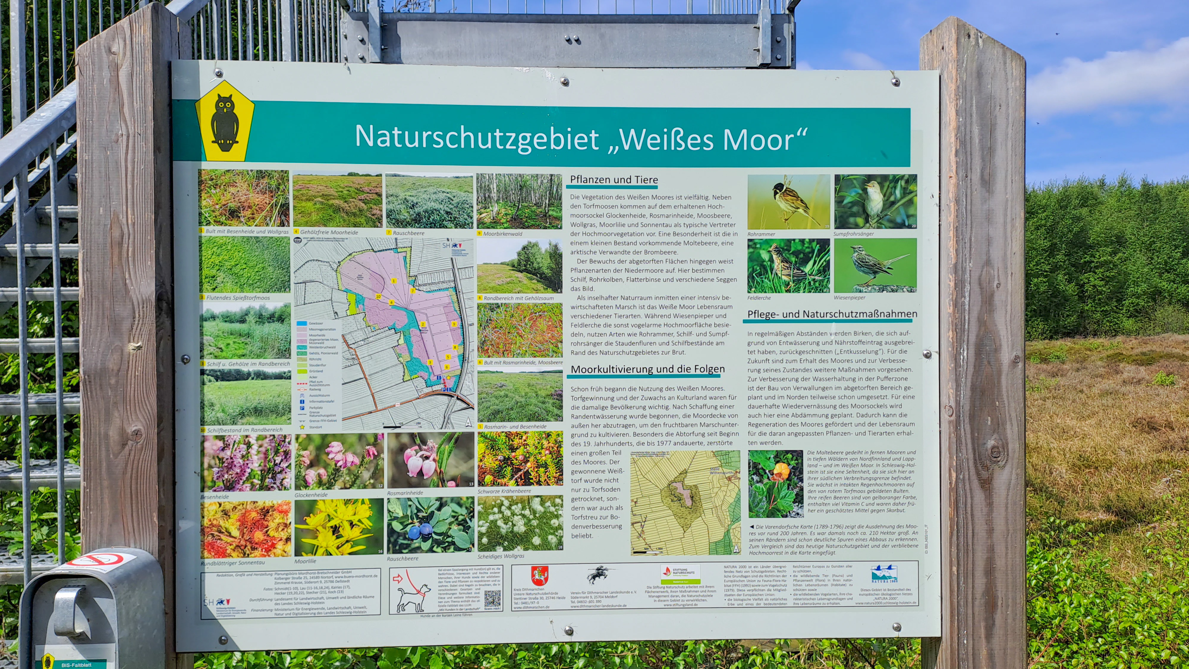
A large rectangular information sign titled Naturschutzgebiet Weißes Moor mounted on wooden posts, featuring a map, botanical and wildlife images, and explanatory text.
Information board at the entrance to the Weiße Moor nature reserve.

Weißes Moor history and protected-area timeline

Weißes Moor's conservation history begins with the establishment of the Naturschutzgebiet Weißes Moor on 3 April 1979, which entirely overlaps the later Natura 2000 designation. By the 1893 edition of the German imperial map, no peat cuttings had yet been undertaken within the moor, but by the 1953 to 1956 national map, numerous peat diggings had appeared around the bog's core. This historical peat extraction contributed to the degraded but restorable character of the current site.

The Natura 2000 Standard Data Sheet was drawn up in June 2004 by the state agency for agriculture, environment, and rural areas of Schleswig-Holstein. The site was proposed as a Site of Community Importance in September 2004, confirmed as such by the European Union in November 2007, and nationally designated as a special area of conservation in January 2010 under the Federal Nature Conservation Act and the corresponding Schleswig-Holstein state law.

From the 1980s onward, conservation managers began closing drainage ditches inside the nature reserve, building embankments around the raised bog, and installing a pump to return lost water back into the peat body. After the Natura 2000 designation, overflow weirs and peat boards were added to better control water levels, and the bog has been regularly cleared of invading shrubs to keep the open bog community intact. A management plan was published in January 2010 and a refreshed data sheet issued in May 2019, with a standard monitoring cycle every six years.

Weißes Moor landscape and geographic character

Weißes Moor occupies an exceptionally flat stretch of coastal marshland, with elevations ranging only from about 2 meters above sea level at the outer boundary to roughly 4 meters at the central dome of the raised bog. Its longest axis runs northwest to southeast for about 1.68 kilometers. The landscape rises gently from the wetter margins into the slightly elevated peat dome where the most intact bog vegetation still survives, before falling back toward the surrounding marsh.

The site sits within the Dithmarscher Marsch, a flat, historically reclaimed coastal plain built up from marine sediments, and is part of the larger Schleswig-Holsteinische Marschen und Nordseeinseln natural region that includes the North Sea fringing islands. Outside the protected area, this is a working agricultural landscape of pasture and arable fields, divided by drainage channels and crossed by regional roads including the Bundesstraße 5 along the site's eastern edge.

Internally, the landscape is defined by open peat bog, wet heath, and scrub. Drainage ditches that once lowered the water table have been largely blocked, and embankments now hold water within the bog. The internal topography is subtle, but the transition from raised bog core to surrounding wet heath and then to drier scrub and grassland creates the visual variety that the observation tower near the southern edge is designed to reveal.
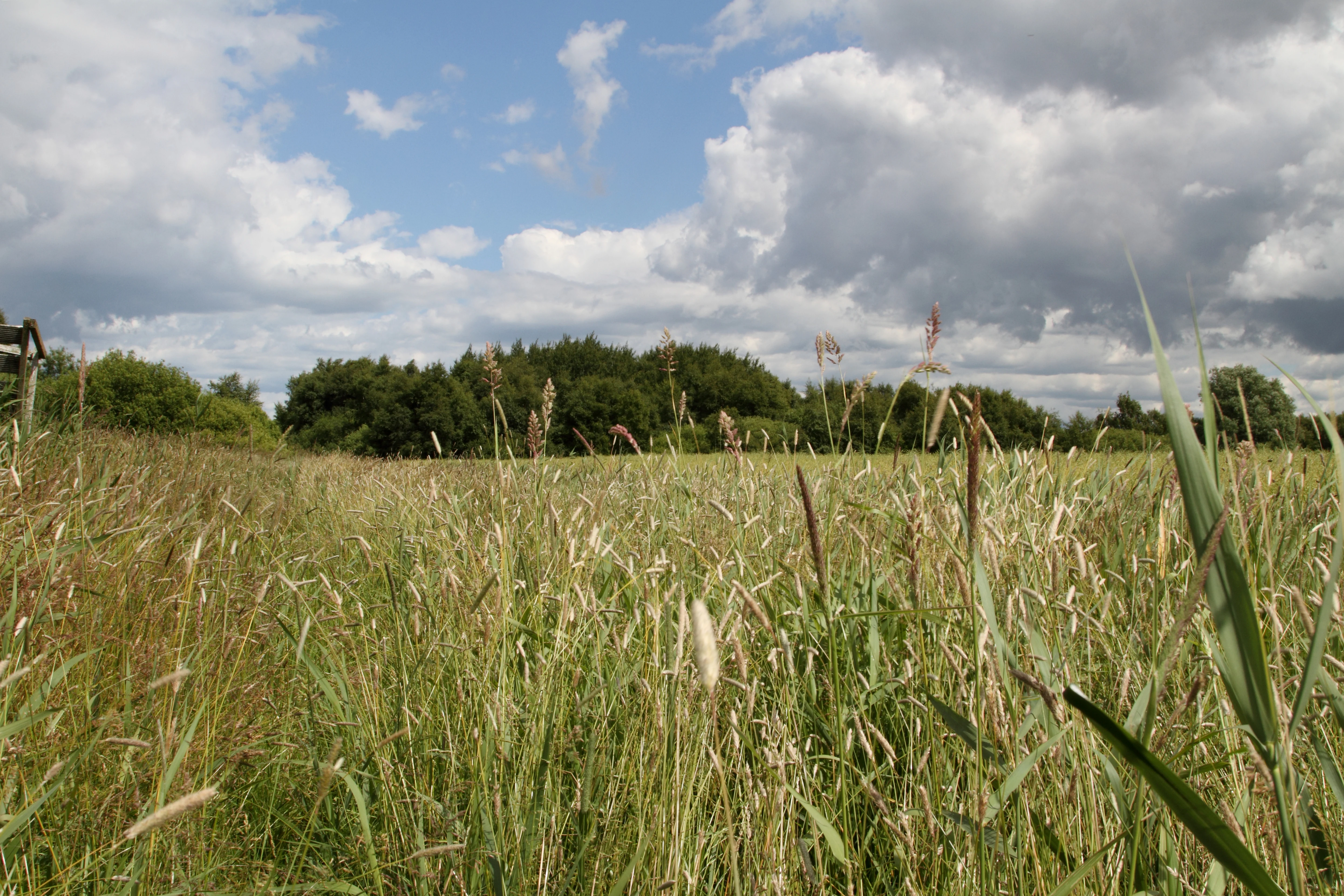
A low-angle view of a grassy meadow with tall reeds, with a line of trees in the distance under a cloudy blue sky.
Grasses and reeds characterize the landscape of the Weiße Moor nature reserve in Schleswig-Holstein.

Weißes Moor ecosystems, habitats, and plant life

Weißes Moor is fundamentally a peatland ecosystem, and more than two-thirds of its surface is classified as bogs, mires, and swamps. The core habitat is a degraded raised bog, which has lost some of its original structure through drainage and peat cutting but retains enough peat-forming potential to qualify as a restorable Annex I habitat type. The surrounding margins support transition mires and floating peat mat communities, which act as a transitional zone between the acid raised bog and the more mineral-rich marsh soils at the edge.

The remaining third of the site is dominated by heath and scrub communities, with mesophilic grassland and a small patch of arable land in the northwest. Across the site, roughly two-thirds of the surface carries habitat types that are also legally protected as biotopes under German law, with an additional small share of legally protected biotopes outside the formal Natura 2000 habitat categories.

The broader landscape context is unusual: although the Dithmarscher Marsch as a whole is considered of limited nature conservation interest by Germany's federal agency for nature conservation, the bog itself is recognized as regionally significant. Conservation activities are focused on maintaining high water levels, preventing shrub encroachment, and keeping the peat dome intact against the encroaching influence of surrounding intensive agriculture.
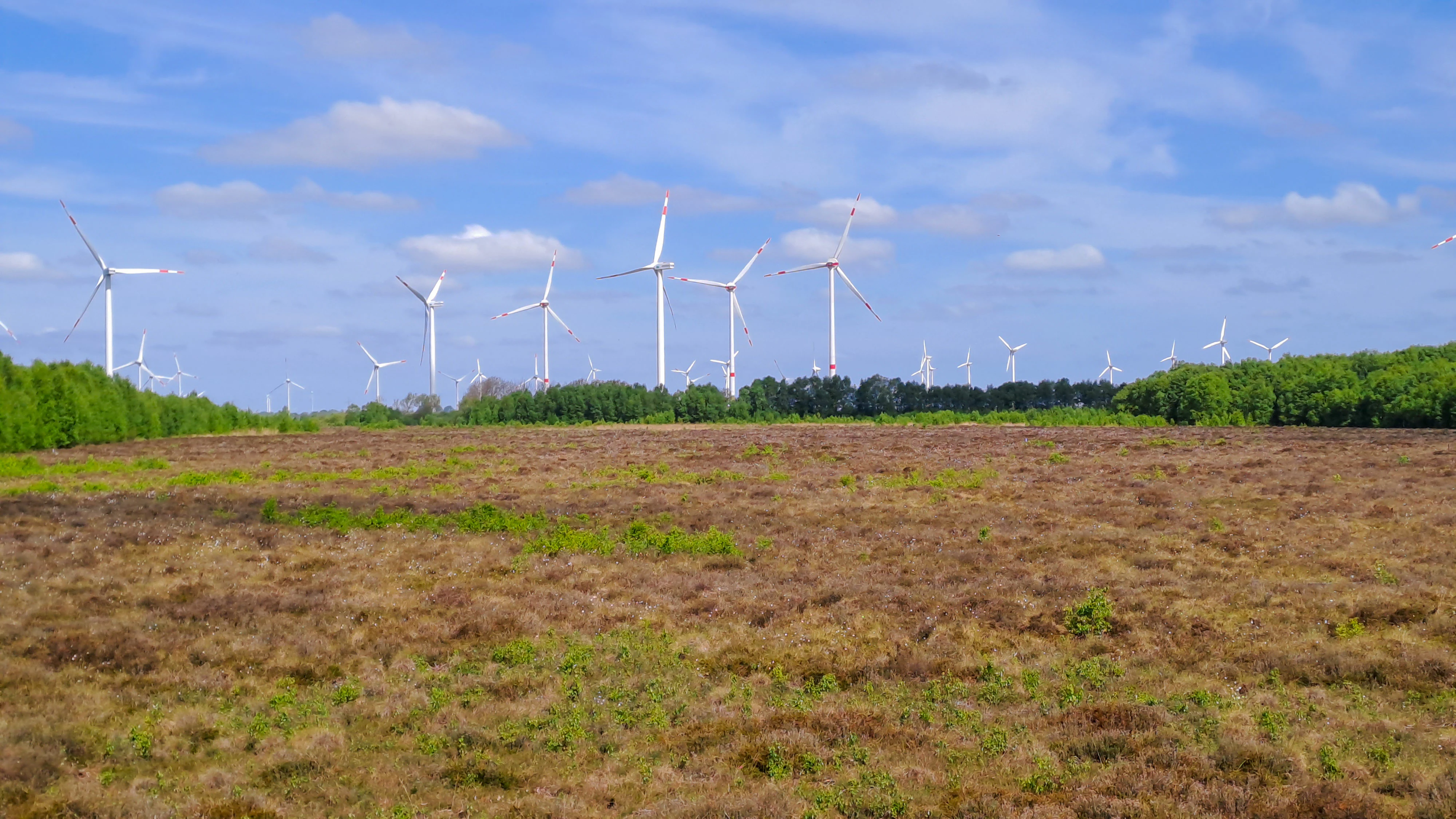
A wide view of a brownish, low-lying bog or moorland with a line of wind turbines standing above a dark green tree line in the distance under a blue sky with light clouds.
The Weiße Moor nature reserve features a low-lying bog landscape with extensive wind turbine infrastructure on the horizon.

Weißes Moor wildlife and species highlights

The source material focuses primarily on habitat types and conservation management rather than on specific animal species, so a detailed species list cannot be built from the available text. Weißes Moor is best understood ecologically as a peatland habitat complex rather than as a site defined by individual charismatic species. The combination of raised bog, transition mire, wet heath, and scrub creates conditions typical for bog-associated invertebrates, breeding and passage birds adapted to open wet peatland, and reptiles or amphibians tied to damp, sun-exposed peat surfaces and ditches.

The site's conservation prioritization for bog regeneration rather than for named species reflects the regional importance of the habitat itself. Maintaining open, waterlogged peat surfaces is the key condition for the wildlife communities associated with this kind of coastal bog, which are typically dominated by specialized rather than widely familiar species. Visitors should expect habitats to be more of an attraction than visible wildlife encounters, partly because public access to the interior is restricted.
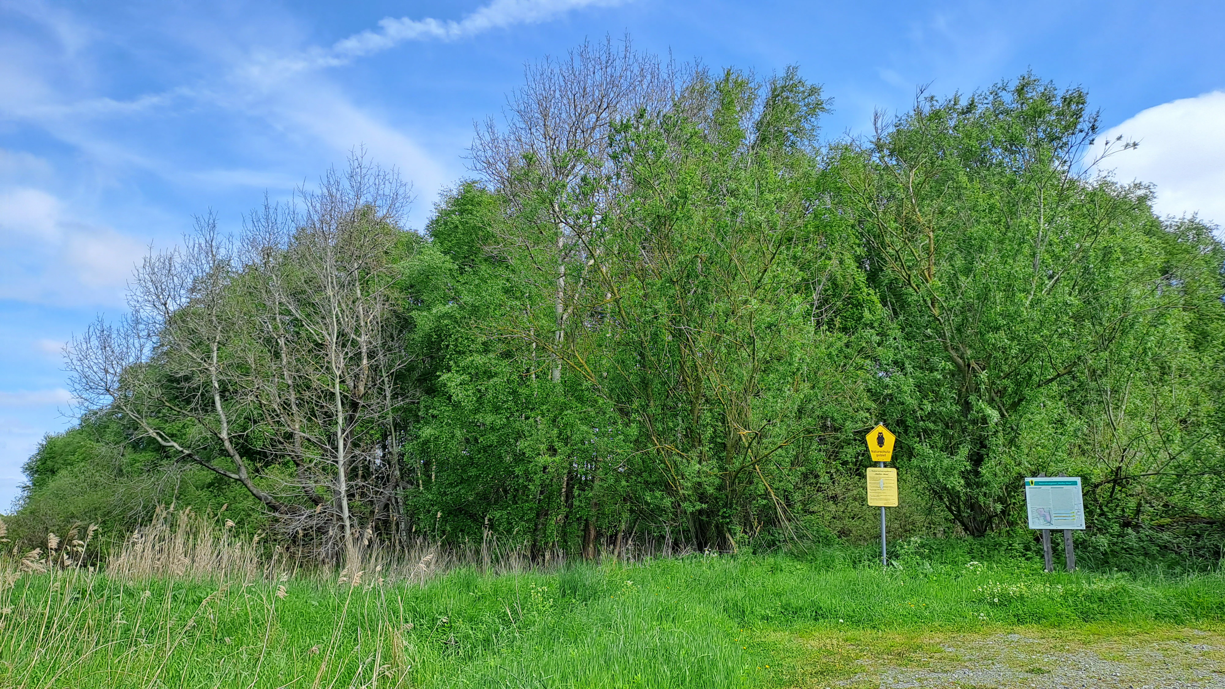
A green nature reserve sign and a yellow triangular warning or informational sign stand at the edge of a dense forest and grassy field.
Information signage at the perimeter of the Weiße Moor nature reserve.

Weißes Moor conservation status and protection priorities

Weißes Moor has a layered conservation status. It is fully covered by a nature reserve dating from 1979 and is simultaneously designated as a Natura 2000 FFH site, with the main conservation focus on degraded but regenerable raised bog habitat. The site's conservation value rests on the fact that it is the last remaining coastal marsh raised bog in Dithmarschen, an outlier of ecological importance within a heavily used agricultural coastal plain.

Land ownership strongly supports its management. The Stiftung Naturschutz Schleswig-Holstein owns the majority of the area, with only three small parcels in private hands along the southern tip and western margin. This ownership pattern means conservation rules, including the prohibition on deterioration of Natura 2000 habitats and the biotope protection regulation, can be effectively enforced across most of the site. Private owners are approached individually to enter voluntary agreements for habitat-friendly management on their lands.

Conservation management has centered on hydrological restoration. Since the 1980s, drainage ditches inside the nature reserve have been closed, embankments built around the high bog, and a pump installed to return lost water to the peat. After the Natura 2000 designation, overflow weirs and bog boards were added to stabilize water levels, and the bog has been periodically cleared of invading shrubs. Planned measures include completing full embankment of the raised bog surface, annual mowing or sheep grazing to maintain embankment vegetation, and the establishment of buffer strips to reduce nutrient and disturbance input from neighboring fields. The site also participates in regional support programs for low-intensity pasture on moor and marshland, and monitoring is carried out on the standard six-year Natura 2000 cycle in Schleswig-Holstein.

Weißes Moor cultural meaning and human context

Weißes Moor lies within Dithmarschen, a coastal region of Schleswig-Holstein historically defined by its reclaimed North Sea marshlands and a strong tradition of independent rural communities. The bog itself has been part of this working landscape for centuries, and historical peat cutting around its core left the imprint that today's conservation program is working to reverse. The site is not a destination for built heritage or cultural monuments, but its identity is closely tied to the agricultural and ecological history of the Dithmarschen Marsch.

Local civic engagement runs deep in the area. The Verein für Dithmarscher Landeskunde has been formally tasked with on-site educational and visitor guidance work under regional nature conservation law, and a broader Bündnis Naturschutz in Dithmarschen brings together the Stiftung Naturschutz Schleswig-Holstein, local water management authorities, the regional tourism organization, municipalities, conservation associations, and private citizens around conservation goals in the Dithmarschen area.
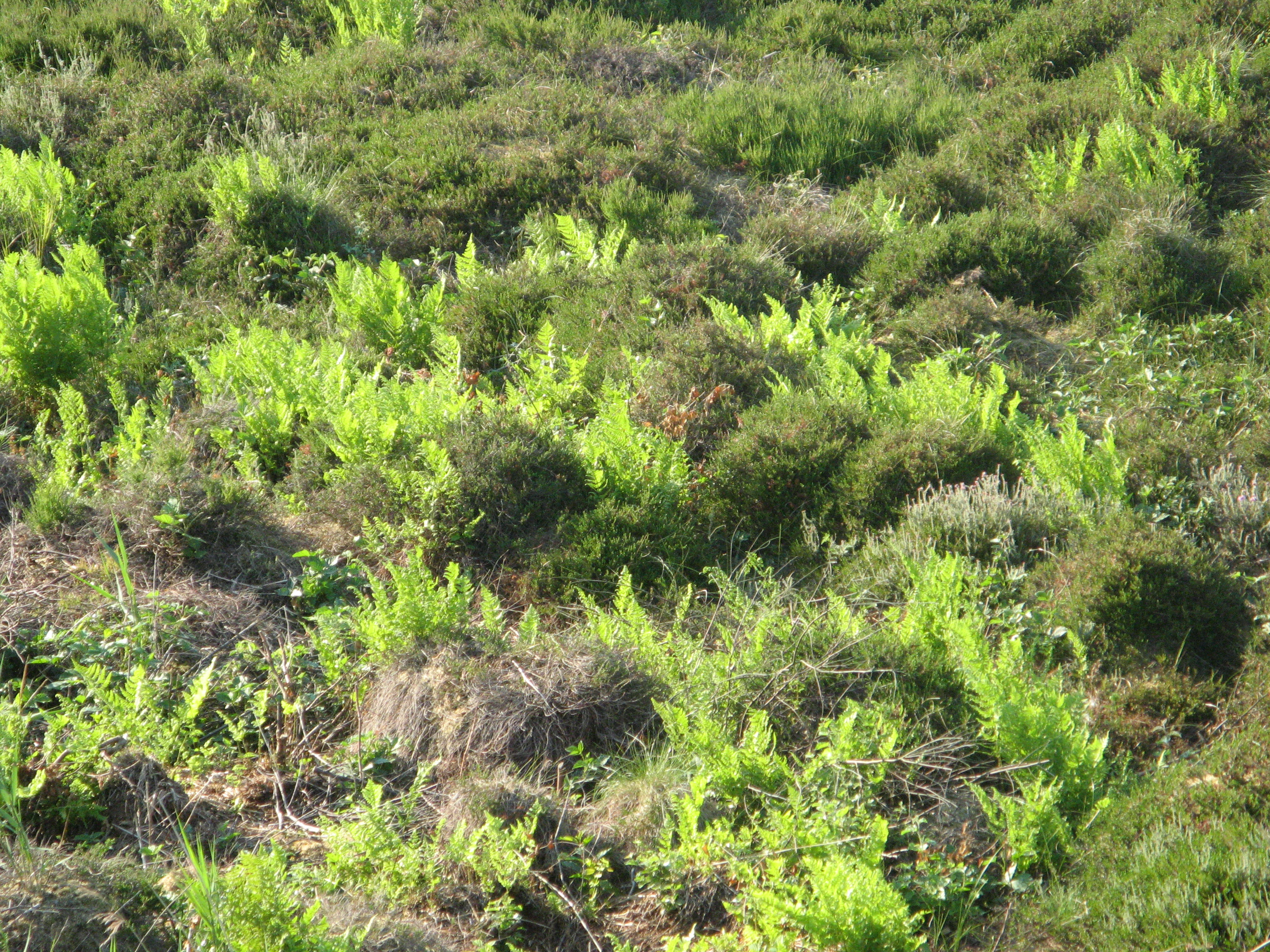
A close up view of ground level vegetation in a boggy area, showing clusters of bright green ferns intermixed with low-lying dark green shrubbery.
Low growing vegetation and ferns within the Weisse Moor nature reserve.

Top sights and standout views in Weißes Moor

Weißes Moor stands out as the last surviving coastal marsh raised bog in Dithmarschen, a habitat type essentially absent elsewhere in the regional landscape. Its modest 69-hectare footprint packs in the full sequence from raised bog core through transition mire to wet heath and scrub, all within a few meters of elevation. Long-running rewetting efforts, ownership by a major regional conservation foundation, and integration into a network of low-intensity pasture programs make it a practical model of small-scale bog restoration within an intensively used coastal plain.

Best time to visit Weißes Moor

Because public access is limited to a parking area, a short path, and an observation tower on the southern edge, the experience of visiting Weißes Moor centers on viewing the open bog landscape rather than walking within it. Conditions are most rewarding when the peat surface is visibly wet and the open bog vegetation stands out clearly against the surrounding green marshland; this typically aligns with the cooler, wetter seasons of the Dithmarschen coast when evaporation is lower and the restored water levels inside the embankments are most evident. Warmer months bring more vigorous shrub growth at the edges, which can partially obscure the contrast between bog and surrounding farmland. Visitors should generally expect quiet, low-traffic conditions and a short but specific experience rather than a long walk.


Monthly climate preview

Trace long-term average temperature swings and monthly precipitation totals across the protected landscape.

Weiße Moor Climate Normals: Annual Temperature and Monthly Precipitation Patterns

Representative coordinate measurements reveal annual temperature rhythms alongside monthly precipitation distributions from NASA climatology records. Reviewing the complete twelve-month sequence details the precise meteorological baseline established for the protected area.
Annual mean9 °C
2 °C18 °C
Jan
Feb
Mar
Apr
May12°
Jun15°
Jul17°
Aug18°
Sep15°
Oct11°
Nov
Dec
Warmest month
August

17.7 °C

Coolest month
February

2.1 °C

Wettest month
October

3.2 mm/day

Driest month
April

1.5 mm/day

Park location guide

Geography guide, regional context, and park location map for Weißes Moor

Weißes Moor park geography, regions, and map view in Germany

Understand where Weißes Moor sits in Germany through a broader geographic reading of the surrounding landscape, nearby location context, and its mapped position within the national park landscape.

How Weißes Moor fits into Germany

Germany is a federal republic in Western and Central Europe with a population of over 83 million across sixteen constituent states. It is Europe's largest economy by nominal GDP and a major global exporter and importer. The capital is Berlin, and the country borders Denmark, Poland, Czech Republic, Austria, Switzerland, France, Luxembourg, Belgium, and the Netherlands.

Wider geography shaping Weißes Moor in Germany

Germany is located in Western and Central Europe, spanning 357,022 km². It borders Denmark to the north, Poland and the Czech Republic to the east, Austria and Switzerland to the south, and France, Luxembourg, Belgium, and the Netherlands to the west. The country has coastlines on the Baltic Sea and North Sea to the north, with the Alps located in the southern region.

Map view of Weißes Moor

Use this park location map to pinpoint Weißes Moor in Germany, understand its exact geographic position, and read its mapped placement within the surrounding landscape more clearly.

Pigeon | © OpenStreetMap contributors

Location context for Weißes Moor

Schleswig-Holstein

Visualizing the rare raised bog habitats and coastal marsh terrain of Schleswig-Holstein

Weiße Moor Photos and Landscape Views of Northern Germany

Photographic records reveal the distinct peat domes, wet heath, and low-lying scrub communities defining Weiße Moor. Visual exploration helps clarify the ecological character and restoration zones of this protected coastal wetland.

A large rectangular information sign titled Naturschutzgebiet Weißes Moor mounted on wooden posts, featuring a map, botanical and wildlife images, and explanatory text.

A metal observation platform with a staircase next to an educational sign in a grassy area with trees.

A low-angle view of a grassy meadow with tall reeds, with a line of trees in the distance under a cloudy blue sky.

A wide view of a brownish, low-lying bog or moorland with a line of wind turbines standing above a dark green tree line in the distance under a blue sky with light clouds.

A green nature reserve sign and a yellow triangular warning or informational sign stand at the edge of a dense forest and grassy field.

A grassy trail leads into the distance through a wide, open meadow bordered by a dense line of trees under a cloudy sky.

A close up view of ground level vegetation in a boggy area, showing clusters of bright green ferns intermixed with low-lying dark green shrubbery.

Park atlas

Compare regional wetlands, coastal reserves, and northern lowland habitats

Explore Other Parks Near Weiße Moor and Surrounding Protected Landscapes

Discover related protected areas surrounding Weiße Moor to understand regional wetland distribution across the coastal plain. Continuing into neighboring conservation zones provides a broader geographical comparison of northern German peatland habitats.
Watercolor illustration of a landscape with green hills, a body of water, and grassy foregrounds
National parkSchleswig-Holstein
About 12 km away#1 closest

Northwest

Schleswig-Holstein Wadden Sea National Park: Germany's Largest Protected Tidal Landscape

Explore the mapped geography of this vital North Sea national park.

Schleswig-Holstein Wadden Sea National Park is a monumental protected area, recognized globally as a UNESCO World Heritage Site for its extraordinary tidal wetland ecosystem. This page offers detailed insights into its geographic scope, from the North Frisian Islands to the Elbe estuary, highlighting the dynamic interplay of mudflats, salt marshes, and coastal terrain. Discover the park's critical role as a migratory bird flyway and marine nursery, providing rich data for geographic and atlas exploration of this unique North Sea protected landscape.

Area
4,410 km²
Established
1985
IUCN
II
Visitors
1.7M annual
Protected areaSchleswig-Holstein
About 21 km away#2 closest

Northeast

Wälder der Ostenfelder Geest: Geographic Mapping of Protected Forests in Northern Germany

A twelve-parcel woodland mosaic in the Schleswig-Holstein Geest.

Wälder der Ostenfelder Geest serves as a prime example of lowland conservation. This protected area connects diverse forest types across a glacial landscape, providing a stable habitat for beech and oak woodland communities while preserving the historic character of the Bredstedt-Husumer terrain.

Area
7.33 km²
Established
2004
Relief
Lowland
Climate
Temperate
Protected areaGermany
About 21 km away#3 closest

East

FFH-Gebiet Wald westlich Wrohm: Protected Forest and Geographic Mapping

Examining historic woodland remnants in the Dithmarschen district.

FFH-Gebiet Wald westlich Wrohm represents an intact matrix of native broadleaf forest within an open agricultural mosaic. This site preserves rare habitat types on a historic geest ridge, acting as a protected island for forest ecology in Northern Germany. Explore the mapped boundaries, floodplain brooks, and characteristic hedgerow landscape that define this important conservation area.

Area
0.26 km²
Established
2004
Relief
Upland
Climate
Temperate
Nature reserveSchleswig-Holstein
About 23 km away#4 closest

South

FFH-Gebiet Windberger Niederung: Exploring the Coastal Mire and Peatland Geography

Protected Natura 2000 landscape in Dithmarschen, Germany

This nature reserve encompasses a flat, post-glacial mosaic of transitional bogs and calcareous fens near the North Sea coast. Its geography is defined by low-lying terrain that spans from sea level to five meters above, showcasing the remnants of historical coastal lagoons and drained mires that now serve as a cornerstone for biotope conservation in the Schleswig-Holstein region.

Area
3.63 km²
Established
2004
Nature reserveSchleswig-Holstein
About 24 km away#5 closest

Northeast

FFH-Gebiet Wälder bei Bergenhusen: Geographic Profile of Northern German Protected Woodlands

Protected forest habitat and historical geest landscapes in Schleswig-Holstein

Covering roughly 145 hectares within the Eider-Treene-Sorge lowland, this nature reserve protects a rare sequence of deciduous forest types and nutrient-rich aquatic habitats. The site is characterized by its distinct northern and southern parcels, which reveal the interplay between post-glacial geomorphology and long-standing human land use patterns preserved through centuries of forestry.

Area
1.45 km²
Established
1999
Relief
Lowland
Climate
Temperate
Nature reserveSchleswig-Holstein
About 33 km away#6 closest

East

Wald östlich Hohn Nature Reserve: Ancient Broadleaf Forest Geography and Mapped Boundaries

Protected glacial moraine woodland in Schleswig-Holstein

Spanning roughly twelve hectares near Hohn, this nature reserve safeguards centuries-old broadleaf forest communities including beech and oak-hornbeam stands. The site is a significant protected area within the Schleswig-Holstein Geest, illustrating how ancient wooded islands persist amid intensive modern agricultural landscapes through formal Natura 2000 conservation status.

Area
0.118 km²
Established
2004
Relief
Lowland
Climate
Temperate
Nature reserveSchleswig-Holstein
About 35 km away#7 closest

Northeast

FFH-Gebiet Übergangsmoor im Kropper Forst: Protected Landscape and Mire Geography

A study of transitional mire habitats in Schleswig-Holstein.

This protected area centers on a treeless mire depression embedded within the coniferous Gehege Kropp forest. Covering 18 hectares of glacial terrain, the site illustrates the delicate balance of mire hydrology and the long-term ecological impact of regional landscape management in northern Germany.

Area
0.18 km²
Established
2004
Relief
Lowland
Climate
Temperate
Nature reserveSchleswig-Holstein
About 36 km away#8 closest

East

Wälder der nördlichen Itzehoer Geest: Protected Area and Forest Landscape Atlas

Natura 2000 ancient woodland in Schleswig-Holstein

Explore the geography of Wälder der nördlichen Itzehoer Geest, featuring four historical forest tracts across glacial moraines. This protected area highlights Atlantic acid beech forests and floodplain habitats, preserving centuries-old woodland continuity within the broader Schleswig-Holstein landscape.

Area
7.11 km²
Established
2004
Relief
Upland
Climate
Temperate

Common questions about visiting, size, designation, and location context for Weißes Moor

Weißes Moor FAQs for park facts, access, geography, and protected area context

Find quick answers about Weißes Moor, including protected-area facts, park geography, trail and visitor context, and how the park fits into its surrounding country and regional landscape.
MoriAtlas Explorer

Continue Your Protected Areas Search Across the Global Atlas

Deepen your exploration by continuing the structured search for national parks and protected areas worldwide. Utilize the comprehensive filtering capabilities to compare different conservation landscapes and refine your understanding of global park geography. Discover more about the distribution and characteristics of protected natural areas.

Global natural geography