
Mori Atlas logo
Nature reserveFFH-Gebiet Wellspanger-Loiter-Oxbek-System und angrenzende Wälder

A complex landscape of glacial streams, bog woodlands, and coastal forest habitats

FFH-Gebiet Wellspanger-Loiter-Oxbek-System und angrenzende Wälder Protected Nature Reserve

The FFH-Gebiet Wellspanger-Loiter-Oxbek-System und angrenzende Wälder represents a significant conservation area within the Schleswig-Holstein region of Germany. This protected landscape encompasses an interconnected system of lowland rivers and lakes that feed into the Schlei inlet, alongside diverse forest blocks ranging from ancient beech stands to bog woodlands. Visitors can trace the intricate hydrologic network of the Wellspanger, Loiter, and Füsinger Au, observing the interaction between morainic topography and fragile aquatic habitats.

Natura 2000FFH sitelowland riversbeech forestbog woodlandheathland
A graphic illustration showing a river winding through a valley flanked by cliffs, a waterfall, pine trees, and distant mountains under a soft sun.

FFH-Gebiet Wellspanger-Loiter-Oxbek-System und angrenzende Wälder

Nature reserve

Park overview

Structured park overview, official facts, and landscape profile for Wellspanger-Loiter-Oxbek System and Adjacent Forests

Wellspanger-Loiter-Oxbek System and Adjacent Forests park facts, protected area profile, and essential visitor context

Review the core facts for Wellspanger-Loiter-Oxbek System and Adjacent Forests, including designation, size, terrain, visitor scale, habitats, and operating context in one park-focused overview.

About Wellspanger-Loiter-Oxbek System and Adjacent Forests

Wellspanger-Loiter-Oxbek and the Adjacent Forests form one of the more complex Natura 2000 sites in northern Germany. Rather than being a single continuous reserve, the site is a mosaic of sub-areas spread across the rural Angeln landscape between Schleswig and Süderbrarup. Some are linear river corridors, while others are blocks of state forest, heathland on former military ground, or patches of bog and wet woodland.

At the heart of the system is the network of slow lowland rivers that rise from morainic terrain and converge before reaching the Schlei. The Wellspanger Au drains the Langsee near Wellspanger and flows south through wet meadows before joining the Loiter Au. After picking up the Boholzer Au and Oxbek near the Brebelholz forest, the river continues as the Loiter Au and then becomes the Füsinger Au, which empties into the Schlei near Füsing. Along the way, the streams form sheltered valleys with alder floodplain forest, sedge meadows, reedbeds and locally important populations of protected aquatic plants.

Alongside the rivers, the forest sub-areas add a strong woodland character. The largest forested unit, Idstedtwege and Karenberg, contains old beech stands, Scots spruce plantation, heath patches, small mires and ponds created from historic fish ponds. Other sub-areas include the dune and bog complex near Idstedt-Osterfeld, the small Brebelholz and Billwatt units protecting wet meadows along the Oxbek, and the Broholm forest near the Füsinger Au, which lies within the Naturpark Schlei. Together these woodlands support important breeding and foraging habitat for bats and forest birds.

A distinctive and somewhat unusual dimension of the protected area is the Neuberend sub-area, which overlaps with a former Bundeswehr pioneer and air-force training ground. Once military use declined following the suspension of conscription in 2011, large parts of the terrain began to revert to open heath, sand-dune vegetation, dystrophic pools and bog woodland, creating habitats rare elsewhere in the region. The combination of natural river dynamics, forest history and post-military rewilding gives the site a layered ecological identity.

Quick facts and research context for Wellspanger-Loiter-Oxbek System and Adjacent Forests

The Wellspanger-Loiter-Oxbek System and Adjacent Forests is a Natura 2000 Fauna-Flora-Habitat (FFH) site in Schleswig-Holstein, northern Germany. It covers roughly 1,434 hectares across the Angeln peninsula in the Kreis Schleswig-Flensburg and stretches about 18.7 kilometres in a roughly north-east to south-west orientation.

The protected area is divided into three main management units: forested SHLF areas, the linear waterways sub-area, and the Neuberend sub-area on a former military training ground. Its habitat mix includes beech forest, oak forest, bog woodland, heathland, inland dunes, wet meadows, calcareous springs and lowland streams. The area is administered under German federal and Schleswig-Holstein nature conservation law and was proposed as a Site of Community Importance in 2004 before being confirmed in 2007 and nationally designated as a Special Area of Conservation in 2010.

Protection and recognition

Documented protection history, terrestrial scope, and designation records

FFH-Gebiet Wellspanger-Loiter-Oxbek-System und angrenzende Wälder Protection Status

Terrestrial protection status for FFH-Gebiet Wellspanger-Loiter-Oxbek-System und angrenzende Wälder establishes official designation records dating from 2010. Documented scope details provide essential background for understanding the conservation framework governing this protected area.

Protection details

Protection scope
Terrestrial
Designated year
2010
Transboundary protection
No
WDPA ID
555517804
Park context

Deeper park guide and search-rich context for Wellspanger-Loiter-Oxbek System and Adjacent Forests

Wellspanger-Loiter-Oxbek System and Adjacent Forests history, landscape, wildlife, and travel context

Explore Wellspanger-Loiter-Oxbek System and Adjacent Forests through its history, landscape character, ecosystems, wildlife, conservation priorities, cultural context, and seasonal travel timing in a structured park guide built for atlas discovery and search intent.

Why Wellspanger-Loiter-Oxbek System and Adjacent Forests stands out

The area is best known for its interconnected lowland river system feeding into the Schlei, paired with patches of high-quality beech and bog woodland. It is recognised at the European level for the diversity of Annex I habitat types concentrated in a single rural landscape. Priority habitats such as bog woodland, calcareous springs and alluvial alder-ash forests are particularly notable. The waterways sub-area is ecologically central because it links the small rivers Wellspanger Au, Loiter Au, Füsinger Au, Oxbek and Boholzer Au with the Langsee, creating a chain of still and flowing water bodies. The rivers are home to protected species like the spined loach and brook lamprey, while surrounding wet forests and heaths add significant biodiversity value.
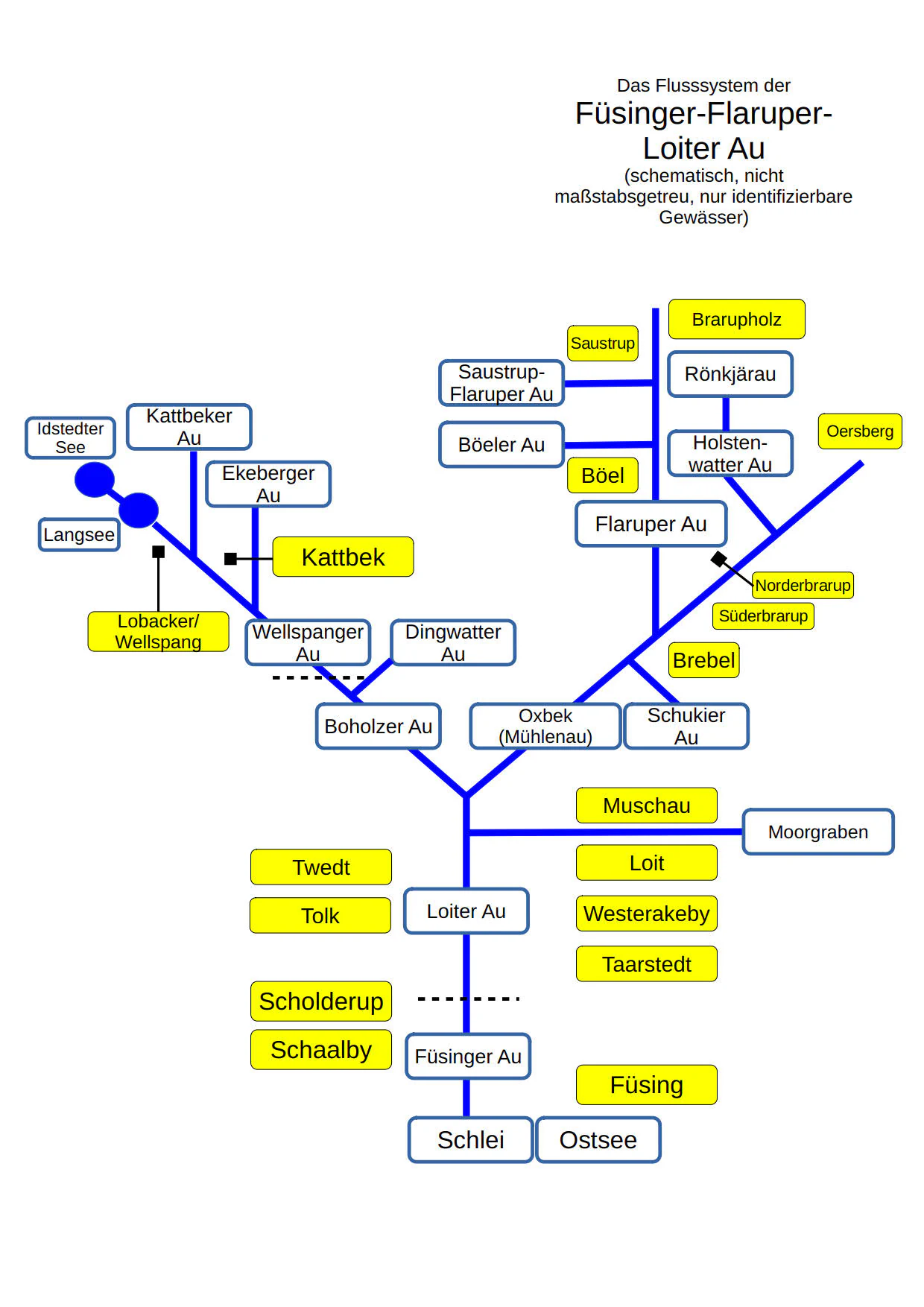
A schematic diagram showing the interconnected river network of the Füsinger, Flaruper, and Loiter Au streams, including labels for towns and specific water bodies.
Schematic diagram showing the river system of the Füsinger, Flaruper, and Loiter Au.

Wellspanger-Loiter-Oxbek System and Adjacent Forests history and protected-area timeline

The Natura 2000 standard data form for the site was prepared in June 2004 by the Schleswig-Holstein State Office for Agriculture, Environment and Rural Areas. It was proposed as a Site of Community Importance in September 2004, confirmed by the European Union in November 2007 and nationally designated as a Special Area of Conservation in January 2010 under the German Federal Nature Conservation Act together with the Schleswig-Holstein Nature Conservation Act.

Because the site spans many landowners and land uses, separate management plans were drawn up for the SHLF forest areas, the waterways sub-area and the Neuberend sub-area. The forest management plan was followed by first cartography in 2006 and a follow-up survey in 2012, which identified no significant changes in habitats. The waterways management plan was published in December 2017 by the Ministry for Energy Transition, Agriculture, Environment, Nature and Digitalisation. The Neuberend plan was released in May 2016 by federal authorities responsible for Bundeswehr infrastructure and federal forests, followed by a detailed care and development plan in December 2017.

The Neuberend sub-area has a particularly layered history. The military training ground was set up between 1958 and 1968 and served as a pioneer training site until March 2003, when the last major Bundeswehr unit stationed in Schleswig, Pionierbataillon 620, was disbanded. After conscription was suspended in July 2011 and many Schleswig-Holstein military sites were closed, use of the area progressively declined. By September 2017 the official site user was Taktisches Luftwaffengeschwader 51 Immelmann at Jagel, and the heavily reduced military activity has allowed natural succession across much of the terrain.

The wider Angeln landscape carries much older human history as well. The forested area around Idstedtwege contains a megalithic collective grave popularly known as the Idstedter Räuberhöhle, accessible from a nearby district road. The Karenberg forest holds a mass grave associated with the Battle of Idstedt in July 1850 during the Schleswig-Holstein Uprising, while another forest sub-area near Idstedt-Osterfeld still contains visible remains of nineteenth-century trenches from the same battle.

Wellspanger-Loiter-Oxbek System and Adjacent Forests landscape and geographic character

The protected area sits in a gently rolling post-glacial landscape on the Angeln peninsula. Elevation runs from about 0.5 metres near the mouth of the Füsinger Au at the Schlei to approximately 52.4 metres in the Gehege Idstedtwege in the west, with overall relief differences in the forest of up to 30 metres. Morainic hills, glacial sands and peat-filled depressions create a mosaic of dry ridges and wet basins that supports both forest and open habitats.

Hydrologically, the area is dominated by elongated lowland streams and a long narrow lake. The central Langsee is roughly 5 kilometres long and up to 420 metres wide, feeding the Wellspanger Au, which later becomes the Loiter Au and Füsinger Au on its way to the Schlei. Tributaries such as the Boholzer Au, Oxbek and Flaruper Au add to the system. The river valleys are typically 80 to 100 metres wide within the protected area and combine natural meanders, straightened agricultural stretches, weir structures and small backwaters.

An unusually varied inland dune and heath landscape is found in the Neuberend sub-area and around Idstedt-Osterfeld. Here former glacial sand deposits have built low dunes, kettle mires and dry heath. Slightly higher ground is occupied by old beech and oak forest, while the lower and wetter ground carries alder and ash floodplain forest, bog woodland and sedge mire. The contrast between low forest hills, open heath dunes and dark bog hollows gives the wider site a strongly varied, though subtly expressed, topography.
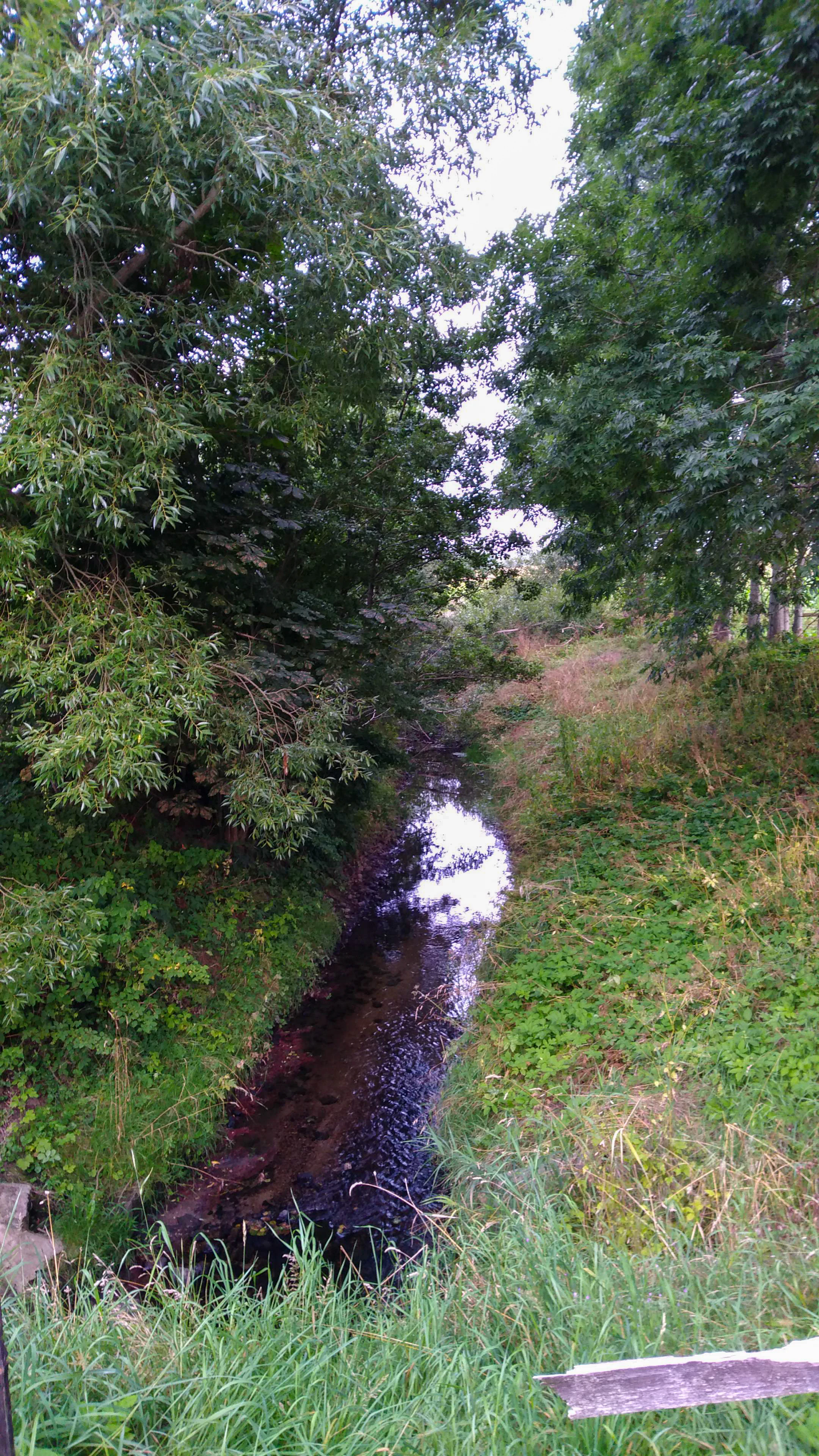
A narrow stream flows through a lush, tree-lined valley with overhanging green foliage and grassy banks.
A small, shaded stream flowing through the protected landscape of the Wellspanger-Loiter-Oxbek system.

Wellspanger-Loiter-Oxbek System and Adjacent Forests ecosystems, habitats, and plant life

Ecologically, the area is defined by the interaction between lowland rivers, nutrient-poor wetlands and ancient forest. Forests are dominated by different types of beech woodland, including Hainsimsen-Buchenwald on more acidic soils and Waldmeister-Buchenwald on richer substrates, with smaller shares of old acidic oak forest on sandy ground, bog woodland in peat-filled depressions and alluvial alder-ash forest along the rivers. More than three quarters of the SHLF forest sub-area consists of beech woodland, with heath forming roughly one fifth of the surface.

The stream system supports a rich freshwater ecology. Annex I habitat types in the waterways sub-area include naturally nutrient-rich stillwaters with pondweed and frogbit communities, dystrophic stillwaters, lowland streams with submerged vegetation, transition and quaking bogs, molinia meadows, tall herb fringes, lowland hay meadows and small calcareous springs. Several plant species recorded in the area are listed on the Schleswig-Holstein Red List, with species such as flutender Sellerie, kleiner Wasserschlauch and Knöterich-Laichkraut classified as endangered.

Semi-open landscapes include dry heaths, wet heaths with cross-leaved heath on sand dunes inland, small patches of inland dunes, and species-rich grasslands used for extensive grazing or mowing. The Neuberend training-ground landscape in particular preserves an unusual combination of inland dunes, dry heath, wet heath, dystrophic pools and bog woodland that has developed after reduced military use. This mosaic supports high biodiversity in a relatively confined area and is one of the most distinctive features of the site.
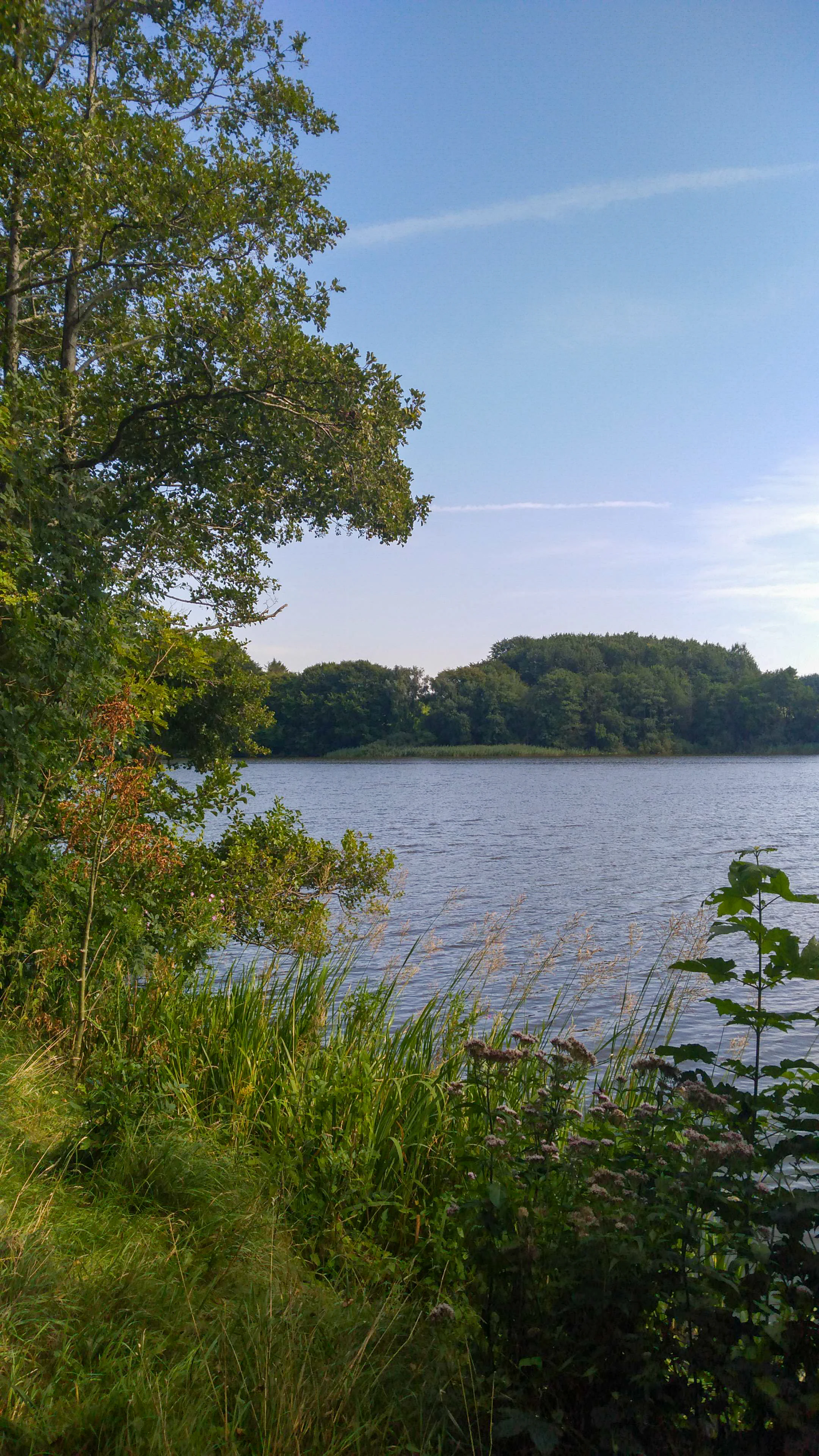
A wide view of a lake surface with dense green trees along the shoreline under a clear blue sky.
A serene view of a lake shore and surrounding riparian forest within the protected area.

Wellspanger-Loiter-Oxbek System and Adjacent Forests wildlife and species highlights

The site is important for a number of protected animal species alongside its habitat diversity. The waterways sub-area is home to fish species listed under the EU Habitats Directive, including the spined loach and the brook lamprey. Otters use the stream network and its fish-rich stretches, while great crested newts inhabit suitable ponds and wet forest edges. Four bat species have been recorded in the area, and additional reports include the moor frog.

The Broholm forest sub-area supports bats such as the common noctule and Nathusius's pipistrelle, as well as wetland-associated birds including the white-tailed eagle, eagle owl and black woodpecker, with the pond bat and mosquito bat also reported. Forest birdlife benefits from old beech and oak stands, while open heath and dune areas in the Neuberend sub-area provide habitat for heathland specialists. Together, these records indicate the area's role as a stepping stone for protected fauna between the Schlei coast and the inland forests of Angeln.
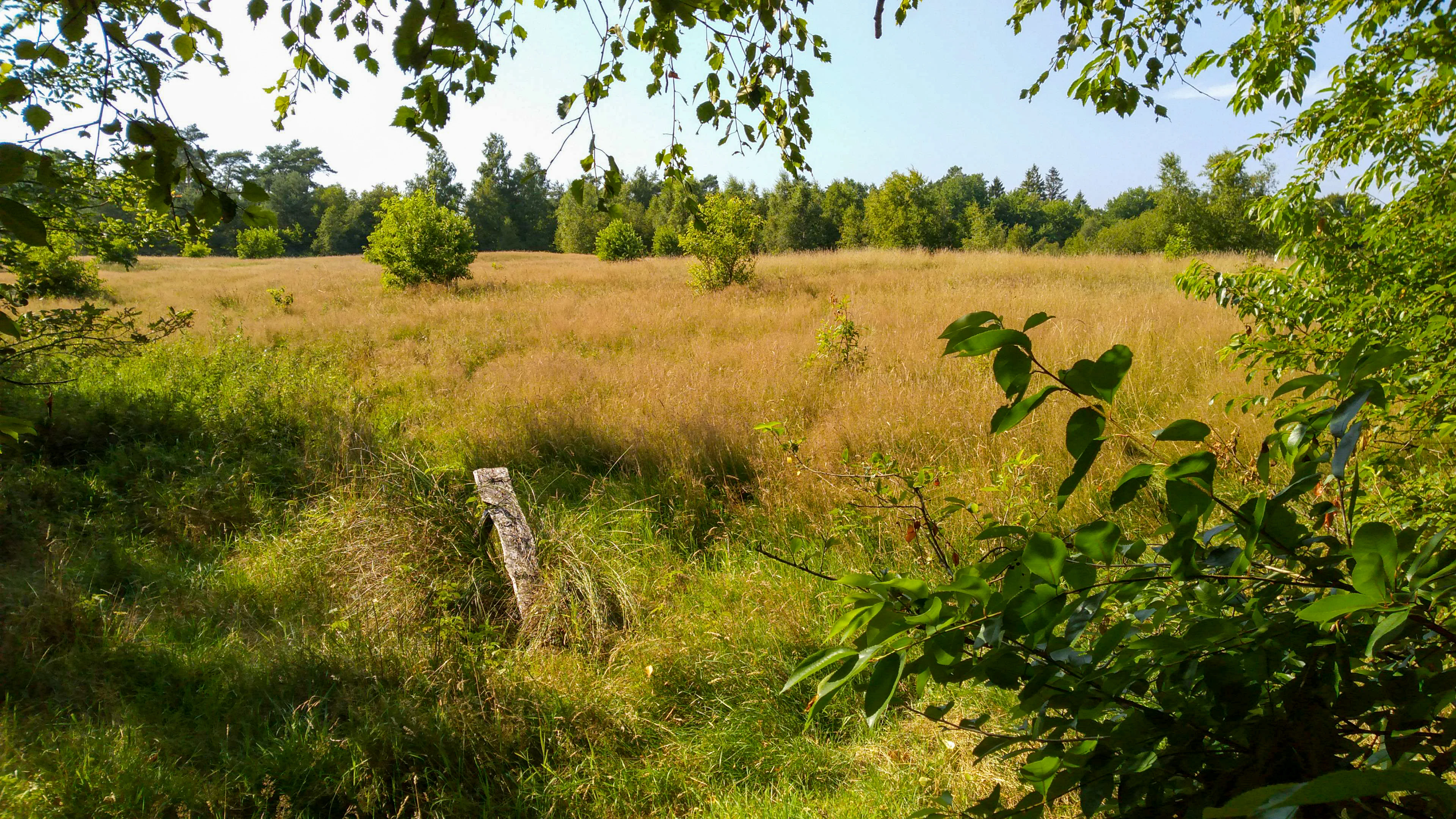
A wide view of a sunlit grassy field framed by green deciduous tree branches in the foreground, with a dense forest line in the background under a clear sky.
A view of the meadows and forest margins at Idstedtosterfeld.

Wellspanger-Loiter-Oxbek System and Adjacent Forests conservation status and protection priorities

From a conservation perspective, the site is significant because it unites a wide spectrum of EU Habitats Directive habitats and species within a single rural landscape. These include several priority habitat types such as bog woodland, calcareous springs and alluvial alder-ash forests. Protection therefore extends across forest, freshwater, mire and open-land habitats, an unusually broad mix for an inland Natura 2000 site in Schleswig-Holstein.

Management focuses on raising groundwater levels to protect mires and buffer forests against drought, which is seen as a central task given the impacts of storm damage and climate change. This includes dismantling drainage systems and installing additional water-retention structures. Other priorities are converting conifer stands to broadleaf forest, preserving old trees and deadwood, maintaining grazing and mowing to prevent heath and grassland succession, and reducing nutrient and sediment inputs from surrounding farmland to protect river habitats.

The formal Natura 2000 designation process is documented through German federal and EU-level steps: data form preparation in 2004, proposal as a Site of Community Importance that year, EU confirmation in 2007 and national designation as a Special Area of Conservation in 2010. Multiple sub-area management plans, a six-yearly monitoring cycle and involvement of state, federal and military authorities show that the site is treated as a long-term conservation responsibility rather than a short-term project.

Wellspanger-Loiter-Oxbek System and Adjacent Forests cultural meaning and human context

The cultural layer of the landscape is unusually visible for a nature protection site. The Gehege Idstedtwege contains a megalithic collective grave known locally as the Idstedter Räuberhöhle, which is publicly accessible from a nearby road with an information board. The Karenberg forest contains a mass grave linked to the Battle of Idstedt of July 1850, which was a decisive engagement of the First Schleswig War.

In the Idstedt-Osterfeld sub-area, remains of nineteenth-century trenches from the same battlefield are still visible in the terrain and are protected as historical monuments. A small forest section near Broholm contains a tumulus grave, and the broader area has been shaped for centuries by water mills, farm clearings, fish-pond systems and traditional grazing. The twentieth-century military history of the Neuberend training ground adds a more recent cultural dimension, while the area's location within the Naturpark Schlei ties it into a broader regional framework for landscape-based recreation and environmental education.
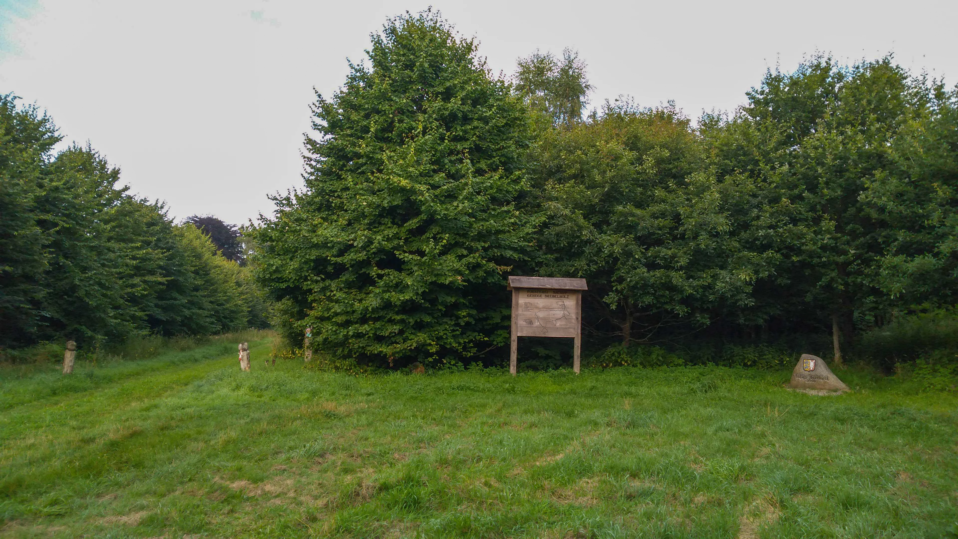
A wooden information sign stands on a grassy clearing at the edge of a dense deciduous forest, with a small trail marker visible on a stone in the foreground.
An information sign at the edge of the Brebelholz forest area within the Wellspanger, Loiter, and Oxbek river system.

Top sights and standout views in Wellspanger-Loiter-Oxbek System and Adjacent Forests

The site is notable for combining a complete lowland river system with extensive beech forest, rare bog woodland and an unusual post-military heathland complex. The rivers Wellspanger Au, Loiter Au, Füsinger Au, Oxbek and Boholzer Au connect in a single network that links inland lakes to the Schlei, producing a corridor of stillwaters, flowing waters, wet meadows and alluvial forest.

The forested Idstedtwege and Karenberg sub-area carries the best-preserved old beech stands, including trees over 220 years old and parts designated as natural forest. The Broholm forest offers accessible walking routes, a forest kindergarten and educational infrastructure within the Naturpark Schlei. The Neuberend training ground provides the most distinctive open-land habitats, with inland dunes, wet and dry heath, dystrophic pools and bog woodland. Together these features create a rich Natura 2000 site where forest, freshwater and heathland conservation meet.
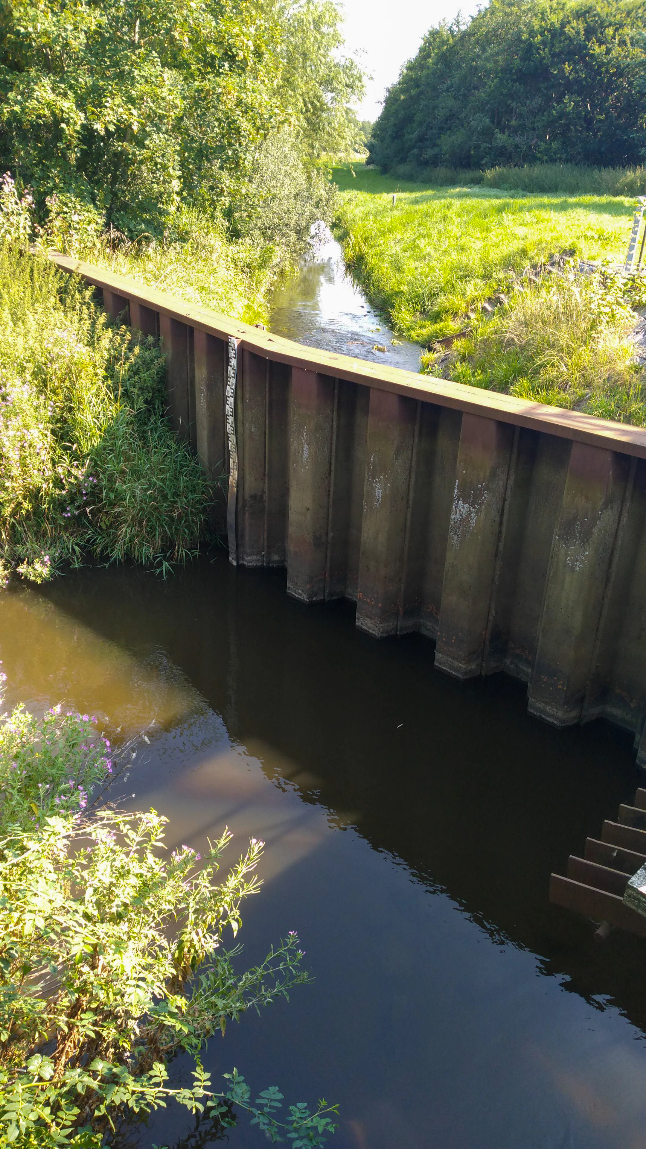
A small stream flowing past a tall, rusted steel sheet piling wall, with lush green trees and grasses in the background.
A steel sheet piling structure regulating water flow within the Wellspanger-Loiter-Oxbek protected area.

Best time to visit Wellspanger-Loiter-Oxbek System and Adjacent Forests

Spring and early summer are generally the most rewarding seasons for observing the area, when wet meadows and river margins are lush, bog plants are flowering and forest birdlife is most active. Summer brings full leaf cover in the beech forests, which can make interior exploration more shaded, but open heaths and dunes in the Neuberend sub-area are at their most colourful.

Late summer and early autumn are good for spotting fungi, observing flowing water levels after the warmest months and approaching bat habitats around dusk. The site is largely used for quiet countryside walking; heavy rainfall can flood low-lying meadows and make some forest paths harder to use, while frost-free, mild days in late spring are excellent for amphibians along the wet woodland edges.


Monthly climate preview

Long-term temperature and monthly precipitation patterns across representative coordinates

FFH-Gebiet Wellspanger-Loiter-Oxbek-System und angrenzende Wälder Climate Normals

Representative coordinate records show measured annual temperature and precipitation rhythms across twelve distinct monthly intervals for FFH-Gebiet Wellspanger-Loiter-Oxbek-System und angrenzende Wälder. Detailed monthly climate profiles provide deeper analytical context for long-term averages without relying on short-term weather forecasts.
Annual mean9 °C
1 °C17 °C
Jan
Feb
Mar
Apr
May12°
Jun15°
Jul17°
Aug17°
Sep14°
Oct10°
Nov
Dec
Warmest month
August

17.4 °C

Coolest month
January

1.3 °C

Wettest month
August

2.7 mm/day

Driest month
April

1.4 mm/day

Park location guide

Geography guide, regional context, and park location map for Wellspanger-Loiter-Oxbek System and Adjacent Forests

Wellspanger-Loiter-Oxbek System and Adjacent Forests park geography, regions, and map view in Germany

Understand where Wellspanger-Loiter-Oxbek System and Adjacent Forests sits in Germany through a broader geographic reading of the surrounding landscape, nearby location context, and its mapped position within the national park landscape.

How Wellspanger-Loiter-Oxbek System and Adjacent Forests fits into Germany

Germany is a federal republic in Western and Central Europe with a population of over 83 million across sixteen constituent states. It is Europe's largest economy by nominal GDP and a major global exporter and importer. The capital is Berlin, and the country borders Denmark, Poland, Czech Republic, Austria, Switzerland, France, Luxembourg, Belgium, and the Netherlands.

Wider geography shaping Wellspanger-Loiter-Oxbek System and Adjacent Forests in Germany

Germany is located in Western and Central Europe, spanning 357,022 km². It borders Denmark to the north, Poland and the Czech Republic to the east, Austria and Switzerland to the south, and France, Luxembourg, Belgium, and the Netherlands to the west. The country has coastlines on the Baltic Sea and North Sea to the north, with the Alps located in the southern region.

Map view of Wellspanger-Loiter-Oxbek System and Adjacent Forests

Use this park location map to pinpoint Wellspanger-Loiter-Oxbek System and Adjacent Forests in Germany, understand its exact geographic position, and read its mapped placement within the surrounding landscape more clearly.

Pigeon | © OpenStreetMap contributors

Location context for Wellspanger-Loiter-Oxbek System and Adjacent Forests

Schleswig-Holstein

Visual exploration of lowland rivers, beech woodlands, and protected habitats across the Angeln peninsula

FFH-Gebiet Wellspanger-Loiter-Oxbek-System und angrenzende Wälder Photos and Landscape Scenery

Visual documentation of FFH-Gebiet Wellspanger-Loiter-Oxbek-System und angrenzende Wälder reveals the intricate terrain, lowland river corridors, and ancient beech forests that define the protected landscape. Examining these field photographs provides a clearer understanding of the rare habitats, glacial topography, and ecological character preserved across the region.

A schematic diagram showing the interconnected river network of the Füsinger, Flaruper, and Loiter Au streams, including labels for towns and specific water bodies.

A wooden bridge crossing a narrow stream, flanked by lush green forest and grassy embankments.

A narrow stream flows through a lush, tree-lined valley with overhanging green foliage and grassy banks.

A wide view of a lake surface with dense green trees along the shoreline under a clear blue sky.

A wide view of a sunlit grassy field framed by green deciduous tree branches in the foreground, with a dense forest line in the background under a clear sky.

A wide, sunlit meadow surrounded by thick green forest under a partly cloudy sky.

A wooden information sign stands on a grassy clearing at the edge of a dense deciduous forest, with a small trail marker visible on a stone in the foreground.

A small stream flowing past a tall, rusted steel sheet piling wall, with lush green trees and grasses in the background.

A slow flowing stream with dense aquatic vegetation visible beneath the water surface, framed by tall grasses and green bushes along the banks.

A calm, reflective stream flows through a lush, green landscape under a soft, light-filled sky.

A wide, calm river flowing between lush green forested banks under a clear blue sky with light clouds.

A wide panoramic landscape view of a green meadow in the foreground, with clusters of trees and a dense forest line in the background under a cloudy sky.

A wooden pedestrian bridge crosses a calm stream in a green, forested landscape under daylight.

A dirt hiking trail leads to a small wooden bridge railing under a canopy of dense deciduous trees.

A wooden pedestrian bridge with metal railings spans a stream in a lush, green landscape with trees and grass.

A calm, reflective stream winds through lush green marshland and reeds at golden hour, with silhouetted trees in the distance.

Park atlas

Compare surrounding protected areas and connected lowland river landscapes across the Angeln peninsula.

Parks Near FFH-Gebiet Wellspanger-Loiter-Oxbek-System und angrenzende Wälder for Regional Discovery

Browsing other protected areas near FFH-Gebiet Wellspanger-Loiter-Oxbek-System und angrenzende Wälder reveals wider regional habitat connectivity and glacial terrain patterns. Extending the geographic review allows visitors to evaluate similar lowland river systems, beech woodlands, and heathland reserves across northern Germany.
Nature reserveBrandenburg
About 5.3 km away#1 closest

Southeast

Tiergarten Nature Reserve: Geography and Protected Habitat Mapping in Brandenburg, Germany

Ancient oak woodland, riparian wetlands, and historic forest trails.

Spanning 158 hectares, the Tiergarten nature reserve serves as an ecologically rich sanctuary of oak-hornbeam forests and wet meadows. This area, formerly a royal hunting ground, offers a dense mosaic of riparian zones along the Staabe river, protecting essential habitats within the broader Brandenburg landscape.

Area
1.58 km²
Established
1995
IUCN
IV
Nature reserveSchleswig-Holstein
About 14 km away#2 closest

North

FFH-Gebiet Wald-, Moor- und Heidelandschaft der Fröruper Berge und Umgebung Landscape Profile

Glacial moraine ridges and wetland mosaic in Schleswig-Holstein.

Analyze the protected boundaries and natural terrain of this German nature reserve. The site hosts a rare combination of beech woodland, transition mires, and sandy inland dunes that represent the complex ecological transition within the Obere Treenelandschaft region.

Area
9.4 km²
Established
2004
Relief
Upland
Climate
Temperate
Nature reserveSchleswig-Holstein
About 16 km away#3 closest

West

Wälder im Süderhackstedtfeld: Protected Nature Reserve and Geest Landscape Atlas

Examining forest habitats in northern Schleswig-Holstein

Trace the boundaries of Wälder im Süderhackstedtfeld, a notable nature reserve in Schleswig-Holstein. This site contains priority atlantic beech and oak forest types within a classic glacial ridge topography, showcasing long-term woodland continuity and structured forest restoration within a compact geographic footprint.

Area
0.76 km²
Established
2004
Relief
Upland
Climate
Temperate
Watercolor illustration of a landscape featuring a winding river through a green valley with rolling purple hills and trees in soft pastel colors
Nature reserveSchleswig-Holstein
About 16 km away#4 closest

North

FFH-Gebiet Wälder an der Bondenau: Nature Reserve Geography and Mapped Forest Landscapes

Protected lowland forest blocks in the Angeln peninsula of Germany

Investigate the protected deciduous woodlands of FFH-Gebiet Wälder an der Bondenau through detailed geographic context. This Natura 2000 site contains historic beech and oak-hornbeam forest stands within a glacial tunnel valley, providing significant habitat conservation and insight into the environmental heritage of Schleswig-Holstein.

Area
1.26 km²
Established
2004
Protected areaSchleswig-Holstein
About 17 km away#5 closest

Southwest

Wälder der Ostenfelder Geest: Geographic Mapping of Protected Forests in Northern Germany

A twelve-parcel woodland mosaic in the Schleswig-Holstein Geest.

Wälder der Ostenfelder Geest serves as a prime example of lowland conservation. This protected area connects diverse forest types across a glacial landscape, providing a stable habitat for beech and oak woodland communities while preserving the historic character of the Bredstedt-Husumer terrain.

Area
7.33 km²
Established
2004
Relief
Lowland
Climate
Temperate
A horizontal watercolor painting depicting a soft, rolling landscape with green trees in the foreground, a light-colored meadow or field in the midground, and distant muted hills in the background.
Protected areaSchleswig-Holstein
About 18 km away#6 closest

Southeast

FFH-Gebiet Wälder der Hüttener Berge: Protected Area and Glacial Moraine Atlas

Ancient beech woodland mosaics in Schleswig-Holstein.

FFH-Gebiet Wälder der Hüttener Berge comprises eleven distinct state forest parcels stretching across northern Germany. This atlas entry details the site's rich habitat structure, including rare Atlantic beech forests, transition mires, and glacial soils, providing essential geographic context for this vital Natura 2000 protected territory.

Area
4.16 km²
Established
2004
Relief
Upland
Climate
Temperate
Nature reserveSchleswig-Holstein
About 19 km away#7 closest

South

FFH-Gebiet Übergangsmoor im Kropper Forst: Protected Landscape and Mire Geography

A study of transitional mire habitats in Schleswig-Holstein.

This protected area centers on a treeless mire depression embedded within the coniferous Gehege Kropp forest. Covering 18 hectares of glacial terrain, the site illustrates the delicate balance of mire hydrology and the long-term ecological impact of regional landscape management in northern Germany.

Area
0.18 km²
Established
2004
Relief
Lowland
Climate
Temperate
Wildlife reserveSchleswig-Holstein
About 23 km away#8 closest

East

Vogelschutzgebiet Schlei: Protected Brackish Coastal Landscapes and Fjord Geography

Wildlife reserve mapping within the Schleswig-Holstein region

Vogelschutzgebiet Schlei acts as a critical wildlife reserve along the Baltic coastline, characterized by a 40-kilometer fjord system. The protected area encompasses varied terrain including shallow sand flats, freshwater fens, and dense beech woodlands. Analyze the geographical extent of this Natura 2000 corridor and explore how its salt marshes and reedbeds serve as central features within the Schleswig-Holstein coastal landscape.

Area
86.86 km²
Established
1997
IUCN
IV

Common questions about visiting, size, designation, and location context for Wellspanger-Loiter-Oxbek System and Adjacent Forests

Wellspanger-Loiter-Oxbek System and Adjacent Forests FAQs for park facts, access, geography, and protected area context

Find quick answers about Wellspanger-Loiter-Oxbek System and Adjacent Forests, including protected-area facts, park geography, trail and visitor context, and how the park fits into its surrounding country and regional landscape.
MoriAtlas Explorer

Continue Your Protected Areas Search Across the Global Atlas

Deepen your exploration by continuing the structured search for national parks and protected areas worldwide. Utilize the comprehensive filtering capabilities to compare different conservation landscapes and refine your understanding of global park geography. Discover more about the distribution and characteristics of protected natural areas.

Global natural geography