
Mori Atlas logo
Protected landscapeWelski Park Krajobrazowy

Uncovering the glacial geomorphology; river valleys, and lake networks of northern Poland

Welski Park Krajobrazowy: A Mapped Protected Landscape in the Warmian-Masurian Voivodeship

Welski Park Krajobrazowy represents a significant protected landscape within the Warmian-Masurian Voivodeship of north-central Poland. The area showcases a distinct geological legacy defined by sandy outwash plains, morainic uplands, and subglacial meltwater channels. This protected territory provides a complex mosaic of post-glacial lakes, peatlands, and the central Wel river corridor, serving as a primary site for understanding northern European lowland geography.

glacial landscapeoutwash plainsmorainic uplandpost-glacial lakesriver valleylowland park
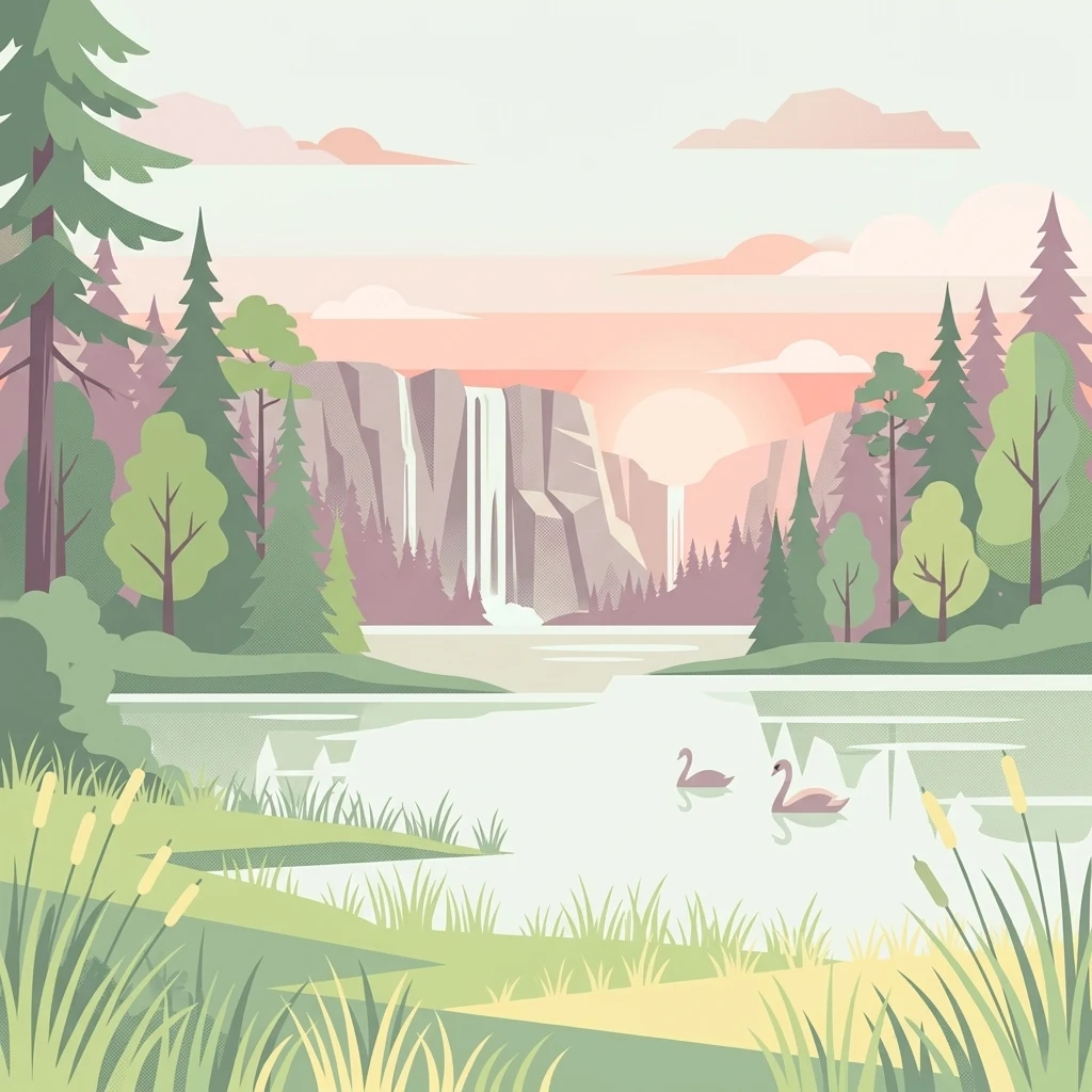
A flat-style digital illustration of a lake landscape at sunrise, featuring coniferous trees, a waterfall cascading down a cliff in the background, and two swans swimming in the foreground.

Welski Park Krajobrazowy

Protected landscape

Park overview

Structured park overview, official facts, and landscape profile for Welski Park Krajobrazowy

Welski Park Krajobrazowy park facts, protected area profile, and essential visitor context

Review the core facts for Welski Park Krajobrazowy, including designation, size, terrain, visitor scale, habitats, and operating context in one park-focused overview.

About Welski Park Krajobrazowy

Welski Park Krajobrazowy lies in the southern portion of the historic region of Warmia and Masuria, occupying a substantial tract of countryside shaped by the last glaciation. The park is administered from a headquarters near Jeleń, close to the town of Lidzbark, and spans the administrative territory of several communes in Działdowo and Nowe Miasto counties.

The park was created on 18 December 1995 under Polish landscape protection law, with the primary purpose of conserving the natural, historical, and cultural heritage of the Wel river basin. Since its establishment, the park has been recognized for the heterogeneity of its environment, both in terms of its plant and animal communities and in the variety of landforms within its boundaries.

From a geological and geomorphological standpoint, the park is a textbook example of the young-glacial landscape of northern Mazovia and southern Warmia. Sandy outwash plains, deposited by meltwater streams flowing from the retreating ice sheet, cover more than half of the park's surface. These flat or gently undulating sandr areas are interspersed with fragments of morainic upland, which rise as small hills and ridges marking former positions of the ice margin. Subglacial meltwater channels cut through the terrain, often now filled by chains of lakes, wetlands, and peat bogs.

The hydrological network of the park is built around the Wel river, a tributary of the Drwęca, which collects water from numerous lakes and smaller streams. At least 13 larger post-glacial lakes are found within the park, each contributing to the region's characteristic scenery and ecological value. The mix of open water, marshland, wet meadow, dry sandy forest, and richer upland habitats creates conditions for a highly varied biota.

The park functions not only as a conservation area but also as a center for environmental education and cultural heritage. Within its administrative facilities, visitors can explore the Museum of Natural History and the Edward Klemens Ethnographic Museum, both offering free access during weekday hours. A network of marked trails for hikers and cyclists, together with a kayaking route along the Wel river, provides structured ways to experience the landscape. Observation towers at Tuczki, Lidzbark, Grądy, and in the Neliwa reserve offer elevated vantage points over the surrounding mosaic of forests, fields, and water.

Protection and recognition

Documented 2020 establishment history and international recognition scope

Welski Park Krajobrazowy Protection Status And Terrestrial Designation

Welski Park Krajobrazowy maintains a documented terrestrial protected area designation established in the year 2020. Structured records outline the official protection status and management scope associated with the landscape.

Protection details

Protection scope
Terrestrial
Designated year
2020
Transboundary protection
No
Buffer area
162.83 km²
Park context

Deeper park guide and search-rich context for Welski Park Krajobrazowy

Welski Park Krajobrazowy history, landscape, wildlife, and travel context

Explore Welski Park Krajobrazowy through its history, landscape character, ecosystems, wildlife, conservation priorities, cultural context, and seasonal travel timing in a structured park guide built for atlas discovery and search intent.

Why Welski Park Krajobrazowy stands out

Welski Park Krajobrazowy is best known for the diversity of its glacial landscape, especially the sandy outwash plains, morainic uplands, glacial lake basins, and the broad Wel river valley that gives the park its name. The park combines wetlands, forests, and lakes within a single protected area, supporting a rich mosaic of flora and fauna. Its 13 larger post-glacial lakes, peatland reserves, and the Wel river corridor make it a representative example of the young-glacial landscape of northern Poland.
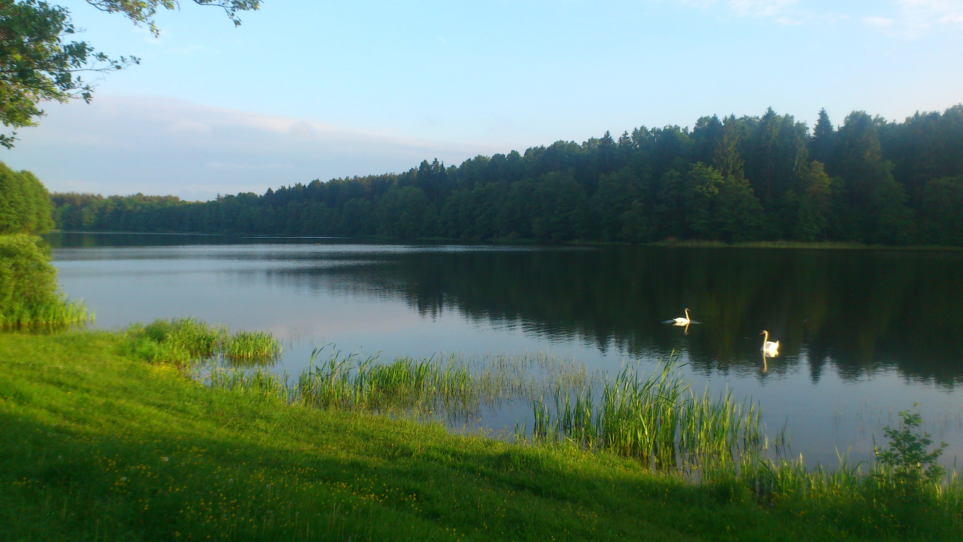
A calm lake reflecting a line of trees on the far shore, with two swans swimming in the water and a grassy bank in the foreground.
A peaceful view of Grady Lake, featuring calm waters and surrounding forest in Welski Park Krajobrazowy.

Welski Park Krajobrazowy history and protected-area timeline

Welski Park Krajobrazowy was formally established on 18 December 1995, making it one of the more recent landscape parks in the Warmian-Masurian Voivodeship. The park was created to consolidate protection of the Wel river valley's natural, historical, and cultural assets, recognizing the region as a coherent ecological and cultural unit rather than a collection of isolated reserves.

The early administration of the park was based in Lidzbark, on Jeleńska Street, before the headquarters was later relocated to a site in Jeleń, a settlement near Lidzbark. This administrative relocation helped anchor the park's identity more directly within the landscape it oversees.

In subsequent years, the park's legal framework was updated and codified. The current operating basis derives from a resolution of the Sejmik of the Warmian-Masurian Voivodeship, adopted on 29 September 2020, which formally defines the Welski Park Krajobrazowy and its protective buffer zone.

A notable event in the park's conservation history occurred in December 2006. The Czapliniec Werski nature reserve, originally created to protect a heron colony, was dissolved after the birds relocated spontaneously to a forest in Rybno. Within the same month, the Jezioro Neliwa reserve was established, preserving a different but equally important wetland and lake habitat. These changes illustrate the adaptive management approach that has shaped the park's reserve network over time.

Welski Park Krajobrazowy landscape and geographic character

The physical landscape of Welski Park Krajobrazowy is characterized by the geological legacy of the Pleistocene glaciations. Sandy outwash plains dominate the terrain, covering more than half of the park's surface. These broad, gently sloping sandr surfaces were formed by meltwater streams that deposited large volumes of sand and gravel in front of the retreating ice sheet.

Rising above the outwash plains are fragments of morainic upland, which represent older or younger moraines left at the margins of glacial advances. These upland areas display greater topographic relief and often host mixed forest stands on more nutrient-rich soils. Between these two dominant landform types, subglacial meltwater channels cut through the landscape, creating elongated depressions that frequently hold chains of lakes, peatlands, and river valleys.

The hydrological backbone of the park is the Wel river, which flows through the central portion of the protected area and connects many of the lakes to a single drainage system. Lakes of post-glacial origin are scattered across the park, with thirteen larger basins forming the most visible water features. Their shorelines vary from flat, marshy edges in the outwash plains to steeper, more defined margins where the lakes abut morainic slopes.

The resulting scenery is one of contrasts: wide open sandy plains covered by pine forests alternate with more intimate lake basins, raised bog remnants, wet meadows, and occasional hilltops that break the horizon. This varied relief creates constantly changing vistas for travelers moving through the park by trail or by waterway.

Welski Park Krajobrazowy ecosystems, habitats, and plant life

The ecological character of Welski Park Krajobrazowy is defined by the diversity of habitats that arise from the interplay between glacial landforms, hydrology, and varying soil conditions. The sandy outwash plains support extensive pine-dominated forests and open sandy grasslands, while the morainic uplands offer more nutrient-rich substrates favorable to mixed deciduous and multi-layered forests.

Wetland habitats are a particularly important component of the park's ecological identity. Peat bogs, marshy lake margins, and floodplain sections along the Wel river and its tributaries create conditions for specialized plant communities and a rich invertebrate fauna. The subglacial meltwater channels, often occupied by water or peat, act as ecological corridors linking otherwise distinct habitat patches.

Lakes within the park host aquatic and emergent vegetation communities that vary with depth, water chemistry, and human disturbance. Surrounding them, transitional zones of reeds, sedge mats, and wet shrub thickets connect open water to surrounding forest and meadow. These transitions are biologically productive and contribute to the park's recognition as a habitat mosaic rather than a single ecological type.

The combination of dry sandy habitats, wet lowlands, and lake environments supports a wider biodiversity than any one of these habitats could alone, and provides the foundation for the park's reputation for natural richness.

Welski Park Krajobrazowy wildlife and species highlights

Wildlife within Welski Park Krajobrazowy benefits from the same habitat diversity that defines its landscape. The mosaic of forests, wetlands, lakes, and open plains supports communities of mammals, birds, amphibians, and aquatic species typical of the young-glacial lowlands of northern Poland.

Wetland and lake environments are especially important for birds, including waterfowl, waders, and species that rely on reedbeds and fish-rich waters. The former Czapliniec Werski reserve demonstrated this ecological significance, having once supported a heron colony that ultimately relocated to a forest in Rybno, illustrating the dynamic nature of bird populations in the area.

The forests of the park, particularly the extensive pine stands on sandy soils and the mixed stands on morainic upland, provide habitat for forest-dwelling mammals as well as a range of breeding birds. Wet meadows and peatland margins add further habitat complexity that benefits amphibians, invertebrates, and smaller mammals adapted to moist conditions.

Rivers, streams, and lake outflows within the park sustain fish populations and a wider aquatic food web. The Wel river itself functions as both habitat and ecological corridor, linking different parts of the park for wildlife movement.

Welski Park Krajobrazowy conservation status and protection priorities

Welski Park Krajobrazowy was established to safeguard the natural, historical, and cultural values of the Wel river valley, and its conservation significance lies primarily in the integrated protection of a complete glacial landscape rather than a single species or habitat.

The park's reserve network includes four nature reserves, each protecting a recognized ecological asset: Bagno Koziana, Piekiełko, Ostrów Tarczyński, and Jezioro Neliwa. These reserves preserve peatlands, lake and island habitats, and old-growth forest communities that would otherwise be vulnerable to drainage, forestry pressure, or development.

Beyond the reserves, the broader landscape protection framework of the park helps maintain ecological processes across the entire protected area, including water flow, forest regeneration, and the connectivity of habitats. The designation of the park under a voivodeship-level legal act in 2020 reinforced this broader protective status and clarified its administrative perimeter.

Conservation management has also been adaptive in responding to ecological change. The dissolution of the Czapliniec Werski reserve and the simultaneous creation of the Jezioro Neliwa reserve illustrate how protection priorities are adjusted as wildlife distributions shift, ensuring that conservation effort remains aligned with current ecological realities.

Welski Park Krajobrazowy cultural meaning and human context

The cultural context of Welski Park Krajobrazowy is closely tied to the rural and small-town landscape of southern Warmia and northern Mazovia. The town of Lidzbark and surrounding communes form the immediate human backdrop to the protected area, and the park's administration has historically been rooted in this local community.

Education and interpretation have long been part of the park's cultural role. The presence of the Museum of Natural History and the Edward Klemens Ethnographic Museum at the park's headquarters reflects a commitment to presenting both the natural and the human heritage of the region. These institutions highlight traditional rural life, local crafts, and the relationship between communities and the surrounding landscape.

The region's historical geography also features in the park's identity, as trails within the protected area connect to the broader regional tourist routes, including the automobile route associated with the historic Grunwald Loop. This connection places the park within a wider cultural framework that links natural heritage with the region's medieval and early-modern history.

Top sights and standout views in Welski Park Krajobrazowy

Welski Park Krajobrazowy's strongest features are the diversity of its glacial landforms, the cluster of thirteen larger post-glacial lakes, and the Wel river corridor that ties the landscape together. The combination of sandy outwash plains, morainic uplands, and subglacial meltwater channels produces a varied and visually rich environment within a relatively compact area.

Equally notable is the park's integrated reserve system, which protects peatlands, lake islands, and wetland forests, alongside an active educational and cultural program centered on its natural history and ethnographic museums. A network of hiking trails, cycling routes, a kayaking route along the Wel, and observation towers at Tuczki, Lidzbark, Grądy, and the Neliwa reserve provides structured ways for visitors to experience the park's defining scenery.

Best time to visit Welski Park Krajobrazowy

The character of a visit to Welski Park Krajobrazowy shifts with the seasons in ways typical of north-central Poland's glacial lowlands. Late spring and early summer bring the most active birdlife and the freshest vegetation around lakes and wetlands, while also offering stable conditions for hiking, cycling, and kayaking on the Wel river.

Summer is the most versatile period for outdoor activities, with long daylight hours, warm conditions for water-based recreation, and fully accessible observation towers and trails. Lakes and ponds are at their most visually active, and forests offer shaded routes that help offset warmer temperatures.

Autumn transforms the park's mixed and broadleaf stands into a contrasting palette against the evergreen pines, and quieter trails make wildlife observation easier. Winter, while colder, can reveal the clean geometric outlines of lakes and the open sweep of the sandy plains under snow, though some activities become limited by seasonal conditions. Each season emphasizes a different aspect of the park's diverse landscape.

Monthly climate preview

Long-term temperature ranges and monthly precipitation averages for Welski Park Krajobrazowy

Welski Park Krajobrazowy Climate Normals and Annual Weather Patterns

Representative coordinate records show measured temperature swings from subzero winter minima to warm summer maxima alongside steady daily precipitation amounts across the year. Reviewing the complete twelve-month sequence provides precise historical context for examining regional climate variations and multi-year environmental trends.
Annual mean7 °C
-4 °C19 °C
Jan-4°
Feb-3°
Mar
Apr
May13°
Jun16°
Jul19°
Aug18°
Sep13°
Oct
Nov
Dec-2°
Warmest month
July

18.7 °C

Coolest month
January

-4 °C

Wettest month
July

2.7 mm/day

Driest month
April

1.4 mm/day

Park location guide

Geography guide, regional context, and park location map for Welski Park Krajobrazowy

Welski Park Krajobrazowy park geography, regions, and map view in Poland

Understand where Welski Park Krajobrazowy sits in Poland through a broader geographic reading of the surrounding landscape, nearby location context, and its mapped position within the national park landscape.

How Welski Park Krajobrazowy fits into Poland

Poland, officially the Republic of Poland, is a Central European country spanning from the Baltic Sea in the north to the Carpathian Mountains in the south. It borders Germany, Czech Republic, Slovakia, Ukraine, Belarus, Lithuania, and Kaliningrad Oblast. The country has a temperate climate, diverse landscapes, and is known for its rich history, cultural heritage, and strong economic position within the EU.

Wider geography shaping Welski Park Krajobrazowy in Poland

Poland occupies 312,696 km2 in Central Europe, extending from the Baltic Sea coast in the north to the Sudetes and Carpathian Mountains in the south. It borders Germany to the west, Czech Republic and Slovakia to the south, Ukraine and Belarus to the east, and Lithuania and Kaliningrad Oblast to the northeast. The landscape includes lowland plains, uplands, and mountain ranges.

Map view of Welski Park Krajobrazowy

Use this park location map to pinpoint Welski Park Krajobrazowy in Poland, understand its exact geographic position, and read its mapped placement within the surrounding landscape more clearly.

Pigeon | © OpenStreetMap contributors

Location context for Welski Park Krajobrazowy

Warmian-Masurian Voivodeship

Examine glacial lakes, outwash plains, and protected habitats in northern Poland.

Welski Park Krajobrazowy Photos and Visual Landscape Exploration

Visual records capture the distinctive glacial landforms, post-glacial lakes, and river valleys that define Welski Park Krajobrazowy. Detailed photography reveals the terrain, vegetation, and environmental character of this protected landscape in north-central Poland.

A calm lake reflecting a line of trees on the far shore, with two swans swimming in the water and a grassy bank in the foreground.

Park atlas

Compare regional glacial landscapes and connected protected terrain

Other Parks and Protected Areas Near Welski Park Krajobrazowy

Browse protected areas and regional reserves situated close to Welski Park Krajobrazowy to compare similar glacial landforms and river valleys. Expanding the geographic view helps trace broader conservation networks across the surrounding northern territory.
Nature reserveWarmian-Masurian Voivodeship
About 7.5 km away#1 closest

Northeast

Jezioro Neliwa Nature Reserve: Mapping Protected Landscapes and Glacial Lake Geography

An important eutrophic water reserve in the Warmian-Masurian Voivodeship.

Located within the Welski Landscape Park, this nature reserve protects a vanishing eutrophic lake ecosystem and its unique slope oak-lime forest. The area provides essential habitat for breeding bird populations and rare aquatic plant species, serving as a vital point of study for lowland glacial geography in northeastern Poland.

Area
0.165 km²
Established
2006
Water
Water-dominated
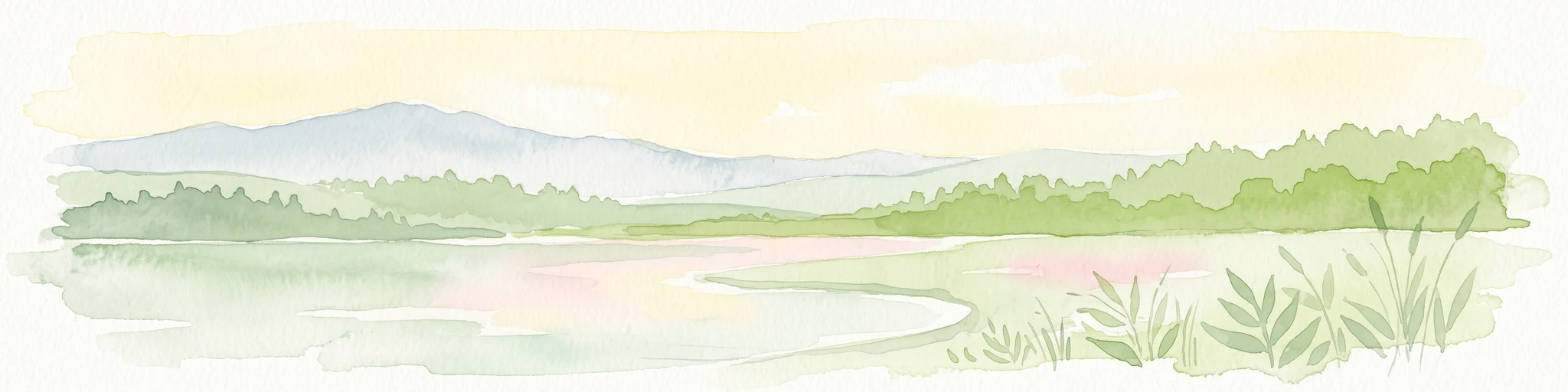
A wide watercolor illustration showing a calm lake with a forested shoreline and distant hills under a pale sky, with reeds in the foreground.
Protected landscapeKuyavian-Pomeranian Voivodeship
About 17 km away#2 closest

West

Brodnicki Park Krajobrazowy: Protected Landscape and Post-Glacial Terrain in Northern Poland

Mapped lake districts and glacial tunnel valleys

Brodnicki Park Krajobrazowy preserves a textbook young-glacial landscape in the Kuyavian-Pomeranian Voivodeship. The terrain features rolling moraine hills and dense chains of lakes linked by slow streams, creating a significant ecological corridor. This protected area offers deep insights into the region's complex hydrological and forest history, spanning across classic lowland meadows, peat bogs, and mature oak-pine woodlands.

Area
166.85 km²
Established
1985
Relief
Lowland
Climate
Temperate
Protected landscapeWarmian-Masurian Voivodeship
About 18 km away#3 closest

North

Park Krajobrazowy Wzgórz Dylewskich: Protected Moraine Terrain and Regional Geography

A study of glacial landforms and hydrological patterns in the Warmian-Masurian Voivodeship

Explore the unique geomorphology of Park Krajobrazowy Wzgórz Dylewskich, where Pleistocene glaciation has carved steep slopes, deep valleys, and expansive hill summits. This protected landscape serves as a central hub for regional biodiversity and acts as a primary source for radiating water networks in northern Poland, offering a high-relief counterpoint to the surrounding lakeland.

Area
71.7 km²
Established
1994
Relief
Mountain
Scope
Terrestrial
A horizontal watercolor illustration depicting a soft, pale green and reddish wetland environment with scattered trees and marsh vegetation.
Nature reserveKuyavian-Pomeranian Voivodeship
About 24 km away#4 closest

Southwest

Mszar Płociczno Nature Reserve: Protected Peatland Geography and Landscape Boundaries in Poland

Regional protected area analysis for Kuyavian-Pomeranian landscape maps.

The Mszar Płociczno nature reserve acts as a critical refuge for transitional peatland, harboring a mosaic of Sphagnum mires, swamp forests, and coniferous woodland. This area functions as a key component of the Brodnica peatland ecological network, demonstrating long-term conservation success within the flat terrain of the Równina Urszulewska mesoregion.

Area
1.824 km²
Established
1997
Relief
Lowland
Scope
Terrestrial
Nature reserveWarmian-Masurian Voivodeship
About 26 km away#5 closest

North

Dylewo Nature Reserve: Protected Beech Woodland in the Warmian-Masurian Voivodeship

A study of glacial topography and rare fern habitats

Located within the Wzgórza Dylewskie landscape park, Dylewo Nature Reserve protects a stable, closed-canopy beech woodland on elevated morainic terrain. Gain deeper insights into the forest composition and the ecological importance of this site as a sheltered habitat for rare flora within the larger northern Polish lakeland region.

Area
0.101 km²
Established
1970
Relief
Mountain
Scope
Terrestrial
Nature reserveWarmian-Masurian Voivodeship
About 30 km away#6 closest

West

Rezerwat przyrody Jezioro Mścin: Protected Wetland Landscapes and Regional Geography

Nature reserve habitat in the Brodnica Lake District

Rezerwat przyrody Jezioro Mścin serves as a primary example of successful wetland restoration for biodiversity conservation. Situated in the Warmian-Masurian Voivodeship, this faunistic reserve integrates open water, marsh, and forest edges to support waterfowl and migratory bird populations within a broader regional network of protected Polish landscapes.

Area
0.499 km²
Established
2024
Relief
Lowland
Climate
Temperate
Nature reserveMazovia Voivodeship
About 36 km away#7 closest

Southeast

Rezerwat przyrody Dolina Mławki: Protected Wetland and Forest Geography

Nature reserve terrain and river valley mapping

Deeply explore the physical geography and conservation profile of Rezerwat przyrody Dolina Mławki. This protected area preserves a complex of alder swamp forests, wet riparian corridors, and vital breeding habitats. The site functions as a key reference for lowland Polish wetland ecosystems, offering insights into the natural hydrological and floristic patterns within the Mławka River valley.

Area
1.474 km²
Established
1994
Relief
Lowland
Scope
Terrestrial
Nature reserveKuyavian-Pomeranian Voivodeship
About 38 km away#8 closest

West

Rezerwat przyrody Mieliwo Nature Reserve: Protected Forest and Glacial Valley Geography

A scientific forest study site within the Brodnica Lake District landscape

This protected forest reserve in the Kuyavian-Pomeranian Voivodeship is defined by its position on a high glacial slope above Lake Mieliwo. It remains a key reference point for studying beech forest stands at the northern edge of their range, contributing to the regional conservation of the Brodnica Lake District and its post-glacial valley network.

Area
0.117 km²
Established
1958
Relief
Upland
Scope
Terrestrial

Common questions about visiting, size, designation, and location context for Welski Park Krajobrazowy

Welski Park Krajobrazowy FAQs for park facts, access, geography, and protected area context

Find quick answers about Welski Park Krajobrazowy, including protected-area facts, park geography, trail and visitor context, and how the park fits into its surrounding country and regional landscape.
MoriAtlas Explorer

Continue Your Protected Areas Search Across the Global Atlas

Deepen your exploration by continuing the structured search for national parks and protected areas worldwide. Utilize the comprehensive filtering capabilities to compare different conservation landscapes and refine your understanding of global park geography. Discover more about the distribution and characteristics of protected natural areas.

Global natural geography