
Mori Atlas logo
Nature reserveWestufer Steinhuder Meer

Tracing the ecological landscape of reedbeds, swamp forests, and raised bog formations

Westufer Steinhuder Meer Nature Reserve: An Atlas of Protected Wetlands in Lower Saxony

(Naturschutzgebiet Westufer Steinhuder Meer)

Westufer Steinhuder Meer serves as a primary conservation complex along the western shore of Lake Steinhude in Lower Saxony, Germany. The nature reserve protects a contiguous mosaic of waterlogged peat soils that transitions from open water and shallow reedbeds into dense alder swamp forest and remnant raised bog. This geographic entity functions as a vital site for migratory waterbirds and amphibians across the North German Plain, offering a clear view of the complex gradients within a protected wetland ecosystem.

wetlandslake shorereedbedsswamp forestfenraised bog
A stylized digital illustration of a wetland landscape featuring reeds, cattails, lily pads, and a calm lake at sunset with distant hills.

Westufer Steinhuder Meer

Nature reserve

Park overview

Structured park overview, official facts, and landscape profile for Westufer Steinhuder Meer

Westufer Steinhuder Meer park facts, protected area profile, and essential visitor context

Review the core facts for Westufer Steinhuder Meer, including designation, size, terrain, visitor scale, habitats, and operating context in one park-focused overview.

About Westufer Steinhuder Meer

Westufer Steinhuder Meer is a recently designated Lower Saxon nature reserve focused on the ecological transition zone between Lake Steinhude and its surrounding lowlands. It lies in north-central Germany, west of Hannover, within the Naturpark Steinhuder Meer, and protects the western margin of the lake together with the adjoining Meerbruch wetland and the southern Hagenburger Moor.

The reserve reflects the long-term natural dynamics of Lake Steinhude, whose shores have gradually been filled in by sediment and organic matter, producing wide belts of peat soils. These slowly thickening fens have given rise to a series of distinct vegetation zones: a fringing belt of willow and alder swamp forest, an outer zone of reeds, sedges and tall herb communities, and further inland, wet grasslands with embedded ponds. In the south, these lowland fens give way to the slightly more elevated Hagenburger Moor, where drained and partially regenerated raised bog fragments and bog forest dominate the landscape.

By integrating former smaller protection zones, the modern reserve consolidates the area's conservation status. It is fully included in the EU Birds Directive site around Lake Steinhude and largely overlaps with the corresponding FFH habitat site, situating it firmly within the European Natura 2000 network. The combination of lakeshore, fen, bog and wet grassland under a single protection regime has turned the western shore into one of the most ecologically coherent wetland complexes in the region.

Although much of the area is closed to general public access to protect sensitive habitats, the reserve still offers a measure of low-impact visitor infrastructure. A section of the circular Lake Steinhude trail runs through the wet meadows along the northern shore, two viewpoints overlook the lake, and an observation tower and three hides near Winzlar allow quiet wildlife observation. This careful balance between strict ecological protection and selective public access is itself part of the reserve's modern identity.

Quick facts and research context for Westufer Steinhuder Meer

Westufer Steinhuder Meer is a designated nature reserve, formally registered as NSG HA 60, in the German federal state of Lower Saxony. It lies along the western shore of Lake Steinhude within the Naturpark Steinhuder Meer, spanning parts of Neustadt am Rübenberge, Wunstorf and Rehburg-Loccum.

The reserve covers around 663 hectares, of which roughly 637 hectares fall within the Region Hannover and the remaining share within the Landkreis Nienburg/Weser. It lies at low elevation, roughly 38 to 43 metres above sea level, and forms part of the broader Steinhuder Meer Ramsar-relevant wetland landscape.

Protection and recognition

Documented protected area metrics, management scope, and international database listings

Westufer Steinhuder Meer Protection Status and Regional Conservation Records

Westufer Steinhuder Meer maintains documented protection status and official database records within the global conservation inventory. Conservation researchers examine these administrative frameworks, designation histories, and associated protected area metrics.

Protection details

WDPA ID
82151
Park context

Deeper park guide and search-rich context for Westufer Steinhuder Meer

Westufer Steinhuder Meer history, landscape, wildlife, and travel context

Explore Westufer Steinhuder Meer through its history, landscape character, ecosystems, wildlife, conservation priorities, cultural context, and seasonal travel timing in a structured park guide built for atlas discovery and search intent.

Why Westufer Steinhuder Meer stands out

Westufer Steinhuder Meer is best known for its extensive lakeside wetlands along the western shore of Lake Steinhude. The reserve protects a continuum of habitats from shallow open water through reedbeds, sedge marshes and willow-alder swamp forest to fragments of raised bog, all developed on peat soils formed by long-term silting of the lake. It is also recognised as an important area for waterbirds, including white-tailed eagle and spotted crake as breeding species, and as a major stopover and wintering site for migratory ducks and herons. The protected mosaic of lakeshore vegetation, peatland and bog forest is the defining ecological identity of the area. The reserve is closely linked to the larger Steinhuder Meer lake ecosystem and lies within the Natura 2000 network, reinforcing its profile as a conservation priority at both regional and European levels.
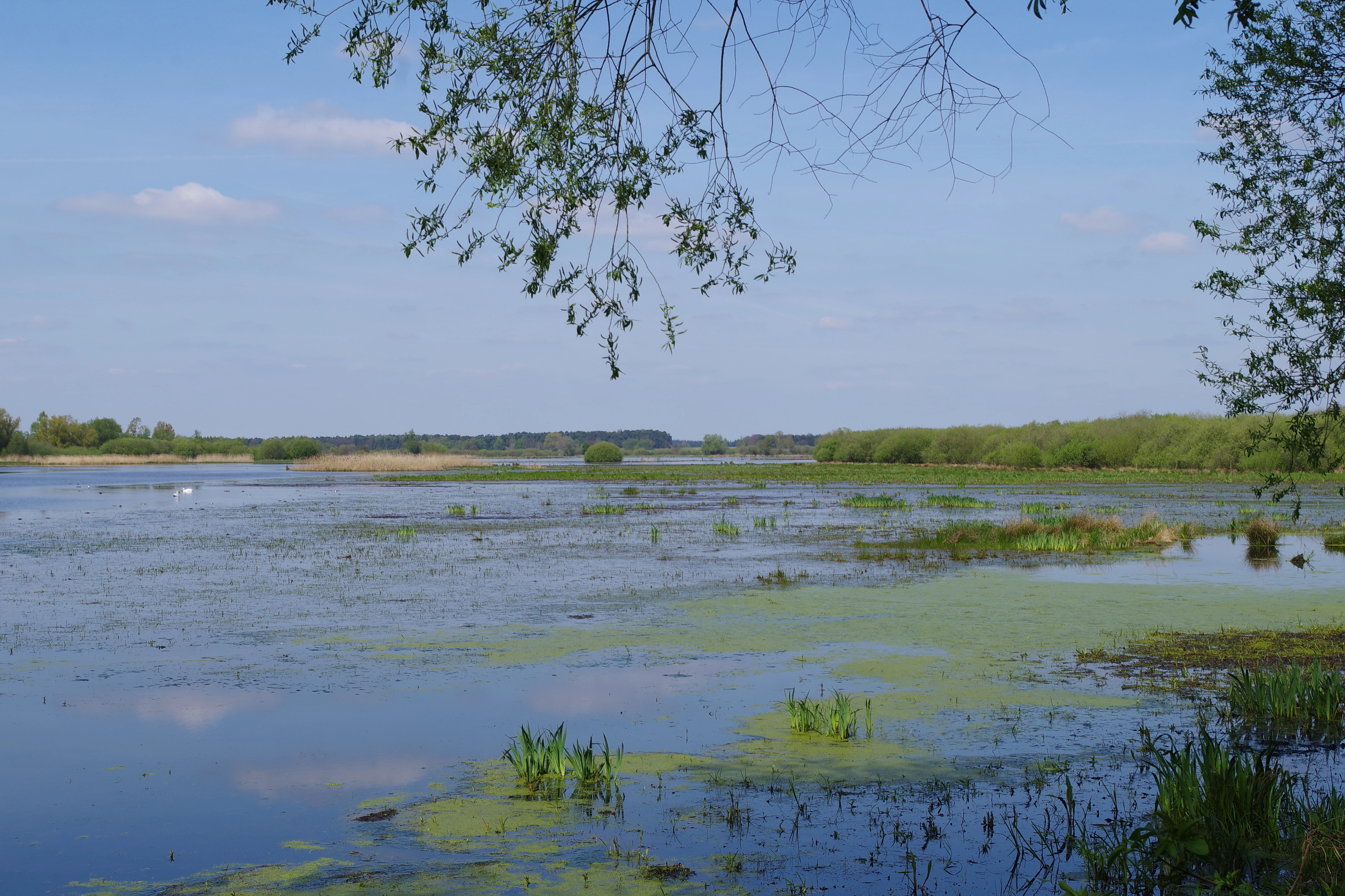
A wide view of a calm wetland with patches of green vegetation on the water surface; distant tree lines and a clear blue sky in the background.
A view of the Meerbruch wetland bird habitat within the Westufer Steinhuder Meer nature reserve.

Westufer Steinhuder Meer history and protected-area timeline

The present-day Westufer Steinhuder Meer reserve is the result of a 2020 consolidation of several earlier protection efforts along the western shore of Lake Steinhude. On 10 December 2020, the Lower Saxon authorities formally designated the new combined area as the Naturschutzgebiet with the identifier NSG HA 60.

Prior to that designation, two separate nature reserves already existed within the same general area: Meerbruch, covering the fen and wet grassland complex, and Hagenburger Moor, focused on the southern raised bog. Surrounding these core areas were parts of the broader landscape protection area "Seefläche Steinhuder Meer". When the new reserve came into force, the two earlier nature reserves were absorbed into it, as were selected portions of that landscape protection area.

This 2020 reorganisation reflects a broader shift in regional conservation toward managing Lake Steinhude's western wetlands as a single coherent ecological system rather than as a patchwork of smaller designations. The new reserve was also deliberately aligned with the overlapping EU Birds Directive and FFH habitat sites, giving the area unified protection under both national and European conservation frameworks.

Westufer Steinhuder Meer landscape and geographic character

At a broad scale, Westufer Steinhuder Meer occupies a low-lying shoreline landscape on the North German Plain, sitting only about 38 to 43 metres above sea level. The terrain is essentially flat, with the visual interest of the reserve arising not from elevation but from the rich transitions between open water, emergent wetland, swamp forest and bog.

The structure of the reserve follows the lake's concentric ecological gradient. Immediately along the shore lies a broad belt of shallow water and silting flats, transitioning into a zone of swamp forest dominated by willows and alders. Inland from this forested fringe, a wide expanse of sedge marsh, reedbed and tall herb vegetation spreads across waterlogged peat soils, forming the Meerbruch. Pools and small still waters are scattered through this fen mosaic, creating a textured mosaic of open water and wetland vegetation.

To the south, the peat soils gradually rise into the Hagenburger Moor, a largely drained former raised bog. Here, surviving patches of near-natural bog vegetation are surrounded by extensive bog woodland, and the area is bounded to the east by the Hagenburger Kanal. East of the canal, the landscape returns to the wet meadow and reed mosaic of the so-called Moorwiesen before the swamp forest belt reappears along the lakeshore once more.

Westufer Steinhuder Meer ecosystems, habitats, and plant life

The reserve's ecological character is shaped by the convergence of lake, fen, lowland raised bog and wet grassland. The vegetation reflects the slow natural silting of Lake Steinhude: as the lake margin has filled with sediment and organic material, peat soils have formed in a broad ring around the shore, supporting successive zones of wetland plant communities.

In the still waters, partly dense floating-leaf and submerged vegetation has developed, including yellow water-lily and frogbit. The wet meadows host marsh marigold and marsh ragwort, while the deeper sedge swamps support species such as dragon arum and slender club-rush. In the Hagenburger Moor, numerous sphagnum mosses are present, alongside a notable isolated population of the regionally threatened Schoenus nigricans.

The Hagenburger Kanal forms a distinct eastern boundary within this mosaic, while further east the landscape returns to wet reed and grassland vegetation interspersed with small pools and scattered shrubs.

Westufer Steinhuder Meer wildlife and species highlights

The combination of shallow lake edge, reedbeds, pools and bog forest makes Westufer Steinhuder Meer a significant habitat for wetland-dependent species. The reserve supports a rich breeding bird community, including strictly protected species such as white-tailed eagle and spotted crake, while also functioning as a major stopover and wintering area for migratory waterfowl.

Duck species such as shoveler, teal, goosander, smew and great crested grebe use the area during migration and the colder months, joined by great egrets and other herons when conditions are favourable. The mosaic of pools, ditches and sedge marshes also supports a diverse amphibian population, with moor frog, tree frog and northern crested newt among the resident species.

In the waterways, native fish such as weather loach and European stone loach are present, and the reserve also hosts Eurasian otter and a re-established population of European mink. Together with the adjacent lake, these communities give the western shore of Lake Steinhude a continuous and ecologically rich wildlife gradient.

Westufer Steinhuder Meer conservation status and protection priorities

Westufer Steinhuder Meer is significant within the European conservation network, being fully part of the EU Birds Directive site "Steinhuder Meer" and largely part of the corresponding FFH habitat site. These designations have shaped its modern protection framework and given the reserve direct relevance to Natura 2000 objectives at the European level.

At the national and regional levels, the area was consolidated in 2020 into a single large nature reserve under the designation NSG HA 60, absorbing the earlier Meerbruch and Hagenburger Moor reserves and selected parts of the surrounding landscape protection area. This unification has allowed authorities to manage the lakeshore fen, bog and wet grassland as one integrated ecological system rather than as disconnected fragments.

The flat terrain and historically drained nature of the surrounding landscape, however, mean that conservation management here includes ongoing efforts to deal with the legacy of peat cutting, drainage and nutrient enrichment. Maintaining and gradually restoring hydrological integrity, particularly in the Hagenburger Moor, is a key long-term concern alongside the protection of the lake's natural silting processes.

Westufer Steinhuder Meer cultural meaning and human context

The reserve lies within a region where traditional land use has long been shaped by the challenges of working with wet, peaty soils. Surrounding villages such as Mardorf and Winzlar, on the edge of the protected area, have historically sustained themselves through a mix of small-scale agriculture, fishing on Lake Steinhude and seasonal wetland exploitation such as peat cutting.

Although the nature reserve itself keeps most of its area closed to general public access to safeguard sensitive habitats, a section of the long-distance circular trail around Lake Steinhude passes through the western shoreline area, and viewpoints, an observation tower near Winzlar and several wildlife observation huts support a low-intensity form of nature-based recreation. This reflects the broader cultural pattern of the Steinhuder Meer region, where modest public access is balanced against the area's ecological sensitivity.

Top sights and standout views in Westufer Steinhuder Meer

Westufer Steinhuder Meer is notable for bringing together, within a single contiguous protection zone, a complete gradient of lakeshore vegetation, from open water and reeds through willow-alder swamp forest to fragments of raised bog.

The reserve's standing in the European Natura 2000 network, its large size and the inclusion of the entire EU Birds Directive site around Lake Steinhude give it unusual conservation weight. Its role as a breeding and wintering area for waterbirds, including white-tailed eagle, adds recognisable flagship species to the area's ecological profile.

Best time to visit Westufer Steinhuder Meer

As a wetland-dominated nature reserve, Westufer Steinhuder Meer shows its character most strongly during the cooler half of the year, when waterfowl gather and migratory species are present along the lake edge and in the reedbeds. Late autumn, winter and early spring are typically the most rewarding periods for bird observation around the open water and wet meadows.

Late spring and early summer, by contrast, are the most important seasons for amphibians and for the flowering of marsh plants in the fens, while the bog forest communities around the Hagenburger Moor can be best appreciated visually in late summer and early autumn when mosses and bog vegetation are at their most distinct. Visiting at any of these periods offers a different but ecologically meaningful view of the reserve.

Monthly climate preview

Long-term monthly temperature and precipitation patterns recorded at representative coordinates

Westufer Steinhuder Meer Climate Normals and Annual Temperature Rhythm

Representative coordinate records show average monthly temperatures ranging from sub-zero winter minimums to warm summer maximums alongside steady daily precipitation amounts. Detailed monthly climate normals provide full twelve-month breakdowns for tracking long-term thermal and precipitation rhythms across the protected landscape.
Annual mean9 °C
1 °C18 °C
Jan
Feb
Mar
Apr
May13°
Jun16°
Jul18°
Aug18°
Sep14°
Oct10°
Nov
Dec
Warmest month
July

18.4 °C

Coolest month
January

0.6 °C

Wettest month
July

2.4 mm/day

Driest month
April

1.4 mm/day

Park location guide

Geography guide, regional context, and park location map for Westufer Steinhuder Meer

Westufer Steinhuder Meer park geography, regions, and map view in Germany

Understand where Westufer Steinhuder Meer sits in Germany through a broader geographic reading of the surrounding landscape, nearby location context, and its mapped position within the national park landscape.

How Westufer Steinhuder Meer fits into Germany

Germany is a federal republic in Western and Central Europe with a population of over 83 million across sixteen constituent states. It is Europe's largest economy by nominal GDP and a major global exporter and importer. The capital is Berlin, and the country borders Denmark, Poland, Czech Republic, Austria, Switzerland, France, Luxembourg, Belgium, and the Netherlands.

Wider geography shaping Westufer Steinhuder Meer in Germany

Germany is located in Western and Central Europe, spanning 357,022 km². It borders Denmark to the north, Poland and the Czech Republic to the east, Austria and Switzerland to the south, and France, Luxembourg, Belgium, and the Netherlands to the west. The country has coastlines on the Baltic Sea and North Sea to the north, with the Alps located in the southern region.

Map view of Westufer Steinhuder Meer

Use this park location map to pinpoint Westufer Steinhuder Meer in Germany, understand its exact geographic position, and read its mapped placement within the surrounding landscape more clearly.

Pigeon | © OpenStreetMap contributors

Location context for Westufer Steinhuder Meer

Lower Saxony

Visual exploration of wetland habitats and lakeshore terrain

Westufer Steinhuder Meer Photos and Landscape Scenery

Examine detailed photographs documenting the diverse wetland habitats and shoreline terrain of Westufer Steinhuder Meer. Visual records reveal the complex transition from shallow open water through swamp forests and raised bogs.

A wide view of a calm wetland with patches of green vegetation on the water surface; distant tree lines and a clear blue sky in the background.

A wide view of a grassy moorland landscape under a partly cloudy blue sky, with a line of trees in the background.

Park atlas

Compare adjacent wetland reserves and regional conservation areas across Lower Saxony

Exploring Parks Near Westufer Steinhuder Meer and Surrounding Protected Landscapes

Compare Westufer Steinhuder Meer with other protected areas across the North German Plain to analyze regional wetland geography. Review adjacent conservation zones to understand the broader ecological network surrounding Lake Steinhude.
Nature reserveLower Saxony
Mapped location lies within the park boundary#1 closest

Northeast

Steinhuder Meer mit Randbereichen: Protected Nature Reserve and Wetland Geography

Lowland lake, fen meadows, and bog ecosystems in Lower Saxony

Steinhuder Meer mit Randbereichen stands as a primary conservation site in northwestern Germany. The protected landscape combines a vast, shallow lowland lake with extensive reed belts and peatland remnants, creating a complex wetland gradient that defines the regional geography of the Weser-Aller lowlands.

Area
53.71 km²
Established
2004
A wide panoramic watercolor illustration showing a winding river or stream flowing through a landscape of green pine trees and pink flowering bushes under a pale sky.
Nature reserveRegion Hannover
About 14 km away#2 closest

East

Wadebruch Nature Reserve: Geographic Analysis of a Lower Leine Floodplain Protected Area

A dense mosaic of alder swamps, oxbow channels, and sandy terrace forest in Germany.

Wadebruch serves as a compact, ecologically rich example of a lower Leine floodplain environment. Located in the Hannover Region, this protected site preserves a historic river meander, including an aging oxbow and alder swamp forest, contrasted against steep sandy banks. The site provides essential insights into the natural river patterns that once characterized this part of Lower Saxony.

Area
0.16 km²
Established
1985
IUCN
IV
Relief
Lowland
Protected areaRegion Hannover
About 17 km away#3 closest

Southeast

Mausohr-Wochenstube bei Barsinghausen: Protected Habitat and Regional Landscape Context

A vital Natura 2000 maternity site in Region Hannover

Examine the geography of Mausohr-Wochenstube bei Barsinghausen, an essential protected area for greater mouse-eared bats. This site showcases the intersection of architectural heritage and natural conservation, relying on the adjacent river corridors and agricultural landscapes of the Region Hannover to sustain its vital ecological function within Lower Saxony.

Area
0.001 km²
Established
2004
Relief
Lowland
Climate
Temperate
Nature reserveNordrhein-Westfalen
About 18 km away#4 closest

West

Weseraue Nature Reserve and Weser River Floodplain Geographic Overview

Protected wetland landscapes in North Rhine-Westphalia

The Weseraue landscape encompasses 25 kilometers of the Weser river corridor, characterized by its diverse mix of dammed sections, natural flow channels, and seasonal wet grasslands. As a cornerstone of the Natura 2000 network, it provides essential habitat for breeding and migratory species, serving as a primary refuge within the North Rhine-Westphalia floodplain geography.

Area
27.438 km²
Established
1983
Relief
Lowland
Scope
Terrestrial
Nature reserveNienburg/Weser
About 18 km away#5 closest

Northwest

Wellier Schleife/Staustufe Landesbergen: A Protected River Oxbow and Floodplain Geography

Mapping protected habitats in the Middle Weser valley of Germany.

This nature reserve protects the Wellier Schleife, a significant oxbow arm created by the Landesbergen weir. The 278-hectare area encompasses former gravel pits, wetland fringes, and agricultural floodplains. It stands as a vital component of the Wesertalaue bei Landesbergen bird protection network, reflecting the interplay between river engineering and conservation efforts.

Area
2.78 km²
Established
1996
IUCN
IV
Relief
Lowland
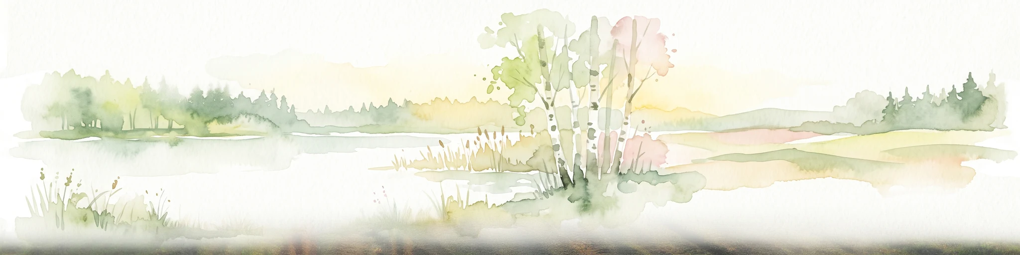
Watercolor illustration of a peaceful lakeside scene at Lahder Marsch, featuring birch trees, marshy vegetation, and a calm water surface.
Nature reserveKreis Minden-Lübbecke
About 22 km away#6 closest

Southwest

Lahder Marsch Nature Reserve: Protected Wetland Mosaic in Kreis Minden-Lübbecke

A mapped sanctuary for migratory birds within the Weser floodplain.

Lahder Marsch is a designated nature reserve located in the Weser river valley, forming a chain of flooded gravel pits that sustain diverse avian populations. This protected landscape, characterized by open water, islands, and dense reed fringes, serves as a crucial habitat within the larger Weseraue Natura 2000 network, illustrating the geographic importance of restored extraction sites in lowland Germany.

Area
0.19 km²
Water
Major water bodies
A horizontal watercolor painting depicting a soft, impressionistic forest landscape with green trees, subtle hints of pink and purple, and a light background.
Nature reserveNorth Rhine-Westphalia
About 24 km away#7 closest

Southwest

Heisterholz: Protected Oak Forests and Wetland Mosaics in North Rhine-Westphalia

Geographic overview of a key nature reserve and forest belt

Explore the structured geography of Heisterholz, a state-protected lowland forest in the Rahden-Diepenauer Geest. This site details the composition of its oak-dominated woodlands, spring zones, and stream valleys, illustrating its critical function within the interconnected forest chain of northern Germany.

Area
8.8 km²
Relief
Lowland
Climate
Temperate
Scope
Terrestrial
Nature reserveGermany
About 24 km away#8 closest

South

Walterbachtal Nature Reserve: A Detailed Geographic Atlas of the Deister Stream Valley

Mapping protected meadow and forest landscapes in Germany

Walterbachtal offers a unique look at small-scale conservation in the Weserbergland. This nature reserve protects a dynamic stream, traditional wet meadows, and oak-hornbeam forests that thrive on the slopes of the Deister. The reserve provides a distinct transition between aquatic and terrestrial zones, serving as a critical corridor for biodiversity in the regional landscape between Hannover and Hameln.

Area
0.32 km²
Established
1987
IUCN
IV
Relief
Upland

Common questions about visiting, size, designation, and location context for Westufer Steinhuder Meer

Westufer Steinhuder Meer FAQs for park facts, access, geography, and protected area context

Find quick answers about Westufer Steinhuder Meer, including protected-area facts, park geography, trail and visitor context, and how the park fits into its surrounding country and regional landscape.
MoriAtlas Explorer

Continue Your Protected Areas Search Across the Global Atlas

Deepen your exploration by continuing the structured search for national parks and protected areas worldwide. Utilize the comprehensive filtering capabilities to compare different conservation landscapes and refine your understanding of global park geography. Discover more about the distribution and characteristics of protected natural areas.

Global natural geography