
Mori Atlas logo
Protected landscapeWhiskeytown–Shasta–Trinity National Recreation Area

Understanding the geography of reservoir basins, riparian corridors, and mixed conifer forests.

Whiskeytown–Shasta–Trinity National Recreation Area: A Mapped Protected Landscape in Northern California

Whiskeytown–Shasta–Trinity National Recreation Area represents a unique federal collaboration encompassing three major reservoir units across northern California. This protected landscape spans an expansive terrain of foothill oak woodlands, chaparral, and coniferous forests integrated with the sprawling basins of Shasta, Trinity, and Whiskeytown Lakes. Discover the complex geographic boundaries and natural features that define this significant riparian and montane recreation region.

reservoirlakenational recreation areafoothillschaparraloak woodland
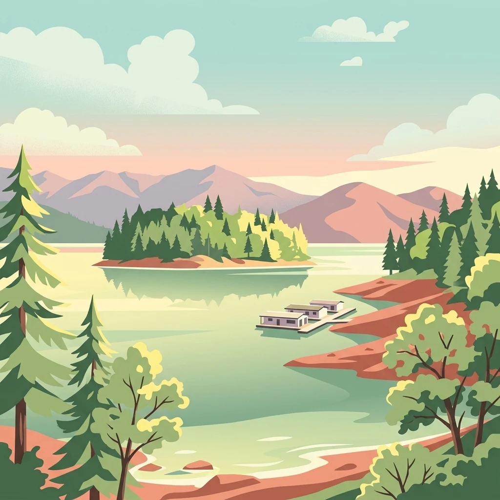
A digital illustration showing a calm reservoir lake surrounded by forested shores and distant mountains, with a small dock and floating structures on the water.

Whiskeytown–Shasta–Trinity National Recreation Area

Protected landscape

Park overview

Structured park overview, official facts, and landscape profile for Whiskeytown, Shasta, Trinity National Recreation Area

Whiskeytown, Shasta, Trinity National Recreation Area park facts, protected area profile, and essential visitor context

Review the core facts for Whiskeytown, Shasta, Trinity National Recreation Area, including designation, size, terrain, visitor scale, habitats, and operating context in one park-focused overview.

About Whiskeytown, Shasta, Trinity National Recreation Area

Whiskeytown–Shasta–Trinity National Recreation Area is a large composite recreation area in the inland northern California foothills, combining lands and waters managed by two different federal agencies. The area was authorized by Congress in 1965 as one of the larger National Recreation Areas in the United States, with the goal of preserving reservoir-centered landscapes while making them broadly accessible for outdoor recreation.

Geographically, the recreation area is centered on three major impoundments that lie along the Sacramento River and Trinity River watersheds. Shasta Lake, formed by Shasta Dam on the Sacramento River system, fills a network of valleys fed by the Sacramento, Pit, and McCloud Rivers. Trinity Lake and Lewiston Lake, formed by Trinity and Lewiston Dams, occupy the Trinity River canyon. Whiskeytown Lake, smaller and shallower than the other two, sits at a lower elevation closer to Redding and is ringed by forested ridges and creeks.

Although each unit functions as a self-contained recreation destination, they share a common environmental character defined by the transition between the Sacramento Valley floor and the higher forested mountains of the Klamath and Cascade ranges. The terrain blends open water and shoreline with steep canyon walls, dry chaparral slopes, oak-covered hills, and pockets of pine and mixed evergreen forest. This mosaic supports a particularly rich wildlife community for an area dominated by reservoirs.

The recreation area is unusual in being jointly administered. The Shasta and Trinity Units are managed by the United States Forest Service, embedded within the surrounding Shasta–Trinity National Forest. The Whiskeytown Unit was later transferred to the National Park Service and is operated today as Whiskeytown National Recreation Area. Together, the units host extensive infrastructure for boating, fishing, camping, hiking, and scenic driving, and together they form one of the most visited outdoor destinations in inland northern California.

Quick facts and research context for Whiskeytown, Shasta, Trinity National Recreation Area

Whiskeytown–Shasta–Trinity National Recreation Area lies in Shasta and Trinity Counties in northern California, with the city of Redding as the nearest major urban center. The federal recreation area was authorized on November 8, 1965 and is classified as an IUCN Category V protected landscape/seascape. It is composed of three units built around Shasta Lake, Trinity Lake (with Lewiston Lake), and Whiskeytown Lake.

The combined footprint covers roughly 246,087 acres, divided between the Forest Service-managed Shasta–Trinity portion and the National Park Service-managed Whiskeytown unit. Shasta Lake alone is California's largest reservoir, with hundreds of miles of shoreline when full. Trinity Lake is impounded by one of the tallest earth-filled dams in the world. The recreation area supports a wide range of outdoor activities including boating, fishing, swimming, camping, and hiking across all three units.

Protection and recognition

Documented terrestrial protection scope and international recognition records for this conservation landscape

Whiskeytown–Shasta–Trinity National Recreation Area Protection Status and Designations

Whiskeytown–Shasta–Trinity National Recreation Area maintains a documented terrestrial protection scope within its regional conservation boundary. Official records outline the established designation framework and international recognition status associated with the protected area.

Protection details

Protection scope
Terrestrial
Transboundary protection
No
Park context

Deeper park guide and search-rich context for Whiskeytown, Shasta, Trinity National Recreation Area

Whiskeytown, Shasta, Trinity National Recreation Area history, landscape, wildlife, and travel context

Explore Whiskeytown, Shasta, Trinity National Recreation Area through its history, landscape character, ecosystems, wildlife, conservation priorities, cultural context, and seasonal travel timing in a structured park guide built for atlas discovery and search intent.

Why Whiskeytown, Shasta, Trinity National Recreation Area stands out

Whiskeytown, Shasta, Trinity National Recreation Area is best known for its trio of large reservoirs set within the foothills of northern California. Shasta Lake is the centerpiece of the area and the largest reservoir in the state, while Trinity Lake and Lewiston Lake together offer some of the most significant freshwater recreation in the region. Whiskeytown Lake, the smallest of the three, anchors the National Park Service-managed unit and is paired with a network of backcountry trails, creeks, and waterfalls. The area is also recognized for its unusually large nesting populations of bald eagles and ospreys, which use the reservoirs' shorelines and surrounding forests as breeding habitat. Its combination of chaparral slopes, oak woodlands, and mixed conifer forests blends Mediterranean-climate vegetation with montane forest types, producing a varied landscape that supports a wide range of wildlife and plant communities in a relatively compact region.
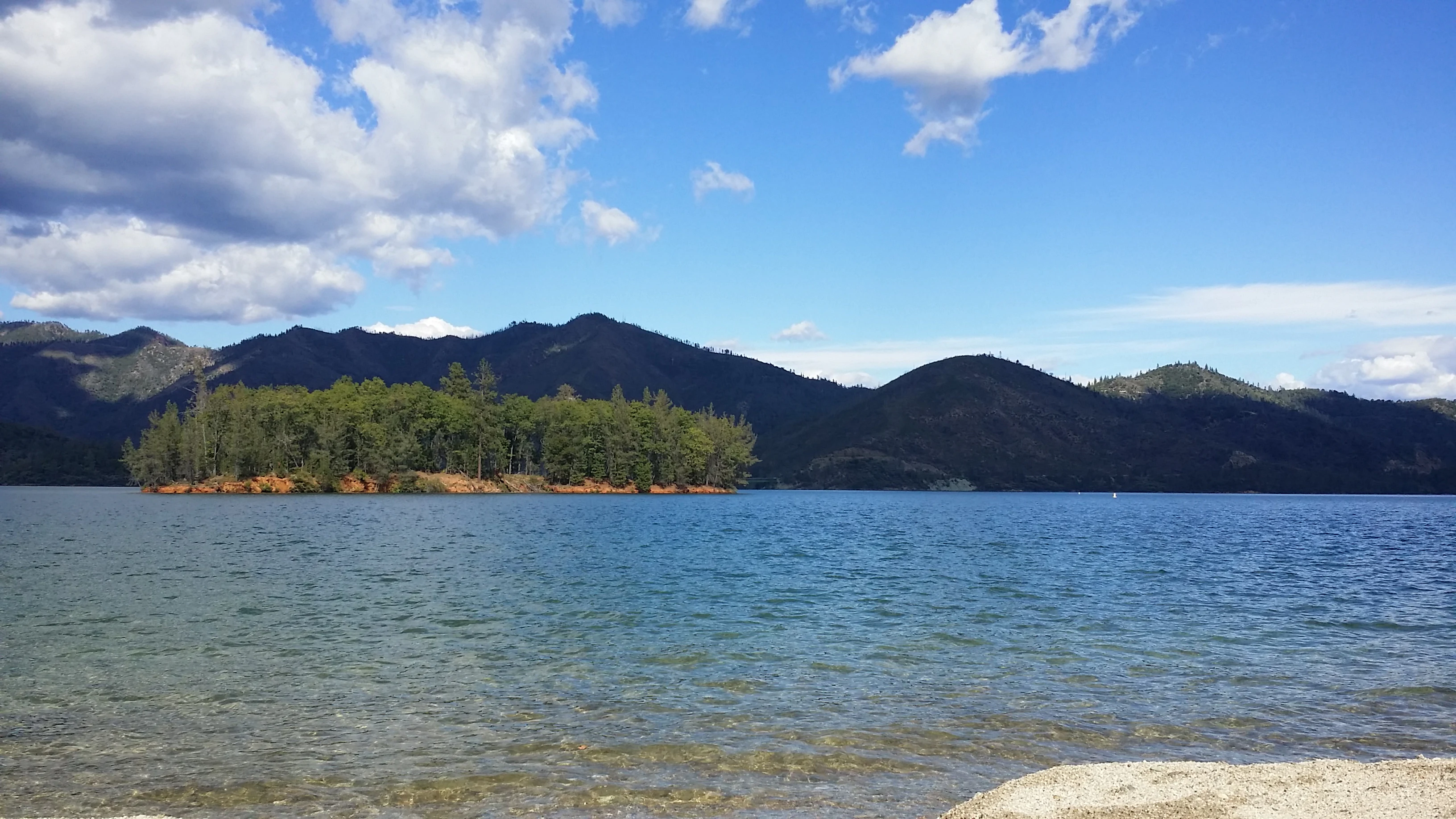
A wide angle shot of a calm blue lake with a small tree-covered island in the center, framed by distant forested mountains under a blue sky with scattered white clouds.
A view of the shoreline and forested island at Whiskeytown Lake.

Whiskeytown, Shasta, Trinity National Recreation Area history and protected-area timeline

The Whiskeytown–Shasta–Trinity National Recreation Area was authorized by the United States Congress on November 8, 1965, when the three distinct reservoir-centered landscapes were unified into a single federal recreation designation. The decision reflected a national trend in the mid-twentieth century toward formal protection of large water-based recreation landscapes around federal dams and reservoirs.

The reservoir at the heart of the recreation area's history was Shasta Lake, completed when Shasta Dam was built on the Sacramento River in the 1940s as part of the Central Valley Project. Trinity Lake and Lewiston Lake were developed somewhat later, with Trinity Dam constructed to support additional water storage and hydroelectric generation in the Trinity River basin. Whiskeytown Lake, completed earlier in the mid-twentieth century, gave its name to the recreation area's National Park Service portion.

Over time, management responsibility for the three units diverged. The Shasta and Trinity components remained with the United States Forest Service as part of the broader Shasta–Trinity National Forest, while the Whiskeytown unit was eventually administered by the National Park Service, which now operates it as a discrete unit called Whiskeytown National Recreation Area. Today the unified recreation area designation endures even though the three units are managed by different federal agencies.

Whiskeytown, Shasta, Trinity National Recreation Area landscape and geographic character

The landscape of Whiskeytown–Shasta–Trinity National Recreation Area is defined above all by water. Shasta Lake, the largest of the three reservoirs, fills a dendritic network of valleys and contains hundreds of miles of shoreline when full, with arms extending up the Sacramento, Pit, and McCloud River canyons. Trinity Lake stretches along the Trinity River, and its companion reservoir at Lewiston occupies a narrower canyon reach above Trinity Dam. Whiskeytown Lake, smaller and shallower, sits in a more enclosed basin ringed by forested ridges.

Surrounding the lakes is a varied foothill environment typical of the inland western slopes of northern California. Lower elevations are dominated by chaparral, blue oak savanna, and mixed oak woodland on dry, sun-exposed slopes. Higher up, the vegetation transitions into knobcone pine, ponderosa pine, and mixed evergreen forests, especially in the Trinity and Whiskeytown backcountry. Riparian corridors along tributary creeks and along the margins of each reservoir add a third distinct vegetation layer.

In the Whiskeytown Unit, the terrain beyond the shoreline rises into a backcountry of mountain creeks, small waterfalls, and forested ridges, crisscrossed by an extensive multi-use trail network. The Shasta and Trinity Units offer more expansive shoreline environments, with steep canyon walls and reservoir vistas shaped by the large earth- and concrete-fill dams that created the lakes.
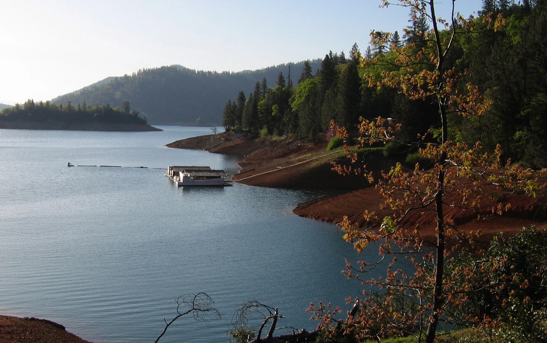
A wide angle view of a reservoir, Shasta Lake, with a floating dock on the water, a reddish-brown shoreline, and forested hills in the background under soft sunlight.
A view of Shasta Lake within the Whiskeytown, Shasta, Trinity National Recreation Area, featuring a floating dock and forested shoreline.

Whiskeytown, Shasta, Trinity National Recreation Area ecosystems, habitats, and plant life

Ecologically, Whiskeytown–Shasta–Trinity National Recreation Area sits at an important vegetation transition zone between the drier Sacramento Valley and the wetter montane forests of the Klamath and Cascade ranges. This position gives the recreation area a high concentration of plant communities within a relatively small footprint, ranging from chaparral and oak woodlands at lower elevations to mixed conifer forests in the higher backcountry.

The area's plant communities include interior chaparral, blue oak grasslands, mixed oak woodlands, knobcone pine stands, ponderosa pine forest, and mixed evergreen forest. Riparian vegetation lines the creeks and reservoir margins, creating distinctive habitat corridors that contrast with the drier slopes above. This diversity of vegetation types supports a correspondingly diverse wildlife community.

The reservoirs themselves are central to the area's ecological character, providing both aquatic habitat and the shoreline conditions that ospreys, bald eagles, and other water-associated species use for nesting and feeding. The combination of open water, riparian zones, oak woodlands, and conifer forest means that visitors moving from one elevation zone to another can encounter strikingly different plant and animal communities within a single unit.

Whiskeytown, Shasta, Trinity National Recreation Area wildlife and species highlights

The recreation area supports an unusually rich assemblage of wildlife for a reservoir-dominated landscape. Among its most notable species are nesting populations of ospreys and bald eagles, both of which use the forested shorelines and adjacent cliffs and trees as breeding habitat. The area is known to host substantial numbers of breeding pairs of both species across its various units.

In addition to raptors, the recreation area supports typical northern California foothill fauna, including black bears and mule deer, which are commonly seen across the Shasta, Trinity, and Whiskeytown Units. Resident and migratory birdlife is abundant throughout the year, taking advantage of the mix of open water, riparian corridors, oak woodlands, and conifer forests. Anglers, in particular, value the reservoirs and smaller lakes for trout and other freshwater fish.

The combination of large reservoirs, varied terrain, and relatively intact habitat makes the recreation area an important regional wildlife resource, especially for species that depend on large bodies of water surrounded by forest cover. The presence of apex predators and nesting raptors suggests that the surrounding habitats remain in reasonably healthy ecological condition.

Whiskeytown, Shasta, Trinity National Recreation Area conservation status and protection priorities

Whiskeytown–Shasta–Trinity National Recreation Area is recognized as an IUCN Category V protected landscape/seascape, reflecting its role as a managed cultural landscape rather than a strict nature reserve. Although heavily used for recreation, its three reservoir-centered units preserve a significant amount of natural habitat across the northern California foothills.

The area's conservation value lies largely in its size and in the diversity of plant communities and wildlife habitats it protects. Together, the three units maintain substantial populations of nesting ospreys and bald eagles, along with resident populations of black bears and mule deer. Riparian habitats along creeks and reservoir margins, oak woodlands on lower slopes, and conifer forests at higher elevations form a connected mosaic that is uncommon in this part of California.

Protection is reinforced by the layered management of the area. The Forest Service units benefit from the broader context of the surrounding Shasta–Trinity National Forest, while the National Park Service-managed Whiskeytown Unit receives an additional layer of federal protection for both its reservoir-centered recreation landscape and the surrounding backcountry. Together, these arrangements help safeguard water quality, wildlife habitat, and the scenic character of the recreation area against the development pressures typical of rapidly growing regions in California.

Whiskeytown, Shasta, Trinity National Recreation Area cultural meaning and human context

The recreation area sits within a region of northern California with a deep history rooted in mining, logging, ranching, and water development. The names of its units, including Whiskeytown and the surrounding Trinity and Shasta regions, reflect this layered past, ranging from Gold Rush-era settlement patterns to later generations of timber harvest and large-scale water infrastructure.

The construction of Shasta Dam, Trinity Dam, and related infrastructure in the twentieth century dramatically reshaped regional society, economy, and identity. The reservoirs created an outdoor recreation culture centered on lake-based activities such as boating, fishing, and camping that continues today. The presence of named scenic byways and established trail systems also points to a long tradition of public enjoyment of these landscapes.

The Trinity Heritage National Scenic Byway in the Trinity Unit, along with established campgrounds, marinas, and visitor amenities across the area, reflects an ongoing effort to interpret and share the natural and human history of this part of California with residents and visitors.

Top sights and standout views in Whiskeytown, Shasta, Trinity National Recreation Area

Three large reservoirs, including California's largest, anchor the recreation area and define its identity: Shasta Lake, Trinity and Lewiston Lakes, and Whiskeytown Lake. Each offers a distinct recreation experience, ranging from the massive shoreline and tributary arms of Shasta Lake to the narrow canyon scenery of the Trinity Unit and the compact, trail-rich environment of the Whiskeytown Unit.

Joint federal management is itself a defining feature: the area is unusual among national recreation areas in being co-administered by the National Park Service and the Forest Service, combining two complementary stewardship traditions. The mixed plant communities, including oak woodlands, chaparral, and montane conifer forests, and the area's nesting bald eagles, abundant ospreys, black bears, and mule deer, make it stand out as a wildlife-rich reservoir landscape in the foothills of northern California.

Best time to visit Whiskeytown, Shasta, Trinity National Recreation Area

The recreation area's appeal varies with the seasons in ways typical of inland northern California. Late spring through early fall is generally the most accessible period, when reservoir-based activities such as boating, swimming, and lakeside camping are fully available and the snow has receded from higher elevations in the Trinity and Shasta Units.

Spring and early summer are particularly favorable for birdwatchers, when migratory species are present alongside the area's nesting ospreys and bald eagles. Fall brings cooler temperatures, fewer crowds, and stable lake levels, making it a good time for hiking, scenic driving, and fishing. Winter conditions can limit access in some areas, especially in the higher elevations of the Shasta and Trinity Units, but the lower Whiskeytown Unit generally remains accessible year-round.

Monthly climate preview

Long-term representative temperature and precipitation normals across the annual cycle

Whiskeytown–Shasta–Trinity National Recreation Area Climate and Weather by Month

Representative coordinates record significant thermal variation alongside distinct precipitation rhythms across the annual cycle at Whiskeytown–Shasta–Trinity National Recreation Area. Detailed monthly climate normals provide structured baseline measurements for tracking temperature ranges and precipitation averages over time.
Annual mean15 °C
5 °C28 °C
Jan
Feb
Mar
Apr12°
May17°
Jun22°
Jul28°
Aug27°
Sep23°
Oct16°
Nov
Dec
Warmest month
July

27.7 °C

Coolest month
December

5 °C

Wettest month
December

6.6 mm/day

Driest month
July

0.1 mm/day

Park location guide

Geography guide, regional context, and park location map for Whiskeytown, Shasta, Trinity National Recreation Area

Whiskeytown, Shasta, Trinity National Recreation Area park geography, regions, and map view in United States of America

Understand where Whiskeytown, Shasta, Trinity National Recreation Area sits in United States of America through a broader geographic reading of the surrounding landscape, nearby location context, and its mapped position within the national park landscape.

How Whiskeytown, Shasta, Trinity National Recreation Area fits into United States of America

The United States of America is a federal presidential republic and one of the world's largest countries by area and population. It consists of 50 states across a vast territory spanning multiple time zones, with its capital in Washington, D.C. and largest city in New York City. The nation has a diverse economy, influential political system, and significant cultural and military presence globally.

Wider geography shaping Whiskeytown, Shasta, Trinity National Recreation Area in United States of America

The United States occupies a vast territory in North America, bordered by Canada to the north and Mexico to the south. The 48 contiguous states stretch from the Atlantic to the Pacific Ocean, while Alaska occupies the northwestern region and Hawaii is an archipelago in the Pacific. The country encompasses diverse terrain including the Rocky Mountains, Appalachian Mountains, Great Plains, and extensive river systems.

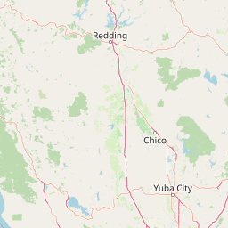
Map view of Whiskeytown, Shasta, Trinity National Recreation Area

Use this park location map to pinpoint Whiskeytown, Shasta, Trinity National Recreation Area in United States of America, understand its exact geographic position, and read its mapped placement within the surrounding landscape more clearly.

Pigeon | © OpenStreetMap contributors

Location context for Whiskeytown, Shasta, Trinity National Recreation Area

California
Recorded earthquake history

Review Recorded Earthquake History near Whiskeytown–Shasta–Trinity National Recreation Area

Investigate historical seismic records in the vicinity of the recreation area to understand regional activity patterns. This MoriAtlas catalogue provides event dates and geographic data points for analysis, offering a deeper view into the seismic context of these northern California foothills and reservoir landscapes.

Whiskeytown–Shasta–Trinity Earthquake History

Catalogued events

103 events

Strongest magnitude

Magnitude 5.1

Most recent event

Oct 16, 2025

This history includes earthquakes recorded inside the park or within 50 km of its borders

Visual reference collection for northern California reservoirs, foothill terrain, and wildlife habitats.

Whiskeytown–Shasta–Trinity National Recreation Area Photos and Landscape Scenery

Visual documentation captures the vast reservoir shores, steep canyon walls, and diverse foothill forests that define Whiskeytown–Shasta–Trinity National Recreation Area. Examining these landscape photographs provides deeper insight into the protected terrain, plant communities, and aquatic environments spanning northern California.

A wide angle shot of a calm blue lake with a small tree-covered island in the center, framed by distant forested mountains under a blue sky with scattered white clouds.

A person sailing a small white sailboat on a calm blue lake with forested mountains in the background.

A wide angle view of a reservoir, Shasta Lake, with a floating dock on the water, a reddish-brown shoreline, and forested hills in the background under soft sunlight.

Park atlas

Compare regional park geography, foothill reserves, and connected northern California conservation units.

Other Parks Near Whiskeytown–Shasta–Trinity National Recreation Area and Surrounding Protected Landscapes

Browsing nearby protected areas allows visitors to evaluate adjacent foothill ecosystems, reservoir environments, and forest reserves. Comparing regional park geography provides broader context for understanding the inland northern California natural landscape.
A soft watercolor painting depicting a serene landscape with gentle green hills, a small forest, and a calm lake at sunrise or sunset.
Protected landscapeCalifornia
5.1 km away#1 closest

West

Shasta, Trinity National Forest: Mapping the Protected Landscapes of Northern California

Volcanic peaks, expansive reservoirs, and rugged mountain wilderness

Spanning over two million acres, Shasta, Trinity National Forest represents a major protected landscape in Northern California. The geography includes the iconic Mount Shasta volcano and the complex shoreline of Shasta Lake, while hosting expansive wilderness areas and diverse terrain ranging from oak-forested foothills to alpine meadows.

Area
8,942.87 km²
Established
1954
Relief
Mountain
Climate
Temperate
A watercolor illustration showing a soft, panoramic view of green trees and rolling hills against pale, pinkish-yellow mountains in the background.
Protected landscapeCalifornia
54 km away#2 closest

South

Mendocino National Forest: Mapping California's Remote Protected Mountain Landscape

Examining wilderness boundaries and rugged coastal terrain

Mendocino National Forest serves as a significant protected area in California, known for being the only national forest in the state without major paved access. Its terrain spans 913,000 acres of mountain peaks, deep river canyons, and old-growth conifer forests. Home to the unique tule elk population at Lake Pillsbury, this landscape provides a rare example of wilderness isolation, complex geothermal features, and rugged, largely untouched northern coastal topography.

Area
3,696.02 km²
Established
1907
Relief
Mountain
Climate
Mediterranean
Watercolor painting of a peaceful river landscape, featuring rolling green hills, dense trees, and distant soft-toned mountains.
Protected areaCalifornia
57 km away#3 closest

Northwest

Six Rivers National Forest: Exploring Protected River Valleys and Mountain Terrain in California

A regional protected area spanning California river systems

Six Rivers National Forest defines much of the rugged landscape in northwestern California. Named for the six major river drainages within its borders, the area features a unique combination of coastal forests, deep river canyons, and high-country ridges that offer significant insight into the region's broader geographic and ecological character.

Area
3,875.2 km²
Established
1947
Relief
Mountain
Climate
Mediterranean
A wide watercolor illustration showing a calm body of water surrounded by green hills, conifer trees, and reeds in the foreground.
Protected landscapeCalifornia
61 km away#4 closest

East

Lassen National Forest: Mapped Geography and Protected Landscapes of Northern California

Volcanic terrain and expansive old growth ecosystems

Lassen National Forest represents a vast protected landscape in Northern California, defined by its severe volcanic geology and resilient conifer forests. This atlas entry provides essential geographic context regarding the forest boundaries, the volcanic rim of Mount Tehama, and the intricate river systems shaping the region. Explore the terrain, from accessible lava tubes to the wilderness areas preserved within this significant mountain corridor.

Area
4,331.53 km²
Established
1905
Relief
Mountain
Climate
Temperate
Wildlife reserveCalifornia
69 km away#5 closest

Southeast

Ishi Wilderness Wildlife Reserve: Mapping the Volcanic Canyons of the Cascade Foothills

Geographic atlas of protected northern California wilderness and cultural landscapes.

Ishi Wilderness represents a crucial protected area in northern California, where volcanic geology meets a deep-rooted cultural history. Explore the mapped ridgelines, river canyons, and diverse oak woodland habitats that define this unique wildlife reserve and its role within the Cascade foothills.

Area
167.29 km²
Established
1984
IUCN
Ib
Relief
Mountain
National parkCalifornia
79 km away#6 closest

East

Lassen Volcanic National Park: Protected Landscape Identity and Geographic Context

Discover the mapped boundaries and natural terrain of this California national park.

Gain a structured understanding of Lassen Volcanic National Park as a protected landscape. This detail page provides essential geographic context, focusing on the park's mapped boundaries and its specific terrain characteristics within California. It is designed for users seeking detailed information about the park's protected status and its placement within the broader atlas of natural areas, emphasizing its unique geographic identity and conservation significance.

Area
430.8 km²
Established
1916
IUCN
II
Visitors
504.8K annual
A soft watercolor illustration depicting a series of distant mountain ranges behind a line of evergreen trees against a white background.
Wildlife reserveCalifornia
81 km away#7 closest

North

Mount Shasta Wilderness: A Geographic Profile of California Volcanic and Alpine Landscapes

Mapping protected volcanic peaks and glacial ecosystems

Deeply explore the protected geography of Mount Shasta Wilderness, a 38,200-acre reserve in Northern California. This record details the park's stratovolcano foundations, glacial terrain, and forested corridors, offering a clear view of the complex landforms and boundary systems that define this significant high-elevation protected area.

Area
155 km²
Established
1984
IUCN
Ib
Relief
Mountain
Protected landscapeCalifornia
84 km away#8 closest

Northwest

Marble Mountain Wilderness: Exploring Protected Mountain Landscapes in Northern California

Klamath Mountains Wilderness and Alpine Geography

Spanning hundreds of thousands of acres, Marble Mountain Wilderness offers a dense concentration of subalpine fir, deep glacial lakes, and steep drainage basins. This northern California protected landscape provides an atlas of rugged ridges and marble-toned peaks that represent one of the most ecologically diverse backcountry areas in the region.

Area
978.3 km²
Established
1964
IUCN
Ib
Relief
Mountain

Common questions about visiting, size, designation, and location context for Whiskeytown, Shasta, Trinity National Recreation Area

Whiskeytown, Shasta, Trinity National Recreation Area FAQs for park facts, access, geography, and protected area context

Find quick answers about Whiskeytown, Shasta, Trinity National Recreation Area, including protected-area facts, park geography, trail and visitor context, and how the park fits into its surrounding country and regional landscape.
MoriAtlas Explorer

Continue Your Protected Areas Search Across the Global Atlas

Deepen your exploration by continuing the structured search for national parks and protected areas worldwide. Utilize the comprehensive filtering capabilities to compare different conservation landscapes and refine your understanding of global park geography. Discover more about the distribution and characteristics of protected natural areas.

Global natural geography