

Mori Atlas logo
Protected landscapeWhite River National Forest

Examining the high-altitude terrain, wilderness boundaries, and regional geography of a key Rocky Mountain protected forest

White River National Forest: A Comprehensive Atlas of Colorado's Primary Protected Landscape

White River National Forest spans over two million acres of diverse terrain across northwest Colorado, encompassing the high peaks of the Central Rockies and the expansive volcanic plateaus of the Western Slope. This protected landscape contains eight distinct wilderness areas and twelve major ski resort hubs, anchoring the environmental and recreational identity of the region. Through detailed mapping and landscape analysis, the forest reveals a complex geography of glacial cirques, subalpine forests, and critical watersheds that define the character of the Colorado mountain corridor.

alpine landscapesrocky mountainsski countrywilderness areasnational forestsubalpine forest

White River National Forest

Protected landscape

Park overview

Structured park overview, official facts, and landscape profile for White River National Forest

White River National Forest park facts, protected area profile, and essential visitor context

Review the core facts for White River National Forest, including designation, size, terrain, visitor scale, habitats, and operating context in one park-focused overview.

About White River National Forest

White River National Forest occupies a substantial portion of northwest Colorado, where the rugged spine of the Rocky Mountains descends toward the Colorado River valley. Geographically it bridges two classic Colorado landscapes: the high, snow-loaded alpine country of the Sawatch, Elk, and Tenmile ranges, and the more open mesas, plateaus, and river canyons of the western slope. The White River itself, which gives the forest its name, flows through the northern part of the unit and eventually joins the Green River drainage.

The forest's protected status dates to June 28, 1902, placing it among the early national forests created in the American West. It has since grown in significance, particularly through the establishment of multiple wilderness areas and the consolidation of the Dillon Ranger District from Arapahoe National Forest in 1998. Today it is managed as a multi-use landscape that balances wilderness protection, outdoor recreation, wildlife habitat, timber and range management, and reservoir operations.

Recreation is the forest's most visible function. Twelve major ski areas operate within or partly within its boundaries, and thousands of miles of roads and trails support summer activities such as hiking, backpacking, mountain biking, horseback riding, and fishing. Major reservoirs, including Dillon, Green Mountain, Ruedi, and Homestake, support boating, water storage, and hydropower, while also providing outstanding trout habitat. Together these amenities establish the forest as a cornerstone of Colorado's outdoor economy.

Wildlife and wilderness are equally central to the forest's identity. Eight officially designated wilderness areas preserve large tracts of undisturbed alpine and subalpine terrain. These areas, along with surrounding national forest lands, sustain elk, mule deer, mountain goats, bighorn sheep, black bears, mountain lions, bobcats, lynx, and moose, as well as diverse birdlife and native trout. The combination of high ecological value, dramatic scenery, and intense recreational use makes White River National Forest one of the most recognizable national forests in the United States.

Quick facts and research context for White River National Forest

White River National Forest covers approximately 2.3 million acres in northwest Colorado, making it one of the largest national forests in the Rocky Mountain region. It was established on June 28, 1902, and is managed by the U.S. Forest Service, with the supervisor's office in Glenwood Springs and ranger district offices in communities including Aspen, Carbondale, Eagle, Meeker, Minturn, Rifle, and Silverthorne.

The forest stretches across parts of nine Colorado counties: Eagle, Pitkin, Garfield, Summit, Rio Blanco, Mesa, Gunnison, Routt, and Moffat. It contains eight designated wilderness areas, ten recognized fourteeners within its boundaries, and roughly 1,900 miles of forest system roads and 2,500 miles of trails, along with the Dillon, Green Mountain, Ruedi, and Homestake reservoirs.

Protection and recognition

Documented terrestrial protection scope and administrative recognition details

White River National Forest Protection Status and Land Designation

White River National Forest maintains a documented terrestrial protection scope without imported international recognition sources. Structured facts outline the baseline administrative designation and management framework governing the protected landscape.

Protection details

Protection scope
Terrestrial
Transboundary protection
No
Park context

Deeper park guide and search-rich context for White River National Forest

White River National Forest history, landscape, wildlife, and travel context

Explore White River National Forest through its history, landscape character, ecosystems, wildlife, conservation priorities, cultural context, and seasonal travel timing in a structured park guide built for atlas discovery and search intent.

Why White River National Forest stands out

White River National Forest is best known for its concentration of Colorado ski areas, including Aspen, Vail, Breckenridge, and Aspen Highlands, which together make it the most visited national forest in the United States. Its ski terrain and high-altitude scenery anchor both winter and summer recreation in the central Rockies. Equally distinctive is the forest's high-alpine character. It includes ten peaks above 14,000 feet and eight wilderness areas, among them the Maroon Bells-Snowmass Wilderness and the Mount of the Holy Cross Wilderness. The Maroon Bells, two of the most photographed mountains in North America, sit within its boundaries and have become a visual signature of the forest.
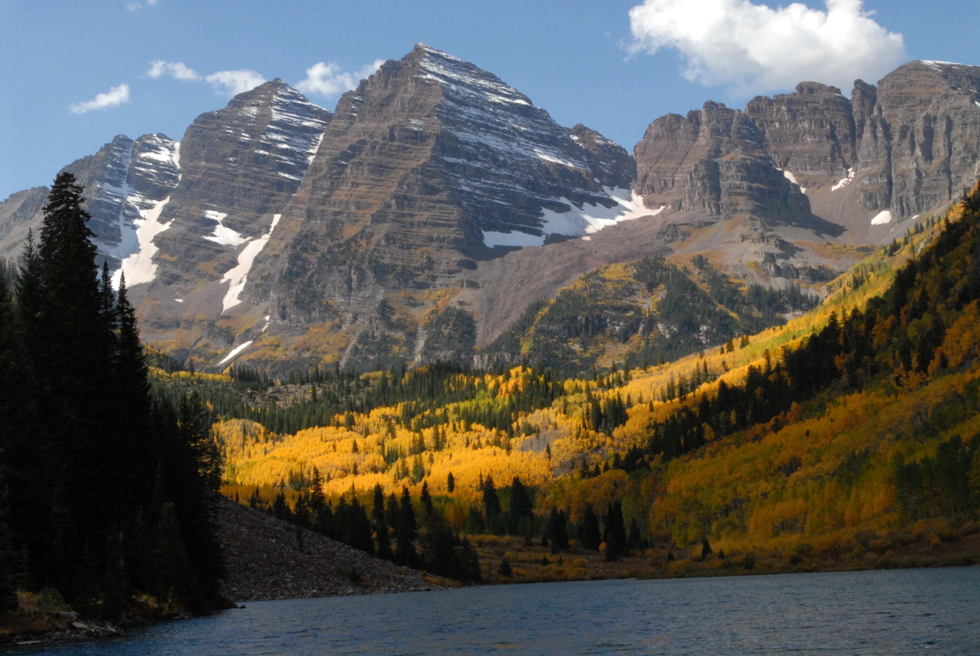
Maroon Lake in autumn
Maroon Lake during peak fall foliage in late September 2011, located in White River National Forest, Colorado.

White River National Forest history and protected-area timeline

White River National Forest was established on June 28, 1902, during the early era of American forest conservation when large tracts of western timberland and watershed were being set aside under the emerging national forest system. Its creation reflected growing recognition of the importance of protecting high-country watersheds, timber resources, and the surrounding mountain ecosystems that fed rivers such as the Colorado, the Gunnison, and the White.

Over the twentieth century the forest's role expanded beyond traditional extraction and watershed management. Wilderness designation brought new layers of protection: the Flat Tops Wilderness, sometimes cited as the birthplace of the U.S. Wilderness Area system, lies within the forest, along with the Maroon Bells-Snowmass, Holy Cross, Eagles Nest, Hunter-Fryingpan, Collegiate Peaks, Raggeds, and Ptarmigan Peak Wilderness Areas. In 1998 the Dillon Ranger District was transferred from the neighboring Arapahoe National Forest into White River National Forest, consolidating management across a more continuous high-country landscape.

The late twentieth and early twenty-first centuries saw explosive growth in outdoor recreation on the forest, particularly downhill and backcountry skiing. Resorts such as Vail, Breckenridge, Aspen Mountain, Aspen Highlands, and Snowmass transformed formerly quiet high-country valleys into some of the most visited recreation sites in the country. The forest's identity today is shaped by this dual inheritance: a conservation legacy expressed through its wilderness and wildlife, and a recreation legacy expressed through its world-class ski areas and trail networks.

White River National Forest landscape and geographic character

White River National Forest spans a striking gradient of Rocky Mountain terrain. In its eastern and central portions, the Sawatch, Elk, Tenmile, and Gore ranges rise above 14,000 feet, with glacial cirques, high alpine tundra, exposed granite, and snowfields visible well into summer. Together these ranges create some of the most photographed high-country scenery in Colorado, including the twin Maroon Bells peaks near Aspen and the distinctive cross-shaped ridgeline of Mount of the Holy Cross.

Moving west and north, the elevation drops and the landscape transitions into the broader plateau country of the Colorado Western Slope. Here, dense coniferous forest covers rolling ridges, while rivers and creeks cut increasingly deep canyons toward the Colorado River system. The northern part of the forest includes terrain associated with the Flat Tops, a massive volcanic plateau characterized by broad, flat summits, basalt cliffs, and scenic high-mountain country.

Several large reservoirs anchor the landscape at lower elevations. Dillon Reservoir, Green Mountain Reservoir, Ruedi Reservoir, and Homestake Reservoir interrupt the river valleys, creating open water, marshy edges, and dam-controlled flows. Together the high peaks, deep valleys, forested slopes, plateau country, and reservoir systems give White River National Forest a landscape diversity that is unusual even within Colorado's network of national forests.

White River National Forest ecosystems, habitats, and plant life

The ecological character of White River National Forest reflects the strong elevation gradient described above. At lower and middle elevations, montane and subalpine forests of lodgepole pine, Engelmann spruce, subalpine fir, and aspen dominate the slopes, often in dense, fire-adapted stands. Higher up, fragile alpine tundra ecosystems cling to ridgelines and peaks above treeline, supporting hardy grasses, wildflowers, and specialized tundra fauna.

Wilderness areas are a defining ecological feature. Eight officially designated wilderness zones, including Flat Tops, Maroon Bells-Snowmass, Holy Cross, and Eagles Nest, protect large blocks of undisturbed forest and alpine habitat. The Flat Tops in particular is noted for its volcanic geology and its mosaic of open meadows, talus slopes, and subalpine forest, while the Maroon Bells-Snowmass Wilderness preserves the dramatic glaciated terrain of the Elk Mountains.

Riparian and aquatic environments form a third ecological pillar. The forest's streams, rivers, and reservoirs support native cutthroat and rainbow trout populations, while riparian corridors along the White River and its tributaries create habitat for waterfowl and other wetland-associated species. Reservoir edges, beaver wetlands, willow bottoms, and meadow systems contribute additional ecological complexity to the otherwise forest-dominated terrain.

White River National Forest wildlife and species highlights

White River National Forest provides significant habitat for a wide range of large mammals typical of the central Rockies. Elk and mule deer are widespread, particularly in the forested elevations and meadow margins, while bighorn sheep and mountain goats occupy the steeper alpine and cliff habitats of the higher ranges. Black bears, mountain lions, bobcats, and the more elusive Canada lynx also roam the forest, the latter tied closely to the dense subalpine spruce-fir forests that serve as its core habitat.

Moose have become an increasingly visible part of the forest's wildlife profile, especially in the willow-dominated riparian zones around the Flat Tops and in the drainages of the northern parts of the forest. Raptors are well represented, with golden eagles, bald eagles, and a variety of hawks nesting along cliff bands and forested ridges, while waterfowl concentrate around the reservoir systems and the marshy edges of the White River.

Aquatic wildlife is also a defining element. Native cutthroat trout populations inhabit high-elevation streams, while the larger reservoirs support both wild and stocked fisheries. The combination of large terrestrial mammals, reclusive predators, alpine raptors, and trout-rich waters gives White River National Forest a wildlife profile closely associated with the classic high-country experience of the Colorado Rockies.

White River National Forest conservation status and protection priorities

Conservation in White River National Forest rests on three reinforcing layers: long-term national forest protection, formal wilderness designation, and watershed-based management. The forest's establishment in 1902 placed its lands under U.S. Forest Service management, and the subsequent designation of eight wilderness areas has permanently protected substantial portions of its most ecologically sensitive terrain from road-building and development. The Flat Tops Wilderness, often cited as a seminal area in the early American wilderness movement, carries special historical significance in this regard.

Watershed protection has long been a quiet but powerful conservation function. The forest's reservoirs and headwater streams supply water to communities, farms, and downstream fisheries across northwest Colorado. By keeping these watersheds under federal management, the forest helps safeguard water quality, downstream river flows, and the broader ecological health of the White River and Colorado River systems.

Wildlife conservation is another central theme. Habitat for elk, mule deer, bighorn sheep, mountain goats, black bears, mountain lions, lynx, moose, raptors, waterfowl, and native trout is preserved across a landscape large enough to support viable populations. Conservation challenges include managing intense recreational pressure, particularly around the ski areas, mitigating the effects of fire and bark beetle outbreaks on forest health, and balancing wilderness values with continuing public access across one of the most heavily used national forests in the country.

White River National Forest cultural meaning and human context

The landscape of what is now White River National Forest has carried cultural meaning for Indigenous peoples, early Anglo-American settlers, ranchers, and miners long before it became a protected area. Ute peoples historically used the high country of the central Rockies for hunting, traveling, and seasonal rounds, and names such as Aspen, Eagle, and Gunnison reflect that older geographic and cultural layer.

The late nineteenth and early twentieth centuries brought mining, ranching, and early tourism to the region. Silver and gold booms, narrow-gauge railroads, and remote ranch homesteads left a lasting imprint on nearby towns such as Aspen, Glenwood Springs, and Silverthorne. Hot springs at Glenwood Springs also helped establish the town as an early resort destination, foreshadowing the forest's later identity as a recreation capital.

The development of the ski industry in the mid-twentieth century transformed the cultural identity of the forest region. Resorts such as Aspen, Vail, and Breckenridge grew from small mountain towns into internationally known destinations, drawing visitors from around the world and embedding skiing and outdoor recreation deeply into local culture. Today, the forest represents both a Colorado cultural icon and a working landscape, simultaneously a symbol of high-country tourism and a continuing expression of the American conservation tradition.

Top sights and standout views in White River National Forest

Among the forest's most recognizable highlights are the Maroon Bells, two of the most photographed mountains in North America, rising beside the still waters of Maroon Lake within the Maroon Bells-Snowmass Wilderness. Equally dramatic is Mount of the Holy Cross, whose distinctive cross-shaped snowfield sits at the heart of the Holy Cross Wilderness and has inspired artists and visitors for more than a century.

The Flat Tops Wilderness offers a strikingly different experience: a vast volcanic plateau of flat-topped summits, broad meadows, and rocky basins often considered the birthplace of the U.S. Wilderness Area system. The forest's twelve ski areas, ranging from Aspen's four mountains to Vail, Breckenridge, Beaver Creek, and Keystone, give it an unmatched role in winter recreation. Together these landscapes, peaks, wilderness zones, and resort destinations form the essential highlights that define White River National Forest.

Best time to visit White River National Forest

White River National Forest offers distinctive experiences through every season, though the optimal time depends on the kind of visit a traveler is seeking. Winter, generally from December through March, is the forest's signature season, when deep snow blankets the high country and the twelve ski areas come fully alive. Resorts such as Vail, Aspen, Breckenridge, and Aspen Highlands offer a full spectrum of piste and powder skiing, while backcountry enthusiasts find extensive terrain throughout the surrounding wilderness areas.

Summer and early autumn, from roughly June through October, are the prime months for hiking, backpacking, wildlife viewing, and scenic drives. high-country roads, including Independence Pass near Aspen, typically open from late spring to early fall, revealing alpine wildflowers in midsummer and golden aspen stands in September. Spring and late autumn tend to be quieter shoulder seasons, with variable access to high elevation roads and an emphasis on lower-elevation trails, reservoir fishing, and early wildlife activity. Each season reflects a different facet of the forest's identity, from snowy recreation center to wildflower-filled alpine wilderness.

Monthly climate preview

Long-term representative temperature and precipitation averages across the protected landscape

White River National Forest Climate Normals and Annual Weather by Month

White River National Forest exhibits a measured annual rhythm of freezing winters and moderate summer peaks across its representative high elevation coordinates. Reviewing the full monthly temperature and precipitation profile provides deeper context for long-term regional climatology.
Annual mean2 °C
-8 °C15 °C
Jan-8°
Feb-8°
Mar-4°
Apr
May
Jun12°
Jul15°
Aug14°
Sep10°
Oct
Nov-4°
Dec-8°
Warmest month
July

15.3 °C

Coolest month
January

-8.4 °C

Wettest month
April

2.1 mm/day

Driest month
December

1 mm/day

Park location guide

Geography guide, regional context, and park location map for White River National Forest

White River National Forest park geography, regions, and map view in United States of America

Understand where White River National Forest sits in United States of America through a broader geographic reading of the surrounding landscape, nearby location context, and its mapped position within the national park landscape.

How White River National Forest fits into United States of America

The United States of America is a federal presidential republic and one of the world's largest countries by area and population. It consists of 50 states across a vast territory spanning multiple time zones, with its capital in Washington, D.C. and largest city in New York City. The nation has a diverse economy, influential political system, and significant cultural and military presence globally.

Wider geography shaping White River National Forest in United States of America

The United States occupies a vast territory in North America, bordered by Canada to the north and Mexico to the south. The 48 contiguous states stretch from the Atlantic to the Pacific Ocean, while Alaska occupies the northwestern region and Hawaii is an archipelago in the Pacific. The country encompasses diverse terrain including the Rocky Mountains, Appalachian Mountains, Great Plains, and extensive river systems.

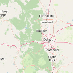
Map view of White River National Forest

Use this park location map to pinpoint White River National Forest in United States of America, understand its exact geographic position, and read its mapped placement within the surrounding landscape more clearly.

Pigeon | © OpenStreetMap contributors

Location context for White River National Forest

Colorado

Visual reference guide to alpine peaks, subalpine forests, and protected wilderness terrain.

White River National Forest Photos and Rocky Mountain Landscape Scenery

Visual records reveal the diverse protected-area environment, from jagged fourteen-thousand-foot peaks to volcanic plateaus and forested river valleys. Examining detailed landscape photography helps researchers understand regional terrain characteristics and high-altitude habitats across the mountain ecosystem.

Maroon Lake in autumn

Park atlas

Compare surrounding regional geography, high-alpine terrain, and protected mountain landscapes

Explore Parks Near White River National Forest and Connected Rocky Mountain Reserves

Continue browsing other parks near White River National Forest to examine adjacent Rocky Mountain reserves and high-altitude wilderness zones. Comparing these surrounding protected landscapes reveals broader regional elevation gradients, wildlife habitats, and interconnected alpine ecosystems.
Protected areaColorado
Mapped location lies within the park boundary#1 closest

East

Mount Evans Wilderness: Alpine Landscapes and Protected Geography in Colorado

Glacial cirques and high-altitude wilderness ecosystems.

Mount Evans Wilderness offers a premier look at the Colorado Front Range, defined by its dramatic relief, sheer cliff lines, and extensive glacial history. This entry examines the wilderness as a protected zone that transitions from montane forests to tundra, providing a reference for high-elevation mountainous geography within the United States.

Area
301.09 km²
Established
1980
IUCN
Ib
Relief
Mountain
Protected areaColorado
About 0.1 km away#2 closest

Southeast

Pike National Forest: Protected Mountain Landscapes and Regional Geography in Central Colorado

Granite peaks, montane forests, and diverse alpine terrain

Spanning from the rolling foothills of the Front Range to the high alpine summits of the Rocky Mountains, Pike National Forest is a significant protected area defined by its unique Pikes Peak granite bedrock and deep river-carved canyons. This analysis provides a structured look at its expansive wilderness boundaries, drainage basins, and the vertical transitions that characterize this vital central Colorado highland.

Area
4,478.27 km²
Established
1892
Relief
Mountain
Climate
Alpine
Protected landscapeColorado
About 29 km away#3 closest

North

Roosevelt National Forest: Mapping Wilderness and Protected Landscapes in Northern Colorado

Regional geography, river corridors, and alpine mountain terrain

Roosevelt National Forest encompasses a significant protected landscape across Larimer, Boulder, Gilpin, and Jefferson counties. The forest features a complex terrain of deep canyons, forested plateaus, and protected wilderness areas that form a scenic buffer along the eastern side of the Continental Divide and Rocky Mountain National Park.

Area
3,293.33 km²
Established
1902
Relief
Mountain
Climate
Subpolar
Wildlife reserveColorado
About 30 km away#4 closest

North

James Peak Wilderness: Geographic Profile and Protected Landscape Mapping

High elevation terrain in the Colorado Rockies

James Peak Wilderness provides a critical protected landscape featuring dramatic alpine summits, U-shaped glacial valleys, and subalpine meadows. Its geographic structure forms an essential ecological link along the Colorado Front Range, characterized by high-elevation peaks, dense coniferous forests, and diverse tundra ecosystems situated immediately east of the Continental Divide.

Area
68.86 km²
Established
2002
IUCN
Ib
Wildlife reserveColorado
About 38 km away#5 closest

North

Indian Peaks Wilderness: Alpine Geography and Front Range Protected Landscapes

Mapping high country summits and glacial basins in Colorado

Indian Peaks Wilderness stands as a signature wildlife reserve along the Colorado Continental Divide. This atlas entry focuses on its complex system of thirteen-thousand-foot peaks, relict glaciers, and interconnected alpine lakes that define the Front Range. Gain insight into the protected boundaries and glacial geomorphology that characterize this high-country landscape near the Denver metropolitan region.

Area
310.44 km²
Established
1978
IUCN
Ib
Relief
Mountain
Wildlife reserveColorado
About 39 km away#6 closest

Southeast

Lost Creek Wilderness: A Mapped Atlas of Granite Formations and Protected Colorado Terrain

Exploratory mapping of central Colorado mountain foothills

Lost Creek Wilderness represents a significant protected corridor within the Pike National Forest of Colorado. The region is characterized by an unusual density of granite spires, arches, and domes, providing a distinct contrast to typical alpine landscapes. By examining the mapped boundaries and natural features of this wildlife reserve, users can better understand the unique hydrographic and geological systems that define this notable section of the Rocky Mountains.

Area
484.8 km²
Established
1980
IUCN
Ib
Relief
Mountain
Wildlife reserveColorado
About 39 km away#7 closest

West

Eagles Nest Wilderness: Alpine Geography and Protected Landscape of the Colorado Gore Range

High-mountain protected area in the White River National Forest

Spanning the southern Gore Range, Eagles Nest Wilderness represents a core protected landscape in Colorado characterized by high-elevation peaks, glacial cirque lakes, and extensive backcountry trail networks. Its geography bridges the gap between deep coniferous forests and exposed alpine tundra, maintaining significant ecological and historical value within the mountainous terrain of Eagle and Summit Counties.

Area
546.79 km²
Established
1976
IUCN
Ib
Relief
Mountain
Protected landscapeGrand County
About 46 km away#8 closest

North

Arapaho National Recreation Area: Geographic Profile and Protected Landscape Context

High-country mountain reservoirs and forested mountain terrain

The Arapaho National Recreation Area defines a unique intersection of montane forest and water-based geography in Grand County, Colorado. As the home to the Great Lakes of Colorado, this protected landscape provides a critical connection point between the Colorado River headwaters and the Continental Divide. Examine the park's terrain, reservoir distribution, and its role as a forested gateway to the neighboring mountain regions.

Area
124.2 km²
Established
1978
Relief
Mountain
Climate
Alpine

Common questions about visiting, size, designation, and location context for White River National Forest

White River National Forest FAQs for park facts, access, geography, and protected area context

Find quick answers about White River National Forest, including protected-area facts, park geography, trail and visitor context, and how the park fits into its surrounding country and regional landscape.
MoriAtlas Explorer

Continue Your Protected Areas Search Across the Global Atlas

Deepen your exploration by continuing the structured search for national parks and protected areas worldwide. Utilize the comprehensive filtering capabilities to compare different conservation landscapes and refine your understanding of global park geography. Discover more about the distribution and characteristics of protected natural areas.

Global natural geography