
Mori Atlas logo
Nature reserveWiesen am Layenhof – Ober-Olmer Wald

Understanding the mapped landscape boundaries and ecological diversity of this Rhineland-Palatinate nature reserve.

Wiesen am Layenhof – Ober-Olmer Wald Nature Reserve: A Protected Mosaic of Forest and Meadow

Wiesen am Layenhof – Ober-Olmer Wald encompasses a complex ecological landscape on the outskirts of Mainz, protecting a diverse interface of mature beech forests, silicate dry grasslands, and traditional orchard meadows. This nature reserve, integral to the European Natura 2000 network, features hummocky woodland pools and extensive species-rich turf that support numerous rare plants and insects. The geographic terrain demonstrates a rare conservation success where sensitive woodland and open meadow habitats coexist within a densely populated German region.

nature reservedeciduous forestorchard meadowsdry grasslandbeech forestNatura 2000
A flat-style digital illustration showing a wooden boardwalk leading toward a central mountain range with a cascading waterfall, surrounded by evergreen and deciduous trees, with a sun shining in the top right corner.

Wiesen am Layenhof – Ober-Olmer Wald

Nature reserve

Park overview

Structured park overview, official facts, and landscape profile for Wiesen am Layenhof, Ober-Olmer Wald

Wiesen am Layenhof, Ober-Olmer Wald park facts, protected area profile, and essential visitor context

Review the core facts for Wiesen am Layenhof, Ober-Olmer Wald, including designation, size, terrain, visitor scale, habitats, and operating context in one park-focused overview.

About Wiesen am Layenhof, Ober-Olmer Wald

Wiesen am Layenhof – Ober-Olmer Wald is a relatively young but ecologically rich nature reserve in the federal state of Rhineland-Palatinate. It represents a deliberate effort to secure, in a single protected framework, both the forested slopes of the Ober-Olmer Wald and the open, traditionally managed grassland landscape around the Layenhof near Mainz-Finthen. Although the two character zones differ markedly, they are linked by shared geology, a common cultural land-use history, and tightly interwoven ecological edges.

Within the city of Mainz, the reserve belongs administratively to the Finthen district, while additional portions extend into the Verbandsgemeinde area around Essenheim and Ober-Olm and into the territory of Ingelheim am Rhein. The landscape reflects the transition between the Mainz basin and the gently rising terrain of the Rheinhessen uplands, where dry, sun-exposed slopes meet cooler, more sheltered woodland hollows. The topography ranges from open, windswept high meadows to dense beech and mixed forest stands dotted with small, temporary pools.

A defining feature of the reserve is the variation in its grassland types. Dry and semi-dry swards, bent-grass communities, silicate dry grasslands, and Mattengras Heath-like Borstgrasrasen all occur, often within short distances of one another. Orchids are a particular hallmark of the dry grassland, while lowland hay meadows and orchard meadows add structural variety and provide food and shelter for insects, birds, and small mammals. The woodland component, dominated by stands of beech with associated oak and other native broadleaf species, is recognized for its high-quality Galio odorati-Fagetum beech forest, a habitat type of European conservation interest.

The reserve was officially designated in January 2017 by the Struktur- und Genehmigungsdirektion Süd, the regional authority responsible for nature protection in southern Rhineland-Palatinate. Its designation follows the long-running recognition of the Ober-Olmer Wald as a Natura 2000 site and reflects the broader Rhineland-Palatinate strategy of combining woodland and open-land habitats into single, integrated protected areas. The reserve is also notable for its connection to the locality's layered history, including the earlier military use of part of the area as a rocket station and its current partial use as a US Forces training ground, both of which have left traces in the cultural landscape.

Quick facts and research context for Wiesen am Layenhof, Ober-Olmer Wald

Wiesen am Layenhof – Ober-Olmer Wald is a combined woodland-and-meadow nature reserve in Rhineland-Palatinate, covering about 533 hectares across parts of Mainz and the Mainz-Bingen district. It was legally designated as a protected area in January 2017.

The reserve lies just west of the city of Mainz, reaching into the municipalities of Essenheim and Ober-Olm and into Ingelheim am Rhein. Its core landscapes include the Ober-Olmer Wald, the dry and orchard meadows around the Layenhof, numerous small woodland pools, and transitional zones between forest and open ground. The Ober-Olmer Wald portion is simultaneously part of the Natura 2000 network, while the Mainz-Finthen airfield sits within the protected boundary under special conditions.

Protection and recognition

Review documented terrestrial protection scope and official recognition details

Wiesen am Layenhof – Ober-Olmer Wald Protection Status and Designated Area Record

Wiesen am Layenhof – Ober-Olmer Wald maintains a documented terrestrial protection scope within its regional landscape. Structured records outline available designation data and management parameters for conservation analysis.

Protection details

Protection scope
Terrestrial
Transboundary protection
No
Park context

Deeper park guide and search-rich context for Wiesen am Layenhof, Ober-Olmer Wald

Wiesen am Layenhof, Ober-Olmer Wald history, landscape, wildlife, and travel context

Explore Wiesen am Layenhof, Ober-Olmer Wald through its history, landscape character, ecosystems, wildlife, conservation priorities, cultural context, and seasonal travel timing in a structured park guide built for atlas discovery and search intent.

Why Wiesen am Layenhof, Ober-Olmer Wald stands out

The reserve is especially valued for its combination of native deciduous woodland with traditionally managed dry and orchard meadows on the edge of a major German city. It is a strong example of how habitat mosaics, including lowland beech forest, silicate dry grasslands, orchid-rich dry turf, and Streuobstwiesen, can be conserved side by side. It is also known ecologically as a refuge for species that have become rare elsewhere in central Europe, including the Bechstein's bat, the stag beetle, the European green woodpecker, the black kite, and ground-nesting birds such as the whinchat that benefit from the fenced, disturbance-protected airfield grassland. The site's biodiversity indicators, around 110 ground beetle species and roughly 280 butterfly species documented for the area, underline its importance as a regional biodiversity hotspot.

A common kestrel standing on a metallic post, viewed in profile against a light background.
A common kestrel perched on a metal structure within the nature reserve.

Wiesen am Layenhof, Ober-Olmer Wald history and protected-area timeline

The landscape that the reserve now protects has a long history of varied human use. Parts of the Ober-Olmer Wald were used for military purposes for several decades, including the operation of a rocket station during the Cold War, a chapter in the site's past commemorated by art steles installed in the protected area. Some zones remain in active military use today as a training ground for the US Forces near Mainz-Finthen, and the reserve's protection rules formally defer to the end of this military use in those sections.

The ecological recognition of the area accumulated gradually. The Ober-Olmer Wald had already gained formal status as a Natura 2000 site before the broader reserve was created, reflecting its value as a habitat for native deciduous woodland, dry grassland, and small water bodies. At the same time, the meadows around the Layenhof had long been appreciated for their species-rich dry grassland and traditional orchard management.

The decisive moment came in January 2017, when the Struktur- und Genehmigungsdirektion Süd formally designated the combined area as the Naturschutzgebiet Wiesen am Layenhof – Ober-Olmer Wald through a published legal ordinance. The opening ceremony, attended by Rhineland-Palatinate's Environment Minister at the time, Ulrike Höfken, framed the designation as a contribution to preserving biodiversity in an area under intense suburban pressure. Shortly afterward, the Wald-Naturschutz-Zentrum, a forest and nature center, opened in 2021 to serve visitors with exhibitions and educational programming, marking a new phase of public engagement with the reserve.

Wiesen am Layenhof, Ober-Olmer Wald landscape and geographic character

The landscape of Wiesen am Layenhof – Ober-Olmer Wald is shaped by a striking contrast between enclosed woodland and open, sunlit grassland. The Ober-Olmer Wald component consists of gently sloping, mature deciduous forest, with beech as the dominant species, accompanied by oak and other native broadleaves. The forest understorey varies with exposure and soil, producing mosaics of dense shade, herb-rich patches, and small clearings.

Interspersed through the woodland are numerous small pools and seasonal puddles, locally called Tümpel, that collect in shallow depressions. These small water bodies are a defining microhabitat of the reserve and give the forest a varied, hummocky character on the ground. Woodland paths trace a roughly 25-kilometer network of trails through this forest landscape, providing access while protecting sensitive zones from widespread disturbance.

Beyond the woodland, the reserve opens onto the Layenhof meadows, a broad, gently rolling tract of dry and semi-dry grassland, orchard meadows, and nutrient-poor swards. The open ground includes silicate dry grassland, bent-grass swards, Borstgrasrasen, lowland hay meadows, and traditional orchard meadows, often drifting into one another across subtle topographic shifts. Dry turf with orchid-rich stands is a particular feature of the warmer, thinner-soiled slopes, while the cooler, north-facing edges support denser vegetation and small thickets. Bushes, hedgerow-like tree lines, and isolated trees break up the open ground in classic Streuobst fashion.
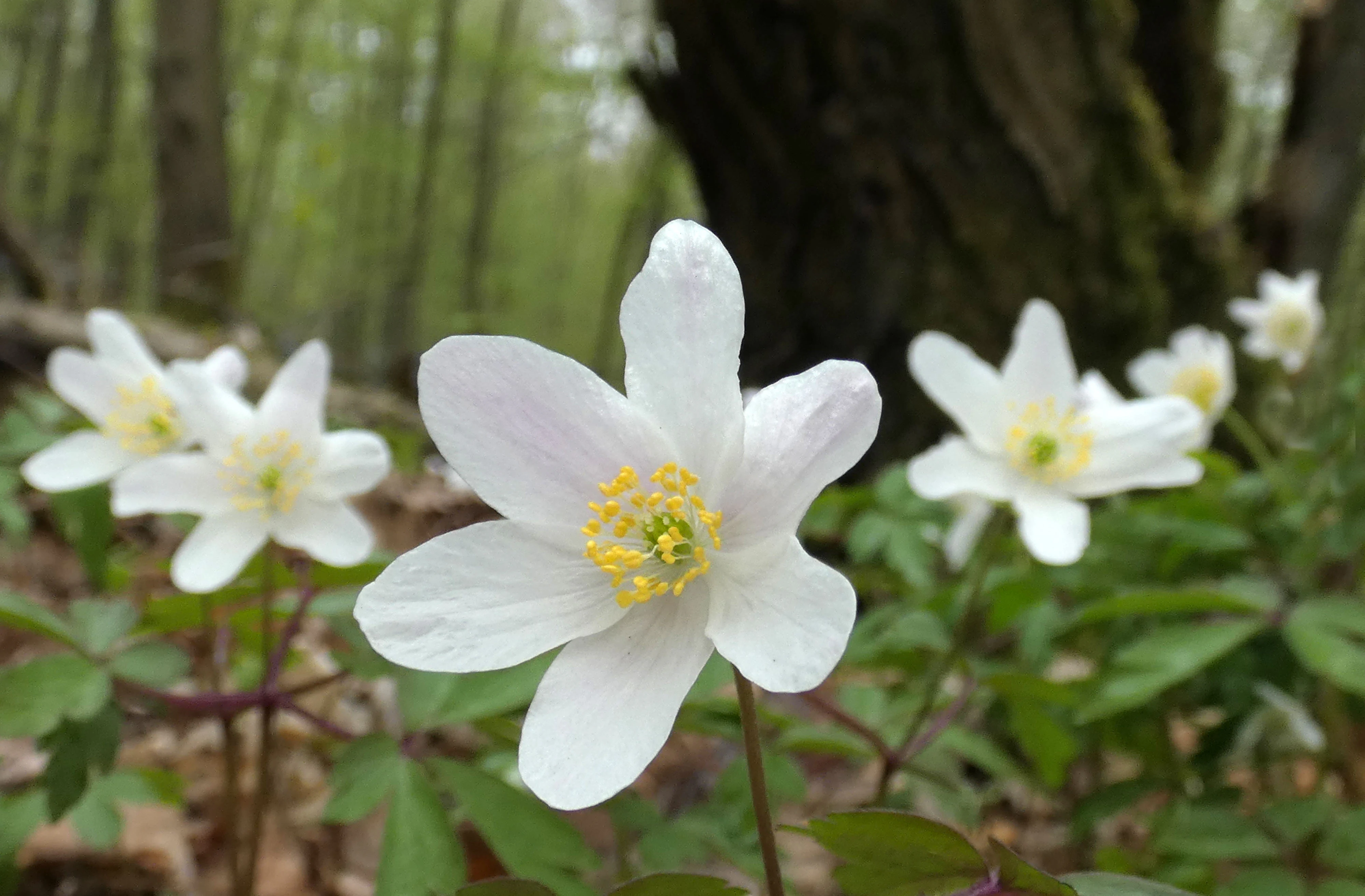
A cluster of white wood anemone flowers in bloom on a forest floor, with a blurred dark tree trunk in the background.
Wood anemones blooming in the Ober-Olmer Wald forest.

Wiesen am Layenhof, Ober-Olmer Wald ecosystems, habitats, and plant life

Ecologically, the reserve is best understood as a habitat mosaic rather than a single ecosystem. Its woodland core is dominated by native broadleaf forest, including a well-developed Galio odorati-Fagetum, or Waldmeister-Buchenwald, a beech forest type rich in woodruff and other characteristic herbs. This woodland type is recognized under European habitat conservation frameworks and forms an important part of the reserve's Natura 2000 identity through the Ober-Olmer Wald.

The open-land habitats layer multiple types of species-rich grassland. Magerwiesen, or lean meadows, Halbtrockenrasen, semi-dry grassland, Silikattrockenrasen, silicate dry grassland, and mat-grass heath-like Borstgrasrasen coexist within a relatively small area. This grassland complexity provides niches for specialist plants such as orchids in dry turf and supports a wide community of insects and other invertebrates. Scattered through the open land are traditional orchard meadows, where old fruit trees rise out of herb-rich swards, adding structural diversity, shade patches, and cavity-bearing wood for wildlife.

Edges and transitions are themselves ecologically important. Hedges, bush groups, scrub patches, and small woodlots connect the forest to the open meadows, functioning as movement corridors and shelter for many species. Small water bodies, temporary pools, and woodland ponds add yet another ecological layer, supporting amphibians and moisture-loving plants while reinforcing the overall habitat diversity of the reserve.
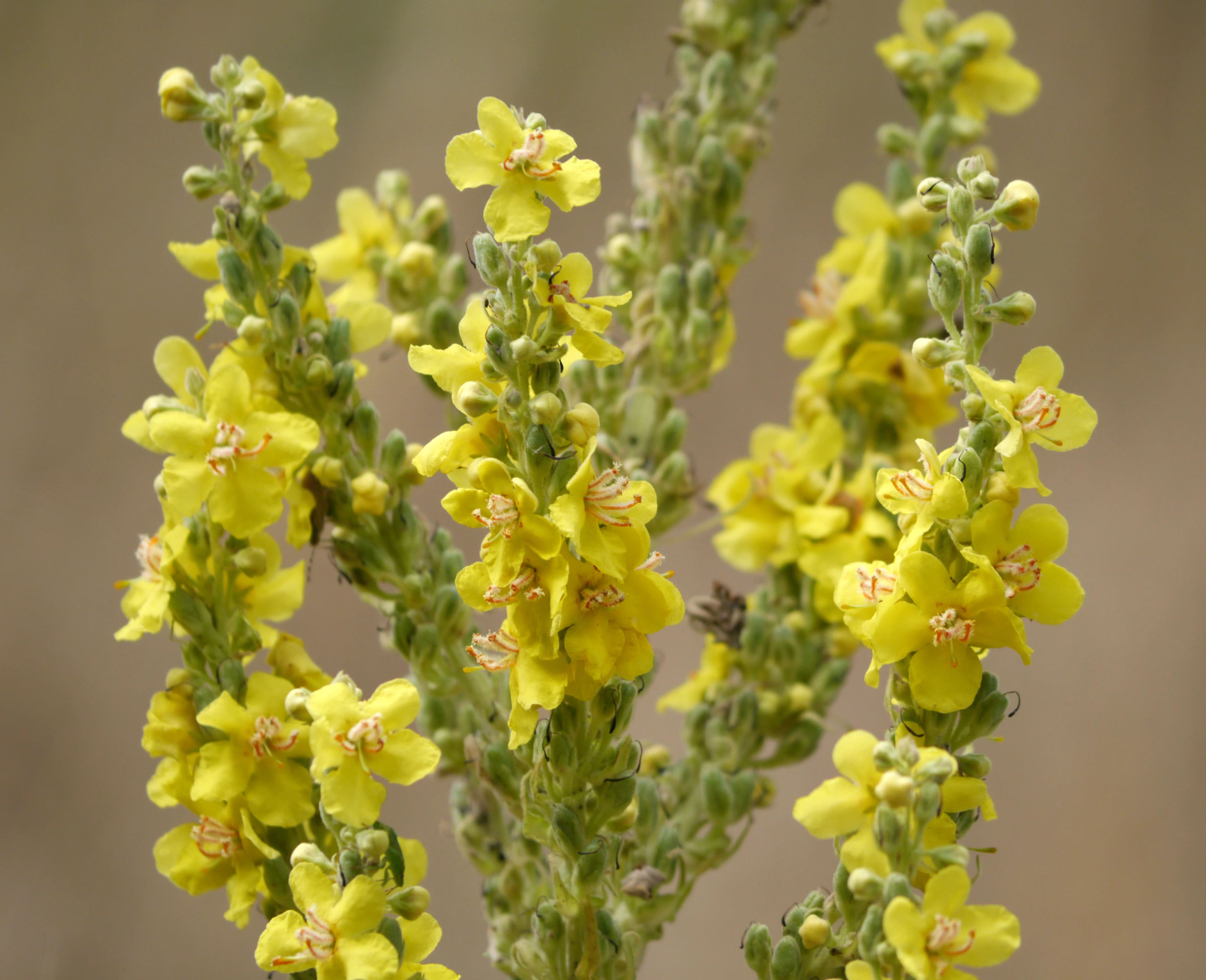
Close-up of a Black Mullein plant with vibrant yellow flowers and unopened green buds against a blurred natural background.
Black Mullein blooming in the Wiesen am Layenhof, Ober-Olmer Wald nature reserve.

Wiesen am Layenhof, Ober-Olmer Wald wildlife and species highlights

The reserve's wildlife profile reflects its combination of robust woodland and extensively managed open grassland. Among the more notable bird species, the European green woodpecker and the black kite have been highlighted as characteristic residents, alongside ground-nesting species such as the whinchat and the stonechat, both of which favor the open, disturbance-protected airfield meadow. Common kestrels use old metal posts on the airfield fencing as hunting perches, taking advantage of the area's high small-mammal populations.

Bats are a particular conservation focus, with the Bechstein's bat identified as a key species of concern. The reserve's mix of mature deciduous forest, cavity-bearing orchard trees, and structurally rich edges provides excellent foraging and roosting habitat for this and other woodland bat species. Invertebrate diversity is also striking, with scientific surveys documenting around 110 ground beetle species and approximately 280 butterfly species for the wider area, including fauna associated with the historic military training grounds.

Amphibians benefit from the network of small woodland pools and puddles in the Ober-Olmer Wald, while the stag beetle is among the most charismatic invertebrates tied to the older broadleaf trees and orchard groves. The fenced enclosure of the Mainz-Finthen airfield, while originally installed for aviation safety, has produced an unintended benefit for ground-breeding birds, reducing human and dog disturbance in those open grassland sections.
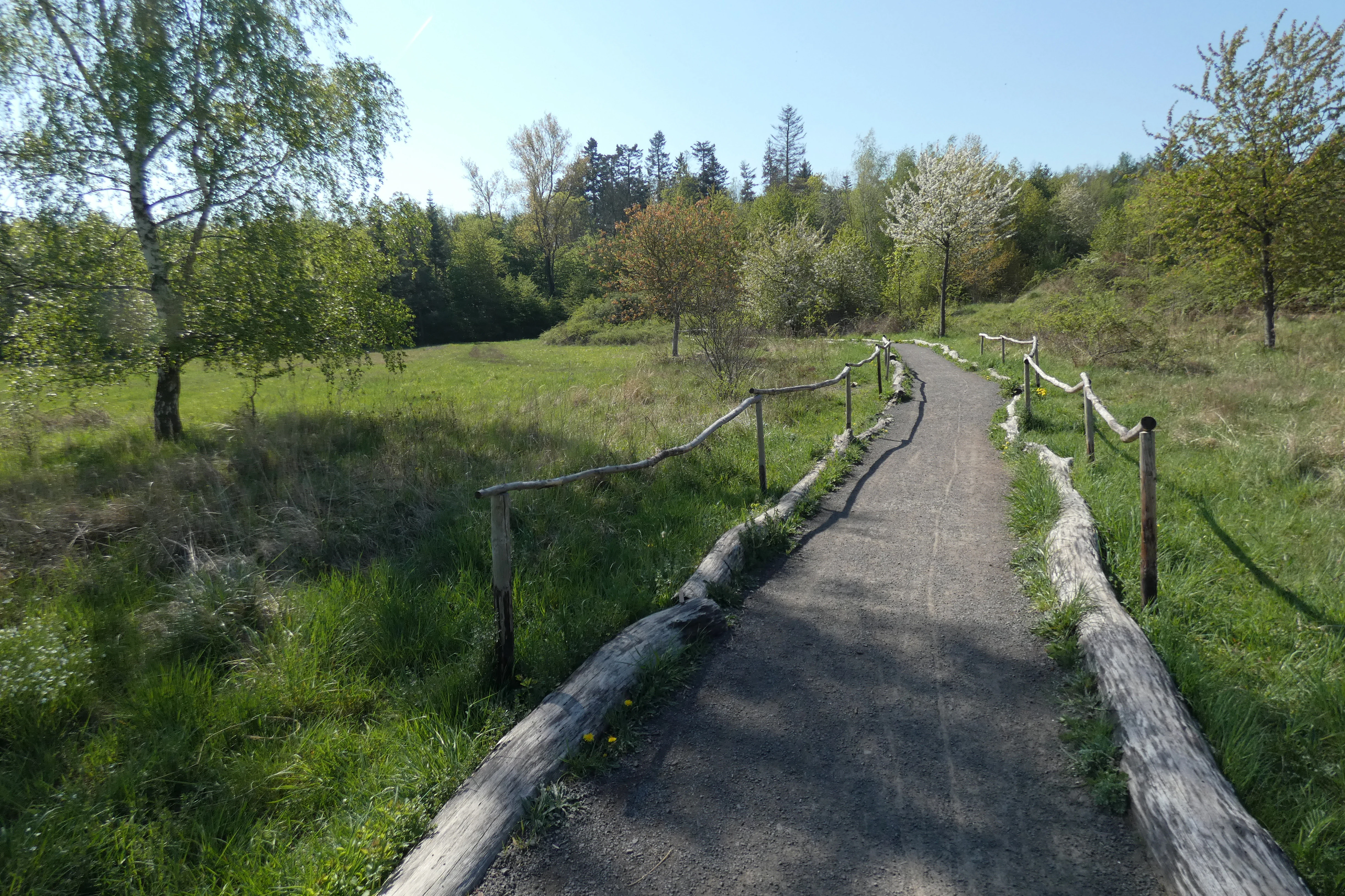
A gravel path for hikers winds through a green meadow with scattered trees and a wooden fence on either side in the Ober-Olmer Wald.
A gravel trail bordered by wooden railings winds through a meadow in the Ober-Olmer Wald nature reserve.

Wiesen am Layenhof, Ober-Olmer Wald conservation status and protection priorities

Wiesen am Layenhof – Ober-Olmer Wald is a conservation response to the pressure of suburban expansion on the western edge of Mainz. By bringing together the Ober-Olmer Wald and the Layenhof meadows in a single legal framework, the reserve protects a connected complex of habitats that would otherwise be vulnerable to fragmentation from urban growth, infrastructure, and changing land use.

The formal protection objectives set by the designating authority, the Struktur- und Genehmigungsdirektion Süd, center on the maintenance, development, and restoration of dry and semi-dry grassland types, including Magerwiesen, Halbtrockenrasen, Silikattrockenrasen, and Borstgrasrasen, and of lowland hay meadows and orchard meadows. The woodland objectives focus on preserving and restoring native deciduous forest, particularly Waldmeister-Buchenwald, and on maintaining small pools, heath patches, and orchid-rich dry turf.

The reserve also carries broader European significance. The Ober-Olmer Wald section is part of the Natura 2000 network, linking the site's protection to EU-wide conservation priorities for habitat types such as dry heath, lowland hay meadows, orchid-rich dry grassland, and Galio odorati-Fagetum beech forest. The reserve's conservation logic therefore extends from local biodiversity policy to transnational habitat protection frameworks, making it a notable example of integrated landscape-level conservation in Rhineland-Palatinate.

Wiesen am Layenhof, Ober-Olmer Wald cultural meaning and human context

The cultural context of the reserve is shaped by the long coexistence of military use, traditional agriculture, and nature protection on the same terrain. During the Cold War, part of the area hosted a rocket station, a chapter of the region's history now commemorated by art steles in the woodland. Today, a portion of the protected area continues to function as a training ground for the US Forces at Mainz-Finthen, with environmental protection rules formally deferred until that military use ends.

Alongside this military heritage, the landscape carries a strong tradition of low-intensity, biodiversity-friendly agriculture. Orchard meadows around the Layenhof reflect generations of regional fruit cultivation interwoven with extensive meadow management, a practice that has both shaped and sustained the species-rich grassland the reserve now protects. The opening of the Wald-Naturschutz-Zentrum in 2021 added a contemporary layer of public engagement, offering exhibitions and educational programming that connect visitors to the area's natural and cultural layers.

A male common stonechat bird perched on horizontal strands of barbed wire against a clear sky.
A male common stonechat perched on a barbed wire fence at the Wiesen am Layenhof nature reserve.

Top sights and standout views in Wiesen am Layenhof, Ober-Olmer Wald

Wiesen am Layenhof – Ober-Olmer Wald stands out for the tight weave of native deciduous forest and extensively managed dry grassland on the edge of a major city. Its 25-kilometer trail network, orchid-rich dry turf, Waldmeister-Buchenwald beech stands, and small woodland pools make it a compact but unusually varied nature reserve. The integration of the Mainz-Finthen airfield into the protected perimeter, with reduced disturbance benefiting ground-nesting birds, adds an unusual dimension to its conservation value.
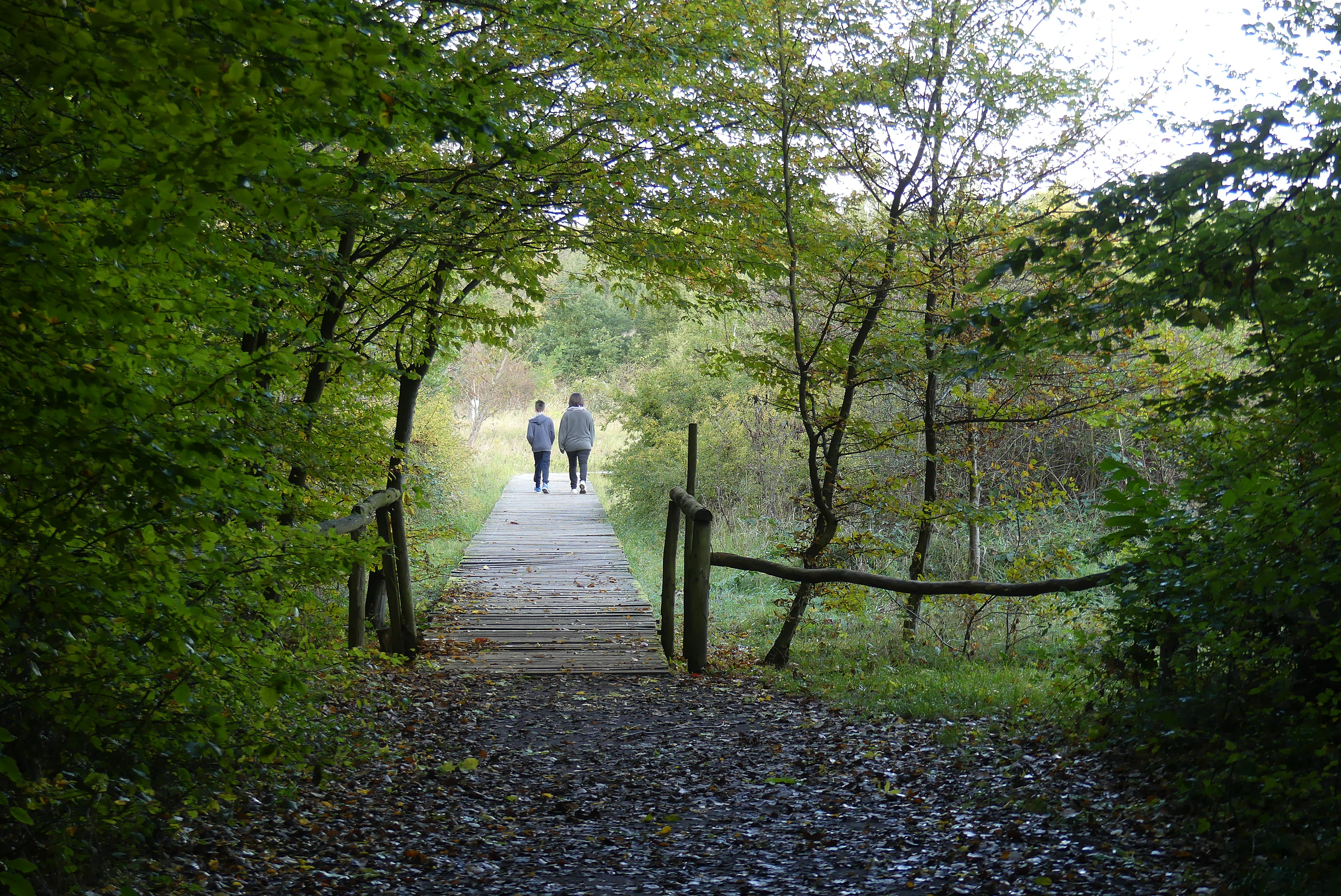
A dirt path leads to a wooden bridge, where two people are walking away from the camera, exiting a dense forest into an open meadow area.
Two people walking on a wooden footbridge transitioning from forest cover to an open area in Ober-Olmer Wald.

Best time to visit Wiesen am Layenhof, Ober-Olmer Wald

Spring is one of the most rewarding seasons to experience the reserve, when woodland paths through the Ober-Olmer Wald are flanked by characteristic displays of wood anemones and fresh herb growth in the beech forest, while early-season warmth begins to activate the meadows and their insect life.

Late spring into early summer brings the dry and semi-dry grasslands into their richest phase, when orchids and a wide range of flowering herbs are most visible in the open Layenhof meadows. Summer continues to offer strong insect and butterfly activity, particularly on warm days on the dry turf. Autumn highlights the older broadleaf and orchard trees in the reserve, while the open ground remains accessible for those interested in the area's late-season plant communities. Quiet, mild days at any time of year tend to be the most rewarding for observing the reserve's birdlife, including ground-nesting species on the airfield meadows.

Monthly climate preview

Long-term temperature ranges and monthly precipitation recorded for this Rhineland-Palatinate coordinate

Wiesen am Layenhof – Ober-Olmer Wald Climate Normals and Annual Weather Patterns

Representative coordinate measurements reveal the multi-year annual rhythm of average temperatures and daily precipitation at Wiesen am Layenhof – Ober-Olmer Wald. Detailed monthly climate normals provide broader context for studying long-term environmental patterns across the protected landscape.
Annual mean9 °C
0 °C20 °C
Jan
Feb
Mar
Apr
May13°
Jun17°
Jul20°
Aug19°
Sep15°
Oct
Nov
Dec
Warmest month
July

19.6 °C

Coolest month
January

-0.1 °C

Wettest month
July

2.2 mm/day

Driest month
April

1.5 mm/day

Park location guide

Geography guide, regional context, and park location map for Wiesen am Layenhof, Ober-Olmer Wald

Wiesen am Layenhof, Ober-Olmer Wald park geography, regions, and map view in Germany

Understand where Wiesen am Layenhof, Ober-Olmer Wald sits in Germany through a broader geographic reading of the surrounding landscape, nearby location context, and its mapped position within the national park landscape.

How Wiesen am Layenhof, Ober-Olmer Wald fits into Germany

Germany is a federal republic in Western and Central Europe with a population of over 83 million across sixteen constituent states. It is Europe's largest economy by nominal GDP and a major global exporter and importer. The capital is Berlin, and the country borders Denmark, Poland, Czech Republic, Austria, Switzerland, France, Luxembourg, Belgium, and the Netherlands.

Wider geography shaping Wiesen am Layenhof, Ober-Olmer Wald in Germany

Germany is located in Western and Central Europe, spanning 357,022 km². It borders Denmark to the north, Poland and the Czech Republic to the east, Austria and Switzerland to the south, and France, Luxembourg, Belgium, and the Netherlands to the west. The country has coastlines on the Baltic Sea and North Sea to the north, with the Alps located in the southern region.

Map view of Wiesen am Layenhof, Ober-Olmer Wald

Use this park location map to pinpoint Wiesen am Layenhof, Ober-Olmer Wald in Germany, understand its exact geographic position, and read its mapped placement within the surrounding landscape more clearly.

Pigeon | © OpenStreetMap contributors

Location context for Wiesen am Layenhof, Ober-Olmer Wald

Rhineland-Palatinate

Visualizing the deciduous forests, dry grasslands, and protected habitats of Rhineland-Palatinate

Wiesen am Layenhof – Ober-Olmer Wald Landscape Photos and Scenery

Visual documentation reveals the intricate mosaic of mature beech woodland, sunlit orchard meadows, and dry turf shaping the protected terrain of Wiesen am Layenhof – Ober-Olmer Wald. Photographic records help visitors examine the distinct microhabitats, open grassland boundaries, and ecological character defining this suburban nature reserve.

A common kestrel standing on a metallic post, viewed in profile against a light background.

Two toads in amplexus floating in dark, rippled water.

A cluster of white wood anemone flowers in bloom on a forest floor, with a blurred dark tree trunk in the background.

Close-up of a Black Mullein plant with vibrant yellow flowers and unopened green buds against a blurred natural background.

A gravel path for hikers winds through a green meadow with scattered trees and a wooden fence on either side in the Ober-Olmer Wald.

A high-angle view of a wooded area in the Ober-Olmer Wald, featuring a paved trail winding through green meadows, shrubs, and deciduous trees under a cloudy sky.

A male common stonechat bird perched on horizontal strands of barbed wire against a clear sky.

A dirt path leads to a wooden bridge, where two people are walking away from the camera, exiting a dense forest into an open meadow area.

A person walks along a wooden boardwalk through a grassy forest clearing, passing a tall rectangular sign displaying a black and white photographic portrait.

A modern, grey-paneled single-story building with a wide, open-air entrance hall, situated in a forest clearing at the Ober-Olmer Wald.

A small whinchat bird with brown and white plumage perched on a green shrub against a soft, out-of-focus background.

A dirt hiking trail leads into the distance through a dense, green forest with autumn leaves scattered on the ground.

A wide view of a grassy meadow with patches of dry grass, scattered small shrubs, and distant airfield buildings under a clear sky.

Park atlas

Compare regional habitats and nearby nature reserves across the surrounding terrain

Parks Near Wiesen am Layenhof – Ober-Olmer Wald and Protected Landscapes

Browsing other parks near Wiesen am Layenhof – Ober-Olmer Wald reveals a rich mosaic of deciduous woodlands and dry grasslands across the surrounding region. Comparing adjacent protected landscapes provides valuable geographic context for understanding central European habitat networks.
A soft watercolor painting of a forest landscape with slender trees, green grass, and distant rolling hills against a pale, warm sky.
Nature reserveRhineland-Palatinate
About 5.6 km away#1 closest

North

Lennebergwald Nature Reserve: Mapped Geography and Protected Forest Landscapes in Germany

Rhineland-Palatinate woodland and dry forest ecosystem analysis

Analyze the Lennebergwald nature reserve through its geological and ecological profile. This protected area in Rhineland-Palatinate showcases a rare inland sand forest structure, linking together pine and oak stands with vital dry grassland habitats that form a critical ecological mosaic in central Germany.

Area
8 km²
Established
1996
Relief
Lowland
Climate
Temperate
Nature reserveRhineland-Palatinate
About 6.4 km away#2 closest

Northwest

Hangflächen um den Heidesheimer Weg: Nature Reserve Geography and Protected Landscape Context

Mainz-Bingen, Rhineland-Palatinate Nature Reserve

Hangflächen um den Heidesheimer Weg contains an unusual ecological convergence of sand dunes, open flats, and calcareous grasslands near Ingelheim am Rhein. This nature reserve provides critical protection for a fragmented yet highly structured landscape where springs and wetland zones intersect with warm, dry slopes. The area preserves a significant biotope complex of national importance within the Upper Rhine Plain.

Area
3.348 km²
Established
2003
A horizontal watercolor illustration of a natural landscape featuring a small body of water or pond in the foreground, surrounded by grassy banks, low hills in the distance, and soft-colored vegetation.
Nature reserveRhineland-Palatinate
About 6.6 km away#3 closest

Northwest

Sandgrube am Weilersberg Nature Reserve and Protected Landscape Map

Rhineland-Palatinate, Germany protected area

Sandgrube am Weilersberg is a protected nature reserve in Rhineland-Palatinate, Germany, known for its compact mosaic of calcareous sand slopes and wet meadows. Part of the Natura 2000 network, the site preserves rare steppe flora and wetland ecosystems that emerged following former sand extraction. The terrain supports significant entomological, botanical, and bryological diversity maintained through active grazing.

Area
0.095 km²
Established
1986
Relief
Lowland
Climate
Temperate
A watercolor painting showing a soft, atmospheric landscape with a river flowing through green hills and gentle, misty mountains.
Nature reserveRhineland-Palatinate
About 7.7 km away#4 closest

Northeast

Inselrhein Nature Reserve, Rhineland-Palatinate: A Geographic and Protected-Area Atlas

River islands, floodplain forests, and Upper Rhine wetlands

Inselrhein features a chain of natural river islands and side channels forming a critical wetland habitat. The terrain transition from soft-wood to hardwood forest communities creates a layered landscape. Examine the protected boundaries and geographic significance of this river corridor between Mainz and Bingen, documented within the Rhineland-Palatinate atlas.

Relief
Lowland
Climate
Temperate
Access
Easy access
Scope
Terrestrial
A horizontal watercolor painting of a river landscape with lush green trees, grasses, and a winding waterway under a soft light.
Nature reserveHessen
About 8.1 km away#5 closest

Northwest

Mariannenaue Nature Reserve: Protected River Island Geography and Landscape Atlas

Rhine river island and floodplain forest in Hessen, Germany.

Mariannenaue serves as a prominent example of a protected inland island in the Upper Rhine. Its geography encompasses a complex mix of veteran floodplain forest, still-water habitats, and centuries-old vineyard cultivation. This detail page provides insights into the park boundaries, the surrounding riverine terrain, and the ecological network that connects this site to the broader Rheingau landscape.

Area
1.96 km²
Established
1972
Relief
Lowland
Climate
Temperate
Watercolor painting of a misty river landscape with green trees, reeds, and soft hills in the background.
Nature reserveHesse
About 8.5 km away#6 closest

North

Niederwallufer Bucht Nature Reserve: Rhine Floodplain Landscape and Geographic Context

Protected riparian habitat in the state of Hesse

Niederwallufer Bucht represents a key example of a conserved Rhine riverbank environment. This nature reserve protects a delicate mix of soft-wood forests, sheltered backwater bays, and riparian meadows. By maintaining these wetlands against the backdrop of the heavily settled Rheingau, the site provides a vital node of ecological continuity and a clear look at floodplain terrain within central Germany.

Area
0.13 km²
Established
2000
IUCN
IV
A wide watercolor illustration showing a winding river flowing through a green floodplain with scattered trees and pale pink and purple hills in the distance.
Nature reserveHesse
About 9 km away#7 closest

North

Rettbergsaue Nature Reserve: Geography and Protected Landscapes in the Rhine Valley

A vital river island ecosystem and floodplain forest in Hesse.

Rettbergsaue serves as an essential riverine habitat in the Upper Rhine. This nature reserve, characterized by its alluvial woodland and riparian meadows, offers a detailed study of sediment-formed islands and the interplay between main-channel water flow and sheltered side-arm environments within the state of Hesse.

Area
0.68 km²
Established
1978
Relief
Lowland
Climate
Temperate
Watercolor painting of a green wetland landscape with a winding river and distant blue hills against a pale sky.
Nature reserveRhineland-Palatinate
About 10 km away#8 closest

East

Laubenheimer-Bodenheimer Ried Nature Reserve in Rhineland-Palatinate: An Atlas of Protected Floodplain Habitats

A vital protected mosaic of reedbeds, wet meadows, and rare dike grasslands in the Upper Rhine region.

The Laubenheimer-Bodenheimer Ried functions as a crucial nature reserve that captures the historical movement of the Rhine through its network of ponds and channels. This area protects a high concentration of botanical diversity and serves as a landmark for regional birding, centered around its prominent stork colony. The reserve offers a clear look at how human-modified landscapes, such as former clay pits, have transitioned into high-value conservation sites.

Area
1.8 km²
Established
1982
Relief
Lowland
Climate
Temperate

Common questions about visiting, size, designation, and location context for Wiesen am Layenhof, Ober-Olmer Wald

Wiesen am Layenhof, Ober-Olmer Wald FAQs for park facts, access, geography, and protected area context

Find quick answers about Wiesen am Layenhof, Ober-Olmer Wald, including protected-area facts, park geography, trail and visitor context, and how the park fits into its surrounding country and regional landscape.
MoriAtlas Explorer

Continue Your Protected Areas Search Across the Global Atlas

Deepen your exploration by continuing the structured search for national parks and protected areas worldwide. Utilize the comprehensive filtering capabilities to compare different conservation landscapes and refine your understanding of global park geography. Discover more about the distribution and characteristics of protected natural areas.

Global natural geography