Mori Atlas logo
Protected landscapeWilliam B. Bankhead National Forest

Mapping the rugged limestone gorges, waterfalls, and river corridors of Alabama

William B. Bankhead National Forest: A Deeply Dissected Cumberland Plateau Protected Landscape

William B. Bankhead National Forest encompasses 181,230 acres of the Cumberland Plateau, forming a landscape characterized by steep ridges and narrow valleys. This protected area supports a network of clear mountain streams, including the Sipsey Fork, Alabama's only National Wild and Scenic River. Through an integrated map view, understand the intersection of hardwood forests, limestone bluffs, and archaeological sites that define this unique southeastern wilderness.

southern Appalachian forestsnational forestCumberland Plateauwaterfallsriver gorgeSipsey Wilderness

William B. Bankhead National Forest

Protected landscape

Park overview

Structured park overview, official facts, and landscape profile for William B. Bankhead National Forest

William B. Bankhead National Forest park facts, protected area profile, and essential visitor context

Review the core facts for William B. Bankhead National Forest, including designation, size, terrain, visitor scale, habitats, and operating context in one park-focused overview.

About William B. Bankhead National Forest

William B. Bankhead National Forest occupies a large swath of the Cumberland Plateau in northwestern Alabama, where erosion has carved the plateau surface into deep hollows, bluffs, and valleys. Its 181,230 acres extend across Lawrence, Winston, and Franklin counties, forming one of the state's most scenic and ecologically varied public-land complexes. The forest creates a transitional zone between the Tennessee Valley to the north and the Warrior Basin to the south, giving it a distinctive mix of upland plateau habitats and steeper gorge environments.

Recreation is central to the forest's identity. Visitors come for hiking, horseback riding, hunting, boating, fishing, swimming, and canoeing, drawn by the promise of cool streams, shaded trails, and the celebrated waterfalls that give the area its "land of a thousand waterfalls" nickname. The Sipsey Wilderness anchors much of that experience, offering more remote terrain with a dense concentration of springs, bluffs, and cascades. Lewis Smith Lake's western shoreline, which the forest surrounds, adds a sizeable aquatic recreation component to the otherwise land-based forest landscape.

The forest also carries a strong cultural dimension. Rock overhangs throughout the area preserve petroglyphs, prehistoric drawings, and other archaeological evidence of long human presence in the region. Sites like Kinlock Shelter combine natural and historical interest and reinforce the forest's appeal beyond its scenic qualities. Together, these natural and cultural elements make Bankhead a defining destination within Alabama's network of National Forests.

Quick facts and research context for William B. Bankhead National Forest

William B. Bankhead National Forest is located in northwestern Alabama, spanning Lawrence, Winston, and Franklin counties. It is governed by the U.S. Forest Service and is one of Alabama's four National Forests, alongside Conecuh, Talladega, and Tuskegee. Headquarters are in Montgomery, with a local ranger district office in Double Springs.

The forest was originally established in 1918 under a different name and has since grown to roughly 181,230 acres. It is notable for containing Alabama's only National Wild and Scenic River, the Sipsey Fork, and for protecting the Sipsey Wilderness, a wild landscape of waterfalls, limestone bluffs, and swift streams.

Protection and recognition

Examine terrestrial protection scope and documented conservation records for the forest.

William B. Bankhead National Forest Protection Status and Designated Area Facts

Comprehensive protected area records outline the terrestrial conservation framework governing William B. Bankhead National Forest. Structured administrative details document the established protection scope and formal management designation.

Protection details

Protection scope
Terrestrial
Transboundary protection
No
Park context

Deeper park guide and search-rich context for William B. Bankhead National Forest

William B. Bankhead National Forest history, landscape, wildlife, and travel context

Explore William B. Bankhead National Forest through its history, landscape character, ecosystems, wildlife, conservation priorities, cultural context, and seasonal travel timing in a structured park guide built for atlas discovery and search intent.

Why William B. Bankhead National Forest stands out

Bankhead National Forest is celebrated above all for its waterfalls, canyons, and clear mountain streams flowing through limestone terrain. The Sipsey Wilderness, contained within the forest, is the focal point of that reputation, with sheer bluffs, hidden gorges, and a network of springs feeding the Sipsey Fork of the Black Warrior River. The forest is also recognized for the Sipsey Fork's status as Alabama's only National Wild and Scenic River, and for the extensive record of human history etched into its rock overhangs. Petroglyphs, prehistoric drawings, and rock shelters such as Kinlock Shelter make Bankhead a premier archaeological destination in the southeastern United States.
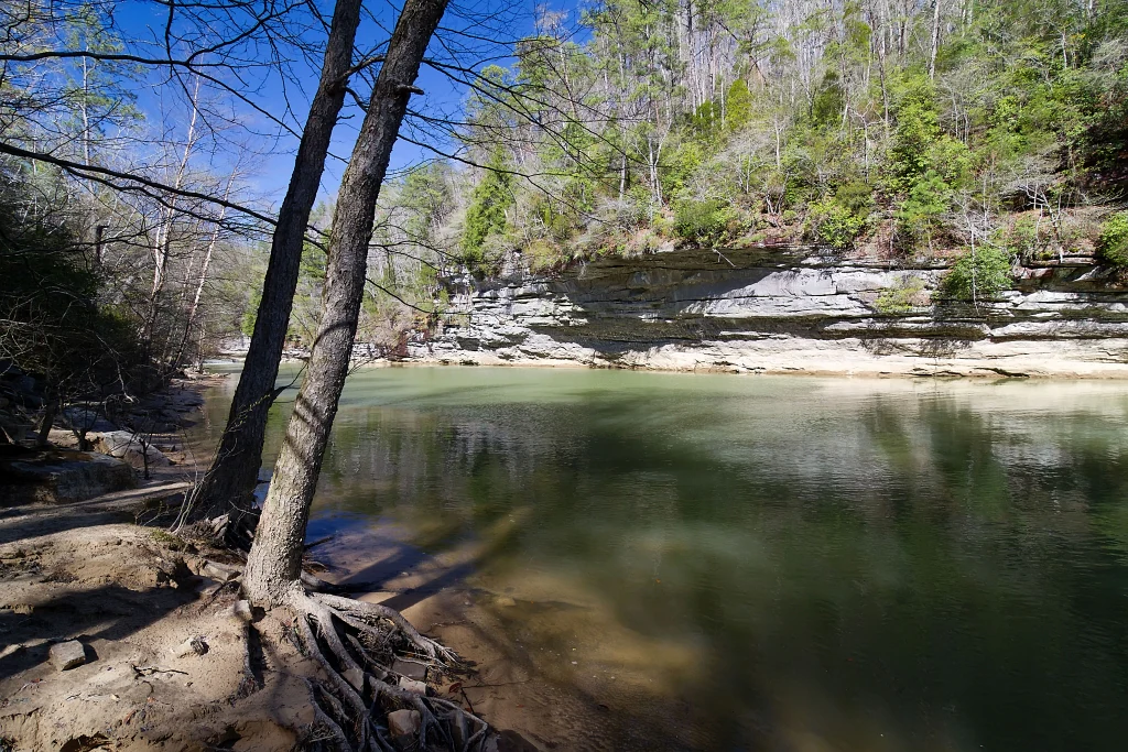
A peaceful, wide river flows past a sandy bank with exposed tree roots and a steep, layered sandstone cliff covered in trees in the background.
Clear Creek winding through the forest in William B. Bankhead National Forest.

William B. Bankhead National Forest history and protected-area timeline

The forest was first established on January 15, 1918, under the name Alabama National Forest, with an initial area of about 66,008 acres. At that early stage, it represented a modest beginning of what would become one of Alabama's most significant National Forest holdings.

On June 19, 1936, the forest was renamed Black Warrior National Forest, reflecting its geographic and cultural ties to the Black Warrior River system that drains the region. Six years later, on June 6, 1942, it was again renamed, this time to William B. Bankhead National Forest, in honor of the longtime Alabama U.S. Representative for whom it is still known today. In 1959, Executive Order 10850 removed a portion of land from the forest's boundaries, adjusting the overall extent of the unit. The forest is now managed by the U.S. Forest Service, with headquarters in Montgomery and on-the-ground operations supported by a ranger district office in Double Springs.

William B. Bankhead National Forest landscape and geographic character

Bankhead's landscape is defined by the dissected edge of the Cumberland Plateau, where flat-topped uplands break apart into steep ridges, deep hollows, and narrow stream valleys. This terrain produces the rugged scenery that gives the area its reputation for waterfalls and rock bluffs. Limestone is a key ingredient in that scenery, creating karst-like features, exposed bluffs, and the geological conditions that allow water to emerge as springs and falls.

The forest's drainage network is dominated by tributaries of the Black Warrior River, including the Sipsey Fork, which cuts striking corridors through the plateau. Together, these waterways have shaped much of what visitors now experience: shaded gorge trails, plunging cascades, and small plunge pools. Along its western edge, the forest also meets Lewis Smith Lake, a large reservoir that contrasts with the otherwise stream-driven terrain and adds open-water scenery to the mix.

William B. Bankhead National Forest ecosystems, habitats, and plant life

The forest supports a mosaic of habitats typical of the southern Cumberland Plateau, from dry upland pine and oak ridges to moist hardwood hollows and stream-side communities. Mixed forests of oak, hickory, tulip poplar, and pine dominate much of the landscape, while richer and more diverse plant communities thrive along the cooler, wetter floors of the deep gorges where the Sipsey Fork and its tributaries flow.

The network of perennial streams, seeps, and springs maintains a constantly refreshed riparian environment throughout the forest. These conditions support a broad range of ecological niches, from mossy rock outcrops and shaded cliff faces to seasonal wildflower displays in spring. The Sipsey Wilderness, in particular, preserves a higher degree of ecological continuity because of its protected status, allowing forest processes and habitat complexity to develop with minimal direct management influence.

William B. Bankhead National Forest wildlife and species highlights

Wildlife across Bankhead reflects the diversity of its mixed forests, stream corridors, and wilderness interior. White-tailed deer are among the most commonly seen large mammals, and the forest's mix of ridges and hollows provides reliable habitat for them. Wild turkey is another signature species, supported by the open understory of many forest areas and managed as part of the forest's hunting program.

Smaller mammals such as gray and fox squirrels thrive in the oak-hickory forests, while raccoons, opossums, and various bat species use both the forest canopy and the area's many caves and rock crevices. Stream-dependent life, including freshwater fish and aquatic invertebrates, inhabits the cold, clear waters of the Sipsey Fork and its tributaries. The variety of habitats and the presence of extensive wilderness and remote tracts make the forest important for both resident species and seasonal migrants moving through the region.

William B. Bankhead National Forest conservation status and protection priorities

Bankhead's conservation importance lies in the protection of representative Cumberland Plateau ecosystems across a very large landscape, ranging from upland forests to broken gorge terrain and high-quality free-flowing rivers. The Sipsey Wilderness is the cornerstone of that effort, providing a buffer from heavy development and preserving ecological conditions that have been altered in many similar landscapes elsewhere in the region.

The designation of the Sipsey Fork as a National Wild and Scenic River adds a major layer of protection to one of the forest's defining features. That designation supports both ecological values, like water quality, riparian habitat, and aquatic biodiversity, and the recreational and scenic qualities that visitors associate with the river. Together, the wilderness, the wild and scenic river corridor, and the broader National Forest designation make Bankhead a key conservation anchor in northwestern Alabama.

William B. Bankhead National Forest cultural meaning and human context

The forest occupies a landscape with deep human history. Long before it became a National Forest, the area's rock overhangs and shelters sustained Indigenous communities, leaving behind petroglyphs, rock carvings, and prehistoric drawings that remain visible across the forest today. Sites such as Kinlock Shelter are regarded as some of the most significant archaeological locations in the southeastern United States.

This enduring archaeological record gives Bankhead a cultural layer beyond its natural features. The forest's modern identity, with its mix of recreational use, wilderness protection, and heritage preservation, reflects a continuing relationship between people and this landscape across thousands of years. That long arc of human presence is part of what distinguishes Bankhead from purely wilderness-oriented public lands elsewhere in the region.

Top sights and standout views in William B. Bankhead National Forest

A defining feature of William B. Bankhead National Forest is the concentration of waterfalls within its deeply cut gorges, the basis for the area's famed "land of a thousand waterfalls" moniker, with the Sipsey Wilderness serving as the primary showcase. Equally important is the Sipsey Fork itself, Alabama's only National Wild and Scenic River, whose clear waters, limestone bluffs, and swift currents anchor both the scenic and ecological identity of the forest. Combined with the surrounding Sipsey Wilderness and the lake scenery of Lewis Smith Lake, these features give Bankhead a layered mix of gorge, river, wilderness, and open-water experiences in a single public-land unit. The forest also stands out for its archaeological wealth, with petroglyphs and prehistoric rock shelters that elevate it from a recreational destination into a landscape of broader regional significance.

Best time to visit William B. Bankhead National Forest

Spring and fall are widely regarded as the most rewarding times to experience Bankhead, when milder temperatures make waterfall trails and long-distance hiking more comfortable and when wildflowers or autumn foliage add extra visual interest to the forest. Spring in particular tends to bring fuller flows to the area's many streams and cascades, reinforcing the waterfall-rich character that defines the region.

Summer visits can also be rewarding because the deeply shaded gorges and the cool waters of the Sipsey Fork provide natural relief from Alabama's heat, though humidity and thunderstorm activity are higher during this season. Winter tends to be quieter, with thinner crowds on the trails and a different visual character as leaves drop from the deciduous forests, exposing more of the rocky bluff lines and stream channels that give the area its distinctive scenery.

Monthly climate preview

Long-term representative temperature and precipitation patterns across twelve recorded monthly intervals

William B. Bankhead National Forest Climate Normals and Monthly Temperature Rhythm

William B. Bankhead National Forest exhibits a measured annual temperature range from a mean of 4.84 degrees Celsius in January to 26.89 degrees Celsius in July alongside steady year-round precipitation. Examining the complete monthly climate dataset provides detailed insight into long-term averages for temperature extremes and rainfall distributions.
Annual mean16 °C
5 °C27 °C
Jan
Feb
Mar11°
Apr16°
May21°
Jun25°
Jul27°
Aug27°
Sep23°
Oct17°
Nov10°
Dec
Warmest month
July

26.9 °C

Coolest month
January

4.8 °C

Wettest month
February

4.8 mm/day

Driest month
October

3 mm/day

Park location guide

Geography guide, regional context, and park location map for William B. Bankhead National Forest

William B. Bankhead National Forest park geography, regions, and map view in United States of America

Understand where William B. Bankhead National Forest sits in United States of America through a broader geographic reading of the surrounding landscape, nearby location context, and its mapped position within the national park landscape.

How William B. Bankhead National Forest fits into United States of America

The United States of America is a federal presidential republic and one of the world's largest countries by area and population. It consists of 50 states across a vast territory spanning multiple time zones, with its capital in Washington, D.C. and largest city in New York City. The nation has a diverse economy, influential political system, and significant cultural and military presence globally.

Wider geography shaping William B. Bankhead National Forest in United States of America

The United States occupies a vast territory in North America, bordered by Canada to the north and Mexico to the south. The 48 contiguous states stretch from the Atlantic to the Pacific Ocean, while Alaska occupies the northwestern region and Hawaii is an archipelago in the Pacific. The country encompasses diverse terrain including the Rocky Mountains, Appalachian Mountains, Great Plains, and extensive river systems.

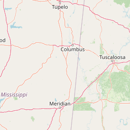
Map view of William B. Bankhead National Forest

Use this park location map to pinpoint William B. Bankhead National Forest in United States of America, understand its exact geographic position, and read its mapped placement within the surrounding landscape more clearly.

Pigeon | © OpenStreetMap contributors

Location context for William B. Bankhead National Forest

Alabama
Recorded earthquake history

Review the Historical Earthquake Catalogue for William B. Bankhead National Forest

Explore a curated archive of seismic events recorded in the vicinity of William B. Bankhead National Forest. This MoriAtlas collection provides transparent access to historical earthquake data, including magnitudes and epicentre distances, for those interested in the regional geographic and seismic profile of the forest.

William B. Bankhead National Forest Earthquake History

Catalogued events

11 events

Strongest magnitude

Magnitude 4.5

Most recent event

May 4, 2007

This history includes earthquakes recorded inside the park or within 50 km of its borders

Visual reference guide to limestone gorges, waterfalls, and protected forest terrain

William B. Bankhead National Forest Photos and Landscape Scenery

Visual documentation captures the rugged Cumberland Plateau terrain, revealing limestone gorges, hidden waterfalls, and dense hardwood canopies across William B. Bankhead National Forest. Examining protected area photography helps researchers and visitors understand the distinctive geological features and wild river corridors defining the region.

A peaceful, wide river flows past a sandy bank with exposed tree roots and a steep, layered sandstone cliff covered in trees in the background.

Park atlas

Compare adjacent southern Appalachian forests and regional protected landscapes.

Explore Protected Areas and Other Parks Near William B. Bankhead National Forest

Browsing nearby national parks and protected areas reveals how the dissected Cumberland Plateau terrain connects across the wider region. Examining adjacent forest reserves provides deeper context for comparing limestone gorges, river corridors, and upland woodlands.
Protected landscapeAlabama
About 108 km away#1 closest

Southeast

Talladega National Forest: Geography and Protected Appalachian Forest Maps

Mapping Alabama high country and southern Appalachian forest recovery

Talladega National Forest is a primary protected landscape in Alabama, offering a detailed look at the transition from central pine-oak ridges to northeastern mixed mesophytic hardwood slopes. This forest manages a diverse range of terrain, including the highest peaks in the state, and represents a major achievement in regional ecological restoration across hundreds of thousands of acres of federally protected land.

Area
1,588.66 km²
Established
1936
Relief
Mixed relief
Climate
Temperate
Protected landscapeMississippi
112 km away#2 closest

West

Tombigbee National Forest: Geographic Atlas and Protected Landscape Overview

Mapping the forest terrain and regional watershed in Mississippi

Tombigbee National Forest represents a complex protected landscape divided into two non-contiguous sections across northeastern Mississippi. From the pine-and-hardwood ridges of its northern unit to the reservoir-anchored southern portion, the forest offers a detailed case study in regional topography and watershed management within the southeastern United States.

Area
271.16 km²
Established
1959
Relief
Upland
Climate
Subtropical
Watercolor painting of a green landscape featuring rolling hills, small clusters of trees, and a calm water feature in the foreground.
Protected landscapeMississippi
129 km away#3 closest

West

Holly Springs National Forest: Geographic Context and Protected Landscape Boundaries

Northern Mississippi forest topography and ecological restoration geography.

Holly Springs National Forest occupies the rolling hills of north central Mississippi, where federal land tracts form a complex mosaic with private holdings. This protected area features diverse forest types including loblolly and shortleaf pine uplands alongside bottomland hardwood swamps. It serves as an essential watershed region, hosting multiple reservoirs like Chewalla Lake and Puskus Lake while protecting the headwaters of the Wolf River.

Area
629.94 km²
Established
1936
Relief
Upland
Climate
Subtropical
Watercolor painting of a mountain landscape with soft layers of green hills, trees, and a foreground area, rendered in a pale and minimalist style.
Wildlife reserveAlabama
136 km away#4 closest

East

Dugger Mountain Wilderness: Mapping Alabama's Appalachian Ridge and Forest Landscapes

Protected mountain terrain and regional Appalachian geography

Dugger Mountain Wilderness acts as a primary anchor for ecological preservation in Alabama. This wildlife reserve preserves over 9,000 acres of steep, roadless ridges near the Appalachian margin. By studying the topographic boundaries and forest cover of this area, observers can better understand the regional mountain characteristics and the critical role this terrain plays in maintaining intact, uninterrupted natural corridors.

Area
37 km²
Established
2000
IUCN
Ib
Relief
Mountain
Protected landscapeMacon County
About 220 km away#5 closest

Southeast

Tuskegee National Forest: A Protected Landscape in Macon County, Alabama

Mapped geography and forest terrain in the American South

Tuskegee National Forest represents a concentrated pocket of protected land in Macon County, Alabama. As the smallest national forest in the country, it provides a dense network of trails and stream terraces that demonstrate how compact forests sustain regional biodiversity and outdoor recreation.

Area
45.54 km²
Established
1959
Relief
Upland
Climate
Subtropical
A watercolor painting showing a stylized landscape with rolling green hills, a band of trees, and a pale pink lake surface under a soft morning sky.
Protected landscapeUnited States of America
224 km away#6 closest

North

Land Between the Lakes National Recreation Area: Mapped Geography and Protected Landscapes

An inland peninsula preserved between two major river reservoirs.

Land Between the Lakes National Recreation Area occupies a distinct narrow land bridge between Kentucky Lake and Lake Barkley. This protected landscape contains a dense mix of forested ridges, stream valleys, and managed wildlife prairies. The area is integral to the lower Ohio River Valley geography, showcasing the results of long-term watershed management and large-scale ecological restoration within the United States.

Area
693.1 km²
Established
1963
Visitors
2M annual
Relief
Lowland
A pale, soft-focus watercolor painting showing a river with gentle banks and distant hills, with tree branches hanging in the top right corner.
Protected landscapeGeorgia
245 km away#7 closest

East

Chattahoochee River National Recreation Area: Protected Landscape Map and Regional Geography

River corridors, Piedmont forest, and historic tributary gorges

This protected landscape in northern Georgia preserves a vital 48-mile corridor along the Chattahoochee River. The terrain shifts from vertical palisade cliffs to wide shoals and forested tributary gorges, weaving through the metropolitan landscape of Atlanta. The area serves as a significant regional anchor for natural river ecosystems and historic industrial remnants.

Area
42.69 km²
Established
1978
IUCN
V
Visitors
3.5M annual
A wide watercolor painting showing a landscape of green rolling hills with trees in the foreground and layers of purple mountains in the background against a white background.
Protected areaGilmer County
252 km away#8 closest

East

Rich Mountain Wilderness: Mapping Appalachian Ridges and Protected Terrain in Georgia

Explore the high-elevation forests of Gilmer County.

Rich Mountain Wilderness encompasses nearly 9,500 acres of undisturbed Appalachian mountain landscape. Characterized by its signature 4,050-foot peak and unique porter's loam soils, the area supports a diverse forest ecosystem shielded under federal wilderness protection within the Chattahoochee National Forest.

Area
38.35 km²
Established
1986
IUCN
Ib
Relief
Mountain

Common questions about visiting, size, designation, and location context for William B. Bankhead National Forest

William B. Bankhead National Forest FAQs for park facts, access, geography, and protected area context

Find quick answers about William B. Bankhead National Forest, including protected-area facts, park geography, trail and visitor context, and how the park fits into its surrounding country and regional landscape.
MoriAtlas Explorer

Continue Your Protected Areas Search Across the Global Atlas

Deepen your exploration by continuing the structured search for national parks and protected areas worldwide. Utilize the comprehensive filtering capabilities to compare different conservation landscapes and refine your understanding of global park geography. Discover more about the distribution and characteristics of protected natural areas.

Global natural geography