
Why Wipperdurchbruch stands out
Wipperdurchbruch is best known for its dramatic, winding Muschelkalk breakthrough gorge, where the Wipper river has carved a steep, narrow passage through the Hainleite ridge. The reserve is particularly valued for its population of rare wild orchids that grow on the warm, calcareous slopes, and for the combination of geological, ecological, and archaeological interest that includes the Arnsburg and Kohnstein earthworks on prominent hilltops above the valley.
Wipperdurchbruch history and protected-area timeline
Wipperdurchbruch's significance as a landscape feature predates any formal conservation designation, since the gorge itself was carved over millennia by the Wipper cutting across the Hainleite ridge. Human activity on the hills above the valley is documented by old earthworks, including the Arnsburg site near Seega and the Kohnstein, both of which are recognized as archaeological monuments (Bodendenkmale) within the present-day nature reserve.
The area's modern protected status reflects growing awareness of the ecological value of its calcareous slopes. The roughly 631 hectare Naturschutzgebiet was established to safeguard the steep valley flanks and adjoining plateau against uses that would degrade the rare plant communities, particularly the orchid populations that thrive on the warm Muschelkalk soils. A conservation and development plan covering the surrounding Hainleite, Wipperdurchbruch, and Kranichholz area has been produced by the Free State of Thuringia's agricultural, forestry, environment and nature conservation ministry, indicating an ongoing, state-level commitment to managing the gorge and its wider landscape context.
Wipperdurchbruch landscape and geographic character
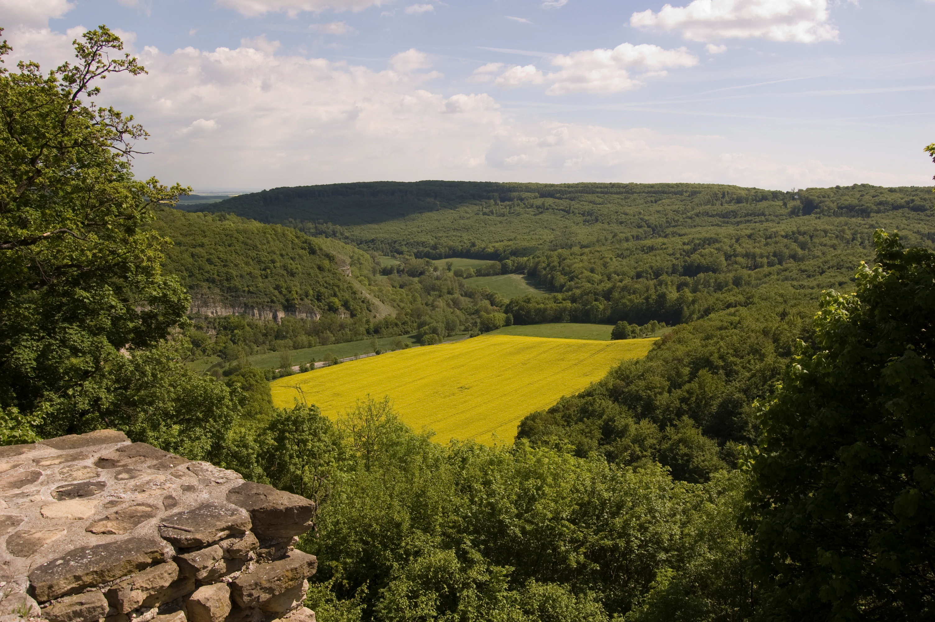
The defining landscape feature of Wipperdurchbruch is the narrow, contorted valley formed where the Wipper river cuts through the Hainleite ridge. The Hainleite is a Muschelkalk, or shell-limestone, ridge, and the river has eroded a winding passage flanked by steep cliffs and sharp spurs. The overall terrain has a strongly structured, almost sculptural quality, with the forested and grassy heights of the ridge dropping abruptly toward the meandering watercourse below.
Within the gorge, two prominent summits frame the northern cliff edge: the Schlossberg, reaching about 354 meters, and the Pfarrkopf at roughly 309 meters. Below them lie further projecting hills such as the Kohnstein and Mühlberg, divided by short side valleys like the Ilmental and the Rabental. A local road, the L 2290, follows the valley floor and connects the settlements of Seega and Günserode, emphasizing how closely the human geography of the area is tied to the narrow, twisting line of the breakthrough itself. The combination of dry, sunny upper slopes and the cooler, sometimes moister valley bottom gives the area a sharp internal contrast that strongly shapes its habitats.
Wipperdurchbruch ecosystems, habitats, and plant life
Wipperdurchbruch's ecological character is shaped by the steep, sun-exposed Muschelkalk slopes of the breakthrough gorge and the contrasting plateau and valley habitats that frame them. These warm, lime-rich slopes support a specialized flora adapted to thin, calcareous soils, while cooler forested slopes, scrub patches, and the riverside environment add further diversity. The reserve is particularly notable for orchid populations that depend on the open, dry grassland conditions typical of such slopes.
The protected area is not only about its unusual plants. The mosaic of dry grassland, rock outcrops, scrub, woodland, small side valleys, and riverside habitats creates conditions for a wide range of invertebrates, birds, and other fauna. By combining the steep valley flanks and parts of the adjoining Hainleite plateau within a single reserve, the designation aims to safeguard the full ecological gradient from valley floor to ridge top rather than just the most visually dramatic gorge sections.
Wipperdurchbruch wildlife and species highlights
The wildlife interest of Wipperdurchbruch is closely tied to its habitat mosaic. The mixture of dry, warm slopes, rocky cliffs, scrub, woodland patches, and riverside environments supports species typical of calcareous hill landscapes in central Germany. Birdlife associated with cliff and edge habitats, insects that depend on dry grassland, and plant communities anchored on the open Muschelkalk slopes are central to the reserve's ecological identity.
Although detailed species inventories are limited in the source material, the area's protected status explicitly references rare animal species alongside its rare plants. The combination of steep, partly inaccessible terrain and varied microhabitats makes the gorge particularly valuable as a refuge for species that struggle to persist in more intensively used landscapes elsewhere in the region. The naming of Kranichholz, the area to the north of the gorge, suggests the wider landscape context also includes habitats relevant to larger bird species.
Wipperdurchbruch conservation status and protection priorities
Wipperdurchbruch is protected as a Naturschutzgebiet, the strongest category of nature protection in German conservation law, signaling its ecological importance at both state and district levels. The reserve straddles the Kyffhäuserkreis and Landkreis Sömmerda and is part of the wider protected-area network of northern Thuringia, alongside other reserves such as the Hohe Schrecke, Süd-Ost-Kyffhäuser, and Schloßberg-Solwiesen.
The conservation rationale centers on safeguarding the breakthrough gorge's calcareous habitats and their associated rare species, especially the orchid-rich dry grasslands of the Muschelkalk slopes. Management is guided by a broader Pflege- und Entwicklungsplan, or care and development plan, produced for the combined Hainleite, Wipperdurchbruch, and Kranichholz project area by the Thuringian ministry responsible for agriculture, forestry, environment and nature conservation. This planning layer shows that the reserve is treated not as an isolated site but as part of an integrated landscape-scale conservation strategy for the northern Thuringian hill country around the Kyffhäuser.
Wipperdurchbruch cultural meaning and human context
The Wipperdurchbruch landscape carries a layered human history. The Schlossberg above the valley is named for its castle association, and the Arnsburg site near Seega has left visible ruins and earthworks on one of the gorge's commanding ridges. The Kohnstein, another prominent hill within the reserve, is likewise documented as a Bodendenkmal, or protected archaeological site. Together these features point to a long history of fortified settlements, control of routes through the Hainleite, and local land use patterns that predate the modern nature reserve.
Today, the villages of Seega and Günserode, both parts of the Kyffhäuserland municipality, anchor the valley. The local road L 2290, running along the valley floor, illustrates how everyday life continues to be organized around the same narrow gorge that defines the protected area, connecting the human geography of the Kyffhäuser region to the geological and ecological identity of the Wipperdurchbruch itself.
Top sights and standout views in Wipperdurchbruch
Wipperdurchbruch's standout features include the dramatic, tightly meandering Muschelkalk gorge of the Wipper, the orchid-rich dry slopes of the Hainleite ridge, and the cluster of protected archaeological sites such as the Arnsburg and Kohnstein that crown the cliffs above the river. Equally notable is the reserve's role within a broader, state-level conservation plan that treats the gorge as part of an integrated Hainleite landscape rather than an isolated site.
Best time to visit Wipperdurchbruch
Wipperdurchbruch is most atmospheric in late spring and early summer, when the protected orchid species are at their most visible on the warm, dry slopes and the valley's mix of fresh greens and exposed limestone is at its most expressive. Early summer also tends to bring favorable conditions for observing the gorge's mix of dry grassland and woodland species. Outside this peak, the contrasting textures of the gorge are appealing in any season, with the structural drama of the cliffs and meanders remaining visible year round.