
Mori Atlas logo
Nature reserveWollerscheider Venn

A vital ecological enclave within the Hohes Venn high plateau and regional Eifel border terrain

Wollerscheider Venn Nature Reserve: Mapped Geography and Protected Peatland Landscapes

(Naturschutzgebiet Wollerscheider Venn)

Wollerscheider Venn represents a significant protected area within North Rhine-Westphalia, showcasing the complex raised bog communities and dwarf-shrub heath typical of the Hohes Venn border region. This nature reserve maintains a mosaic of swamp woodland, Nardus grassland, and open peatland habitats that support specialized invertebrate species and migratory bog flora. The geography of the site, characterized by its waterlogged ground and historical peat accumulation, serves as a key node in the regional conservation of fragmented high plateau ecosystems.

raised bogpeatlandHohes Vennbog heathwetland habitatsswamp woodland
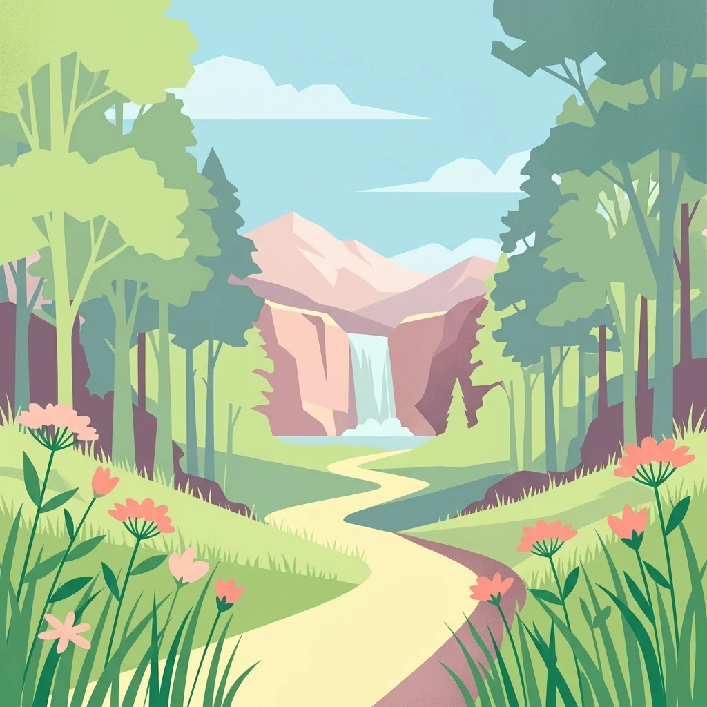
Vector illustration of a winding dirt path through a forest leading to a waterfall between mountain cliffs, with wildflowers in the foreground.

Wollerscheider Venn

Nature reserve

Park overview

Structured park overview, official facts, and landscape profile for Wollerscheider Venn

Wollerscheider Venn park facts, protected area profile, and essential visitor context

Review the core facts for Wollerscheider Venn, including designation, size, terrain, visitor scale, habitats, and operating context in one park-focused overview.

About Wollerscheider Venn

Wollerscheider Venn is a compact but ecologically significant nature reserve in North Rhine-Westphalia, in the western part of Germany near the Belgian border. It lies within the municipality of Simmerath, in the administrative district of Städteregion Aachen, and falls geographically within the Roetgen/Lammersdorf exclave, a particular territorial arrangement that shapes how the protected area is administered and connected to surrounding landscapes.

The site is a textbook example of a Venn landscape, the open, waterlogged peatland and heath terrain characteristic of the higher elevations of the Eifel and the cross-border Hohes Venn plateau. Although its bog systems are described as partly degenerated, the reserve still harbors the typical habitats that define this landscape: raised bogs, swamps, springs, natural standing waters, wet meadows, bog and swamp woodlands, dwarf-shrub heaths, broom heaths, juniper heaths, and mat-grass grasslands.

The purpose of the reserve is the preservation, development, and, where possible, restoration of these natural habitats in line with Annex I of the EU Habitats Directive (FFH-Richtlinie). It also functions as a refuge for bog fauna, including rare butterflies and dragonflies whose life cycles depend directly on intact peatland and bog pool conditions. Within the wider Natura 2000 framework, Wollerscheider Venn plays a small but meaningful role in maintaining the coherence of the cross-border peatland ecosystem that extends into Belgium.

Quick facts and research context for Wollerscheider Venn

Wollerscheider Venn is a designated nature reserve of about 42 hectares in the municipality of Simmerath, North Rhine-Westphalia, established in 1961. It is administered under the landscape plan of Simmerath by the lower landscape authority of the Städteregion Aachen and is categorized as an IUCN Category IV habitat/species management area.

The reserve carries the official identifier ACK-001, is registered in the World Database on Protected Areas under WDPA ID 344824, and forms part of the Natura 2000 network as site DE-5303-301. It lies just north of the B399, near the Belgian border, within the broader context of the Hohes Venn peatland landscape.

Protection and recognition

Examine the official protection records and international registry data for Wollerscheider Venn.

Wollerscheider Venn Protection Status and Designated Area Facts

Review the documented protection status, management parameters, and registry identifiers established for Wollerscheider Venn. Access structured conservation context and verified administrative metrics for this protected natural area.

Protection details

WDPA ID
344824
Park context

Deeper park guide and search-rich context for Wollerscheider Venn

Wollerscheider Venn history, landscape, wildlife, and travel context

Explore Wollerscheider Venn through its history, landscape character, ecosystems, wildlife, conservation priorities, cultural context, and seasonal travel timing in a structured park guide built for atlas discovery and search intent.

Why Wollerscheider Venn stands out

Wollerscheider Venn is best known for its raised bog communities and bog-dependent species. The reserve preserves characteristic Hochmoor vegetation and associated wet habitats typical of the Hohes Venn, including moor, swamp, spring, bog woodland, dwarf-shrub heath, juniper heath, and Nardus grassland habitats. It is also known among ecologists and naturalists for the presence of highly specialized species such as the bog Fritillary butterflies, bog dragonflies, and the small bog cranberry (Gemeine Krähenbeere) communities that typify the older peatland vegetation of this border region.
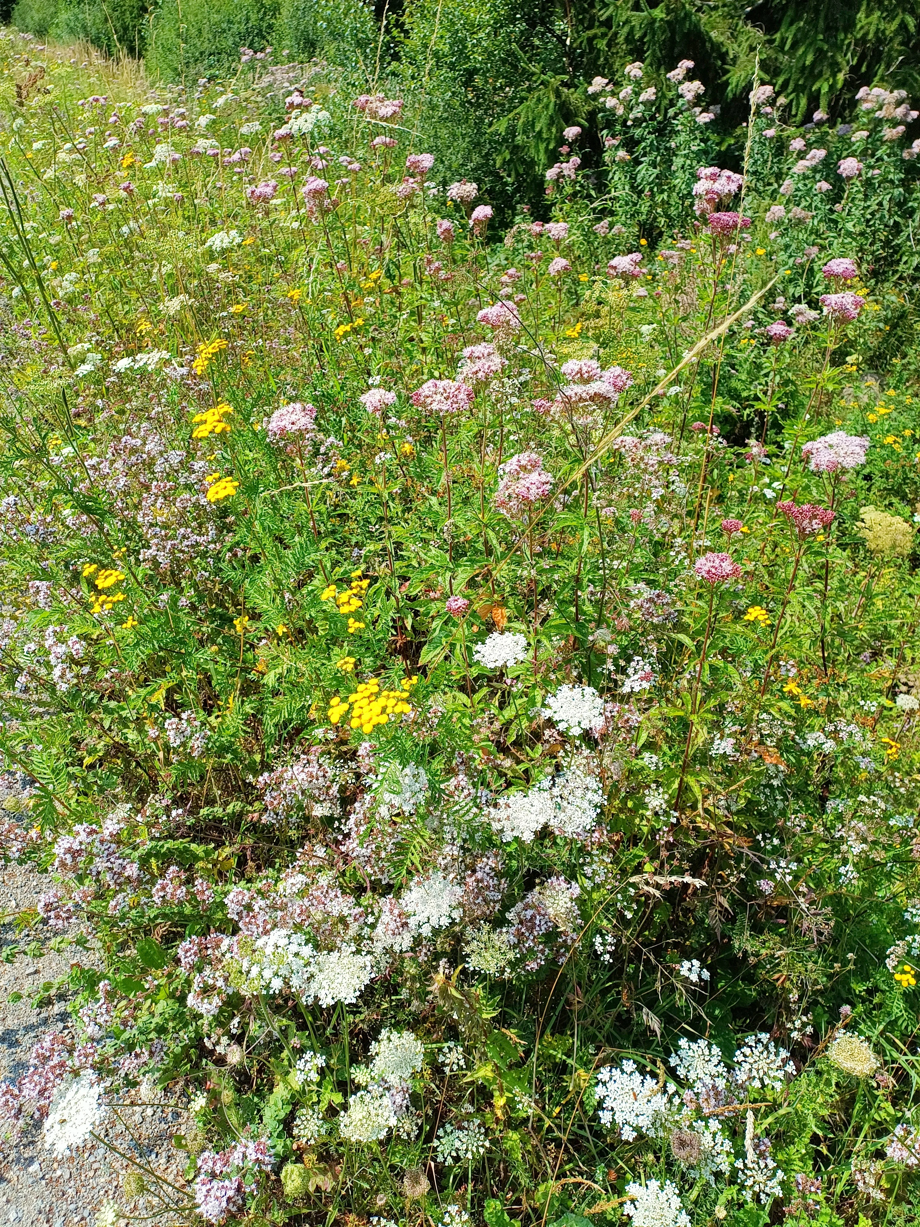
A lush patch of diverse wildflowers, including white yarrow and pink hemp-agrimony, growing at the edge of a gravel path in Wollerscheider Venn.
Wildflowers in the Wollerscheider Venn nature reserve.

Wollerscheider Venn history and protected-area timeline

Wollerscheider Venn was formally designated as a nature reserve in 1961, placing it among the earlier postwar efforts to protect the remaining peatland habitats of the Hohes Venn fringe in North Rhine-Westphalia. Its protection framework was aligned with the Simmerath landscape plan (Landschaftsplan), and administration falls under the Lower Landscape Authority (Untere Landschaftsbehörde) of the Städteregion Aachen.

Over time, the site has been integrated into broader European conservation frameworks, including designation as a Natura 2000 area, reflecting the recognition of Venn peatlands as habitat of community interest under the EU Habitats Directive.

Wollerscheider Venn landscape and geographic character

The landscape of Wollerscheider Venn is shaped by its position on the northwestern fringe of the Hohes Venn, a high plateau that extends across the German-Belgian border and is characterized by extensive peat formation. The terrain is flat to gently undulating, dominated by waterlogged ground, open peatland, low heaths, and patches of bog woodland.

The reserve sits west of the village of Lammersdorf, just north of the B399 federal road, which also serves as the border with Belgium. This location places the site at the edge of the broader elevated peatland system, where peat layers have historically accumulated in poorly drained basins and along shallow slopes. Small streams, springs, and bog pools punctuate the landscape, supporting a mosaic of open mire, wet meadow, and marginal woodland.

Although historically more extensive and pristine, the Venn landscape here has been altered by centuries of grazing, peat cutting, drainage, and forestry, leaving a partly degenerated but still recognizable bog mosaic. The present-day reserve captures that mosaic in a relatively compact footprint, including fragments of natural standing water, swamp woodland (Bruch- und Sumpfwälder), and the characteristic dwarf-shrub and juniper heaths that border the open bog areas.
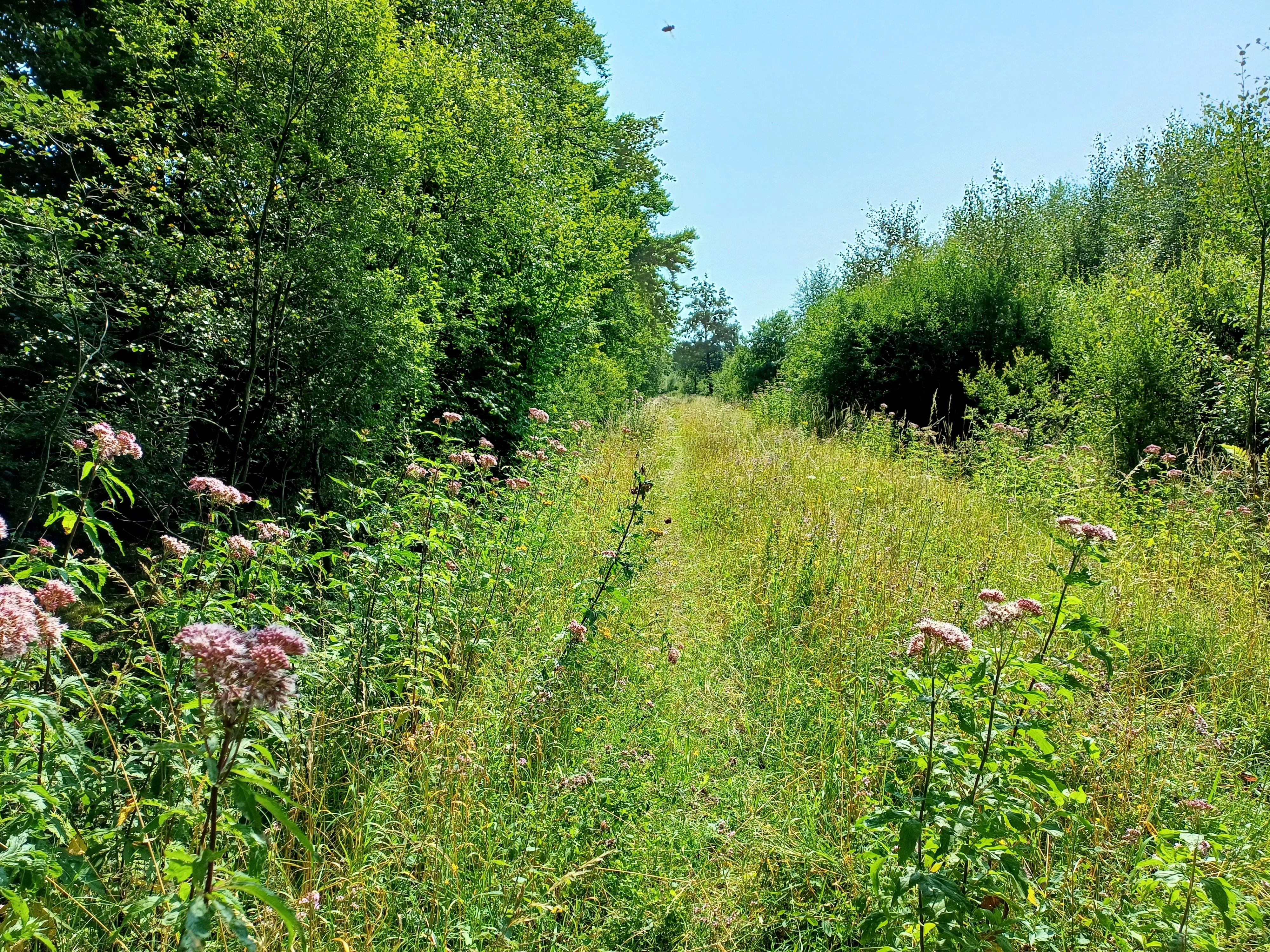
A narrow, grassy path stretches forward through a meadow, flanked by dense trees on the left and shrubs on the right, with tall pink wildflowers blooming in the foreground.
A grassy trail bordered by dense vegetation and wildflowers in the Wollerscheider Venn nature reserve.

Wollerscheider Venn ecosystems, habitats, and plant life

Ecologically, Wollerscheider Venn is defined by its peatland communities. Large sections are covered by Hochmoorgesellschaften (raised bog plant communities) with classic bog-building mosses and characteristic bog plants. These include sphagnum mosses (Torfmoose), round-leaved sundew (Rundblättriger Sonnentau), the small cranberry relative Gemeine Krähenbeere (black crowberry), rosemary heath (Rosmarinheide), common bog clubmoss (Gemeiner Moorbärlapp), bladderwort (Kleiner Wasserschlauch), German broom (Deutscher Ginster), and the lung gentian (Lungen-Enzian).

The habitat mosaic is unusually varied for such a small area, reflecting the conservation priority placed on maintaining all the biotope types listed under the FFH Habitats Directive Annex I that occur in this part of the Hohes Venn. Beside the open raised bog, the reserve includes acidic mires, fens, spring habitats, naturally formed ponds, wet and moist grasslands, swamp forests, dwarf-shrub heaths, broom heaths, juniper heaths, and mat-grass swards.

This combination makes the reserve a representative sample of Venn ecology, despite its relatively small footprint. The juxtaposition of bog, heath, woodland, and wet grassland creates transitional zones that are particularly important for invertebrates and birds adapted to open, low-structured habitats.

Wollerscheider Venn wildlife and species highlights

Wollerscheider Venn supports a specialized community of species tied to peatland and wet heath habitats. Among birds, the whinchat (Braunkehlchen) is a notable ground-nesting inhabitant, using the open structure of the bog margins and surrounding heath for breeding.

The reserve is particularly rich in bog-specialist insects. Its butterfly fauna includes several rare pearl fritillaries: the Hochmoor-Perlmuttfalter (bog fritillary), the Braunfleckiger Perlmuttfalter, the Blauschillernder Feuerfalter, and the Lilagold-Feuerfalter, as well as the Randring-Perlmuttfalter. These species depend on the specific host plants and microclimate of intact bog and bog-marginal habitats.

The dragonfly fauna is also a highlight, with species such as the Torf-Mosaikjungfer (bog hawker) and Hochmoor-Mosaikjungfer breeding in the reserve's bog pools and small standing waters. The Arktische Smaragdlibelle, a species strongly associated with undisturbed peatlands, also occurs here. Among grasshoppers, the rare Kurzflügelige Beißschrecke is recorded in the area. Together, these species underscore the value of Wollerscheider Venn as a refuge for fauna that has disappeared from much of the surrounding modified agricultural and forested land.

Wollerscheider Venn conservation status and protection priorities

The Wollescheider Venn was designated primarily to preserve, develop, and, where feasible, restore natural habitats of community interest under Annex I of the EU Habitats Directive. Protection targets include the full chain of Venn biotopes, from active raised bog and bog pools through transition mires and swamp woodland to bog-marginal heath communities and wet grasslands.

The reserve is formally recognized at the European level through its inclusion in the Natura 2000 network (site DE-5303-301) and is registered in the World Database on Protected Areas (WDPA ID 344824). At the national and state level, it is classified as an IUCN Category IV area, indicating management focused on particular species or habitats rather than full wilderness protection.

Conservation significance lies in part in the reserve's role as one of the remaining refuges for Hochmoor vegetation and bog fauna at the western edge of the Hohes Venn in North Rhine-Westphalia. Peatlands of this type have been heavily reduced regionally through drainage, peat extraction, and land-use change, so even small, partially degraded sites such as Wollerscheider Venn carry disproportionate importance for maintaining viable populations of bog-dependent species and for connecting the broader cross-border peatland complex.

Wollerscheider Venn cultural meaning and human context

The Venn landscape of the Hohes Venn region has a long history of traditional human use, including grazing, peat cutting, and small-scale extraction of bog products, which have all shaped the open character of these peatlands over centuries. The Wollerscheider Venn reflects that layered interaction between human land use and the underlying bog environment, even though the reserve's primary mission today is ecological restoration and habitat protection.

Its position in the Roetgen/Lammersdorf exclave adds a distinctive administrative and geographic context, linking it historically to local communities and traditional land-management patterns of the western Eifel border region.

Top sights and standout views in Wollerscheider Venn

Wollerscheider Venn is a compact but representative example of a Hohes Venn peatland reserve, preserving a full chain of bog, heath, swamp woodland, and wet grassland habitats in a single protected footprint. Its raised bog communities, with classic bog plants such as sundews, bog clubmosses, and sphagnum mosses, define its scientific and conservation value.

The reserve is also notable for its specialized invertebrate fauna, including several bog fritillary butterflies, rare peatland dragonflies, and the Arctic emerald damselfly, which together give the site a disproportionate ecological significance relative to its small size. As part of the Natura 2000 network and connected to the broader cross-border peatland system, it serves as a key node in the long-term conservation of the Hohes Venn landscape.

Best time to visit Wollerscheider Venn

The reserve can be appreciated in most seasons, but late spring and summer are typically the richest periods for observing its characteristic open bog, heath vegetation, and active butterfly and dragonfly communities. Late spring brings flowering of bog and heath plants as well as returning whinchats to the open terrain.

Midsummer is the best window for bog fritillary butterflies, peatland dragonflies, and many of the heath plants. In autumn the colours of the dwarf-shrub heaths and bog vegetation intensify, while winter reveals the open structure of the bog and the stillness of the wetland landscape, though access and trail conditions are more weather-dependent at that time of year.

Monthly climate preview

Long-term representative monthly averages for temperature and precipitation

Wollerscheider Venn Climate Normals and Annual Temperature Patterns

Wollerscheider Venn records measured long-term temperature swings and daily precipitation rates across a twelve-month climatology cycle. Accessing the complete monthly profile provides detailed data on average minimum and maximum thresholds for each recorded period.
Annual mean8 °C
0 °C17 °C
Jan
Feb
Mar
Apr
May11°
Jun15°
Jul17°
Aug17°
Sep13°
Oct
Nov
Dec
Warmest month
July

17 °C

Coolest month
January

-0 °C

Wettest month
December

3.1 mm/day

Driest month
April

1.9 mm/day

Park location guide

Geography guide, regional context, and park location map for Wollerscheider Venn

Wollerscheider Venn park geography, regions, and map view in Germany

Understand where Wollerscheider Venn sits in Germany through a broader geographic reading of the surrounding landscape, nearby location context, and its mapped position within the national park landscape.

How Wollerscheider Venn fits into Germany

Germany is a federal republic in Western and Central Europe with a population of over 83 million across sixteen constituent states. It is Europe's largest economy by nominal GDP and a major global exporter and importer. The capital is Berlin, and the country borders Denmark, Poland, Czech Republic, Austria, Switzerland, France, Luxembourg, Belgium, and the Netherlands.

Wider geography shaping Wollerscheider Venn in Germany

Germany is located in Western and Central Europe, spanning 357,022 km². It borders Denmark to the north, Poland and the Czech Republic to the east, Austria and Switzerland to the south, and France, Luxembourg, Belgium, and the Netherlands to the west. The country has coastlines on the Baltic Sea and North Sea to the north, with the Alps located in the southern region.

Map view of Wollerscheider Venn

Use this park location map to pinpoint Wollerscheider Venn in Germany, understand its exact geographic position, and read its mapped placement within the surrounding landscape more clearly.

Pigeon | © OpenStreetMap contributors

Location context for Wollerscheider Venn

North Rhine-Westphalia

Visualizing the peatland terrain, raised bogs, and protected habitats of the Eifel border region.

Wollerscheider Venn Photos and Landscape Scenery

Visual documentation captures the open peatland terrain, waterlogged ground, and dwarf-shrub heaths that define Wollerscheider Venn. Examining photographic records helps researchers evaluate regional bog restoration, wetland habitats, and protected-area character.

A lush patch of diverse wildflowers, including white yarrow and pink hemp-agrimony, growing at the edge of a gravel path in Wollerscheider Venn.

A narrow dirt path leads into a dense forest of green trees and bushes at the Wollerscheider Venn nature reserve on a sunny day.

A narrow, grassy path stretches forward through a meadow, flanked by dense trees on the left and shrubs on the right, with tall pink wildflowers blooming in the foreground.

Park atlas

Compare regional peatland habitats and adjacent reserves across the Eifel border

Explore Parks Near Wollerscheider Venn and Surrounding Protected Areas

Browsing other parks near Wollerscheider Venn reveals connected wetland ecosystems and protected landscapes across the surrounding region. Comparing these neighboring reserves provides broader geographic context for high plateau peatlands and cross border conservation networks.
A watercolor painting showing a soft, pastel-colored landscape with a wetland in the foreground and gentle, rolling hills in the background.
Nature reserveNordrhein-Westfalen
About 1.2 km away#1 closest

West

Hoscheider Venn mit Quellgebieten des Dreiläger- und Schleebaches Nature Reserve Atlas

Protected raised bog and glacial pingo terrain in North Rhine-Westphalia

Hoscheider Venn mit Quellgebieten des Dreiläger- und Schleebaches safeguards a representative upland moor environment on the western edge of the Eifel. The reserve includes diverse habitats ranging from nutrient poor bog pools to acidophilous forests, maintaining active restoration zones for regenerating wet heath and peatland ecosystems across its unique topographic mosaic.

Area
1.96 km²
Established
1982
IUCN
IV
Relief
Upland
A soft, horizontal watercolor painting of rolling green hills under a faint, warm-toned sky, with no sharp outlines.
Nature reserveNorth Rhine-Westphalia
About 2.1 km away#2 closest

Southeast

Lenzbach Nature Reserve: Protected Stream Valley and Habitat Connectivity in the Northern Eifel

Geographic atlas and ecological landscape context in North Rhine-Westphalia

Lenzbach Nature Reserve encompasses a near-natural headwater stream valley characterized by expansive wet grasslands and spring mires. As part of the Natura 2000 Kalltal und Nebentäler complex, the reserve serves as an essential ecological link within the cross-border landscape between Belgium and Germany, supporting diverse wetland flora and maintaining habitat connectivity for regional wildlife.

Area
0.11 km²
Established
1999
IUCN
IV
Watercolor painting of a soft, hazy landscape featuring rolling hills and marshy wetlands in muted green and yellow tones.
Nature reserveNorth Rhine-Westphalia
About 3 km away#3 closest

South

Kalltal Nature Reserve: Protected Stream Valley and Eifel Landscape in North Rhine-Westphalia

Ecological corridor with rare bog habitats and wet meadows.

Kalltal protects a stretch of the Kall stream, creating a haven for moisture-dependent plant species and wildlife within the Monschau municipality. Its terrain is defined by soft wet grasslands, peat-rich depressions, and small forest patches that form an intact ecological refuge within the broader German landscape.

Area
0.545 km²
Established
1998
IUCN
IV
Watercolor painting of a rolling stream valley with soft green hills and light water
Nature reserveStädteregion Aachen
About 3.4 km away#4 closest

Northeast

Kelzer- und Saarscher Bachtal: Protected Brook Valley Geography and Forest Terrain

Nature reserve exploration in the Städteregion Aachen landscape

The Kelzer- und Saarscher Bachtal nature reserve protects a vital network of brook valley habitats, including deciduous forest remnants, wet heath, and cascading stream sections. This area offers a clear look at local hydrologic restoration and the structural diversity found within the Eifel district, providing a focused view for those interested in regional protected-land geography.

Area
0.46 km²
Established
1999
IUCN
IV
A soft watercolor illustration showing a hazy, green landscape with a winding stream, distant hills, and low-lying vegetation on a white background.
Nature reserveNordrhein-Westfalen
About 3.5 km away#5 closest

Southeast

Kranzbach und Kranzbruchvenn: Protected Nature Reserve and Bog Landscape in Nordrhein-Westfalen

Wetland stream valleys and historic military relic landscapes

Investigate the specialized wetland ecosystems of Kranzbach und Kranzbruchvenn, a nature reserve in Nordrhein-Westfalen known for its bog and fen habitats. The site offers a detailed case study of small-stream hydrology and the transformation of former Westwall dragon teeth structures into unique marsh environments.

Area
0.328 km²
Established
2002
IUCN
IV
A watercolor painting depicting rolling, soft-toned green hills and a foreground of trees and riparian vegetation.
Nature reserveNorth Rhine-Westphalia
About 4.5 km away#6 closest

North

Laubwald am Hasselbachgraben Nature Reserve in North Rhine-Westphalia

Protected Eifel forest and riparian stream landscape

Located in the Städteregion Aachen, Laubwald am Hasselbachgraben preserves a distinct mix of European beech, oak, and spruce. The reserve is anchored by the Hasselbach stream valley and the landmark Kreitzberg Naturwaldzelle, providing a critical study of near-natural woodland structure within the northern Eifel region.

Area
2.88 km²
Established
1999
IUCN
IV
Relief
Upland
A watercolor painting of a river winding through a valley with mountains in the background and foreground trees.
Nature reserveNorth Rhine-Westphalia
About 5.1 km away#7 closest

Northeast

Mittleres Kalltal Nature Reserve: Mapped Geography and Protected Landscapes in the Eifel

River valley ecosystems and mountain forest habitats

Mittleres Kalltal is a protected nature reserve in the Simmerath municipality of North Rhine Westphalia, Germany. This area preserves an intact stretch of the Kall river, featuring a diverse mosaic of gorge woodlands, alder floodplains, and mountain forest slopes that serve as vital habitats within the northern Eifel region.

Area
0.42 km²
Established
1999
IUCN
IV
Relief
Mountain
A watercolor painting depicting a soft, panoramic landscape of a meandering stream valley with rolling hills, meadows, and scattered patches of trees.
Nature reserveNordrhein-Westfalen
About 7.4 km away#8 closest

South

Kleines Laufenbachtal Nature Reserve: Geographic Atlas of an Eifel Stream Valley

Protected brook habitats and natural rock landscapes in North Rhine-Westphalia

Investigate the topographical features and habitat diversity of Kleines Laufenbachtal, an established nature reserve in the Eifel. This protected area showcases a dense assembly of wet grasslands, reed banks, and rocky slopes that anchor local ecological corridors within the Monschau landscape.

Area
0.13 km²
Established
1997
IUCN
IV

Common questions about visiting, size, designation, and location context for Wollerscheider Venn

Wollerscheider Venn FAQs for park facts, access, geography, and protected area context

Find quick answers about Wollerscheider Venn, including protected-area facts, park geography, trail and visitor context, and how the park fits into its surrounding country and regional landscape.
MoriAtlas Explorer

Continue Your Protected Areas Search Across the Global Atlas

Deepen your exploration by continuing the structured search for national parks and protected areas worldwide. Utilize the comprehensive filtering capabilities to compare different conservation landscapes and refine your understanding of global park geography. Discover more about the distribution and characteristics of protected natural areas.

Global natural geography