
Mori Atlas logo
Nature reserveWupperhang mit Henkensiepen und Hüscheider Bachtal

Examining the ecological terrain and forested stream valleys of the Bergisches Land region

Wupperhang mit Henkensiepen und Hüscheider Bachtal Nature Reserve and Mapped Protected Landscapes

(Naturschutzgebiet Wupperhang mit Henkensiepen und Hüscheider Bachtal)

Wupperhang mit Henkensiepen und Hüscheider Bachtal comprises a significant protected mosaic of beech forests, floodplain woodlands, and spring-fed Siefen valleys along the Wupper River in Nordrhein-Westfalen. This high-quality nature reserve exhibits a complex topography characterized by steep river slopes and sheltered side valleys that support diverse forest habitats and wet meadow ecosystems. The reserve acts as a critical woodland connector within the Bergisches Land network, offering essential insights into the region's riverine geography and protected landscape structure.

nature reservebeech forestriver valleywet meadowfloodplain woodlandcalcareous springs
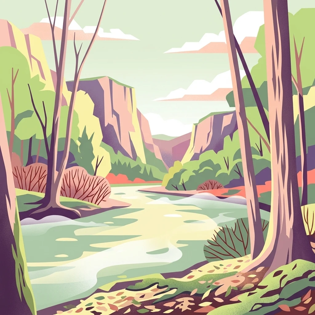
A stylized vector illustration of a river winding through a valley flanked by steep, rocky cliffs and dense forests with autumn colors.

Wupperhang mit Henkensiepen und Hüscheider Bachtal

Nature reserve

Park overview

Structured park overview, official facts, and landscape profile for Wupperhang mit Henkensiepen und Hüscheider Bachtal

Wupperhang mit Henkensiepen und Hüscheider Bachtal park facts, protected area profile, and essential visitor context

Review the core facts for Wupperhang mit Henkensiepen und Hüscheider Bachtal, including designation, size, terrain, visitor scale, habitats, and operating context in one park-focused overview.

About Wupperhang mit Henkensiepen und Hüscheider Bachtal

Wupperhang mit Henkensiepen und Hüscheider Bachtal is a nature reserve on the edge of the city of Leverkusen that protects a stretch of the Wupper River together with the surrounding steep slopes and tributary valleys. Designated in 1985, it forms part of the broader network of protected stream valley landscapes that runs through the Bergisches Land, the hilly transitional region between the lower Rhine plain and the central German uplands.

The core of the reserve is the outer bank of the Wupper as it enters Leverkusen from the north and swings west near Imbach. The river still supports submerged aquatic vegetation here, while the steep valley side above is covered by mature beech forest in which the ground layer is dominated by woodrush (Hainsimsen). A narrow strip of alder lines the riverbank, separated from the steeper woodland by a small track, and several calcareous springs trickle down toward the river, giving the slopes their characteristic mix of damp pockets and drier ridges.

The reserve expands eastward along the Henkensiepen and toward Hüscheid in the southeast. Here the forest transitions into a Waldmeister-type beech community, with notably large old trees in places. Several small brooks cut through this woodland in the classic Bergisches style of steep, narrow Siefen. In the wetter lowlands, black alder and ash floodplain woodland occurs, alongside a small reed bed and grey willow shrub. An extensively managed wet meadow in the Henkensiepen valley and the fat meadows and large orchard near Hüscheid complete the habitat mosaic.

Although the reserve itself is compact, it sits within a much larger Natura 2000 site and is locally valued as one of the best-preserved forest sections within the connected Bergisches stream valley system, carrying at least regional ecological significance.

Quick facts and research context for Wupperhang mit Henkensiepen und Hüscheider Bachtal

This is a nature reserve (Naturschutzgebiet) in Leverkusen, North Rhine-Westphalia, designated in 1985 under the code LEV-006 and legally grounded in the Leverkusen landscape plan of 1987. The reserve belongs to IUCN Category IV, classifying it as a habitat and species management area. It covers about 34.65 hectares across two separate parcels following the Wupper River and its tributary valleys.

The protected area overlaps with the larger Natura 2000 site DE-4808-301, which extends roughly 556 hectares across the surrounding landscape. Administratively, the reserve is managed by the lower landscape authority of the city of Leverkusen and lies at elevations between about 50 and 128 meters above sea level.

Protection and recognition

Examine documented protected area records and administrative designation facts.

Wupperhang mit Henkensiepen und Hüscheider Bachtal Protection Status

Wupperhang mit Henkensiepen und Hüscheider Bachtal brings together verified protection records and baseline conservation designations. Official database tracking outlines the administrative scope without relying on external recognition assumptions.

Protection details

WDPA ID
166373
Park context

Deeper park guide and search-rich context for Wupperhang mit Henkensiepen und Hüscheider Bachtal

Wupperhang mit Henkensiepen und Hüscheider Bachtal history, landscape, wildlife, and travel context

Explore Wupperhang mit Henkensiepen und Hüscheider Bachtal through its history, landscape character, ecosystems, wildlife, conservation priorities, cultural context, and seasonal travel timing in a structured park guide built for atlas discovery and search intent.

Why Wupperhang mit Henkensiepen und Hüscheider Bachtal stands out

The reserve is best known for preserving one of the finest remaining stretches of beech forest along the Wupper River and its side valleys in the Bergisches Land region. Its Hainsimsen beech forest on the steep western slopes is particularly luxuriant and represents a high-quality example of this habitat type. It is also recognized for the combination of habitats within a small area: old beech and ash forests, spring-fed brook valleys (Siefen), wet meadows, reed beds, and the laterally eroding outer bank of the Wupper with scattered exposed rock faces and calcareous springs.
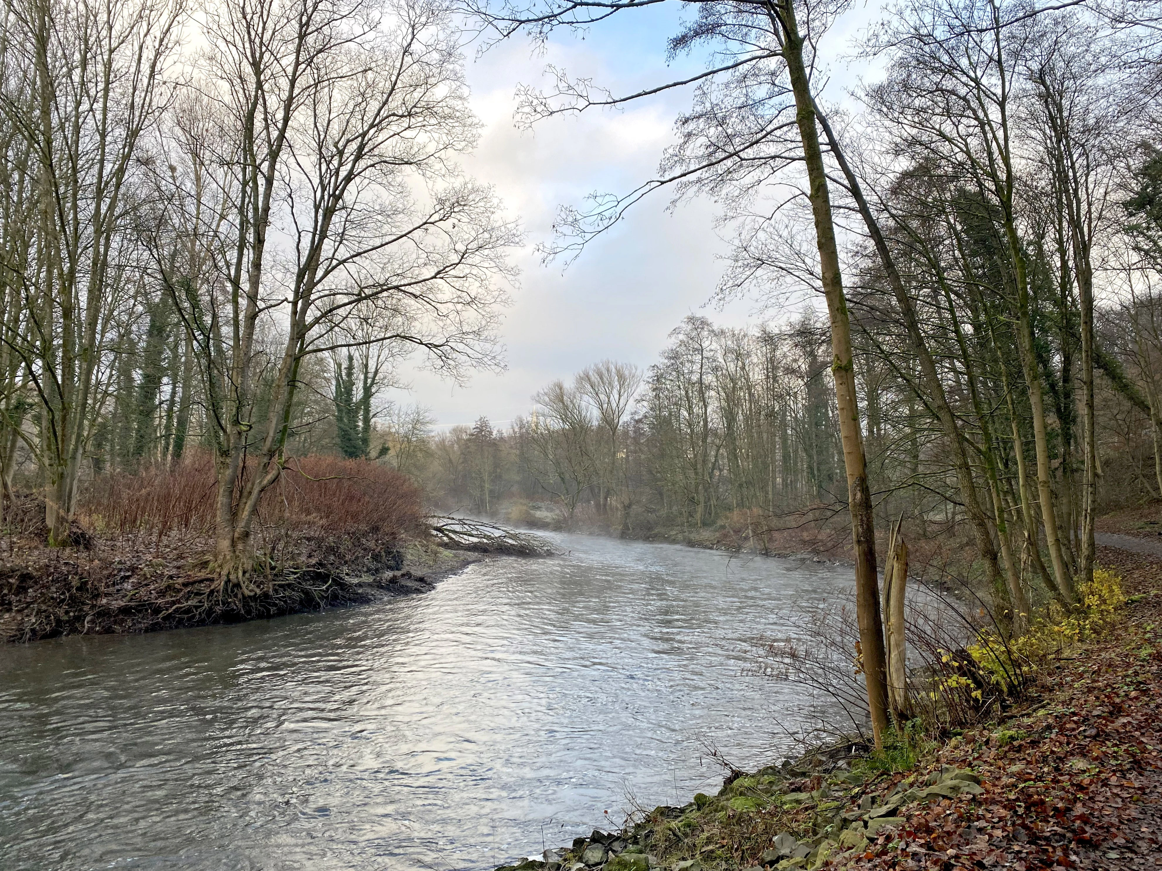
A tranquil river flows through a dense deciduous forest with bare trees along the banks on an overcast day.
The Wupper river flows through the Wupperhang nature reserve, flanked by deciduous forest and slopes.

Wupperhang mit Henkensiepen und Hüscheider Bachtal history and protected-area timeline

The nature reserve Wupperhang mit Henkensiepen und Hüscheider Bachtal was formally placed under protection in 1985 under the official designation LEV-006. Its legal foundation is the Leverkusen landscape plan, which became legally binding in 1987 and remains the framework for its management.

Since its designation, the reserve has been administered by the lower landscape authority (Untere Landschaftsbehörde) of the city of Leverkusen, and the conservation goals defined in the landscape plan have continued to guide habitat management. The area has also been incorporated into the European Natura 2000 network, embedding the small reserve within a much larger cross-border habitat protection framework.

Wupperhang mit Henkensiepen und Hüscheider Bachtal landscape and geographic character

The landscape of the reserve is shaped primarily by the Wupper River and the narrow valleys that feed into it from the south. As the Wupper enters Leverkusen from the north, it bends sharply westward near Imbach, and along this bend it has eroded a steep outer bank that exposes occasional rock faces and forms the scenic backbone of the protected area.

On the western side of the reserve, this Prallhang rises sharply above the river, covered in closed beech forest that reaches right to the upper edge of the slope. Small streams descend in deeply incised channels known locally as Siefen, creating a rugged, dissected topography typical of the Bergisches Land.

Further east, the terrain opens slightly into the Henkensiepen valley and the broader catchment around Hüscheid. Here flatter pockets support wet meadows, reed beds, and orchards, contrasted with the enclosed feel of the wooded Wupper slope. Elevation ranges from about 50 meters near the river to roughly 128 meters on the upper slopes, with an average of about 89 meters.
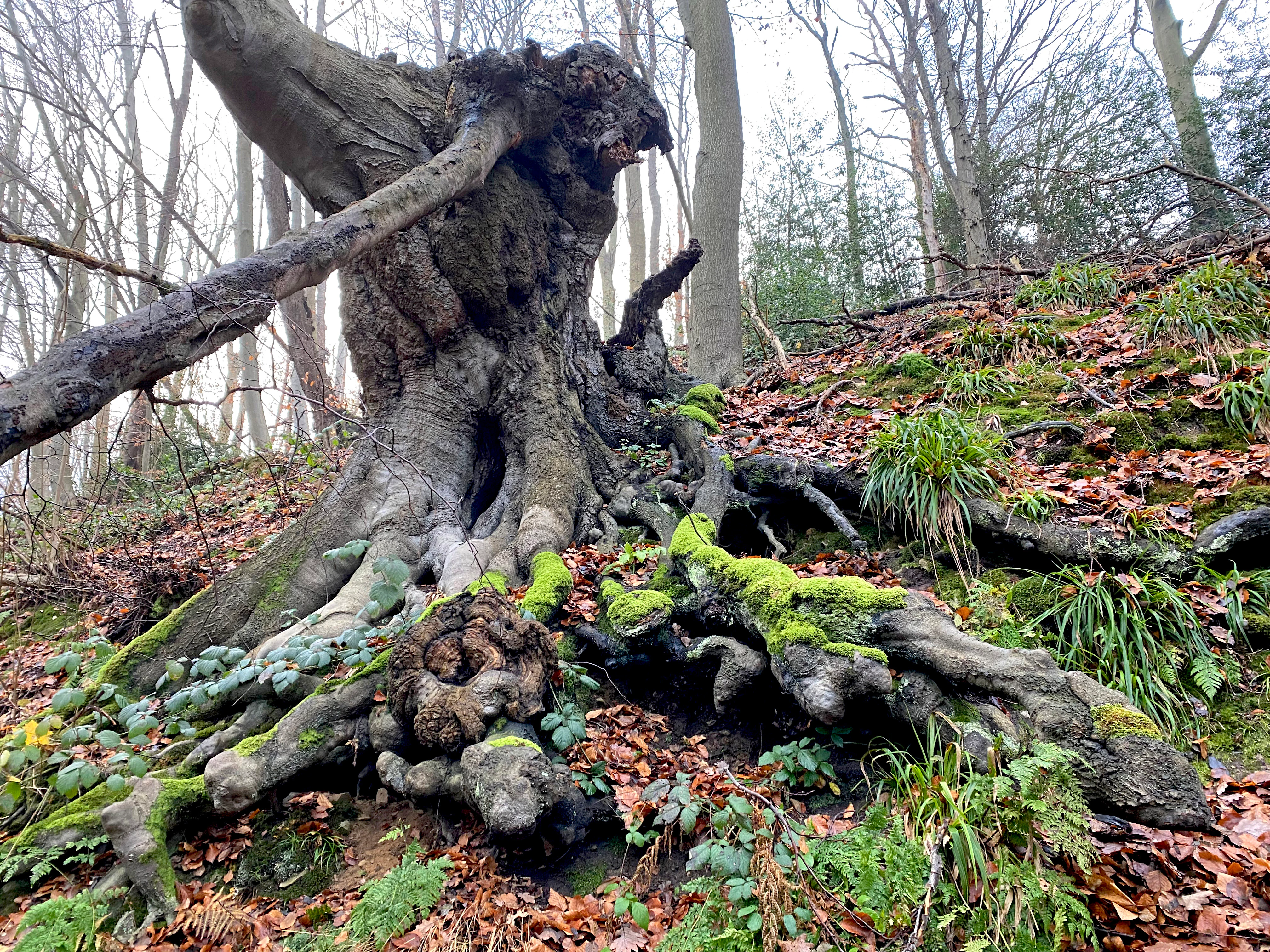
A close up view of an old, knotty beech tree trunk and exposed root system on a forested slope, covered in patches of green moss and fallen leaves.
A gnarled, moss-covered beech tree root system on the steep slopes of the Wupperhang nature reserve.

Wupperhang mit Henkensiepen und Hüscheider Bachtal ecosystems, habitats, and plant life

The reserve protects a remarkably varied ecological mosaic within a small footprint. The dominant habitat is Hainsimsen beech forest (Luzulo-Fagetum) on the steepest, more acidic slopes of the Wupperhang, where the characteristic tufted grass Luzula gives the woodland floor a distinctive texture. To the east this transitions into a richer Waldmeister beech forest (Galio odorati-Fagetum), notable for patches of very old, large-diameter beech trees and an associated deadwood component.

Alongside the river, a single row of alder follows the bank, while the wetter low ground supports black alder and ash floodplain woodland. Several calcareous springs feed into the Wupper, locally enriching the soil and supporting more demanding plant communities. In the Henkensiepen valley, an extensively managed wet meadow borders a small reed bed and grey willow shrub, and the wider Hüscheid area contributes species-rich fat meadows and a sizeable traditional orchard.

Together these features make the reserve a textbook example of Bergisches stream-valley ecology, linking aquatic, spring, forest, and open grassland habitats within a few hundred meters of each other.
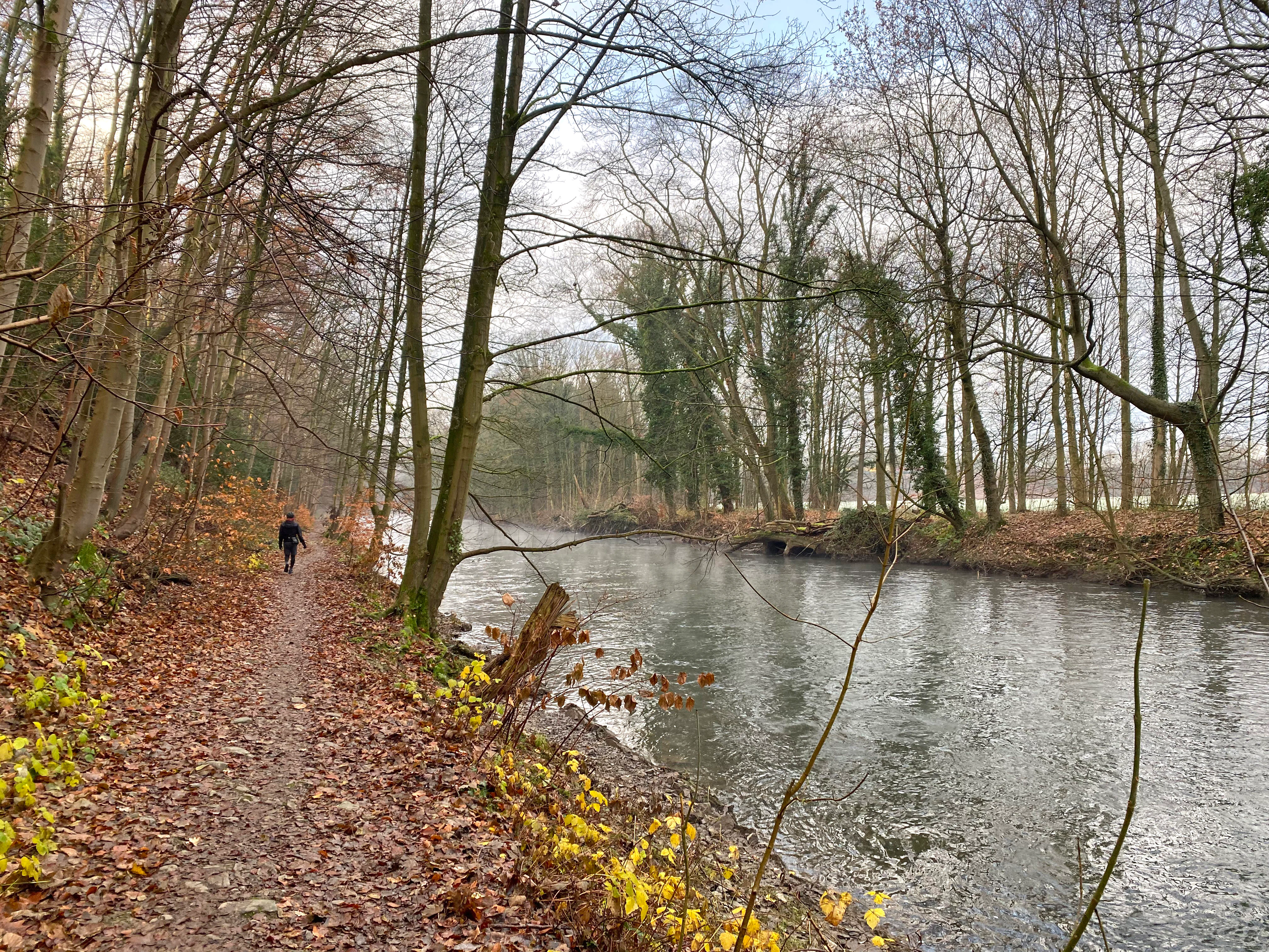
A dirt trail covered in autumn leaves runs alongside a calm river with bare trees in a forest setting.
A person walking along the Landrat Lucas Way, a trail following the Wupper River through the Wupperhang nature reserve.

Wupperhang mit Henkensiepen und Hüscheider Bachtal wildlife and species highlights

The reserve is primarily valued for its habitat structure rather than as a high-profile wildlife destination, but the combination of old beech forest, deadwood, spring-fed streams, wet meadows, and orchard habitat supports a diverse community of woodland, riverine, and meadow species typical of the Bergisches Land.

Old-growth beech with substantial deadwood provides nesting cavities and feeding habitat for hole-breeding and bark-feeding insects and the birds that depend on them, while the undisturbed forest floor and the wetland pockets in the Henkensiepen valley support amphibians, invertebrates, and other moisture-dependent fauna. The extensive wet meadows and reed beds near Henkensiepen and Hüscheid offer additional habitat value for insects and small wetland-associated species.
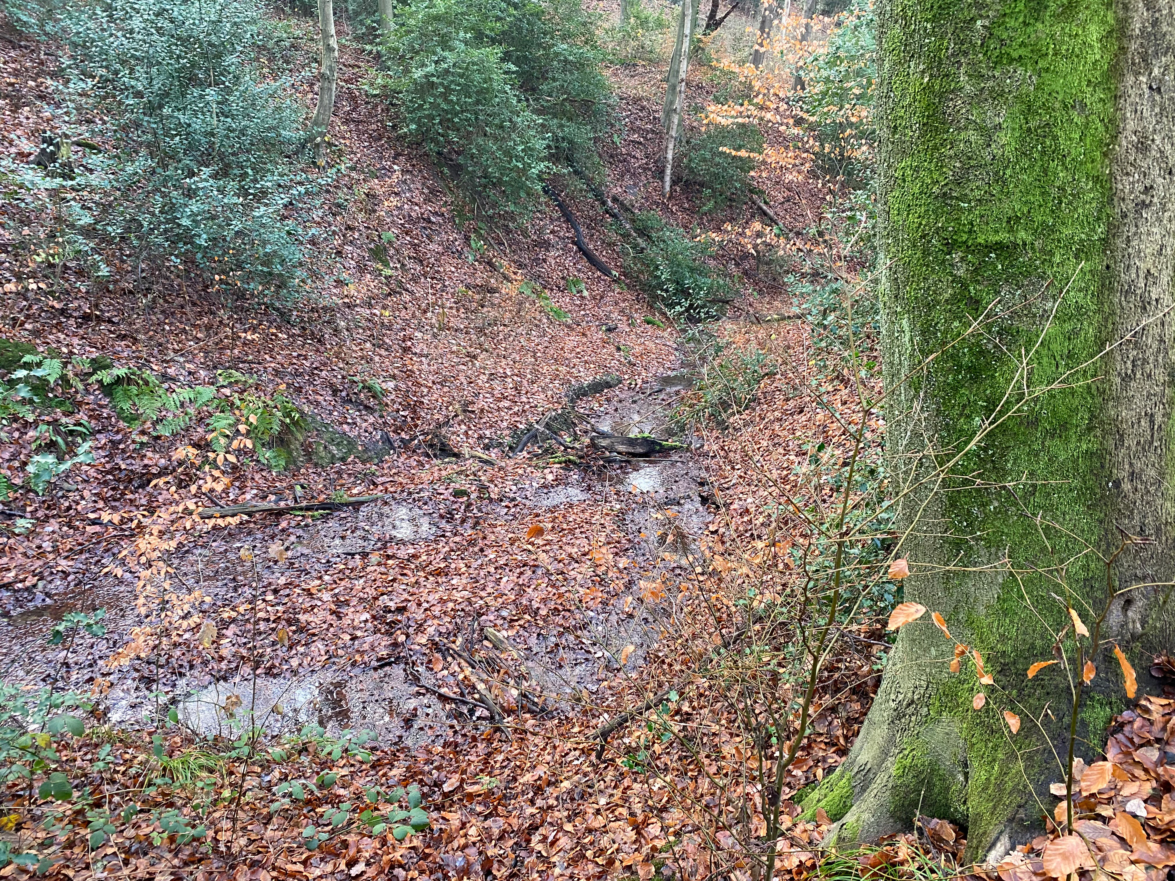
A small woodland stream flows through a forest ravine covered in fallen brown autumn leaves, with a large moss-covered tree trunk in the foreground.
The Henkensiepen stream flowing through the forest floor of the Wupperhang mit Henkensiepen und Hüscheider Bachtal nature reserve.

Wupperhang mit Henkensiepen und Hüscheider Bachtal conservation status and protection priorities

Conservation efforts in the reserve focus on maintaining and restoring the near-natural character of the Wupper slope and its side valleys. Protection goals explicitly target the stream valleys with their wet meadows, reed beds, floodplain woodland remnants, beech forest, and old-growth stands, allowing them to develop through natural succession where possible or through near-natural management where intervention is needed.

The wet meadow in the Henkensiepen valley is managed extensively to retain its open, species-rich character, and the orchards and fat meadows around Hüscheid are kept as part of the protected mosaic. By sitting within the much larger Natura 2000 site DE-4808-301, the reserve is also linked into broader European efforts to protect Bergisches stream-valley habitats as a connected ecological network.

Top sights and standout views in Wupperhang mit Henkensiepen und Hüscheider Bachtal

One of the best-preserved forest sections in the Bergisches stream-valley network, with an unusually intact Hainsimsen beech forest on the steep slopes above the Wupper. The reserve combines near-natural woodland, spring-fed brooks, wet meadows, reed beds, and traditional orchard landscape within a compact area.

Its placement within a larger Natura 2000 area and its status as one of the core woodland sections along a regionally important river corridor give it ecological significance well beyond its modest size.
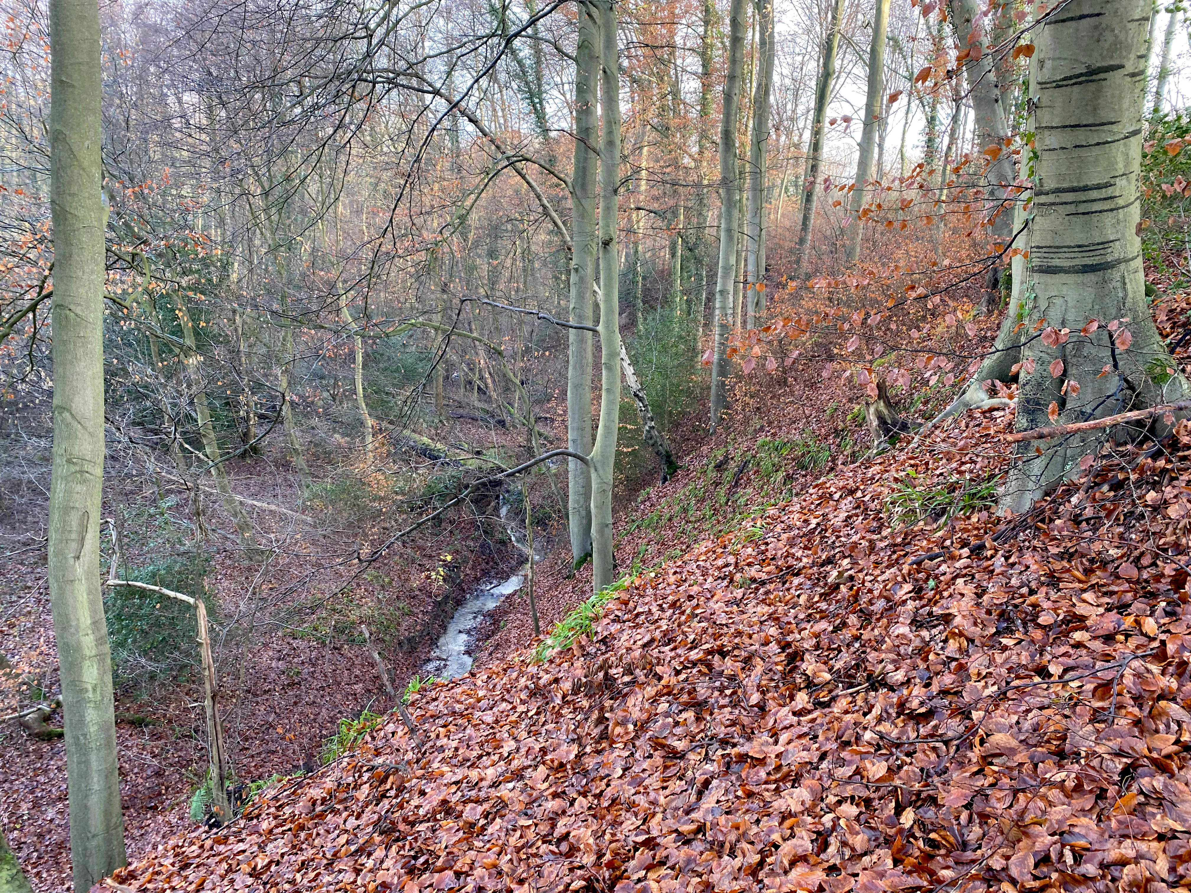

A view of a steep, deciduous forest slope covered in brown fallen autumn leaves, leading down to a small, narrow stream winding through the valley floor, with slender tree trunks in the background.
A steep, leaf-covered forest slope descending into a small stream valley in the Wupperhang with Henkensiepen and Hüscheider Bachtal nature reserve.
Monthly climate preview

Long-term representative monthly temperature and precipitation data recorded across the protected terrain

Wupperhang mit Henkensiepen und Hüscheider Bachtal Climate Normals and Annual Temperature Patterns

Representative coordinates track the long-term annual temperature range and steady precipitation rhythm across Wupperhang mit Henkensiepen und Hüscheider Bachtal from 1991 to 2020. Examining the complete twelve-month climatology profile reveals deeper variations in average maximum and minimum temperatures.
Annual mean10 °C
1 °C19 °C
Jan
Feb
Mar
Apr
May13°
Jun17°
Jul19°
Aug19°
Sep15°
Oct10°
Nov
Dec
Warmest month
July

19.2 °C

Coolest month
January

1.3 °C

Wettest month
December

2.6 mm/day

Driest month
April

1.6 mm/day

Park location guide

Geography guide, regional context, and park location map for Wupperhang mit Henkensiepen und Hüscheider Bachtal

Wupperhang mit Henkensiepen und Hüscheider Bachtal park geography, regions, and map view in Germany

Understand where Wupperhang mit Henkensiepen und Hüscheider Bachtal sits in Germany through a broader geographic reading of the surrounding landscape, nearby location context, and its mapped position within the national park landscape.

How Wupperhang mit Henkensiepen und Hüscheider Bachtal fits into Germany

Germany is a federal republic in Western and Central Europe with a population of over 83 million across sixteen constituent states. It is Europe's largest economy by nominal GDP and a major global exporter and importer. The capital is Berlin, and the country borders Denmark, Poland, Czech Republic, Austria, Switzerland, France, Luxembourg, Belgium, and the Netherlands.

Wider geography shaping Wupperhang mit Henkensiepen und Hüscheider Bachtal in Germany

Germany is located in Western and Central Europe, spanning 357,022 km². It borders Denmark to the north, Poland and the Czech Republic to the east, Austria and Switzerland to the south, and France, Luxembourg, Belgium, and the Netherlands to the west. The country has coastlines on the Baltic Sea and North Sea to the north, with the Alps located in the southern region.

Map view of Wupperhang mit Henkensiepen und Hüscheider Bachtal

Use this park location map to pinpoint Wupperhang mit Henkensiepen und Hüscheider Bachtal in Germany, understand its exact geographic position, and read its mapped placement within the surrounding landscape more clearly.

Pigeon | © OpenStreetMap contributors

Location context for Wupperhang mit Henkensiepen und Hüscheider Bachtal

Nordrhein-Westfalen

Visual exploration of steep river slopes, old-growth beech forests, and protected stream valleys.

Wupperhang mit Henkensiepen und Hüscheider Bachtal Photos and Landscape Scenery

Visual documentation of Wupperhang mit Henkensiepen und Hüscheider Bachtal reveals the complex topography of steep riverbanks, incised spring brooks, and floodplain habitats. Photographic records capture the protected landscape character and forest mosaic along the Wupper River corridor.

A tranquil river flows through a dense deciduous forest with bare trees along the banks on an overcast day.

A view looking down a steep, wooded slope with mature beech trees and leaf litter, characteristic of the Wupperhang nature reserve.

A close up view of an old, knotty beech tree trunk and exposed root system on a forested slope, covered in patches of green moss and fallen leaves.

A dirt trail covered in autumn leaves runs alongside a calm river with bare trees in a forest setting.

A small woodland stream flows through a forest ravine covered in fallen brown autumn leaves, with a large moss-covered tree trunk in the foreground.

A narrow dirt hiking path covered in autumn leaves winds through a deciduous forest with a steep, green, grassy slope to the left and a tree marked with a trail sign to the right.

A view of a steep, deciduous forest slope covered in brown fallen autumn leaves, leading down to a small, narrow stream winding through the valley floor, with slender tree trunks in the background.

A triangular nature reserve sign with a bird silhouette stands near a mossy fallen log over a small creek in a wooded area.

A small, muddy stream bed meanders through a deciduous forest floor covered in brown fallen leaves and patches of bright green sedge or grass, with tree trunks and holly bushes in the background.

Park atlas

Compare regional stream valleys, riverine beech forests, and connected conservation areas across the surrounding terrain.

Explore Parks Near Wupperhang mit Henkensiepen und Hüscheider Bachtal and Surrounding Protected Landscapes

Browse protected areas and river valley reserves located near Wupperhang mit Henkensiepen und Hüscheider Bachtal to evaluate regional ecological networks. Examining adjacent forest habitats and stream networks provides broader geographic context for the Bergisches Land conservation corridor.
Watercolor painting of a pastoral landscape featuring a winding river, green fields, and clusters of trees, rendered in a soft, impressionistic style on a white background.
Nature reserveNordrhein-Westfalen
About 2.4 km away#1 closest

West

Southerberg Nature Reserve: Protected Woodland and Wetland Mosaic in Nordrhein-Westfalen

A rare habitat bridge on the Bergische Sand terrace.

Southerberg serves as a crucial nature reserve in Leverkusen, Nordrhein-Westfalen, balancing wet birch-oak forests with reedbeds and meadows. This compact protected area functions as a key ecological connector between larger regional habitats, showcasing a refined topographic transition from valley basin to sandy slope.

Area
0.149 km²
Established
1987
IUCN
IV
Relief
Lowland
Nature reserveNordrhein-Westfalen
About 3.9 km away#2 closest

Southwest

Wupperinsel Nature Reserve: Mapped Protected Landscapes in Nordrhein-Westfalen

Riparian woodland, floodplain islands, and meadow habitats.

Discover the geographic role of Wupperinsel as a designated nature reserve within the Wupper River corridor. This site features a rare Glatthafer meadow, mature poplar lines, and mixed-woodland groves that provide essential habitat connectivity. Analyze the protected island boundaries and the layered floodplain terrain that characterize this significant ecological fragment in urban Germany.

Area
0.054 km²
Established
1987
IUCN
IV
Nature reserveLeverkusen
About 6.8 km away#3 closest

West

Krapuhlsee Nature Reserve: Protected Wetland and Gravel Lake Geography in Leverkusen

Exploring post-industrial habitat mosaics and conservation terrain

Krapuhlsee is a protected nature reserve in Leverkusen, North Rhine-Westphalia, known for its unique concentration of post-mining gravel lakes and nutrient-poor grassland habitats. Managed to support rare wild bee populations and ground-nesting birds, the reserve acts as a critical stepping-stone for ecological connectivity across the heavily industrialized Rhine corridor.

Area
0.082 km²
Established
1986
IUCN
IV
Relief
Lowland
Watercolor illustration of a peaceful lake with trees on a small island and flowering meadows in the foreground.
Nature reserveNordrhein-Westfalen
About 7.9 km away#4 closest

West

Monheimer Baggersee Nature Reserve: Geographic Overview and Protected Landscape Mapping

Located within the Lower Rhine terrace of Nordrhein-Westfalen

Monheimer Baggersee represents a vital protected landscape shaped from a former gravel quarry. This reserve provides a comprehensive geographic look at mineral-substrate habitats, irregular lake shorelines, and specialized avian breeding grounds within the urbanized Mettmann district.

Area
0.712 km²
Established
1981
IUCN
IV
Relief
Lowland
Watercolor painting of a tranquil, marshy landscape with soft green trees, grass, and a winding path, rendered in a pale, minimalist style.
Nature reserveNordrhein-Westfalen
About 8 km away#5 closest

Northwest

Krüdersheide und Götsche Nature Reserve: Geographic Mapping and Protected Land Data

Wetland mosaic and bog forest habitats in Nordrhein-Westfalen

Located in Solingen, the Krüdersheide und Götsche nature reserve protects essential bog woodland, peat cushions, and stream habitats on the Bergische Heideterrasse. This 55-hectare site serves as an important ecological corridor for moisture-dependent flora and fauna within an urbanized region of Nordrhein-Westfalen. Study its mapped boundaries and terrain context through our specialized atlas database.

Area
0.547 km²
Established
2005
IUCN
IV
Relief
Lowland
A horizontal watercolor painting showing a peaceful river valley with green meadows, trees on both sides, and soft rolling hills in the background under a warm sky.
Nature reserveRheinisch-Bergischer Kreis
About 9.1 km away#6 closest

Southeast

Naturschutzgebiet Pfengstbach: Protected Brook Valley and Meadow Landscape Analysis

Regional geography and natural valley terrain of Rheinisch-Bergischer Kreis

Analyze the structural integrity of the Naturschutzgebiet Pfengstbach brook valley, featuring a detailed look at its riparian woodland, seepage springs, and wet meadow distribution. This protected area offers a precise example of Bergisches Land valley morphology, where meadow floors and mixed deciduous slopes intersect within a significant Natura 2000-linked conservation corridor.

Area
18.6 km²
Established
1994
IUCN
IV
Relief
Upland
A soft watercolor painting of a small grove of trees standing near a body of water, featuring pale green and yellow tones.
Nature reserveNordrhein-Westfalen
About 10 km away#7 closest

North

Naturschutzgebiet Hildener Heide, südlich Sandberg: Protected Area and Landscape Atlas

Bog woodland and wet heathland geography in North Rhine-Westphalia.

Examine the topography and habitat mosaic of Naturschutzgebiet Hildener Heide, südlich Sandberg. This nature reserve serves as an important ecological anchor on the Bergische Heideterrasse, preserving rare wetland, alder bog forest, and heath vegetation within a compact and structurally diverse geographic footprint.

Area
0.08 km²
Established
1938
IUCN
IV
Relief
Lowland
Nature reserveNorth Rhine-Westphalia
About 11 km away#8 closest

West

Worringer Bruch Nature Reserve: A Relict Rhine Floodplain in North Rhine-Westphalia

Ancient oxbow meander and vital inner-city wetland landscape.

Worringer Bruch stands as one of the best-preserved, silted-up oxbow meanders along the Lower Rhine. Spanning roughly 164 hectares, this nature reserve integrates floodplain forests, traditional orchards, and marshy meadows into a cohesive wetland mosaic. Serving as a low-lying ecological refuge near Cologne, the area remains deeply connected to the groundwater dynamics of the historic Rhine river corridor.

Area
1.64 km²
Established
1991
Relief
Lowland
Climate
Temperate

Common questions about visiting, size, designation, and location context for Wupperhang mit Henkensiepen und Hüscheider Bachtal

Wupperhang mit Henkensiepen und Hüscheider Bachtal FAQs for park facts, access, geography, and protected area context

Find quick answers about Wupperhang mit Henkensiepen und Hüscheider Bachtal, including protected-area facts, park geography, trail and visitor context, and how the park fits into its surrounding country and regional landscape.
MoriAtlas Explorer

Continue Your Protected Areas Search Across the Global Atlas

Deepen your exploration by continuing the structured search for national parks and protected areas worldwide. Utilize the comprehensive filtering capabilities to compare different conservation landscapes and refine your understanding of global park geography. Discover more about the distribution and characteristics of protected natural areas.

Global natural geography