
Mori Atlas logo
Protected landscapeZałęczański Park Krajobrazowy

Investigating karst terrain, river gorges, and limestone topography across the central Polish plateau.

Załęczański Park Krajobrazowy: Geographic Atlas and Protected Landscape Mapping of the Warta River

Załęczański Park Krajobrazowy represents a significant protected landscape within the Łódź Voivodeship, defining a complex mosaic of the Warta River valley and the surrounding Jurassic plateau. This geographic analysis focuses on the distinct Warta bend and its geological features, including karst springs, sinkholes, and the dense cave systems of Góra Zelce and Góra Draby. The mapped terrain reveals deep river gorges, forested limestone slopes, and a network of wetlands that characterize this cornerstone of central Polish nature conservation.

Polish JuraJura Polskariver valley parkWarta Rivermeanderkarst landscape
A graphic illustration depicting a winding river surrounded by green coniferous and deciduous forests under a sunrise, with rocky cliffs visible in the distance.

Załęczański Park Krajobrazowy

Protected landscape

Park overview

Structured park overview, official facts, and landscape profile for Załęczański Landscape Park

Załęczański Landscape Park park facts, protected area profile, and essential visitor context

Review the core facts for Załęczański Landscape Park, including designation, size, terrain, visitor scale, habitats, and operating context in one park-focused overview.

About Załęczański Landscape Park

Załęczański Landscape Park occupies a distinctive band of the Polish Jura in central Poland, centered on the middle section of the Warta River. The park follows both the great meander loop of the river, known as the Łuk Załęczański, and the two breakthrough gorges called the Działoszyński and Krzeczowski Przełomy Warty, where the Warta cuts through the limestone edge of the Wieluńska Upland. This combination of an open valley and dramatic gorges gives the park a varied terrain of river flats, steep wooded slopes, and isolated limestone hills.

The wider setting is part of the Jura Polska, a limestone belt whose substrate shapes both the scenery and the ecology of the park. Karst processes have produced sinkholes, dry valleys, caves, and a range of spring types, including the pulsating, terraced 'Granatowe Źródła' near Bobrowniki, which is unique within the Polish Jura. Rocky outcrops and isolated hills such as Góra Świętej Genowefy and Góra Wapiennik rise above the valley, providing viewpoints and anchoring several protected monuments of nature within the park.

Forestry is a major land use. Forests cover roughly half of the park and consist mostly of pine-dominated habitats on sandy terraces, with more natural oak, beech, and fir communities surviving in isolated fragments. The river corridor adds willow-poplar floodplain forest and alder swamps along the Warta and its old oxbows, which together provide an important habitat mosaic for species ranging from wetland plants to bats and kingfishers.

Administratively, the park is a park krajobrazowy, a form of protected landscape area under Polish law. Its core area of about 14,750 hectares lies mainly in Łódzkie Voivodeship, while smaller slivers extend into Opolskie and Śląskie voivodeships. The park is part of the larger Zespół Jurajskich Parków Krajobrazowych, a group of landscape parks that together safeguard representative sections of the Polish Jura.

Quick facts and research context for Załęczański Landscape Park

Załęczański Landscape Park is a protected landscape area (park krajobrazowy) situated on the Wieluńska Upland, a part of the Wyżyna Woźnicko-Wieluńska in central Poland. It was established on 5 January 1978 by the Wojewódzka Rada Narodowa in Sieradz, becoming the first landscape park of its kind in central Poland.

The protected area spans roughly 14,750 hectares, with an additional protective buffer zone of about 12,010 hectares. While the majority of the park lies within Łódzkie Voivodeship, smaller portions extend into the adjoining Opolskie and Śląskie voivodeships. The park is defined by the great bend of the Warta River known as the Łuk Załęczański and by the Działoszyński and Krzeczowski river gorges, which together give it a strongly riverine and karst character.

Protection and recognition

Documented terrestrial protection framework and management parameters

Załęczański Park Krajobrazowy Protection Status and Conservation Scope

Załęczański Park Krajobrazowy maintains a documented terrestrial protection framework with established management parameters and designated conservation scopes. Official records outline the formal recognition history and administrative structure governing the protected landscape.

Protection details

Protection scope
Terrestrial
Transboundary protection
No
Buffer area
120.1 km²
Park context

Deeper park guide and search-rich context for Załęczański Landscape Park

Załęczański Landscape Park history, landscape, wildlife, and travel context

Explore Załęczański Landscape Park through its history, landscape character, ecosystems, wildlife, conservation priorities, cultural context, and seasonal travel timing in a structured park guide built for atlas discovery and search intent.

Why Załęczański Landscape Park stands out

Załęczański Landscape Park is best known for protecting the great bend of the Warta River, the Załęczański Łuk Warty, and the two gorges through which the Warta crosses the Wieluńska Upland. Its scenic combination of river valleys, limestone hills, and extensive forests is widely considered one of the most characteristic pieces of the Polish Jura west of Częstochowa. The park is also recognized for its karst phenomena, including sinkholes, caves along Góra Zelce and Góra Draby, and unusual karst springs such as the pulsating 'Granatowe Źródła'. Together with multiple nature reserves within and around its buffer zone, these features give the park a strong profile in landscape, geological, and ecological terms within the Polish system of protected areas.
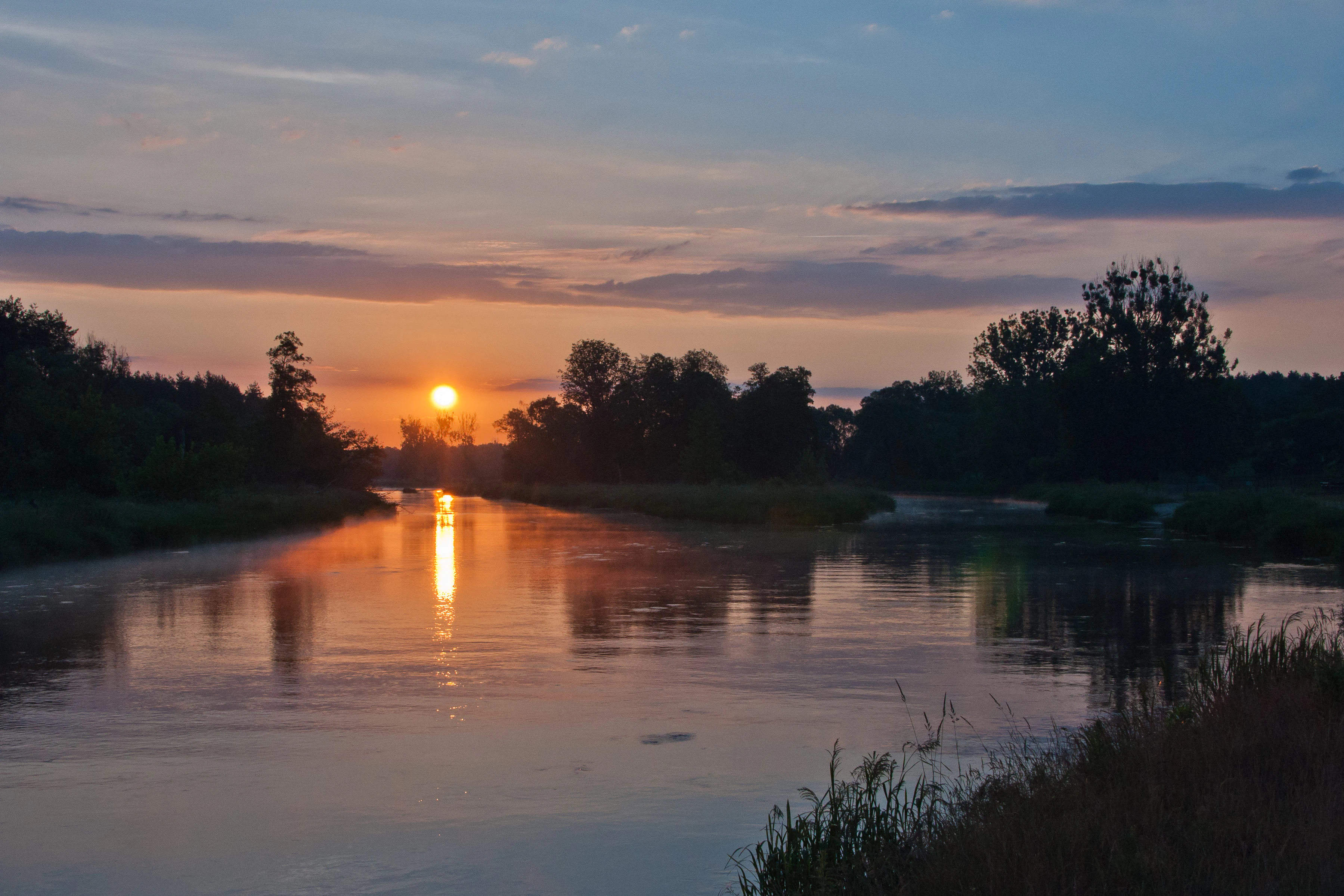
A peaceful river flows through a treelined landscape at sunrise, with the sun casting a reflection on the calm water surface.
Sunrise over the Warta River within Załęczański Landscape Park.

Załęczański Landscape Park history and protected-area timeline

Załęczański Landscape Park was created on 5 January 1978 under Resolution XIII/50/78 of the Wojewódzka Rada Narodowa in Sieradz. Its establishment marked it as the first landscape park designated in central Poland, reflecting an interest in protecting the scenic and ecological character of the Wieluńska Upland at a time when such designations were still relatively new.

Early after creation, the park's boundaries and protective buffer zone were adjusted in 1989 under a separate resolution of the same regional authority. The current legal framework within Łódzkie Voivodeship is based on Regulation No. 45/2005 of the Wojewoda Łódzki, issued on 24 November 2005, which formally defines the park's present boundaries in that voivodeship.

Over time the park has accumulated additional layers of protection. Nature reserves have been designated both inside the park and in its buffer zone, several caves have been documented and protected as monuments of nature, and educational trails have been developed to make the area accessible. These steps have expanded the park's role from a purely landscape designation into a broader hub for nature conservation, geological heritage, and outdoor education in the region.

Załęczański Landscape Park landscape and geographic character

The landscape of Załęczański Landscape Park is shaped by the interaction between the Warta River and the Jurassic limestone plateau of the Wieluńska Upland. The defining feature is the great bend of the Warta known as the Załęczański Łuk Warty, a broad meander that swings around a peninsula of higher ground. Where the river cuts back into the plateau it forms two gorges, the Działoszyński Przełom and the Krzeczowski Przełom, creating sudden transitions between open valley and enclosed, steep-sided corridor.

Karst landforms are a recurring element throughout the park. Sinkholes, dry valleys, caves, and karst springs cluster along the limestone edge. The cave complexes of Góra Zelce, including Jaskinia Za Kratą, Jaskinia Stalagmitowa, Jaskinia Niespodzianka, and Jaskinia Samsonowicza, together with Jaskinia Ewy on Góra Draby and the Szachownica cave system on Krzemienna Góra, give the park one of the denser concentrations of small caves in the Polish Jura. The unusual 'Granatowe Źródła' near Bobrowniki, with water emerging both at the river bank and from the bed of an oxbow, is a particularly rare karst feature on a national scale.

Land cover reflects the underlying relief. Forests dominate roughly half of the park and occupy the higher and drier parts of the terrain, while the river valley and old meanders carry meadows, pasture, oxbow lakes, and wetlands. Standing water bodies such as Żabi Staw, perched above the Warta valley west of Bobrowniki, and old channels like Wronia Woda add further variety to the mosaic. Isolated limestone outcrops and hills, including Góra Świętej Genowefy, Góra Wapiennik, and the Draby range, punctuate the skyline and serve as visual landmarks visible from many parts of the park.
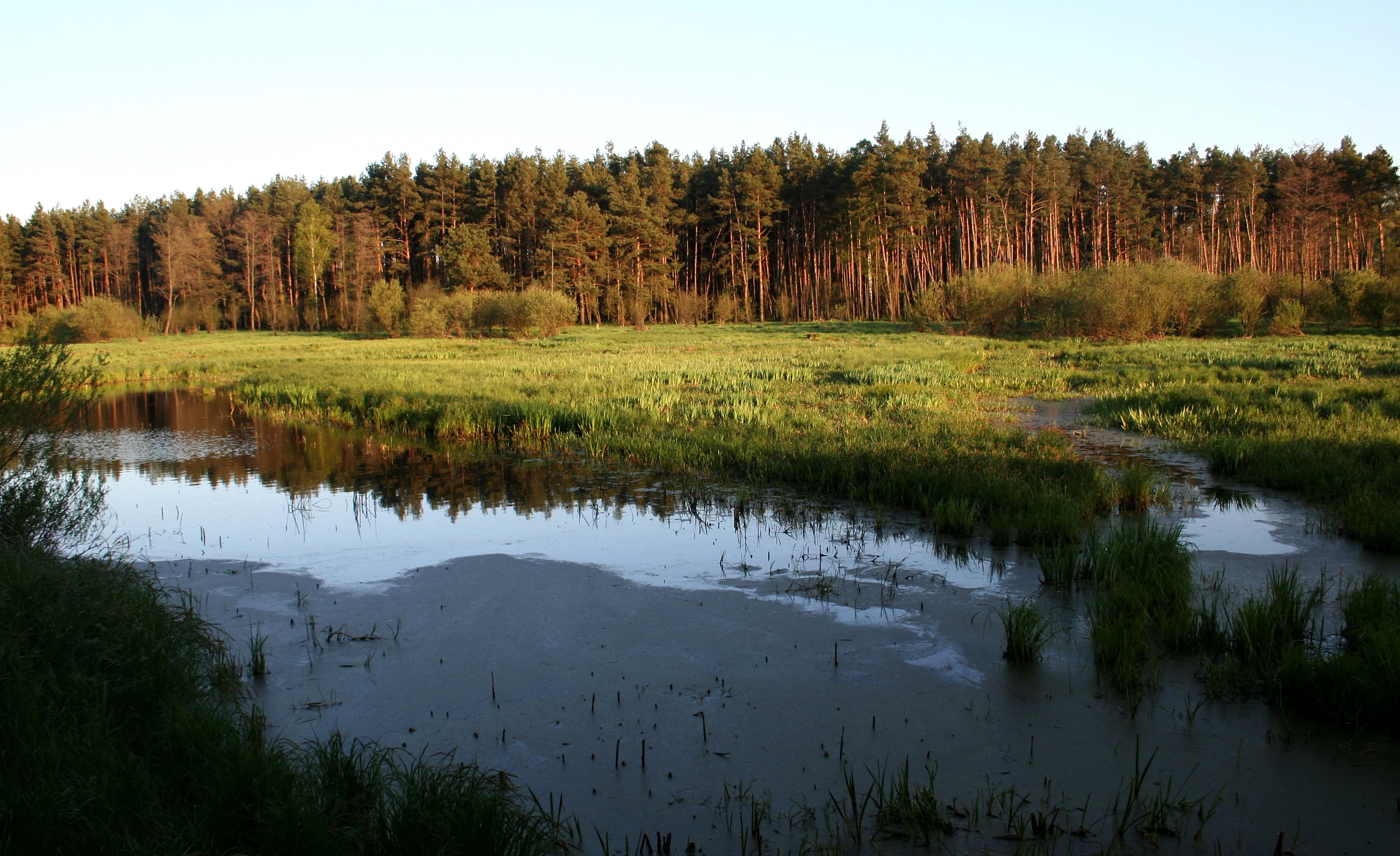
A peaceful wetland scene with a calm pool of water in the foreground, grassy meadows in the midground, and a dense pine forest standing against the horizon under soft light.
The Wronia Woda ecological site, a quiet wetland area bordered by coniferous forest in Załęczański Park Krajobrazowy.

Załęczański Landscape Park ecosystems, habitats, and plant life

Ecologically, Załęczański Landscape Park sits at the meeting point of riverine, forest, and karst habitats. The forests can be broadly divided between pine-dominated habitats on the poor sandy terraces, which form the majority of the woodland cover, and small but valuable remnants of more natural forest types in scattered locations. Among these natural remnants are the light oak forest, or świetlista dąbrowa, near Niżankowice, oak forests in the Ruda and Mierzyce forest tracts, a highland fir-mixed forest in the Kluski area, and an acid beech forest in the southwestern part of the park.

The Warta corridor adds a contrasting set of habitats. Willow stands line the active riverbank, with patches of willow-poplar floodplain forest and currant alder swamp along quieter stretches and oxbows. The river itself, its floodplain watercourses, and its springs support wetland vegetation, including aquatic plants such as yellow water-lily and white water-lily, while mires and bog features host sphagnum communities, round-leaved sundew, cotton grass, bog rosemary, and cranberry. Rocky outcrops and cave entrances provide substrate for a characteristic limestone fern community that includes rustyback spleenwort, wall rue, and brittle bladder fern.

Karst environments shape the park's flora in a more specialized way. Species such as houseleek, rock garlic, and the limestone ferns mark the presence of exposed Jurassic rock, while protected plants, regionally rare species, and species at the edge of their geographic range collectively number several dozen across the park and its buffer zone. Overall, the flora of the park and its surroundings has been documented to include close to 770 vascular plant taxa, around 100 moss species, and roughly 80 lichen species.
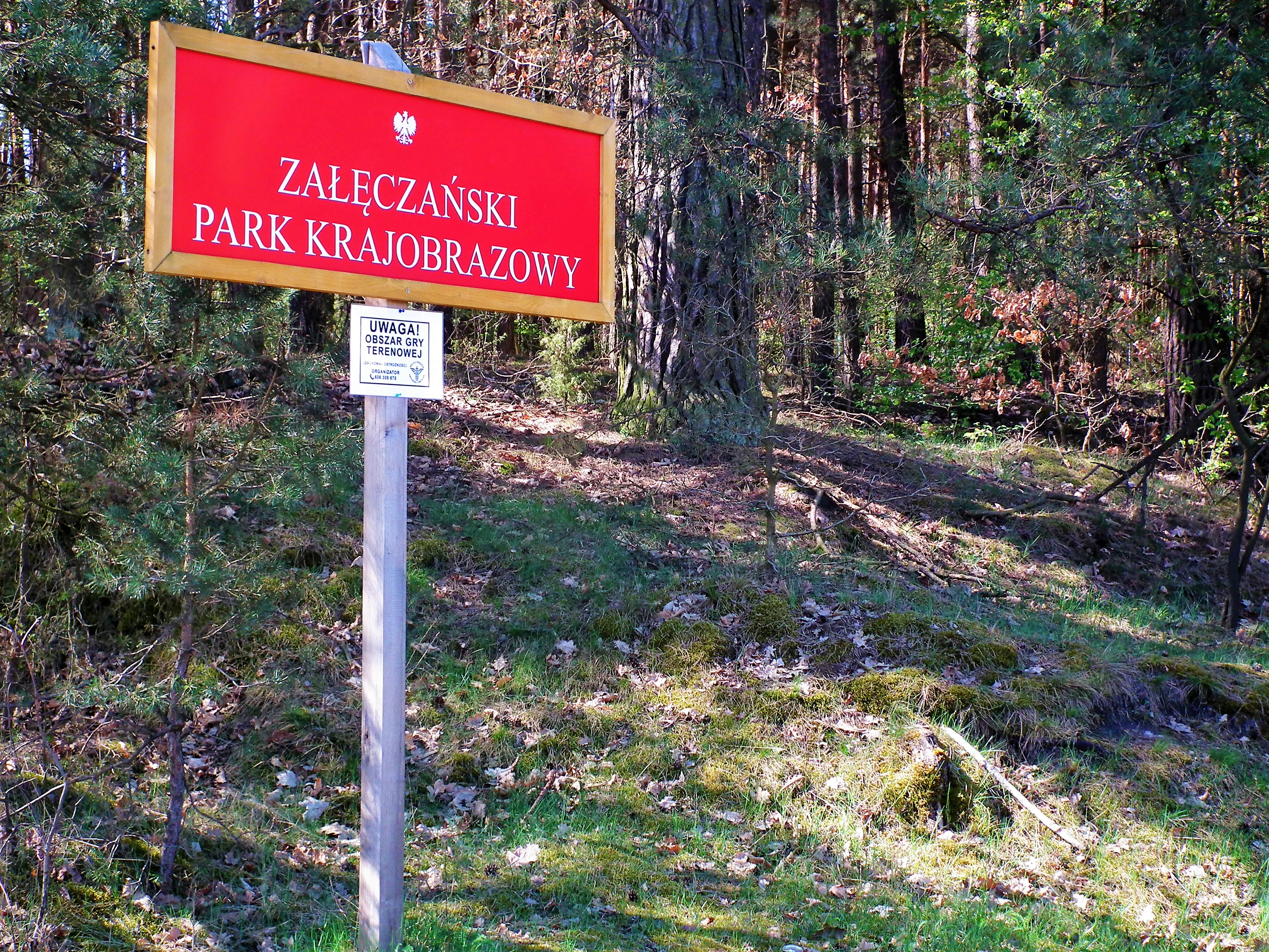
A rectangular red sign with white text reading Zaleczanski Park Krajobrazowy, mounted on a wooden post at the edge of a pine forest.
A red information sign marking the entrance to Załęczański Park Krajobrazowy in Poland.

Załęczański Landscape Park wildlife and species highlights

Wildlife in Załęczański Landscape Park is closely tied to the variety of its habitats. The park provides a home for a wide range of invertebrates, including butterflies, ground beetles from the Carabidae family, crickets, and orthopterans, which occupy meadows, forest edges, and rocky habitats. The Warta and its associated waters support a diverse fish community, with species such as roach, perch, carp, ide, dace, asp, catfish, eel, chub, burbot, pike, gudgeon, barbel, and bleak recorded in the river.

Amphibians and reptiles are represented by fire salamander among the amphibians and by the rarely recorded spotted snake as a reptile of particular regional note. Birdlife is one of the most visible aspects of the park's fauna, with roughly 130 bird species documented. Among the more distinctive species are kingfisher, hoopoe, common merganser, common goldeneye, and whooper swan, which are linked to the river and to wetland habitats such as oxbows and ponds.

Mammal records include the European hamster, an exceptionally important species at this latitude, as well as European beaver and Eurasian otter along the Warta corridor. The park has also been documented as home to a significant bat fauna, with around a dozen species including greater mouse-eared bat, Natterer's bat, common pipistrelle, brown long-eared bat, western barbastelle, and Brandt's bat, many of which rely on caves, old trees, and built structures for roosting.
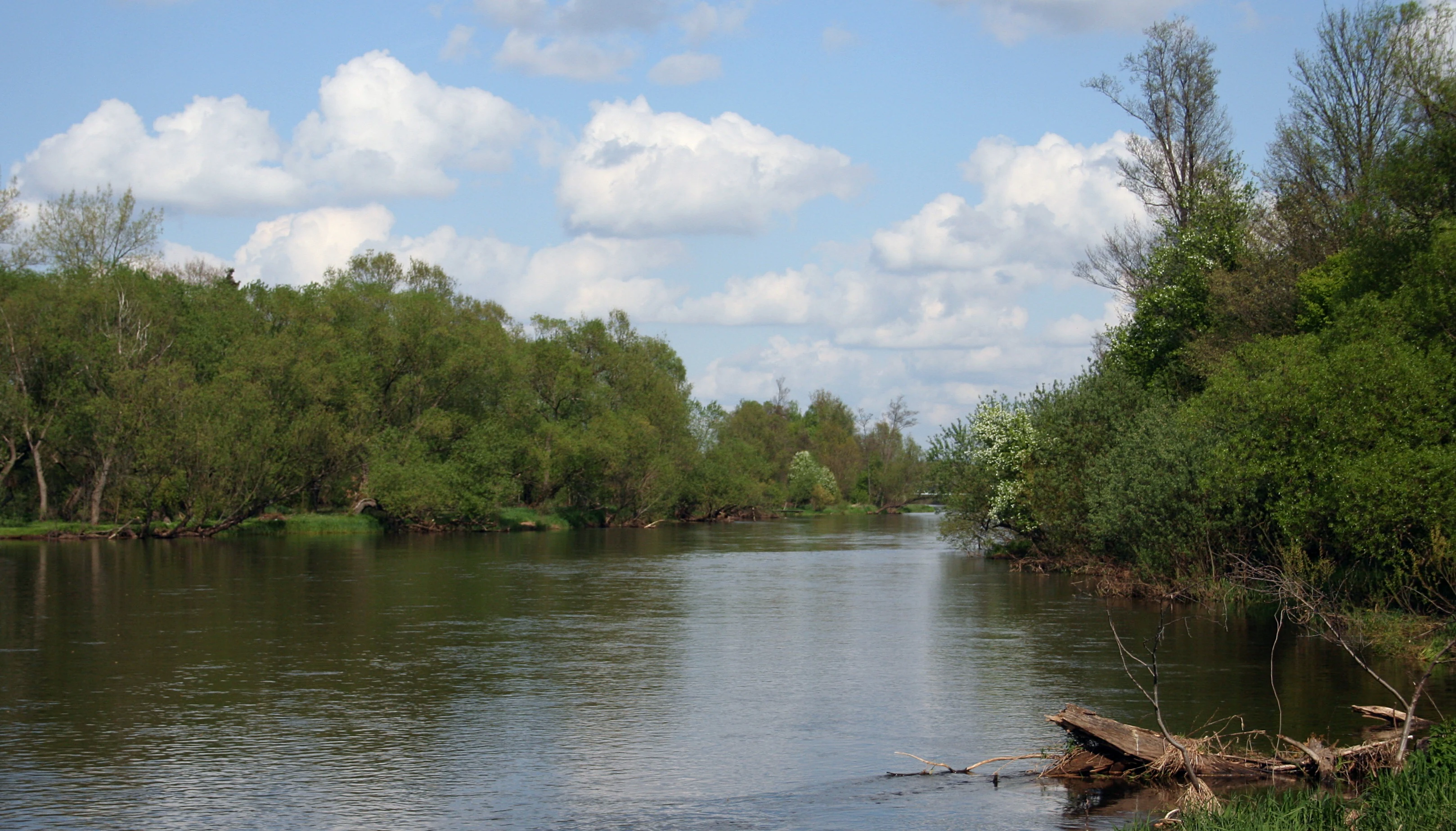
A peaceful river winds through a forest with dense trees on both banks and a blue sky with white clouds above.
The Warta River flowing through the lush greenery of Załęczański Landscape Park near Bobrowniki.

Załęczański Landscape Park conservation status and protection priorities

Załęczański Landscape Park plays an important role in conserving the natural character of the middle Warta and a representative section of the Polish Jura. As a park krajobrazowy it provides baseline protection for a large, continuous landscape area and its surrounding buffer zone, ensuring that the great river bend and the breakthrough gorges of the Warta remain in a largely natural state despite long-standing agricultural use in parts of the valley.

Within this broader protection, the park contains a layered network of more strictly protected sites. Three nature reserves lie fully within the park, including the strictly protected Bukowa Góra reserve in Silesia and the Dąbrowa w Niżankowicach and Węże reserves in Łódzkie, while two additional reserves, Stawiska and Szachownica, lie within the buffer zone. Karst springs, oxbow lakes, isolated hills, and notable trees are individually protected as monuments of nature, adding a finer scale of protection on top of the landscape-level designation.

Ecologically, the park guards valuable forest remnants, riverine habitats, karst systems, and cave fauna that together support rare plants and animals, including several protected vascular plant species, regionally rare or range-edge plants, and a notable assemblage of bats. The combination of large-scale landscape protection with smaller, targeted reserves and monuments gives the park a substantial role in the wider Zespół Jurajskich Parków Krajobrazowych network that safeguards the Polish Jura.

Załęczański Landscape Park cultural meaning and human context

The cultural landscape of Załęczański Landscape Park reflects centuries of human presence in the Warta valley. Small wooden churches of the regional 'Wieluń type' survive around and within the park area, in places such as Łaszew Rządowy, Popowice, and Grębień, exemplifying a distinctive vernacular sacred architecture tradition of the region. Another prominent feature of the cultural landscape is a pair of large princely burial mounds from the 2nd to 3rd century CE, located on the edge of the Warta valley near Przywóz, alongside other archaeological sites scattered across the area.

Traditional rural buildings and technical monuments remain part of the park's heritage. A wooden water mill of the late 19th century stands at Kępowizna, a wooden manor house from 1757 in Ożarów now serves as a museum of period interiors, and a wooden post windmill from 1914 survives near Ożarów. The remains of small, primitive lime kilns near Działoszyn, Lisowice, and Kolonia Lisowice record older extractive use of the local limestone. Together with the network of educational and tourist trails, these features weave the park into the broader cultural identity of the Wieluń region.
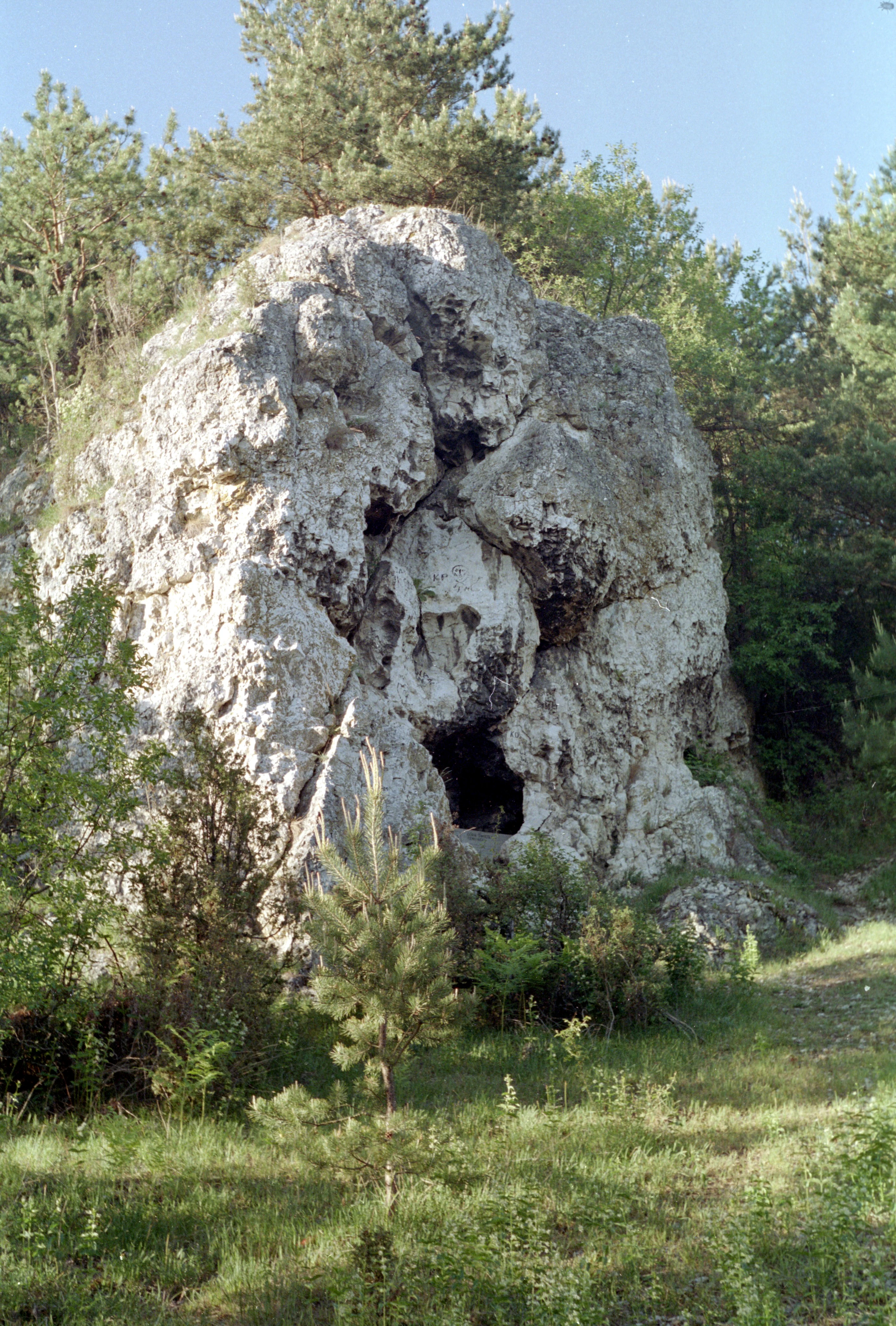
A large, rugged limestone rock outcrop with a small cave opening at its base, surrounded by pine trees and green grass.
A limestone rock formation, often associated with Genowefa Hill, within Załęczański Park Krajobrazowy.

Top sights and standout views in Załęczański Landscape Park

The Załęczański Łuk Warty, with its sweeping meander and the irregular limestone hills overlooking the river, is the defining scenic highlight of Załęczański Landscape Park. Closely linked to it are the Działoszyński and Krzeczowski river gorges, which compress the Warta between forested limestone slopes and offer some of the most striking views in the park.

Caves and karst springs add a distinct geological highlight. The cave systems of Góra Zelce and Góra Draby, including Jaskinia Szachownica and Jaskinia Ewy, give the park one of its most recognizable underground landscapes. The 'Granatowe Źródła', with their unusual pulsating springs, and the perched Żabi Staw, noted for its protected water lilies, are distinctive natural monuments that visitors and educational trails converge around.
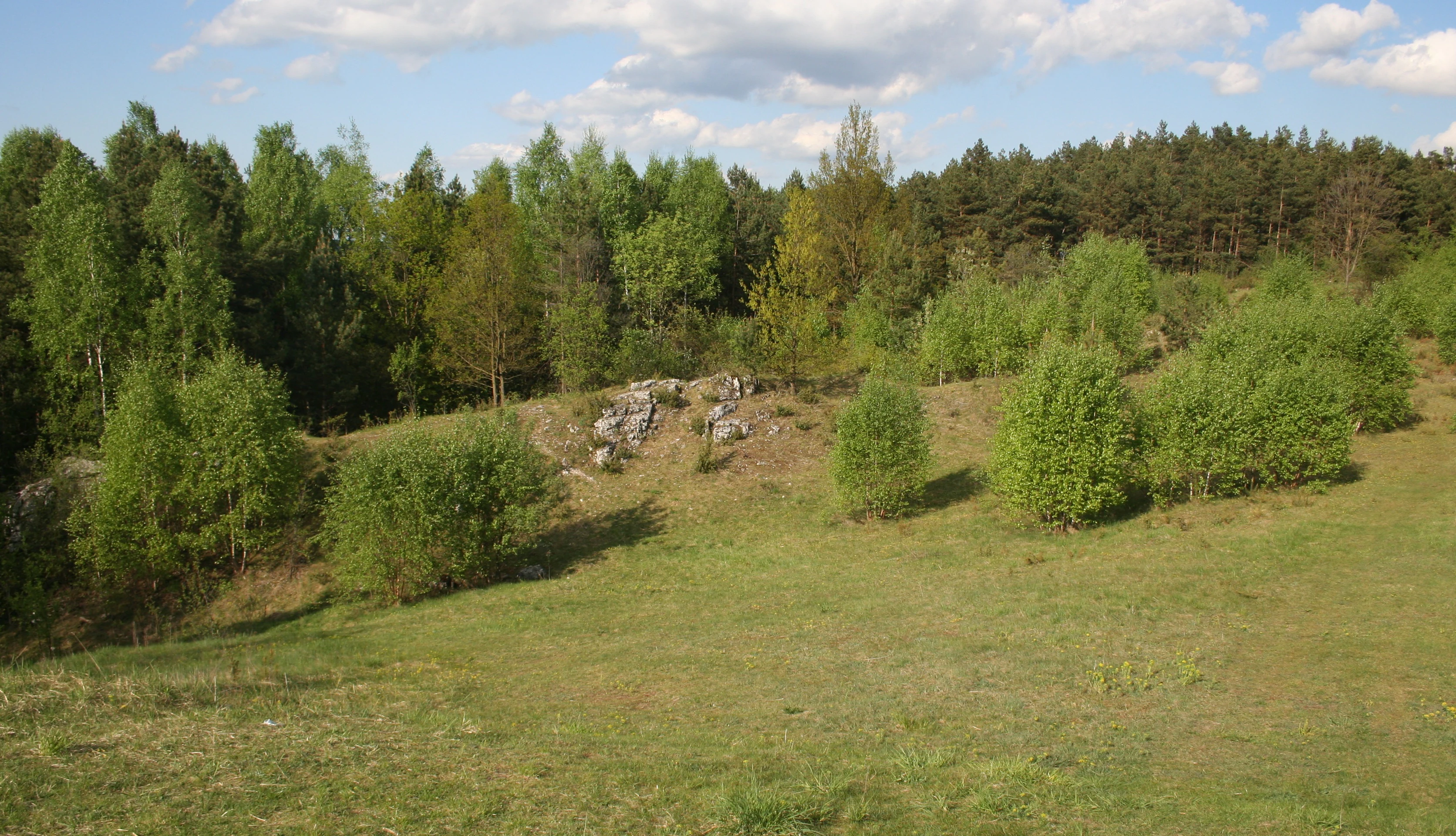
A gentle grassy hill featuring small limestone rock outcroppings, surrounded by mixed deciduous and coniferous forest under a partly cloudy sky.
Limestone outcrops in the Węże Nature Reserve within Załęczański Landscape Park.

Best time to visit Załęczański Landscape Park

Załęczański Landscape Park can be experienced across the seasons, but spring and early summer tend to bring the most active birdlife along the Warta and the richest display of woodland and meadow vegetation. Warmer months are also when the cycling and hiking trails around the Łuk Załęczański are most comfortably explored, and when the caves and karst features are easiest to reach on foot.

Autumn produces a strong secondary season of interest, with forest color change in the pine and broadleaf stands, while winter, though quieter, offers clearer views of the river's meanders and the outline of the limestone hills. Because the park supports both aquatic, meadow, and forest habitats, the seasonal emphasis can shift toward river and wetland birds in early spring, wildflower interest in late spring, and warmer-weather hiking or cycling in summer and early autumn.

Monthly climate preview

Long-term representative point measurements for monthly temperature and precipitation.

Załęczański Park Krajobrazowy Climate Normals and Annual Temperature Rhythm

Representative coordinates record measured monthly averages spanning sub-zero winter minimums and warm summer maximums alongside consistent daily precipitation rates. Reviewing the complete twelve-month profile provides deeper analytical context for long-term regional weather patterns.
Annual mean9 °C
-3 °C20 °C
Jan-3°
Feb-1°
Mar
Apr
May14°
Jun18°
Jul20°
Aug20°
Sep15°
Oct
Nov
Dec-2°
Warmest month
July

20.2 °C

Coolest month
January

-3.1 °C

Wettest month
July

2.6 mm/day

Driest month
January

1.4 mm/day

Park location guide

Geography guide, regional context, and park location map for Załęczański Landscape Park

Załęczański Landscape Park park geography, regions, and map view in Poland

Understand where Załęczański Landscape Park sits in Poland through a broader geographic reading of the surrounding landscape, nearby location context, and its mapped position within the national park landscape.

How Załęczański Landscape Park fits into Poland

Poland, officially the Republic of Poland, is a Central European country spanning from the Baltic Sea in the north to the Carpathian Mountains in the south. It borders Germany, Czech Republic, Slovakia, Ukraine, Belarus, Lithuania, and Kaliningrad Oblast. The country has a temperate climate, diverse landscapes, and is known for its rich history, cultural heritage, and strong economic position within the EU.

Wider geography shaping Załęczański Landscape Park in Poland

Poland occupies 312,696 km2 in Central Europe, extending from the Baltic Sea coast in the north to the Sudetes and Carpathian Mountains in the south. It borders Germany to the west, Czech Republic and Slovakia to the south, Ukraine and Belarus to the east, and Lithuania and Kaliningrad Oblast to the northeast. The landscape includes lowland plains, uplands, and mountain ranges.

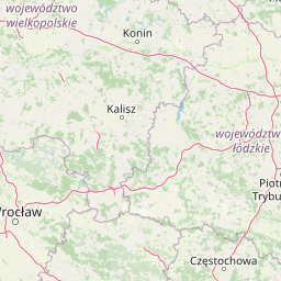
Map view of Załęczański Landscape Park

Use this park location map to pinpoint Załęczański Landscape Park in Poland, understand its exact geographic position, and read its mapped placement within the surrounding landscape more clearly.

Pigeon | © OpenStreetMap contributors

Location context for Załęczański Landscape Park

Łódź Voivodeship
Natural feature types

Explore the Natural Landmark Collection for Załęczański Park Krajobrazowy

Deepen your understanding of the Załęczański Park Krajobrazowy environment by reviewing its documented natural features. This MoriAtlas collection maps the core karst, hydrological, and topographical elements that define the character of this protected Polish landscape.
Recorded earthquake history

View Documented Seismic Activity Near Załęczański Park Krajobrazowy

Explore a structured archive of historical earthquake events associated with the geographic footprint of Załęczański Park Krajobrazowy. This catalogue displays event timing, intensity, and location data to help build a clearer picture of regional seismic history.

Załęczański Park Krajobrazowy Earthquake History

Catalogued events

22 events

Strongest magnitude

Magnitude 4.8

Most recent event

Nov 30, 2014

This history includes earthquakes recorded inside the park or within 50 km of its borders

Protected area scenery, limestone formations, and Warta River valley views

Załęczański Park Krajobrazowy Photos and Visual Landscape Exploration

Visual records illustrate the dramatic limestone hills, deep river gorges, and extensive forest habitats defining Załęczański Park Krajobrazowy. Photographic documentation reveals the intricate karst topography and meandering waterways characterizing this protected Jurassic landscape.

A peaceful river flows through a treelined landscape at sunrise, with the sun casting a reflection on the calm water surface.

A close-up view of the Granatowe Zrodla springs where clear water flows beneath tangled, moss-covered tree roots and over a rocky bed.

A peaceful wetland scene with a calm pool of water in the foreground, grassy meadows in the midground, and a dense pine forest standing against the horizon under soft light.

A rectangular red sign with white text reading Zaleczanski Park Krajobrazowy, mounted on a wooden post at the edge of a pine forest.

A peaceful river winds through a forest with dense trees on both banks and a blue sky with white clouds above.

A calm, slow moving river winding through a dense forest with trees and green vegetation along the banks.

A large, rugged limestone rock outcrop with a small cave opening at its base, surrounded by pine trees and green grass.

A gentle grassy hill featuring small limestone rock outcroppings, surrounded by mixed deciduous and coniferous forest under a partly cloudy sky.

A concrete trail marker post standing in a pine forest, featuring a stenciled bicycle icon and text reading EWI 6 and EWI 7 with yellow circular markers.

A view inside a limestone cave showing rocky walls and a narrow, dark winding passage.

Park atlas

Compare regional geography and connected protected areas across the Polish Jura

Explore Parks Near Załęczański Park Krajobrazowy and Surrounding Protected Landscapes

Browse other parks near Załęczański Park Krajobrazowy to compare similar river valleys, limestone formations, and forest ecosystems. Extending your exploration across the surrounding region reveals broader patterns in regional park geography and protected landscapes.
Nature reserveŁódź Voivodeship
Mapped location lies within the park boundary#1 closest

Northeast

Dąbrowa w Niżankowicach Nature Reserve: Protected Forest Landscapes and Regional Geography

A vital oak forest sanctuary in Poland's Łódź Voivodeship.

Dąbrowa w Niżankowicach preserves a mosaic of acidophilous oak woodlands and rare flora within the Łódź Voivodeship. This nature reserve functions as a concentrated site for vegetation-focused conservation, maintaining natural forest structures that have become increasingly scarce throughout the wider Wyżyna Wieluńska landscape. Its mapped boundaries highlight a significant ecological island within a predominantly agricultural region.

Area
1.025 km²
Established
1983
Relief
Upland
Climate
Temperate
Nature reserveLodzkie Voivodeship
About 5.2 km away#2 closest

Northeast

Rezerwat przyrody Mokry Las: Protected Oak-Hornbeam Forest and Regional Geography

A botanical forest refuge in the Kotlina Szczercowska basin.

Situated in the Pajęczno County of central Poland, Rezerwat przyrody Mokry Las is a dedicated nature reserve protecting a complete stand of oak-hornbeam forest. The area stands as an island of mixed deciduous and coniferous woodland within the gentle terrain of the Kotlina Szczercowska, offering a clear view of regional botanical conservation and forest ecology.

Area
0.146 km²
Established
1983
Relief
Lowland
Climate
Temperate
Protected landscapeLodzkie Voivodeship
About 5.8 km away#3 closest

North

Osjakowski Zespół Przyrodniczo-Krajobrazowy: River Valley Geography and Protected Terrain

A vital wetland corridor within the Lodzkie Voivodeship landscape network.

Located in central Poland, this protected landscape safeguards a representative stretch of the Warta river valley. It acts as an essential ecological bridge, connecting surrounding regional parks through a diverse mosaic of floodplain habitats, riparian forests, and riverine terrain that host unique bird and plant communities.

Area
24.92 km²
Established
1998
Relief
Lowland
Scope
Terrestrial
A watercolor painting of a green, tree-covered hillside set against a pale background.
Nature reserveSilesian Voivodeship
About 12 km away#4 closest

South

Modrzewiowa Góra Nature Reserve: Protected Forest Geography in Silesian Voivodeship

Veteran larch and oak woodland on the Wieluńska Upland

Modrzewiowa Góra functions as a critical nature reserve containing hundreds of mature Polish larch and ancient oaks. Representing a significant ecological fragment in southern Poland, the site maintains natural woodland structure that contrasts with the surrounding agricultural land. This map and geographic record explores the reserve's unique status as a botanical archive within the broader context of the Silesian Voivodeship's natural terrain.

Area
0.493 km²
Established
1957
Relief
Upland
Climate
Temperate
A watercolor painting showing a soft landscape with green fields, a cluster of trees, and a small lookout tower against a plain white background.
Nature reserveŚląskie
About 22 km away#5 closest

Southeast

Dębowa Góra Nature Reserve: Geographic Profile of an Urban-Adjacent Protected Forest

Preserving ancient mixed woodland in the Śląskie Voivodeship

Located in the town of Kłobuck, Dębowa Góra serves as a critical nature reserve shielding a fragmented but authentic relic of old-growth oak and hornbeam forest. The site occupies the elevated topography of the Wieluńska Upland, providing an important contrast to the surrounding industrial landscape through its ancient trees and protected understory vegetation.

Area
0.054 km²
Established
1953
Relief
Upland
Climate
Temperate
A soft watercolor painting of a wide, rolling landscape with green hills, patches of trees, and subtle pink ground tones.
Protected areaPoland
40 km away#6 closest

Southeast

Przełom Warty koło Mstowa: Mapping the Protected River Corridor and Limestone Geography

A critical geological breakthrough in the Częstochowa Upland.

This protected area features a twelve kilometer river gorge carved by the Warta. The terrain is characterized by dramatic limestone outcrops such as the Brama Mirowska, paired with rich meadow habitats and oak hornbeam forests. Explore the intersection of geology and conservation within this key corridor of the Polish Jura, where river dynamics meet ancient upland landscapes.

Relief
Upland
Climate
Temperate
Scope
Terrestrial
Water
Major water bodies
Nature reserveŁódź Voivodeship
About 41 km away#7 closest

Northwest

Długosz Królewski w Węglewicach Nature Reserve: Mapped Protected Landscapes in Poland

A focused floristic sanctuary in the Łódź Voivodeship.

Długosz Królewski w Węglewicach is a small but ecologically significant nature reserve in the Łódź Voivodeship. Primarily designated to protect royal fern habitats, the reserve showcases a diverse transition of forest types and wetland conditions, offering a clear window into the rare botanical geography of the Kotlina Grabowska region.

Area
0.033 km²
Established
1965
Relief
Lowland
Scope
Terrestrial
A soft watercolor painting of a rolling landscape featuring light-colored limestone cliffs, green hills, and a winding path, rendered in pale pastel tones.
Nature reserveSilesian Voivodeship
41 km away#8 closest

Southeast

Ostoja Olsztyńsko-Mirowska: A Detailed Map and Geographic Overview of the Protected Reserve

Karst limestone formations and diverse forest habitats in Silesian Voivodeship.

Ostoja Olsztyńsko-Mirowska stands as a centerpiece of the Częstochowa Upland, characterized by its dramatic mogotes, caves, and sheltered xerothermic grasslands. This atlas-focused entry details the area's topographic complexity, ranging from the wooded ridges of Sokole Góry to the historic limestone spurs housing medieval ruins. Uncover the ecological dynamics of this protected landscape where beech forest stands and rare cave systems form a critical regional biodiversity network.

Area
22.109 km²
Established
2008
Relief
Upland
Climate
Temperate

Common questions about visiting, size, designation, and location context for Załęczański Landscape Park

Załęczański Landscape Park FAQs for park facts, access, geography, and protected area context

Find quick answers about Załęczański Landscape Park, including protected-area facts, park geography, trail and visitor context, and how the park fits into its surrounding country and regional landscape.
MoriAtlas Explorer

Continue Your Protected Areas Search Across the Global Atlas

Deepen your exploration by continuing the structured search for national parks and protected areas worldwide. Utilize the comprehensive filtering capabilities to compare different conservation landscapes and refine your understanding of global park geography. Discover more about the distribution and characteristics of protected natural areas.

Global natural geography