
Mori Atlas logo
Natural monumentZmrzlík

Mapping Silurian stratotypes and historic agricultural terrain in the Prague Basin

Zmrzlík Natural Monument: A Geological and Ecological Atlas of Prague Protected Landscapes

Zmrzlík Natural Monument serves as an essential window into the Silurian geological history of central Bohemia. Located within the southwestern reaches of Prague, this protected area preserves an internationally recognized stratotype of the Kopanina Formation. Beyond its fossil-rich limestone quarries and evidence of ancient volcanic activity, the landscape maintains a distinct mosaic of dry calcareous grasslands and meadow habitats shaped by centuries of traditional agricultural practices.

natural monumentPrague protected areasSilurian geologyfossil sitecalcareous grasslandsxerothermic vegetation
A graphic illustration showing a river winding through a valley flanked by steep cliffs, a waterfall, and coniferous trees.

Zmrzlík

Natural monument

Park overview

Structured park overview, official facts, and landscape profile for Zmrzlík Natural Monument

Zmrzlík Natural Monument park facts, protected area profile, and essential visitor context

Review the core facts for Zmrzlík Natural Monument, including designation, size, terrain, visitor scale, habitats, and operating context in one park-focused overview.

About Zmrzlík Natural Monument

Zmrzlík occupies a slender, ecologically rich corridor on the left slope of the Mlýnský potok and its tributary Draská gorge, just outside the historical village of Zadní Kopanina on the southwestern edge of Prague. Although it lies inside the capital, the area feels profoundly rural, shaped by centuries of grazing and small-scale agriculture on shallow limestone soils. Its protected status reflects two overlapping values: a fossil-bearing Silurian rock sequence of international geological interest, and a relict landscape of warm-loving meadows, limestone ridges, and scattered shrubs that harbors uncommon plants and steppe-type insects.

The geology is the heart of the site. The exposed sequence brings to the surface rocks of the Prague Basin that are normally hidden beneath younger Devonian deposits elsewhere in the area. Visitors walking the slopes encounter the remains of old quarries where fossil-rich cephalopod limestones of the Kopanina Formation were once worked and cut into ornamental slabs known historically as 'Kopanina marble.' Silurian graptolite shales, a basaltic intrusion from one of the latest volcanic pulses in the basin, and overlying Devonian limestones of the Praha Formation also reach the surface here, forming a compact stratigraphic archive.

The biological value mirrors the geological depth. The dry, sun-exposed limestone ridges support xerothermic grasslands with feather grass, sage, scabious, and other warmth-loving species. Damp hollows along the streams carry richer meadow vegetation, and old orchard and forest patches have grown up where grazing temporarily relented. Because the landscape has never been fully industrialized, it has retained a community of phytophagous beetles, spiders, butterflies, and land snails typical of central European steppe and forest-steppe habitats, several of them considered regionally rare.

Quick facts and research context for Zmrzlík Natural Monument

Zmrzlík is a natural monument in Prague 5, on the territory of Zadní Kopanina and Radotín. Its size is approximately 16 hectares, with elevations between about 280 and 344 meters. It was designated as a protected natural creation in 1988 and reclassified as a natural monument in 1992. The protection covers a Silurian stratotype section of the Kopanina Formation and the old agricultural landscape with warm-loving plant communities associated with it. The site is part of the Radotínsko-Chuchelský háj natural park and a European Important Site, and partly lies within the Český kras protected landscape area. Management is shared between the Central Bohemia Regional Office of the Nature Conservation Agency of the Czech Republic and the Prague City Hall.

Protection and recognition

Terrestrial protected area records established in 1992

Zmrzlík Protection Status and Documented Designation History

Terrestrial protection status for Zmrzlík is established through documented records dating from its initial designation year in 1992. Official records outline the baseline conservation scope and historical designation context for this protected natural area.

Protection details

Protection scope
Terrestrial
Designated year
1992
Transboundary protection
No
Park context

Deeper park guide and search-rich context for Zmrzlík Natural Monument

Zmrzlík Natural Monument history, landscape, wildlife, and travel context

Explore Zmrzlík Natural Monument through its history, landscape character, ecosystems, wildlife, conservation priorities, cultural context, and seasonal travel timing in a structured park guide built for atlas discovery and search intent.

Why Zmrzlík Natural Monument stands out

Zmrzlík is best known for its Silurian geological profile and the rich fossil assemblages preserved in its old limestone quarries. The site includes exposures of graptolite shales, cephalopod limestones of the Kopanina and Požáry formations, and a basaltic body representing one of the youngest Silurian volcanic eruptions in the Prague Basin. These features give Zmrzlík an outsized scientific importance relative to its modest size, and it has been a documented locality for paleontological research since Joachim Barrande's 19th-century work Systéme Silurien. Equally distinctive is the surviving agricultural landscape itself: warm-loving dry grasslands, species-rich meadows along the Mlýnský potok, and patches of steppe-like vegetation that host relict insects and rare plants typical of pre-intensive Czech farmland.
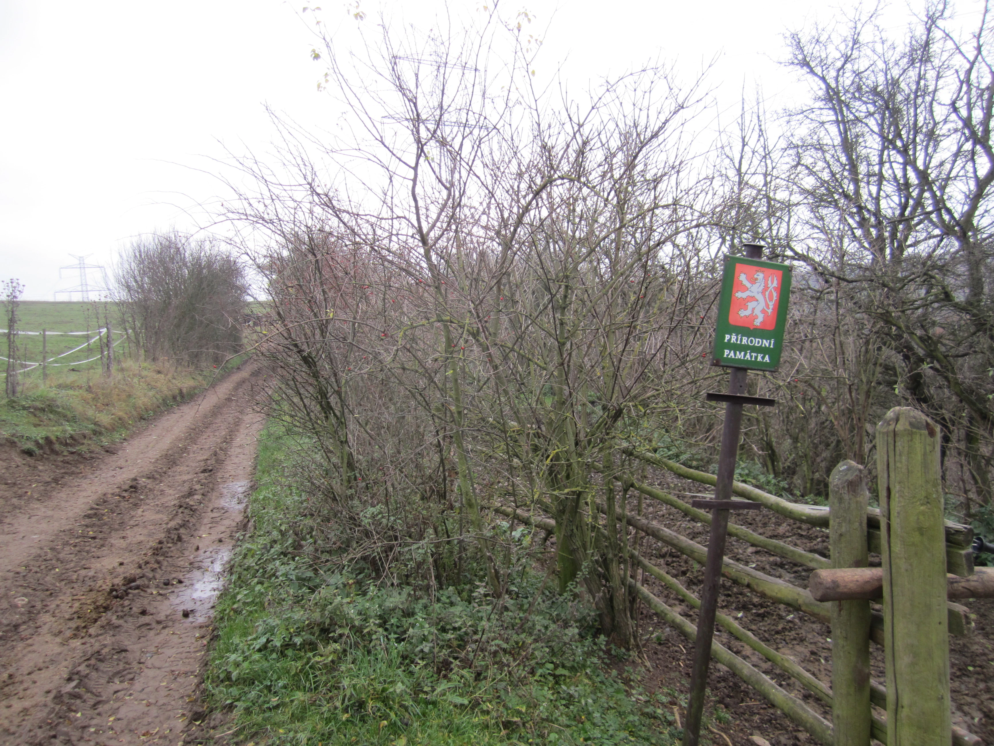
A dirt path leading into a wooded area in Zmrzlík, with a green Czech protected area sign on a metal post near a wooden fence.
The entrance to the Zmrzlík natural monument, featuring a marked Czech protected area sign.

Zmrzlík Natural Monument history and protected-area timeline

The Zmrzlík area has been used by people for a very long time, but the modern cultural landscape that is now protected only emerged after centuries of grazing and stone extraction on limestone slopes. Until the 1920s, the terrain around the present-day settlement was largely treeless, dominated by open rocky pastures that supported flocks of goats and later sheep. A small part of the site was afforested during the interwar period using tax incentives, but the chosen species, black locust, proved poorly suited and did not characterize the historical vegetation.

Stone quarrying left perhaps the most visible mark on the area. Several small quarries opened in the limestone, including the Jirasův lom, which produced ornamental slabs from cephalopod-rich limestones marketed as 'Kopanina marble' until the 1940s. The long-abandoned wall quarry in the Kopanina Formation limestones was likely cut by local inhabitants for building stone, and a partly infilled pit quarry supplied limestone for lime production. The fossils of Zmrzlík were documented scientifically as early as the mid-19th century by Joachim Barrande, who incorporated numerous specimens from the locality into his multi-volume Systéme Silurien.

After the Second World War, the cessation of grazing allowed woody vegetation to colonize slopes that had been kept open, accelerating the gradual afforestation still visible today. The site's official recognition came in 1988, when it was declared a protected natural creation (chráněný přírodní výtvor), and in 1992 it was reclassified as a přírodní památka, a natural monument. Today the area is jointly administered by the Central Bohemia regional office of the Czech Nature Conservation Agency and the Prague City Hall.

Zmrzlík Natural Monument landscape and geographic character

Despite its small footprint, Zmrzlík contains a varied terrain that combines the rather flat agricultural uplands around Zadní Kopanina with steeper slopes descending toward the Mlýnský potok. Elevations range from roughly 280 to about 344 meters, and the land drops into the Draská gorge and along the main stream valley. The result is a landscape of rolling, undulating limestone ridges, small stream valleys, sunny south-facing slopes, and shaded north-facing hillsides.

The warm dry climate classification (T2) and the karstic character of the bedrock shape how surface water moves through the area. Springs and tiny brooks feed the Mlýnský potok, which in turn drains into the broader Berounka system. Outcrops of Silurian and Devonian limestone create distinctive rocky exposures along the slopes, particularly visible in the old quarry faces that punctuate the valleys. Where the bedrock is shallower or where soil has accumulated, the landscape opens into small meadows and pastures; where the rock lies more exposed, the terrain thins into dry grasslands, scattered shrubs of cotoneaster and dog rose, and patches of woodland planted or grown up since the 20th century.
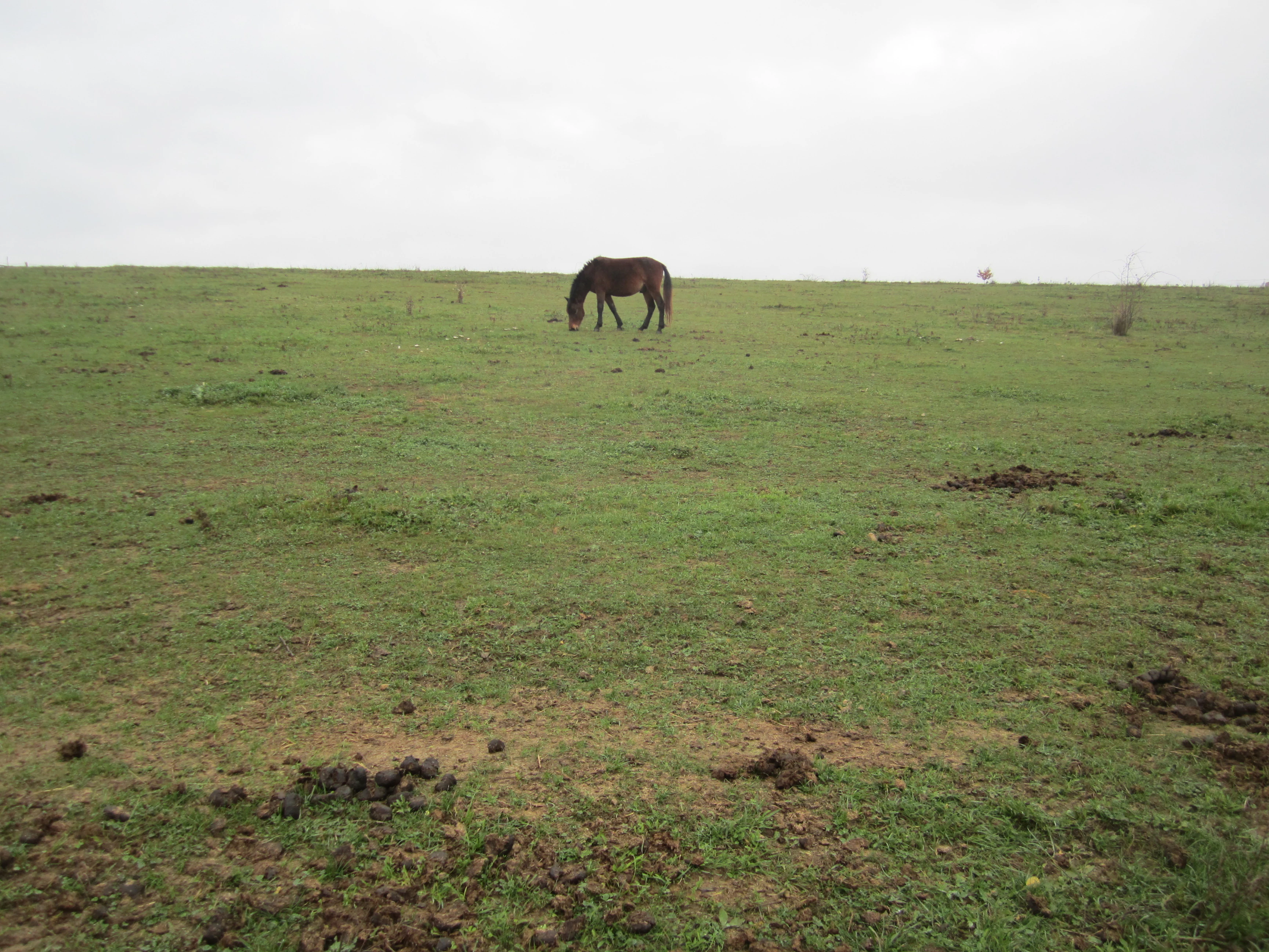
A single dark horse grazes in an open, grassy pasture under an overcast sky.
A horse grazing on a thermophilous pasture in the Zmrzlík natural monument area.

Zmrzlík Natural Monument ecosystems, habitats, and plant life

Ecologically, Zmrzlík is essentially a remnant of a pre-modern Czech agricultural landscape. The mosaic of dry, warm limestone ridges, species-rich meadow depressions, old orchards, small woodland patches, and stream banks creates habitat gradients over short distances. This supports both calcareous grassland flora on the slopes and more mesic meadow communities in the bottomlands, with transitional shrub vegetation in between.

A particularly important feature is the presence of relict xerothermic ecosystems. The calcareous dry grasslands belong to alliances such as Festucion valesicae, with characteristic species including feather grass (Stipa joannis), woodland sage (Salvia nemorosa), clustered bellflower (Campanula glomerata), crested hair grass (Koeleria macrantha), golden aster (Aster linosyris), hairy oxytropis (Oxytropis pilosa), and St Bernard's lily (Anthericum liliago). On the cooler north-facing slope, a small sesleria-rich grassland community has developed alongside more scattered species such as large speedwell (Veronica teucrium), a seseli species (Seseli hippomarathrum), hoary rockrose (Helianthemum canum), and hairy inula (Inula hirta). The original grassland mosaic was historically maintained by grazing, and succession toward shrubs and woodlands remains a constant management challenge.
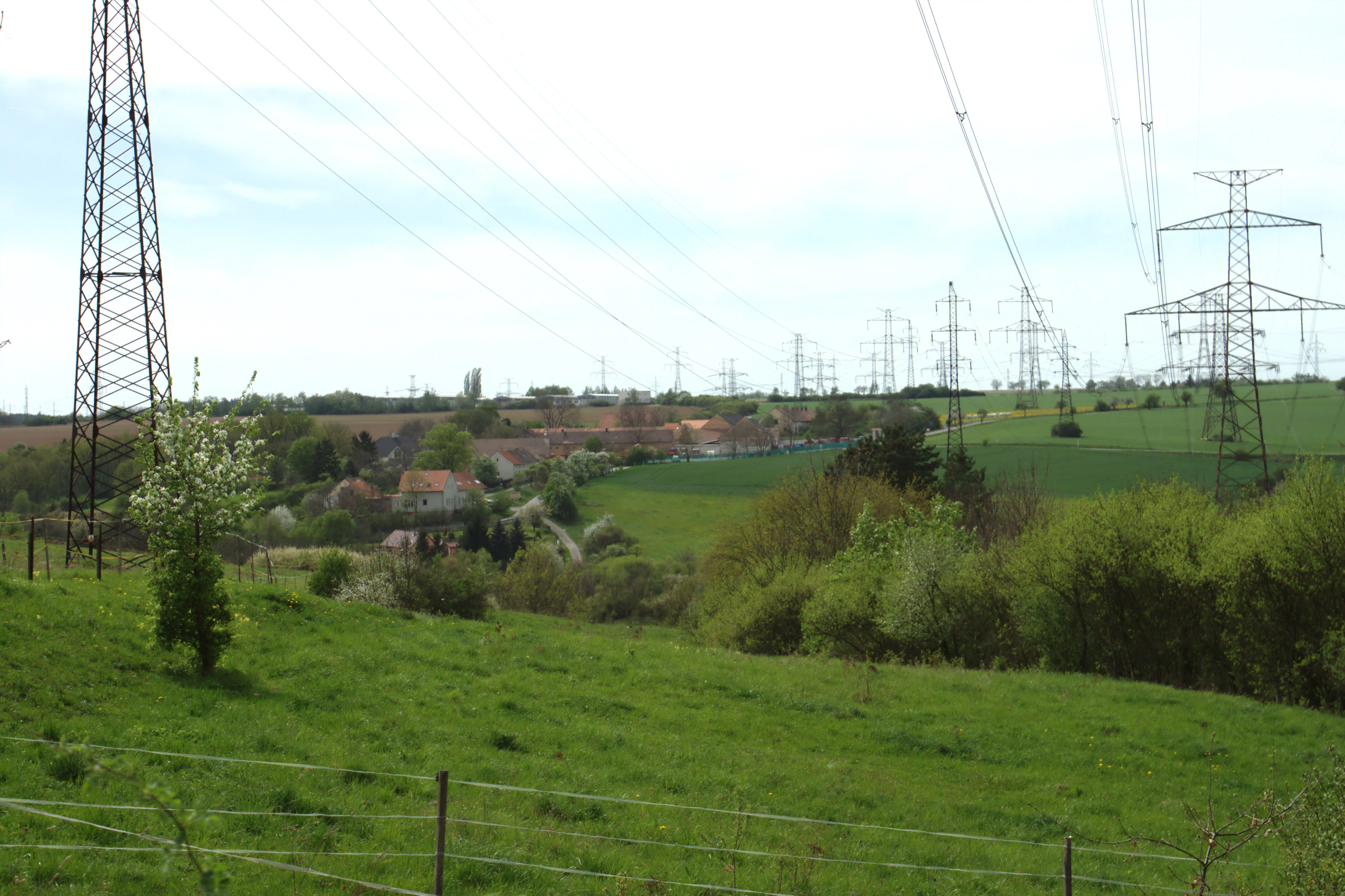
A wide view of green meadows and rolling hills with several large metal electrical transmission towers in the foreground and distance, near a rural settlement.
Meadows near the Zmrzlik natural monument, featuring the local agricultural landscape and transmission lines.

Zmrzlík Natural Monument wildlife and species highlights

Zmrzlík's fauna mirrors its mosaic of dry and mesic habitats. The most distinctive element is a community of relict phytophagous insects tied to steppe and forest-steppe environments. Leaf beetles, weevils, and seed beetles recorded here include species such as Coptocephala rubicunda, Cryptocephalus primarius, Luperus xanthopoda, several Aphtona and Longitarsus flea beetles, Cassida pannonica on knapweeds, and a constellation of weevils including Otiorhynchus fullo, Otiorhynchus ligustici, and various Sitona, Tychius, and Ceutorhynchus species. Many of these beetles are associated with specific host plants and persist only where warm, dry calcareous habitat remains intact.

Spiders typical of warm open habitats are also present, including Xysticus robustus and Ozyptila nigrita living in the litter of dry grasslands. The butterfly fauna includes burnet moths, the broad-bordered bee hawk-moth (Hemaris fuciformis), the marbled white (Melanargia galathea), the mourning cloak (Nymphalis antiopa), the brimstone (Gonepteryx rhamni), the small copper (Lycaena phlaeas), and notably both the Old World swallowtail (Papilio machaon) and the scarce swallowtail (Iphiclides podalirius). Among land snails, Granaria frumentum and Cepaea vindobonensis are characteristic of open calcareous terrain. Long-tongued bee-flies (Bombylius) that mimic bumblebees are also part of this fauna.
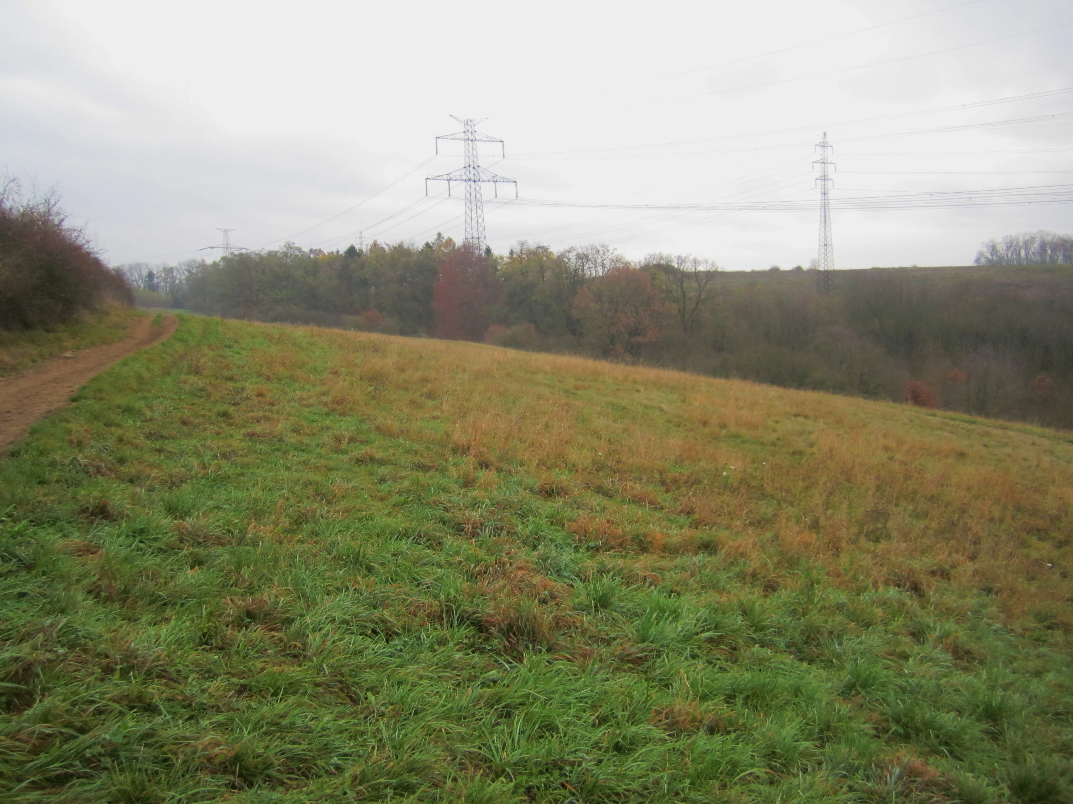
A wide view of a grassy meadow under an overcast sky, with a dirt trail on the left and tall power line towers visible in the background against a line of trees.
A meadow landscape in the Zmrzlík nature area, showing characteristic terrain and surrounding vegetation.

Zmrzlík Natural Monument conservation status and protection priorities

From a conservation perspective, Zmrzlík is significant because it combines geological reference value with biological reference value in a single compact site. The Silurian stratotype exposures and fossil assemblages give it an importance that transcends the Czech Republic, while the surviving warm-loving plant communities and steppe-type insect fauna of the surface landscape make it an important local refuge for species that have largely retreated from the modern Czech countryside.

Management efforts focus on maintaining the open character of the slopes and preventing further overgrowth. Rock outcrops and former quarry faces need to be kept clear of woody vegetation and protected from illegal dumping. Valley meadows require regular mowing, and slope pastures benefit from continued, but carefully calibrated, grazing pressure. At present, a local operation breeding Hucul horses maintains grazing on a portion of the area, though observations suggest that grazing intensity on certain plots may already be too high and contributes to accelerated erosion on this inherently fragile substrate. The single greatest long-term threat to Zmrzlík, however, is residential and other development pressure on individual plots within the protected territory.

Zmrzlík Natural Monument cultural meaning and human context

Zmrzlík sits in a landscape shaped by centuries of human presence on the southwestern edge of Prague. The villages of Zadní Kopanina and Radotín have long histories, and the rock exposures of the area have been used both as a source of building stone and ornamental facing and as a subject of scientific curiosity since the 19th century. Joachim Barrande's pioneering paleontological work, including specimens recovered from the local Kopanina Formation limestones, established Zmrzlík as part of an internationally recognized geological heritage even before any formal nature protection existed.

In the 20th century, the landscape transitioned from a heavily grazed, largely treeless pastural setting to one where abandoned pastures have progressively reverted to shrub and woodland, a transformation shaped by the interruption of grazing during and after the Second World War. Today, although the area lies within the Czech capital, it retains the atmosphere of an older rural village landscape, with Hucul horse breeding on parts of the slopes connecting contemporary land use to older agricultural traditions.
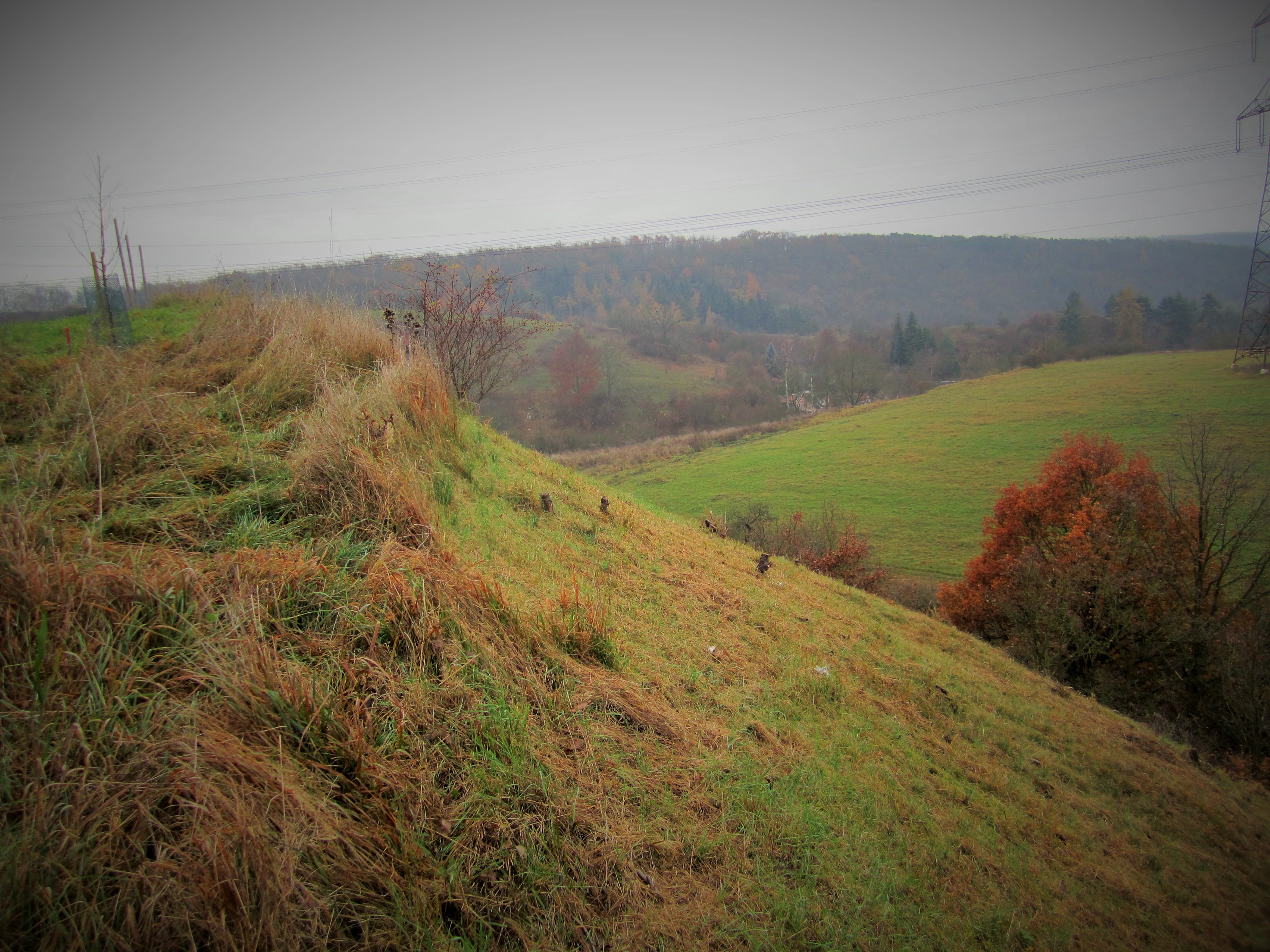
A sloped grassy hillside covered in dry and green grass leads down toward a valley filled with trees and more rolling hills under an overcast sky.
A view of the grassy slopes and hilly terrain within the Zmrzlík natural monument.

Top sights and standout views in Zmrzlík Natural Monument

The principal highlight of Zmrzlík is the Silurian geological profile of the Kopanina Formation and its accompanying fossil localities, which together form one of the most instructive small-scale windows into Silurian stratigraphy in central Bohemia. Old quarry faces expose cephalopod limestones historically marketed as Kopanina marble, graptolite-bearing shales, and even a basaltic body representing late Silurian volcanism in the Prague Basin.

A second highlight is the surviving complex of warm-loving calcareous grasslands, meadows, and scattered shrubs that has developed on the same slopes, sustained by centuries of low-intensity grazing. This combination of internationally important geology and steppe-like flora and insect fauna within an area of only about sixteen hectares, set against the backdrop of one of Europe's central cities, makes Zmrzlík unusually distinctive among small protected sites.

Best time to visit Zmrzlík Natural Monument

Late spring and early summer are widely considered the most rewarding period to visit sites like Zmrzlík, when warm-loving calcareous grasslands bloom most visibly and insects, especially butterflies and beetles tied to dry habitats, are most active. Early mornings and late afternoons in these seasons offer the best conditions for observing wildlife, with cooler temperatures keeping both plants and animals accessible along the sun-facing slopes and along the Mlýnský potok valley. Late summer visits are still attractive for those interested in dry meadows at peak flowering and for observing the contrasts between grazed and overgrown areas, while autumn can be useful for appreciating the geological exposures clearly through thinning vegetation.

Monthly climate preview

Long term representative coordinate measurements for monthly weather variation

Zmrzlík Climate Normals, Annual Temperature and Precipitation Rhythm

Measured NASA climatology data reveals the annual temperature and precipitation rhythm across Zmrzlík from representative coordinate records. Examining the complete monthly climate normals provides deeper context on long term thermal swings and precipitation rates.
Annual mean9 °C
-2 °C20 °C
Jan-2°
Feb-1°
Mar
Apr
May13°
Jun17°
Jul20°
Aug19°
Sep14°
Oct
Nov
Dec-1°
Warmest month
July

19.7 °C

Coolest month
January

-2.2 °C

Wettest month
June

2.6 mm/day

Driest month
February

1.1 mm/day

Park location guide

Geography guide, regional context, and park location map for Zmrzlík Natural Monument

Zmrzlík Natural Monument park geography, regions, and map view in Czechia

Understand where Zmrzlík Natural Monument sits in Czechia through a broader geographic reading of the surrounding landscape, nearby location context, and its mapped position within the national park landscape.

How Zmrzlík Natural Monument fits into Czechia

Czech Republic is a landlocked Central European country with a population of approximately 10.9 million people. The nation was established as an independent state on January 1, 1993, following the dissolution of Czechoslovakia. Its capital and largest city is Prague, with other major urban centers including Brno, Ostrava, Plzeň, and Liberec.

Wider geography shaping Zmrzlík Natural Monument in Czechia

The Czech Republic is a landlocked country in Central Europe. It is bordered by Germany to the west, Austria to the south, Poland to the northeast, and Slovakia to the southeast. The landscape is predominantly hilly, with the territory covering 78,871 square kilometers.

Map view of Zmrzlík Natural Monument

Use this park location map to pinpoint Zmrzlík Natural Monument in Czechia, understand its exact geographic position, and read its mapped placement within the surrounding landscape more clearly.

Pigeon | © OpenStreetMap contributors

Location context for Zmrzlík Natural Monument

Prague

Explore photographic records of limestone ridges, dry grasslands, and fossil-rich quarry exposures.

Zmrzlík Photos and Protected Landscape Scenery: Visualizing the Geological Terrain

Visual documentation reveals the distinct terrain, limestone outcrops, and warm-loving grassland habitats defining Zmrzlík. Examining these protected area photographs provides clear insight into the regional ecology and Silurian geological profile of the reserve.

A dirt path leading into a wooded area in Zmrzlík, with a green Czech protected area sign on a metal post near a wooden fence.

A wide landscape view of an agricultural field with brown, plowed earth in the foreground and a distant valley with trees, structures, and power lines under a hazy, overcast sky.

A single dark horse grazes in an open, grassy pasture under an overcast sky.

A wide view of green meadows and rolling hills with several large metal electrical transmission towers in the foreground and distance, near a rural settlement.

A wide view of a grassy meadow under an overcast sky, with a dirt trail on the left and tall power line towers visible in the background against a line of trees.

A wide view of a sloping, grassy landscape with scattered trees, shrubs, and a simple wire fence in the foreground under a cloudy sky.

A sloped grassy hillside covered in dry and green grass leads down toward a valley filled with trees and more rolling hills under an overcast sky.

Park atlas

Compare adjacent limestone landscapes, valley habitats, and regional reserves

Other Parks Near Zmrzlík and Protected Areas in the Surrounding Region

Continue exploring regional park geography by comparing adjacent protected areas and natural monuments sharing similar limestone terrain. Expanding the search helps trace connected conservation landscapes and regional reserves surrounding Zmrzlík.
A horizontal watercolor illustration of gentle, rolling green hills under a pale sky, with clusters of stylized trees in the foreground and faded distant mountains in the background.
Natural monumentPrague
About 3.2 km away#1 closest

Southeast

Radotínské skály Natural Monument: Geological Mapping and Protected Landscapes in Prague

Geological profiles and steppe biodiversity near the capital.

Radotínské skály stands as a key protected area in Prague, showcasing an internationally significant stratigraphic record of the Prague Basin. From exposed rock walls to warm-loving forest-steppe communities, the site offers a detailed look at how geological heritage persists alongside urban development, making it an essential destination for those exploring the regional geography of the Czech Republic.

Area
0.277 km²
Established
1988
IUCN
III
Relief
Upland
Nature reservePraha 5
About 3.4 km away#2 closest

Northeast

Prokopské údolí Nature Reserve: Geological Mapping and Protected Area Discovery

A limestone karst landscape situated within the Praha 5 district

Prokopské údolí is an essential protected nature reserve in Praha 5, featuring a deep limestone valley that serves as a globally significant site for Paleozoic fossils and karst geography. This protected landscape encompasses a range of habitats including rock steppes, thermophilic woodlands, and volcanic outcrops, providing a unique look at urban-adjacent nature conservation and historical limestone quarrying within the Czech Republic.

Area
1.71 km²
Established
1978
IUCN
III
Relief
Upland
Natural monumentPrague
About 6.1 km away#3 closest

North

Vidoule Natural Monument: Geological Profile and Protected Landscape Context in Prague

A table mountain remnant with exposed Cretaceous sandstone formations.

Vidoule stands as a significant natural monument in western Prague, defined by its flat-topped table mountain geometry and horizontal Cretaceous strata. The site offers a unique perspective on the regional geology of the Prague Plateau, where protected slopes guard rare dry grassland habitats and fossil-rich layers against a backdrop of dense urban development.

Area
0.087 km²
Established
1988
IUCN
III
Relief
Upland
Nature reservePrague
About 9 km away#4 closest

East

V hrobech Nature Reserve: A Protected Botanical Island within the Urban Landscape of Prague

Rare dry-grassland habitats in the Kamýk district

V hrobech is a designated nature reserve in Prague featuring 1.3 hectares of southeast-facing slopes and species-rich grassland. This site is home to rare thermophilic plants and represents an important example of intensive conservation management in an urban environment. Its protected boundaries connect with local forest fragments to maintain ecological value amidst the residential developments of Lhotka and Libuš.

Area
0.013 km²
Established
1988
IUCN
IV
Relief
Lowland
Natural monumentPrague
About 11 km away#5 closest

North

Vizerka Natural Monument: Mapped Protected Landscapes and Rocky Terrain in Prague

A rare xerothermic steppe refuge on the edge of the Šárka Valley

Vizerka represents a compact yet significant natural monument located on the rocky slopes of the Šárecké údolí in Prague. Featuring exposed Proterozoic shale and shallow soils, this protected site serves as a vital island of thermophilic grasslands and shrubby terrain. It offers a fascinating look at relict warm-loving habitats and rare species survival within the dense geographical context of a European capital city.

Area
0.031 km²
Established
1988
IUCN
IV
Relief
Upland
A horizontal watercolor illustration showing a soft, dreamy landscape with rolling green hills, light purple and yellow tones, a winding path or stream, and a lone bare tree in the foreground.
Protected landscapePraha
About 12 km away#6 closest

North

Přírodní park Šárka-Lysolaje: Protected Landscape Mapping and Geographic Identity in Praha

A dense mosaic of stream valleys and protected natural monuments near the heart of Praha

Examine the detailed geography of Přírodní park Šárka-Lysolaje, an extensive protected landscape in Praha that functions as a critical green corridor. Its terrain, defined by deeply incised stream valleys and steep forested slopes, hosts a unique concentration of smaller nature reserves and monuments, creating a coherent ecological framework directly adjacent to the urban metropolitan environment.

Area
10.05 km²
Established
1990
Climate
Temperate
Scope
Terrestrial
A soft watercolor painting of a green landscape featuring a small body of water, rolling hills, and trees, painted in a minimalist style on a white background.
Protected landscapePrague
About 14 km away#7 closest

East

Hostivař-Záběhlice Nature Park: Protected Landscape and Mapped Prague Geography

River valleys and reservoir terrain within the capital city.

Hostivař-Záběhlice Nature Park represents a vital natural zone in Prague, characterized by the mature forests and meandering river paths along the Botič stream. This record highlights the park's geographic composition, including its reservoirs, lowland forest patches, and its function as a preserved natural corridor within the city.

Area
4.23 km²
Established
1990
Relief
Lowland
Climate
Temperate
Natural monumentPrague
About 15 km away#8 closest

Northeast

Velká skála Natural Monument: Geological Protected Area within the Prague Plateau

A landmark siliceous rock outcrop in the Troja district

Velká skála offers a concentrated look at the geological heritage of central Bohemia. As a designated natural monument, the site protects a rare siliceous rock outcrop that contrasts with the rolling terrain of the surrounding Prague Plateau, serving as a vital reference for regional geomorphology.

Area
0.018 km²
Established
1968
IUCN
III
Relief
Upland

Common questions about visiting, size, designation, and location context for Zmrzlík Natural Monument

Zmrzlík Natural Monument FAQs for park facts, access, geography, and protected area context

Find quick answers about Zmrzlík Natural Monument, including protected-area facts, park geography, trail and visitor context, and how the park fits into its surrounding country and regional landscape.
MoriAtlas Explorer

Continue Your Protected Areas Search Across the Global Atlas

Deepen your exploration by continuing the structured search for national parks and protected areas worldwide. Utilize the comprehensive filtering capabilities to compare different conservation landscapes and refine your understanding of global park geography. Discover more about the distribution and characteristics of protected natural areas.

Global natural geography