
Mori Atlas logo
Nature reserveAdolfsburg – Bornberg – Sülzenberg

Examining the Muschelkalk limestone landscapes, calcareous slopes, and protected habitats above the River Werra.

Adolfsburg – Bornberg – Sülzenberg Nature Reserve: A Detailed Geographic Atlas of Thuringia

(Fauna-Flora-Habitat-Gebiet Adolfsburg – Bornberg – Sülzenberg)

Adolfsburg – Bornberg – Sülzenberg represents a concentrated mosaic of high-value natural habitats situated on the south-facing limestone slopes of the Werrabergland in Thuringia, Germany. This protected area features a complex terrain of Muschelkalk rock faces, scree slopes, and plateaus that support rare calcareous grasslands and orchid-rich meadows. By tracing these boundaries and studying the surrounding cultural landscape, researchers and enthusiasts can better understand the unique geological and botanical convergence found within this segment of the Werratal.

FFH-GebietNatura 2000Muschelkalkcalcareous grasslandsemi-dry grasslandorchid habitat
A flat-style digital illustration depicting a mountain valley with a cascading waterfall, coniferous trees, and a sun setting behind distant mountain ranges.

Adolfsburg – Bornberg – Sülzenberg

Nature reserve

Park overview

Structured park overview, official facts, and landscape profile for Adolfsburg, Bornberg, Sülzenberg

Adolfsburg, Bornberg, Sülzenberg park facts, protected area profile, and essential visitor context

Review the core facts for Adolfsburg, Bornberg, Sülzenberg, including designation, size, terrain, visitor scale, habitats, and operating context in one park-focused overview.

About Adolfsburg, Bornberg, Sülzenberg

Adolfsburg – Bornberg – Sülzenberg is a protected landscape in the northwest of the Thuringian Wartburgkreis, named after three hills that dominate the south-facing slopes of the lower Werra valley just north of Treffurt. Although modest in size, the area is a textbook example of how Muschelkalk geology, traditional land use, and a mild local climate combine to produce a highly diverse protected habitat complex.

The site functions as a Natura 2000 / Fauna-Flora-Habitat area (FFH area 4827-304) and is fully encompassed by the Eichsfeld-Hainich-Werratal Nature Park. Its ecological importance was recognized in stages: proposed by the Thuringian Ministry for the Environment in 2000, confirmed as a Site of Community Importance in 2004, and integrated into the EU's coherent network of special areas of conservation in 2008 under the Thuringian Natura 2000 Conservation Objectives Ordinance.

What makes the landscape distinctive is the patchwork character of its land cover. Steep, rocky Muschelkalk slopes with pioneer vegetation and scree forest transition into juniper scrub, semi-dry grasslands, hay meadows with old fruit trees, and smaller woodland patches on the higher plateaus. Around the Adolfsburg especially, this combination supports rare species groups such as calcareous pioneer mosses, lime-loving lichens, and wild orchid populations that are otherwise scarce in Thuringia. The site therefore functions simultaneously as a habitat reserve for protected European species and as a cultural landscape shaped by centuries of viticulture, orchards, sheep grazing, and small-scale quarrying.

Quick facts and research context for Adolfsburg, Bornberg, Sülzenberg

Adolfsburg – Bornberg – Sülzenberg is a Thuringian Natura 2000 / FFH site in the Wartburgkreis, located north of Treffurt on the Werra valley's south-facing Muschelkalk slopes. It was proposed as an FFH site in 2000, confirmed by the EU in 2004, and formally listed in 2008 under the Thuringian Natura 2000 Conservation Objectives Ordinance. The area covers 148 hectares, ranges from roughly 220 to 379 meters in elevation, and lies inside the Eichsfeld-Hainich-Werratal Nature Park. It also touches Germany's former inner-German border "Green Belt." The site protects ten EU habitat types and several Annex II species, including lady's slipper orchid, Bechstein's bat, lesser horseshoe bat, and scarce moss and butterfly species.

Protection and recognition

Documented conservation status and official international recognition records

Adolfsburg – Bornberg – Sülzenberg Protection Status and Natura 2000 Recognition

Adolfsburg – Bornberg – Sülzenberg maintains verified status through official Natura 2000 framework records and administrative boundary listings. Such documentation details international recognition sources without projecting management effectiveness or legal outcomes.
Park context

Deeper park guide and search-rich context for Adolfsburg, Bornberg, Sülzenberg

Adolfsburg, Bornberg, Sülzenberg history, landscape, wildlife, and travel context

Explore Adolfsburg, Bornberg, Sülzenberg through its history, landscape character, ecosystems, wildlife, conservation priorities, cultural context, and seasonal travel timing in a structured park guide built for atlas discovery and search intent.

Why Adolfsburg, Bornberg, Sülzenberg stands out

Adolfsburg, Bornberg, Sülzenberg is best known for its exceptionally species-rich semi-dry calcareous grasslands on steep Muschelkalk slopes, particularly around the Adolfsburg hill. Large areas of these grasslands harbor notable orchid populations, including fly orchid, military orchid, and purple orchid, alongside rare calcareous pioneer mosses and lichens that have their only Thuringian occurrences in this site.
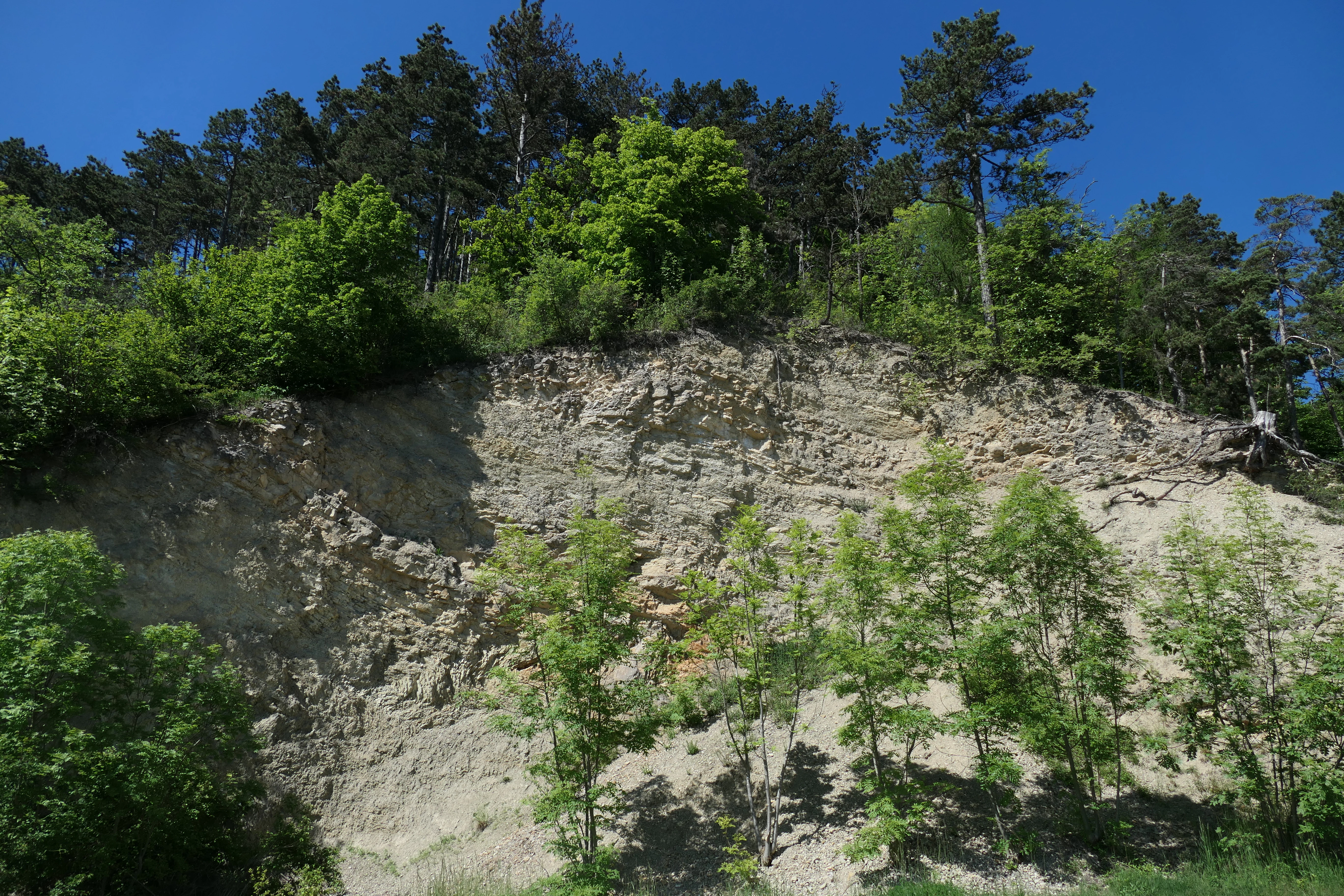
A steep limestone cliff face with sparse small trees at the base and a dense forest canopy above against a clear blue sky.
Limestone rock formation topped by forest at the Adolfsburg, Bornberg, and Sülzenberg nature reserve.

Adolfsburg, Bornberg, Sülzenberg history and protected-area timeline

The area around Adolfsburg – Bornberg – Sülzenberg has a long history of human use that continues to shape its ecological character. During the medieval and early modern era of viticulture in the middle Werra valley, the southern slope of the Adolfsburg was itself used as vineyard land. As less productive sites were progressively abandoned, these areas were converted to pasture and cropland, while the favorable geology and microclimate also encouraged extensive fruit growing around the Adolfsburg and Mühlberg. By the late eighteenth century, a municipal ordinance of 1788 required new residents and young husbands to plant grafted fruit trees, a tradition that, in a contemporary form, is still echoed in the town's practice of gifting a cherry sapling to each marrying couple since 2014.

The area sees historical grazing pressure stretching back to the DDR period, when about 1,200 sheep in four herds were driven across the area three to four times a year; after 1989 the livestock count was reduced to two herds and herding was eventually taken over by a landscape conservation association rather than an agricultural cooperative. Small quarries for gypsum, limestone, and sandstone were once active on the Adolfsburg, Bornberg, and Sülzenberg slopes, and their abandoned workings have since been recolonized as part of the protected habitat mosaic.

The site became a formal part of the European conservation network in stages. It was proposed as an FFH area by the Thuringian Environment Ministry in September 2000, formally entered the EU list of Sites of Community Importance in December 2004, and was adopted as a Special Area of Conservation in July 2008 under the Thuringian Natura 2000 Conservation Objectives Ordinance of 29 May 2008. At a larger landscape scale, Adolfsburg – Bornberg – Sülzenberg lies entirely within the Eichsfeld-Hainich-Werratal Nature Park (provisionally secured in 1990 as part of the GDR's national park program and formally designated in 2011). A narrow western strip also belongs to Germany's "Green Belt" along the former inner-German border, designated a National Natural Monument in 2018.

Adolfsburg, Bornberg, Sülzenberg landscape and geographic character

The protected area forms a varied, mostly south-facing landscape on Muschelkalk limestone above the Werra. The terrain rises from about 220 meters near the river to around 379 meters on the higher hills, with steep rock faces, debris slopes, and plateau edges creating strong transitions in microclimate and vegetation within short distances.

Three named landmarks define the area: the rocky Adolfsburg summit, the Bornberg, and the Sülzenberg, which together shape a series of stepped hillsides and upper plateaus between the Werra valley and the uplands. Natural-region classifications place the site where the Wanfried Werra Heights and the Falken Plateau meet the Treffurt-Wanfried Werra Valley, both belonging to the broader northwestern rim of the Thuringian Basin. In Thuringia's internal classification, the area sits within the Werrabergland / Hörselberge natural region, a Muschelkalk plateau and hill-landscape.

Abandoned Muschelkalk quarries expose lower Muschelkalk strata that are now integrated into the protected mosaic, while views from the Adolfsburg summit open across the Werra valley toward the town of Treffurt and the village of Falken. Hedges, field tracks, and dry-stone walls further break up the higher plateau into small parcels, lending the cultural landscape a strongly compartmentalized texture that mirrors the underlying geological diversity.
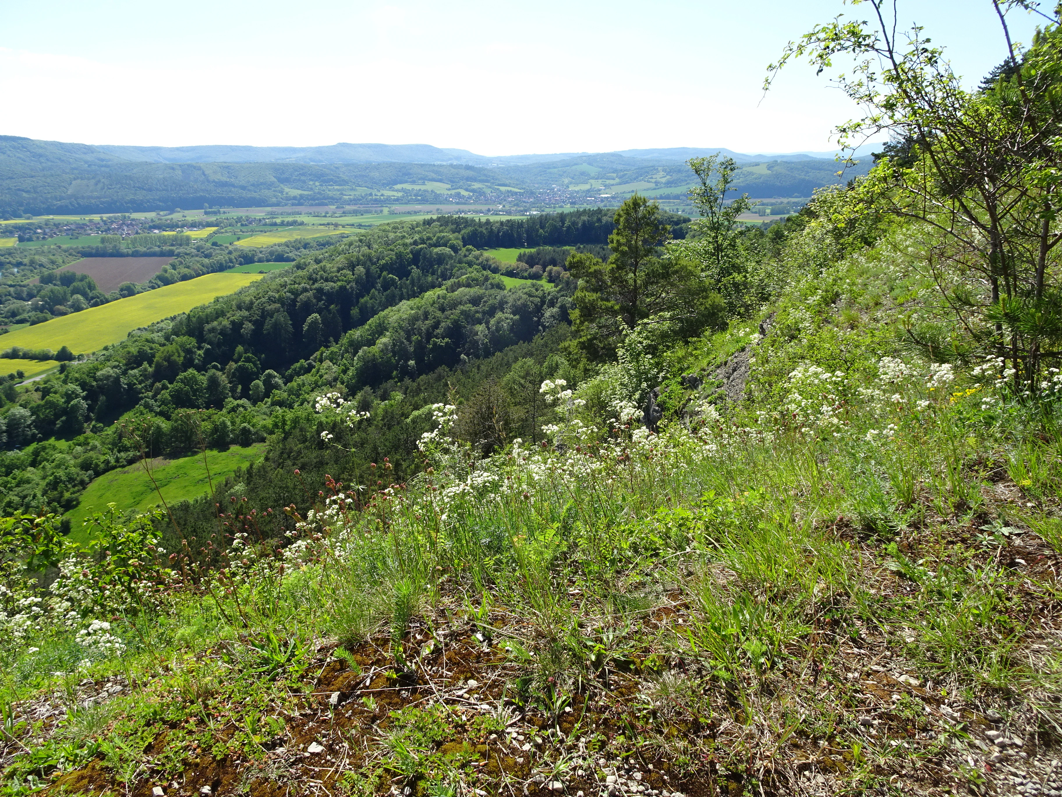
Wide angle view from a grassy hillside overlooking a green valley with patches of forest, agricultural fields, and rolling hills in the distance.
A scenic view over the hilly, forested landscape and agricultural fields of the Adolfsburg, Bornberg, and Sülzenberg nature reserve.

Adolfsburg, Bornberg, Sülzenberg ecosystems, habitats, and plant life

The site's ecological character is built around ten Annex I habitat types that together form one of the most compact and diverse calcareous habitat mosaics in Thuringia. Forests cover less than half of the area, with mixed and coniferous stands dominating today, although long-term management aims to gradually shift these toward beech-wood habitats. The remaining landscape is a mosaic of open habitat types ranging from nutrient-poor meadows and juniper heathland on the Sülzenberg, through extensive semi-dry calcareous grasslands on the southerly slopes, to pioneer vegetation on rocky outcrops and scree.

Habitats of particular European importance include the lime-pioneer swards of the Adolfsburg upper slopes and rock edges and the orchid-rich variant of the semi-dry calcareous grasslands, both designated as priority habitat types within the EU directive. Other communities include nutrient-rich meadows on the plateau above the Adolfsburg, where old cherry and plum orchards continue to occupy former plantation ground, as well as caves and rock-crevice vegetation on the limestone.

The plateau's nutrient-rich meadows are notable for their old orchard character, with veteran cherry trees above the Adolfsburg forming part of a living cultural landscape; juniper heath, meanwhile, is restricted to the southeast-facing slopes of the Sülzenberg, where the juniper bushes themselves are mostly in aging and declining phase without clear regeneration. The dry variants of these meadows reflect a long history of grazing and mowing that, in places, is now weakening under shrub encroachment.
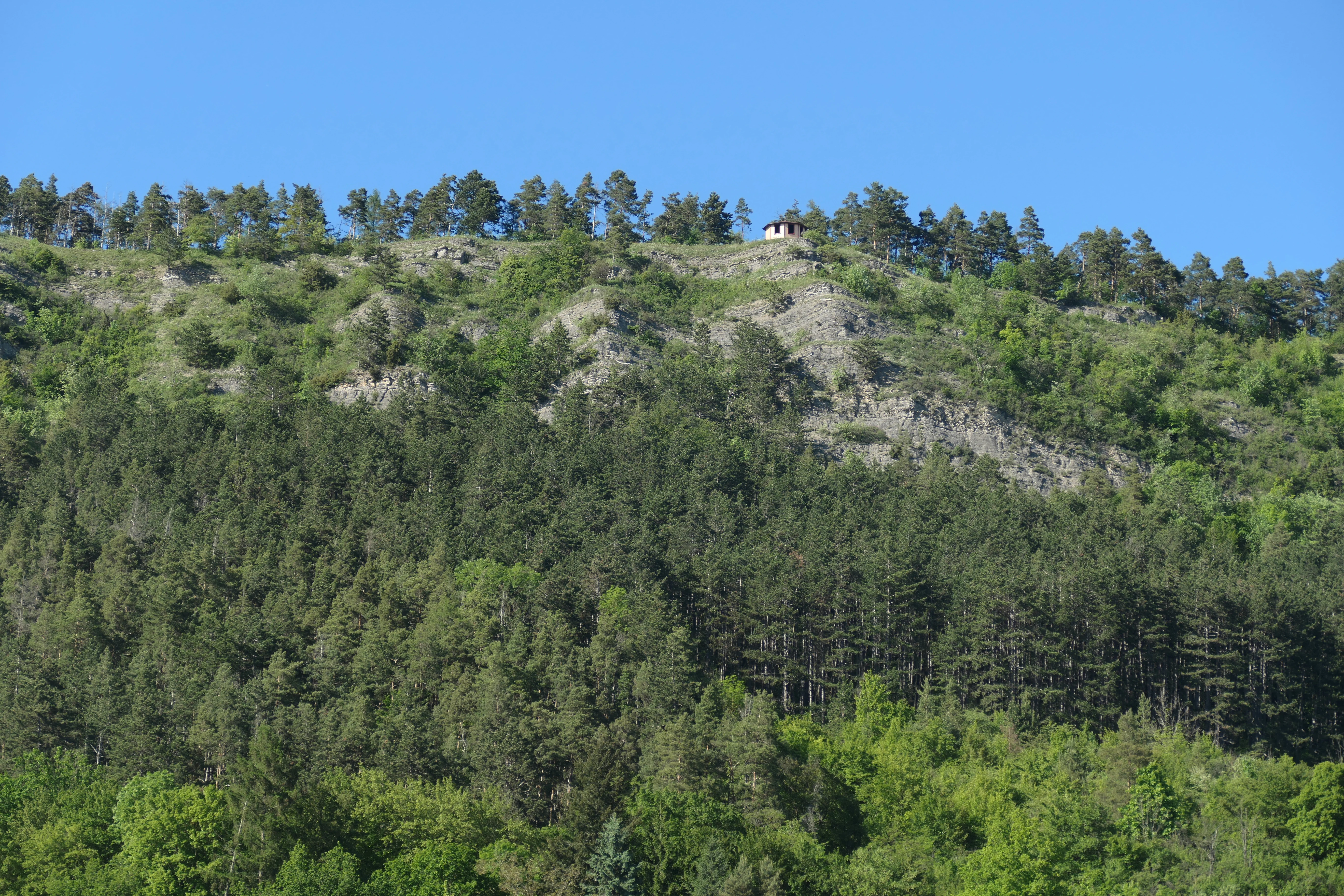
A view looking up at a steep, rocky, tree-covered hillside with a small building visible along the ridge line against a clear blue sky.
A forested hillside within the Adolfsburg, Bornberg, and Sülzenberg nature reserve.

Adolfsburg, Bornberg, Sülzenberg wildlife and species highlights

Adolfsburg – Bornberg – Sülzenberg's wildlife profile is dominated by species tied to calcareous open landscapes, wood edges, and forest structures. Among Annex II species, the Marsh Fritillary (Euphydryas aurinia) is documented in the area, although surveys indicate that its populations have sharply declined and several former localities have disappeared. Two bat species, Bechstein's bat (Myotis bechsteinii) and the lesser horseshoe bat (Rhinolophus hipposideros), are noted for the site; neither has been confirmed within the FFH boundaries themselves, with the high share of open habitat thought to limit their roosting opportunities.

The flora is exceptionally rich for protected fauna too. Lady's slipper orchid (Cypripedium calceolus) occurs on lightly shaded to half-shaded sites and benefits from Thuringia's broader role as a national stronghold. The Green Goblin Moss (Buxbaumia viridis), once believed lost in Thuringia until its rediscovery in 2007 on a decaying pine trunk by a path here, is a particularly notable find. Strictly protected Annex IV species additionally recorded in the area include the smooth snake, sand lizard, Brandt's bat, whiskered bat, and the large blue butterfly (Phengaris arion), indicating a diverse reptile, bat, and invertebrate assemblage.
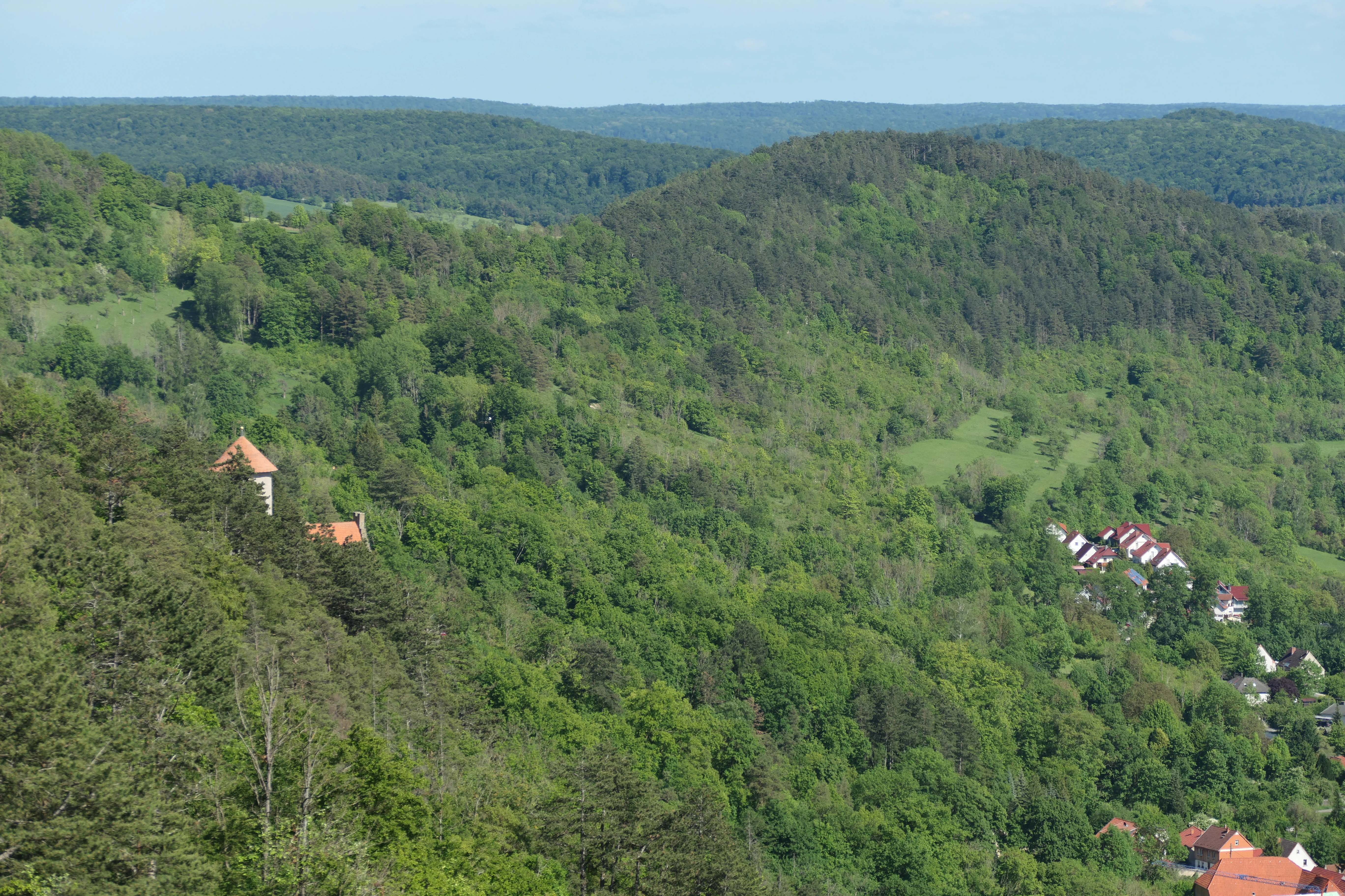
A green, hilly, forested landscape in Germany with scattered houses and a prominent building with a red-tiled roof visible on the left slope.
A wide view of the hilly, forested landscape of the Adolfsburg, Bornberg, and Sülzenberg nature reserve in Thuringia.

Adolfsburg, Bornberg, Sülzenberg conservation status and protection priorities

The site's conservation significance rests on its combination of European-level habitat and species obligations and on the unusually high density of calcareous habitat types per hectare. Designated for ten Annex I habitats, including priority types such as calcareous scree, lime-pioneer vegetation, and orchid-rich variants of semi-dry grassland, the area has been subject to a formal management planning process since 2015, with separate contributions prepared for open land and forest by Thuringian research and specialist consultancies.

Management aims are long-term and structural: shifting the area's currently conifer-dominated forest stands toward beech woodland communities, preserving open habitat mosaics against scrub encroachment, and safeguarding specialized mosses and lichens that have only scattered Thuringian localities. Protection intersects with landscape and cultural-conservation goals because the area lies within the Eichsfeld-Hainich-Werratal Nature Park and, along its western edge, the National Natural Monument of the former German "Green Belt" along the inner-German border, giving the site multiple overlapping frameworks of protection and management.

Adolfsburg, Bornberg, Sülzenberg cultural meaning and human context

The cultural identity of the Adolfsburg – Bornberg – Sülzenberg area is closely tied to fruit cultivation, viticulture, and traditional grazing. The southern slopes of the Adolfsburg were once vineyard land during the era of Werra valley wine growing, before being progressively converted to pasture and cropland as viticulture declined.

In the 18th century, a 1788 ordinance made fruit-tree planting a civic duty, and the resulting network of orchards on the Adolfsburg and Mühlberg gave the region an economic backbone based on cherries and plums; at one point, about 25,000 fruit trees stood in the area's fields. Today, local tradition continues through the practice begun in 2014 of gifting a cherry sapling to each couple marrying in Treffurt, an initiative explicitly aimed at preserving the orchard landscape. Heritage features such as hedges, dry-stone walls, and small disused quarries remain visible elements of how generations of human land use shaped the present protected mosaic.

Top sights and standout views in Adolfsburg, Bornberg, Sülzenberg

A compact but exceptionally diverse Natura 2000 site on Muschelkalk above the Werra valley, dominated by south-facing hills whose slopes and plateaus protect ten European habitat types in immediate proximity. Its semi-dry calcareous grasslands harbor large populations of protected wild orchids, while its rocky pioneer habitats shelter rare mosses and lichens that have their only Thuringian occurrences here.

The integration of FFH, nature park, and former "Green Belt" protection frameworks, combined with a still-living cultural landscape of old cherry orchards and field tracks, gives the area a layered heritage value alongside its natural-heritage importance.

Best time to visit Adolfsburg, Bornberg, Sülzenberg

Spring and early summer are especially rewarding, when the calcareous grasslands come into bloom, wild orchids are at their most visible on the warm south-facing slopes, and the plateau orchards are flowering. Late spring and summer also offer the clearest views across the Werra valley toward Treffurt and Falken from the Adolfsburg summit.

In winter, the open Muschelkalk slopes and rock faces retain a stark, structured character that highlights the area's geology, while orchards above the Adolfsburg show their old fruit trees in bare outline. Because the habitats are vulnerable to disturbance, visitors should stick to the marked circular walks and the long-distance Werratal and Naturpark trails described for the area.


Monthly climate preview

Track representative monthly temperature swings and precipitation patterns across the year

Adolfsburg – Bornberg – Sülzenberg Climate and Long Term Weather Normals

Representative coordinate records show measured long term temperature fluctuations and precipitation rates across the annual cycle. Reviewing the complete monthly climate breakdown provides deeper context for the environmental conditions recorded at this elevation.
Annual mean8 °C
-1 °C18 °C
Jan-1°
Feb
Mar
Apr
May12°
Jun16°
Jul18°
Aug18°
Sep14°
Oct
Nov
Dec
Warmest month
July

18.3 °C

Coolest month
January

-1.1 °C

Wettest month
July

2.6 mm/day

Driest month
April

1.4 mm/day

Park location guide

Geography guide, regional context, and park location map for Adolfsburg, Bornberg, Sülzenberg

Adolfsburg, Bornberg, Sülzenberg park geography, regions, and map view in Germany

Understand where Adolfsburg, Bornberg, Sülzenberg sits in Germany through a broader geographic reading of the surrounding landscape, nearby location context, and its mapped position within the national park landscape.

How Adolfsburg, Bornberg, Sülzenberg fits into Germany

Germany is a federal republic in Western and Central Europe with a population of over 83 million across sixteen constituent states. It is Europe's largest economy by nominal GDP and a major global exporter and importer. The capital is Berlin, and the country borders Denmark, Poland, Czech Republic, Austria, Switzerland, France, Luxembourg, Belgium, and the Netherlands.

Wider geography shaping Adolfsburg, Bornberg, Sülzenberg in Germany

Germany is located in Western and Central Europe, spanning 357,022 km². It borders Denmark to the north, Poland and the Czech Republic to the east, Austria and Switzerland to the south, and France, Luxembourg, Belgium, and the Netherlands to the west. The country has coastlines on the Baltic Sea and North Sea to the north, with the Alps located in the southern region.

Map view of Adolfsburg, Bornberg, Sülzenberg

Use this park location map to pinpoint Adolfsburg, Bornberg, Sülzenberg in Germany, understand its exact geographic position, and read its mapped placement within the surrounding landscape more clearly.

Pigeon | © OpenStreetMap contributors

Location context for Adolfsburg, Bornberg, Sülzenberg

Thuringia
Recorded earthquake history

Explore the Historical Record of Earthquakes Near Adolfsburg – Bornberg – Sülzenberg

Access a detailed catalogue of recorded seismic activity associated with this Thuringian nature reserve. MoriAtlas compiles event dates and magnitude data to assist in the geographic analysis of the landscape surrounding the Adolfsburg, Bornberg, and Sülzenberg hills.

Adolfsburg – Bornberg – Sülzenberg Earthquake History

Catalogued events

4 events

Strongest magnitude

Magnitude 3.6

Most recent event

Oct 25, 2006

This history includes earthquakes recorded inside the park or within 50 km of its borders

Visualizing the calcareous grasslands, limestone slopes, and protected habitats of central Germany.

Adolfsburg – Bornberg – Sülzenberg Photos and Landscape Scenery

Visual records illustrate the rugged terrain and specialized limestone habitats found across the protected slopes of Adolfsburg – Bornberg – Sülzenberg. Photographic documentation reveals the geological character and varied botanical communities shaping the protected landscape above the Werra valley.

A steep limestone cliff face with sparse small trees at the base and a dense forest canopy above against a clear blue sky.

A high-angle view looking down over a small town with red-roofed buildings nestled in a valley, surrounded by green hills, forests, and fields under a blue sky.

Wide angle view from a grassy hillside overlooking a green valley with patches of forest, agricultural fields, and rolling hills in the distance.

A view looking up at a steep, rocky, tree-covered hillside with a small building visible along the ridge line against a clear blue sky.

A green, hilly, forested landscape in Germany with scattered houses and a prominent building with a red-tiled roof visible on the left slope.

An informational nature sign stands on a wooden post in a grassy meadow, next to a carved wooden sculpture of a fruit on a log bench, with orchard trees in the background.

Park atlas

Compare adjacent limestone reserves and regional conservation zones across the Werra valley

Parks Near Adolfsburg – Bornberg – Sülzenberg and Surrounding Protected Landscapes

Browsing nearby protected areas helps expand the geographic context gained from Adolfsburg – Bornberg – Sülzenberg. Comparing adjacent limestone habitats reveals wider regional patterns in Thuringian conservation landscapes.
Nature reserveThuringia
0.3 km away#1 closest

East

Werrahänge von Frankenroda bis Falken: A Deep Dive into Thuringian Protected Landscapes

Mapping limestone river canyons and unique forest habitats in Wartburgkreis.

This protected area captures a distinct geomorphological intersection of river-cut canyons and plateau ridges in Thuringia. The site preserves an intense mosaic of juniper heath, dry grasslands, and ancient beech forests, functioning as a vital link for species conservation. Examine the mapped boundaries, karst features, and the sculptural topography formed by the Werra river as it winds through the Muschelkalk rim of the Thuringian Basin.

Area
5.69 km²
Established
1999
IUCN
IV
Relief
Upland
Nature reserveThuringia
0.4 km away#2 closest

Southeast

Werra bis Treffurt mit Zuflüssen: Protected River and Floodplain Network in Thuringia

Mapping an extensive 191 kilometer Natura 2000 river corridor.

The Werra bis Treffurt mit Zuflüssen protected area serves as a vital ecological corridor in Thuringia. This site encompasses a complex mosaic of fast-flowing highland brooks, expansive floodplain meadows, inland salt sites, and rare dissolution lakes. Its geography bridges high-altitude source regions with lower river valleys, creating a distinctive landscape transect that supports essential freshwater habitats and rare aquatic species across the state.

Area
22.6 km²
Established
2008
IUCN
IV
Relief
Mixed relief
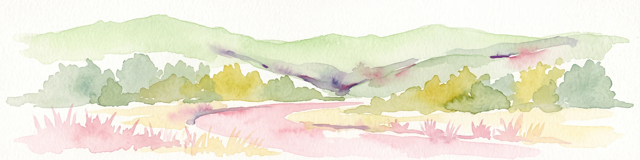
Watercolor illustration showing a wide landscape with green rolling hills in the background, a line of trees in the midground, and a pinkish meadow with grasses in the foreground
Nature reserveHesse
0.4 km away#3 closest

Southwest

Frankenloch bei Heldra Nature Reserve: Mapped Protected Landscapes in Hesse, Germany

A rare, near-natural Werra river oxbow and wetland floodplain sanctuary.

Discover the geographic layout of Frankenloch bei Heldra, a protected nature reserve located along the River Werra. This site offers insight into floodplain dynamics, reed-bed ecology, and the restoration of natural river channels within the Werra-Meissner-Kreis district of Hesse, Germany.

Area
0.089 km²
Established
1995
Relief
Lowland
Climate
Temperate
Nature reserveWartburgkreis
About 0.7 km away#4 closest

West

Werraaue Treffurt Nature Reserve: Geographic Overview and Protected Floodplain Map

Wartburgkreis wetland refuge and Green Belt stepping stone

Werraaue Treffurt comprises a complex riverine landscape where sediment-rich floodplain soils and restored gravel-pit lakes create a diverse sanctuary. Located near the Thuringia-Hessia state border, this nature reserve integrates into the broader Green Belt, offering significant habitat continuity for species dependent on transition zones. Its position in the Werra valley floor highlights the intersection of hydrological change, historical land-use exclusion, and modern ecological protection in Germany.

Area
0.685 km²
Established
1995
IUCN
IV
Relief
Lowland
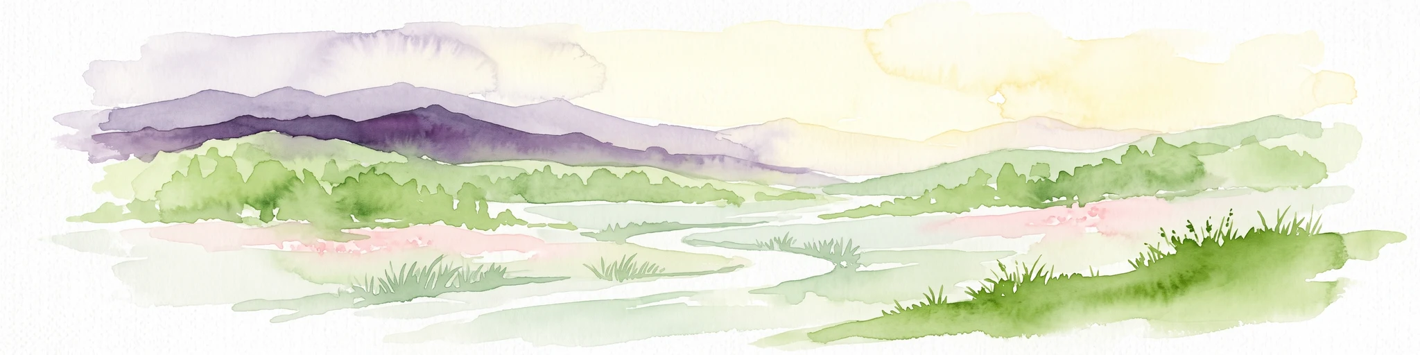
Watercolor painting of a rolling green landscape with a winding trail leading toward purple mountains under a soft light.
Nature reserveWartburgkreis
2.8 km away#5 closest

Southwest

Mertelstal - Heldrastein: Protected Nature Reserve and Forested Limestone Geography in Wartburgkreis

Mapping the natural relief and ecological boundaries of a central German nature reserve.

Mertelstal - Heldrastein stands as a protected natural landmark in the Wartburgkreis district, defined by its dramatic limestone cliffs and ancient beech forest canopy. The reserve features a unique vertical relief above the Werra river valley, housing rare orchid communities and specialized bryophytes. This entry maps the structural geography and conservation value of the site, highlighting its dual identity as both a Natura 2000 protected habitat and a place of deep historical resonance across the former inner-German border landscape.

Area
2.525 km²
Established
1997
IUCN
IV
Relief
Mountain
A wide watercolor painting depicting a landscape with green and purple trees and pale hills in the background.
Nature reserveGermany
About 3.3 km away#6 closest

Southeast

Probsteizella Nature Reserve: A Geographical Overview of Limestone Cliffs and Forested Valleys in Germany

Mapping the Muschelkalk sequences and woodland habitats of the Werra valley.

Probsteizella is a distinctive nature reserve in Germany that showcases the dramatic geomorphology of the Werra valley. The site features the Falkener Klippen, an exposed limestone cliff face showing a full stratigraphic sequence, and the historic Bauernkanzel outcrop. This area supports a rich diversity of beech-woodland communities, providing a focused example of central German river valley protected terrain.

Area
0.269 km²
Established
1961
Relief
Upland
Climate
Temperate
Watercolor painting of a green landscape featuring rolling hills and sparse trees.
Nature reserveWerra-Meißner-Kreis
About 5.6 km away#7 closest

Southwest

Dreiherrenstein-Eschenberg-Kreutzerberg Nature Reserve and Border Landscape Geography

Protected calcareous forests and limestone ridges in Werra-Meißner-Kreis

Spanning 206 hectares of the Ringgau escarpment, this reserve features ancient beech forests, steep limestone cliffs, and rare steppe-heath grasslands. It sits at a cultural and ecological intersection, preserving Cold War-era boundary markers alongside post-glacial biological relicts within the broader Hessian protected-area network.

Area
2.063 km²
Established
1998
IUCN
IV
Relief
Mountain
A wide watercolor painting showing a gentle river winding through green hills with pink flowering trees and pale blue mountains in the background.
Nature reserveUnstrut-Hainich-Kreis
About 6.7 km away#8 closest

North

Klosterschranne, Faulunger Stein Nature Reserve: Mapped Boundaries and Regional Geography

A protected Muschelkalk valley landscape in the Thuringia region

Klosterschranne, Faulunger Stein consists of a protected woodland and rock environment shaped by limestone erosion. The reserve features sharp valley spurs, calcareous springs, and cliffs that rise up to thirty meters, anchoring a larger network of habitats within the Upper Eichsfeld plateau. Users can examine the layered conservation status and distinct topographic features that define this ecologically significant German site.

Area
2.983 km²
Established
1996
IUCN
IV
Relief
Mountain

Common questions about visiting, size, designation, and location context for Adolfsburg, Bornberg, Sülzenberg

Adolfsburg, Bornberg, Sülzenberg FAQs for park facts, access, geography, and protected area context

Find quick answers about Adolfsburg, Bornberg, Sülzenberg, including protected-area facts, park geography, trail and visitor context, and how the park fits into its surrounding country and regional landscape.
MoriAtlas Explorer

Continue Your Protected Areas Search Across the Global Atlas

Deepen your exploration by continuing the structured search for national parks and protected areas worldwide. Utilize the comprehensive filtering capabilities to compare different conservation landscapes and refine your understanding of global park geography. Discover more about the distribution and characteristics of protected natural areas.

Global natural geography