
Mori Atlas logo
Nature reserveProbsteizella

A study of vertical Muschelkalk cliff sequences and orchid-rich beech woodland within a protected river valley.

Probsteizella Nature Reserve: Mapped Protected Landscapes and Geological Formations in the Werra Valley of Germany

Probsteizella represents a significant protected area in the Thuringia region of Germany, defined by the deep incisions of the upper Werra valley. The landscape centers on the Falkener Klippen, where massive Muschelkalk limestone cliffs expose layered stratigraphic sequences from the river level to the plateau above. This nature reserve sustains a mosaic of ash and sycamore ravine forests alongside warmth-loving beech woodland, forming an essential component of the broader Werra valley habitat network.

nature reserveWerra valleyMuschelkalk cliffsbeech forestorchid-rich woodlandlimestone slope
A colorful vector style illustration showing a winding river and path flowing through a green forest with tall pine trees, leading towards large layered rock cliffs under a sunny sky with clouds.

Probsteizella

Nature reserve

Park overview

Structured park overview, official facts, and landscape profile for Probsteizella

Probsteizella park facts, protected area profile, and essential visitor context

Review the core facts for Probsteizella, including designation, size, terrain, visitor scale, habitats, and operating context in one park-focused overview.

About Probsteizella

Probsteizella is one of the smaller but geologically and ecologically distinctive nature reserves in the Werra valley of northwestern Thuringia. Despite its modest size of around 26.9 hectares, it captures a complete cross-section of a middle-European limestone valley landscape, from the river level of the Werra through sheer cliff faces and up to the plateau forests above.

The reserve is centered on the Falkener Klippen, where the deep fluvial incision of the Werra has carved into the Muschelkalk plateau. The exposed cliffs reveal the entire stratigraphy of the Muschelkalk formation in a compact profile, a feature that gives the site real geological interest beyond its ecological value. The steep, actively eroding rock face is known for frequent rockfall, and the road that threads along the slope is part of the Werratal long-distance cycling route, drawing visitors into close contact with the landscape.

Ecologically, the reserve is almost entirely wooded. Its slopes and plateau support orchid-rich beech forest, one of the characteristic high-value forest types of the Werra hills, while the very steep western slope carries a different community of bluegrass beech forest. Where the forest meets the sun-exposed rocks, warmth-loving fringe vegetation and dwarf medlar shrub communities take over, and an ash and sycamore ravine-type stand grows beneath the cliff.

Together with neighboring protected slopes, Probsteizella forms part of the contiguous Werra valley cliff habitat complex along the border between Thuringia and Hesse. Its long-standing protected status, dating from 1961, and its inclusion in the EU Habitats Directive site Werrahänge von Frankenroda bis Falken give it a defined role in conserving the cliff, forest, and woodland edge habitats of the upper Werra region.

Quick facts and research context for Probsteizella

Probsteizella is a Thuringian nature reserve established on 23 March 1961, covering roughly 26.9 hectares in the northern Wartburgkreis between Falken and Frankenroda along the Werra. It carries registry number 27 in the Wartburgkreis list of protected areas and is classified as an IUCN Category IV Habitat and Species Management Area. The site overlaps with the EU Habitats Directive area Werrahänge von Frankenroda bis Falken and lies within the Eichsfeld-Hainich-Werratal Nature Park. Its defining features are the Falkener Klippen limestone cliffs and a near-continuous canopy of orchid-rich beech forest on the steep valley slopes.

Protection and recognition

Examine the verified terrestrial protection metrics and official registry data for Probsteizella.

Probsteizella Protection Status, Designated Scope, and Conservation Recognition

Probsteizella maintains a documented terrestrial protection profile within official conservation databases. Records outline the designated management scope and recognized status parameters for the protected area.

Protection details

Protection scope
Terrestrial
Transboundary protection
No
WDPA ID
165045
Park context

Deeper park guide and search-rich context for Probsteizella

Probsteizella history, landscape, wildlife, and travel context

Explore Probsteizella through its history, landscape character, ecosystems, wildlife, conservation priorities, cultural context, and seasonal travel timing in a structured park guide built for atlas discovery and search intent.

Why Probsteizella stands out

Probsteizella is best known for the Falkener Klippen, a deeply incised cliff section along the Werra where the Muschelkalk limestone sequence is fully exposed in a single valley wall. The reserve combines striking geomorphology with one of the most distinctive beech forest communities in the Werra valley, including warmth-loving fringe vegetation and rare whitebeam species on the cliff edges. The site is also recognized in cultural history for the Bauernkanzel, a prominent rock outcrop associated with the rallying call to the 1525 German Peasants' War, giving the otherwise quiet valley a strong sense of historical landscape character.
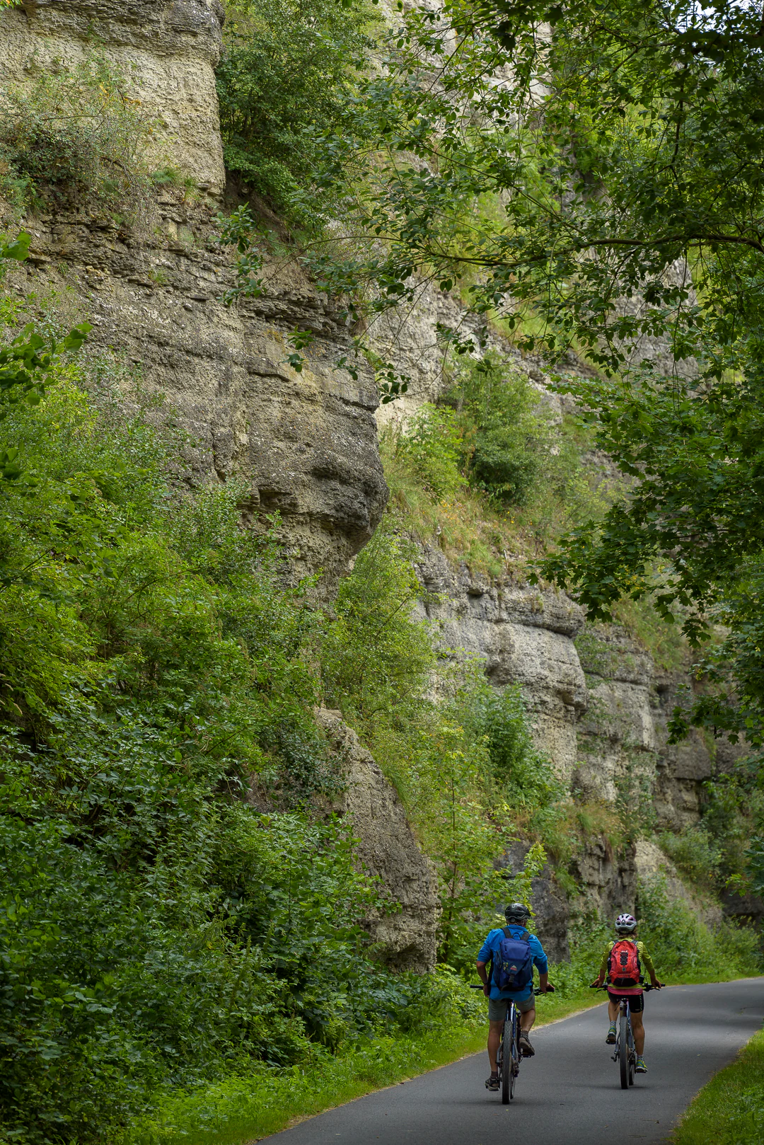
Two cyclists riding away on a paved path next to a steep, vegetation-covered rocky cliff.
Two cyclists ride along a paved path at the base of a lush, rocky cliff face in the Werratal valley.

Probsteizella history and protected-area timeline

Probsteizella was formally designated as a nature reserve on 23 March 1961, embedding it in an early wave of post-war nature conservation designations in Thuringia. The site was protected because of its combination of dramatic Werra valley cliffs and unusually well-developed beech forest communities, including orchid-rich and warmth-loving fringe types that were already recognized as regionally valuable at the time of designation.

The area has deeper cultural memory than its modest size might suggest. The rock outcrop known as the Bauernkanzel, on the cliff below Probsteizella farm, is traditionally associated with the call that drew local participants into the German Peasants' War of 1525, making the reserve a landscape with strong historical resonance alongside its natural heritage.

In more recent decades, the reserve was integrated into the Natura 2000 network through its inclusion in the FFH (Fauna-Flora-Habitat) site Werrahänge von Frankenroda bis Falken, reinforcing its role in protecting the connected cliff and forest habitats along this stretch of the Werra.

Probsteizella landscape and geographic character

The landscape of Probsteizella is shaped almost entirely by the upper Werra valley. The Werra has cut a deep, narrow incision into the surrounding Muschelkalk plateau, producing a classic central German limestone valley profile: a flat river corridor at the base, a sheer and often actively eroding rock wall in the middle, and a forested plateau above.

The defining landform is the Falkener Klippen, a near-vertical cliff face in the heart of the reserve. In places the rocks rise roughly fifty meters above the valley floor, exposing the layered stratigraphy of the Muschelkalk from the Wellenkalk at the base through the Anhydrit sequence on the upper slope to the Hauptmuschelkalk at the plateau edge. The cliffs are deeply fissured, weathered, and prone to rockfall, which adds both drama and a constant process of landscape renewal.

Below the cliffs, the village of Falken and the farm of Probsteizella itself sit on a narrow shelf between rock and river, with the road passing close beneath the overhanging rock walls. The Werra itself stays visible and audible along much of the reserve, framing the steep slopes and rocks. Above the cliffs, the terrain levels out onto the wooded plateau that characterizes the broader Wartburgkreis countryside.
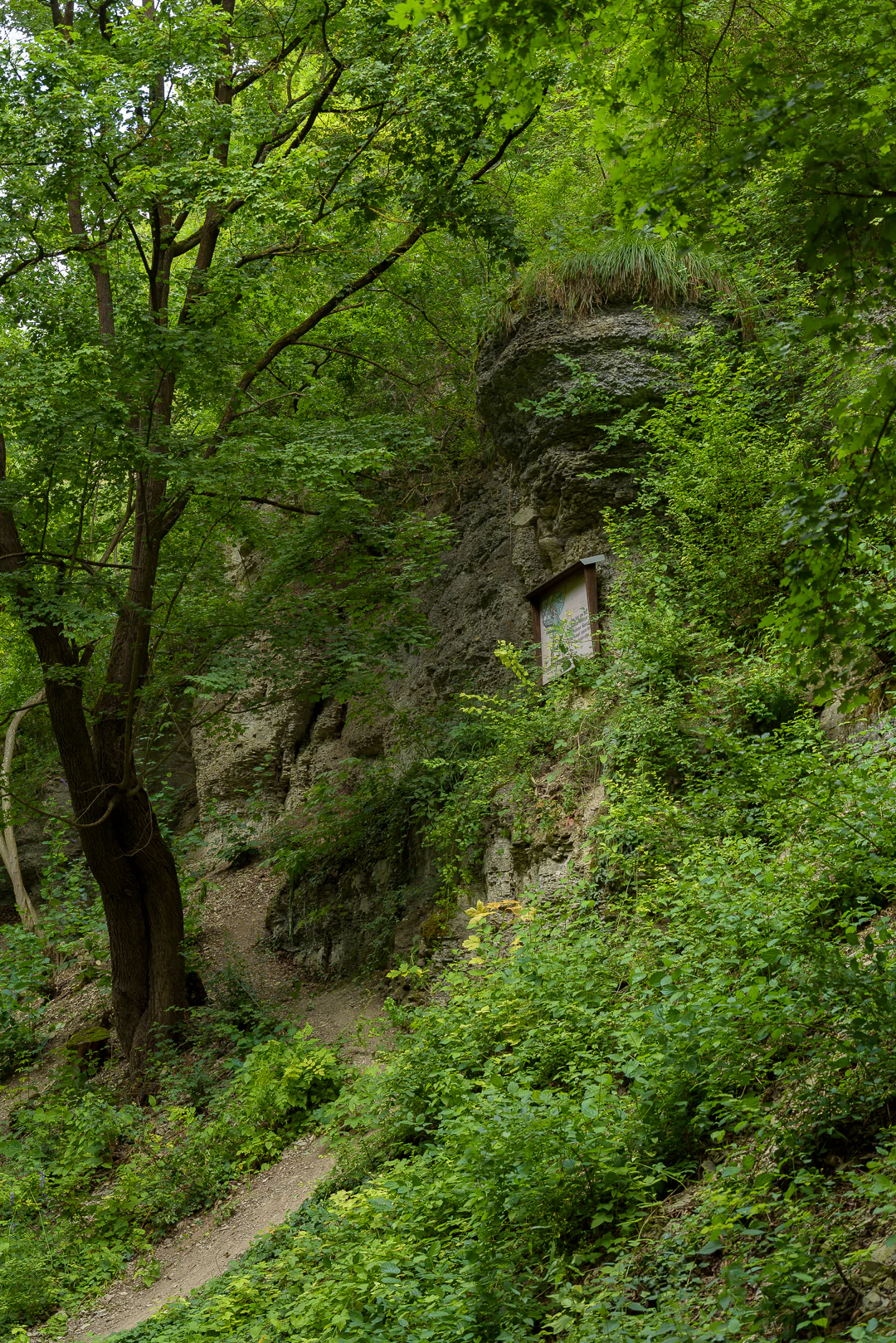
A narrow dirt path curves through a dense green forest, flanked by a rocky cliff face on the right with a small wooden sign attached.
A narrow dirt hiking trail winds through a lush green forest alongside a rocky cliff face with a small wooden information sign.

Probsteizella ecosystems, habitats, and plant life

Probsteizella's ecological identity is that of a compact, unusually complete Werra valley forest community, layered across slope, cliff, and water's edge. Almost the entire reserve is under woodland cover, making it essentially a forest reserve rather than a mixed agricultural or grassland site.

The dominant forest type is orchid-rich beech forest, a high-value community typical of warmer limestone slopes in central Germany. On the steepest, sunny western slope this transitions into a bluegrass-beech community adapted to drier and more exposed conditions. At the rim where the forest meets the cliffs, warmth-loving fringe societies and dwarf medlar shrub communities colonize the thin, sun-baked soils that accumulate on the rock ledges. Beneath the cliffs the cooler, shaded rock bases support a different stand reminiscent of ash and sycamore ravine forest.

The reserve's flora is particularly notable for the presence of several warmth-loving plant species at the northern edge of their range, including swallowwort, peach-leaved bellflower, bloody cranesbill, and ostrich-flowered chrysanthemum. The forest is also rich in whitebeam and wild service tree, including the rare microspecies Sorbus acutisecta, lending the woodland an additional layer of botanical interest. As part of the larger FFH area Werrahänge von Frankenroda bis Falken, Probsteizella contributes to the conservation of these habitat types at the regional scale.
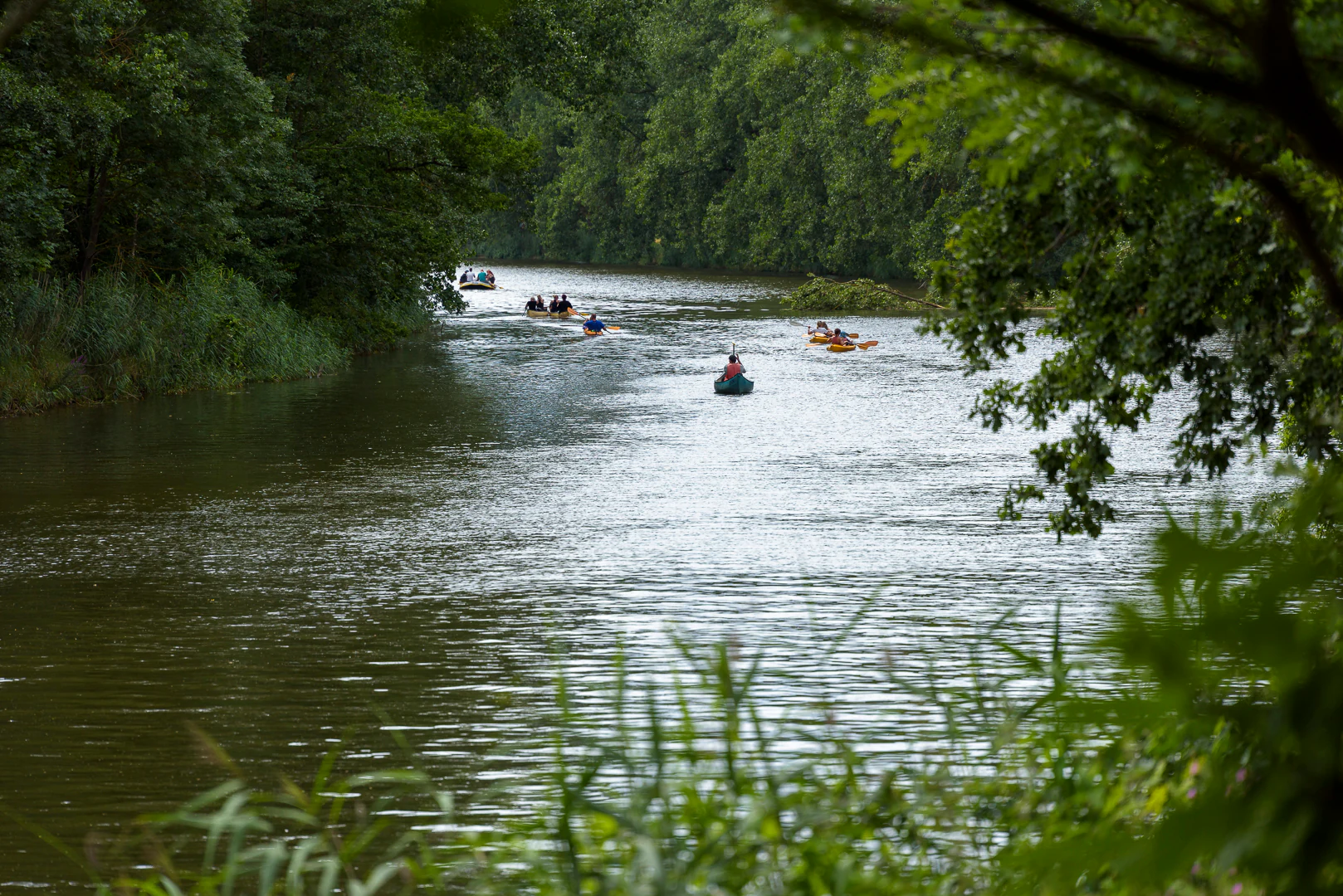
A wide river flows through a dense green forest with several people paddling in small boats and rafts.
People paddling canoes and kayaks on the Werra river surrounded by dense green forest.

Probsteizella wildlife and species highlights

Wildlife interest in Probsteizella is concentrated more in the structural habitats, cliffs and forest edges, than in any single charismatic species. The sheer rock walls of the Falkener Klippen provide nesting sites for cliff-dwelling birds, and the eagle owl has been recorded breeding in the cliff face in some years, which is one of the most notable faunal occurrences associated with the site.

The near-continuous canopy of mature beech forest, together with the more open, shrub-rich cliff edges and the shaded ash and sycamore patches beneath the rocks, supports a varied woodland bird and small mammal community typical of central German limestone forests. The combination of rock, woodland, and proximity to the Werra also makes the reserve a stepping stone within the wider Werra slope ecosystem for species moving along the valley.

Because the reserve is small and largely forested, broader large-mammal visibility is limited, and the site is ecologically more notable for its habitat structures and plant communities than for an extensive mammal fauna.
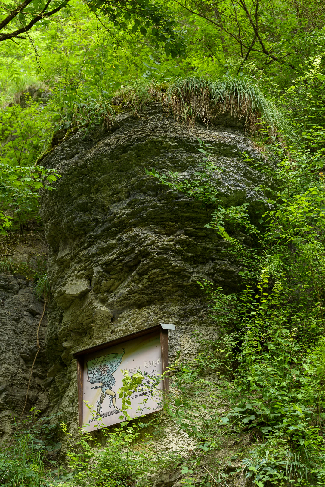
A large mossy rock formation in a forest with a wooden-framed information sign at its base showing an illustration and text, surrounded by green vegetation and trees
Information board at the base of a moss-covered rock formation along the Werratal hiking trail near the Bauernkanzel viewpoint

Probsteizella conservation status and protection priorities

Probsteizella's conservation significance rests on the close coexistence of two protected features within a very small area: a complete Muschelkalk cliff profile and an unusually well-developed mosaic of beech forest communities. The reserve has been formally protected since 1961, making it one of the longer-standing designations in the Wartburgkreis.

Its inclusion in the European Natura 2000 network through the FFH area Werrahänge von Frankenroda bis Falken ties it into a larger conservation unit aimed at safeguarding the cliff and slope habitats of this stretch of the Werra. This connectedness is important because many of the habitats represented, including orchid-rich beech forest, bluegrass beech forest, and warmth-loving fringe communities, depend on the long continuity of the Werra valley's cliff ecology and would be vulnerable if broken up.

The reserve also plays a role in protecting rare plant genetic resources, particularly rare whitebeam taxa such as Sorbus acutisecta, whose survival in the Werra hills is closely linked to the persistence of these cliff and slope forests.

Probsteizella cultural meaning and human context

Probsteizella sits in a landscape with an unusually strong cultural memory for such a small nature reserve. The Bauernkanzel, a prominent rock outcrop below the Probsteizella farm, is closely tied to the opening of the German Peasants' War in 1525, when the location was used as a platform for rallying calls to the local rural population. The rock and its associated viewing platform have since become a recognized cultural landmark and a frequent stop for visitors following the Werratal cycling route.

The farm and hamlet of Probsteizella itself have given the reserve its name and reflect a long history of small-scale settlement nestled between river and cliff in the Werra valley. The villages of Falken and Frankenroda, which bracket the reserve, are traditional Werra valley communities whose landscapes have long been shaped by the interplay of agriculture, forestry, and the dramatic rock walls above.
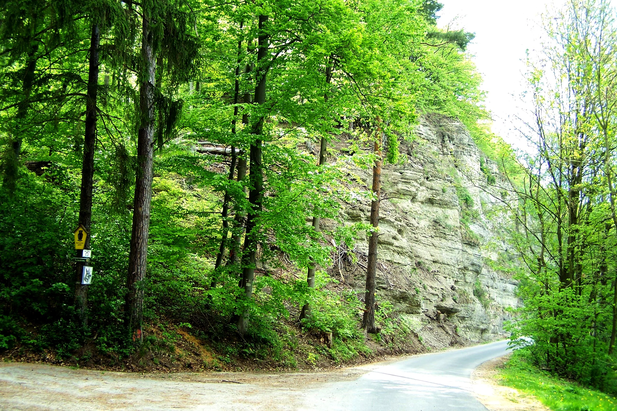
A paved road curves to the right through a forest with tall trees on the left and a large gray rocky cliff face on the right, with a yellow road sign visible on the left side
Road leading into the Ziegental gorge with a rocky cliff face and dense forest

Top sights and standout views in Probsteizella

The single most distinctive feature of Probsteizella is the Falkener Klippen, a near-vertical Muschelkalk cliff face that exposes a full sequence of limestone strata in one valley wall. The reserve also stands out for its compact but exceptionally diverse woodland mosaic, ranging from orchid-rich beech forest on the plateau to bluegrass-beech forest on the steep slope, with warmth-loving fringe vegetation and a ravine-style ash and sycamore stand beneath the rocks.

Its historical dimension, especially the Bauernkanzel rock outcrop linked to the 1525 Peasants' War, and its role as one component of the larger Werrahänge von Frankenroda bis Falken FFH site, give the reserve a layered identity that combines geology, ecology, and cultural landscape memory within a very small footprint.

Best time to visit Probsteizella

Probsteizella is best appreciated when the cliffs and forests are most accessible on foot or by bicycle along the Werratal cycle route, which runs directly beneath the cliffs. Spring and early summer are particularly rewarding for visitors interested in the reserve's orchid-rich beech forest and warmth-loving fringe vegetation, when woodland wildflowers and cliff-edge plants are at their peak and the cliff face contrasts vividly with fresh green foliage.

Late summer and early autumn are also attractive, since warmer and drier conditions along the exposed rock face in late summer tend to favor the very species communities for which the reserve is recognized, and the deciduous canopy begins to frame the cliffs in a different way. Because the rock walls experience frequent rockfall, visitors following the road beneath the cliffs should be cautious at any season, but especially after periods of freeze-thaw or heavy rain.


Monthly climate preview

Long-term representative temperature and precipitation averages for Probsteizella

Probsteizella Climate Normals and Measured Monthly Weather Patterns

Historical coordinate data reveals the measured annual temperature rhythm and monthly precipitation distribution across Probsteizella. Reviewing the complete twelve-month normals profile provides deeper analytical context for studying long-term regional climate trends.
Annual mean8 °C
-1 °C18 °C
Jan-1°
Feb
Mar
Apr
May12°
Jun16°
Jul18°
Aug18°
Sep14°
Oct
Nov
Dec
Warmest month
July

18.3 °C

Coolest month
January

-1.1 °C

Wettest month
July

2.6 mm/day

Driest month
April

1.4 mm/day

Park location guide

Geography guide, regional context, and park location map for Probsteizella

Probsteizella park geography, regions, and map view in Germany

Understand where Probsteizella sits in Germany through a broader geographic reading of the surrounding landscape, nearby location context, and its mapped position within the national park landscape.

How Probsteizella fits into Germany

Germany is a federal republic in Western and Central Europe with a population of over 83 million across sixteen constituent states. It is Europe's largest economy by nominal GDP and a major global exporter and importer. The capital is Berlin, and the country borders Denmark, Poland, Czech Republic, Austria, Switzerland, France, Luxembourg, Belgium, and the Netherlands.

Wider geography shaping Probsteizella in Germany

Germany is located in Western and Central Europe, spanning 357,022 km². It borders Denmark to the north, Poland and the Czech Republic to the east, Austria and Switzerland to the south, and France, Luxembourg, Belgium, and the Netherlands to the west. The country has coastlines on the Baltic Sea and North Sea to the north, with the Alps located in the southern region.

Map view of Probsteizella

Use this park location map to pinpoint Probsteizella in Germany, understand its exact geographic position, and read its mapped placement within the surrounding landscape more clearly.

Pigeon | © OpenStreetMap contributors

Visualizing limestone cliffs, river valleys, and forest habitats across the nature reserve

Probsteizella Photos and Protected Landscape Scenery

Explore detailed photographs capturing the rugged limestone cliffs, deep river corridors, and orchid-rich beech woods of Probsteizella. Visual references reveal the distinctive terrain and protected habitats defining this protected valley landscape.

Two cyclists riding away on a paved path next to a steep, vegetation-covered rocky cliff.

A paved path winds through a green forest with a tall layered rock cliff rising on the left side and dense trees on the right under an overcast sky.

A narrow dirt path curves through a dense green forest, flanked by a rocky cliff face on the right with a small wooden sign attached.

A wide river flows through a dense green forest with several people paddling in small boats and rafts.

A large mossy rock formation in a forest with a wooden-framed information sign at its base showing an illustration and text, surrounded by green vegetation and trees

A rectangular informational sign with an illustration and German text mounted on a rocky cliff face surrounded by green foliage.

A paved road curves to the right through a forest with tall trees on the left and a large gray rocky cliff face on the right, with a yellow road sign visible on the left side

Park atlas

Compare limestone valley reserves and regional protected areas across the surrounding district

Other Parks Near Probsteizella and Connected Protected Landscapes

Browse nearby national parks and protected areas sharing the distinctive limestone valley terrain and wooded plateau geography of Probsteizella. Expanding the geographic comparison reveals broader ecological networks and regional conservation corridors across Thuringia.
Nature reserveThuringia
Mapped location lies within the park boundary#1 closest

Northwest

Werrahänge von Frankenroda bis Falken: A Deep Dive into Thuringian Protected Landscapes

Mapping limestone river canyons and unique forest habitats in Wartburgkreis.

This protected area captures a distinct geomorphological intersection of river-cut canyons and plateau ridges in Thuringia. The site preserves an intense mosaic of juniper heath, dry grasslands, and ancient beech forests, functioning as a vital link for species conservation. Examine the mapped boundaries, karst features, and the sculptural topography formed by the Werra river as it winds through the Muschelkalk rim of the Thuringian Basin.

Area
5.69 km²
Established
1999
IUCN
IV
Relief
Upland
Nature reserveThuringia
About 0 km away#2 closest

Northwest

Werra bis Treffurt mit Zuflüssen: Protected River and Floodplain Network in Thuringia

Mapping an extensive 191 kilometer Natura 2000 river corridor.

The Werra bis Treffurt mit Zuflüssen protected area serves as a vital ecological corridor in Thuringia. This site encompasses a complex mosaic of fast-flowing highland brooks, expansive floodplain meadows, inland salt sites, and rare dissolution lakes. Its geography bridges high-altitude source regions with lower river valleys, creating a distinctive landscape transect that supports essential freshwater habitats and rare aquatic species across the state.

Area
22.6 km²
Established
2008
IUCN
IV
Relief
Mixed relief
A horizontal watercolor painting depicting a soft-toned, layered landscape of rolling hills and forests in shades of green and pale yellow.
Nature reserveThuringia
About 3.3 km away#3 closest

Northwest

Adolfsburg, Bornberg, Sülzenberg: A Protected Muschelkalk Landscape in Thuringia

Geographic map and protected-area atlas context

This nature reserve stands as a prominent geological feature in the Werrabergland region, where steep Muschelkalk hills and plateaus meet the Werra valley. The site protects a rare assembly of habitats including juniper heathland, scree slopes, and old-growth orchards, offering a dense case study for regional botanical diversity and limestone-terrain mapping in central Germany.

A horizontal watercolor illustration showing a landscape with rolling, misty purple hills in the background and a line of stylized green and pink trees in the foreground, with a meandering river winding through the scene.
Nature reserveThuringia
About 4 km away#4 closest

South

Creuzburger Werratal-Hänge Nature Reserve: Geography and Protected Landscape Analysis

Muschelkalk cliffs and calcareous dry grasslands in Thuringia

Located in western Thuringia, the Creuzburger Werratal-Hänge nature reserve features an intricate mosaic of cliff faces, ravine forests, and nutrient-poor dry grasslands. This protected area stands out for its high density of orchid species and mosses, all sculpted by the erosional force of the river Werra through the regional limestone bedrock.

Area
1.47 km²
Established
2000
IUCN
IV
Relief
Mountain
Watercolor illustration of a landscape featuring green fields, trees, a river, and distant hills under a pale sky
National parkThuringia
About 5.3 km away#5 closest

East

Hainich National Park: Protected Ancient Beech Forest Landscape in Thuringia, Germany

Regional geography and primeval forest boundaries

Hainich National Park occupies 75 square kilometers of the larger Hainich forest in western Thuringia. This canonical protected area is defined by its ancient beech woodland and ongoing forest restoration processes. The geography of the region, situated between Eisenach and Bad Langensalza, provides a critical example of primary forest dynamics and central European biodiversity, serving as an anchor for environmental research and landscape analysis.

Area
75 km²
Established
1997
IUCN
II
Climate
Temperate
A watercolor painting of a rolling, forested landscape with soft green and pink tones, featuring gentle hills and vegetation.
National parkThuringia
About 5.3 km away#6 closest

East

Nationalpark Hainich: Exploring the Geography of Thuringia's Beech Forest Wilderness

Mapped protected landscapes in the German heartland

Nationalpark Hainich protects one of the most important remaining deciduous woodlands in Central Europe. This detailed atlas entry covers the park's rolling terrain, the transition of its former training grounds into wild forest, and the geographic context of its position within the broader Thuringian landscape.

Area
75 km²
Established
1997
Relief
Upland
Climate
Temperate
A soft watercolor painting of a river landscape with rolling green hills and gentle slopes.
Nature reserveWartburgkreis
About 6.2 km away#7 closest

Southwest

Lienig Nature Reserve: Protected Karst Forest Landscapes in the Wartburgkreis Region

A study of steep forested slopes and limestone gullies

Lienig acts as a crucial protected sanctuary for deciduous forest communities situated on the steep, north-facing slopes of the Werra valley. The terrain presents a complex geological profile defined by shell limestone bedrock, small-scale karst features, and deeply incised erosion ravines that support a rare assembly of spring geophytes and old-growth forest characteristics.

Area
0.225 km²
Established
1961
IUCN
IV
Relief
Upland
A soft watercolor painting showing a green landscape with a winding river and a prominent cliff face on the left, set against a white background.
Nature reserveWartburgkreis
About 6.2 km away#8 closest

Southwest

Ebenauer Köpfe und Wisch Protected Landscape Map and Regional Geography

Nature reserve featuring Muschelkalk cliffs in the Wartburgkreis district

Analyze the geological formation and ecological importance of Ebenauer Köpfe und Wisch. This nature reserve encompasses steep canyon slopes, rare calcareous dry grasslands, and ancient rock communities essential to the Werra valley network.

Area
0.797 km²
Established
1996
IUCN
IV
Relief
Upland

Common questions about visiting, size, designation, and location context for Probsteizella

Probsteizella FAQs for park facts, access, geography, and protected area context

Find quick answers about Probsteizella, including protected-area facts, park geography, trail and visitor context, and how the park fits into its surrounding country and regional landscape.
MoriAtlas Explorer

Continue Your Protected Areas Search Across the Global Atlas

Deepen your exploration by continuing the structured search for national parks and protected areas worldwide. Utilize the comprehensive filtering capabilities to compare different conservation landscapes and refine your understanding of global park geography. Discover more about the distribution and characteristics of protected natural areas.

Global natural geography