
Why Frankenloch bei Heldra stands out
Frankenloch bei Heldra is best known for being one of the few surviving near-natural oxbow stretches of the Werra, an important refuge for wetland species in an otherwise intensively used floodplain. Its profile is shaped by the rare crucian carp, a fish considered endangered in Hesse and characteristic of aging floodplain waters, as well as by reed beds that host uncommon breeding and migratory birds. The reserve's history as a largely undisturbed strip along the former East-West border gives it unusual ecological continuity, while its recent restoration, including the reopening of a flood channel, has reintroduced dynamic river processes that had been lost for decades.
Frankenloch bei Heldra history and protected-area timeline
Frankenloch's significance as a protected area is closely tied to its position along the former inner-German border. For decades, the strip of Werra floodplain near Heldra was difficult to access, and the absence of intensive land use allowed the old arm, the reeds, and the wet meadows to develop with relatively little human interference.
Formal protection began on 28 November 1995, when the Regierungspräsidium Kassel designated the floodplain area as a nature reserve, citing the need to preserve habitat for rare animal and plant species and to maintain it through extensive grassland management and targeted care measures. In April 1999, the same boundaries were notified to the European Commission as part of the implementation of the Habitats Directive, embedding Frankenloch in the emerging Natura 2000 network. A formal Natura 2000 designation followed in January 2008 under Hessian law.
Beyond these ecological designations, the area also benefits from broader landscape protection. It lies within the Auenverbund Werra landscape protection area, established in 1992, and in 2023 the Hessian parliament designated the Green Belt in Hesse as a National Nature Monument, placing Frankenloch firmly within the strictest core zone of that monument.
Frankenloch bei Heldra landscape and geographic character
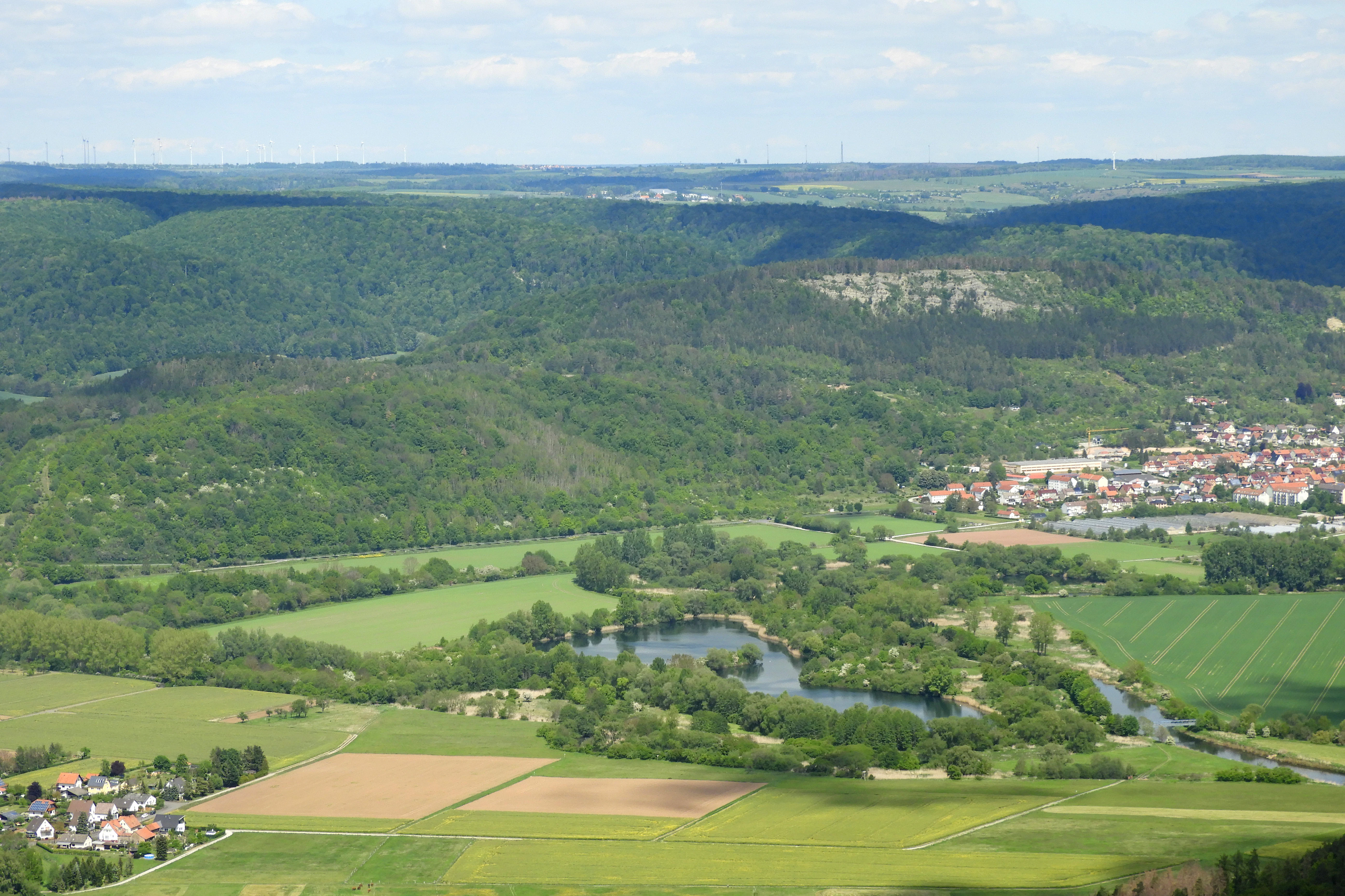
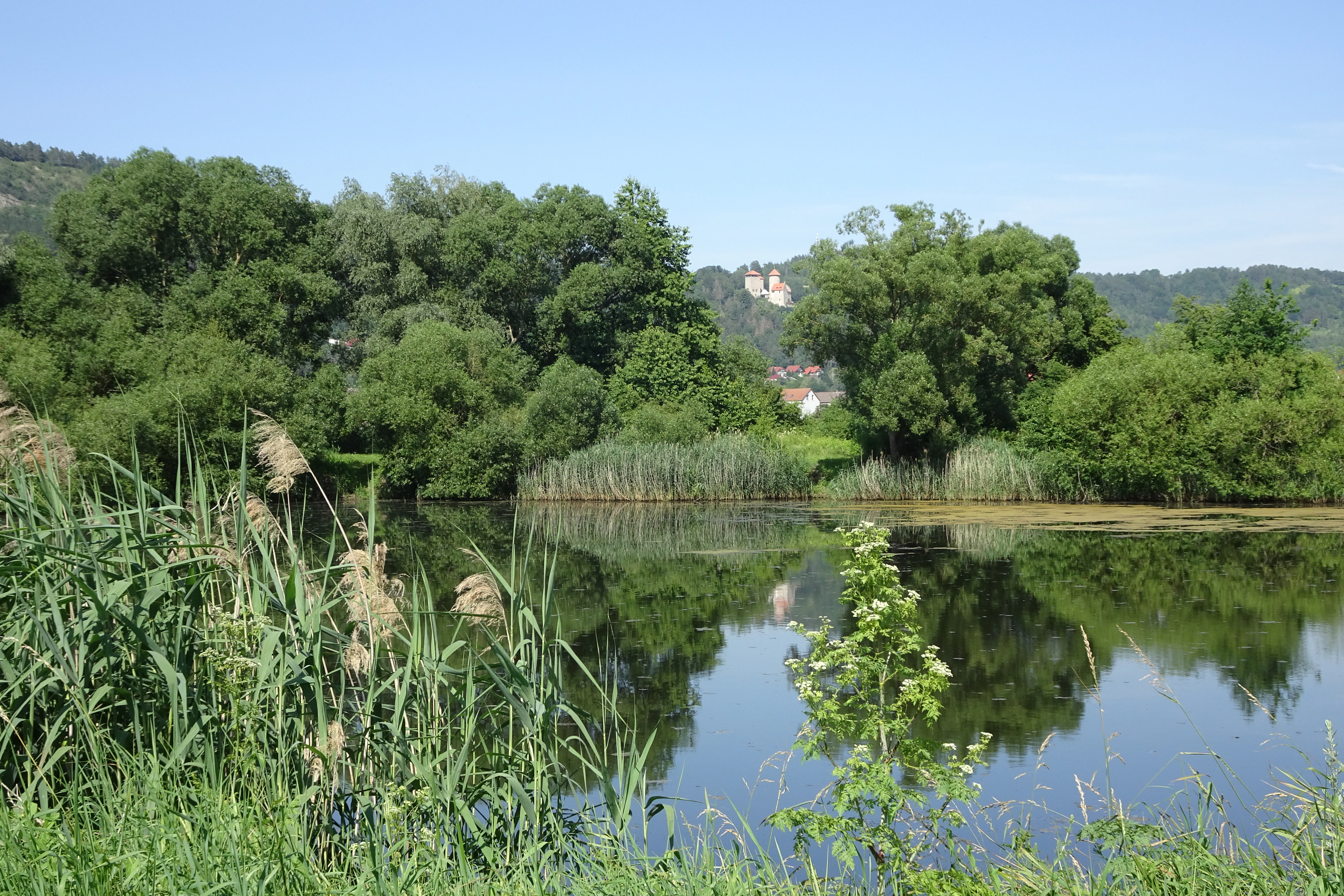
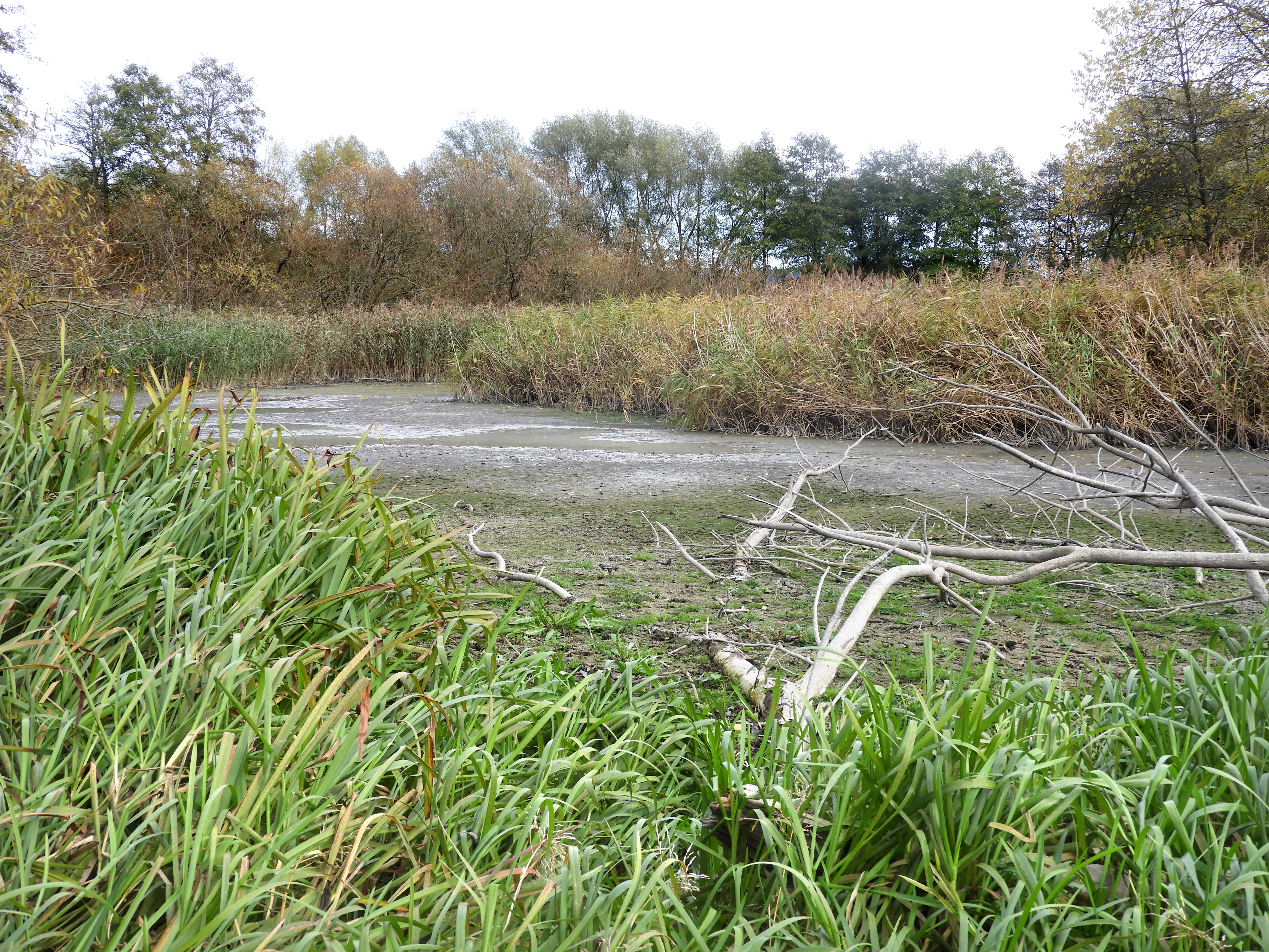
The landscape of Frankenloch bei Heldra is defined by a narrow strip of Werra floodplain pressed against the base of the Heldrastein ridge. The old river arm forms a long, curved depression in the valley floor, only briefly refilled by Werra water during exceptional floods. Outside these events, the old arm stands as a still, nutrient-rich pond-like waterbody, gradually filling with sediment and vegetation.
Beneath the floodplain deposits lie river gravels, and the overlying one to two meters of flood loam give the meadows and pastures their characteristically rich soils. The floodplain forms a sharp visual contrast to the steeply rising Heldrastein forest above it, while to the south and east the open Werra valley continues toward the Thuringian border. A short stretch of the Werra itself, roughly 270 meters long, forms the southeastern boundary of the reserve.
Frankenloch bei Heldra ecosystems, habitats, and plant life
Ecologically, Frankenloch bei Heldra is a mosaic of small, closely interwoven wetland habitats. Reedbeds, large sedge marshes, tall-herb communities, wet fallow land, and fragments of softwood floodplain forest create a varied structure that supports a wide range of bird, insect, fish, and plant species.
The standing water of the old arm falls within the European Habitats Directive's category of eutrophic lakes, and the slow silting-up of the floodplain is a defining ecological process here. Management aims to reverse some of that aging by reopening flood channels, allowing periodic flooding to rejuvenate parts of the system. Surrounding grasslands, used as hay meadows or as horse pasture, are kept in an extensively managed state that preserves the open character of the floodplain and supports meadow-breeding birds.
Frankenloch bei Heldra wildlife and species highlights
The wetland mosaic at Frankenloch provides habitat and breeding conditions for many bird species and serves as a stopover site for migrating birds passing along the Werra valley. Particularly notable are uncommon migrants such as the great reed warbler, black tern, common snipe, whinchat, northern lapwing, and hen harrier, some of which linger as feeding visitors after the main migration period.
Beneath the surface of the old arm, the crucian carp stands out as a conservation priority. Considered endangered in Hesse, this cyprinid fish is a characteristic species of aging floodplain waters and a key indicator of habitat quality here. The presence of such species, alongside the rich birdlife, gives the small reserve an ecological weight well beyond its size.
Frankenloch bei Heldra conservation status and protection priorities
Frankenloch bei Heldra illustrates how a small, carefully targeted protection effort can have disproportionate ecological value. The combination of a national nature reserve status, a European FFH designation, inclusion in the Auenverbund Werra landscape protection area, and integration into the National Nature Monument Grünes Band Hessen stacks multiple layers of legal protection over essentially the same stretch of floodplain.
Conservation work has gone beyond paper designations. Through land consolidation procedures, nearly all of the nature reserve has been acquired by conservation organizations, most prominently the Zoologische Gesellschaft Frankfurt, separating it from the intensive agricultural use that dominates much of the Werra valley. A re-excavated flood channel now allows Werra water to re-enter parts of the reserve during high water, restoring a degree of natural floodplain dynamics. Monitoring and management plans prepared for the Regierungspräsidium Kassel continue to guide the conservation of the crucian carp, the reed habitats, and the broader floodplain ecosystem, including the transboundary link to the Thuringian Werraaue Treffurt.
Frankenloch bei Heldra cultural meaning and human context
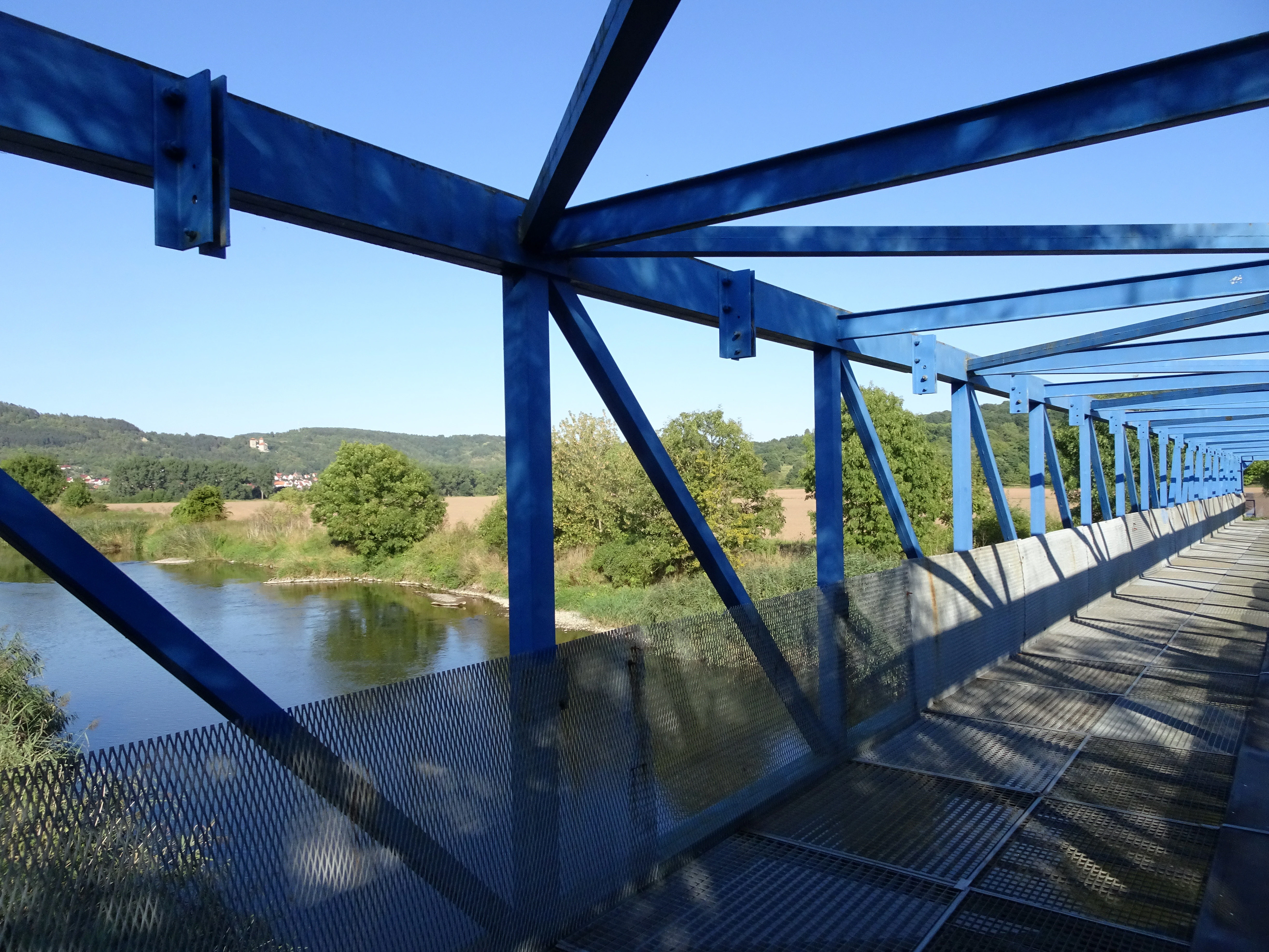
The reserve carries a deep historical weight beyond its natural features. For decades it lay directly along the inner-German border, where limited access shielded it from the agricultural intensification that transformed much of the Werra valley on either side of the Cold War divide. Remnants of that era still shape the landscape: a blue steel pedestrian and cycle bridge across the Werra, originally built as a border barrier to prevent escapes across the river, was later converted into a crossing for hikers and cyclists, with former grid panels reinstalled by local heritage volunteers.
The Heldrastein above the reserve also carries cultural significance. A viewing tower, the Turm der Einheit, marks the ridge and is reached by a premium hiking trail, the P6 Heldrastein, that passes through the protected floodplain below. Together, the border relics, the trails, and the surrounding villages connect Frankenloch to a regional identity shaped by division, reunion, and renewed appreciation of the natural landscape along the former frontier.
Top sights and standout views in Frankenloch bei Heldra
Frankenloch bei Heldra is a compact showcase of floodplain conservation: a near-natural Werra oxbow with rare fish, exceptional bird habitats, and restored flood dynamics, all squeezed into a narrow strip below the Heldrastein.
Its layered protection status as a nature reserve, a Natura 2000 site, and a core zone of the National Nature Monument Grünes Band Hessen gives it rare legal durability, while its transboundary continuity with the Thuringian Werraaue Treffurt extends its ecological reach well beyond its own borders.
Best time to visit Frankenloch bei Heldra
Spring and early summer are particularly rewarding for visits, when water levels are typically reliable enough to show the wetland character clearly, breeding birds are active in the reedbeds, and the meadows around the old arm are at their most lush. Migratory species are most visible during the main spring and autumn passage periods, when uncommon visitors such as snipe, whinchat, and northern lapwing may appear along the floodplain.
Late summer and early autumn offer a quieter atmosphere, with extensive meadows, mature reed growth, and good conditions for unhurried walks along the circular route between Treffurt and Heldra. High water events, although rare, can transform the area dramatically when Werra water re-enters the revived flood channel. Hikers tackling the steeper P6 Heldrastein premium trail will encounter the most demanding conditions in winter or after heavy rain, when the ascents to the ridge are at their most slippery.