
Mori Atlas logo
Nature reserveCreuzburger Werratal-Hänge

Mapping the cliff-side geology, dry grasslands, and biodiversity of the Werra valley escarpments

Creuzburger Werratal-Hänge: A Protected Muschelkalk Landscape in the Thuringia River Valley

Creuzburger Werratal-Hänge encompasses a dramatic series of steep shell limestone cliffs along the Werra river in the Thuringia region of Germany. This protected landscape combines complex Muschelkalk geology with varied habitats, ranging from sun-baked calcareous dry grasslands to deep, cool ravine forests. The area serves as a critical biological site, known for its diverse orchid populations and significant bryological variety across these rugged, canyon-like river slopes.

limestone cliffsMuschelkalkdry grasslandscalcareous beech forestorchid-rich habitatsravine forests
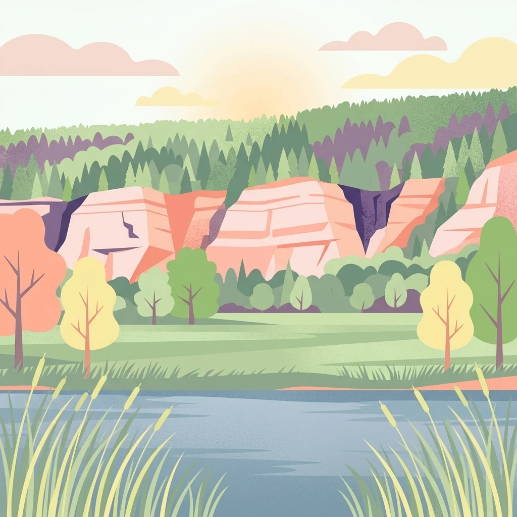
A digital illustration of a landscape with a river in the foreground, bordered by tall grasses. In the midground, there are trees and a meadow, and in the background, steep light-colored cliffs rise beneath a soft sunset sky with green forest on the slopes.

Creuzburger Werratal-Hänge

Nature reserve

Park overview

Structured park overview, official facts, and landscape profile for Creuzburger Werratal-Hänge

Creuzburger Werratal-Hänge park facts, protected area profile, and essential visitor context

Review the core facts for Creuzburger Werratal-Hänge, including designation, size, terrain, visitor scale, habitats, and operating context in one park-focused overview.

About Creuzburger Werratal-Hänge

Creuzburger Werratal-Hänge is one of the more ecologically distinctive Natura 2000 sites in western Thuringia, protecting a compact but exceptionally varied mosaic of limestone cliff, dry grassland, juniper heath, and ancient deciduous forest along the upper Werra valley. Although it covers only about 147 hectares, it concentrates an unusually rich set of habitat types that are individually rare across the broader Thuringian Basin.

The landscape emerges from the geological contrast at the edge of the Thuringian Basin. Where the Werra cuts down through the Muschelkalk strata near Creuzburg, it has carved a tight meander valley with steep, sometimes nearly vertical, Prallhang cliffs on the outside of each bend and gentler Gleithang slopes inside. The protected area occupies three particular sections of this valley: the cliff-and-woodland complex of Lienig, the dramatic Nordmannssteine cliffs with the surrounding Klosterholz forest, and the broad south-facing slopes of the Ebenauer Köpfe. From their base near the Werra floodplain to their upper plateaus, these slopes rise from around 198 meters up to about 376 meters in elevation.

Ecologically, the site's character comes from the strong microclimatic contrast between its slopes. South- and west-facing hillsides are exposed to intense sun, drying winds, and shallow, stony soils derived from the Wellenkalk and Middle Muschelkalk. Here, the land could never easily be cultivated, and centuries of sheep and goat grazing, combined with nutrient-poor rendzina soils, have produced a thick mosaic of calcareous dry grassland, juniper heath, rock-pioneer vegetation, and orchid-rich Magerrasen. By contrast, the shaded gullies, north-facing slopes, and ravines retain a cooler, moister microclimate that supports residual and climax beech communities, ravine forests of ash and sycamore maple, and a rich ground flora of woodland geophytes such as wild garlic and wood mercury.

Creuzburger Werratal-Hänge is also a particularly important area for Lower Plants.

Quick facts and research context for Creuzburger Werratal-Hänge

Creuzburger Werratal-Hänge is a 147-hectare Natura 2000 site (FFH-Gebiet 35) located in the northwestern Wartburgkreis of Thuringia, near the town of Creuzburg along the upper Werra valley. It lies within the Eichsfeld-Hainich-Werratal Nature Park and protects three originally separate nature reserves: Lienig, Klosterholz und Nordmannssteine, and Ebenauer Köpfe und Wisch.

The landscape is defined by steep Muschelkalk cliff faces rising more than 100 meters above the Werra, with elevations across the site ranging from roughly 198 to 376 meters. Management is overseen by the Thüringer Landesamt für Umwelt, Bergbau und Naturschutz (TLUBN), and the area has carried WDPA code 555520295 and European site code DE 4927-303 since its formal designation in 2008.

Protection and recognition

Official terrestrial protection history and international designation records

Creuzburger Werratal-Hänge Protection Status and Natura 2000 Recognition

Documented protection records for Creuzburger Werratal-Hänge outline established terrestrial conservation frameworks and official Natura 2000 recognition details. Systematic conservation data provides clear baseline context regarding the designated territory and international status.

International recognition

Protection details

Protection scope
Terrestrial
Designated year
2008
Transboundary protection
No
WDPA ID
555520295
Park context

Deeper park guide and search-rich context for Creuzburger Werratal-Hänge

Creuzburger Werratal-Hänge history, landscape, wildlife, and travel context

Explore Creuzburger Werratal-Hänge through its history, landscape character, ecosystems, wildlife, conservation priorities, cultural context, and seasonal travel timing in a structured park guide built for atlas discovery and search intent.

Why Creuzburger Werratal-Hänge stands out

The site is best known for its dramatic Muschelkalk cliff faces along a tight meander of the Werra, and for the unusually rich mosaic of calcareous dry grassland and beech forest that crowds onto the narrow, sun-baked slopes. Its flora is another defining feature: roughly twenty orchid species have been recorded across the reserves, including nationally notable populations of Lady's Slipper, several Ophrys species, and abundance-rich stands of the rare Small Spider Orchid (Ophrys sphegodes) at its only natural Thuringian site. The Muschelkalk outcrops themselves are also valued as a regionally important bryological hotspot, harboring around 180 moss species and a rich lichen flora directly attached to the limestone.
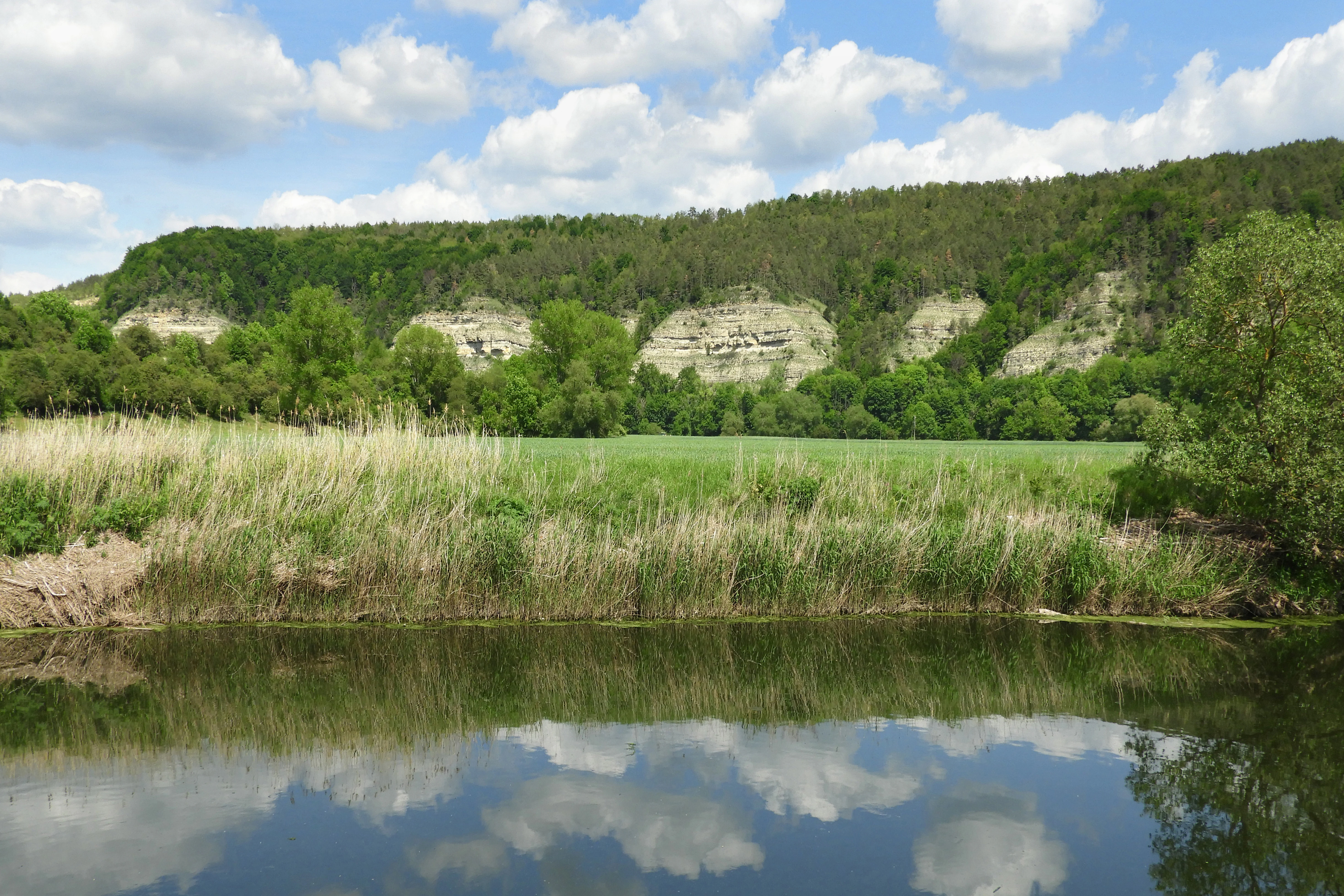
A calm river reflects a blue sky with fluffy white clouds, with a grassy riverbank and steep, tree-covered limestone cliffs in the background.
Limestone cliffs overlooking the Werra river at Creuzburger Werratal-Hänge.

Creuzburger Werratal-Hänge history and protected-area timeline

The conservation history of Creuzburger Werratal-Hänge is layered: the three component reserves came under protection at very different moments, well before they were merged into a single European site.

The Lienig reserve was first secured as a small forest area under an East German ministerial order of 30 March 1961, which confirmed provisional protections across Thuringia. That 1961 designation aimed to safeguard representative samples of the region's full range of landscape and site types, and for Lienig specifically it was directed at preserving a tree-species-rich deciduous forest and its karst-related landforms. The Klosterholz portion of the larger Klosterholz und Nordmannssteine reserve was placed under protection at the same time in 1961, then greatly expanded in May 1995 to include the surrounding Nordmannssteine cliffs and the still-active Buchenau limestone quarry.

The Ebenauer Köpfe area was only provisionally protected between 1990 and 1995 after reunification, and finally designated by the Thüringer Landesverwaltungsamt in April 1996. In November 2017 it was further enlarged and renamed Ebenauer Köpfe und Wisch.

At the European level, the three reserves were grouped together in September 2000 when the Thüringer Umweltministerium proposed them as a single Natura 2000 site under the EU Habitats Directive. The European Commission confirmed the site's inclusion in the Natura 2000 network in December 2004, and the formal German protection order, the Thüringer Natura 2000-Erhaltungsziele-Verordnung, followed on 29 May 2008.

Alongside conservation, the landscape also carries an industrial past. A soda factory established at Buchenau in 1922 and later absorbed into the Ernest Solvay group used nearby limestone quarries, with sedimentation ponds and spoil heaps from the works still visible in parts of the reserve. The quarry continued intermittent operation into the 1990s and early 2000s before closing at the end of 2014 and being formally renaturalised, leaving its flooded pit, locally called the Blaue Lagune, inside the protected area.

Creuzburger Werratal-Hänge landscape and geographic character

The physical landscape of Creuzburger Werratal-Hänge is dominated by the canyon-like valley the Werra has cut through the edge of the Thuringian Basin near Creuzburg. The river enters a tight meander loop, producing sharply contrasting cliff face and gentler slope on opposite banks. The protected area picks out three of these valley sections, between Creuzburg and Mihla.

On the Ebenauer Köpfe side, the Werra flows in a steep-sided gorge with rock faces rising more than 110 meters above the water at gradients of 30 to 40 degrees. These southern exposures expose the well-bedded Wellenkalk of the Lower Muschelkalk, with harder limestone bands weathering out as prominent rock ledges above softer layers. Above the cliff line, a more gentle Middle Muschelkalk slope runs up onto the plateau, where small areas of Upper Muschelkalk and even Lower Keuper are exposed along a fault.

Across the river, the Nordmannssteine cliffs form the visual centerpiece of the reserve: nearly vertical, west- to southwest-facing rock walls structured by erosional gullies, rock ledges, and overhangs. Below them, a former limestone quarry contributing to the old Solvay soda factory has been excavated out of the slope face, leaving terraced sedimentation basins and spoil tips along its lower flank. The Lienig section further northeast has a longer, slightly gentler Prallhang at around 20 degrees, cut by a series of eleven ravine-like Runsen formed by runoff from the agricultural land above.

Soils follow the underlying geology closely. The steep slopes carry thin, skeletal, calcium-rich leach soils and rock rendzinas with very limited water storage and a strong tendency to dry out, while flatter upper slopes and the lower slopes of Lienig carry clay-rich rendzinas and loamy soils developed from weathering of the Middle Muschelkalk.
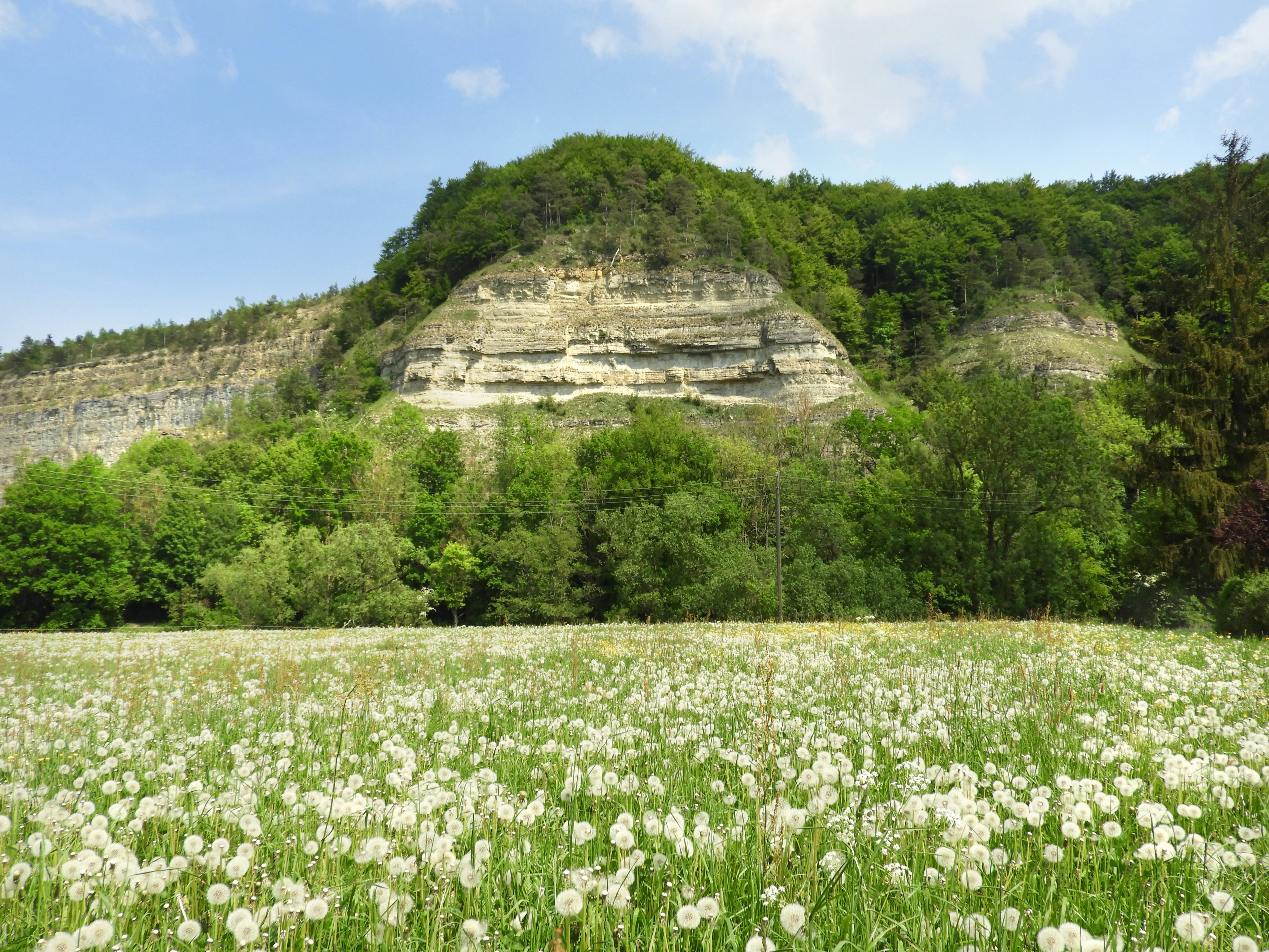
A wide view of a field covered in white, fluffy dandelion seed heads with a steep, green, limestone-cliffed hill rising in the background under a blue sky.
A meadow of seed-bearing dandelions set against the limestone bluffs of the Werra valley in the Creuzburger Werratal-Hänge nature reserve.

Creuzburger Werratal-Hänge ecosystems, habitats, and plant life

Ecologically, Creuzburger Werratal-Hänge sits at the meeting point of two broad regional patterns: the warm, dry, calcareous woodlands and grasslands of the Muschelkalk escarpments, and the cooler, moister deciduous forest communities that survive in shaded ravines and north-facing woodland.

Twelve habitat types of European interest are recorded here under the Habitats Directive. The forest habitats cover by far the largest share: woodland-master beech forest (Waldmeister-Buchenwald), Central-European orchid-calcareous beech forest, oak-hornbeam forest, and especially the priority Schlucht- und Hangmischwälder (ravine and slope mixed forests), which together account for roughly 119 of the site's 147 hectares. These forests are dominated by European beech on the well-drained upper slopes and pass into ash-sycamore ravine forest on the deeper, moister midslopes and along the gullies.

Where the slopes are too steep for trees, the land has been kept open in a different way. Eight open-land habitat types are present, accounting for about 18 hectares, but they pack an enormous botanical density. Calcareous dry grasslands, juniper heaths, priority orchid-rich forms of the Trespen-Schwingel-Kalk-Trockenrasen, and rock-pioneer vegetation grow in tightly interlocked patches with limestone cliff and scree. Two tiny areas of petrifying spring (Kalktuffquellen), one of the rarest habitat types in Thuringia, also occur here.

A defining biological feature of the area is the exceptional bryophyte and lichen flora on the Muschelkalk rock surfaces. Around 180 moss species and 46 moss communities have been identified, including rare xerothermic specialists on sun-exposed limestone, and roughly 50 lichen species, several of which grow directly on the rock rather than on soil or bark.
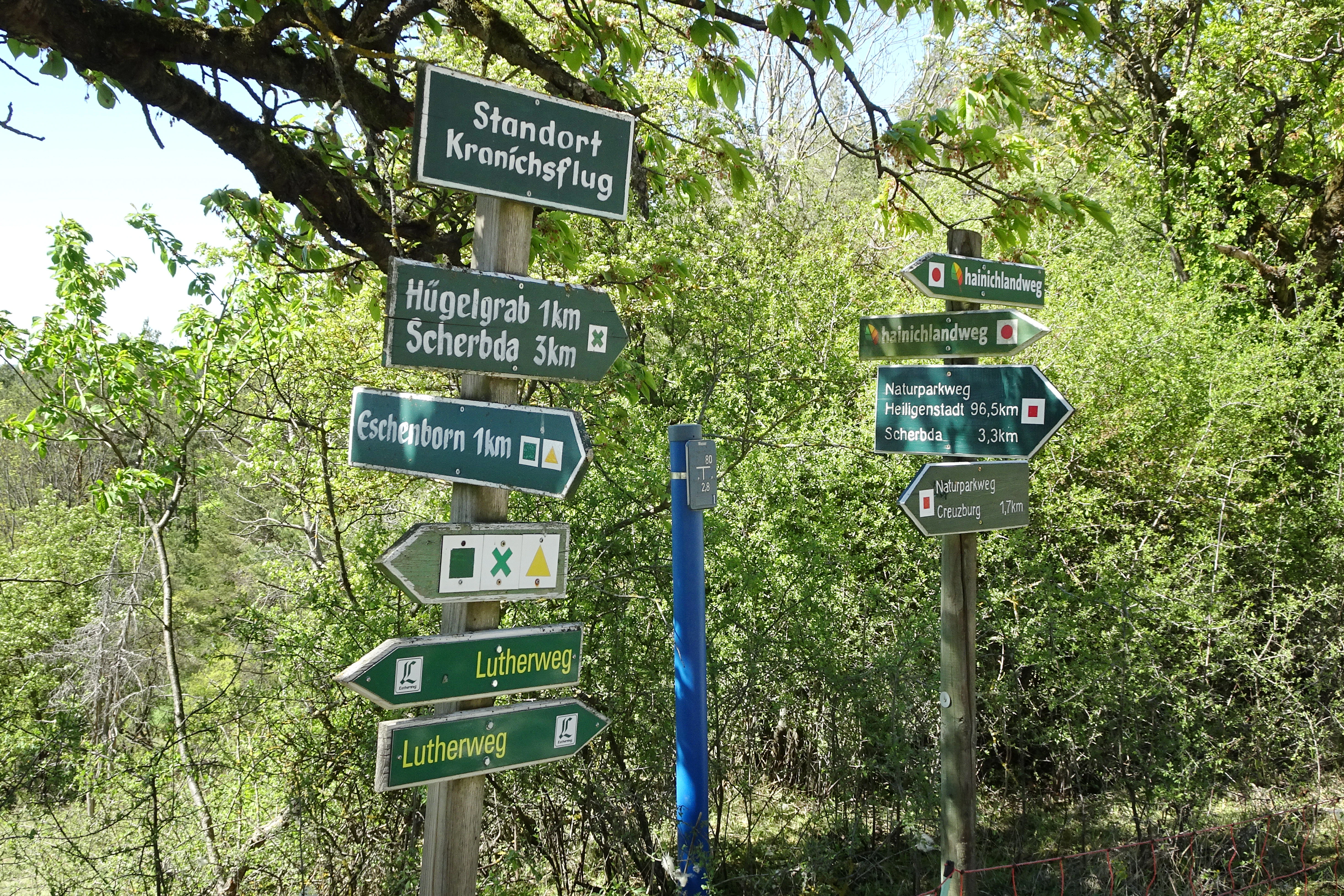
Two wooden posts with multiple green and white hiking directional signs situated in a wooded area.
Hiking trail signs at the Kranichsflug location in the Creuzburger Werratal-Hänge area.

Creuzburger Werratal-Hänge wildlife and species highlights

The cliffs and woodlands of Creuzburger Werratal-Hänge support a distinctive mix of cliff-nesting birds, rare cave-roosting bats, and a rich community of butterflies and moths tied to the warm dry-grassland slopes.

Among birds, several species listed under Annex I of the EU Birds Directive have been recorded, including red-backed shrike, pied flycatcher, grey partridge, black and grey woodpeckers, red kite, and peregrine falcon. The rock faces of the Nordmannssteine and Ebenauer Köpfe also provide ideal breeding habitat for eagle owls.

The reserve is regionally important for bats. Two strictly protected species are present: the greater mouse-eared bat, which here supports one of its largest German populations in warm, structurally varied woodland; and the lesser horseshoe bat, whose breeding colony in one of the natural caves of the Ebenauer Köpfe was only discovered in the mid-2000s. Greater noctule bats have also been observed along the slopes.

The dry-grassland and rock-steppe habitats harbor an unusually diverse invertebrate fauna. Surveys in the early 1990s recorded more than 30 butterfly species, including several Red List butterflies such as the fiery fritillary, the heath fritillary, and the scarce copper. More than 100 moth species, including the threatened Perlen-Erdeule moth, around 100 geometer moths, and roughly 50 species of bombyx and hawk moths, have been documented, alongside grasshoppers such as the red-winged bush-cricket and rare micro-moths, several of them first records for Thuringia.
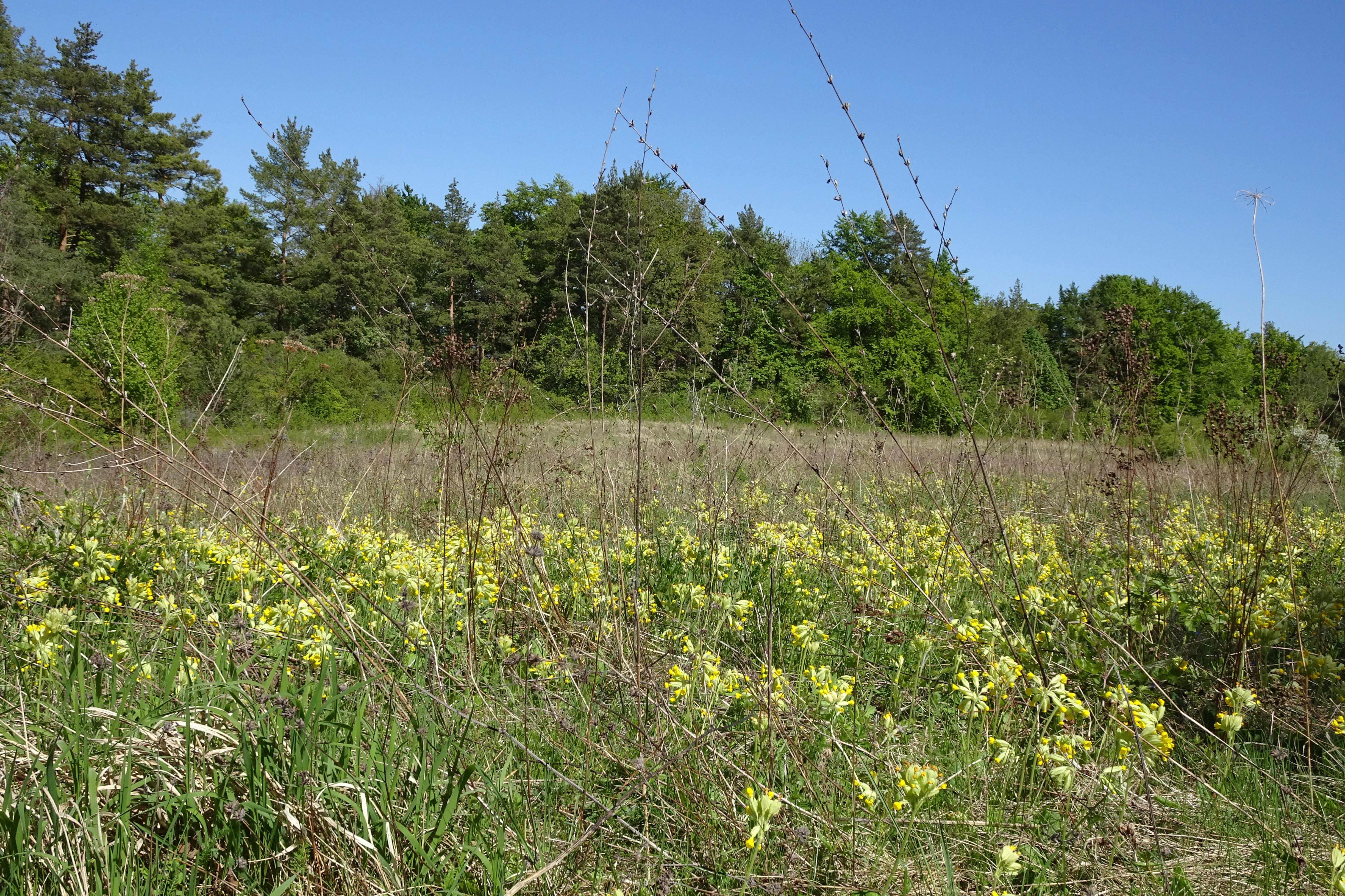
A sunny, eye-level view of a dry grassland meadow dotted with many small, yellow flowers, likely cowslips, with a dense green forest line in the background under a clear blue sky.
A meadow of blooming cowslips in the dry grassland habitat of the Creuzburger Werratal-Hänge.

Creuzburger Werratal-Hänge conservation status and protection priorities

Creuzburger Werratal-Hänge is one of the more important Natura 2000 areas in western Thuringia for the conservation of calcareous grassland, rocky steppe, and orchid-rich beech forest on Muschelkalk. Its protected status rests on two overlapping layers: the underlying German nature reserve designations for Lienig, Klosterholz und Nordmannssteine, and Ebenauer Köpfe und Wisch, and the formal 2008 Thuringian Natura 2000 conservation objectives order that brought all three together as European site DE 4927-303.

The site's core value is the unusually dense concentration of European habitat types in a small area. Four of the eleven habitat types recorded here, including orchid-rich calcareous dry grassland, priority ravine and slope forests, and priority limestone pioneer vegetation, are classified as priority for conservation, meaning the EU bears particular responsibility for their survival. These habitats are also the substrate for a number of species of community interest, including several bat species, the green shield-moss Buxbaumia viridis (which had been considered lost in Thuringia until its rediscovery here), and many rare mosses and lichens tied to the Muschelkalk.

At a regional level, the reserve serves as an important genetic reservoir for juniper and yew on the dry, rocky ridges of Klosterholz, and as a rediscovery site for otherwise vanished bryophyte species. Management is oriented around preserving open dry grassland through continued grazing or mowing where possible, supporting natural forest regeneration and high dead-wood levels on Lienig, and protecting the rock and scree habitats of Nordmannssteine and Ebenauer Köpfe, which are also designated as priority areas for landscape and open-space preservation and, in part, flood protection under the South-West Thuringia regional plan.

Creuzburger Werratal-Hänge cultural meaning and human context

The cultural dimension of Creuzburger Werratal-Hänge is shaped by centuries of low-intensity use of what was, in practical terms, marginal agricultural land. The plateau of the Ebenauer Köpfe, in particular, was historically grazed by sheep and goats and used for hay production, while the lower slopes once hosted small orchards and vineyards; relics of old vineyard walls are still visible in places.

A more recent layer of cultural landscape is industrial. Between 1922 and 1968, the Solvay soda factory at Buchenau, founded on Belgian chemist Ernest Solvay's ammonia-soda process, quarried limestone from the cliff itself and pumped the resulting waste into sedimentation basins on the lower slopes of the reserve. After the factory closed, the renaturalised quarry pit filled with rainfall to form the so-called Blaue Lagune, today embedded in the protected landscape.

The valley floor also carries the trace of a railway that ran through here in the early 20th century: the Werratalbahn from Treffurt to Wartha, later curtailed after 1945 war damage, the closure of the soda factory, and Cold War-era German division, and finally abandoned altogether in 1968. Parts of its route have been converted into a cycle path, with a new pedestrian and cycle bridge reinstalled across an old railway bridge site at Ebenau in 2016, and this stretch of the Werratal cycle route now passes directly under the protected cliffs.
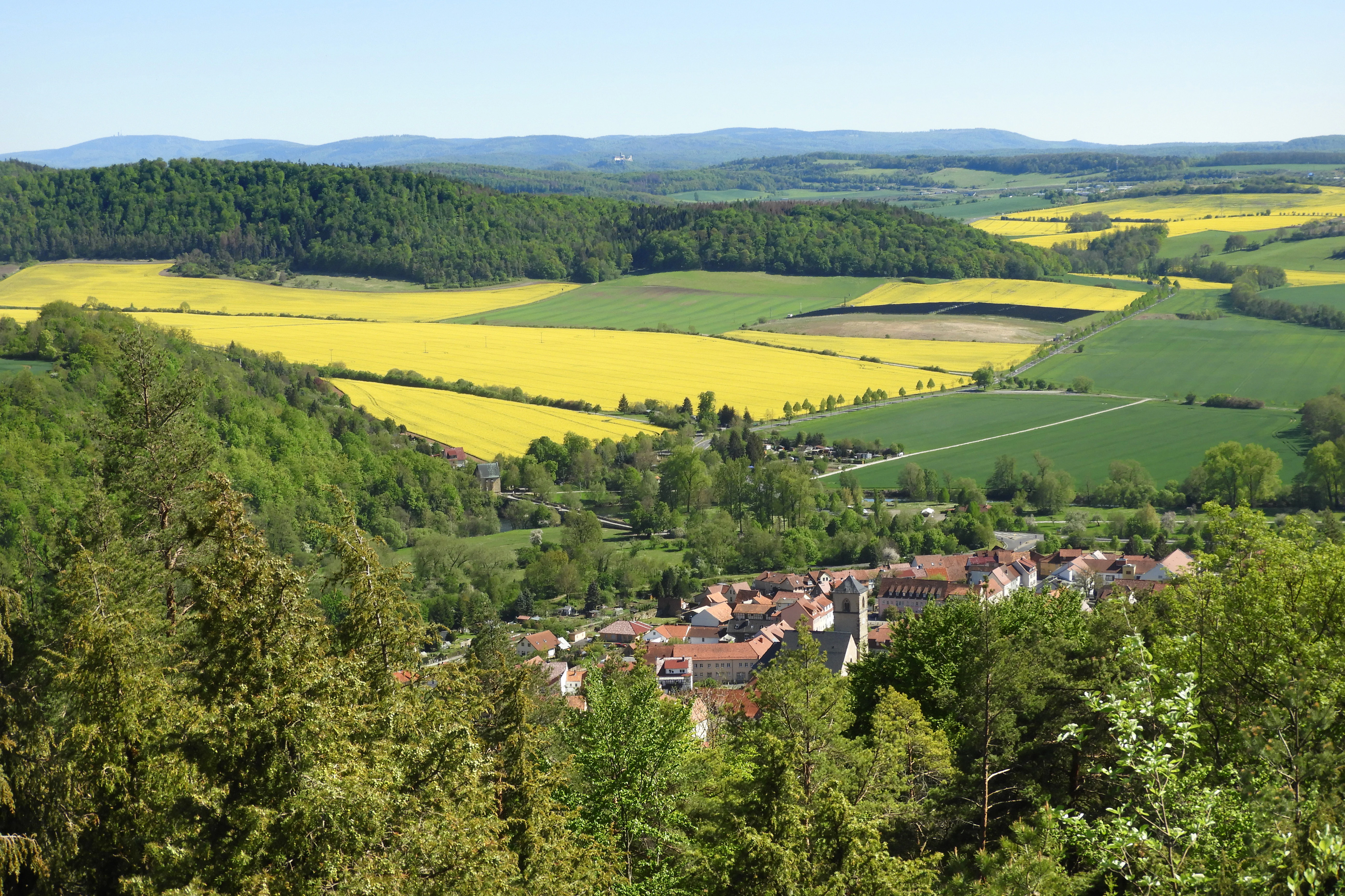
A wide, high-angle landscape shot showing a lush green valley with rolling hills, vibrant yellow fields, and a small town nestled among trees.
Panoramic view from the Wisch lookout over the Werra river valley toward Creuzburg and the surrounding countryside.

Top sights and standout views in Creuzburger Werratal-Hänge

The strongest highlights of Creuzburger Werratal-Hänge are the contrast between the burning-hot, south-facing Muschelkalk cliffs of Ebauer Köpfe and the cool, fern-rich ravine forests of Klosterholz, the sheer, almost vertical Nordmannssteine rock walls, and the unusually rich orchid flora of the dry grasslands.

It also stands out for its status as a regionally important bryological hotspot, with around 180 moss species recorded across small-calcareous rock, calcareous dry grassland, and forest edge, including the rare green shield-moss Buxbaumia viridis. The renaturalised former quarry at Buchenau, today a striking blue-water pit known as the Blaue Lagune inside the protected area, is another distinct landmark within the reserve.
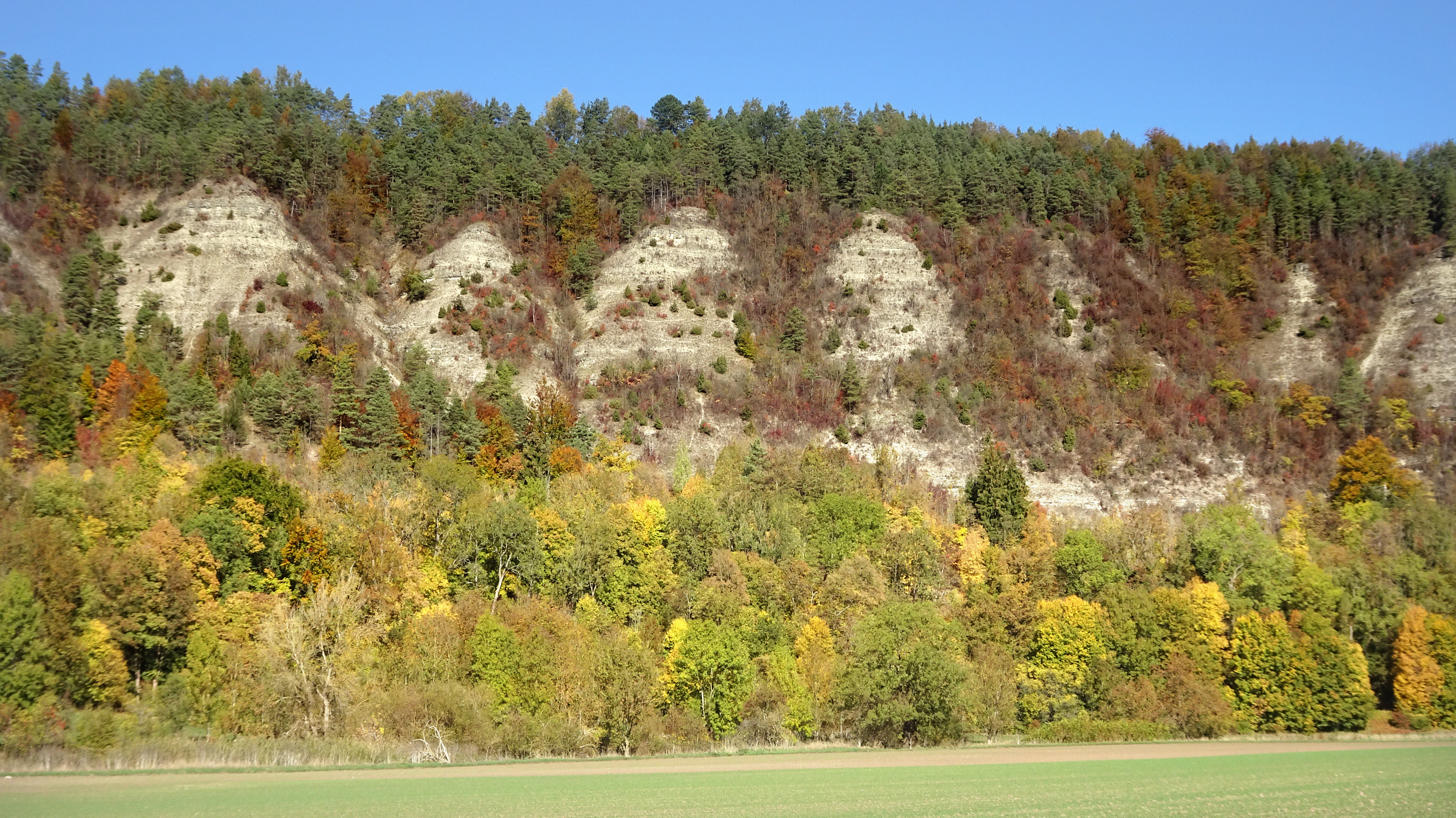
A horizontal landscape view of a steep limestone cliff face partially covered by mixed coniferous and deciduous forests displaying autumn colors under a clear blue sky, above a field in the foreground.
The Ebenauer Köpfe cliffs, featuring limestone rock formations rising above the autumn forest in the Creuzburger Werratal-Hänge reserve.

Best time to visit Creuzburger Werratal-Hänge

Late spring and early summer, roughly May into early July, is the strongest season for visiting Creuzburger Werratal-Hänge, when the orchid-rich calcareous dry grasslands of the Ebenauer Köpfe and Nordmannssteine are in full bloom and the cliff-nesting bird life is most active. Summer brings hot, dry conditions on the south-facing slopes and vivid grasshopper and butterfly activity, while autumn is the best time for richer forest coloration along the beech and ravine slopes. Winters tend to be cool and relatively damp, with snow possible, and the exposed Muschelkalk cliffs become a striking but colder landscape.

Monthly climate preview

Long-term monthly temperature and precipitation patterns sampled at a representative coordinate

Creuzburger Werratal-Hänge Climate Normals and Annual Temperature Rhythm

The recorded data outlines measured long-term averages for monthly temperature ranges and precipitation rates across a representative coordinate at 339.36 meters elevation. Reviewing the complete twelve-month profile provides deeper analytical context on annual meteorological shifts without relying on live forecasts.
Annual mean8 °C
-1 °C18 °C
Jan-1°
Feb
Mar
Apr
May12°
Jun16°
Jul18°
Aug18°
Sep14°
Oct
Nov
Dec
Warmest month
July

18.3 °C

Coolest month
January

-1.1 °C

Wettest month
July

2.6 mm/day

Driest month
April

1.4 mm/day

Park location guide

Geography guide, regional context, and park location map for Creuzburger Werratal-Hänge

Creuzburger Werratal-Hänge park geography, regions, and map view in Germany

Understand where Creuzburger Werratal-Hänge sits in Germany through a broader geographic reading of the surrounding landscape, nearby location context, and its mapped position within the national park landscape.

How Creuzburger Werratal-Hänge fits into Germany

Germany is a federal republic in Western and Central Europe with a population of over 83 million across sixteen constituent states. It is Europe's largest economy by nominal GDP and a major global exporter and importer. The capital is Berlin, and the country borders Denmark, Poland, Czech Republic, Austria, Switzerland, France, Luxembourg, Belgium, and the Netherlands.

Wider geography shaping Creuzburger Werratal-Hänge in Germany

Germany is located in Western and Central Europe, spanning 357,022 km². It borders Denmark to the north, Poland and the Czech Republic to the east, Austria and Switzerland to the south, and France, Luxembourg, Belgium, and the Netherlands to the west. The country has coastlines on the Baltic Sea and North Sea to the north, with the Alps located in the southern region.

Map view of Creuzburger Werratal-Hänge

Use this park location map to pinpoint Creuzburger Werratal-Hänge in Germany, understand its exact geographic position, and read its mapped placement within the surrounding landscape more clearly.

Pigeon | © OpenStreetMap contributors

Location context for Creuzburger Werratal-Hänge

Thuringia
Recorded earthquake history

Examine the Recorded Earthquake History of Creuzburger Werratal-Hänge

Investigate a structured collection of seismic events recorded in the vicinity of Creuzburger Werratal-Hänge. This MoriAtlas dataset allows you to review historical earthquake locations, magnitudes, and depths associated with the limestone cliffs of the Werra valley and surrounding region.

Creuzburger Werratal-Hänge Earthquake History

Catalogued events

4 events

Strongest magnitude

Magnitude 3.6

Most recent event

Oct 25, 2006

This history includes earthquakes recorded inside the park or within 50 km of its borders

Visual exploration of limestone cliffs, dry grasslands, and river valley habitats

Creuzburger Werratal-Hänge Landscape Photos and Protected Area Scenery

Visual records capture the steep Muschelkalk rock faces, sun-baked slopes, and shaded ravine forests that define the protected landscape. Examining terrain photography helps observers understand the varied habitats and geological formations shaping the Werra river valley.

A calm river reflects a blue sky with fluffy white clouds, with a grassy riverbank and steep, tree-covered limestone cliffs in the background.

A wide view of a river valley in autumn with steep limestone cliffs topped by mixed forests, showing colorful orange, yellow, and green foliage reflected in the still river below.

A wide view of a field covered in white, fluffy dandelion seed heads with a steep, green, limestone-cliffed hill rising in the background under a blue sky.

Two wooden posts with multiple green and white hiking directional signs situated in a wooded area.

A sunny, eye-level view of a dry grassland meadow dotted with many small, yellow flowers, likely cowslips, with a dense green forest line in the background under a clear blue sky.

Two cyclists riding on a paved path through a flat field with a steep, forested limestone cliff face in the background under a clear blue sky.

A wide, high-angle landscape shot showing a lush green valley with rolling hills, vibrant yellow fields, and a small town nestled among trees.

A horizontal landscape view of a steep limestone cliff face partially covered by mixed coniferous and deciduous forests displaying autumn colors under a clear blue sky, above a field in the foreground.

A high-angle scenic view of the Werra river meandering through a lush green valley, with limestone rock faces and forest on the left and a wind farm visible on the distant horizon.

A view of a turquoise, water-filled quarry surrounded by high limestone cliff walls, with yellow flowering plants in the foreground.

A wide view of a limestone quarry with high, stratified rock walls and areas of sparse vegetation and trees against a clear blue sky.

Park atlas

Compare adjacent river valleys, limestone escarpments, and regional nature reserves

Parks Near Creuzburger Werratal-Hänge and Surrounding Protected Landscapes

Browsing parks near Creuzburger Werratal-Hänge reveals similar limestone geology, river corridors, and protected escarpments across the region. Expanding the geographic comparison highlights related protected landscapes and deepens regional park discovery.
A soft watercolor painting showing a green landscape with a winding river and a prominent cliff face on the left, set against a white background.
Nature reserveWartburgkreis
Mapped location lies within the park boundary#1 closest

West

Ebenauer Köpfe und Wisch Protected Landscape Map and Regional Geography

Nature reserve featuring Muschelkalk cliffs in the Wartburgkreis district

Analyze the geological formation and ecological importance of Ebenauer Köpfe und Wisch. This nature reserve encompasses steep canyon slopes, rare calcareous dry grasslands, and ancient rock communities essential to the Werra valley network.

Area
0.797 km²
Established
1996
IUCN
IV
Relief
Upland
Watercolor illustration of a lush river valley with gently rolling hills and trees under a soft, light sky.
Nature reserveWartburgkreis
Mapped location lies within the park boundary#2 closest

South

Klosterholz und Nordmannssteine: Geography and Protected Area Landscape Context

Essential nature reserve mapping in the Wartburgkreis district

Klosterholz und Nordmannssteine is a significant nature reserve situated along the Werra river. This protected area features a striking vertical profile defined by exposed shell-limestone cliffs, diverse ravine forests, and remnants of industrial activity. It serves as a key site for calcareous flora and avian conservation within the broader ecological network of the Eichsfeld-Hainich-Werratal nature park region.

Area
1.395 km²
Established
1961
IUCN
IV
A soft watercolor painting of a river landscape with rolling green hills and gentle slopes.
Nature reserveWartburgkreis
Mapped location lies within the park boundary#3 closest

West

Lienig Nature Reserve: Protected Karst Forest Landscapes in the Wartburgkreis Region

A study of steep forested slopes and limestone gullies

Lienig acts as a crucial protected sanctuary for deciduous forest communities situated on the steep, north-facing slopes of the Werra valley. The terrain presents a complex geological profile defined by shell limestone bedrock, small-scale karst features, and deeply incised erosion ravines that support a rare assembly of spring geophytes and old-growth forest characteristics.

Area
0.225 km²
Established
1961
IUCN
IV
Relief
Upland
Nature reserveThuringia
Park boundaries overlap#4 closest

North

Werra bis Treffurt mit Zuflüssen: Protected River and Floodplain Network in Thuringia

Mapping an extensive 191 kilometer Natura 2000 river corridor.

The Werra bis Treffurt mit Zuflüssen protected area serves as a vital ecological corridor in Thuringia. This site encompasses a complex mosaic of fast-flowing highland brooks, expansive floodplain meadows, inland salt sites, and rare dissolution lakes. Its geography bridges high-altitude source regions with lower river valleys, creating a distinctive landscape transect that supports essential freshwater habitats and rare aquatic species across the state.

Area
22.6 km²
Established
2008
IUCN
IV
Relief
Mixed relief
Nature reserveThuringia
1.5 km away#5 closest

North

Werra-Aue zwischen Breitungen und Creuzburg: Protected Floodplain and River Geography

Nature reserve sanctuary in western Thuringia

Spanning over 33 kilometers of the Werra river, this protected floodplain is defined by its distinctive geological sinkholes, seasonal wetlands, and diverse bird habitats. Discover the layered conservation status and riparian terrain that mark this significant Thuringian nature reserve as a crucial node for European ecological connectivity.

Area
25.78 km²
Established
2007
IUCN
IV
Relief
Lowland
Nature reserveThuringia
About 2.2 km away#6 closest

Southwest

Wilhelmsglücksbrunn Nature Reserve and Werra Valley Protected Landscape Geography

A mapped overview of inland saline springs in Thuringia

The Wilhelmsglücksbrunn nature reserve preserves a rare inland saline ecosystem within the flat Werra floodplain of western Thuringia. This site sustains a complex landscape of reed beds, wet meadows, and brine-fed habitats that connect to the broader Green Band ecological corridor, providing essential staging grounds for diverse migratory bird populations.

Area
0.773 km²
Established
2000
IUCN
IV
Relief
Lowland
Nature reserveThuringia
2.2 km away#7 closest

North

Werrahänge von Frankenroda bis Falken: A Deep Dive into Thuringian Protected Landscapes

Mapping limestone river canyons and unique forest habitats in Wartburgkreis.

This protected area captures a distinct geomorphological intersection of river-cut canyons and plateau ridges in Thuringia. The site preserves an intense mosaic of juniper heath, dry grasslands, and ancient beech forests, functioning as a vital link for species conservation. Examine the mapped boundaries, karst features, and the sculptural topography formed by the Werra river as it winds through the Muschelkalk rim of the Thuringian Basin.

Area
5.69 km²
Established
1999
IUCN
IV
Relief
Upland
A wide watercolor painting depicting a landscape with green and purple trees and pale hills in the background.
Nature reserveGermany
About 4 km away#8 closest

North

Probsteizella Nature Reserve: A Geographical Overview of Limestone Cliffs and Forested Valleys in Germany

Mapping the Muschelkalk sequences and woodland habitats of the Werra valley.

Probsteizella is a distinctive nature reserve in Germany that showcases the dramatic geomorphology of the Werra valley. The site features the Falkener Klippen, an exposed limestone cliff face showing a full stratigraphic sequence, and the historic Bauernkanzel outcrop. This area supports a rich diversity of beech-woodland communities, providing a focused example of central German river valley protected terrain.

Area
0.269 km²
Established
1961
Relief
Upland
Climate
Temperate

Common questions about visiting, size, designation, and location context for Creuzburger Werratal-Hänge

Creuzburger Werratal-Hänge FAQs for park facts, access, geography, and protected area context

Find quick answers about Creuzburger Werratal-Hänge, including protected-area facts, park geography, trail and visitor context, and how the park fits into its surrounding country and regional landscape.
MoriAtlas Explorer

Continue Your Protected Areas Search Across the Global Atlas

Deepen your exploration by continuing the structured search for national parks and protected areas worldwide. Utilize the comprehensive filtering capabilities to compare different conservation landscapes and refine your understanding of global park geography. Discover more about the distribution and characteristics of protected natural areas.

Global natural geography