Why Arusha National Park stands out
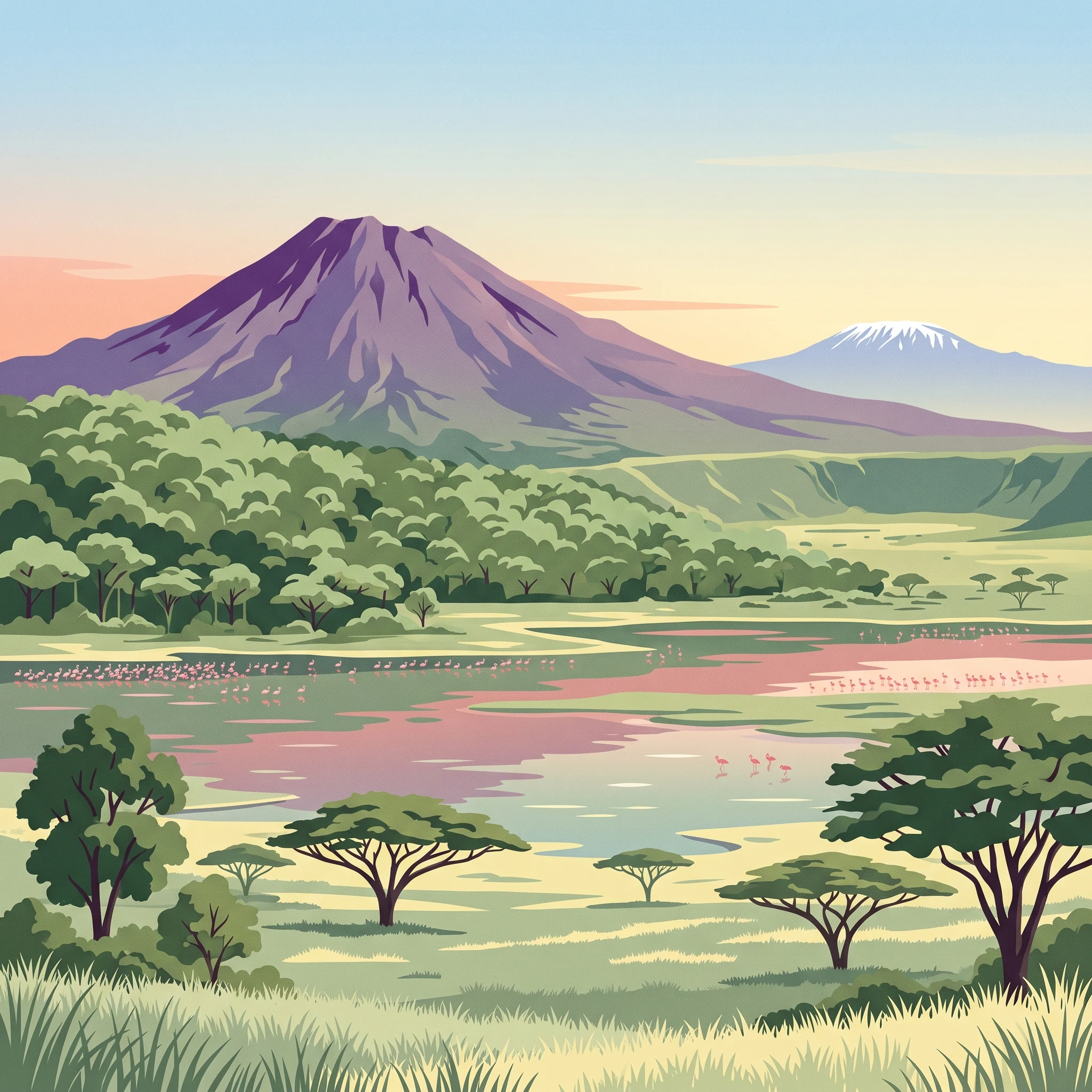
Arusha National Park is best known for its remarkable concentration of diverse ecosystems within a compact area. The park's defining feature is Mount Meru, Tanzania's second-highest mountain, whose volcanic crater rim forms a dramatic backdrop for the entire reserve. The Momella Lakes stand out as a premier birdwatching destination, where thousands of flamingos create a spectacular pink veneer across the shallow alkaline waters while numerous wading bird species thrive in the nutrient-rich environment. The Ngurdoto Crater offers a contrasting landscape of open grasslands teeming with wildlife, while the montane forests on Mount Meru's slopes shelter populations of black-and-white colobus and blue monkeys. The park also provides exceptional access to climbing Mount Meru, offering trekkers a challenging but rewarding alternative to the more crowded Kilimanjaro routes.
Arusha National Park history and protected-area timeline
The human history of Arusha National Park stretches back centuries, beginning with the Rwa people who were the first documented inhabitants of the region long before colonial influence arrived. The area gained international attention in 1876 when Hungarian explorer Count Pál Teleki visited the Momella Lakes, becoming one of the first Europeans to document the region's remarkable wildlife. Teleki famously reported observing abundant populations of hippopotamuses and black rhinos in the area, evidence of the region's ecological richness even in that era. The colonial period brought significant changes when the Trappe family from England settled in the Momella area in 1907 during Britain's administration of Tanganyika Territory. The family established a cattle ranch and farming operation across substantial portions of the area. Notably, Mrs. Trappe became the first female professional hunter in East Africa and made a significant contribution to conservation by donating a substantial portion of the Momella estate to establish a game reserve. This donated land formed the foundation of what would eventually become the national park. The park was formally established in 1960 under the name Ngurdoto Crater National Park, initially covering only the Ngurdoto Crater area without Mount Meru included within its boundaries. Following Tanzania's independence, the park underwent significant expansion in 1967 when it was renamed Arusha National Park after the Mount Meru region was incorporated into the protected area. The new name honored the Waarusha people who had historically inhabited the western portion of the region, linking the park's identity to the local communities whose cultural heritage predates the formal protected area designation.
Arusha National Park landscape and geographic character
Arusha National Park presents an extraordinary variety of volcanic landscapes within its relatively compact boundaries, a consequence of its position on the slopes of Mount Meru and its proximity to the East African Rift system. The park's western section is dominated by Mount Meru itself, a stratovolcano rising to 4,566 meters that ranks as Tanzania's second-highest peak after Kilimanjaro. The mountain's ash cone and crater form a dramatic focal point, with the Meru Crater creating a steep-walled amphitheater that channels the Jekukumia River through its floor. The landscape here features dramatic volcanic terrain including lava flows, ash fields, and rugged cliffs that attest to the mountain's volcanic origins. The southeastern portion of the park contains the Ngurdoto Crater, a collapsed volcanic caldera approximately three kilometers across whose steep forested walls enclose a flat grassland floor. This crater environment creates a distinct microcosm where wildlife congregates in the open grasslands surrounded by forest-covered slopes. The northeastern sector features the Momella Lakes, a chain of shallow alkaline lakes whose basin was formed by volcanic activity and subsequent water accumulation. These lakes display striking color variations caused by algal blooms responding to the alkaline chemistry of the water, creating visual displays that range from vivid pink during flamingo congregations to turquoise and emerald green depending on seasonal conditions. The overall terrain ranges from flat lake margins through rolling volcanic foothills to the steep slopes and cliffs of Mount Meru's middle elevations, providing remarkable scenic diversity within a small geographic area.
Arusha National Park ecosystems, habitats, and plant life
The ecological diversity of Arusha National Park stems from its elevation range and the variety of habitat types contained within its boundaries, from alkaline wetlands through grassland plains to montane forest. The Momella Lakes represent the park's most distinctive ecological feature, where the shallow, alkaline waters support specialized communities of algae, crustaceans, and aquatic plants that create the foundation for one of East Africa's most impressive bird concentrations. The lakes' alkaline chemistry favors certain halophilic organisms that thrive in conditions lethal to most freshwater species, producing the colorful blooms that give the lakes their remarkable appearance. The surrounding marsh areas and lake margins provide critical habitat for waterfowl and wading birds, while the grasslands of the Ngurdoto Crater floor support populations of large mammals and their predators. The montane forests climbing Mount Meru's slopes represent a different ecological realm entirely, with vegetation transitions from lower-altitude savanna through forest zones to subalpine conditions near the summit. These forests harbor endemic species adapted to the cool, moist conditions at higher elevations, and the forest interior supports diverse primate populations including the arboreal black-and-white colobus and blue monkeys that move through the canopy. The combination of volcanic soils, varied elevation, and multiple water sources creates a complex ecological mosaic that supports significantly higher biodiversity than the park's small size would suggest.
Arusha National Park wildlife and species highlights
Arusha National Park supports a diverse mammalian community although visitors should not expect the same density of large wildlife found in Tanzania's more famous northern circuit parks. The park's grasslands and woodland areas support populations of giraffe, Cape buffalo, zebra, and warthog, with these species often visible from the main roads and viewing areas, particularly around the Ngurdoto Crater. The forest areas harbor primate populations including both black-and-white colobus and blue monkeys, whose distinctive calls often announce their presence before visitors spot them moving through the canopy. Elephants are present in the park though their populations are not as abundant as in larger reserves, and they move through the forested areas in search of browse. Smaller mammals include bushbuck, which occupy the forest edges and thicker vegetation zones. Leopards are resident in the park but are rarely seen due to their secretive nature and preference for dense cover, making sightings a matter of fortunate timing rather than predictable game viewing. The birdlife in Arusha National Park proves particularly noteworthy, with the Momella Lakes attracting impressive concentrations of waterfowl and wading species. Flamingos represent the most visually spectacular avian residents, their pink plumage creating a striking contrast against the blue-green waters when large flocks congregate to feed on the algae-rich lake margins. The forests support a different avifauna, with species like the Narina trogon and bar-tailed trogon providing rewarding discoveries for birders willing to explore the walking trails. The forest canopy also supports diverse starling species and numerous other woodland birds, making Arusha particularly appealing for ornithological exploration.
Arusha National Park conservation status and protection priorities
Arusha National Park holds significant conservation value despite its modest size, serving as a critical protected area within Tanzania's northern safari circuit and as a habitat for several threatened species. The park's designation as an IUCN Category II protected area reflects its primary purpose of preserving natural ecosystems while allowing for sustainable visitor use and environmental education. The protection of Mount Meru within the park boundaries preserves a significant volcanic ecosystem and watershed that would otherwise face development pressure given the park's proximity to Arusha city. The Momella Lakes receive special conservation attention due to their ecological sensitivity as alkaline wetlands, which are uncommon in East Africa and support specialized species not found in freshwater systems. The park also functions as a corridor for wildlife moving between larger protected areas along the northern circuit, allowing for genetic exchange between populations in Serengeti, Ngorongoro, and Kilimanjaro ecosystems. The montane forests of Mount Meru provide watershed protection for communities downstream while harboring biodiversity that exists nowhere else in Tanzania. Ongoing management by the Tanzanian National Parks Authority focuses on balancing visitor access with habitat protection, fire management, and wildlife monitoring to ensure the park's ecological integrity is maintained for future generations.
Arusha National Park cultural meaning and human context
The cultural landscape of Arusha National Park extends beyond its current boundaries to encompass the historical territories of several indigenous communities who have maintained connections to the land for generations. The park is named after the Waarusha people, a group whose traditional lands occupied the western portion of the region before the protected area was established. The Rwa people are recognized as the first inhabitants of the area, with their presence predating significant colonial contact and representing deep historical roots in the landscape. The naming of the park after the Waarusha connects the protected area to the region's human heritage, acknowledging that the land has supported human communities well before formal conservation designations. The Trappe family, particularly Mrs. Trappe, played an important historical role in the park's establishment through their donation of land for the original game reserve, creating a foundation for conservation that began with private initiative rather than state action. This colonial-era philanthropy represents a transitional moment when European settlers began recognizing the value of protecting wildlife areas, though the motivations and methods would differ significantly from contemporary conservation approaches. Today, the park remains connected to the surrounding communities through employment, tourism revenue sharing, and the cultural connections that local people maintain with the landscape.
Top sights and standout views in Arusha National Park
Arusha National Park offers several standout experiences that distinguish it from other Tanzanian protected areas, beginning with the opportunity to climb Mount Meru, Africa's fourth-highest peak, which provides trekkers with a challenging but rewarding alternative to Kilimanjaro climbs. The Momella Lakes present a spectacular natural display when thousands of flamingos concentrate along the lake margins, their feeding activities creating a constantly shifting pink mass against the colorful alkaline waters. The Ngurdoto Crater viewpoint offers visitors a chance to observe wildlife in a dramatic volcanic amphitheater where buffalo and other herbivores often congregate on the crater floor. The forest walks and trails that ascend Mount Meru provide opportunities to encounter forest-specialist bird species like the Narina trogon and bar-tailed trogon, which are more reliably seen here than in other Tanzania parks. The park's compact size allows visitors to experience multiple ecosystems within a single day, from lake margins through grassland to montane forest, making it efficient for travelers with limited time. The visibility of Mount Kilimanjaro from the park on clear mornings creates a memorable backdrop that connects Arusha to Tanzania's most iconic landscape feature.
Best time to visit Arusha National Park
Arusha National Park can be visited year-round, though certain seasons offer distinct advantages depending on visitor priorities and interests. The dry season from June through October typically provides the most reliable wildlife viewing as animals concentrate around remaining water sources and vegetation thins, making animals easier to spot in the grasslands and around the lakes. This period also offers the clearest views of Mount Kilimanjaro and Mount Meru as dust levels remain low and cloud formations are less persistent. The wet season from November through May brings green vegetation that transforms the park's appearance, with the Momella Lakes often displaying more vivid colors as algal growth responds to increased nutrients in the water. Bird enthusiasts may find the wet season particularly rewarding as migratory species arrive and resident birds become more active. The short rains of November and December and the long rains from March through May can affect trail conditions, particularly on higherelevation routes up Mount Meru, though the loweraltitude sections of the park remain accessible. Temperature varies significantly with elevation, from warm conditions at the lake level to cold conditions near the mountain summit, requiring appropriate clothing for visitors planning to explore multiple zones within the park.