
Mori Atlas logo
Nature reserveAuf den Hesseln bei Naumburg

A mapped study of calcareous terrain, dry grasslands, and Ballenbach alluvial woodland

Auf den Hesseln bei Naumburg Nature Reserve: Protected Limestone Grasslands in Hesse

Auf den Hesseln bei Naumburg serves as an ecologically vital nature reserve in northern Hesse, Germany, protecting a dense mosaic of calcareous grasslands and stream corridor habitats. This site reveals the transition between sunbaked limestone slopes, juniper-rich scrub, and the moist alluvial forest along the Ballenbach stream. The reserve functions as a critical reservoir for botanical diversity, showcasing how traditional conservation management sustains specialized vegetation on thin, base-rich soils.

naturschutzgebietffh-sitenatura-2000calcareous-grasslandlimestone-grasslandkalkmagerrasen
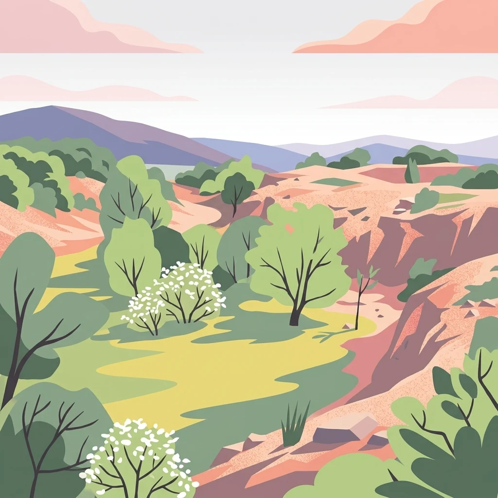
A stylized vector illustration showing a landscape with soft green meadows, scattered trees, and rocky, terracotta-colored hills under a pale sky with pink-hued clouds.

Auf den Hesseln bei Naumburg

Nature reserve

Park overview

Structured park overview, official facts, and landscape profile for Auf den Hesseln bei Naumburg

Auf den Hesseln bei Naumburg park facts, protected area profile, and essential visitor context

Review the core facts for Auf den Hesseln bei Naumburg, including designation, size, terrain, visitor scale, habitats, and operating context in one park-focused overview.

About Auf den Hesseln bei Naumburg

Auf den Hesseln bei Naumburg protects a compact but ecologically rich patch of calcareous landscape in the transition zone between the Habichtswald uplands and the surrounding agricultural lowland. Although small in size, the reserve captures several contrasting habitat types in immediate proximity to each other, which is the main reason for its conservation value.

The backbone of the site is a south- and east-exposed slope where centuries of grazing and mowing have produced species-rich limestone grassland. These open communities harbour a dense flora typical of Central European Kalkmagerrasen, including clustered bellflower, fringed gentians (both the common and the German fringed gentian), large-flowered self-heal, common thyme, bird's-foot trefoil, and scattered juniper bushes. The mosaic of short turf, taller herbaceous plants, and juniper clumps creates the structural variety that butterfly and reptile species depend on.

In the northern part of the reserve lies an abandoned mussel limestone quarry. Its exposed rock faces and a basin that once held seasonal water have historically provided breeding habitat for natterjack toad and common midwife toad, although changes in the basin's vegetation have reduced its suitability over time. The quarry therefore represents both a cultural heritage element and a fragile ecological feature that requires careful management.

The Ballenbach stream forms the third axis of the reserve. Its banks are lined by a narrow strip of grey alder, ash, and willow woodland classified as priority habitat type 91E0, softwood alluvial forest. While narrow, this riparian corridor introduces moisture-loving species such as stinging nettle, wood stitchwort, enchanter's nightshade, marsh sedge, and wood club-rush into an otherwise dry, sun-loving landscape. The contact zone between the dry grasslands and the wet woodland is one of the site's most distinctive features.

Quick facts and research context for Auf den Hesseln bei Naumburg

Auf den Hesseln bei Naumburg is a protected area of about 19.6 hectares located south of Naumburg in the Kassel district of Hesse. It was formally designated as a nature reserve on 23 January 1996 under the official number 1633040.

The site carries a dual protection status: it is simultaneously a German Naturschutzgebiet (NSG) and a Habitats Directive / Natura 2000 site, with the European designation 4721-302. Its geographical setting inside the Naturpark Habichtswald places it within one of Hesse's recognized landscape-scale conservation regions.

Protection and recognition

Documented terrestrial protection scope, boundary records, and Natura 2000 listings.

Auf den Hesseln bei Naumburg Protection Status and International Recognition Data

Terrestrial protection status records for Auf den Hesseln bei Naumburg outline the official boundaries and designation framework. Official documentation incorporates Natura 2000 data sources to map international recognition parameters and administrative scope.

International recognition

Protection details

Protection scope
Terrestrial
Transboundary protection
No
WDPA ID
162278
Park context

Deeper park guide and search-rich context for Auf den Hesseln bei Naumburg

Auf den Hesseln bei Naumburg history, landscape, wildlife, and travel context

Explore Auf den Hesseln bei Naumburg through its history, landscape character, ecosystems, wildlife, conservation priorities, cultural context, and seasonal travel timing in a structured park guide built for atlas discovery and search intent.

Why Auf den Hesseln bei Naumburg stands out

The reserve is primarily known for its calcareous dry grasslands (Kalkmagerrasen), especially the orchid- and gentian-rich communities on a sun-exposed south- and east-facing slope. It is also notable for the combination of dry grassland, scrub, and a short riparian corridor along the Ballenbach, plus a disused limestone quarry that adds further microhabitats for amphibians and specialized plants.
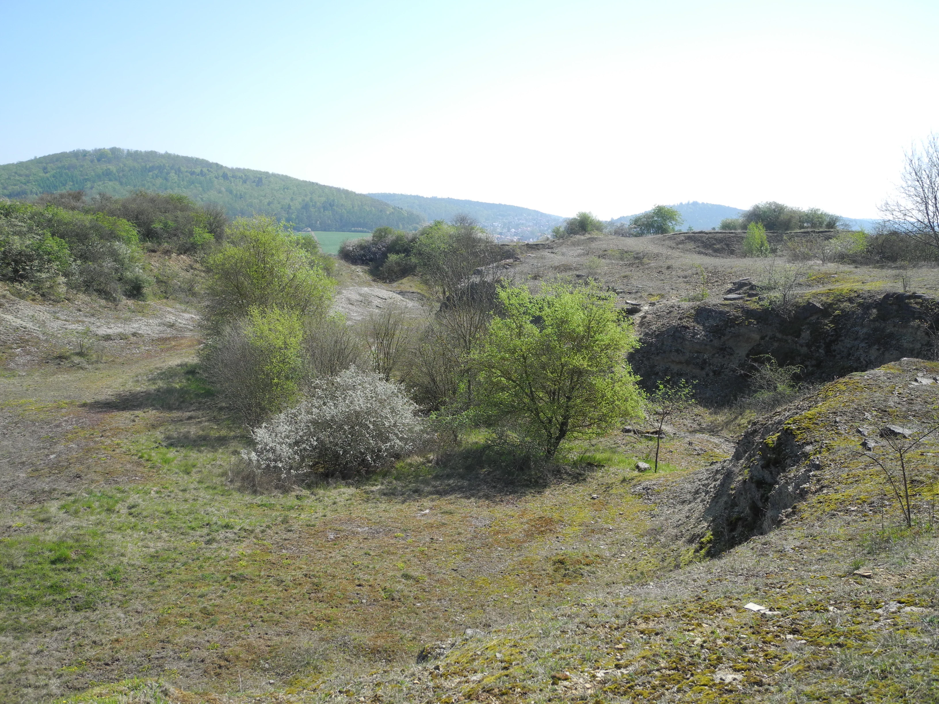
A slightly elevated view of a natural landscape with sparse green vegetation, scattered bushes, rocky patches, and forested rolling hills in the background.
A view of the landscape within the Auf den Hesseln bei Naumburg nature reserve, featuring open terrain, shrubs, and rocky outcrops.

Auf den Hesseln bei Naumburg history and protected-area timeline

The reserve's designation as a protected area is relatively recent in formal terms: it has been under nature protection since 23 January 1996, when the Hessian authorities recognized the area under the number 1633040. At the same time, the area was integrated into the European Natura 2000 network under the designation 4721-302, giving it both national and EU-level protection status.

The current character of the site, however, is the product of a much longer history of land use. The calcareous dry grasslands on the slope have been shaped by traditional grazing, particularly with sheep, supplemented by mowing for hay. This extensive, low-intensity management, maintained across generations, prevented forest encroachment and preserved the open conditions that allow calcicole plant communities to thrive.

A separate but related historical thread is the former limestone quarry in the northern part of the site, which records a phase of industrial extraction in an otherwise rural landscape. After extraction ended, the quarry was abandoned and gradually recolonized by vegetation, turning from a working site into a secondary habitat that now hosts specialized plant and amphibian communities. A 2008 baseline survey and a 2016 management plan produced by the Kassel regional council (Regierungspräsidium Kassel) provide the modern framework for ongoing conservation work.

Auf den Hesseln bei Naumburg landscape and geographic character

The reserve occupies a modest but sharply defined section of the landscape south-east of Naumburg, sitting at the southern fringe of the Habichtswald range of hills. Topographically, it is built around a slope that opens towards the south and east, providing the sunny conditions that calcareous grassland communities require.

Geologically, the substrate is dominated by Triassic mussel limestone (Muschelkalk), which is responsible both for the hillside topography and for the thin, base-rich soils that allow specialized lime-loving (calcicole) plants to flourish. The exposed quarry faces in the northern sector reveal this limestone directly and show how erosion of the soft bedrock has shaped the micro-relief of the site.

Water plays a comparatively limited but ecologically important role. The Ballenbach stream, a small lowland watercourse, cuts through the reserve and widens the habitat spectrum by introducing a narrow alluvial corridor of moist woodland. The combined effect of slope, geology, stream, and former quarry is a compact landscape in which dry, open, and moist shaded conditions sit within a short distance of one another, and that contrast is at the heart of the site's landscape character.

Auf den Hesseln bei Naumburg ecosystems, habitats, and plant life

The ecological identity of Auf den Hesseln bei Naumburg is defined by the close coexistence of calcareous grassland, juniper scrub, softwood alluvial forest, and lightly wooded quarry margins. The dry grasslands belong formally to EU habitat types 6110 (open calcicolous pioneer grasslands) and 6210 (semi-natural dry grasslands and scrubland facies on calcareous substrates). These are among the most species-rich habitat types in the European Union and are a strong focus of conservation effort across Hesse.

Openness is maintained by a combination of sheep grazing, which targets the finer-leaved and scrubby plants, and traditional mowing of the remaining meadows. Where management is less intense, the grassland grades into juniper-dominated scrub with patchy shrubs, a transition that supports both plant specialists and insects reliant on warm, sheltered microclimates.

Along the Ballenbach, a narrow gallery of grey alder, ash, and willow woodland corresponds to habitat type 91E0, softwood alluvial forest. Although physically confined, this strip introduces wetland- and moisture-loving species, such as marsh sedge, enchanter's nightshade, and woodland club-rush, into an otherwise dry habitat matrix and creates sharp ecological edges that benefit invertebrates and birds.

Auf den Hesseln bei Naumburg wildlife and species highlights

The wildlife interest of the reserve is strongly associated with its dry, flower-rich grasslands. The combination of varied vegetation structure and abundant nectar sources supports a notable community of butterflies, including species such as the greenish blue, marbled white, gatekeeper, and the small skipper-type species typical of fragmented limestone landscapes. The continued presence of these butterflies is closely tied to ongoing grazing and mowing, which keeps the sward open and floristically diverse.

Reptiles are represented by the lacerta lizard (Zauneidechse), which uses the warm, sunny edges between short turf and juniper scrub. The former quarry basin has historically been important for amphibians, although previously documented populations of natterjack toad and common midwife toad may have declined as the temporary pool became overgrown with rushes and lost suitability as breeding habitat.

Beyond these highlight groups, the diverse plant communities attract a wide range of pollinating insects, while the alluvial woodland along the Ballenbach supports a more typical small-stream fauna, including invertebrates that benefit from shaded, humid conditions and the leaf-litter of alder and ash.

Auf den Hesseln bei Naumburg conservation status and protection priorities

As both a German Naturschutzgebiet and an EU Natura 2000 (FFH) site, Auf den Hesseln bei Naumburg sits inside two overlapping conservation frameworks. The national designation protects the area against land-use change and damaging interventions, while the EU Habitats Directive status obliges the responsible authorities to maintain or restore the favourable conservation status of the listed habitat types and species.

The principal conservation targets are the 6110 and 6210 calcareous grassland habitat types, the 91E0 softwood alluvial forest along the Ballenbach, and the populations of characteristic species linked to these habitats, including butterflies and reptiles. Because almost the entire reserve is surrounded by farmland, its long-term survival depends on the continuation of traditional, low-intensity grazing and mowing, without which the open grasslands would rapidly revert to scrub and closed forest.

A 2008 baseline survey and a 2016 management plan produced by the Kassel regional council set out concrete measures to maintain open habitats, control encroachment, and, where possible, restore breeding conditions for amphibians in the quarry basin. These plans reflect a typical European approach to small, habitat-rich reserves: preserve what already exists through low-intensity management, and target limited restoration where specific features have deteriorated.

Auf den Hesseln bei Naumburg cultural meaning and human context

The cultural dimension of the reserve is closely tied to traditional rural land use. The sheep grazing that keeps the calcareous grasslands open is part of a centuries-old regional practice in Hesse, and the hay meadows embedded in the site reflect an older farming economy. Together, these activities have created a cultural landscape in which biodiversity and human use are mutually reinforcing rather than opposed.

The disused limestone quarry in the northern sector is a reminder of an earlier industrial period, when local extraction of building stone was economically important. Its abandonment and gradual ecological recovery illustrate a common trajectory in Central Europe, where former working sites have become secondary refuges for specialist species and are now valued primarily for their conservation interest rather than for their original economic function.

Top sights and standout views in Auf den Hesseln bei Naumburg

Auf den Hesseln bei Naumburg offers an unusually dense concentration of calcareous grassland habitats, softwood alluvial forest, and relict quarry features within just a few hectares. The juxtaposition of sunbaked limestone slope, juniper scrub, shaded Ballenbach woodland, and abandoned quarry gives the site strong habitat diversity despite its small size.

The botanical richness of the dry grasslands, with orchids, gentians, juniper, and a deep herb layer on a thin calcareous soil, is the reserve's most distinctive natural asset. The historical and ongoing importance of grazing and mowing for maintaining this richness, combined with formal protection at both national and EU level, makes the site a textbook example of how small, intensively managed grassland reserves can serve as reservoirs of characteristic Central European flora and fauna.

Best time to visit Auf den Hesseln bei Naumburg

Late spring through early autumn is the period when the calcareous grasslands show their richest expression, with flowering peaks typically occurring in late spring and early summer and a second wave of late-summer blooms extending the display into the warmer months. The butterfly fauna is generally most active on warm, sunny days during this window, when grazing pressure is low and the sward is most diverse.

Visiting in mid- to late summer also offers the best chance to see the structural contrast between flowering grassland, juniper, and riparian woodland at its sharpest. As with any small, ecologically sensitive reserve, visitors should stay on existing paths and avoid disturbing grazing animals or trampling the open sward.


Monthly climate preview

Long-term representative point measurements tracking monthly temperature and precipitation patterns

Auf den Hesseln bei Naumburg Climate Normals and Annual Temperature Rhythm

Historical data records the measured annual temperature and precipitation rhythm across twelve distinct monthly intervals for Auf den Hesseln bei Naumburg. Detailed monthly climate profiles provide full meteorological context for comparative geographic research.
Annual mean9 °C
-1 °C19 °C
Jan-1°
Feb
Mar
Apr
May12°
Jun16°
Jul19°
Aug18°
Sep14°
Oct
Nov
Dec
Warmest month
July

18.6 °C

Coolest month
January

-0.8 °C

Wettest month
July

2.5 mm/day

Driest month
April

1.4 mm/day

Park location guide

Geography guide, regional context, and park location map for Auf den Hesseln bei Naumburg

Auf den Hesseln bei Naumburg park geography, regions, and map view in Germany

Understand where Auf den Hesseln bei Naumburg sits in Germany through a broader geographic reading of the surrounding landscape, nearby location context, and its mapped position within the national park landscape.

How Auf den Hesseln bei Naumburg fits into Germany

Germany is a federal republic in Western and Central Europe with a population of over 83 million across sixteen constituent states. It is Europe's largest economy by nominal GDP and a major global exporter and importer. The capital is Berlin, and the country borders Denmark, Poland, Czech Republic, Austria, Switzerland, France, Luxembourg, Belgium, and the Netherlands.

Wider geography shaping Auf den Hesseln bei Naumburg in Germany

Germany is located in Western and Central Europe, spanning 357,022 km². It borders Denmark to the north, Poland and the Czech Republic to the east, Austria and Switzerland to the south, and France, Luxembourg, Belgium, and the Netherlands to the west. The country has coastlines on the Baltic Sea and North Sea to the north, with the Alps located in the southern region.

Map view of Auf den Hesseln bei Naumburg

Use this park location map to pinpoint Auf den Hesseln bei Naumburg in Germany, understand its exact geographic position, and read its mapped placement within the surrounding landscape more clearly.

Pigeon | © OpenStreetMap contributors

Location context for Auf den Hesseln bei Naumburg

Hesse

Visualizing limestone dry grasslands, quarry topography, and alluvial woodland habitats

Auf den Hesseln bei Naumburg Landscapes and Calcareous Grassland Scenery

Visual records capture the sun-exposed limestone slopes, juniper scrub, and rich calcareous grassland flora defining Auf den Hesseln bei Naumburg. Photographic documentation reveals the compact terrain contrasts between open dry habitats and the shaded Ballenbach stream corridor.

A slightly elevated view of a natural landscape with sparse green vegetation, scattered bushes, rocky patches, and forested rolling hills in the background.

Park atlas

Compare regional limestone grasslands and protected landscapes across northern Hesse.

Exploring Parks Near Auf den Hesseln bei Naumburg and Surrounding Protected Areas

Browse other protected areas and nature reserves located near Auf den Hesseln bei Naumburg in the surrounding region. Compare regional park geography and discover adjacent conservation landscapes to expand your field knowledge.
A minimalist watercolor painting of rolling hills and a stream, using soft greens, purples, and pale yellows on a white background.
Protected landscapeHesse
About 5.7 km away#1 closest

Southeast

Naturpark Habichtswald: Protected Landscape and Basalt Terrain Atlas in Northern Hesse

Exploration of forested ridges and medieval castle ruins.

Explore the geographic identity of Naturpark Habichtswald, a prominent protected landscape in northern Hesse. This record covers the park's volcanic basalt hills, broad wooded ridges, and the diverse historical ruins that define its unique topographic character across the Habichtswälder Bergland.

Area
474.28 km²
Established
1962
Relief
Mountain
Climate
Temperate
A horizontal watercolor painting depicting a calm wetland landscape with soft green trees, grassy banks, and rolling hills in the background.
Nature reserveHesse
About 7.7 km away#2 closest

North

Glockenborn bei Bründersen Nature Reserve: Regional Geography and Wetland Protected Areas

A mapped overview of wetland terrain in northern Hesse

Glockenborn bei Bründersen offers a focused look at how managed wetlands integrate into the agricultural landscape of northern Hesse. Known for its distinct shallow lakes and bird-rich environments, this nature reserve serves as an essential case study in ecological restoration and the maintenance of open grazing lands within a protected boundary.

Area
0.07 km²
Established
2004
Watercolor painting showing a landscape with hills, forest, and a body of water
National parkHesse
8.2 km away#3 closest

Southwest

Kellerwald-Edersee National Park: Hesse's Protected Landscape Exploration

Mapped boundaries and geographic context for this German national park.

Navigate the protected landscape of Kellerwald-Edersee National Park, a key national park situated in the German state of Hesse. This atlas entry focuses on its precise geographic definition, mapped terrain features, and the broader regional context it occupies within central Germany. Gain structured insights into the park's conservation significance and its place in the mapped landscape.

Area
76.88 km²
Established
2004
IUCN
II
Relief
Highland
Watercolor painting of a soft, rolling landscape with green fields, distant hills, and low foreground vegetation.
Protected areaGermany
9.4 km away#4 closest

Northeast

Langenberger Huete bei Breitenbach: Mapped Geography and Protected Area Landscape Context

Nature reserve terrain and grassland boundaries in northern Hesse

Examine the geographic layout of Langenberger Huete bei Breitenbach, a protected dry grassland area near Schauenburg, Germany. This site preserves open meadow habitats along the forested Langenberg ridge, offering insight into traditional land use and small-scale conservation within the Habichtswald region. Access detailed boundary data and terrain information to understand its position within the surrounding agricultural and woodland zones.

Area
0.14 km²
Established
1992
Relief
Upland
Climate
Temperate
A soft watercolor painting depicting rolling green hills against a faint, light-colored background.
Nature reserveHessen
11 km away#5 closest

North

Festberg bei Philippinenthal Nature Reserve: Geography and Protected Landscape Context

A rare calcareous grassland ecosystem in northern Hessen.

Festberg bei Philippinenthal encompasses a ridge of tilted Muschelkalk limestone rising above the Lohbach stream in Hessen. This nature reserve protects a vital combination of juniper heath, dry calcareous grassland, and small-scale forest habitats maintained by historic and modern conservation grazing, offering a clear example of local geology shaping biodiversity.

Area
0.143 km²
Established
1992
IUCN
IV
Nature reserveHessen
About 12 km away#6 closest

North

Dörneberg bei Viesebeck: Protected Calcareous Grassland and Beech Forest in Hessen

Mapped nature reserve and orchid-rich protected landscape in northern Hessen.

Located in the Hessen region of Germany, Dörneberg bei Viesebeck is a carefully managed nature reserve characterized by its thin, lime-rich soils and diverse habitat mosaic. The reserve preserves rare calcareous dry grasslands, historical quarry features, and orchid-bearing beech woodlands. As part of a protected Natura 2000 site, it offers a condensed look at the ecologically significant limestone landscapes found within northern Hessen.

Area
0.256 km²
Established
1982
Watercolor painting of a rolling forested landscape with distant hills under a soft light.
Nature reserveHesse
About 14 km away#7 closest

Northeast

Erlebach bei Ehlen Nature Reserve: Protected Terrain and Brook Valley Geography in Hesse

Mapped beech forest mosaic and riparian habitat corridors

Located in the Hoher Habichtswald, Erlebach bei Ehlen preserves a distinctive transition between mature beech forest and open grassland valley. This nature reserve serves as an essential case study for understanding riparian ecology, stream-side woodland distribution, and habitat connectivity within the regional topography of Hesse, Germany.

Area
0.342 km²
Established
1996
A watercolor painting in soft pastel tones showing a winding river or path flanked by small clusters of green trees, with gently rolling hills in the background against a white backdrop.
Nature reserveKassel
17 km away#8 closest

East

Dönche Nature Reserve: Investigating the Protected Landscapes and Urban Geography of Kassel

Exploring the historic grassland and wetland mosaic in northern Hesse

Dönche serves as a primary example of an inner-city nature reserve in Germany, preserving 170 hectares of open countryside within the Kassel urban fabric. Its landscape is shaped by the Dönchebach and Krebsbach streams, forming a rhythmic structure of ponds, beech wood pastures, and tall herb communities that offer a deep look into regional ecology and historical land use.

Area
1.709 km²
Established
1983
Water
Minor water

Common questions about visiting, size, designation, and location context for Auf den Hesseln bei Naumburg

Auf den Hesseln bei Naumburg FAQs for park facts, access, geography, and protected area context

Find quick answers about Auf den Hesseln bei Naumburg, including protected-area facts, park geography, trail and visitor context, and how the park fits into its surrounding country and regional landscape.
MoriAtlas Explorer

Continue Your Protected Areas Search Across the Global Atlas

Deepen your exploration by continuing the structured search for national parks and protected areas worldwide. Utilize the comprehensive filtering capabilities to compare different conservation landscapes and refine your understanding of global park geography. Discover more about the distribution and characteristics of protected natural areas.

Global natural geography