
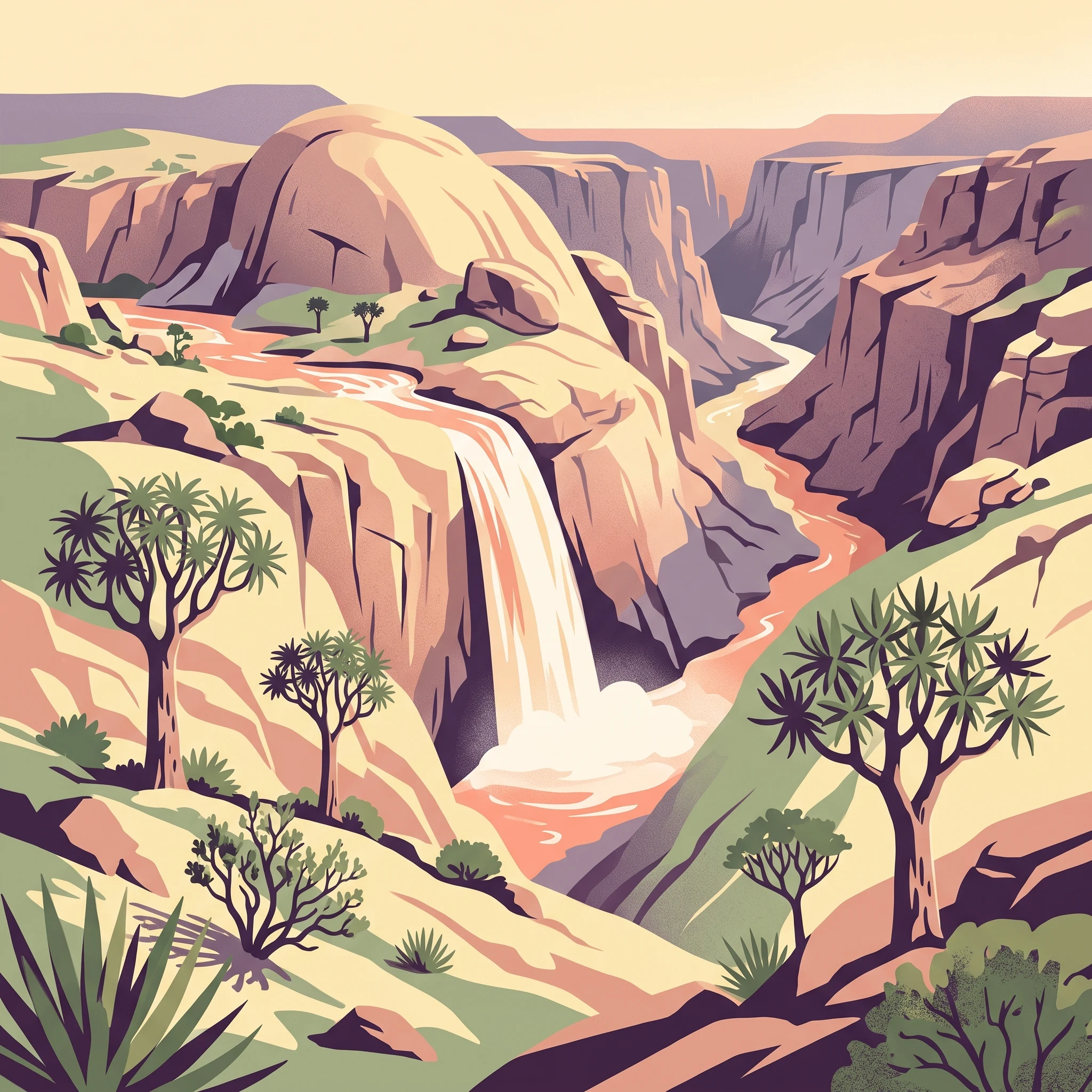
Visitor Planning
When Is the Best Time to Visit Augrabies Falls National Park?
Determining the best time to visit Augrabies Falls National Park involves a primary trade-off between experiencing the dramatic power of the Orange River and navigating the intense heat of the Northern Cape summer. Because the park is situated within an arid environment, there is no single month that perfectly balances all conditions for every type of traveller. Instead, the timing of your visit should be dictated by whether you prioritize the spectacular flow of the falls or more moderate temperatures suitable for extended outdoor exploration.
The Seasonal Heat Trade-off
Temperature extremes are the most significant factor influencing your visit. During the summer months, spanning December through February, daytime temperatures regularly climb above 40 degrees Celsius. While this period can coincide with seasonal rains that significantly increase the volume of the Orange River as it plunges into the granite gorge, the heat makes rigorous physical activity like hiking or walking long distances to various viewpoints difficult and potentially unsafe. Visitors planning a trip during these months should expect limited daytime excursion capacity and should focus on early morning or late afternoon activities, taking full advantage of the cooler nocturnal hours.
Prioritizing Water Flow and Landscape Contrast
For many, the primary draw is the visual spectacle of the waterfall itself. The flow of the Orange River is highly seasonal, with peak volumes often following regional rainfall patterns. Visitors seeking to see the falls at their most powerful must accept the trade-off of high heat, as these wet periods generally occur during the hottest months of the year. If you prefer a quieter experience where the landscape, including the distinctive quiver trees and the expansive Moon Rock formation, takes precedence over the sheer volume of the water, cooler months offer a more hospitable climate. From May through August, daytime temperatures are much milder, often dropping near freezing at night, which creates a sharp, dry environment that is excellent for photography and walking, though the river may be reduced to a more modest, albeit still scenic, flow.
Understanding the Desert Climate Influence
Augrabies Falls National Park sits at an elevation of nearly 800 meters, which contributes to substantial daily temperature fluctuations. Regardless of the time of year, travellers should prepare for significant cooling after sunset. The park's arid character means that humidity remains generally low, which can make the midday heat feel more intense when combined with the lack of natural shade in the gorge area. Because the park is defined by its deep granite landscape, there is very little buffer against the sun, making your choice of season the most critical step in ensuring comfort and accessibility during your visit.
Seasonal Planning
Best Months to Visit Augrabies Falls National Park for Specific Interests
Peak Flow Spectacle: Late Summer to Early Autumn
Visitors prioritising the visual impact of the falls should look toward the period between February and April. This window follows the primary rainfall months, which often results in increased discharge through the Orange River. While the heat remains intense during February, with average maximums frequently exceeding 40°C, the water volume provides a dynamic contrast to the arid granite gorge. The primary trade-off during this period is the extreme ambient temperature, which can make extended hiking or prolonged exposure during mid-day hours physically demanding. Travellers visiting during this window benefit from the reduced risk of rain showers compared to the wetter months, but they must plan their outdoor activities around the cooler early morning or late afternoon hours to manage the desert heat.
The Cool-Weather Hiking Window: May to August
For those focused on exploring the park's network of trails, geological landmarks like Moon Rock, and the arid shrubland, the period from May through August offers the most temperate conditions. Average daytime maximums drop significantly, hovering in the mid-20s°C, creating a comfortable environment for walking that is unavailable during the height of the summer. Nighttime temperatures in June and July frequently approach or fall below freezing, necessitating appropriate gear for camping or early starts. The trade-off for these mild, dry days is the decreased intensity of the falls, as river flow typically diminishes during the winter months. This period is ideal for photography of the desert flora, particularly the quiver trees, which stand out sharply against the clear, cool skies characteristic of the Northern Cape winter.
Spring Transition: September to November
September through November marks a transitional phase where daytime temperatures begin to climb back toward their summer highs. This period serves as a compromise for visitors seeking a balance between the mild winter temperatures and the encroaching summer heat. By October, maximum temperatures typically rise into the upper 30s°C, and by November, they often return to levels comparable to mid-summer. This window is particularly well-suited for birdwatching and observing wildlife activity in the transition period before the heat becomes a major limiting factor for movement. Visitors in this window should expect a gradual warming trend and should remain flexible with their outdoor schedules as the sun’s intensity increases daily. The lack of significant rainfall during these months ensures consistent access to trails, although the river levels will continue to reflect the preceding seasonal cycles until the summer rains commence.
Annual Climate Overview
Temperature, Precipitation, and Daylight at Augrabies Falls National Park
Understanding the Arid Climate Cycle
The climate at Augrabies Falls National Park is dictated by its position within the Nama-Karoo biome, characterized by high-intensity heat and limited precipitation. Long-term climate normals indicate a distinct annual cycle where extreme summer temperatures dominate the experience, while winter offers a stark, cold transition that fundamentally alters how visitors interact with the terrain. These measurements reflect regional conditions at an elevation of approximately 800 meters and should be interpreted as general patterns rather than precise daily forecasts for your specific travel dates.
Summer Heat and Atmospheric Intensity
The period from November through March marks the peak of the park's thermal intensity. Daytime maximums regularly climb above 40 degrees Celsius during December and January. This phase is defined by more than just heat; it represents the most active meteorological period for the Orange River, as regional summer rainfall contributes to increased flow at the falls. Humidity levels remain relatively low, typically dipping below 30 percent during the height of the summer heat. While the increased water volume creates a spectacular visual, the accompanying high temperatures place a significant constraint on outdoor activity duration and physical exertion. Visitors often find that the intense solar radiation during these months makes midday exploration of the exposed granite gorges challenging.
The Shift Toward Cool Winter Conditions
A notable decline in both temperature and daylight occurs from April, leading into the heart of winter during June and July. During these months, the daily temperature range becomes the defining feature of the park's climate. While daytime maximums remain pleasant, often averaging in the mid-20s Celsius, the nighttime minimums can approach or drop below the freezing point. This shift is critical for those planning extended stays, as the lack of humidity during winter months causes temperatures to plummet rapidly once the sun sets. The total daylight hours also reach their lowest point in June, providing roughly 10 hours of natural light, which is significantly less than the 13.8 hours experienced in December.
Wind, Daylight, and Precipitation Patterns
Wind patterns at Augrabies show a consistent year-round presence, with average speeds typically fluctuating between 3.7 and 4.5 meters per second. This air movement can exacerbate the perception of temperature, especially during the cold winter nights. Rainfall is minimal and highly sporadic throughout the year, with averages rarely exceeding 1 millimeter per day even in the wettest months. Because precipitation is so low, the park does not experience a traditional rainy season in the sense of prolonged storms; instead, visitors should expect long stretches of clear, dry weather. The primary meteorological variation remains the tension between the extreme solar heat of the summer months and the crisp, high-contrast environment of the winter period. Always consult current meteorological reports for precise, localized conditions before entering the park, as the arid landscape responds rapidly to changing atmospheric pressure and wind shifts.
Seasonal dynamics
Understanding seasonal weather patterns and transitions at Augrabies Falls
Augrabies Falls National Park does not conform to the conventional four-season model found in temperate climates. Instead, the park functions through two primary atmospheric phases driven by the intense heat of the Northern Cape and the cooling influence of winter air. Visitors should view the annual rhythm as a transition between a summer of extreme, dry heat and a winter of stark, clear, and manageable temperatures.
The Summer Heat and Arid Intensity
From December through March, the park enters its most intense phase. Daytime temperatures frequently push well above 40°C, creating an environment where heat stress is a genuine factor for any outdoor activity. This period is characterized by very low humidity and high solar radiation, which can make midday hiking on the exposed granite surfaces particularly demanding. While this is the season when the Orange River is most likely to experience surges,often following rains that fall well outside the park boundaries,the environmental reality remains one of arid dominance. During these months, the heat defines the visiting experience, limiting active exploration to the very early mornings or late evenings and necessitating careful hydration and sun protection for all visitors.
The Winter Cooling Period
As April gives way to May, the park undergoes a noticeable transformation. The average daily highs shift from the 30s into the 20s, and the biting heat of the summer months retreats. June and July represent the core of this cooling phase, where overnight temperatures can dip near or below freezing. This period is the most stable time of the year, marked by consistently clear skies and a lack of precipitation. The cooling trend allows for extended daytime exploration, as the granite domes and gorge trails become accessible without the extreme risks associated with the summer sun. Visitors will find that the desert landscape feels more approachable, though the river flow during these months is typically at its lowest annual volume, reflecting the lack of recent, significant inland rains.
Navigating the Transitional Windows
The months of April and October serve as essential transition periods that bridge the extremes. April is often the most comfortable month, as the transition from the peak summer heat to the winter chill is in progress, typically resulting in moderate daytime temperatures that allow for a wider variety of activities. October represents the reverse shift; the environment begins to warm significantly as the days grow longer, yet it frequently avoids the sustained, extreme heat peaks found in December and January. These transitional windows are not defined by rain or blooming cycles but by the steady recalibration of temperatures. For planners, these months offer a reliable middle ground, yet they require an awareness that the weather can fluctuate as the park moves between its two dominant states of dry, intense heat and clear, crisp coolness.
Seasonal Experiences
Seasonal Experiences and Landscapes in Augrabies Falls National Park
Balancing Activity Intensity with Seasonal Heat
The landscape of the park, characterized by the Nama-Karoo semi-desert and the granite gorge of the Orange River, dictates the timing for active exploration. Because the park features extreme maximum temperatures that frequently exceed 40 degrees Celsius during the summer months from December to February, physically demanding activities are often physically restricted or discouraged. The 3-day Klipspringer hiking trail, a premier experience for those seeking deep immersion in the arid terrain, is intentionally closed during the summer period to protect visitors from severe heat exposure. Visitors planning to undertake significant walking routes should prioritize the cooler winter months between May and August, when daytime temperatures are significantly more manageable for outdoor exertion.
Viewing the Waterfall and River Landscapes
The experience of the Augrabies Falls changes fundamentally based on river volume. While the waterfall is a perennial feature, its visual impact is tied to the flow of the Orange River. Peak flow typically follows the arrival of seasonal rains, often occurring in the late summer or early autumn period. Travelers aiming to witness the falls when the water is most powerful should note that this experience often coincides with higher temperatures and the potential for increased humidity. Conversely, during the winter months, the flow may settle into a more moderate cascade, which some visitors find provides a clearer view of the deep, eroded granite gorge and the intricate rock formations that define the canyon downstream.
Geological and Flora Sightseeing
Geological landmarks such as Moon Rock remain accessible throughout the year, but the experience of visiting them is highly dependent on the time of day and the season. In the winter months, the moderate daylight temperatures allow for longer exploration of the granite dome without the intense solar radiation found in summer. The quiver tree, or kokerboom, serves as a focal point for photography and natural observation. These trees provide a unique seasonal display when they flower, an event that attracts local birdlife and baboons. Visitors interested in the interaction between the park flora and the local fauna may find the cooler transition months offer a quieter environment for observation, as the wildlife remains active across the landscape.
Night Drives and Nocturnal Activity
The park offers night drives that provide an entirely different perspective on the arid environment. Because the desert floor can cool down rapidly once the sun sets, these drives can be pleasant even in months when the daytime heat is challenging. The park also maintains illumination for the falls until 10 pm, offering a spectacular, cool-weather opportunity to see the water cascade after dark. This provides a clear experience-based advantage for visiting during periods when the intense heat makes midday exploration difficult, as it shifts the primary activity windows toward the early morning and evening hours.
Travel Priorities
Optimizing Your Augrabies Falls National Park Visit Based on Interests
Prioritizing Milder Temperatures for Active Exploration
If your primary goal is to engage in longer hikes or spend significant time moving across the arid terrain of the park, the cooler winter months between May and August represent the most viable window. During this period, the average daily maximum temperatures remain in the range of 26°C to 31°C, a stark improvement over the intense heat that defines the summer months. The significantly lower humidity, often sitting between 38% and 45%, combined with winter's predictable, cooler daily minimums, creates a more forgiving environment for physical exertion. While mid-winter mornings can be exceptionally cold, often reaching freezing temperatures, the warming trend throughout the day allows for a comfortable midday and afternoon period that is rarely possible from December through March.
Witnessing Maximum River Flow
For those drawn primarily to the visual power of the Augrabies Falls, the decision requires balancing spectacle against comfort. Peak river volume typically coincides with the late summer and early autumn months, often following seasonal rainfall patterns elsewhere in the catchment area. While the sight of the Orange River at full capacity is a highlight for many visitors, this often necessitates being in the park during periods where maximum daily temperatures frequently exceed 39°C. If you choose to prioritize the waterfall's peak output during this hotter window, it is essential to plan all outdoor observation and activity for the early morning or late evening hours. The park's infrastructure, such as lighted lookout points, is designed to accommodate this by allowing for safer, more comfortable viewing after the sun has set.
Maximizing Daylight for Sightseeing
Visitors who prefer longer days for photography or general sightseeing should look toward the summer months, specifically November through January, when daylight hours extend up to 13.8 hours. This increase in sunlit hours provides a larger window for navigating the park's granite domes and geological landmarks, such as Moon Rock, during the cooler segments of the day. However, this comes with the trade-off of the most extreme heat of the year, with average monthly maximums reaching their peak in January. If you prioritize daylight duration, you must accept that the heat intensity will strictly dictate your ability to remain outdoors. In contrast, the winter months, while cooler and more suitable for extended activity, offer shorter days of approximately 10 hours, which reduces the time available for photography or exploration between dawn and dusk.
Logistics and Access
Seasonal Access and Operational Planning for Augrabies Falls National Park
Navigating Access and Road Infrastructure
Access to the park is primarily managed via the town of Upington, which serves as the regional hub for travelers. The main road entry involves a drive of approximately 120 kilometers from Upington Airport. While the primary access routes are well-established, visitors should be aware that the quality of roads can vary. Driving routes from major cities like Cape Town often include significant stretches of road that may transition from asphalt to secondary or dirt surfaces. Before finalizing your travel itinerary, you must consult official South African National Parks (SANParks) communication channels to confirm the current state of regional road networks and local weather alerts, as seasonal events can influence road conditions in the Northern Cape.
Operational Status and Park Infrastructure
Augrabies Falls National Park operates year-round, but specific facilities, guided excursions, and service availability are subject to change. The park structure supports both self-drive exploration and organized activities like nocturnal game drives, which are popular for observing wildlife during the cooler hours of the night. However, do not assume that all activities are available on a daily basis. The scheduling of guided tours and the operational status of internal park facilities are managed based on current demand and park management requirements. Always check the official park website or contact the camp office directly to verify opening times, guided activity schedules, and the availability of amenities during your planned dates of travel.
Permits and Entry Requirements
Standard park entry requires the payment of conservation fees, which contribute to the ongoing management of this arid protected area. For international visitors, these fees differ from local rates, and it is essential to verify current fee structures on the official SANParks portal before your departure. If your visit involves specific activities that require additional permits or if you are planning to book accommodation within the park, these reservations should be secured well in advance. During periods of high visitation, such as South African school holidays or long weekends, accommodation and activity slots can fill up rapidly. Always confirm booking requirements and permit processes through the official entity to ensure your entry and stay comply with current park regulations. The park does not manage external transport such as shuttles from regional airports, so visitors should arrange independent vehicle hire or private transfers prior to arrival.
Safety and Preparation
Seasonal Weather Safety and Preparation for Augrabies Falls National Park
Navigating Extreme Temperature Fluctuations
The most critical aspect of physical preparation at this park is the significant range in daily and seasonal temperatures. During the intense summer months, maximum daily temperatures regularly exceed 40 degrees Celsius. This environment demands that all outdoor activity be front-loaded into the earliest hours of the day. Because the terrain is exposed with limited natural shade, the heat index is high, and visitors must plan to be back at their accommodation or in the air-conditioned visitor center well before the hottest period of the afternoon. Conversely, winter nights can drop to near freezing, requiring layers that allow for rapid adjustments. A thermal base layer is often necessary for sunrise excursions or early morning game drives, while lighter, breathable fabrics are required as the sun rises and temperatures climb quickly throughout the morning.
Protective Measures for Arid Environments
The arid landscape of the Northern Cape requires specific attention to sun exposure and dehydration risk, even during cooler months. Ultraviolet exposure remains high year-round due to the park's latitude and clear skies. Regardless of the season, protecting your skin and eyes from persistent, direct sunlight is essential. Furthermore, the dryness of the air can be deceptive, as it causes perspiration to evaporate almost instantly, which often masks how much fluid your body is actually losing. Regularly monitoring your physical comfort and prioritizing shaded resting points during midday, even if you feel comfortable in the breeze, is a key safety practice. Always check for local alerts or park-specific warnings regarding extreme heat advisories, as these can significantly alter safe travel times.
Wildlife Awareness and Trail Safety
When walking or hiking within the park, remaining aware of your surroundings is a vital part of personal safety. While the landscape is rugged and grand, it is also home to diverse local wildlife that requires respectful distance. Baboons and vervet monkeys, in particular, are common near visitor areas and may be attracted to food. Securing all food supplies and keeping windows closed when leaving your vehicle or cottage is essential to prevent unwanted encounters. Additionally, the park's rocky terrain, which includes features like the Moon Rock, serves as a habitat for scorpions and various snake species. While these are rarely encountered if you stay on established trails, it is important to be mindful of where you step and place your hands. Always shake out shoes or clothing left on a porch or near the ground before use. Please verify the latest park safety guidelines and wildlife reports from official SANParks resources before beginning any hike, as guidance on specific trail conditions or wildlife activity can change based on recent park observations.
Final Planning
How to Choose the Best Time for Your Augrabies Falls Visit
Balancing Thermal Tolerance and River Intensity
The final decision on when to visit Augrabies Falls rests on your personal threshold for arid heat versus your desire to witness the Orange River at its most thunderous capacity. Because the park experiences significant climatic shifts throughout the year, the most successful visits are those that align your primary interests with the physical reality of the Northern Cape environment. If your priority is active exploration of the gorge and the granite landscape, the cooler months from May through August provide the essential thermal window to conduct physical activities safely and comfortably. These months offer lower daily maximums and more manageable conditions, making them ideal for hiking the trails or visiting geological features like Moon Rock without the risks posed by the extreme summer temperatures.
Conversely, if your primary goal is to view the waterfall during its period of peak power, the late summer and early autumn months offer the greatest likelihood of seeing the river in flood. This period requires a deliberate trade-off, as you must be prepared to navigate temperatures that frequently exceed 40 degrees Celsius. Visitors choosing this window are often rewarded with the sight of the river at its most dramatic volume, but they must accept that physical exertion during daylight hours is ill-advised. In these warmer months, planning must shift to early morning or late afternoon activities, utilizing air-conditioned accommodation to survive the heat of the midday sun.
Establishing Your Priorities
To finalize your travel dates, evaluate your trip through the lens of your specific expectations. If you are indifferent to the intensity of the waterfall but prioritize long days of exploring the park trails, targeting the late autumn or winter period is the most logical choice. These months minimize heat-related health risks and maximize the amount of time you can spend outdoors. However, if the visual spectacle of the falls is the central motivation for your journey, you may find the summer months more satisfying despite the arid heat. In all cases, remember that the monthly climate normals provided throughout this guide reflect long-term averages rather than precise forecasts. Before finalizing your booking, consult current official weather reports, park alerts, and SANParks operational updates to ensure that road conditions, facility availability, and safety warnings align with your planned dates.