Mori Atlas logo
National parkAugrabies Falls National Park

Discover the mapped geography and protected landscape of Augrabies Falls National Park.

Augrabies Falls National Park: South Africa's Dramatic Waterfall National Park in Northern Cape

Augrabies Falls National Park represents a significant protected area within South Africa's Northern Cape Province, celebrated for its powerful Orange River waterfall cascading into a deeply eroded granite gorge. This national park offers a unique glimpse into the stark beauty of the Nama-Karoo semi-desert, defined by its dramatic geological formations, including the iconic Moon Rock and striking quiver trees. Users can explore the park's mapped boundaries and understand its place within the regional geography, experiencing a landscape shaped by arid conditions and the powerful flow of the Orange River.

waterfallOrange Riversemi-desertgranite gorgeNama-Karooriparian ecosystem

Augrabies Falls National Park

National park

Park overview

Structured park overview, official facts, and landscape profile for Augrabies Falls National Park

Augrabies Falls National Park park facts, protected area profile, and essential visitor context

Review the core facts for Augrabies Falls National Park, including designation, size, terrain, visitor scale, habitats, and operating context in one park-focused overview.

About Augrabies Falls National Park

Augrabies Falls National Park occupies a unique position in South Africa's protected area network as an example of riparian ecosystems thriving within an otherwise arid continental interior. The park's defining feature is the waterfall where the Orange River, the region's major watercourse flowing from the Lesotho Highlands to the Atlantic Ocean, descends abruptly over a granite shelf in a region of minimal rainfall. The resulting gorge represents millions of years of erosional work, exposing ancient crystalline basement rocks and creating a deep incision through the surrounding Karoo landscape. The Orange River corridor provides critical habitat in this parched environment, supporting vegetation communities that would otherwise be impossible in the surrounding semi-desert. The park offers visitors access to this dramatic landscape through a network of trails including the Dassie Trail, a 5-kilometer route, and the Klipspringer Trail, a more extensive 3-day hike covering 14.4 kilometers. Night drives during peak season allow visitors to experience the nocturnal wildlife activity patterns characteristic of this environment.

Quick facts and research context for Augrabies Falls National Park

Augrabies Falls National Park lies in the Northern Cape Province, roughly 120 kilometers west of Upington along the Orange River. Established in 1966, the park encompasses 820 square kilometers of semi-desert Karoo terrain surrounding a dramatic 60-meter waterfall. The granite gorge below the falls reaches depths of about 240 meters and stretches for 18 kilometers, showcasing powerful erosion processes into ancient basement rock. The region experiences extremely hot summers and mild winters, with the rainy season concentrated between January and April.

Protection and recognition

Documenting the terrestrial designation history and conservation framework established in 1966

Augrabies Falls National Park Protection Status and Protected Area History

Explorers can trace the official terrestrial protection status and designated boundaries of Augrabies Falls National Park. Documenting the 1966 establishment year and regional management scope provides essential geographic context for South African conservation areas.

Protection details

Protection scope
Terrestrial
Designated year
1966
Transboundary protection
No
Park context

Deeper park guide and search-rich context for Augrabies Falls National Park

Augrabies Falls National Park history, landscape, wildlife, and travel context

Explore Augrabies Falls National Park through its history, landscape character, ecosystems, wildlife, conservation priorities, cultural context, and seasonal travel timing in a structured park guide built for atlas discovery and search intent.

Why Augrabies Falls National Park stands out

The park is most renowned for the Augrabies Falls themselves, a thundering cascade that achieves particular majesty during flood periods when the Orange River swells with seasonal rains. Beyond the waterfall, the park is celebrated for its starkly beautiful semi-desert landscape of granite domes, deep gorges, and sparse but distinctive vegetation adapted to extreme aridity. The iconic quiver tree, a giant aloe reaching five meters in height, dominates the scenery with its striking silhouette, while the remarkable Moon Rock formation, an enormous exfoliation dome measuring approximately 700 meters in length, stands as a geological landmark within the park.

Augrabies Falls National Park history and protected-area timeline

The area has deep human heritage extending back to the Khoekhoe peoples who originally inhabited the region and gave the waterfall its evocative Khoikhoi name Ankoerebis, translating to the place of great noise, a reference to the thunderous sound of water crashing over the falls. The Khoekhoe and San communities constructed distinctive domed huts known as matjiehuise, mat houses, engineered to adapt to the extreme temperature variations of the desert environment. These traditional structures utilize plant stems that contract in heat to create cooling ventilation gaps and expand in cold weather to seal out chill. Following the arrival of Trekboer settlers in the region, the name evolved into Augrabies, with occasional spelling as Aughrabies. The park was formally established in 1966, creating the protected area that safeguards this remarkable desert waterfall and its surrounding ecosystem.

Augrabies Falls National Park landscape and geographic character

The park showcases a distinctive semi-desert landscape characteristic of the Nama-Karoo biome, dominated by vast open spaces of rocky terrain interspersed with sparse vegetation. The granite basement rock forms prominent features throughout the park, from the dramatic waterfall ledge to the impressive Moon Rock, a massive rounded exfoliation dome rising about 30 meters high and extending roughly 700 meters in length. The deeply incised gorge below the falls provides the most dramatic topographic relief, with sheer rock walls descending to the river below. The Orange River corridor creates a linear oasis through the otherwise arid terrain, with riverine vegetation contrasting sharply against the surrounding Karoo plains. The landscape achieves particular intensity during flood seasons when the falls become a powerful torrent, and the gorge carries the immense volume of water downstream.

Augrabies Falls National Park ecosystems, habitats, and plant life

The park's ecological character is defined by the tension between extreme aridity and the life-giving presence of the Orange River. The Nama-Karoo environment supports specialized vegetation adapted to high temperatures, low rainfall, and nutrient-poor soils. The quiver tree, Aloidendron dichotomum, stands as the park's most characteristic plant, reaching heights of up to five meters with its distinctive branching pattern. This remarkable aloe gets its name from the traditional use of its soft branches by San people to make quivers for their arrows. During winter flowering, the trees attract numerous bird species seeking nectar, while baboons are commonly observed feeding on the flowers. The shepherd's tree represents another culturally significant species, held in reverence by local Khoikhoi and San communities who traditionally forbade its destruction.

Augrabies Falls National Park wildlife and species highlights

Despite the harsh environment, Augrabies Falls National Park supports a surprising diversity of wildlife adapted to semi-desert conditions. Large mammals include springbok, gemsbok, and the endangered south-central black rhinoceros, the latter representing a significant conservation priority for the park. Smaller predators such as the black-backed jackal, caracal, bat-eared fox, and African wildcat inhabit the rocky terrain, while the Cape clawless otter maintains populations along the Orange River. The river also supports the Nile monitor, Africa's largest lizard species, while birdlife includes both double-banded and Namaqua sandgrouse. The park's 28,000 hectares provide crucial habitat for these species within the broader arid landscape.

Augrabies Falls National Park conservation status and protection priorities

The park plays a vital role in protecting both the unique waterfall ecosystem and the surrounding semi-desert environment of the Nama-Karoo biome. Conservation efforts focus on maintaining viable populations of the endangered south-central black rhinoceros alongside other species characteristic of this arid environment. The riparian corridor along the Orange River represents a critical conservation asset, preserving biodiversity in an otherwise harsh landscape. The protection of the granite gorge and surrounding terrain also safeguards geological features of scientific and scenic significance.

Augrabies Falls National Park cultural meaning and human context

The park encompasses cultural heritage of the indigenous Khoekhoe and San peoples who historically inhabited this region. The original Khoekhoe name for the waterfall, Ankoerebis meaning place of great noise, reflects the powerful impression the falls made on these communities. Traditional dome-shaped matjiehuise buildings constructed by these peoples demonstrate sophisticated adaptation to the extreme temperature variations of the desert environment. Local legend speaks of alluvial diamond deposits along the Orange River, with folklore suggesting that the largest cache of diamonds in the world lies within the swirl-holes eroded into the granite at the base of the falls.

Top sights and standout views in Augrabies Falls National Park

The thundering Augrabies Falls themselves represent the park's primary attraction, particularly impressive during flood periods when the Orange River swells with seasonal rains. The deep granite gorge extending 18 kilometers downstream offers one of the most dramatic canyon landscapes in South Africa. Moon Rock provides an accessible geological landmark, its massive exfoliated dome visible from within the park. The distinctive silhouette of quiver trees against the arid landscape has become emblematic of the Northern Cape environment. The night drives offer opportunities to experience the park's wildlife in the nocturnal hours when many species become active.

Best time to visit Augrabies Falls National Park

The park can be visited throughout the year, though the experience varies significantly with seasons. The rainy season from January to April brings the Orange River to higher levels, making the falls more impressive but also potentially affecting some access routes. The winter months from May to August offer milder daytime temperatures more comfortable for hiking, while summer temperatures can be extremely hot. The best overall conditions for most visitors typically occur during the cooler dry season months when daytime temperatures are moderate and wildlife viewing along the river corridor remains productive.
Park guides

Targeted planning resources addressing key questions on seasonal timing and river flows

Augrabies Falls National Park Published Guides and Focused Research Material

Selected reference materials offer structured insights into the protected area's distinct environmental patterns and arid terrain dynamics. Publications examine critical timing considerations for evaluating cooler hiking conditions alongside peak summer river volumes.
Monthly climate preview

Long-term temperature averages and monthly precipitation profiles in the arid Orange River gorge

Augrabies Falls National Park Climate Normals and Weather by Month

Long-term meteorological records at 799.4 meters elevation show severe temperature fluctuations, featuring summer highs above 41 degrees Celsius and winter minimums near freezing with minimal rainfall. Reviewing the complete twelve month cycle reveals historical precipitation patterns and average monthly temperatures across the protected landscape.
Annual mean21 °C
12 °C29 °C
Jan29°
Feb28°
Mar26°
Apr21°
May17°
Jun12°
Jul12°
Aug14°
Sep18°
Oct22°
Nov25°
Dec27°
Warmest month
January

28.8 °C

Coolest month
July

11.9 °C

Wettest month
March

1 mm/day

Driest month
August

0.1 mm/day

Park location guide

Geography guide, regional context, and park location map for Augrabies Falls National Park

Augrabies Falls National Park park geography, regions, and map view in South Africa

Understand where Augrabies Falls National Park sits in South Africa through a broader geographic reading of the surrounding landscape, nearby location context, and its mapped position within the national park landscape.

How Augrabies Falls National Park fits into South Africa

South Africa is the southernmost country in Africa, spanning 1.22 million km² with a population of over 63 million. The country operates with three capital cities, Pretoria (executive), Cape Town (legislative), and Bloemfontein (judicial), and is renowned for its biodiversity, national parks, and multicultural society.

Wider geography shaping Augrabies Falls National Park in South Africa

South Africa occupies the southernmost region of Africa, with coastline along both the Atlantic Ocean to the west and the Indian Ocean to the east. The interior features elevated plateaus including the Highveld, with the Drakensberg escarpment marking the eastern highlands. The country shares borders with Namibia, Botswana, Zimbabwe, Mozambique, Eswatini, and Lesotho.

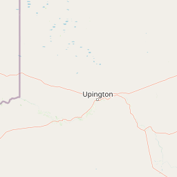
Map view of Augrabies Falls National Park

Use this park location map to pinpoint Augrabies Falls National Park in South Africa, understand its exact geographic position, and read its mapped placement within the surrounding landscape more clearly.

Pigeon | © OpenStreetMap contributors

Location context for Augrabies Falls National Park

Northern Cape
Natural feature types

Explore the Named Natural Features of Augrabies Falls National Park

Continue geographic discovery by examining the specific landforms and water bodies situated within Augrabies Falls National Park. MoriAtlas provides a structured view of the granite structures and river systems that define this protected landscape in South Africa.
Recorded earthquake history

View the Documented Earthquake History for Augrabies Falls National Park

Explore the historical seismic catalogue for Augrabies Falls National Park to review recorded events near this Northern Cape landscape. This dataset offers transparent, data-driven insights into regional earthquake history, curated for geographic exploration within MoriAtlas.

Augrabies Falls National Park Earthquakes

Catalogued events

7 events

Strongest magnitude

Magnitude 4.6

Most recent event

Dec 18, 2011

This history includes earthquakes recorded inside the park or within 50 km of its borders

Park atlas

Explore the surrounding Nama-Karoo landscapes and Orange River riparian zones with nearby protected areas

Discover Other National Parks and Protected Areas Near Augrabies Falls National Park

Browse a curated list of national parks and protected areas located in the vicinity of Augrabies Falls National Park. Compare their distinct Nama-Karoo biomes, granite formations, and riverine ecosystems to understand the broader conservation landscape of South Africa's Northern Cape Province.
Nature reserveNorthern Cape
About 204 km away#1 closest

East

Witsand Nature Reserve: Protected Sand Dunes and Northern Cape Regional Geography

A remote arid plateau and singing sand landscape

Witsand Nature Reserve encompasses a 3,500 hectare protected area set atop a rocky plateau in the Northern Cape. Known for its distinctive red Kalahari-style dunes that produce acoustic booming sounds, the reserve offers a unique look at the arid interior of South Africa through a lens of quiet, expansive geography and remote terrain.

Area
31.7 km²
Established
1994
Relief
Upland
Climate
Arid
National parkKgalagadi District
216 km away#2 closest

North

Kgalagadi Transfrontier Park National Park: Explore Its Mapped Protected Landscape

Discover the desert geography and unique terrain of the southern Kalahari.

Kgalagadi Transfrontier Park is a monumental protected area within the Kgalagadi District, embodying the vastness and stark beauty of the Kalahari Desert. This national park page offers an atlas-centric view of its sweeping red dunes, sparse vegetation, and the crucial dry river systems that shape its arid environment. Understand the geographic scope and the protected landscape character of this significant cross-border conservation area, perfect for detailed map exploration and understanding regional desert ecosystems.

Area
38,000 km²
Established
2000
IUCN
II
Visitors
52.5K annual
National parkNorthern Cape
238 km away#3 closest

West

Richtersveld National Park: Geographic and Protected Area Map Context

Exploring arid volcanic landscapes in Northern Cape

Richtersveld National Park represents a vast, complex protected area defined by its rugged mountain ridges and arid desert ecology. Centered in South Africa's Northern Cape, the landscape is shaped by the Orange River and high-altitude volcanic formations. This profile offers detailed insight into the park's natural boundaries, endemic plant habitats, and its role as a living cultural landscape within the wider regional geography.

Area
1,624.45 km²
Established
1991
Relief
Mountain
Climate
Arid
Watercolor illustration of rolling hills and scattered trees under a pale sky
National parkNorthern Cape
About 250 km away#4 closest

Southeast

Meerkat National Park National Park: Geographic Atlas and Protected Landscape Details

Explore the mapped boundaries and regional geography of Meerkat National Park.

Meerkat National Park is a significant protected area identified as a national park within the expansive Northern Cape region of South Africa. This detail page offers insight into its specific landscape character and mapped geographic extent, serving as a crucial node for atlas-based exploration. Understand the park's role as a protected national landscape and its relationship to the broader regional geography of Northern Cape, contributing to a structured understanding of conservation areas.

Area
1,352.45 km²
Established
2020
IUCN
II
Relief
Lowland
National parkNorthern Cape
267 km away#5 closest

Southwest

Namaqua National Park: Protected Landscape and Geographic Atlas Details

Explore Northern Cape's National Park mapped context.

Gain insight into Namaqua National Park, a protected national park situated in the expansive Northern Cape region of South Africa. This resource provides detailed geographic context, focusing on its mapped protected landscape and unique regional features. Understand its role as a distinct natural area for atlas-based exploration and geographic discovery within South Africa's diverse terrain.

Area
1,368.18 km²
Established
2001
Climate
Arid
Access
Moderate access
Wildlife reserveNamibia
About 283 km away#6 closest

West

ǀAi-ǀAis Hot Springs Game Park: A Namibian Wildlife Reserve Bridging Desert and Geothermal Landscapes

Explore mapped boundaries and regional park geography.

ǀAi-ǀAis Hot Springs Game Park represents a vital protected area within Namibia's arid southern reaches. This wildlife reserve is characterized by its namesake hot springs, which foster unique riparian ecosystems against a backdrop of rugged desert mountains and the impressive Fish River canyon. Its inclusion in a transfrontier conservation effort underscores its significance for regional landscape mapping and the preservation of stark desert beauty and geothermal features.

IUCN
II
Relief
Mixed relief
Climate
Arid
Access
Remote access
Protected areaNamibia
About 283 km away#7 closest

West

Ai-Ais/Richtersveld Transfrontier Park: Mapped Boundaries of a Southern African Protected Area

Exploring its desert terrain and cross-border conservation geography.

Ai-Ais/Richtersveld Transfrontier Park is a significant protected area that spans across Namibia and South Africa, embodying a vital component of Southern Africa's conservation efforts. This page focuses on the park's geographic identity, detailing its arid landscape characteristics and the mapped extent of its protected boundaries. Understanding this transfrontier park offers insight into cross-border ecological cooperation and the unique desert terrain it encompasses, providing a foundation for structured geographic discovery.

Area
6,045 km²
Established
2003
IUCN
II
Relief
Mountain
Nature reserveNorthern Cape
About 334 km away#8 closest

South

Oorlogskloof Nature Reserve; Protected Mountain Landscapes and River Gorges of Northern Cape

A diverse protected area featuring Karoo-fynbos biome transitions.

Oorlogskloof Nature Reserve presents a dramatic study in regional geography, characterized by deep river canyons, exposed rock shelves, and vast semi-desert plateaus. Located near the edge of the Knersvlakte, the reserve creates a refuge where seasonal waterfalls and rocky basins provide essential freshwater habitats. This atlas entry focuses on the interplay between its steep cliff formations and the surrounding Northern Cape plains, offering a comprehensive view of the terrain and ecological diversity.

Area
47.76 km²
Established
1971
Relief
Mountain
Scope
Terrestrial

Common questions about visiting, size, designation, and location context for Augrabies Falls National Park

Augrabies Falls National Park FAQs for park facts, access, geography, and protected area context

Find quick answers about Augrabies Falls National Park, including protected-area facts, park geography, trail and visitor context, and how the park fits into its surrounding country and regional landscape.
MoriAtlas Explorer

Continue Your Protected Areas Search Across the Global Atlas

Deepen your exploration by continuing the structured search for national parks and protected areas worldwide. Utilize the comprehensive filtering capabilities to compare different conservation landscapes and refine your understanding of global park geography. Discover more about the distribution and characteristics of protected natural areas.

Global natural geography