
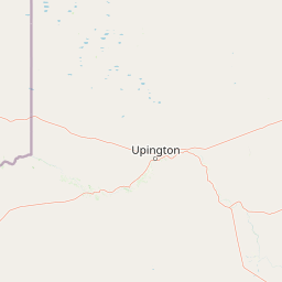
Rivers
Park geography
Structured regional data covering elevation, landscape features, and terrain extent
Comprehensive Geographic Profile and Mapped Boundaries of Augrabies Falls National Park
Examine the physical geography of Augrabies Falls National Park within the Northern Cape of South Africa. This data profile presents measured boundary extents, riverine corridors, plateau features, and associated desert ecosystems to provide a precise understanding of the park landscape.
Related tags
waterfallOrange Riversemi-desertgranite gorgeNama-Karoo
Arid canyon wilderness protecting the thundering falls of the Orange River
Augrabies Falls National Park
Augrabies Falls National Park is a dramatic protected area in South Africa's Northern Cape Province, centered around a spectacular waterfall where the Orange River plunges over a granite ledge in the heart of the Nama-Karoo semi-desert. The park covers approximately 820 square kilometers along the Orange River, creating a ribbon of riparian life through one of the country's most arid landscapes. The falls themselves drop about 60 meters into a deeply eroded granite gorge that averages 240 meters in depth and extends for 18 kilometers downstream, presenting one of the most visually striking geological features in southern Africa's protected areas. Originally inhabited by Khoekhoe peoples who named the waterfall Ankoerebis, meaning the place of great noise, the area later attracted Trekboer settlers who derived the name Augrabies from the original language.
- Location
- South Africa
- Park type
- National park
- Established
- 1966
- Area
- 820 km²
Location overview
National and regional placement within the Northern Cape province
Geographic Location of Augrabies Falls National Park in South Africa
Augrabies Falls National Park is situated within the Northern Cape region of South Africa. Administrative records define its geographic status as an inland, non-transboundary protected area.
- Countries
- South Africa
- Regions
- Northern Cape
- Primary location
- Northern Cape
- Geographic setting
- Inland
Boundary and coordinates
Analyzing the 820 square kilometer spatial footprint and regional extent
Augrabies Falls National Park Boundary Map and Spatial Limits
Interactive geometry displays the mapped outline to clarify the spatial orientation of the park. Calculated measurements provide estimated values for the total area, coordinates, and geographic center.
- Boundary area
- 565.9 km²
- Boundary perimeter
- 175 km
- Northernmost point
- 28.4118° S
- Southernmost point
- 28.6233° S
- Easternmost point
- 20.402° E
- Westernmost point
- 19.8837° E
- Geographic centre
- 28.5367° S, 20.1666° E
- North–south span
- 23.4 km
- East–west span
- 50.7 km
Terrain and natural features
Upland terrain classifications and recorded named natural features
Augrabies Falls National Park Terrain and Natural Features
Upland terrain classifications define the regional landscape across Augrabies Falls National Park. Linked feature cards supply names, types, and spatial relationships for recorded natural features.
Selected named natural features
Islands
Klaaseiland
Reservoirs
Volstruiswater Waterhole
Islands
Tierhokeiland
Viewpoints
Swartrante
Peaks
Spieëlkop
904 m
Environmental setting
Arid climate zones, upland relief, and major riverine water features
Augrabies Falls National Park Environmental Setting and Landscape Classification
Recorded landscape features, habitat types, and climate categories provide structured insight into the physical setting of Augrabies Falls National Park. Stored classifications connect directly to broader atlas records for comparative environmental analysis.
- Relief
- Upland
- Climate
- Arid
- Water
- Major water bodies
- Forest cover
- Sparse forest
- Seasonality
- Seasonal
Landscape features
Canyon · Cliffs · Desert · Forest · Plateau · Rivers · Waterfalls
Habitat types
Desert habitat · Shrubland · Grassland · Riverine habitat
Park atlas
Explore the surrounding Nama-Karoo landscapes and Orange River riparian zones with nearby protected areas
Discover Other National Parks and Protected Areas Near Augrabies Falls National Park
Browse a curated list of national parks and protected areas located in the vicinity of Augrabies Falls National Park. Compare their distinct Nama-Karoo biomes, granite formations, and riverine ecosystems to understand the broader conservation landscape of South Africa's Northern Cape Province.
Nature reserveNorthern Cape
About 204 km away#1 closest
East

Witsand Nature Reserve: Protected Sand Dunes and Northern Cape Regional Geography
A remote arid plateau and singing sand landscape
Witsand Nature Reserve encompasses a 3,500 hectare protected area set atop a rocky plateau in the Northern Cape. Known for its distinctive red Kalahari-style dunes that produce acoustic booming sounds, the reserve offers a unique look at the arid interior of South Africa through a lens of quiet, expansive geography and remote terrain.
- Area
- 31.7 km²
- Established
- 1994
- Relief
- Upland
- Climate
- Arid
National parkKgalagadi District
216 km away#2 closest
North

Kgalagadi Transfrontier Park National Park: Explore Its Mapped Protected Landscape
Discover the desert geography and unique terrain of the southern Kalahari.
Kgalagadi Transfrontier Park is a monumental protected area within the Kgalagadi District, embodying the vastness and stark beauty of the Kalahari Desert. This national park page offers an atlas-centric view of its sweeping red dunes, sparse vegetation, and the crucial dry river systems that shape its arid environment. Understand the geographic scope and the protected landscape character of this significant cross-border conservation area, perfect for detailed map exploration and understanding regional desert ecosystems.
- Area
- 38,000 km²
- Established
- 2000
- IUCN
- II
- Visitors
- 52.5K annual
National parkNorthern Cape
238 km away#3 closest
West
Richtersveld National Park: Geographic and Protected Area Map Context
Exploring arid volcanic landscapes in Northern Cape
Richtersveld National Park represents a vast, complex protected area defined by its rugged mountain ridges and arid desert ecology. Centered in South Africa's Northern Cape, the landscape is shaped by the Orange River and high-altitude volcanic formations. This profile offers detailed insight into the park's natural boundaries, endemic plant habitats, and its role as a living cultural landscape within the wider regional geography.
- Area
- 1,624.45 km²
- Established
- 1991
- Relief
- Mountain
- Climate
- Arid
National parkNorthern Cape
About 250 km away#4 closest
Southeast
Meerkat National Park National Park: Geographic Atlas and Protected Landscape Details
Explore the mapped boundaries and regional geography of Meerkat National Park.
Meerkat National Park is a significant protected area identified as a national park within the expansive Northern Cape region of South Africa. This detail page offers insight into its specific landscape character and mapped geographic extent, serving as a crucial node for atlas-based exploration. Understand the park's role as a protected national landscape and its relationship to the broader regional geography of Northern Cape, contributing to a structured understanding of conservation areas.
- Area
- 1,352.45 km²
- Established
- 2020
- IUCN
- II
- Relief
- Lowland
National parkNorthern Cape
267 km away#5 closest
Southwest
Namaqua National Park: Protected Landscape and Geographic Atlas Details
Explore Northern Cape's National Park mapped context.
Gain insight into Namaqua National Park, a protected national park situated in the expansive Northern Cape region of South Africa. This resource provides detailed geographic context, focusing on its mapped protected landscape and unique regional features. Understand its role as a distinct natural area for atlas-based exploration and geographic discovery within South Africa's diverse terrain.
- Area
- 1,368.18 km²
- Established
- 2001
- Climate
- Arid
- Access
- Moderate access
Wildlife reserveNamibia
About 283 km away#6 closest
West

ǀAi-ǀAis Hot Springs Game Park: A Namibian Wildlife Reserve Bridging Desert and Geothermal Landscapes
Explore mapped boundaries and regional park geography.
ǀAi-ǀAis Hot Springs Game Park represents a vital protected area within Namibia's arid southern reaches. This wildlife reserve is characterized by its namesake hot springs, which foster unique riparian ecosystems against a backdrop of rugged desert mountains and the impressive Fish River canyon. Its inclusion in a transfrontier conservation effort underscores its significance for regional landscape mapping and the preservation of stark desert beauty and geothermal features.
- IUCN
- II
- Relief
- Mixed relief
- Climate
- Arid
- Access
- Remote access
Protected areaNamibia
About 283 km away#7 closest
West
Ai-Ais/Richtersveld Transfrontier Park: Mapped Boundaries of a Southern African Protected Area
Exploring its desert terrain and cross-border conservation geography.
Ai-Ais/Richtersveld Transfrontier Park is a significant protected area that spans across Namibia and South Africa, embodying a vital component of Southern Africa's conservation efforts. This page focuses on the park's geographic identity, detailing its arid landscape characteristics and the mapped extent of its protected boundaries. Understanding this transfrontier park offers insight into cross-border ecological cooperation and the unique desert terrain it encompasses, providing a foundation for structured geographic discovery.
- Area
- 6,045 km²
- Established
- 2003
- IUCN
- II
- Relief
- Mountain
Nature reserveNorthern Cape
About 334 km away#8 closest
South
Oorlogskloof Nature Reserve; Protected Mountain Landscapes and River Gorges of Northern Cape
A diverse protected area featuring Karoo-fynbos biome transitions.
Oorlogskloof Nature Reserve presents a dramatic study in regional geography, characterized by deep river canyons, exposed rock shelves, and vast semi-desert plateaus. Located near the edge of the Knersvlakte, the reserve creates a refuge where seasonal waterfalls and rocky basins provide essential freshwater habitats. This atlas entry focuses on the interplay between its steep cliff formations and the surrounding Northern Cape plains, offering a comprehensive view of the terrain and ecological diversity.
- Area
- 47.76 km²
- Established
- 1971
- Relief
- Mountain
- Scope
- Terrestrial
MoriAtlas Explorer
Continue Exploring Augrabies Falls National Park's Mapped Landscape and Geographic Context
Deepen your understanding of Augrabies Falls National Park by exploring its specific geography, mapped boundaries, and the unique characteristics of its semi-desert environment. Gain detailed insights into this protected landscape within South Africa's Northern Cape, perfect for atlas-driven discovery and appreciating the natural terrain.
Browse next
Global natural geography
Explore related park routes
Explore MoriAtlas Global ParksBrowse All MoriAtlas ParksGlobal Park Map DiscoveryMoriAtlas: Browse All CountriesBrowse All MoriAtlas ContinentsNational Park Environment AtlasGrand Canyon National Park AtlasYellowstone National Park AtlasYosemite National Park Atlas and GeographySerengeti National Park AtlasGalápagos National Park Protected LandscapeBanff National Park Geography and AtlasKruger National Park Atlas EntryUluṟu-Kata Tjuṯa National Park AtlasExplore Uluru-Kata Tjuta National Park GeographyPlitvice Lakes National Park AtlasFiordland National Park Protected LandscapeGreat Smoky Mountains National Park AtlasAfghanistan National Parks and Protected AreasAlbania National Parks and Protected AreasAlgeria National Parks and Protected AreasAmerican Samoa National Parks and Protected AreasAndorra National Parks and Protected AreasAngola National Parks and Protected AreasAntarctica National Parks and Protected AreasAntigua and Barbuda Park List