Mori Atlas logo
Biosphere reserveReserva de biosfera Bañados del Este

Analyzing the diverse terrain of wetlands, coastal lagoons, and savanna ecosystems in eastern Uruguay

Reserva de biosfera Bañados del Este: Protected Landscape and Geographic Atlas of Uruguay

(Reserva de Biosfera Bañados del Este y Franja Costera)

Reserva de biosfera Bañados del Este encompasses a vast protected network across eastern Uruguay, defined by its intricate system of freshwater marshes, Atlantic coastal lagoons, and palm savannas. This geographic analysis traces the transition from crystalline sierras to sedimentary plains, mapping the hydrographic influence of the Cuchilla Grande watershed. Users can examine the distribution of these varied natural environments, from seasonal floodplains to the distinct barrier dunes along the Atlantic frontier.

wetlandsbiosphere reserveUNESCOcoastal lagoonsAtlantic coastpalm savanna

Reserva de biosfera Bañados del Este

Biosphere reserve

Park overview

Structured park overview, official facts, and landscape profile for Bañados del Este Biosphere Reserve

Bañados del Este Biosphere Reserve park facts, protected area profile, and essential visitor context

Review the core facts for Bañados del Este Biosphere Reserve, including designation, size, terrain, visitor scale, habitats, and operating context in one park-focused overview.

About Bañados del Este Biosphere Reserve

The Bañados del Este Biosphere Reserve is the flagship conservation landscape of eastern Uruguay and one of the most representative biosphere reserves in the Southern Cone of South America. It occupies a broad swath of territory stretching from the low sierras of the southern Brazilian-Uruguayan borderlands to the Atlantic Ocean, encompassing the entire gradient between the continental interior and the coast.

Ecologically, the reserve is defined by its wetlands. Its name, Bañados del Este, means "Eastern Wetlands," and the region is built around the Atlantic-slope rivers that drain the Cuchilla Grande range, including the Olimar, Cebollatí, Tacuarí, San Luis, and Yaguarón rivers, along with a dense network of smaller streams. These rivers slow as they approach the coast, broadening into one of South America's great wetland mosaics, with seasonal floodplains, permanent marshes, and a celebrated chain of coastal lagoons: Laguna José Ignacio, Laguna Garzón, Laguna de Rocha, and Laguna de Castillos.

Alongside the wetlands, the reserve encompasses a striking diversity of non-wetland habitats. The interior contains rolling hills, low sierras, sedimentary plains, and fertile valleys used for agriculture, livestock, and increasingly for commercial forestry. Toward the coast, the landscape shifts to dunes, sandy plains, coastal scrub, and the open palm savannas of Butia odorata that cover tens of thousands of hectares. Offshore, the reserve includes coastal islands and oceanic waters where marine mammals, seabirds, and shorebirds concentrate.

As a UNESCO biosphere reserve, Bañados del Este was conceived around the idea that conservation and human development must be reconciled in the same territory. The reserve therefore protects not only ecological values but working landscapes, rural communities, and traditional land uses. It is widely regarded as a model of how large biosphere reserves can integrate private productive lands, multiple formal protected areas, and a regional planning framework into a single coordinated conservation strategy.

Quick facts and research context for Bañados del Este Biosphere Reserve

Designated a UNESCO biosphere reserve in June 1976, Bañados del Este is the largest and most ecologically diverse protected area in Uruguay. It spans roughly 1.25 million hectares across four eastern departments, with a permanent human population of around 70,000.

More than ninety percent of its surface is privately owned, making the reserve a leading example of mixed conservation and productive land use in South America. About 3.7 percent of the territory is open water in lagoons and wetlands, while 4.2 percent is oceanic coastal waters, including important breeding colonies of the South American fur seal on islands such as Isla de Lobos.

Protection and recognition

Examine the documented conservation framework and international recognition data for this protected area.

Reserva de biosfera Bañados del Este Protection Status and Management Scope

Conservation records compile the mixed protection scope and international recognition status assigned to Reserva de biosfera Bañados del Este. Structured atlas entries outline the official designation framework and management context for this protected landscape.

Protection details

Protection scope
Mixed
Transboundary protection
No
Park context

Deeper park guide and search-rich context for Bañados del Este Biosphere Reserve

Bañados del Este Biosphere Reserve history, landscape, wildlife, and travel context

Explore Bañados del Este Biosphere Reserve through its history, landscape character, ecosystems, wildlife, conservation priorities, cultural context, and seasonal travel timing in a structured park guide built for atlas discovery and search intent.

Why Bañados del Este Biosphere Reserve stands out

Bañados del Este is best known for its enormous wetland complex, which combines freshwater marshlands, seasonal floodplains, slow rivers, and a chain of brackish Atlantic coastal lagoons along Uruguay's southern coast. The reserve also protects the iconic palmares of Rocha, open butiá palm savannas that today rank among the most distinctive botanical features of eastern Uruguay. The reserve is further recognized for its role in safeguarding threatened grassland birds such as the monjita dominicana and the yellow-headed marsh bird known locally as dragón, as well as for supporting the endemic Uruguayan pampas deer, the venado de campo de los Ajos. Its Atlantic coastal strip, meanwhile, hosts major breeding colonies of the South American fur seal and forms a key chapter in Uruguay's coastal conservation network.
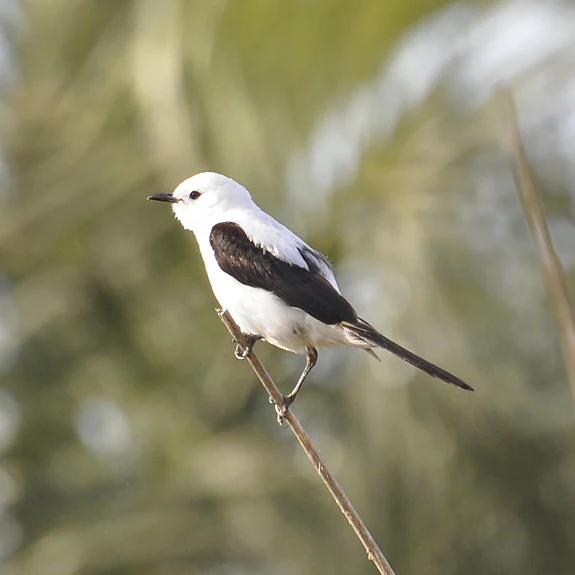
A Black-and-white Monjita bird with white head and body and black wings perched on a thin, dry branch against a blurred green background.
A Black-and-white Monjita perched in the Bañados del Este biosphere reserve.

Bañados del Este Biosphere Reserve history and protected-area timeline

The Bañados del Este Biosphere Reserve was formally recognized by UNESCO in June 1976 as part of its Man and the Biosphere programme. At the time, the reserve covered roughly 200,000 hectares and was confined to the department of Rocha, where the most emblematic wetlands, coastal lagoons, and palm savannas were already recognized for their outstanding biological value.

In 1997 the reserve was greatly expanded. Drawing on a watershed-based approach, planners extended its boundaries across Treinta y Tres, Rocha, Cerro Largo, Lavalleja, and parts of Maldonado, encompassing rivers draining toward both the Laguna Merín basin and the Atlantic coast. At its largest, the reserve covered about 3.85 million hectares, stretching from Aceguá in the north to Isla de Lobos near Punta del Este in the south, and as far west as Illescas.

A subsequent re-delimitation approved in 2004 reduced the reserve to the more focused current extent of roughly 1.25 million hectares, now home to about 70,000 permanent residents and distributed across Rocha, Treinta y Tres, Cerro Largo, and eastern Maldonado. This revised configuration emphasized ecological coherence and a tighter administrative management framework.

Throughout its history, Bañados del Este has functioned as a framework rather than a single park. Privately owned ranches, commercial rice paddies, planted forests, and a network of state-managed protected areas, including Cabo Polonio national park, Laguna de Rocha, Laguna Garzón, Quebrada de los Cuervos, San Miguel, and Cerro Verde, all operate within its boundaries.

Bañados del Este Biosphere Reserve landscape and geographic character

The landscape of Bañados del Este is unusually varied for an eastern Uruguay biosphere reserve, ranging from low crystalline sierras to extensive coastal wetlands. The reserve sits on the southeastern edge of the South American crystalline shield, where gentle hills and ridges rarely exceed 250 meters in elevation. These uplands form the Cuchilla Grande watershed divide that organizes the entire reserve's hydrography.

From these hills, rivers descend into a wide sedimentary plain that, near the Laguna Merín basin, is shaped by tectonic subsidence and the accumulation of deep sediment layers. To the east, the subsidence intensifies into the structural trench known as the Fosa de la Laguna Merín. The combined effect is a gently sloping terrain that traps water, creating the extensive bañados, marshes, and perennial lagoons that define the region.

Ichnographic studies divide the reserve into several recurring landscape types. Crystalline and Gondwanan sierras account for roughly a third of the area and include the reserve's highest and most rugged terrain. Rolling hills and fertile valleys cover about thirteen percent, while sedimentary uplands and Gondwanan hill country together form a further ten percent. Elevated and intermediate plains used for rice cultivation and extensive grazing occupy another fourteen percent, and the perennially or seasonally flooded lowlands make up roughly seventeen percent, including most of the wetlands around Laguna Merín and along the Atlantic slope rivers.

The coastal strip is a landscape in its own right. Dunes, sandy plains, coastal scrub, rocky shores, sandy beaches, and a chain of barrier lagoons stretch from near Punta del Este north to the vicinity of the Brazilian border. The coast is interrupted by offshore islands such as Isla de Lobos, which, while not contiguous with the reserve's land surface, is administratively linked to its coastal protection strategies.
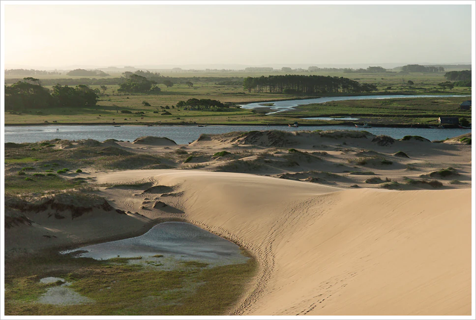
A high-angle view overlooking rolling golden sand dunes in the foreground, with a body of water and green coastal grasslands in the background.
A wide view of the sand dunes and surrounding wetlands in the Valizas area of the Bañados del Este biosphere reserve.

Bañados del Este Biosphere Reserve ecosystems, habitats, and plant life

Bañados del Este protects one of South America's most ecologically complete wetland systems, combining freshwater marshes, brackish coastal lagoons, slow riparian corridors, palm savannas, coastal dunes, and patches of native forest. Although tropical grasslands dominate by area, the reserve's character is shaped by its hydrological diversity.

Vegetation patterns follow water availability and soil type. Gallery forests line the major rivers, providing one of the most biologically rich forest habitats in the region. Along the coast, psammophilous (sand-loving) plant communities, including coastal scrub and dune vegetation, occupy the shifting sands, while xerophilous forests survive on the driest uplands. Above all, the reserve is renowned for the palmares of Rocha, an open, near-monoespecific savanna dominated by the butiá palm, Butia odorata, which occupies tens of thousands of hectares and forms one of the most photogenic landscapes of eastern Uruguay.

The wetlands support extensive communities of hydrophilous plants, while the productive lowland plains, especially around the eastern wetlands of Rocha, are dominated by extensive rice cultivation. Although rice paddies are an artificial agroecosystem, they have become ecologically important as feeding and breeding habitat for waterbirds, demonstrating how human-modified landscapes can reinforce, rather than undermine, the reserve's biodiversity values.
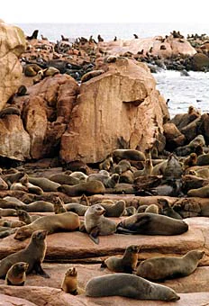
A dense colony of numerous brown fur seals lying and sitting on large, light-colored rocky terrain near the ocean.
A large colony of South American fur seals resting on the rocky coast of Isla de Lobos.

Bañados del Este Biosphere Reserve wildlife and species highlights

The reserve's wildlife reflects its position at the intersection of pampas grasslands, coastal lagoons, and Atlantic marine systems. Among mammals, its most distinctive resident is the Uruguayan pampas deer, the venado de campo de los Ajos, which is endemic to this area and considered a flagship species for conservation in the region.

Marine mammals are concentrated along the Atlantic coast. The coastal islands within or adjacent to the reserve, most notably Isla de Lobos, host important breeding colonies of Arctophoca australis australis, the South American fur seal, providing one of the largest pinniped populations in the South Atlantic.

Avifauna is exceptionally rich. The reserve supports important populations of threatened and declining grassland birds, including the monjita dominicana and the yellow-headed tordo, locally known as dragón. The rice-farming wetlands and coastal lagoons attract large concentrations of plovers, sandpipers, and other shorebirds, with the lagoons of José Ignacio, Garzón, Rocha, and Castillos acting as key staging and feeding sites for migratory waterbirds along the Atlantic flyway.

Taken together, the reserve's mammal fauna, seabird islands, waterbird-rich wetlands, and endemic ungulate populations make it one of the most important sites for wildlife conservation in southern South America.
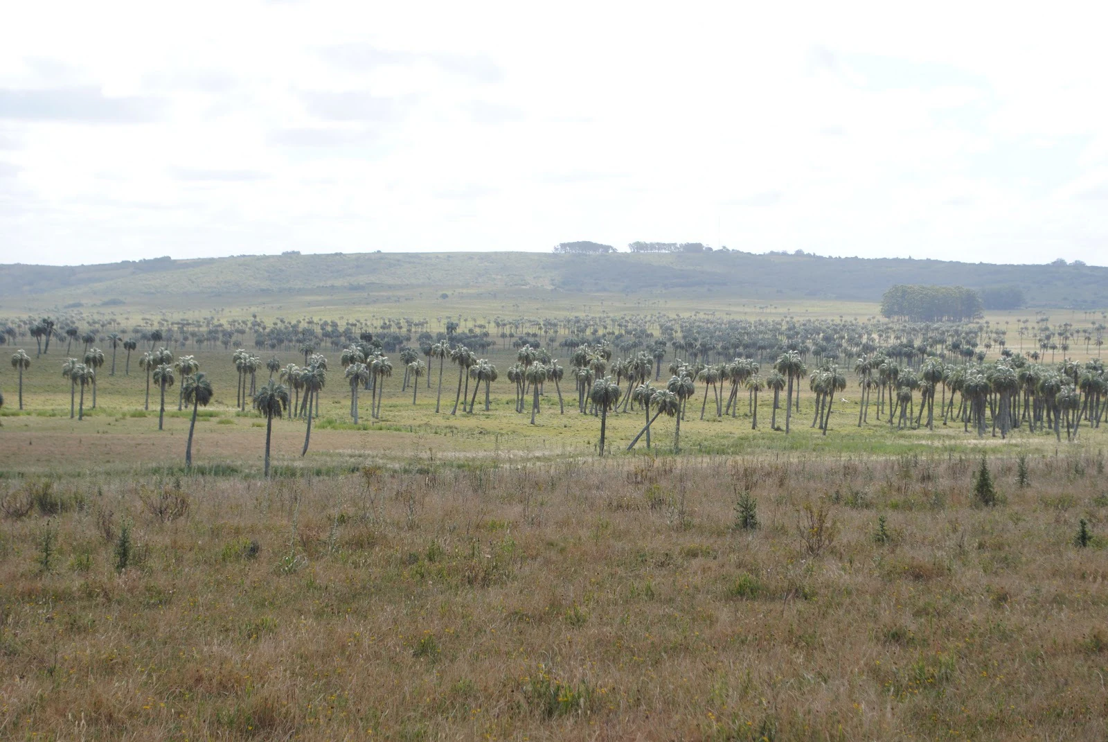
A wide landscape view of an expansive grassland filled with numerous tall, slender palm trees under a pale, overcast sky.
A vast grove of Butia capitata palm trees in the Palmares de Castillos region of the Bañados del Este biosphere reserve.

Bañados del Este Biosphere Reserve conservation status and protection priorities

Bañados del Este is internationally significant for conservation because it preserves an unusually complete gradient of habitat types on the eastern coast of South America, from interior sierras to oceanic waters. It is also one of the few large biosphere reserves in the region where the majority of the land remains in private hands, demonstrating how conservation strategies can integrate productive use of natural resources.

The reserve hosts a mosaic of formal protected areas administered by different national agencies, including the Parque Nacional de Islas Costeras and other units managed under Uruguay's national protected-area system (SNAP), such as Quebrada de los Cuervos, the San Miguel flora and fauna reserve, Cerro Verde e Islas de la Coronilla, Cabo Polonio national park, Laguna de Rocha, and Laguna Garzón. Together, these areas form a nested network of strictly protected zones within a broader landscape that also accommodates sustainable forestry, ranching, and rice cultivation.

From a biodiversity standpoint, the reserve's conservation importance includes protecting endemic mammals such as the Uruguayan pampas deer, safeguarding threatened grassland birds such as the monjita dominicana and the tordo amarillo, and supporting internationally significant waterbird populations in its chain of coastal lagoons. The coastal lagoons themselves are considered critical biodiversity nodes, and several have been given their own protected-area designations. As a result, Bañados del Este functions as both a landscape-scale conservation framework and a platform for internationally coordinated species and habitat protection.

Bañados del Este Biosphere Reserve cultural meaning and human context

The reserve is not an uninhabited wilderness. It is home to dozens of rural towns and small cities, including Melo, Treinta y Tres, Rocha, and Río Branco, plus a constellation of smaller settlements. This human presence is part of the reserve's identity, mirrored in the long tradition of cattle ranching on the native grasslands, the deep cultural roots of rice cultivation in the lowlands, and the artisanal and small-scale forestry practices that coexist with the broader ecosystem.

Coastal communities, such as Barra de Valizas, Valizas, and the settlements around Cabo Polonio, Laguna de Rocha, and Laguna Garzón, also carry a distinct cultural heritage linked to artisanal fishing, local boatbuilding, and small-scale tourism. Local ranching traditions, combined with the palmares landscape, have shaped a regional identity closely tied to the butiá palm and its products.

Indigenous cultural traces in the region and modern community involvement in biosphere reserve management reinforce the idea that Bañados del Este is as much a social and cultural landscape as a biological one, with sustainable rural development forming a central pillar of its mission.

Top sights and standout views in Bañados del Este Biosphere Reserve

The Bañados del Este Biosphere Reserve stands out for the sheer scale and ecological diversity of its protected landscape, which combines freshwater wetlands, coastal lagoons, pampas grasslands, palm savannas, dune systems, and Atlantic marine habitat in a single coordinated framework.

Its signature natural attractions include the palmares of Rocha, the four major coastal lagoons of José Ignacio, Garzón, Rocha, and Castillos, and the breeding colonies of the South American fur seal on the offshore islands. The reserve also hosts globally important populations of threatened grassland birds and one of the eastern coast's largest concentrations of migratory waterbirds, making it a key site for both landscape and species conservation in South America.

Best time to visit Bañados del Este Biosphere Reserve

Eastern Uruguay has a temperate climate with a slight subtropical tendency, moderated year-round by the Atlantic Ocean, so seasonal variation is moderate rather than extreme. Rainfall is fairly evenly distributed throughout the year, with annual totals typically between roughly 1,100 and 1,300 millimeters, so any season can bring showers.

The cooler months of late autumn, winter, and early spring are usually the most comfortable for walking, exploring the palmares, and birdwatching around the wetlands and coastal lagoons. Warmer months bring peak insect and bird activity, more lively wildlife behavior, and the richest conditions for waterbird observation, though temperatures can be high inland. Wildlife viewing along the coast and lagoons can be rewarding in any season, with the chain of coastal lagoons offering changing scenery through the year rather than a single peak window.
Monthly climate preview

Long term representative temperature and precipitation averages recorded at coordinate sample points

Reserva de biosfera Bañados del Este Climate Normals and Annual Weather Patterns

Historical monitoring data records monthly temperature and precipitation fluctuations across the representative park coordinate from 1991 to 2020. Opening the complete twelve month profile provides detailed metrics for comparing long term climate normals and seasonal variations.
Annual mean17 °C
11 °C23 °C
Jan23°
Feb23°
Mar21°
Apr18°
May15°
Jun12°
Jul11°
Aug12°
Sep14°
Oct16°
Nov19°
Dec21°
Warmest month
January

23 °C

Coolest month
July

10.6 °C

Wettest month
February

4.3 mm/day

Driest month
November

2.6 mm/day

Park location guide

Geography guide, regional context, and park location map for Bañados del Este Biosphere Reserve

Bañados del Este Biosphere Reserve park geography, regions, and map view in Uruguay

Understand where Bañados del Este Biosphere Reserve sits in Uruguay through a broader geographic reading of the surrounding landscape, nearby location context, and its mapped position within the national park landscape.

How Bañados del Este Biosphere Reserve fits into Uruguay

Uruguay is a unitary presidential republic located in southeastern South America. It covers approximately 176,215 km² and has a population of nearly 3.5 million people. The capital and largest city is Montevideo, where roughly 2 million people live in the metropolitan area. Uruguay gained independence between 1825 and 1828 following territorial disputes involving Portugal, Spain, Brazil, and the United Provinces of the Río de la Plata.

Wider geography shaping Bañados del Este Biosphere Reserve in Uruguay

Uruguay is situated in the southeastern part of South America, bordering Argentina to its west and southwest, Brazil to its north and northeast, the Río de la Plata estuary to the south, and the Atlantic Ocean to the southeast. The terrain consists primarily of rolling plains and low hills, with the highest point being Cerro Catedral at approximately 514 meters. The country has several rivers including the Uruguay River, Paraná River, and Negro River.

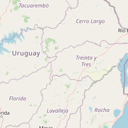
Map view of Bañados del Este Biosphere Reserve

Use this park location map to pinpoint Bañados del Este Biosphere Reserve in Uruguay, understand its exact geographic position, and read its mapped placement within the surrounding landscape more clearly.

Pigeon | © OpenStreetMap contributors

Location context for Bañados del Este Biosphere Reserve

Cerro LargoMaldonadoRochaTreinta y Tres

Visualizing wetlands, coastal lagoons, and palm savannas in eastern Uruguay

Reserva de biosfera Bañados del Este Photos and Protected Landscape Imagery

Visual records capture the vast wetland complexes, barrier lagoons, and palm savannas that define the protected terrain of Reserva de biosfera Bañados del Este. Photographic documentation provides critical reference value for examining the habitats, topography, and ecological character of eastern Uruguay.

A Black-and-white Monjita bird with white head and body and black wings perched on a thin, dry branch against a blurred green background.

A Pampas deer with antlers standing in a field of tall, dry grass, looking toward the camera.

A high-angle view overlooking rolling golden sand dunes in the foreground, with a body of water and green coastal grasslands in the background.

A dense colony of numerous brown fur seals lying and sitting on large, light-colored rocky terrain near the ocean.

A wide landscape view of an expansive grassland filled with numerous tall, slender palm trees under a pale, overcast sky.

Park atlas

Compare surrounding regional geography and connected wetland landscapes.

Explore Protected Areas and Parks Near Reserva de biosfera Bañados del Este

Browse nearby national parks and protected areas sharing the regional wetland geography and coastal ecosystems of Reserva de biosfera Bañados del Este. Extending the geographic review allows comparison of adjacent wildlife habitats, protected landscapes, and regional conservation zones.
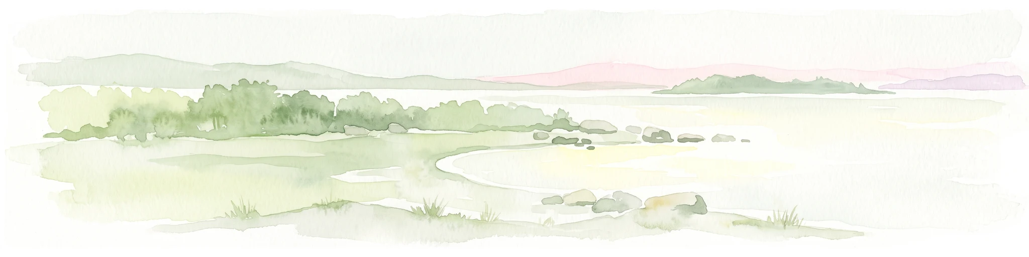
A wide, panoramic watercolor illustration showing a landscape of rolling green hills, grassy foreground vegetation, and distant pale mountains under a soft sky.
National parkDepartamento de Rocha
About 44 km away#1 closest

Southeast

Parque nacional San Miguel: Mapped Protected Landscapes of Departamento de Rocha

Volcanic hills, native woodlands, and seasonal wetlands

Parque nacional San Miguel serves as a vital protected area, showcasing the distinctive topography of the Sierra de San Miguel. The terrain transitions from rocky volcanic slopes to expansive low-lying wetlands, creating a layered environment of native forests and open prairies that define this essential segment of the regional geography in Departamento de Rocha.

Area
15.42 km²
Established
1937
Relief
Upland
Climate
Temperate
Watercolor painting of a wide, calm lake landscape with a sandy shoreline, sparse vegetation, and gentle hills in the background.
National parkRocha Department
About 61 km away#2 closest

Southeast

Parque Nacional Laguna Negra: Geographic Map and Protected Area Overview

Wetland and Savanna Landscapes in Rocha Department

Parque Nacional Laguna Negra protects a compressed mosaic of coastal environments in eastern Uruguay. The area integrates dense marshlands with native grasslands and patches of indigenous forest, providing a essential habitat corridor along the Atlantic coast. Use this atlas resource to understand its terrain and internal environmental distribution.

Area
7.15 km²
Established
2025
Relief
Lowland
Climate
Temperate
National parkRocha Department
About 66 km away#3 closest

Southeast

Santa Teresa National Park: Mapped Coastal Forest and Beach Protected Landscape

Explore Rocha Department's unique protected Atlantic coast geography.

Santa Teresa National Park, a designated national park in Uruguay's Rocha Department, offers a compelling example of a protected coastal environment. Its landscape is characterized by a distinctive blend of dense forests that reach down to the sandy shores of the Atlantic Ocean, a rare feature in the region's protected areas. This page provides detailed geographic context and map-based exploration for understanding this unique seaside national park and its place within Uruguay's conservation atlas.

IUCN
II
Relief
Lowland
Climate
Subtropical
Access
Easy access
Wildlife reserveDepartamento de Rocha
About 67 km away#4 closest

Southeast

Área de manejo de hábitats y/o especies Cerro Verde e Islas de la Coronilla Protected Landscape

Coastal and marine wildlife reserve in Departamento de Rocha

Spanning both land and sea, this reserve protects a rare combination of granite coastal hills, relict forests, and oceanic islands along the Uruguayan Atlantic. Learn about its integrated role within the Banos del Este biosphere and its importance as a habitat for endangered green sea turtles and migrating southern right whales.

Area
16.88 km²
Established
2011
Relief
Lowland
Climate
Temperate
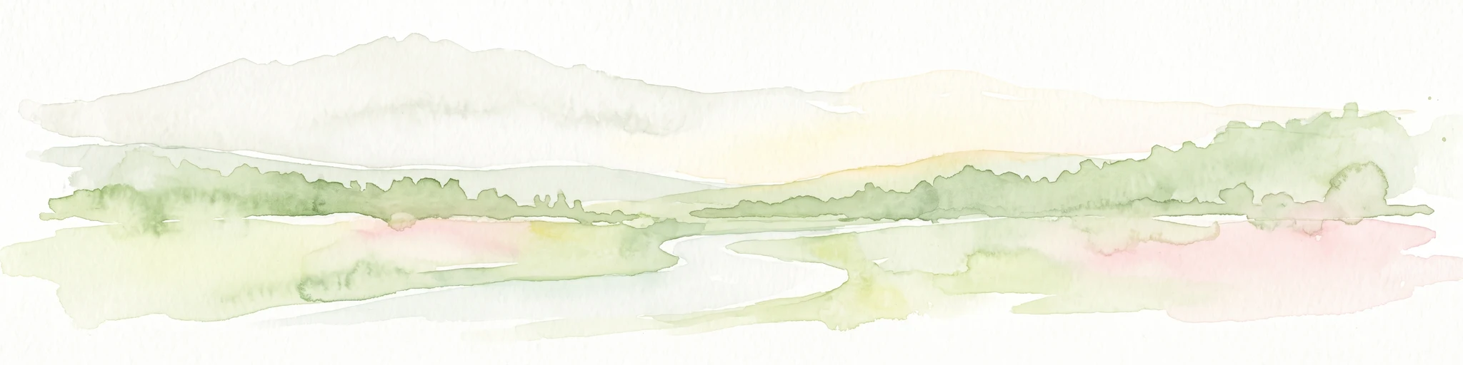
A soft watercolor illustration featuring a winding river flowing through a hilly, green landscape under a pale sky.
Protected landscapeTreinta y Tres Department
About 76 km away#5 closest

Northwest

Paisaje protegido Quebrada de los Cuervos y Sierras del Yerbal: Protected Landscape Atlas

Geographic analysis of gorge formations and eastern hill ecosystems.

Spanning ancient metamorphic terrain in Treinta y Tres Department, this protected landscape is defined by the steep-walled Quebrada de los Cuervos. The site offers an opportunity to study the intersection of stream-carved gorges, subtropical gallery forests, and high-elevation grasslands in a formal conservation setting.

Area
193.95 km²
Established
2008
Relief
Upland
Climate
Subtropical
Protected landscapeRocha
About 95 km away#6 closest

South

Paisaje protegido Laguna de Castillos: Mapped Geography and Protected Landscape Features

Coastal lagoon and native woodland terrain in Rocha, Uruguay

Investigate the geographic profile of Paisaje protegido Laguna de Castillos, an essential protected area in Rocha. This terrain features the largest continuous ombú forest in the country alongside shallow coastal lagoon waters and complex wetland habitats that support a high diversity of native waterfowl.

Area
82.64 km²
Established
2020
Relief
Lowland
Climate
Subtropical
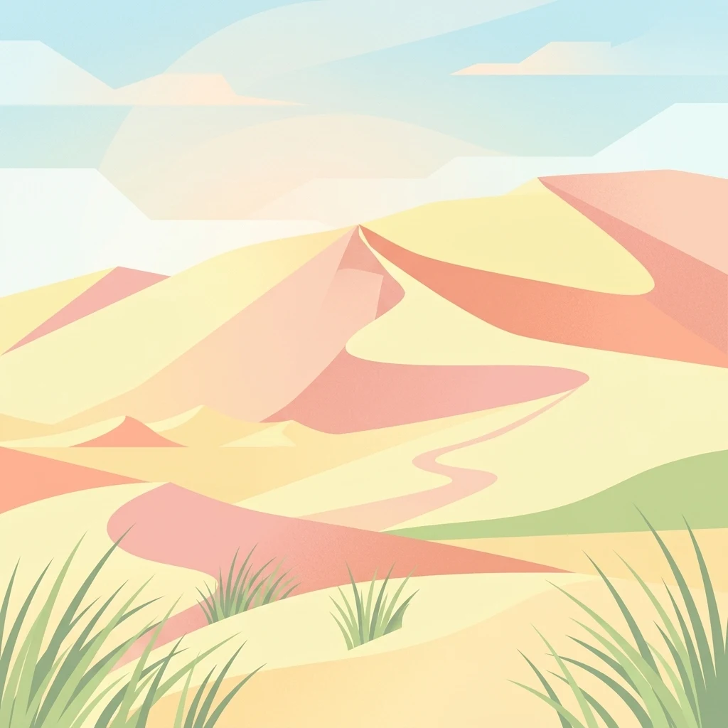
A stylized digital illustration of yellow and peach-toned sand dunes under a soft blue sky, with small patches of green grass in the foreground.
National parkRocha
About 100 km away#7 closest

South

Parque nacional Cabo Polonio: Coastal Geography and Marine Protected Area Atlas

Examining dune systems, coastal lagoons, and marine habitats

Analyze the geography of Parque nacional Cabo Polonio, a protected area in Uruguay's Rocha region. This atlas entry details the mosaic of transverse dunes, interdunal wetlands, rocky outcrops, and oceanic islands that define this significant coastal-marine protected landscape.

Area
258.2 km²
Established
2009
Relief
Lowland
Climate
Subtropical
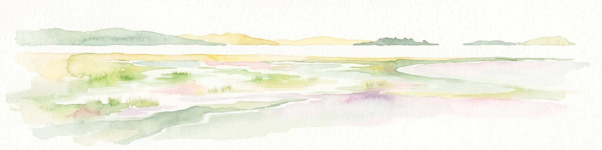
A horizontal watercolor illustration showing a shallow lagoon with soft green, yellow, and grey tones depicting vegetation, water, and distant low hills against a white background.
Protected landscapeRocha Department
About 118 km away#8 closest

South

Laguna de Rocha Protected Landscape: Mapping Coastal Uruguay and its Dynamic Wetland Geography

Explore the unique barrier lagoon system and diverse coastal habitats of Rocha Department.

Laguna de Rocha functions as a vital coastal lagoon and wetland complex in southeastern Uruguay. Characterized by its shallow water and temporary sandbar breaches, the area supports a distinct mosaic of habitats, including dunes, reedbeds, and mudflats. Its status as a biosphere reserve and Important Bird Area underscores the ecological importance of this regional geography in providing a sanctuary for migratory waterbirds along the Atlantic coast.

Area
220 km²
Established
2010
Relief
Lowland
Climate
Temperate

Common questions about visiting, size, designation, and location context for Bañados del Este Biosphere Reserve

Bañados del Este Biosphere Reserve FAQs for park facts, access, geography, and protected area context

Find quick answers about Bañados del Este Biosphere Reserve, including protected-area facts, park geography, trail and visitor context, and how the park fits into its surrounding country and regional landscape.
MoriAtlas Explorer

Continue Your Protected Areas Search Across the Global Atlas

Deepen your exploration by continuing the structured search for national parks and protected areas worldwide. Utilize the comprehensive filtering capabilities to compare different conservation landscapes and refine your understanding of global park geography. Discover more about the distribution and characteristics of protected natural areas.

Global natural geography