
Why Cabo Polonio National Park stands out
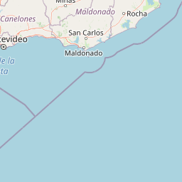
Cabo Polonio National Park is best known for its combined coastal and marine conservation profile, where Atlantic ocean, dunes, wetlands, and a chain of small islands form a single integrated protected landscape. The park's oceanic islands host major breeding colonies of South American sea lions and South American fur seals, making it one of the most important pinniped sites along Uruguay's coast. Equally distinctive is the park's dune and lagoon interface: mobile transverse dunes, frontal dune cordons, interdunal freshwater pools, and the transition zone between the Castillos lagoon and the Valizas stream combine to create a highly heterogeneous coastal mosaic. This ecological richness, paired with the area's biosphere reserve and Ramsar designations, gives the park a strong profile as a coastal biodiversity hotspot rather than simply a scenic beach destination.
Cabo Polonio National Park history and protected-area timeline
The earliest formal protection effort in the Cabo Polonio area dates back to 1966, when a national-interest declaration through Decree 266 of 2 June that year recognized the preservation value of the Cabo Polonio region alongside other Rocha coast locations. The same instrument also designated the dune system stretching between Cabo Polonio and Punta del Diablo as a Natural Monument, marking the first recognition of the area's geomorphological significance.
In 1996, the offshore islands along the coast, including those fronting Cabo Polonio, were grouped together with other coastal islands of the Río de la Plata and given protection under Decree 447 of 20 November 1996, which created the National Park of Coastal Islands. This step laid the groundwork for the marine and insular components of today's national park.
A more structured process toward creating the current national park began on 27 June 2006, when a proposal was formally presented to the National Advisory Commission on Protected Areas. The proposal was developed jointly by Uruguay's ministry responsible for housing, land-use planning, and the environment, the ministry of livestock, agriculture, and fisheries, the ministry of tourism and sport, and the municipal government of Rocha, with public disclosure following on 4 August 2006.
Two public hearings, held in August and November 2007, allowed the proposal to be presented in situ and gave local community members and interest groups the chance to contribute concerns and input. The participatory process concluded when Decree 337/009, issued on 20 July 2009, formally approved the selection and delimitation of the Cabo Polonio protected area and integrated it into Uruguay's National System of Protected Areas under the National Park category, giving the area its current protection status.
Cabo Polonio National Park landscape and geographic character
The landscape of Cabo Polonio National Park is shaped by the constant dialogue between the Atlantic Ocean and the Uruguayan coast. The terrain is generally low, with elevations ranging roughly between 10 and 60 meters above sea level. The highest points are the soft, rounded hills of the Lomadas de Narváez, composed of marine deposits and shaped by active erosion that has carved gullies into their slopes. The summit of this system reaches 60 meters at the Cerro de la Buena Vista.
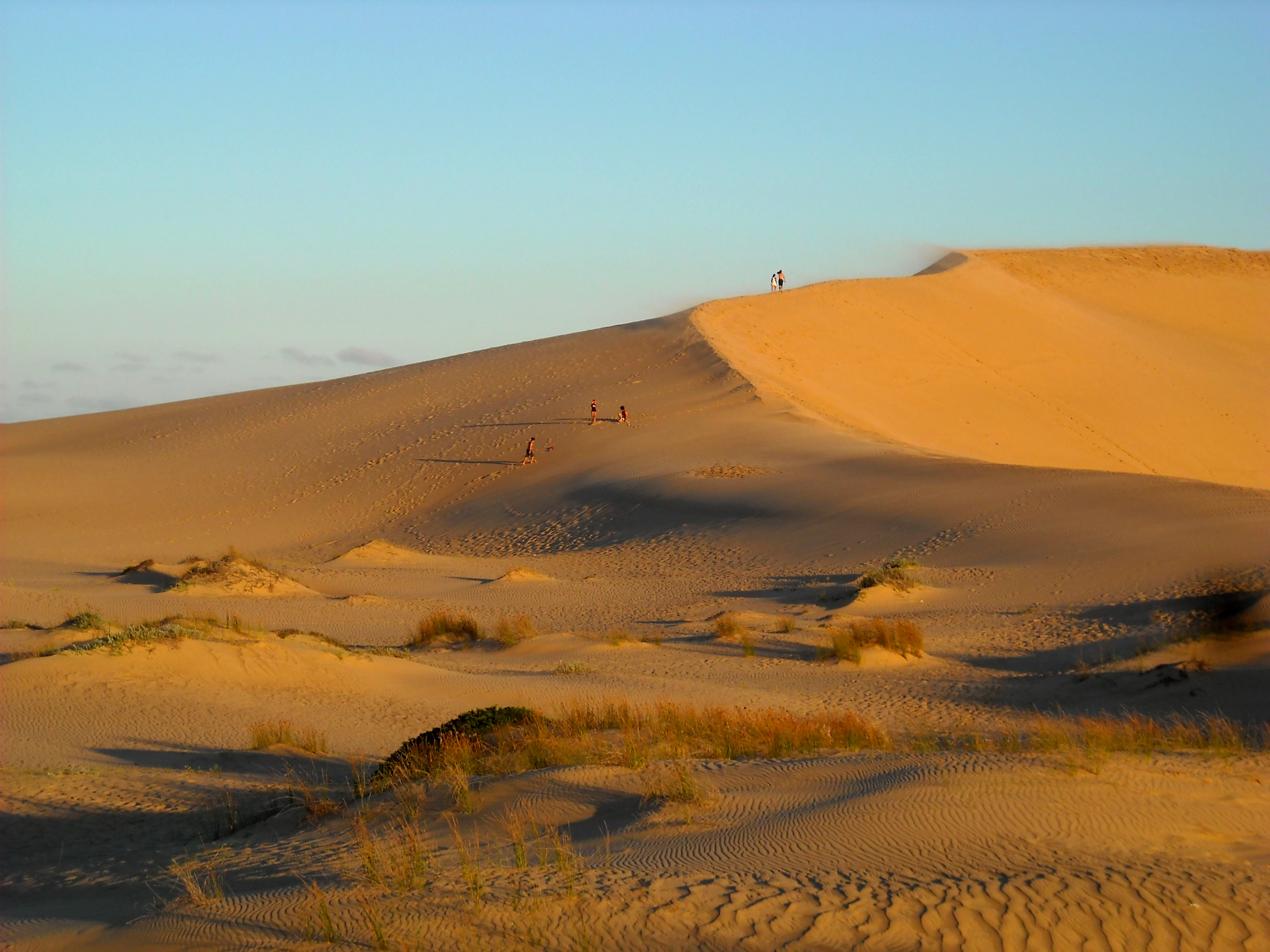
Along the coast itself, the geography cycles through a sequence of distinct forms. Wide sandy beaches give way to rocky supralittoral points, which in turn are backed by a continuous frontal dune cordon running parallel to the shoreline. Behind this frontline, the terrain opens into a system of transverse dunes oriented across the coast, with hollows between the dunes hosting permanent and semi-permanent interdunal pools fed by groundwater. Further inland, the dunes connect to the floodplains of the Castillos lagoon and the Valizas stream, generating a smoother gradient of wetlands, peatlands, and floodable plains.
A particularly striking feature is the tómbolo that anchors the Cabo Polonio peninsula, where an ancient island or rocky dome, with exposed granite outcrops, has been gradually tied to the mainland by sediments stabilized over time by colonizing grasses. The resulting landform hosts low-stature vegetation forming dense mats over the surface. Offshore, the islands of Rasa, Encantada, Islote, del Marco, and Seca rise from the Atlantic as the visible peaks of a broader submarine system, completing the park's coastal-marine landscape mosaic.
Climatically, the park experiences a humid subtropical climate with strong maritime influence. Average annual temperature sits around 16.4 degrees Celsius, with minimum temperatures from July to August and maximum temperatures in January, while annual precipitation averages about 1,277 millimeters and tends to concentrate in the winter months. The climate supports both the dune vegetation and the more humid wetland formations that depend on consistent rainfall.
Cabo Polonio National Park ecosystems, habitats, and plant life
The park's natural environment is defined by an unusually high heterogeneity of habitats compressed into a relatively small coastal territory. Because the protected area sits at the interface of marine, dune, freshwater, and coastal plain systems, it supports six clearly differentiated environmental units, each with distinct geomorphology and ecological character.
On the Lomadas de Narváez uplands, native coastal forest grows on sandy soils alongside native coastal grasslands. Tree species such as coronilla, aruera, molle, and related woody species form the canopy of these patches, with a layered understory of shrubs adapted to sandy, salty-influenced conditions. This elevated system contrasts sharply with the lower-lying transition zones.
The transition area between the Castillos lagoon, the Valizas stream, and the dune system is characterized by peat bogs, floodable grasslands, zones of recent stream migration, and abandoned meanders. Vegetation in this zone is dominated by tall sedge communities known locally as pajonales, junco rush stands, and caraguatal formations, along with hydrophilic species and Sphagnum moss mats. This wet mosaic functions as a critical interface for nutrient cycling and supports species with strict water requirements.
Along the marine edge, the park includes sandy beaches with minimal vegetation, supralittoral rocky points, and frontal dunes. Behind the frontal cordon lie mobile transverse dunes, sparsely vegetated but home to a distinctive insect fauna and, in their interdunal depressions, semi-permanent freshwater pools that serve as amphibian, mollusk, and insect habitat. The rocky points and islands add yet another layer, providing nesting, resting, and feeding platforms for seabirds and marine mammals.
Together, these units form an ecological gradient that moves from upland forest and grassland through dune and wetland onto rocky shore, island, and open ocean, making the park a compact but unusually rich example of Atlantic coastal ecology in South America.
Cabo Polonio National Park wildlife and species highlights
Wildlife in Cabo Polonio National Park reflects the unusually broad habitat spectrum described above. The wetland systems tied to the Castillos lagoon and the Valizas stream host a wide variety of birds, while also supporting mammals such as coypu, the familiar carpincho, and smaller mammals such as the dark-backed cavy. The same wetlands shelter the side-necked turtle Acanthochelys spixii, an emblematic freshwater reptile of the region.
The coastal transition zone, including beaches, rocky points, and frontal dunes, is especially important for shorebirds. Sandpipers and plovers frequent the open beaches, while the supralittoral rocky points serve as resting and feeding areas for coastal birds and marine mammals. South American sea lions and South American fur seals use these rocky outcrops and islands as haul-out and breeding sites, and four of the offshore islands host especially large pinniped colonies that are considered priorities for conservation.
In the marine zone, fish diversity is high, including sharks such as the narrownose shark, the sand tiger shark, and hammerhead species, alongside bony fishes like pescadilla de calada, white croaker, black drum, pejerrey, and flounders. The park's waters also host transient and resident sea turtles, including green, loggerhead, and leatherback turtles, and a varied seabird community that includes several tern species, the kelp gull, and the snowy sheathbill.
Marine mammals are among the most notable wildlife features of the park. South American sea lions and South American fur seals are resident breeders, while the southern right whale, the franciscana dolphin, and the common bottlenose dolphin occur in surrounding waters. The combination of breeding pinniped colonies, migratory cetaceans, and seabird-rich waters gives the park a distinctive marine wildlife profile that complements its terrestrial richness.
Cabo Polonio National Park conservation status and protection priorities
Cabo Polonio National Park holds a layered conservation significance that extends well beyond its national status. The park is part of Uruguay's National System of Protected Areas under the National Park category, formalized through Decree 337/009 of 20 July 2009. This designation places it within the country's principal framework for conserving representative ecosystems and biodiversity.
At the international level, the park lies within the Bañados del Este Biosphere Reserve, which was incorporated into UNESCO's Man and the Biosphere Programme network in 1976. Overlapping with this biosphere designation, the area includes a Ramsar wetland site designated on 22 May 1984, recognizing its particular importance for waterbirds and wetland-dependent biodiversity.
The protected area combines terrestrial, marine, and island components within a single management unit, a configuration that is itself conservation-relevant because it safeguards ecological connections between very different systems. The marine strip extends five nautical miles out from the shore and includes islands that host key pinniped breeding colonies, while the terrestrial side preserves dune, wetland, and native coastal forest communities that would otherwise be vulnerable to coastal development pressures.
The park's conservation history also reflects a participatory approach. Its designation followed a multi-year process involving several national ministries, the Rocha municipal government, and public hearings in 2007 that allowed local communities and interested groups to contribute input. Land within the park includes both private parcels and state-owned land, with state portions administered by relevant national authorities, highlighting the need for ongoing management coordination across institutional and ownership boundaries.
Cabo Polonio National Park cultural meaning and human context
The cultural dimension of Cabo Polonio National Park is closely tied to the small settlement of Cabo Polonio itself, located within the park's boundaries. This fishing village has long been associated with a traditional maritime way of life on Uruguay's Atlantic coast, and its continued presence inside the protected area gives the park an unusually visible human component.
The broader region of Rocha, where the park is situated, has historically supported coastal livelihoods linked to artisanal fishing, seasonal tourism, and small-scale settlement patterns along the Atlantic shore. Nearby localities, including Aguas Dulces, Laguna de Castillos, and Punta del Diablo, form part of the same coastal cultural geography that has shaped relationships with the protected landscape.
The park's creation process also reflected an effort to integrate local voices into conservation planning, with public hearings held in 2007 that allowed local actors, including residents and interest groups, to influence how the protected area was defined. This participatory dimension gives the park a cultural context that combines traditional coastal communities with a modern framework of national and international landscape protection.
Top sights and standout views in Cabo Polonio National Park
A standout feature of Cabo Polonio National Park is its integrated coastal-marine-insular design, which protects sandy beaches, frontal and transverse dune systems, interdunal wetlands, coastal lagoons, and offshore islands within a single legal framework through Decree 337/009 of 2009. Equally important is the park's overlapping international recognition through the Bañados del Este Biosphere Reserve since 1976 and a Ramsar designation from 1984.
The park's offshore islands host major colonies of South American sea lions and South American fur seals, making the area one of Uruguay's most significant sites for pinniped conservation. Meanwhile, the inland transition zone between the Castillos lagoon and the Valizas stream supports peat wetlands, floodable grasslands, and pajonales that are particularly rich in birdlife and freshwater species. Together, these elements give the park an unusually complete cross-section of southeastern Uruguayan coastal ecology within a compact protected boundary.
Best time to visit Cabo Polonio National Park
The park's climate is humid subtropical with strong maritime influence, so seasonal conditions significantly shape the visitor experience. Summer, peaking in temperature around January, offers the warmest conditions and is generally associated with beach and coastal scenery at its most inviting, though it also coincides with the period of greater human activity along Uruguay's Atlantic coast.
Winter, spanning roughly July and August, brings cooler temperatures and the highest concentrations of rainfall, with the annual average of approximately 1,277 millimeters falling mostly during these months. The wetter winter landscape can make dune and wetland areas more visually lush and can be favorable for observing waterbirds and wetland-dependent wildlife. Extended dry periods are a recurring climatic feature of the region, a factor worth keeping in mind when planning around seasonal conditions.