Mori Atlas logo
Wildlife reserveArea de manejo de habitats y/o especies Laguna Garzon

Discover the geographic mosaic of interconnected coastal lagoons and Atlantic dune environments.

Area de manejo de habitats y/o especies Laguna Garzon: Coastal Protected Wildlife Reserve Map

The Area de manejo de habitats y/o especies Laguna Garzon serves as a critical protected landscape along the southeastern Atlantic coast of Uruguay. This wildlife reserve encompasses a complex network of brackish lagoons, surrounding rural plains, and maritime zones that transition into the Atlantic Ocean. The area preserves a distinct coastal corridor, providing a mapped look at the relationship between inland water systems, dune barriers, and the marine environment within the Maldonado region.

coastal lagoonwetland habitatdune landscapeAtlantic coastsoutheastern Uruguayprotected natural area

Area de manejo de habitats y/o especies Laguna Garzon

Wildlife reserve

Park overview

Structured park overview, official facts, and landscape profile for Laguna Garzon Protected Habitat and Species Management Area

Laguna Garzon Protected Habitat and Species Management Area park facts, protected area profile, and essential visitor context

Review the core facts for Laguna Garzon Protected Habitat and Species Management Area, including designation, size, terrain, visitor scale, habitats, and operating context in one park-focused overview.

About Laguna Garzon Protected Habitat and Species Management Area

Laguna Garzon Protected Habitat and Species Management Area is a coastal reserve in southeastern Uruguay, designed around the protection of a lagoon complex and its surrounding habitats. The area is situated at the meeting point of the Maldonado and Rocha departments, along a stretch of the Uruguayan Atlantic coast known for its combination of sandy beaches, coastal dunes, and shallow lagoon systems. The nearby resort of Jose Ignacio and the coastal town of La Paloma provide geographic reference points within this corner of the country.

The centerpiece of the protected area is Laguna Garzon, a coastal lagoon separated from the ocean by a narrow dune barrier. The lagoon is brackish and shallow, and its margins support wetland vegetation and waterbird habitat typical of the Uruguayan coast. Around Laguna Garzon the area encompasses several additional lagoons: Laguna Nueva, Rincon de Techera, Mansa, Larga, and Chica. Together these form a linked system of coastal wetlands that together create a remarkable habitat mosaic in southeastern Uruguay.

In addition to the lagoons themselves, the protected area includes a ring of rural properties encircling the waterbodies and a marine sector of the Atlantic Ocean that extends a defined distance seaward from the coast. This combination reflects a recognition that the conservation of coastal lagoons in Uruguay depends on managing not only the open water, but also the surrounding land, the dune systems, and the nearshore marine environment.

The area is accessed via national routes 9 and 10, both of which trace the southeast coast of Uruguay. Its broader regional context places it among other notable coastal lagoons of eastern Uruguay, including Laguna Jose Ignacio to the west and Laguna de Rocha to the east, the three together forming one of the most important chains of coastal lagoons in the country.

Quick facts and research context for Laguna Garzon Protected Habitat and Species Management Area

Laguna Garzon Protected Habitat and Species Management Area lies in southeastern Uruguay, on the departmental boundary between Maldonado and Rocha. Its central feature is Laguna Garzon, surrounded by several smaller linked lagoons including Laguna Nueva, Rincon de Techera, Mansa, Larga, and Chica. The protected perimeter also includes a ring of rural properties around these waterbodies and a marine sector of the adjacent Atlantic Ocean.

The area was formally incorporated into Uruguay's National System of Natural Protected Areas in November 2014 through Decree 341/014. Earlier recognition dates to 1977, when the lagoon became part of a larger Lacustrine National Park and Multiple Use Area alongside Laguna Jose Ignacio and Laguna de Rocha. The current management-oriented designation reflects its role in preserving wetland habitats, coastal dunes, and lagoonal biodiversity in one of Uruguay's most ecologically significant coastal zones.

Park context

Deeper park guide and search-rich context for Laguna Garzon Protected Habitat and Species Management Area

Laguna Garzon Protected Habitat and Species Management Area history, landscape, wildlife, and travel context

Explore Laguna Garzon Protected Habitat and Species Management Area through its history, landscape character, ecosystems, wildlife, conservation priorities, cultural context, and seasonal travel timing in a structured park guide built for atlas discovery and search intent.

Why Laguna Garzon Protected Habitat and Species Management Area stands out

The protected area is best known for its coastal lagoon system, which combines brackish and freshwater wetlands, dune-backed shorelines, and open ocean. Laguna Garzon itself is the defining feature, complemented by a series of smaller, interconnected lagoons that together create a mosaic of shallow water, marshy margins, and surrounding rural land. Its position at the junction of two departments along Uruguay's southeast Atlantic coast gives it both ecological and geographical significance. The combination of lagoonal habitat, coastal dune environments, and a seaward extension into the Atlantic makes the area a noteworthy component of Uruguay's network of coastal and wetland protected areas.
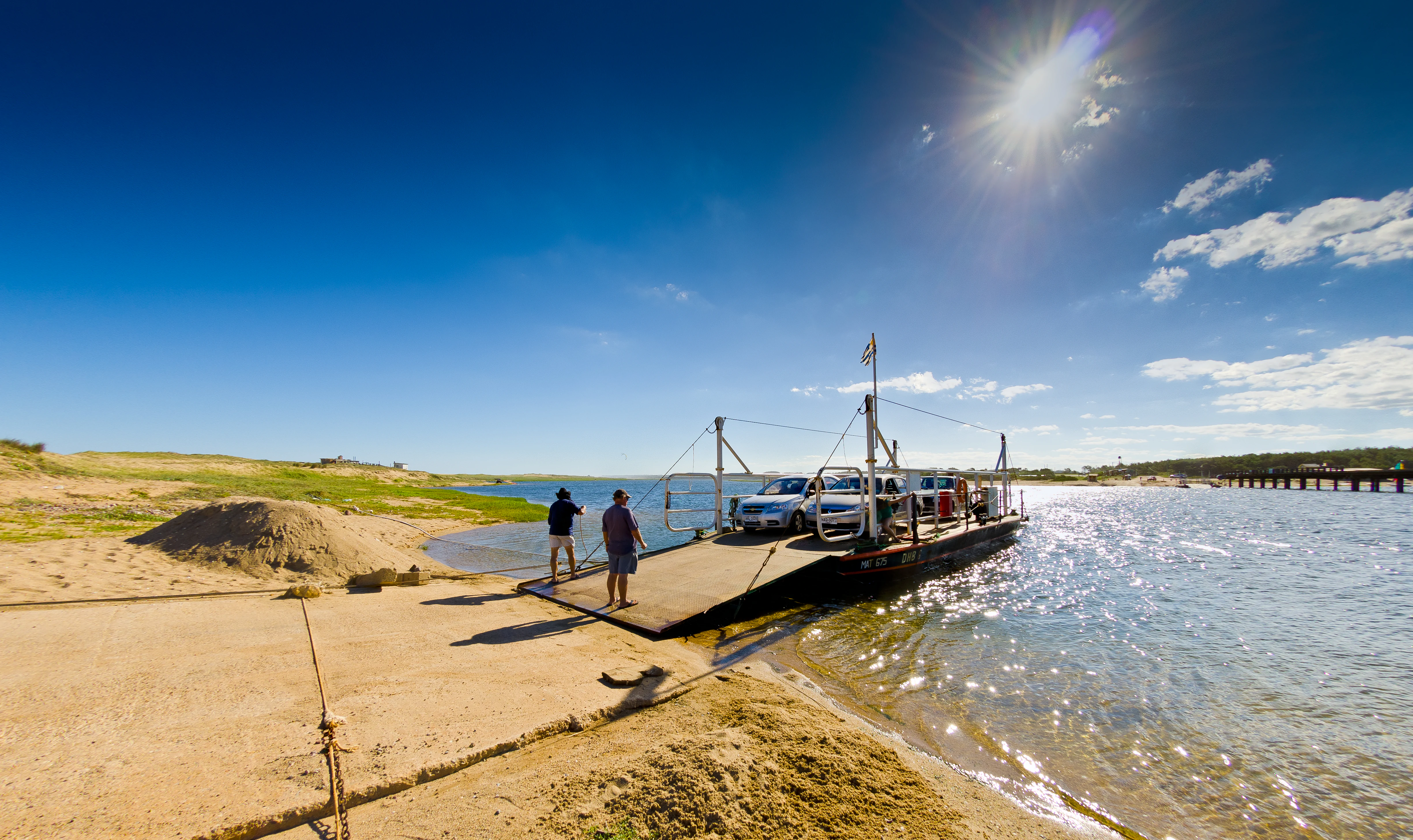
A small flat-deck ferry boat carrying vehicles docked at a sandy shoreline in Laguna Garzon, with two people standing on the ramp in the foreground and bright sunlight overhead.
The ferry crossing at the mouth of Laguna Garzon, facilitating vehicle transport across the lagoon.

Laguna Garzon Protected Habitat and Species Management Area history and protected-area timeline

The decisive step came in November 2014, when Decree 341/014 brought Laguna Garzon and the surrounding properties, along with a sector of the adjacent ocean, into Uruguay's National System of Natural Protected Areas as a habitat and species management area. This formalized protection that had been discussed for decades and created an independent protected status for the lagoon complex, separating it from the broader lacustrine park that had earlier grouped it with neighboring lagoons.

Laguna Garzon Protected Habitat and Species Management Area landscape and geographic character

The landscape of the Laguna Garzon protected area is defined by a coastal lagoon environment along Uruguay's southeast Atlantic shore. The dominant feature is Laguna Garzon itself, a shallow brackish lagoon separated from the ocean by a narrow strip of sand and dune. The lagoon sits in a low-relief coastal plain, where the land transitions gradually from freshwater and brackish marsh margins to open water and out toward the dune barrier that fronts the Atlantic.

Beyond Laguna Garzon, the protected area includes a chain of smaller coastal lagoons: Laguna Nueva, Rincon de Techera, Mansa, Larga, and Chica. These shallow waterbodies share the same general character: gentle margins, soft sediment bottoms, and a close relationship with both inland runoff and coastal groundwater. Together they form a series of quiet, reflective landscapes typical of Uruguay's southeastern coast.

A ring of rural land surrounds the lagoon system, ranging from grazing pastures and low scrub to more vegetated patches near the water margins. Toward the ocean side, the landscape shifts into the coastal dune belt that characterizes this stretch of the Uruguayan Atlantic. The protected area also extends seaward for a defined distance into the Atlantic Ocean, recognizing the lagoon system as part of a larger coastal and marine continuum rather than a purely terrestrial reserve.

Laguna Garzon Protected Habitat and Species Management Area ecosystems, habitats, and plant life

The ecological identity of the protected area is built around its coastal lagoon and wetland habitats. Brackish and shallow freshwater environments dominate the core of the reserve, providing conditions for wetland vegetation along the margins and open-water habitat across the lagoon surfaces. The interplay between freshwater inflow and marine influence gives these lagoons a distinctive ecological character, supporting communities adapted to variable salinity and seasonal hydrological change.

Surrounding habitats include low coastal scrub, grazed grasslands on the rural properties around the lagoons, and the dune plant communities on the barrier between the lagoons and the ocean. These dune zones are themselves ecologically important, stabilizing the sand barrier that shapes the hydrology of the lagoons behind them and supporting plant and animal communities adapted to sandy, exposed conditions.

The seaward extension of the protected area acknowledges that the lagoons are not isolated waterbodies but part of an exchange with the Atlantic. The coastal ocean adjacent to Laguna Garzon completes the ecological picture, linking lagoon outflow, nearshore marine waters, and the dune-protected shoreline into a single environmental system.

Laguna Garzon Protected Habitat and Species Management Area wildlife and species highlights

The lagoon complex at the heart of the protected area provides habitat for waterbirds typical of Uruguay's coastal wetlands, including species that use shallow brackish lagoons as feeding, resting, and seasonal habitat. The combination of open water, vegetated margins, and protected shorelines makes the area valuable for resident and migratory birdlife along the Atlantic coast of South America.

The dune systems and surrounding rural land add further habitat variety, supporting terrestrial fauna associated with coastal scrub and grassland. The seaward component of the protected area also connects the lagoon system with marine wildlife in the adjacent Atlantic waters, including fish and invertebrate populations that depend on the exchange between lagoon and ocean.

Laguna Garzon Protected Habitat and Species Management Area conservation status and protection priorities

The protection of Laguna Garzon and its surrounding area is significant because coastal lagoons are among Uruguay's most ecologically important and most threatened habitats. Lagoon environments are sensitive to changes in freshwater inflow, sediment dynamics, coastal development, and land use on the surrounding properties. Recognizing Laguna Garzon as a habitat and species management area within the National System of Natural Protected Areas reflects an effort to manage these pressures in a coordinated way.

The protected area's design is itself a conservation statement. By combining the lagoons themselves, the surrounding rural land, and a defined marine sector, the area treats the coastal lagoon system as an integrated ecological unit rather than a single waterbody. This integrated approach is consistent with the broader purpose of habitat and species management areas within Uruguay's protected areas framework, which focus on maintaining natural conditions for ecologically important species and habitats rather than imposing strict preservation in the sense of a national park.

In a regional sense, the area also plays a role in the conservation of Uruguay's chain of southeastern coastal lagoons. Together with Laguna Jose Ignacio and Laguna de Rocha, Laguna Garzon forms part of a broader network of coastal wetlands whose long-term integrity depends on coordinated protection along the entire southeast coast.

Laguna Garzon Protected Habitat and Species Management Area cultural meaning and human context

The Laguna Garzon protected area lies in a coastal region of Uruguay where human activity has long been shaped by the relationship between lagoon, dune, and ocean. Rural land use, including grazing and small-scale agriculture, occupies the properties encircling the lagoons, while fishing and seasonal use of the coast have historically been part of life along this stretch of the Atlantic shore.

In recent decades the area has also become associated with the growth of coastal tourism in southeastern Uruguay, exemplified by the nearby resort of Jose Ignacio. The protected area designation represents an attempt to maintain the natural and ecological values of the lagoon system alongside the social and economic activities that have long defined the region.

Top sights and standout views in Laguna Garzon Protected Habitat and Species Management Area

The standout qualities of the Laguna Garzon protected area include the linked lagoon system at its core, the surrounding dune and rural landscape, and the marine extension into the Atlantic. The inclusion of multiple lagoons, not just Laguna Garzon itself, gives the area a richer habitat mosaic than a single-lagoon reserve. The combination of wetland, dune, rural land, and ocean in one protected perimeter also distinguishes it within Uruguay's coastal conservation framework.

Best time to visit Laguna Garzon Protected Habitat and Species Management Area

The southeast coast of Uruguay has a temperate climate with clearly defined seasons. Spring and summer bring warmer conditions, longer days, and active waterbird presence around the lagoons, while autumn and winter offer quieter landscapes with soft light, fewer visitors, and a different rhythm of birdlife along the coast. The dunes and lagoon margins can be appreciated in any season, though weather conditions along the exposed Atlantic shoreline can be less comfortable during the cooler months.
Monthly climate preview

Long-term temperature ranges and monthly precipitation distribution for Maldonado

Area de manejo de habitats y/o especies Laguna Garzon Climate and Annual Weather Patterns

Area de manejo de habitats y/o especies Laguna Garzon records a measured annual temperature rhythm alongside consistent daily precipitation averages across representative coordinates in Maldonado. Detailed monthly climate normals provide full visibility into seasonal fluctuations and multi-year meteorological trends.
Annual mean17 °C
11 °C22 °C
Jan22°
Feb22°
Mar21°
Apr19°
May16°
Jun13°
Jul11°
Aug12°
Sep13°
Oct15°
Nov17°
Dec20°
Warmest month
February

21.9 °C

Coolest month
July

11.2 °C

Wettest month
April

4.5 mm/day

Driest month
January

3 mm/day

Park location guide

Geography guide, regional context, and park location map for Laguna Garzon Protected Habitat and Species Management Area

Laguna Garzon Protected Habitat and Species Management Area park geography, regions, and map view in Uruguay

Understand where Laguna Garzon Protected Habitat and Species Management Area sits in Uruguay through a broader geographic reading of the surrounding landscape, nearby location context, and its mapped position within the national park landscape.

How Laguna Garzon Protected Habitat and Species Management Area fits into Uruguay

Uruguay is a unitary presidential republic located in southeastern South America. It covers approximately 176,215 km² and has a population of nearly 3.5 million people. The capital and largest city is Montevideo, where roughly 2 million people live in the metropolitan area. Uruguay gained independence between 1825 and 1828 following territorial disputes involving Portugal, Spain, Brazil, and the United Provinces of the Río de la Plata.

Wider geography shaping Laguna Garzon Protected Habitat and Species Management Area in Uruguay

Uruguay is situated in the southeastern part of South America, bordering Argentina to its west and southwest, Brazil to its north and northeast, the Río de la Plata estuary to the south, and the Atlantic Ocean to the southeast. The terrain consists primarily of rolling plains and low hills, with the highest point being Cerro Catedral at approximately 514 meters. The country has several rivers including the Uruguay River, Paraná River, and Negro River.

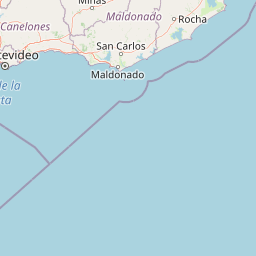
Map view of Laguna Garzon Protected Habitat and Species Management Area

Use this park location map to pinpoint Laguna Garzon Protected Habitat and Species Management Area in Uruguay, understand its exact geographic position, and read its mapped placement within the surrounding landscape more clearly.

Pigeon | © OpenStreetMap contributors

Location context for Laguna Garzon Protected Habitat and Species Management Area

MaldonadoRocha

Visual reference collection showcasing coastal wetland scenery and lagoon habitats

Area de manejo de habitats y/o especies Laguna Garzon Landscape Photos

Area de manejo de habitats y/o especies Laguna Garzon photos capture the distinctive coastal lagoon systems, dune barriers, and Atlantic shoreline environments of southeastern Uruguay. Visual documentation of the park terrain reveals wetland habitats and protected ecosystems across the surrounding marine and rural margins.

A small flat-deck ferry boat carrying vehicles docked at a sandy shoreline in Laguna Garzon, with two people standing on the ramp in the foreground and bright sunlight overhead.

Park atlas

Compare surrounding coastal lagoons, wetland habitats, and regional protected landscapes

Parks Near Area de manejo de habitats y/o especies Laguna Garzon and Related Protected Areas

Browsing other parks near Area de manejo de habitats y/o especies Laguna Garzon reveals connected coastal ecosystems and adjacent wetland reserves along the southeastern Atlantic shore. Extending the geographical comparison across regional protected areas provides broader context on Uruguay conservation networks.
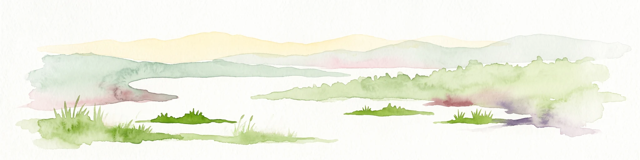
A horizontal watercolor illustration showing a shallow lagoon with soft green, yellow, and grey tones depicting vegetation, water, and distant low hills against a white background.
Protected landscapeRocha Department
About 21 km away#1 closest

Northeast

Laguna de Rocha Protected Landscape: Mapping Coastal Uruguay and its Dynamic Wetland Geography

Explore the unique barrier lagoon system and diverse coastal habitats of Rocha Department.

Laguna de Rocha functions as a vital coastal lagoon and wetland complex in southeastern Uruguay. Characterized by its shallow water and temporary sandbar breaches, the area supports a distinct mosaic of habitats, including dunes, reedbeds, and mudflats. Its status as a biosphere reserve and Important Bird Area underscores the ecological importance of this regional geography in providing a sanctuary for migratory waterbirds along the Atlantic coast.

Area
220 km²
Established
2010
Relief
Lowland
Climate
Temperate
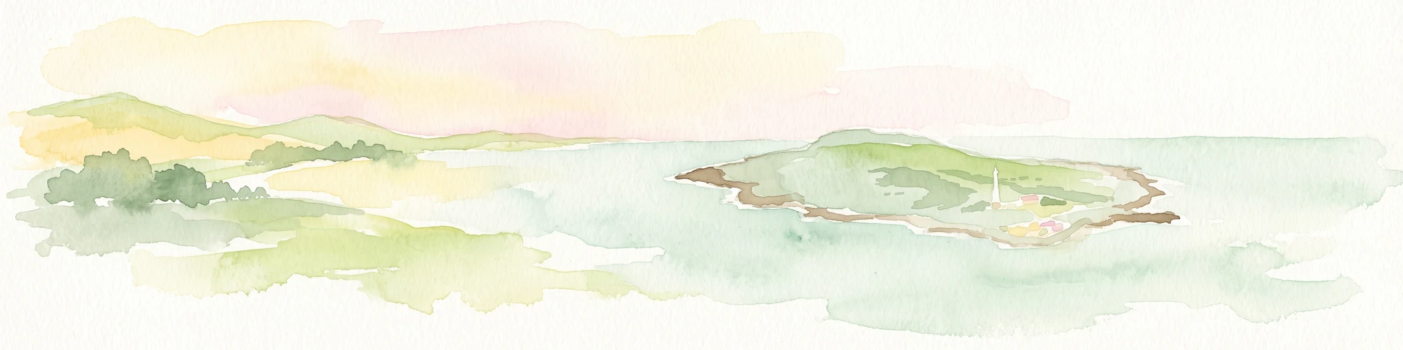
A soft watercolor painting showing an island surrounded by water, with distant green hills on the horizon under a light-colored sky.
National parkMaldonado
About 41 km away#2 closest

Southwest

Parque nacional Isla e islote de Lobos y su entorno sumergido: Protected Area Atlas

Mapping the oceanic terrain and rocky coastal landscapes of Uruguay

This resource provides a detailed geographic overview of Parque nacional Isla e islote de Lobos y su entorno sumergido. Explore the composition of this protected marine environment, which spans both rugged island terrain and extensive submerged rocky formations within the Atlantic waters of Maldonado.

Area
40 km²
Established
2024
Relief
Lowland
Climate
Temperate
Protected landscapeRocha
About 78 km away#3 closest

Northeast

Paisaje protegido Laguna de Castillos: Mapped Geography and Protected Landscape Features

Coastal lagoon and native woodland terrain in Rocha, Uruguay

Investigate the geographic profile of Paisaje protegido Laguna de Castillos, an essential protected area in Rocha. This terrain features the largest continuous ombú forest in the country alongside shallow coastal lagoon waters and complex wetland habitats that support a high diversity of native waterfowl.

Area
82.64 km²
Established
2020
Relief
Lowland
Climate
Subtropical
A stylized digital illustration of yellow and peach-toned sand dunes under a soft blue sky, with small patches of green grass in the foreground.
National parkRocha
About 81 km away#4 closest

Northeast

Parque nacional Cabo Polonio: Coastal Geography and Marine Protected Area Atlas

Examining dune systems, coastal lagoons, and marine habitats

Analyze the geography of Parque nacional Cabo Polonio, a protected area in Uruguay's Rocha region. This atlas entry details the mosaic of transverse dunes, interdunal wetlands, rocky outcrops, and oceanic islands that define this significant coastal-marine protected landscape.

Area
258.2 km²
Established
2009
Relief
Lowland
Climate
Subtropical
Watercolor painting of a soft landscape with rolling hills in the background and grassy plains in the foreground on a white background.
National parkLavalleja Department
About 84 km away#5 closest

Northwest

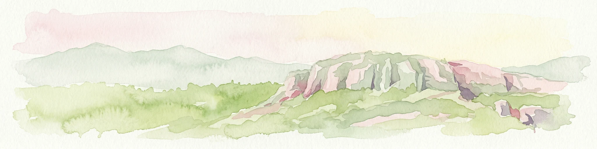
Parque nacional Arequita: Protected Landscape and Volcanic Geography in Lavalleja

Mapped natural terrain and protected ecosystems of southeastern Uruguay.

Parque nacional Arequita preserves a unique volcanic landscape in the Lavalleja Department, centered on the ancient basalt hill of Cerro Arequita. The area protects diverse environments ranging from rocky cave systems and native forests to critical freshwater watersheds. This record offers a deep look into the geographical character, internal boundaries, and ecological importance of one of Uruguay's most prominent natural sites.

Area
5.6 km²
Established
2024
Relief
Upland
Climate
Temperate
Watercolor painting showing a hill with green landscape and distant mountains
National parkUruguay
About 84 km away#6 closest

Northwest

Arequita National Park: Uruguay's National Park Protected Landscape and Geography

Mapped boundaries and regional natural terrain context for a key protected area.

Delve into Arequita National Park, a designated national park contributing to Uruguay's protected land inventory. This resource explores the park's unique geographic setting, its mapped boundaries, and its significance within the natural landscape of the Southern Cone. Gain structured insight into its role as a protected area and its contribution to the regional geography of South America.

Scope
Terrestrial
Water
No major water
National parkRocha Department
About 122 km away#7 closest

Northeast

Santa Teresa National Park: Mapped Coastal Forest and Beach Protected Landscape

Explore Rocha Department's unique protected Atlantic coast geography.

Santa Teresa National Park, a designated national park in Uruguay's Rocha Department, offers a compelling example of a protected coastal environment. Its landscape is characterized by a distinctive blend of dense forests that reach down to the sandy shores of the Atlantic Ocean, a rare feature in the region's protected areas. This page provides detailed geographic context and map-based exploration for understanding this unique seaside national park and its place within Uruguay's conservation atlas.

IUCN
II
Relief
Lowland
Climate
Subtropical
Access
Easy access
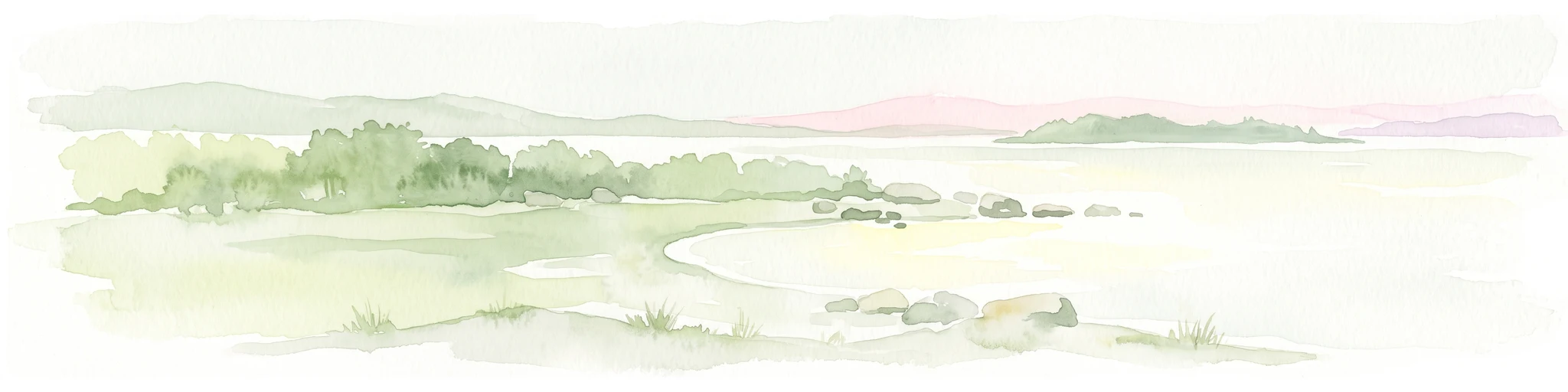
Watercolor painting of a wide, calm lake landscape with a sandy shoreline, sparse vegetation, and gentle hills in the background.
National parkRocha Department
About 123 km away#8 closest

Northeast

Parque Nacional Laguna Negra: Geographic Map and Protected Area Overview

Wetland and Savanna Landscapes in Rocha Department

Parque Nacional Laguna Negra protects a compressed mosaic of coastal environments in eastern Uruguay. The area integrates dense marshlands with native grasslands and patches of indigenous forest, providing a essential habitat corridor along the Atlantic coast. Use this atlas resource to understand its terrain and internal environmental distribution.

Area
7.15 km²
Established
2025
Relief
Lowland
Climate
Temperate

Common questions about visiting, size, designation, and location context for Laguna Garzon Protected Habitat and Species Management Area

Laguna Garzon Protected Habitat and Species Management Area FAQs for park facts, access, geography, and protected area context

Find quick answers about Laguna Garzon Protected Habitat and Species Management Area, including protected-area facts, park geography, trail and visitor context, and how the park fits into its surrounding country and regional landscape.
MoriAtlas Explorer

Continue Your Protected Areas Search Across the Global Atlas

Deepen your exploration by continuing the structured search for national parks and protected areas worldwide. Utilize the comprehensive filtering capabilities to compare different conservation landscapes and refine your understanding of global park geography. Discover more about the distribution and characteristics of protected natural areas.

Global natural geography