
Mori Atlas logo
National parkParque Nacional Laguna Negra

Examining the Mapped Boundaries and Diverse Ecological Mosaic in Eastern Uruguay

Parque Nacional Laguna Negra: A Detailed Atlas of Coastal Wetlands and Native Grasslands

Parque Nacional Laguna Negra serves as a critical protected landscape within Rocha Department, Uruguay. This national park features a distinct mosaic of coastal wetlands, native palm savannas, indigenous monte forest, and Atlantic shoreline. Its geographic context reinforces a vital conservation corridor that links local basins with the broader protected Atlantic coastal network.

wetlandscoastal lagoonnative grasslandindigenous monte forestAtlantic shorelinemigratory shorebirds
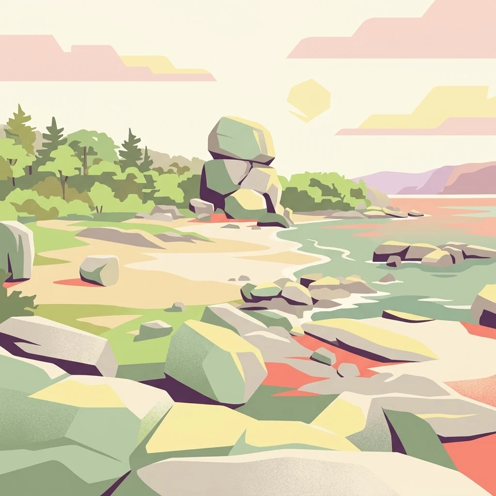
A stylized digital illustration of a serene lakeshore with scattered large boulders, a sandy beach area, and a lush green forest under a soft, pastel-colored sky.

Parque Nacional Laguna Negra

National park

Park overview

Structured park overview, official facts, and landscape profile for Parque Nacional Laguna Negra

Parque Nacional Laguna Negra park facts, protected area profile, and essential visitor context

Review the core facts for Parque Nacional Laguna Negra, including designation, size, terrain, visitor scale, habitats, and operating context in one park-focused overview.

About Parque Nacional Laguna Negra

Parque Nacional Laguna Negra is a young but ecologically significant protected area in the Rocha department of eastern Uruguay, near the country's Atlantic coast. Designated as a national park in February 2025, it consolidates different landscape elements that had previously been managed separately, bringing the Laguna Negra lagoon, the Potrerillo de Santa Teresa biological station, and the northern portion of the existing Parque Nacional Santa Teresa into a single management framework.

The protected area covers the surface water of Laguna Negra as well as the surrounding terrestrial environments. The Potrerillo area alone spans about 715 hectares and is dominated by a large wetland complex, while the included northern section of Santa Teresa National Park adds dune, forest, and coastal habitats that complement the hydrological and biological character of the lagoon basin.

The park reflects a wider effort to safeguard the wetlands of eastern Uruguay and to strengthen the connectivity between the country's protected coastal reserves. Its lands are owned by the Ministry of Environment and the Ministry of Defense, and they have been managed in coordination with PROBIDES, a long-running program focused on biodiversity conservation and sustainable development in the eastern wetlands, along with the national environment agency DINAMA. The integration of the site into the National System of Protected Areas formalizes this long-standing coordinated management.

At a landscape level, Parque Nacional Laguna Negra is distinctive because it concentrates four interrelated ecosystems in a relatively compact area: wetland, grassland, native forest, and sandy Atlantic shore. This diversity produces sharp ecological transitions, from dense reedbeds growing in saturated soils to dry grasslands dotted with butiá palms, and from shaded monte indígena dominated by trees such as arrayán, coronilla, and canelón to open coastal dunes used by migratory shorebirds. The result is a park that feels less like a single uniform environment and more like a layered mosaic of coastal Uruguay.

Quick facts and research context for Parque Nacional Laguna Negra

Parque Nacional Laguna Negra is located in the northeastern part of the Rocha department in eastern Uruguay, near the older Parque Nacional Santa Teresa. The park combines the Laguna Negra lagoon, the 715-hectare Potrerillo de Santa Teresa biological station, and the northern portion of Santa Teresa National Park lying north of Route 9.

The protected area integrates four principal environments: coastal wetland, native grassland, indigenous monte forest, and sandy Atlantic shoreline. Ownership is shared between Uruguay's Ministry of Environment and Ministry of Defense, and management has historically been coordinated through PROBIDES and DINAMA. The park was officially created on 20 February 2025 through Decree 43/025 and now forms part of Uruguay's National System of Protected Areas.

Protection and recognition

Examine official terrestrial designation records and protection history.

Parque Nacional Laguna Negra Protection Status and Designated Area Facts

Terrestrial protection status records for Parque Nacional Laguna Negra outline the official establishment year and management scope. Designated area data provides structured conservation facts without external recognition sources.

Protection details

Protection scope
Terrestrial
Designated year
2025
Transboundary protection
No
Park context

Deeper park guide and search-rich context for Parque Nacional Laguna Negra

Parque Nacional Laguna Negra history, landscape, wildlife, and travel context

Explore Parque Nacional Laguna Negra through its history, landscape character, ecosystems, wildlife, conservation priorities, cultural context, and seasonal travel timing in a structured park guide built for atlas discovery and search intent.

Why Parque Nacional Laguna Negra stands out

Parque Nacional Laguna Negra is known for its mosaic of coastal wetland, native forest, and Atlantic shoreline in one of Uruguay's most biodiverse regions. The park guards a strongly heterogeneous landscape where dense pajonales and espadaña marshes of Potrerillo de Santa Teresa meet native grasses, isolated pockets of monte indígena, and a narrow strip of Atlantic beach. The protected area is also notable for its combination of resident fauna, including nutrias, carpinchos, lobitos de río, ñandú, and lagarto overo, with migratory shorebirds such as chorlos, gaviotines, espátulas rosadas, and garzas blancas that use the coastal habitats. Its proximity to the older Santa Teresa reserve makes it a key extension of the protected landscape network in eastern Rocha.
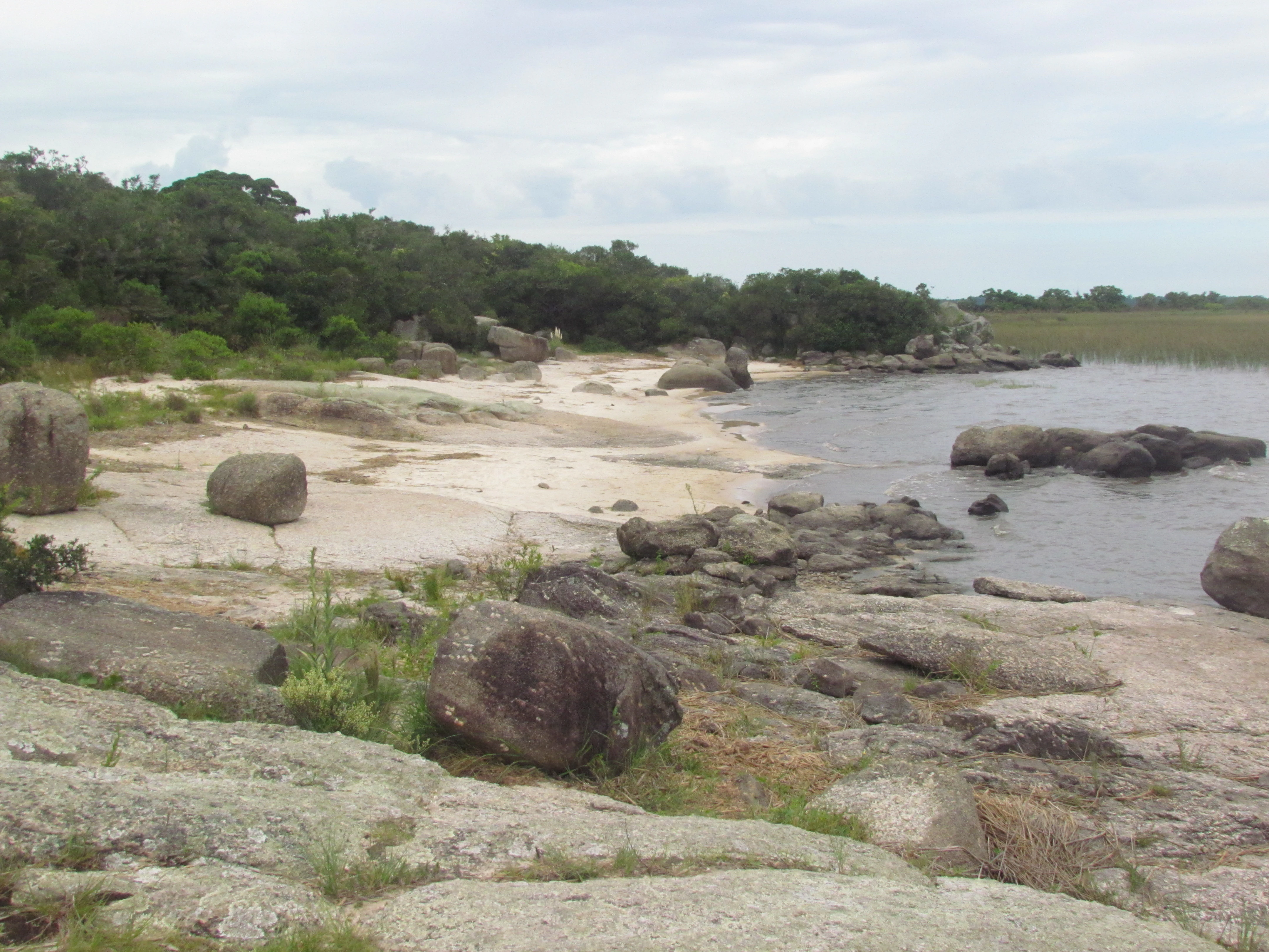
A wide shot showing the rocky, light-colored shoreline of a lake with dark water, bordered by native shrubbery and trees under an overcast sky.
The rocky shoreline of Laguna Negra in the Rocha Department.

Parque Nacional Laguna Negra history and protected-area timeline

The history of Parque Nacional Laguna Negra is closely tied to the land history of the Potrerillo de Santa Teresa property. Before becoming part of the Uruguayan state, the field belonged to the Banco República. In 1939, Law 9889 of 9 November formalized the donation of the property from the bank to the State, creating the basis for what would later become an ecologically managed reserve.

In 1991, Law 16226 placed this reserve under the provisions of article 458 of Law 16170, giving the Ministry of Housing, Territorial Planning, and Environment the task of studying, defining, regulating, and managing the area as a site of protection and ecological reserve. Although this represented a significant step toward formal conservation, the precise boundaries and management plan were still to be defined, and the land continued to be managed in a coordinated fashion by PROBIDES and DINAMA in subsequent decades.

The decisive institutional moment came on 20 February 2025, when Decree 43/025 approved the selection and delimitation of the Laguna Negra natural protected area and incorporated it into the National System of Protected Areas under the category of National Park. This decree transformed a long-running conservation effort into a fully designated national park, integrating Laguna Negra's water body, the Potrerillo de Santa Teresa biological station, and the northern portion of Santa Teresa National Park lying north of Route 9.

Parque Nacional Laguna Negra landscape and geographic character

The landscape of Parque Nacional Laguna Negra is defined by a sharp mosaic of environments packed into a relatively small territory. Within the Potrerillo de Santa Teresa area, coastal wetland is the dominant element, occupying roughly 465 hectares, or about 64 percent of the property. This wetland is filled with dense pajonales of cortadera and espadaña, interrupted by patches of grama, sarandí colorado, ceibo, curupí, duraznillo, and junco, giving the basin a lush, almost impenetrable appearance in many stretches.

Native grassland covers about 215 hectares, roughly 30 percent of the area. Grasses dominate, with local patches of spiny shrubs such as espina de la cruz, paja estrelladora, and caraguatá. On higher ground, the butiá palm stands out as a characteristic feature of the savanna-like appearance, while in lower and seasonally flooded areas, one finds species adapted to wet conditions such as cola de zorro and grama. The terrain shifts here from relatively dry knolls to periodically soaked lowlands, producing a textured and visually varied open landscape.

Indigenous monte forest occupies around 35 hectares, or about 5 percent of the property, and is made up of small trees such as chal-chal, arrayán, coronilla, canelón, and tala trepador, accompanied by shrubs like envira. Although limited in extent, these wooded patches provide important shade, structural variety, and habitat continuity with adjacent protected areas. Finally, a sandy Atlantic shoreline of less than one percent of the property closes the mosaic, where sarandí colorado and maritime grasses colonize the dunes and migratory shorebirds forage along the water's edge.

Parque Nacional Laguna Negra ecosystems, habitats, and plant life

Ecologically, Parque Nacional Laguna Negra functions as a layered system of cooperating habitats. The wetland is the hydrological heart of the area, holding and slowly releasing water through the dense root mats of cortadera and espadaña, and providing the moisture that sustains the grassland and forest communities downstream in the landscape gradient. The interplay between saturated soil and drier upland creates conditions for both wetland specialists and savanna species to coexist.

Native grassland and monte indígena act as transitional habitats between the wetland and the coast. In the grasslands, periodic flooding and drier spells produce different microhabitats, while the small monte remnants harbor shade-loving birds, climbing plants, and tree species that would otherwise be scarce in this open coastal environment. The presence of species such as butiá palm, arrayán, coronilla, and canelón links the park's flora to the broader phytogeography of eastern Uruguay, where coastal forest fragments are increasingly important refuges for native ligneous species.

The shoreline completes the ecological picture by introducing a dynamic, wind- and wave-driven edge with vegetation adapted to salt spray and shifting sands, such as sarandí colorado. Together, these habitats create a gradient that supports a wide spectrum of feeding, breeding, and shelter opportunities for both resident and migratory fauna.

Parque Nacional Laguna Negra wildlife and species highlights

The fauna of Parque Nacional Laguna Negra reflects the diversity of its habitats. The wetland environment hosts aquatic and semi-aquatic mammals such as nutrias, carpinchos, and lobitos de río, along with water-associated birds like ipecá, pico de plata, piojito gris, and the locally named dragón.

The grassland habitats support open-country species typical of the Uruguayan countryside, including zorrillo, apereá, ñandú, the small lechucita común, and the distinctive lagarto overo. In the monte indígena, larger mammals such as guazú virá, gato montés, and mano pelada find cover, while the bird community includes species such as the cardinal azul, zorzal, and sabiá, as well as reptiles like the culebra verde esmeralda.

The Atlantic shoreline is the most dynamic wildlife arena, attracting migratory shorebirds such as chorlos and gaviotines, along with espátulas rosadas, garzas blancas, cigüeñas, and several species of wild ducks. The combination of resident mammals, breeding birds, and seasonal migrants gives the park a full annual wildlife cycle.

Parque Nacional Laguna Negra conservation status and protection priorities

From a conservation perspective, Parque Nacional Laguna Negra is significant because it anchors a formally protected corridor in the eastern wetlands of Uruguay, where coastal lagoons, grasslands, and fragments of native forest are under growing pressure from land use change. By bringing the Laguna Negra basin and the Potrerillo de Santa Teresa reserve into the National System of Protected Areas, the park ensures long-term legal protection for habitats that had previously been conserved mainly through coordinated interagency management rather than formal designation.

The site also strengthens the ecological relationship between Laguna Negra and the older Parque Nacional Santa Teresa to its south. The northern portion of Santa Teresa is now part of the same protected landscape, helping to maintain habitat continuity for terrestrial species and to safeguard the dune systems and forest patches that connect the two reserves. The shared ownership between the Ministry of Environment and the Ministry of Defense adds a distinctive institutional dimension, embedding the park within both environmental and national defense land stewardship frameworks.

The longstanding conservation role of PROBIDES, focused on the eastern wetlands' biodiversity and sustainable development, and the regulatory involvement of DINAMA mean that the park inherits an established scientific and management tradition. The two interpretation trails, El Tarumán and El Ceibo, further serve a conservation-education function, allowing visitors to engage directly with native forest and the broader mosaic of grassland, wetland, and coastal habitats.

Parque Nacional Laguna Negra cultural meaning and human context

Parque Nacional Laguna Negra carries a meaningful but understated cultural-historical layer through its archaeological heritage. Within the Potrerillo de Santa Teresa property, two cerritos de indios are preserved. Excavations at these earthworks recovered a human burial and a dog burial, along with ceramics from more superficial layers, confirming the funerary role of these structures for indigenous populations that once inhabited the area.

The archaeological record also reveals information about the historical environment of the lagoon basin. Remains of now locally extinct fauna such as large cérvidos and possibly pumas have been recovered, alongside bones of species that still inhabit the park, including small rodents, nutrias, comadrejas, birds, and guazú-bira. This stratigraphy illustrates a long-term human presence in the landscape and documents ecological change that reaches back well beyond modern conservation efforts. The preservation of these cerritos within the new national park gives the site an enduring cultural and paleoecological value alongside its natural significance.

Top sights and standout views in Parque Nacional Laguna Negra

Parque Nacional Laguna Negra stands out for the unusually compressed diversity of its habitats, which combine coastal wetland, native grassland, monte indígena, and an Atlantic shoreline within the boundaries of a single national park. The wetland basin of Potrerillo de Santa Teresa, the open grassland butiá palm savannas, the arrayán and coronilla monte remnants, and the migratory bird-rich coast each contribute a distinct visual and ecological identity.

Equally important is the park's institutional profile as a node in Uruguay's expanding National System of Protected Areas, with formal linkages to the older Santa Teresa reserve and a deep cooperative management history through PROBIDES and DINAMA. The presence of cerritos de indios and the long-documented archaeological record add a cultural dimension that complements the park's natural appeal.

Best time to visit Parque Nacional Laguna Negra

Because Parque Nacional Laguna Negra encompasses coastal wetland, native grassland, monte forest, and an Atlantic shoreline, the character of a visit varies meaningfully across the seasons. The warmer months tend to bring more active birdlife and richer wetland vegetation, while migratory shorebird use of the coast is notable throughout much of the year.

Visiting in cooler months can make the open grasslands and trails more comfortable for walking, while also offering clearer views across the lagoon and surrounding habitats. For those primarily interested in migratory shorebirds and waterfowl, periods when coastal and wetland habitats are fully active offer the strongest wildlife interest. The interpretation trails El Tarumán and El Ceibo provide year-round access to representative examples of the park's native forest and mosaic of ecosystems.
Monthly climate preview

Long-term temperature and precipitation averages across representative coordinates

Parque Nacional Laguna Negra Climate Normals and Monthly Weather Records

Historical climate data for Parque Nacional Laguna Negra shows sustained seasonal shifts in average monthly temperatures and precipitation levels from 1991 to 2020. Examining the complete twelve-month record provides deeper insight into measured baseline patterns and long-term meteorological normals.
Annual mean17 °C
11 °C22 °C
Jan22°
Feb22°
Mar21°
Apr18°
May15°
Jun12°
Jul11°
Aug12°
Sep13°
Oct16°
Nov18°
Dec21°
Warmest month
January

22.3 °C

Coolest month
July

10.7 °C

Wettest month
February

4.2 mm/day

Driest month
November

2.7 mm/day

Park location guide

Geography guide, regional context, and park location map for Parque Nacional Laguna Negra

Parque Nacional Laguna Negra park geography, regions, and map view in Uruguay

Understand where Parque Nacional Laguna Negra sits in Uruguay through a broader geographic reading of the surrounding landscape, nearby location context, and its mapped position within the national park landscape.

How Parque Nacional Laguna Negra fits into Uruguay

Uruguay is a unitary presidential republic located in southeastern South America. It covers approximately 176,215 km² and has a population of nearly 3.5 million people. The capital and largest city is Montevideo, where roughly 2 million people live in the metropolitan area. Uruguay gained independence between 1825 and 1828 following territorial disputes involving Portugal, Spain, Brazil, and the United Provinces of the Río de la Plata.

Wider geography shaping Parque Nacional Laguna Negra in Uruguay

Uruguay is situated in the southeastern part of South America, bordering Argentina to its west and southwest, Brazil to its north and northeast, the Río de la Plata estuary to the south, and the Atlantic Ocean to the southeast. The terrain consists primarily of rolling plains and low hills, with the highest point being Cerro Catedral at approximately 514 meters. The country has several rivers including the Uruguay River, Paraná River, and Negro River.

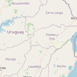
Map view of Parque Nacional Laguna Negra

Use this park location map to pinpoint Parque Nacional Laguna Negra in Uruguay, understand its exact geographic position, and read its mapped placement within the surrounding landscape more clearly.

Pigeon | © OpenStreetMap contributors

Location context for Parque Nacional Laguna Negra

Rocha Department

Visualizing coastal wetlands, palm savannas, and protected habitats

Parque Nacional Laguna Negra Photos and Landscape Scenery

Visual documentation of Parque Nacional Laguna Negra reveals the intricate mosaic of coastal wetlands, native grasslands, and Atlantic shoreline environments. Examining field photography helps researchers and visitors analyze the distinctive terrain, vegetation patterns, and conservation character of eastern Uruguay.

A wide shot showing the rocky, light-colored shoreline of a lake with dark water, bordered by native shrubbery and trees under an overcast sky.

Park atlas

Compare adjacent wetland reserves, coastal habitats, and regional conservation networks.

Exploring Parks Near Parque Nacional Laguna Negra and Surrounding Protected Areas

Continue geographic comparison by examining other parks near Parque Nacional Laguna Negra within the Rocha department and eastern Uruguay. Discover connected protected landscapes and regional wetland corridors that share similar coastal and grassland terrain.
National parkRocha Department
About 7.2 km away#1 closest

East

Santa Teresa National Park: Mapped Coastal Forest and Beach Protected Landscape

Explore Rocha Department's unique protected Atlantic coast geography.

Santa Teresa National Park, a designated national park in Uruguay's Rocha Department, offers a compelling example of a protected coastal environment. Its landscape is characterized by a distinctive blend of dense forests that reach down to the sandy shores of the Atlantic Ocean, a rare feature in the region's protected areas. This page provides detailed geographic context and map-based exploration for understanding this unique seaside national park and its place within Uruguay's conservation atlas.

IUCN
II
Relief
Lowland
Climate
Subtropical
Access
Easy access
Wildlife reserveDepartamento de Rocha
About 13 km away#2 closest

East

Área de manejo de hábitats y/o especies Cerro Verde e Islas de la Coronilla Protected Landscape

Coastal and marine wildlife reserve in Departamento de Rocha

Spanning both land and sea, this reserve protects a rare combination of granite coastal hills, relict forests, and oceanic islands along the Uruguayan Atlantic. Learn about its integrated role within the Banos del Este biosphere and its importance as a habitat for endangered green sea turtles and migrating southern right whales.

Area
16.88 km²
Established
2011
Relief
Lowland
Climate
Temperate
A wide, panoramic watercolor illustration showing a landscape of rolling green hills, grassy foreground vegetation, and distant pale mountains under a soft sky.
National parkDepartamento de Rocha
About 25 km away#3 closest

North

Parque nacional San Miguel: Mapped Protected Landscapes of Departamento de Rocha

Volcanic hills, native woodlands, and seasonal wetlands

Parque nacional San Miguel serves as a vital protected area, showcasing the distinctive topography of the Sierra de San Miguel. The terrain transitions from rocky volcanic slopes to expansive low-lying wetlands, creating a layered environment of native forests and open prairies that define this essential segment of the regional geography in Departamento de Rocha.

Area
15.42 km²
Established
1937
Relief
Upland
Climate
Temperate
Protected landscapeRocha
About 49 km away#4 closest

Southwest

Paisaje protegido Laguna de Castillos: Mapped Geography and Protected Landscape Features

Coastal lagoon and native woodland terrain in Rocha, Uruguay

Investigate the geographic profile of Paisaje protegido Laguna de Castillos, an essential protected area in Rocha. This terrain features the largest continuous ombú forest in the country alongside shallow coastal lagoon waters and complex wetland habitats that support a high diversity of native waterfowl.

Area
82.64 km²
Established
2020
Relief
Lowland
Climate
Subtropical
A stylized digital illustration of yellow and peach-toned sand dunes under a soft blue sky, with small patches of green grass in the foreground.
National parkRocha
About 50 km away#5 closest

South

Parque nacional Cabo Polonio: Coastal Geography and Marine Protected Area Atlas

Examining dune systems, coastal lagoons, and marine habitats

Analyze the geography of Parque nacional Cabo Polonio, a protected area in Uruguay's Rocha region. This atlas entry details the mosaic of transverse dunes, interdunal wetlands, rocky outcrops, and oceanic islands that define this significant coastal-marine protected landscape.

Area
258.2 km²
Established
2009
Relief
Lowland
Climate
Subtropical
Biosphere reserveUruguay
About 61 km away#6 closest

Northwest

Reserva de biosfera Bañados del Este: Geographic Overview of Uruguay Wetlands

Mapping protected lagoons, sierras, and palm savannas

Reserva de biosfera Bañados del Este represents one of South America's most significant wetland systems. This overview highlights the ecological and physical geography of a protected area that stretches from rolling crystalline sierras down to the Atlantic coastal lagoons, examining the interplay of marshlands, grasslands, and forest remnants that shape this vital Uruguayan region.

Area
12,500 km²
Established
1976
IUCN
IV
Relief
Mixed relief
A horizontal watercolor illustration showing a shallow lagoon with soft green, yellow, and grey tones depicting vegetation, water, and distant low hills against a white background.
Protected landscapeRocha Department
About 86 km away#7 closest

Southwest

Laguna de Rocha Protected Landscape: Mapping Coastal Uruguay and its Dynamic Wetland Geography

Explore the unique barrier lagoon system and diverse coastal habitats of Rocha Department.

Laguna de Rocha functions as a vital coastal lagoon and wetland complex in southeastern Uruguay. Characterized by its shallow water and temporary sandbar breaches, the area supports a distinct mosaic of habitats, including dunes, reedbeds, and mudflats. Its status as a biosphere reserve and Important Bird Area underscores the ecological importance of this regional geography in providing a sanctuary for migratory waterbirds along the Atlantic coast.

Area
220 km²
Established
2010
Relief
Lowland
Climate
Temperate
Wildlife reserveMaldonado
About 123 km away#8 closest

Southwest

Area de manejo de habitats y/o especies Laguna Garzon: Wildlife Reserve and Coastal Atlas

Mapped wetlands and Atlantic coastal landscapes in Maldonado, Uruguay.

The Area de manejo de habitats y/o especies Laguna Garzon protected area features a unique mosaic of interconnected lagoons and dune-backed shorelines. This coastal wildlife reserve offers a significant geographic study of wetland habitats and their interaction with the Atlantic maritime zone, providing essential context for understanding Uruguay's southeastern coastal terrain.

Established
2014
Water
Water-dominated

Common questions about visiting, size, designation, and location context for Parque Nacional Laguna Negra

Parque Nacional Laguna Negra FAQs for park facts, access, geography, and protected area context

Find quick answers about Parque Nacional Laguna Negra, including protected-area facts, park geography, trail and visitor context, and how the park fits into its surrounding country and regional landscape.
MoriAtlas Explorer

Continue Your Protected Areas Search Across the Global Atlas

Deepen your exploration by continuing the structured search for national parks and protected areas worldwide. Utilize the comprehensive filtering capabilities to compare different conservation landscapes and refine your understanding of global park geography. Discover more about the distribution and characteristics of protected natural areas.

Global natural geography