Mori Atlas logo
Marine protected areaBarren Isles

Tracing the protected maritime landscapes, shifting sand banks, and coastal island geography.

Barren Isles Marine Protected Area: Navigating the Archipelago off the Coast of Melaky, Madagascar

(Iles Barren)

The Barren Isles form a significant marine protected area located roughly 40 kilometres off the western coast of Madagascar in the Melaky region. This archipelago comprises nine principal islands and shifting sand banks within the Mozambique Channel, serving as a critical Ramsar wetland. The geography of the islands represents a complex intersection of shallow lagoon systems and offshore marine environments, supporting both delicate coastal habitats and long-standing seasonal maritime cultural patterns.

archipelagomarine ecosystemsRamsar wetlandMozambique Channelwest coast MadagascarMelaky region

Barren Isles

Marine protected area

Park overview

Structured park overview, official facts, and landscape profile for Barren Isles

Barren Isles park facts, protected area profile, and essential visitor context

Review the core facts for Barren Isles, including designation, size, terrain, visitor scale, habitats, and operating context in one park-focused overview.

About Barren Isles

The Barren Isles form a dispersed archipelago in the Mozambique Channel, stretching across roughly 40 kilometres of ocean off the western coast of Madagascar. Geographically, the archipelago belongs to the Melaky region and sits within the broader western seascape where Madagascar's continental shelf gives way to deeper channel waters. The chain consists of nine main islands, supplemented by sand banks that shift and reshape under the influence of currents, tides, and seasonal weather patterns.

For most of recorded history, the isles were considered unsuitable for permanent settlement by local custom, and they functioned primarily as temporary shelters for fishermen moving along the coast. This changed notably from 2004 onward, as Vezo fishermen, especially those from the Toliara region in the southwest, began to settle on the islands in increasing numbers. Today, between March and December, an estimated 4,000 Vezo fishermen live on the archipelago in makeshift dwellings built from palms, tarpaulins, and salvaged wood, weaving a new chapter of maritime cultural presence into a previously transient landscape.

Environmentally, the Barren Isles have attracted international attention. In 2017, the archipelago was officially designated as a Ramsar Wetland under the name Iles Barren, recognizing its importance as a coastal and marine wetland system. Madagascar's National Service of Protected Areas has also examined the region as a potential marine-protected area zone, reflecting the growing recognition of the archipelago's ecological value alongside its evolving human dimension.

Quick facts and research context for Barren Isles

The Barren Isles are an archipelago in the Melaky region of Madagascar, lying about 40 kilometres off the country's west coast in the Mozambique Channel. The island group includes nine main named isles and supporting sand banks. Traditionally uninhabited, the archipelago has become a seasonal home for Vezo fishing communities, with roughly 4,000 fishermen present during parts of the year.

The site was recognized internationally as a Ramsar Wetland on 22 May 2017 under the official name Iles Barren, signifying its wetland and shallow-water ecological importance. The archipelago has also been identified by Madagascar's National Service of Protected Areas as a potential marine-protected area zone.

Protection and recognition

Examining documented Ramsar site recognition and protected area boundaries

Barren Isles Protection Status and International Recognition Data

Barren Isles maintains verified designation records tied to international Ramsar wetland recognition frameworks. Structured conservation data outlines official protection attributes and documented administrative boundaries.
Park context

Deeper park guide and search-rich context for Barren Isles

Barren Isles history, landscape, wildlife, and travel context

Explore Barren Isles through its history, landscape character, ecosystems, wildlife, conservation priorities, cultural context, and seasonal travel timing in a structured park guide built for atlas discovery and search intent.

Why Barren Isles stands out

The Barren Isles are best known for their Ramsar-listed marine and coastal wetland ecosystems and for their role as a seasonal hub for Vezo fishermen, who have transformed the once-uninhabited archipelago into a living maritime cultural landscape. The combination of remote island geography, shifting sand banks, and traditional fishing practices defines the archipelago's distinct character off Madagascar's west coast.

Barren Isles history and protected-area timeline

Human history on the Barren Isles has long been shaped by restriction and seasonal use. Until November 2013, local customs explicitly forbade permanent habitation on the archipelago, with only short-term shelter and rest permitted for passing fishermen. The islands therefore existed, in cultural terms, as a place of transit rather than residence, embedded in the broader maritime traditions of Madagascar's west coast.

A significant shift began in 2004, when Vezo fishermen from the southwest, particularly the area around Toliara, began relocating to the Barren Isles in meaningful numbers. Over the following decade, this migration expanded into a sustained seasonal settlement pattern, with communities now typically present on the islands from March through December, sometimes for up to ten months a year. By the 2010s, an estimated 4,000 Vezo fishermen were living on the archipelago in improvised palm, tarpaulin, and timber dwellings.

On the conservation side, the archipelago was identified by Madagascar's National Service of Protected Areas, known in French as the Système des Aires Protégées de Madagascar (SAPM), as a candidate marine-protected area zone. Its formal international recognition followed on 22 May 2017, when the Barren Isles were designated as a Ramsar Wetland of international importance, marking the beginning of a new phase in the islands' environmental governance.

Barren Isles landscape and geographic character

The Barren Isles occupy a stretch of ocean roughly 40 kilometres wide off Madagascar's west coast, within the Mozambique Channel. The archipelago is composed of nine principal islands, each with its own character and naming tradition in the local Malagasy language: Nosy Marify, Nosy Manandra, also known as Banc Bayfield, Nosy Mboro (or Nosy Mavony), Nosy Maroantaly, Nosy Abohazo (also called Nosy Androtra), Nosy Dondosy, Nosy Mangily, Nosy Andrano, and Nosy Lava.

Barren Isles ecosystems, habitats, and plant life

While detailed ecological descriptions of the Barren Isles are limited in available sources, the archipelago's designation as a Ramsar Wetland in 2017 reflects the international recognition of its coastal and marine ecological character. The combination of small islands, sand banks, and surrounding shallow marine environments places the Barren Isles within the broader family of western Madagascar coastal wetland systems, which are known for their productivity and ecological importance in the Mozambique Channel.

Barren Isles conservation status and protection priorities

The conservation profile of the Barren Isles is anchored by two key developments. First, the archipelago was formally designated as a Ramsar Wetland on 22 May 2017 under the official name Iles Barren, placing it within the international Convention on Wetlands framework and underscoring the value of its coastal marine and wetland habitats.

Second, the National Service of Protected Areas of Madagascar, known as the Système des Aires Protégées de Madagascar (SAPM), associated with the Ministry of Environment and Forests, classified the Barren Isles as a potential marine-protected area zone. Together, these recognitions mark the archipelago as an emerging area of conservation attention, balancing growing human presence from Vezo fisheries with the need to preserve its wetland and marine environmental assets.

Barren Isles cultural meaning and human context

The cultural identity of the Barren Isles is closely tied to the Vezo, a southwest Malagasy people historically defined by their maritime traditions. For generations, the archipelago was treated as a space for temporary shelter rather than permanent residence, with local customs formally prohibiting living on the islands until November 2013.

Since 2004, this relationship has changed significantly. Vezo fishermen from areas south of Toliara have migrated to the archipelago in increasing numbers, establishing seasonal communities that are active for much of the year. Living in makeshift settlements of palms, tarpaulins, and wood, the fishing population, estimated at around 4,000 people during peak months, has given the once-uninhabited Barren Isles a distinct cultural and demographic character tied to traditional resource use and adaptation to remote island conditions.

Top sights and standout views in Barren Isles

The Barren Isles stand out for their combination of remoteness, ecological recognition, and traditional maritime culture. Their 2017 Ramsar designation marks them as an internationally acknowledged wetland and marine system, while their evolving role as a seasonal home for Vezo fishermen adds a rare cultural dimension to a typically uninhabited island chain.

Best time to visit Barren Isles

Publicly available sources do not provide detailed seasonal visiting guidance for the Barren Isles. However, the documented presence of Vezo fishing communities on the archipelago between March and December suggests that this period is the most active time of year on the islands, both in terms of human presence and likely associated marine resource activity.
Monthly climate preview

Long-term representative point measurements tracking monthly temperature and precipitation rhythms

Barren Isles Climate Normals and Measured Annual Weather Patterns

Barren Isles exhibits a measured annual temperature range from 24.32 degrees Celsius to 28.46 degrees Celsius alongside distinct monthly precipitation shifts across the representative coordinate. Exploring the comprehensive twelve-month climate profile reveals complete seasonal averages and detailed precipitation normals for this protected area.
Annual mean27 °C
24 °C28 °C
Jan28°
Feb28°
Mar28°
Apr28°
May26°
Jun25°
Jul24°
Aug24°
Sep25°
Oct26°
Nov27°
Dec28°
Warmest month
March

28.5 °C

Coolest month
July

24.3 °C

Wettest month
January

10.2 mm/day

Driest month
August

0.2 mm/day

Park location guide

Geography guide, regional context, and park location map for Barren Isles

Barren Isles park geography, regions, and map view in Madagascar

Understand where Barren Isles sits in Madagascar through a broader geographic reading of the surrounding landscape, nearby location context, and its mapped position within the national park landscape.

How Barren Isles fits into Madagascar

Madagascar is an island nation in the Indian Ocean, positioned off the southeastern coast of Africa. As the world's fourth-largest island and second-largest island country, it stands out for its exceptional biodiversity, over 90% of its wildlife is endemic, making it one of 17 megadiverse countries. The population is approximately 32 million, with Antananarivo as both the capital and largest city.

Wider geography shaping Barren Isles in Madagascar

Madagascar lies in the Indian Ocean off the southeastern coast of Africa, separated from the mainland by the Mozambique Channel. The island is situated approximately 400 km from the African continent. As the world's fourth-largest island, it also includes numerous smaller peripheral islands.

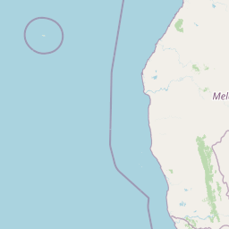
Map view of Barren Isles

Use this park location map to pinpoint Barren Isles in Madagascar, understand its exact geographic position, and read its mapped placement within the surrounding landscape more clearly.

Pigeon | © OpenStreetMap contributors

Location context for Barren Isles

Melaky
Recorded earthquake history

Review the Historical Catalogue of Recorded Seismic Events for the Barren Isles

Explore the documented earthquake history associated with the Barren Isles through a curated collection of USGS-derived records. Gain insight into past seismic activity patterns across this marine environment, including event magnitudes, depths, and proximity details maintained by the MoriAtlas geographic database.

Barren Isles Earthquake History

Catalogued events

1 event

Strongest magnitude

Magnitude 4.6

Most recent event

Jul 23, 2025

This history includes earthquakes recorded inside the park or within 50 km of its borders

Park atlas

Compare surrounding marine environments and connected coastal wetland reserves

Other Parks Like Barren Isles and Related Protected Areas in the Region

Browsing other parks near Barren Isles helps contextualize regional marine ecosystems, shallow lagoons, and offshore sand banks across the Mozambique Channel. Comparing adjacent protected areas reveals broader patterns in coastal wetland conservation and traditional fishing landscapes along the western coast.
National parkMelaky
57 km away#1 closest

Southeast

Tsingy de Bemaraha National Park: A Protected Landscape within Melaky, Madagascar

Explore mapped boundaries and regional geography for atlas discovery.

Tsingy de Bemaraha National Park is a designated national park offering profound opportunities for geographic discovery. As a key protected area in the Melaky region, its mapped boundaries and natural landscape characteristics are vital for understanding Madagascar's conservation geography. This resource facilitates detailed atlas exploration, providing structured insights into the park's terrain and its position within the broader regional context, enabling a focused study of its protected land identity.

Area
723.4 km²
Established
1997
IUCN
II
Visitors
10.1K annual
Nature reserveMelaky
About 59 km away#2 closest

East

Tsingy de Bemaraha Strict Nature Reserve: Karst Pinnacles and Protected Landscapes

Exploration of Madagascar karst geography and Melaky forest zones

Tsingy de Bemaraha Strict Nature Reserve is recognized for its unique labyrinth of stone needles and extensive canyon systems carved into the limestone plateau. The protected area preserves a rich variety of habitats, including dry tropical forests and riverine corridors that support a high concentration of endemic species. Delve into the mapped boundaries and topographical complexity of this iconic Madagascar landscape to understand its vital role in regional conservation.

Area
1,577.1 km²
Established
1927
IUCN
Ia
Relief
Highland
Nature reserveMadagascar
About 167 km away#3 closest

South

Réserve spéciale d'Andranomena: Protected Nature Reserve in Western Madagascar

Deciduous forest canopy, seasonal wetlands, and endemic baobab ecosystems.

Réserve spéciale d'Andranomena protects a significant block of dry dense forest within the Menabe region. The territory is known for its monumental baobab specimens, intricate seasonal hydrology, and high concentrations of Malagasy endemic species. This nature reserve provides a critical baseline for understanding the western island landscape, bridging the gap between coastal dune influence and interior deciduous terrain.

Area
64.2 km²
Established
1958
IUCN
IV
Relief
Lowland
National parkMahajanga Province
About 224 km away#4 closest

Northeast

Tsingy de Namoroka National Park: Geography, Karst Formations, and Regional Context

Protected karst landscapes in Mahajanga Province.

Tsingy de Namoroka National Park stands as a prime example of Madagascar's unique geological heritage, featuring sprawling fields of razor-sharp limestone pinnacles and intricate cave networks. This protected area offers deep insight into the intersection of subterranean hydrology and dry forest ecology within the broader Mahajanga Province.

Area
220.71 km²
Established
1927
IUCN
II
Relief
Mixed relief
Nature reserveToliara Province
About 229 km away#5 closest

South

Kirindy Forest Nature Reserve: Protected Dry Deciduous Forest in Western Madagascar

Geography, protected boundaries, and unique dry forest ecosystems

Kirindy Forest offers a detailed look into the ecology of western Madagascar. As a protected nature reserve, it shelters three species of baobab trees and diverse primate populations. Its terrain ranges from flat to gently undulating, creating a distinct visual rhythm through alternating dry and rainy seasons within the Menabe region.

Area
125 km²
Relief
Lowland
Climate
Tropical
Access
Moderate access
National parkMadagascar
About 229 km away#6 closest

South

Kirindy Mitea National Park: Madagascar National Park with Distinct Protected Landscape Identity

Explore the mapped geographic context of Kirindy Mitea National Park.

Kirindy Mitea National Park serves as a notable protected area, holding national park status within Madagascar's distinctive island geography. This entry focuses on understanding the park's unique protected landscape and its charted boundaries, offering essential context for atlas-driven exploration. Discover the geographic elements that define Kirindy Mitea National Park and its place within the broader conservation map of the region.

Area
1,563.5 km²
Established
1997
IUCN
IV
Relief
Mixed relief
National parkBoeny
About 249 km away#7 closest

Northeast

Baie de Baly National Park: Mapped Boundaries and Protected Landscape Context

Explore the geography and natural terrain of this national park.

Baie de Baly National Park presents a critical focal point for understanding protected areas within the Boeny region. As a national park, it showcases specific mapped boundaries that contribute to the broader geographic understanding of Madagascar's conservation landscapes. This detailed view allows for an atlas-driven exploration of the park's natural terrain and its significance as a distinct protected landmass within its regional context.

Area
571.42 km²
Established
1997
IUCN
II
Climate
Tropical
National parkBoeny Region
329 km away#8 closest

Northeast

Ankarafantsika National Park: Protected Area Atlas and Regional Geography Discovery

Explore mapped boundaries and natural landscape context.

Ankarafantsika National Park serves as a key protected area for understanding the geography of Madagascar's Boeny Region. This canonical page offers a detailed atlas-style view, highlighting the park's mapped boundaries and its role as a distinct natural landscape. Engage with structured geographic data to comprehend the park's protected status and its contribution to the regional terrain, facilitating a deeper appreciation of protected lands.

Area
1,365.13 km²
Established
2002
IUCN
II
Relief
Lowland

Common questions about visiting, size, designation, and location context for Barren Isles

Barren Isles FAQs for park facts, access, geography, and protected area context

Find quick answers about Barren Isles, including protected-area facts, park geography, trail and visitor context, and how the park fits into its surrounding country and regional landscape.
MoriAtlas Explorer

Continue Your Protected Areas Search Across the Global Atlas

Deepen your exploration by continuing the structured search for national parks and protected areas worldwide. Utilize the comprehensive filtering capabilities to compare different conservation landscapes and refine your understanding of global park geography. Discover more about the distribution and characteristics of protected natural areas.

Global natural geography