Mori Atlas logo
National parkTsingy de Bemaraha National Park

Understand the mapped boundaries and regional landscape context of this protected natural area.

Tsingy de Bemaraha National Park: Madagascar National Park Geographic Identity and Atlas Exploration

Tsingy de Bemaraha National Park stands as a significant protected landscape within the Melaky region of Madagascar. This national park offers a crucial point for understanding protected area distribution and natural geography. Explore its mapped boundaries, discover its place within the regional context, and gain insights into its unique landscape through detailed atlas and map-based exploration tools.

karst landscapeUNESCO World Heritage Sitelimestone formationsendemic speciesMadagascar protected areaswestern Madagascar

Tsingy de Bemaraha National Park

National park

Park overview

Structured park overview, official facts, and landscape profile for Tsingy de Bemaraha National Park

Tsingy de Bemaraha National Park park facts, protected area profile, and essential visitor context
Review the core facts for Tsingy de Bemaraha National Park, including designation, size, terrain, visitor scale, habitats, and operating context in one park-focused overview.

About Tsingy de Bemaraha National Park

Tsingy de Bemaraha National Park represents one of Madagascar's most distinctive protected landscapes, combining dramatic karst topography with extraordinary biological diversity. The park's core feature is the tsingy formation, a karstic landscape where limestone has been sculptured by millennia of water erosion into a maze of vertical cliffs, narrow gorges, and razor-sharp needles. This geological process has created a complex three-dimensional environment where different elevations and aspects of each limestone pinnacle support distinct microhabitats and species communities. The Great Tsingy and Little Tsingy formations together form the heart of the park, providing both the visual signature that attracts visitors and the ecological conditions that have driven remarkable evolutionary adaptation. The park's inclusion as part of a UNESCO World Heritage Site, together with the adjacent Strict Nature Reserve, reflects its global significance as both a geological phenomenon and a biodiversity hotspot.

Quick facts and research context for Tsingy de Bemaraha National Park

Tsingy de Bemaraha lies in northwestern Madagascar within the Antsalova District, with a smaller portion extending into Morafenobe District. The park is centered on spectacular karstic plateaus where groundwater has carved deep fissures and caverns into the limestone bedrock. The Manambolo River crosses through the park, providing additional ecological diversity. As a UNESCO World Heritage Site encompassing both the national park and the adjacent Tsingy de Bemaraha Strict Nature Reserve, the area represents one of Madagascar's most important protected landscapes. The park receives approximately 10,000 visitors annually and is managed by Madagascar National Parks.

Park context

Deeper park guide and search-rich context for Tsingy de Bemaraha National Park

Tsingy de Bemaraha National Park history, landscape, wildlife, and travel context
Explore Tsingy de Bemaraha National Park through its history, landscape character, ecosystems, wildlife, conservation priorities, cultural context, and seasonal travel timing in a structured park guide built for atlas discovery and search intent.

Why Tsingy de Bemaraha National Park stands out

Tsingy de Bemaraha is renowned for its extraordinary limestone karst formations that create a surreal landscape of towering needles, deep gorges, and hidden caves. The superimposition of vertical and horizontal erosion patterns has produced what appears as a 'forest' of limestone spikes, making this one of the most visually distinctive protected areas in Africa. Beyond its geological spectacle, the park is celebrated for its exceptional endemism, where the unique microhabitats created by different elevations on the limestone needles support species found nowhere else on the planet.

Tsingy de Bemaraha National Park history and protected-area timeline

Tsingy de Bemaraha was established as a national park on August 1, 1997, representing Madagascar's commitment to protecting its unique natural heritage. The creation of the park came as recognition grew of the extraordinary geological and ecological values of the tsingy formations and the surrounding landscapes. The national park was later integrated into a World Heritage Site designation that also encompasses the adjacent Tsingy de Bemaraha Strict Nature Reserve, providing comprehensive protection for the broader ecosystem. Management responsibility lies with Madagascar National Parks, the national body overseeing the country's protected area network. The establishment of the park also recognized the need to balance conservation with sustainable tourism, providing economic incentives for local communities while protecting the irreplaceable natural values.

Tsingy de Bemaraha National Park landscape and geographic character

The Tsingy de Bemaraha landscape is defined by its spectacular karst geology, where limestone plateaus have been dramatically eroded to create some of Madagascar's most unusual terrain. Groundwater percolating through the rock has carved extensive networks of caves, tunnels, and fissures, while surface erosion has produced the characteristic 'forests' of limestone needles that give the area its name. The Great Tsingy forms the most extensive and dramatic section, with limestone pillars rising dozens of meters above the forest floor, their steep faces scarred by vertical crevices. Between the needle formations, deep gorges and collapsed passages create a terrain that is both visually stunning and practically impenetrable. The Manambolo River has carved its own path through this landscape, adding riverine environments to the karst topography. The overall effect is a landscape of extraordinary vertical complexity, where the interplay of light and shadow across the needle formations creates an almost otherworldly scenery.

Tsingy de Bemaraha National Park ecosystems, habitats, and plant life

The Tsingy de Bemaraha ecosystem represents a remarkable example of how geological complexity drives biological diversity. The vertical stratification created by the limestone needles, from the summit through the slopes to the base, produces distinct ecological zones each supporting different species assemblages. The extremely steep slopes and specialized habitats have allowed populations to evolve in isolation, resulting in exceptionally high levels of endemism. Each limestone pinnacle can function as a separate ecological island, with species adapted to specific conditions of sun exposure, moisture, and substrate stability. The combination of karst geology with Madagascar's position as a biodiversity hotspot has produced an area where new species continue to be discovered, particularly among invertebrates and smaller vertebrates that inhabit the intricate cave systems and hidden crevices throughout the formation.

Tsingy de Bemaraha National Park wildlife and species highlights

The wildlife of Tsingy de Bemaraha is characterized by extraordinary endemism, with numerous species found only within the park's unique karst habitats. The different elevations and aspects of the limestone needles create varied microhabitats that have driven adaptive radiation in several groups. Reptiles and amphibians are particularly well represented, with numerous gecko and chameleon species adapted to life among the vertical rock faces. The forest-dwelling lemurs that inhabit the surrounding areas occasionally venture into the tsingy edges, though the most specialized species have evolved to navigate the needle formations. Birdlife includes several endemic species that have adapted to the karst environment, using the vertical cliffs for nesting and foraging. The deeper caves and underground passages shelter specialized troglobitic species that have evolved in complete isolation from the surface world.

Tsingy de Bemaraha National Park conservation status and protection priorities

Tsingy de Bemaraha holds UNESCO World Heritage status recognizing its outstanding universal value as both a geological phenomenon and a biodiversity hotspot. The designation encompasses both the national park and the adjacent Strict Nature Reserve, providing comprehensive protection for the broader tsingy ecosystem. The karst landscape presents both conservation challenges and opportunities, as the rugged terrain naturally limits some human impacts while also making patrolling and monitoring difficult. Conservation efforts focus on protecting the endemic species that inhabit the specialized microhabitats, many of which are threatened by habitat loss in other parts of Madagascar. The park's management balances tourism pressure with protection needs, recognizing that visitor revenue can provide sustainable financing for conservation while also requiring careful monitoring to prevent impacts on the sensitive limestone formations.

Tsingy de Bemaraha National Park cultural meaning and human context

While Tsingy de Bemaraha is primarily valued for its geological and ecological significance, the area exists within a broader regional context of traditional Malagasy communities. The name 'tsingy' itself originates from the Malagasy language, reflecting the long-standing recognition by local people of the landscape's distinctive and challenging character. The park lies within traditional territory where local communities maintain connections to the land, though the extreme terrain of the tsingy formations limited extensive human settlement within the core protected areas. Understanding the cultural context helps frame the park within Madagascar's broader relationship with its unique natural landscapes.

Top sights and standout views in Tsingy de Bemaraha National Park

The Great Tsingy formation stands as the park's most spectacular feature, a labyrinth of limestone needles rising dramatically from the forest floor. Visitors can traverse suspension bridges that provide access into the heart of the needle formations, offering views down into the crevices and across the landscape of spires. The cave systems within the karst provide additional exploration opportunities, with some passages containing significant geological formations. The river canyons along the Manambolo offer contrasting landscapes, with boat trips providing access to different perspectives on the park. The extraordinary biodiversity, with species found nowhere else on Earth, makes every visit a chance to observe organisms unknown to science anywhere else.

Best time to visit Tsingy de Bemaraha National Park

The optimal time to visit Tsingy de Bemaraha falls during the cooler, drier months from May through October, when conditions are most comfortable for exploring the park's trails and formations. The dry season offers clearer visibility for photography and easier navigation along the suspension bridges and paths. During the wet season from November through April, heavy rains can make some trails treacherous and the limestone surfaces slippery and dangerous. The hottest period typically occurs in October and November before the rains truly begin. Wildlife viewing is generally better during the dry season when animals concentrate around water sources, though the unique species of the tsingy can be observed year-round.
Park location guide

Geography guide, regional context, and park location map for Tsingy de Bemaraha National Park

Tsingy de Bemaraha National Park park geography, regions, and map view in Madagascar
Understand where Tsingy de Bemaraha National Park sits in Madagascar through a broader geographic reading of the surrounding landscape, nearby location context, and its mapped position within the national park landscape.

How Tsingy de Bemaraha National Park fits into Madagascar

Madagascar is an island nation in the Indian Ocean, positioned off the southeastern coast of Africa. As the world's fourth-largest island and second-largest island country, it stands out for its exceptional biodiversity, over 90% of its wildlife is endemic, making it one of 17 megadiverse countries. The population is approximately 32 million, with Antananarivo as both the capital and largest city.

Wider geography shaping Tsingy de Bemaraha National Park in Madagascar

Madagascar lies in the Indian Ocean off the southeastern coast of Africa, separated from the mainland by the Mozambique Channel. The island is situated approximately 400 km from the African continent. As the world's fourth-largest island, it also includes numerous smaller peripheral islands.

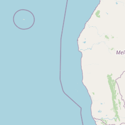
Map view of Tsingy de Bemaraha National Park

Use this park location map to pinpoint Tsingy de Bemaraha National Park in Madagascar, understand its exact geographic position, and read its mapped placement within the surrounding landscape more clearly.

Pigeon | © OpenStreetMap contributors

Location context for Tsingy de Bemaraha National Park

Melaky
Park atlas

Compare diverse protected landscapes and regional park geography around Madagascar's unique karst formations.

Exploring Other National Parks and Protected Areas Beyond Tsingy de Bemaraha National Park
Explore a curated selection of other national parks and protected areas geographically near Tsingy de Bemaraha National Park or within Madagascar, allowing for direct comparison of conservation landscapes and unique terrain. Broaden your understanding of regional park geography and discover how various protected-area designations preserve diverse ecosystems across the island.
National parkMadagascar

Kirindy Mitea National Park: Madagascar National Park with Distinct Protected Landscape Identity

Explore the mapped geographic context of Kirindy Mitea National Park.

Kirindy Mitea National Park serves as a notable protected area, holding national park status within Madagascar's distinctive island geography. This entry focuses on understanding the park's unique protected landscape and its charted boundaries, offering essential context for atlas-driven exploration. Discover the geographic elements that define Kirindy Mitea National Park and its place within the broader conservation map of the region.

Area
1,563.5 km²
Established
1997
IUCN
IV
Relief
Mixed relief
National parkBoeny

Baie de Baly National Park: Mapped Boundaries and Protected Landscape Context

Explore the geography and natural terrain of this national park.

Baie de Baly National Park presents a critical focal point for understanding protected areas within the Boeny region. As a national park, it showcases specific mapped boundaries that contribute to the broader geographic understanding of Madagascar's conservation landscapes. This detailed view allows for an atlas-driven exploration of the park's natural terrain and its significance as a distinct protected landmass within its regional context.

Area
571.42 km²
Established
1997
IUCN
II
Climate
Tropical
National parkMadagascar

Marolambo National Park: Madagascar's National Park and Protected Landscape

Explore mapped boundaries and regional geography.

Marolambo National Park stands as a protected national park within Madagascar's globally recognized biodiversity hotspot. This entry provides focused insight into its protected landscape, its specific geographic context within the island nation, and its role in the conservation of unique natural terrain. Understanding Marolambo National Park through its mapped boundaries and regional geography contributes to a broader atlas exploration of Madagascar's endemic ecosystems.

Area
950.63 km²
Climate
Tropical
Access
Remote access
Scope
Terrestrial
National parkBoeny Region

Ankarafantsika National Park: Protected Area Atlas and Regional Geography Discovery

Explore mapped boundaries and natural landscape context.

Ankarafantsika National Park serves as a key protected area for understanding the geography of Madagascar's Boeny Region. This canonical page offers a detailed atlas-style view, highlighting the park's mapped boundaries and its role as a distinct natural landscape. Engage with structured geographic data to comprehend the park's protected status and its contribution to the regional terrain, facilitating a deeper appreciation of protected lands.

Area
1,365.13 km²
Established
2002
IUCN
II
Relief
Lowland
National parkAlaotra-Mangoro

Andasibe-Mantadia National Park: National Park and Protected Landscape Identity

Explore its mapped boundaries and geographic context.

Andasibe-Mantadia National Park is a distinct protected territory within the Alaotra-Mangoro region, serving as a crucial focal point for understanding Madagascar's regional geography and protected land distribution. This detail page provides essential atlas-style information on the park's mapped area and its natural landscape characteristics. Engage with structured data that highlights the park's protected status and its position within the broader geographic framework of eastern Madagascar, supporting focused discovery for researchers and explorers.

Area
155 km²
Established
1989
IUCN
II
Visitors
26.1K annual
Watercolor illustration of a landscape featuring mountains, a lake, trees, and pink flowers in the foreground
National parkAlaotra-Mangoro

Analamazaotra National Park: Protected Rainforest Ecosystem and Mapped Landscape in Alaotra-Mangoro

Explore Madagascar's Eastern Highlands protected area geography.

Analamazaotra National Park, situated in Madagascar's Alaotra-Mangoro region, represents a critical segment of the island's protected eastern rainforests. This national park is mapped as a vital conservation area, offering insights into its unique ecosystems and natural terrain. Understanding Analamazaotra National Park's geographic placement and protected boundaries provides essential context for regional landscape exploration and atlas-based geographic discovery within Madagascar.

Area
26.53 km²
Established
2015
IUCN
II
Relief
Highland
National parkMadagascar

Ranomafana National Park: Madagascar's premier Tropical Rainforest Protected Area

Explore its unique mapped geography and landscape context.

Ranomafana National Park stands as a crucial national park within Madagascar's protected lands, safeguarding a significant expanse of tropical rainforest. This page offers a deep dive into its geographic setting, detailing the mapped boundaries and the distinctive natural terrain that supports its exceptional biodiversity. Discover the atlas value of this protected landscape for understanding regional conservation and geographic context.

Area
416 km²
Established
1991
IUCN
II
Climate
Tropical
National parkMadagascar

Zahamena National Park: Madagascar National Park Exploration and Geographic Context

Mapping the protected boundaries and landscape of Zahamena National Park.

Delve into Zahamena National Park, a vital protected territory situated in Madagascar. This national park offers a unique perspective on the island's natural geography and its status as a significant protected landscape. Understand its position within Madagascar's broader context, focusing on the mapped aspects of its protected area identity and its contribution to the country's renowned biodiversity hotspot status.

Area
423 km²
Established
1997
IUCN
II
Relief
Mountain

Common questions about visiting, size, designation, and location context for Tsingy de Bemaraha National Park

Tsingy de Bemaraha National Park FAQs for park facts, access, geography, and protected area context
Find quick answers about Tsingy de Bemaraha National Park, including protected-area facts, park geography, trail and visitor context, and how the park fits into its surrounding country and regional landscape.
MoriAtlas Explorer

Continue Your Protected Areas Search Across the Global Atlas

Deepen your exploration by continuing the structured search for national parks and protected areas worldwide. Utilize the comprehensive filtering capabilities to compare different conservation landscapes and refine your understanding of global park geography. Discover more about the distribution and characteristics of protected natural areas.

Global natural geography