
Mori Atlas logo
National parkTsingy de Namoroka National Park

Mapping the dramatic blade-like pinnacles and subterranean cave systems in northwestern Madagascar.

Tsingy de Namoroka National Park: A Study in Limestone Karst and Protected Geography

Tsingy de Namoroka National Park is a protected landscape in northwestern Madagascar defined by its vast limestone karst geology. This park encompasses sharp, vertical pinnacles known as tsingy, deep canyons, and the extensive Marosakabe cave system. Beyond these eroded formations, a mosaic of dry deciduous forests and seasonal wetlands provides habitat for diverse endemic wildlife in this region of Mahajanga Province.

tsingykarst landscapelimestone formationsdry deciduous forestcavescave system
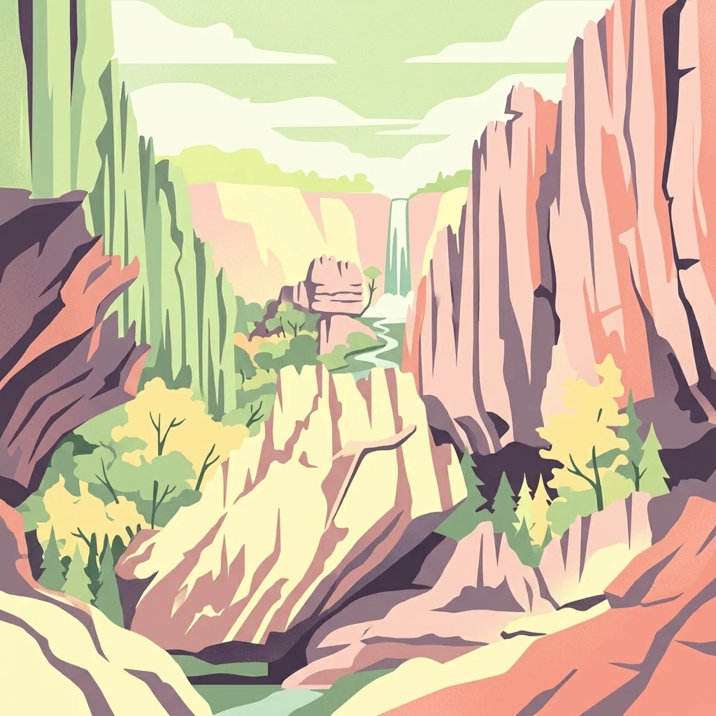
A graphic art style illustration showing a deep canyon with jagged, colorful rock walls, lush vegetation, and a small waterfall in the distance.

Tsingy de Namoroka National Park

National park

Park overview

Structured park overview, official facts, and landscape profile for Tsingy de Namoroka National Park

Tsingy de Namoroka National Park park facts, protected area profile, and essential visitor context

Review the core facts for Tsingy de Namoroka National Park, including designation, size, terrain, visitor scale, habitats, and operating context in one park-focused overview.

About Tsingy de Namoroka National Park

Tsingy de Namoroka National Park occupies part of the karst plateau of northwestern Madagascar, where ancient limestones have been sculpted by water into a maze of vertical pinnacles, fissures, sinkholes, and caverns. The result is a striking topography of jagged ridges and broken towers that makes movement on foot difficult, giving the entire region a fortress-like character. Within this dramatic setting, pockets of dry deciduous forest persist, clinging to soil accumulated in crevices and depressions between the limestone teeth.

The park sits between about 50 kilometers south of Soalala on the country's western coast, placing it firmly within the seasonally dry western biogeographic region of Madagascar. The climate is hot and strongly seasonal, with a long dry period and a shorter rainy season. Precipitation is lower than in many other parts of the island, helping to shape the dry-adapted vegetation patterns that dominate here. Rivers and seasonal streams run through the karst, sometimes disappearing underground and re-emerging in natural pools, creating a network of water features that supports both wildlife and the cave systems below.

Ecologically, Namoroka is exceptional even by Madagascar's standards. Its combination of intact dry forest, isolated limestone outcrops, and varied microhabitats allows a large number of species to coexist across a relatively compact protected area. Birdlife is particularly rich, with dozens of species recorded, including many endemic to Madagascar. The park also hosts multiple lemur species, several of which are difficult to observe elsewhere, along with notable populations of reptiles and amphibians.

Together, its geology, climate, and ecological isolation make Tsingy de Namoroka an essential counterpart to the larger Tsingy de Bemaraha complex further south. While Bemaraha is more famous and more frequently visited, Namoroka offers a quieter, wilder experience of the same geological phenomenon, with the added draw of long cave systems and an unusually well-preserved dry forest ecosystem.

Quick facts and research context for Tsingy de Namoroka National Park

Tsingy de Namoroka National Park is located in the Soalala District of the Mahajanga Province in northwestern Madagascar, situated roughly 50 kilometers south of the coastal town of Soalala. It is classified as a national park under IUCN Category II and covers an area of approximately 220 square kilometers.

The park was first protected as the Namoroka Strict Nature Reserve in 1927 and later redesignated as a special reserve before becoming a full national park. It lies within a dry-tropical climate zone with a pronounced dry season of about seven months and a shorter rainy season, and contains some of the most extensive karst formations in Madagascar, including a portion of Africa's longest cave system, the Marosakabe cave network.

Protection and recognition

Documented terrestrial protection scope, establishment year, and management records

Tsingy de Namoroka National Park Protection Status and Designation History

Tsingy de Namoroka National Park maintains a documented terrestrial protection scope established in 1966. Structured records provide baseline designation history and administrative context for this protected natural area.

Protection details

Protection scope
Terrestrial
Designated year
1966
Transboundary protection
No
Park context

Deeper park guide and search-rich context for Tsingy de Namoroka National Park

Tsingy de Namoroka National Park history, landscape, wildlife, and travel context

Explore Tsingy de Namoroka National Park through its history, landscape character, ecosystems, wildlife, conservation priorities, cultural context, and seasonal travel timing in a structured park guide built for atlas discovery and search intent.

Why Tsingy de Namoroka National Park stands out

Tsingy de Namoroka is best known for its spectacular tsingy landscapes; towering fields of razor-sharp limestone pinnacles formed by millennia of water erosion through soluble rock. These sharp formations give the park its evocative name, as 'tsingy' broadly translates in Malagasy as a sense of walking on tiptoes across something sharp. Beyond the surface karst, the park is recognized for the enormous Marosakabe cave system, one of the most significant subterranean networks in Africa. It is also valued for its high concentration of endemic species, particularly lemurs and birds, that thrive in the dry deciduous forest and isolated rock habitats of the region.
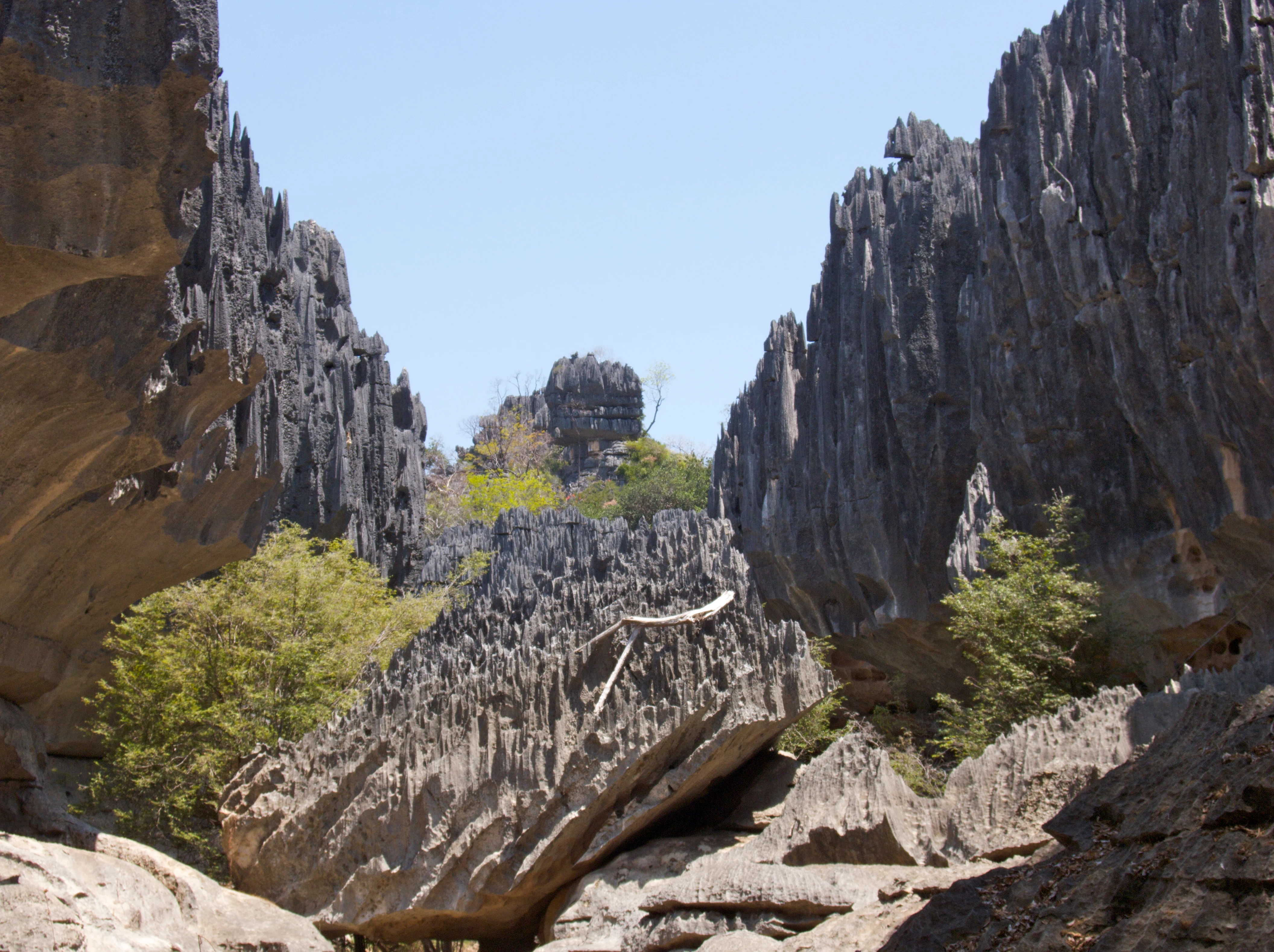
Rugged, needle-like limestone rock formations rising steeply from the ground in a canyon-like setting under a clear sky.
Sharp karst limestone rock formations known as tsingy within Tsingy de Namoroka National Park.

Tsingy de Namoroka National Park history and protected-area timeline

The area that is now Tsingy de Namoroka National Park was first brought under formal protection in 1927, when it was established as the Namoroka Strict Nature Reserve. This early date, less than a decade after many similar reserves were set up across the colonial-era territories of the western Indian Ocean, reflects the early recognition of the site's unusual geological and biological character.

In 1966 the reserve was reclassified as a special reserve, a designation that adjusted its management status while retaining its protected character. Over the following decades, Madagascar's protected-area system was reorganized, and the site eventually became Tsingy de Namoroka National Park, administered by Madagascar National Parks, the country's principal public body for managing national parks and reserves.

Today the park is managed alongside neighboring Baie de Baly National Park, with which it forms a broader conservation complex along the western coast of Madagascar. This pairing reflects both ecological linkages between the two areas and the regional planning approach that Madagascar applies to its protected landscapes.

Tsingy de Namoroka National Park landscape and geographic character

The landscape of Tsingy de Namoroka is dominated by karst, a terrain shaped by the slow dissolution of limestone bedrock over millions of years. Across much of the park, the surface has been eaten away into a field of sharp, vertical pinnacles called tsingy, which rise from the plateau like a forest of stone blades. Between these formations lie deep crevices, narrow canyons, and collapsed sinkholes that make travel through the area a slow and careful process.

The underlying geology is riddled with caves. The Marosakabe cave system runs deep beneath the karst, extending for more than 100 kilometers through the limestone and constituting one of Africa's longest mapped cave networks. On the surface, seasonal rivers and streams carve through the rock, occasionally plunging into the karst to emerge elsewhere as natural pools and clear waterholes. During the rainy season these features fill and overflow, briefly transforming the dry appearance of the park.

Beyond the most dramatic tsingy walls, the park also includes stretches of dry deciduous forest, patches of savanna-like woodland, and seasonal wetlands. Together these habitats create a varied topography in which the barren, eroded limestone contrasts sharply with the green that gathers wherever water and soil accumulate. The result is a layered, dramatic physical environment in which geology, hydrology, and vegetation are tightly intertwined.

Tsingy de Namoroka National Park ecosystems, habitats, and plant life

Ecologically, Tsingy de Namoroka lies within Madagascar's western dry forest biome, one of the most distinctive and threatened vegetation zones on the island. The dominant habitats are dry deciduous forests that shed their leaves during the long dry season, interspersed with more open woodland and grassy areas, and patches of evergreen vegetation where moisture is more reliable.

These forests are adapted to seasonal drought, with trees and shrubs that flower and leaf out in response to the rains and stand bare through much of the year. Where the underlying limestone allows water to accumulate in dolines and other depressions, denser and lusher plant communities can develop, sometimes including small marshy areas. The juxtaposition of dry canopy and greener pockets around water sources creates a mosaic habitat structure within the park.

The combination of dolomitic and limestone substrates, varied topography, and dry-forest vegetation sustains a high level of botanical endemism found throughout western Madagascar. Plants clinging to cracks in the tsingy are particularly specialized, often growing in isolated conditions that favor unique evolutionary lineages over long timescales.

Tsingy de Namoroka National Park wildlife and species highlights

Tsingy de Namoroka supports one of the densest concentrations of wildlife found in any single protected area of Madagascar. The park is especially significant for its birds: more than 80 species are known from the area, including a substantial proportion that are endemic either to Madagascar alone or to the broader western Malagasy region.

Lemurs are another defining feature of the park's fauna. Several lemur species inhabit the dry forests and rocky outcrops of Namoroka, including Some of the species recorded here include Von der Decken's sifaka, the red lemur, the eastern lesser bamboo lemur, the Masoala fork-crowned lemur, the gray mouse lemur, Milne-Edwards' sportive lemur, the fat-tailed dwarf lemur, and the rare and unusually cryptic aye-aye. The presence of eight lemur species, including nocturnal and cathemeral forms, underlines the importance of the park as a refuge for primates that have elsewhere lost much of their habitat.

Reptiles are also diverse in the park, with more than 30 recorded species that occupy sandy areas, rocky outcrops, and the leaf litter of the dry forest. Several frog species complete the amphibian community, alongside roughly 16 mammal species in total. The combination of primates, birds, reptiles, amphibians, and small mammals in a relatively compact area is a hallmark of Madagascar's biological identity, and Namoroka is widely regarded as one of the better places to encounter that diversity in a single visit.

Tsingy de Namoroka National Park conservation status and protection priorities

Conservation significance of Tsingy de Namoroka lies in its role as a refuge for intact western dry forest, a vegetation type that has been heavily reduced by agricultural expansion, charcoal production, and fires elsewhere in Madagascar. By encompassing a substantial block of this habitat together with its associated karst, the park preserves both the ecological community and the physical setting in which that community evolved.

The site also has particular importance for primate conservation. Multiple lemur species, including several classified as threatened or range-restricted, find essential habitat within its boundaries. The park is therefore regarded as a priority area for long-term survival of these primates, alongside broader efforts to protect linked forests across the island.

In addition, the karst landscape itself represents a conservation asset. The cave and surface formations within Namoroka shelter unique cave-adapted fauna and microhabitats that exist nowhere else. Management by Madagascar National Parks, in partnership with international conservation organizations, focuses on maintaining ecological integrity, limiting invasive pressures, and ensuring that the dry forest, the tsingy formations, and the cave systems remain as an integrated and functioning protected landscape.

Tsingy de Namoroka National Park cultural meaning and human context

The name 'tsingy' itself is a piece of cultural and linguistic heritage, derived from Malagasy and broadly evoking the sensation of walking carefully, even on tiptoes, across a sharp surface. The word has come to be used widely for these karst landscapes wherever they occur on Madagascar, and in doing so it carries with it a long local history of engagement with these formidable terrains.

In the broader region of northwestern Madagascar, rural communities have long interacted with the karst landscape in practical ways, drawing on seasonal water sources in the natural pools and on the resilience of plant and animal species adapted to dry conditions. Local traditions often distinguish between accessible forest areas and the most impenetrable tsingy, with difficult terrain serving as a kind of natural boundary between settled lands and the deeper wilderness of the plateau.

The remote character of Namoroka, with limited road access and few nearby large settlements, has helped preserve both its natural qualities and the relatively undisturbed local cultural connections to the surrounding landscape, which contrasts with more heavily visited parks elsewhere on the is land.

Top sights and standout views in Tsingy de Namoroka National Park

Tsingy de Namoroka stands out for the dramatic scale and sharpness of its limestone formations, the enormous subterranean extent of the Marosakabe cave system, and the unusually rich co-occurrence of multiple lemur species within a single protected area. These features together create a park where geology and biology are equally compelling.

For travelers, the most memorable elements include walking beneath towering tsingy walls, spotting sifakas and other lemurs in the dry forest canopy, descending into shaded canyons, and encountering natural pools in the rock. The complementary relationship with nearby Baie de Baly National Park adds a coastal and estuarine dimension to the broader protected landscape of the region.

Best time to visit Tsingy de Namoroka National Park

Given the strongly seasonal climate of the region, the most comfortable and ecologically rewarding times to visit Tsingy de Namoroka are generally tied to the transition between dry and wet seasons, as well as the early part of the rainy season. During the dry months, vegetation is sparse and many trees lose their leaves, which can make wildlife viewing easier but also concentrates heat and dust across the exposed limestone.

When the rains arrive, the dry deciduous forest greens up dramatically, the natural pools fill, and bird activity and lemur movements often increase. Cave systems can also be more visually striking at this time, with active water flow through the karst. Because access roads and certain interior trails can become more difficult in heavy rain, the shoulder periods when rains begin but are not yet at their peak often offer the best balance of scenery, wildlife activity, and reasonable travel conditions.
Monthly climate preview

Measured long-term temperature ranges and precipitation data across twelve monthly intervals

Tsingy de Namoroka National Park Climate Normals and Annual Weather Patterns

Representative coordinate sampling reveals distinct annual temperature rhythms and monthly precipitation variations across Tsingy de Namoroka National Park. Examining the complete twelve-month climate profile provides deeper statistical insight into historical meteorological averages for this protected region.
Annual mean26 °C
23 °C28 °C
Jan26°
Feb26°
Mar26°
Apr25°
May24°
Jun23°
Jul23°
Aug24°
Sep27°
Oct28°
Nov28°
Dec27°
Warmest month
October

28.5 °C

Coolest month
June

22.6 °C

Wettest month
January

16.4 mm/day

Driest month
August

0.5 mm/day

Park location guide

Geography guide, regional context, and park location map for Tsingy de Namoroka National Park

Tsingy de Namoroka National Park park geography, regions, and map view in Madagascar

Understand where Tsingy de Namoroka National Park sits in Madagascar through a broader geographic reading of the surrounding landscape, nearby location context, and its mapped position within the national park landscape.

How Tsingy de Namoroka National Park fits into Madagascar

Madagascar is an island nation in the Indian Ocean, positioned off the southeastern coast of Africa. As the world's fourth-largest island and second-largest island country, it stands out for its exceptional biodiversity, over 90% of its wildlife is endemic, making it one of 17 megadiverse countries. The population is approximately 32 million, with Antananarivo as both the capital and largest city.

Wider geography shaping Tsingy de Namoroka National Park in Madagascar

Madagascar lies in the Indian Ocean off the southeastern coast of Africa, separated from the mainland by the Mozambique Channel. The island is situated approximately 400 km from the African continent. As the world's fourth-largest island, it also includes numerous smaller peripheral islands.

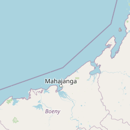
Map view of Tsingy de Namoroka National Park

Use this park location map to pinpoint Tsingy de Namoroka National Park in Madagascar, understand its exact geographic position, and read its mapped placement within the surrounding landscape more clearly.

Pigeon | © OpenStreetMap contributors

Location context for Tsingy de Namoroka National Park

Mahajanga Province

Visual reference of razor sharp karst pinnacles, deep canyons, and dry forest habitats

Tsingy de Namoroka National Park Photos and Limestone Landscapes

Visual documentation of Tsingy de Namoroka National Park reveals the dramatic scale of its towering limestone pinnacles, deep canyons, and subterranean cave networks. Protected area photography captures the intricate interplay between weathered geological formations and the surrounding deciduous forest habitats.

Rugged, needle-like limestone rock formations rising steeply from the ground in a canyon-like setting under a clear sky.

Park atlas

Compare adjacent limestone reserves and regional conservation networks in northwestern Madagascar

Parks Near Tsingy de Namoroka National Park and Surrounding Protected Landscapes

Browse protected areas and national parks situated near Tsingy de Namoroka National Park to compare regional limestone terrain, dry deciduous forests, and subterranean cave networks. Evaluating adjacent reserves reveals the broader ecological spread and unique geological diversity defining western Madagascar.
National parkBoeny
About 44 km away#1 closest

North

Baie de Baly National Park: Mapped Boundaries and Protected Landscape Context

Explore the geography and natural terrain of this national park.

Baie de Baly National Park presents a critical focal point for understanding protected areas within the Boeny region. As a national park, it showcases specific mapped boundaries that contribute to the broader geographic understanding of Madagascar's conservation landscapes. This detailed view allows for an atlas-driven exploration of the park's natural terrain and its significance as a distinct protected landmass within its regional context.

Area
571.42 km²
Established
1997
IUCN
II
Climate
Tropical
National parkBoeny Region
About 133 km away#2 closest

East

Ankarafantsika National Park: Protected Area Atlas and Regional Geography Discovery

Explore mapped boundaries and natural landscape context.

Ankarafantsika National Park serves as a key protected area for understanding the geography of Madagascar's Boeny Region. This canonical page offers a detailed atlas-style view, highlighting the park's mapped boundaries and its role as a distinct natural landscape. Engage with structured geographic data to comprehend the park's protected status and its contribution to the regional terrain, facilitating a deeper appreciation of protected lands.

Area
1,365.13 km²
Established
2002
IUCN
II
Relief
Lowland
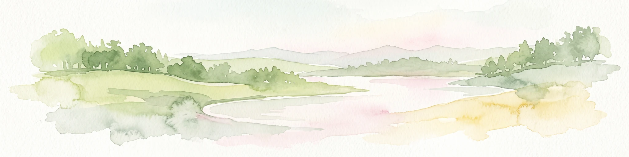
Watercolor painting of a coastal landscape with green trees, rolling hills, and light water reflections.
Protected areaSofia
About 168 km away#3 closest

North

Anjajavy Forest Protected Area: Landscape Geography and Regional Mapping

Tsingy karst, dry forest, and mangrove ecosystems in Sofia, Madagascar

The Anjajavy Forest protects a unique peninsula defined by the meeting of dry deciduous forest and jagged marine tsingy limestone. Spanning fifty square kilometres, this area is bordered by the Majajamba and Narinda Bays, showcasing an accessible convergence of complex karst topography and coastal mangrove corridors essential for endemic species.

Area
50 km²
Relief
Mixed relief
Climate
Tropical
Scope
Mixed
Marine protected areaMelaky
About 224 km away#4 closest

Southwest

Barren Isles Marine Protected Area: Geographic Overview and Island Chain Mapping

Exploration of the nine islands in the Mozambique Channel.

The Barren Isles comprise a distinct chain of nine islands and sand banks stretching across the Mozambique Channel in Madagascar. This marine protected area offers a look into a complex coastal system that balances sensitive wetland habitats with seasonal maritime migration. Gain geographic perspective on this isolated archipelago located within the Melaky region, where shifting marine environments create a unique natural landscape.

Water
Water-dominated
Nature reserveMelaky
About 228 km away#5 closest

South

Tsingy de Bemaraha Strict Nature Reserve: Karst Pinnacles and Protected Landscapes

Exploration of Madagascar karst geography and Melaky forest zones

Tsingy de Bemaraha Strict Nature Reserve is recognized for its unique labyrinth of stone needles and extensive canyon systems carved into the limestone plateau. The protected area preserves a rich variety of habitats, including dry tropical forests and riverine corridors that support a high concentration of endemic species. Delve into the mapped boundaries and topographical complexity of this iconic Madagascar landscape to understand its vital role in regional conservation.

Area
1,577.1 km²
Established
1927
IUCN
Ia
Relief
Highland
National parkMelaky
About 248 km away#6 closest

South

Tsingy de Bemaraha National Park: A Protected Landscape within Melaky, Madagascar

Explore mapped boundaries and regional geography for atlas discovery.

Tsingy de Bemaraha National Park is a designated national park offering profound opportunities for geographic discovery. As a key protected area in the Melaky region, its mapped boundaries and natural landscape characteristics are vital for understanding Madagascar's conservation geography. This resource facilitates detailed atlas exploration, providing structured insights into the park's terrain and its position within the broader regional context, enabling a focused study of its protected land identity.

Area
723.4 km²
Established
1997
IUCN
II
Visitors
10.1K annual
Wildlife reserveSofia region
About 312 km away#7 closest

East

Tampoketsa Analamaitso Reserve: Wildlife Reserve and Protected Forest Geography in Sofia Region

Ecological transition zone featuring humid and dry forest biomes

Tampoketsa Analamaitso Reserve provides a protected sanctuary for northern Madagascar's primate fauna, defined by its rare combination of humid mid-altitude and dense dry forest ecosystems. Managed for habitat conservation, the reserve remains a remote wilderness area with intact forest cover that stretches across the Sofia region. Its geographic importance lies in the ecological gradient that links distinct upland and lowland vegetation types, offering a comprehensive look at the island's diverse natural terrain.

Area
171.5 km²
Established
1958
IUCN
IV
Relief
Upland
Protected landscapeAlaotra-Mangoro
About 356 km away#8 closest

East

Lake Alaotra Protected Landscape: Atlas and Geographic Wetland Profile

Mapping the primary wetland basin of Madagascar's Alaotra-Mangoro region.

Lake Alaotra serves as a central protected landscape within the Alaotra-Mangoro region, featuring an extensive system of marshes, reedbeds, and freshwater zones. This profile offers a structured look at the lake's geography, its role as a critical wetland habitat, and the surrounding terrain that shapes this important Madagascar catchment area.

Area
7,223 km²
Relief
Lowland
Scope
Terrestrial
Water
Water-dominated

Common questions about visiting, size, designation, and location context for Tsingy de Namoroka National Park

Tsingy de Namoroka National Park FAQs for park facts, access, geography, and protected area context

Find quick answers about Tsingy de Namoroka National Park, including protected-area facts, park geography, trail and visitor context, and how the park fits into its surrounding country and regional landscape.
MoriAtlas Explorer

Continue Your Protected Areas Search Across the Global Atlas

Deepen your exploration by continuing the structured search for national parks and protected areas worldwide. Utilize the comprehensive filtering capabilities to compare different conservation landscapes and refine your understanding of global park geography. Discover more about the distribution and characteristics of protected natural areas.

Global natural geography