Mori Atlas logo
Marine protected areaBeachy Head West

Examine the underwater chalk formations and coastal protected boundaries along the English Channel

Beachy Head West Marine Protected Area: Mapped Coastal Geography and Seabed Landscapes

(Beachy Head West Marine Conservation Zone)

Beachy Head West represents a significant marine conservation zone extending the iconic chalk landscapes of the English Channel below the waterline. This geographic entry point outlines the distribution of submerged chalk reefs and gullies across the East Sussex coastline. Gain insight into the marine topography and ecological connections that define this protected zone, characterized by its mosaic of seabed substrates and unique geology within the regional maritime network.

marine conservation zonechalk reefssubmerged chalk habitatenglish channeleast sussex coastcoastal conservation

Beachy Head West

Marine protected area

Park overview

Structured park overview, official facts, and landscape profile for Beachy Head West

Beachy Head West park facts, protected area profile, and essential visitor context

Review the core facts for Beachy Head West, including designation, size, terrain, visitor scale, habitats, and operating context in one park-focused overview.

About Beachy Head West

Beachy Head West is a marine protected area in the English Channel that captures a stretch of seabed and coastal waters running parallel to one of the most iconic coastlines in southeast England. The zone covers roughly 24 square kilometres between Brighton Marina in the west and Beachy Head in the east, broken into two separate sections by the mouth of the River Ouse near Newhaven. The site was designated as a Marine Conservation Zone on 21 November 2013 and is managed locally by the Sussex Inshore Fisheries and Conservation Authority.

What sets Beachy Head West apart from many other inshore marine sites in the region is the continuation of the South Downs chalk geology beneath the sea. The cliffs of the Sussex coast are formed of Cretaceous chalk, and offshore this same geology creates distinctive chalk reefs and gullies on the seabed. These underwater landforms are uncommon in the southeastern English Channel and provide a hard substrate in an otherwise soft-sediment seascape, enabling ecological communities that would otherwise struggle to establish there.

The site sits within a broader landscape of conservation designations that together reinforce its significance. Its waters overlap with the Heritage Coast portion of the South Downs National Park, the eastern half of the UNESCO Brighton and Lewes Downs Biosphere Reserve, and part of the Seven Sisters Voluntary Marine Conservation Area. This stacking of protections across land and sea reflects the importance of the Sussex chalk coastline as a continuous ecological and cultural landscape, extending from the famous white cliffs above the water down into the marine habitats below.

Quick facts and research context for Beachy Head West

Beachy Head West is a Marine Conservation Zone in the English Channel, off the East Sussex coast between Brighton and Eastbourne. It covers roughly 24 square kilometres across two separate areas and was formally established on 21 November 2013. The zone features submerged chalk reefs and gullies that are among the most extensive examples of this habitat type in southeast England, and it also overlaps with the South Downs National Park Heritage Coast, a UNESCO Biosphere Reserve, and a Voluntary Marine Conservation Area.

Protection and recognition

Examine documented marine protection scope and official designation records for Beachy Head West.

Beachy Head West Protection Status and Marine Conservation Framework

Marine protection status and management scope for Beachy Head West appear alongside official designation records to outline conservation frameworks. Documented protection details clarify the scope of marine conservation without relying on external recognition sources or unverified metrics.

Protection details

Protection scope
Marine
Transboundary protection
No
Park context

Deeper park guide and search-rich context for Beachy Head West

Beachy Head West history, landscape, wildlife, and travel context

Explore Beachy Head West through its history, landscape character, ecosystems, wildlife, conservation priorities, cultural context, and seasonal travel timing in a structured park guide built for atlas discovery and search intent.

Why Beachy Head West stands out

Beachy Head West is best known for its submerged chalk reefs and gullies in the English Channel. These rare seabed formations support specialised communities of marine animals and seaweeds, including the short-snouted seahorse. The combination of chalk geology extending below the waterline with neighboring terrestrial heritage designations makes the site a notable example of connected land-sea conservation in southeast England.

Beachy Head West history and protected-area timeline

Beachy Head West was formally established as a Marine Conservation Zone on 21 November 2013 as part of the development of the Marine Conservation Zone network around the English coast. The designation recognised the exceptional chalk reef and gully habitats of the seabed off East Sussex and the ecological communities they support.

The site also sits within a longer history of conservation along this stretch of coast. The neighboring South Downs National Park, the Heritage Coast designation, the Brighton and Lewes Downs Biosphere Reserve recognized by UNESCO, and the Seven Sisters Voluntary Marine Conservation Area all reflect decades of recognition that the chalk cliffs, downland, and inshore waters of Sussex form a single landscape worthy of coordinated protection. The 2013 marine designation extended that logic below the tideline.

Beachy Head West landscape and geographic character

The landscape character of Beachy Head West is defined by the underwater continuation of the Sussex chalk. Above the water, the same coastline is famous for the white chalk cliffs of the Seven Sisters and Beachy Head, shaped by long-term erosion into bays, headlands, and steep faces. Below the surface, the chalk creates a distinct marine topography of reefs and gullies on the seabed.

Between the reef systems there are areas of softer sediment and varied substrate, giving the zone a mosaic of seabed conditions over its roughly 24 square kilometres. River input from the Ouse near Newhaven introduces localised variation in water clarity and sediment character, and the gap in the zone's coverage at the river mouth reflects practical and ecological considerations. The combined effect is a marine landscape shaped equally by geology, coastal processes, and freshwater influence from the land.

Beachy Head West ecosystems, habitats, and plant life

Beachy Head West is ecologically significant because its chalk reefs and gullies provide hard substrate in a part of the English Channel that is otherwise dominated by softer sediments. This hard substrate supports specialised marine communities, including seaweeds and sessile animals adapted to chalk surfaces, that are not typical of the surrounding seabed.

The site is also part of a wider ecological gradient that links the marine zone to the chalk grassland, cliffs, and downs above the shoreline. Together, the South Downs National Park, the Brighton and Lewes Downs Biosphere Reserve, and the Seven Sisters Voluntary Marine Conservation Area form a continuous protection chain from terrestrial habitats through the intertidal zone down into the subtidal chalk reefs.

Beachy Head West wildlife and species highlights

The chalk reefs and gullies of Beachy Head West support communities of marine animals and seaweeds that are specialised for these hard, chalk-based habitats. Among the species highlighted in the site's ecological profile is the short-snouted seahorse, a nationally rare species whose presence reflects the unusual habitat complexity of the reef system.

The broader marine environment also supports typical English Channel inshore fauna adapted to mixed seabed conditions, from chalk-associated species on the reefs to fauna found over the surrounding sediments. The presence of these communities on the Sussex coast helps connect the region's marine biodiversity with its globally recognised chalk cliffs above the waterline.

Beachy Head West conservation status and protection priorities

Beachy Head West was designated as a Marine Conservation Zone to protect what are considered some of the best examples of underwater chalk habitat in southeast England. The zone's chalk reefs and gullies are a regionally rare habitat type, and their protection is intended to safeguard both the physical substrate and the specialised biological communities it supports.

The site's conservation importance is reinforced by the presence of nationally rare species such as the short-snouted seahorse, and by its overlap with multiple complementary designations on land. Because Marine Conservation Zones are managed within the broader marine planning system, Beachy Head West is overseen locally by the Sussex Inshore Fisheries and Conservation Authority. The combination of habitat rarity, species interest, and stacked land-sea designations gives the site clear conservation significance beyond routine inshore protection.

Beachy Head West cultural meaning and human context

The coastline beneath which Beachy Head West lies is one of the most culturally recognised in Britain, framed by the chalk cliffs of the Seven Sisters, the South Downs landscape, and the long maritime history of Sussex ports such as Brighton, Newhaven, and Eastbourne. The designation of a Marine Conservation Zone along this coast reflects a broader public identification of the Sussex chalk landscape as a nationally and internationally important heritage feature, reinforced by the presence of the UNESCO Brighton and Lewes Downs Biosphere Reserve and the South Downs National Park.

Top sights and standout views in Beachy Head West

Beachy Head West stands out for the unusual quality of its seabed: chalk reefs and gullies extending the iconic Sussex chalk landscape below the waterline. The site hosts regionally rare marine communities anchored to this substrate, including species such as the short-snouted seahorse. Its position within overlapping coastal and marine designations, from the South Downs National Park to a UNESCO Biosphere Reserve, gives the zone a distinctive land-sea connection that is relatively unusual in the English marine protection network.

Best time to visit Beachy Head West

As an offshore Marine Conservation Zone rather than a land-based visitor destination, Beachy Head West is appreciated mainly through boat trips, diving, coastal walks along the neighboring cliffs, and visits to the adjacent Seven Sisters Country Park and Beachy Head itself. Sea conditions along this exposed stretch of the English Channel tend to be calmer in late spring and summer, when visibility for diving and snorkeling on the chalk reefs is generally more favourable, while winter seas bring heavier swell and stronger wave action along the cliffs above.

Monthly climate preview

Long term representative measurements and monthly weather patterns for East Sussex

Beachy Head West Climate Normals, Annual Temperature and Precipitation Rhythm

Beachy Head West exhibits a measured annual temperature and precipitation rhythm derived from long term NASA coordinates in East Sussex. Reviewing the complete twelve month profile clarifies detailed monthly temperature ranges and precipitation normals across the representative coordinate.
Annual mean11 °C
5 °C17 °C
Jan
Feb
Mar
Apr
May12°
Jun15°
Jul17°
Aug17°
Sep15°
Oct12°
Nov
Dec
Warmest month
August

17.2 °C

Coolest month
February

5 °C

Wettest month
November

2.9 mm/day

Driest month
March

1.6 mm/day

Park location guide

Geography guide, regional context, and park location map for Beachy Head West

Beachy Head West park geography, regions, and map view in United Kingdom

Understand where Beachy Head West sits in United Kingdom through a broader geographic reading of the surrounding landscape, nearby location context, and its mapped position within the national park landscape.

How Beachy Head West fits into United Kingdom

The United Kingdom is a parliamentary constitutional monarchy located in northwestern Europe, consisting of four constituent countries: England, Scotland, Wales, and Northern Ireland. As a major global power with over 69 million residents, it maintains significant international influence in politics, economics, and culture.

Wider geography shaping Beachy Head West in United Kingdom

The United Kingdom is an island nation located in northwestern Europe, surrounded by the Atlantic Ocean, North Sea, English Channel, Celtic Sea, and Irish Sea. It shares a land border with the Republic of Ireland to the west. The territory includes the island of Great Britain, the northeastern portion of Ireland, and most of the smaller British Isles islands.

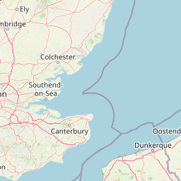
Map view of Beachy Head West

Use this park location map to pinpoint Beachy Head West in United Kingdom, understand its exact geographic position, and read its mapped placement within the surrounding landscape more clearly.

Pigeon | © OpenStreetMap contributors

Location context for Beachy Head West

East Sussex
Park atlas

Discover related coastal reserves, marine zones, and regional park geography

Explore Parks Near Beachy Head West and Surrounding Protected Landscapes

Browsing other protected areas near Beachy Head West reveals connected coastal ecosystems and chalk landscapes across the surrounding region. Comparing adjacent marine reserves and terrestrial parks expands geographic understanding of southeast England.
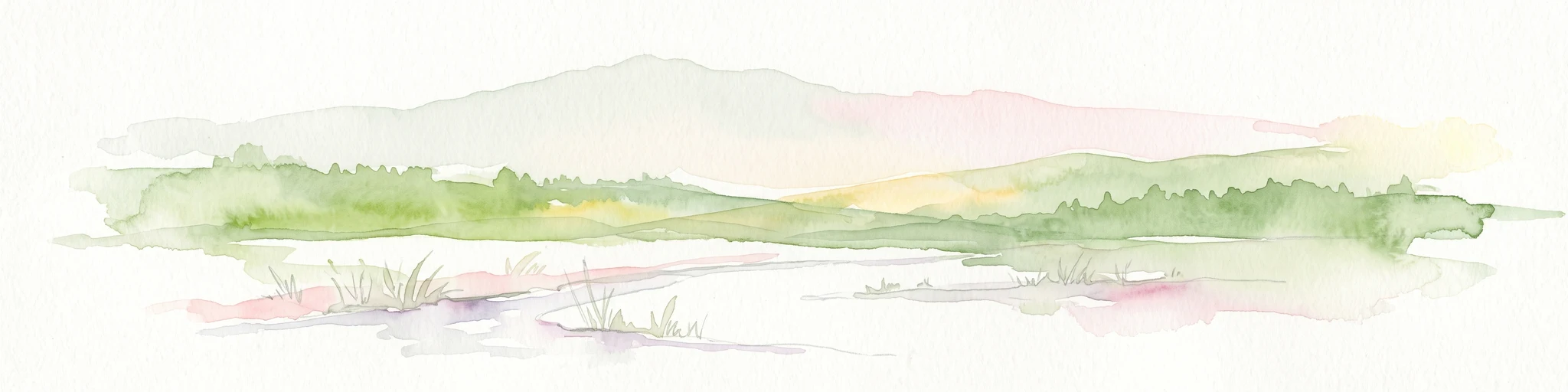
Watercolor illustration of a coastal landscape featuring green hills, white cliffs, and a body of water
National parkSouth East England
About 1.2 km away#1 closest

Northwest

South Downs National Park: A Distinctive Chalk Landscape in South East England's Atlas

Iconic chalk downland, coastal cliffs, and mapped terrain.

South Downs National Park is a premier protected landscape in South East England, celebrated for its unique chalk downland terrain and dramatic coastal formations. This page provides detailed geographic context for the park, highlighting its rolling hills, dry valleys, and ancient woodlands. Discover the park's mapped boundaries and its significance within England's protected areas, offering a structured atlas view for landscape exploration.

Area
1,627 km²
Established
2010
IUCN
V
Visitors
18M annual
Biosphere reserveSussex
About 15 km away#2 closest

Northwest

Brighton and Lewes Downs Biosphere Reserve: Geography and Protected Coastal Landscapes

Chalk downlands and marine ecosystems in Sussex

The Brighton and Lewes Downs Biosphere Reserve anchors a diverse range of protected habitats from the South Downs ridges to the English Channel seafloor. This mapped record details the terrestrial chalk grasslands, coastal cliffs, and rare offshore reef systems that characterize this notable biosphere reserve in Sussex. It serves as a comprehensive geographic reference for understanding the boundary between land-based conservation and marine habitat management.

Area
295.14 km²
Established
2014
Visitors
12M annual
Relief
Upland
Marine protected areaWest Sussex
About 38 km away#3 closest

West

Kingmere Marine Conservation Zone: Protected Marine Geography and Chalk Reef Landscapes

Submerged chalk cliff systems and rocky reefs in West Sussex

The Kingmere Marine Conservation Zone protects an unusual underwater landscape of chalk ridges and rocky outcrops within the English Channel. Stretching between Littlehampton and Worthing, this area serves as a vital spawning ground and exhibits some of the finest chalk reef features in European waters.

Area
47 km²
Established
2013
Relief
Lowland
Climate
Temperate
Nature reserveSurrey
About 87 km away#4 closest

Northwest

Wraysbury Reservoir: An Engineered Nature Reserve and Vital Wetland Habitat in Surrey

Examining infrastructure, ecology, and sonar testing geography.

Wraysbury Reservoir stands as a unique example of late-twentieth-century industrial landscape design, serving as both a primary London water resource and a protected Ramsar wetland. Its earthen embankments enclose a specialized environment where sonar research and ecological conservation coexist within the wider context of the Thames Valley. This record details the site's boundaries, its function as a wintering bird refuge, and its specialized role in UK marine testing.

Area
2.05 km²
Established
1970
Relief
Lowland
Climate
Temperate
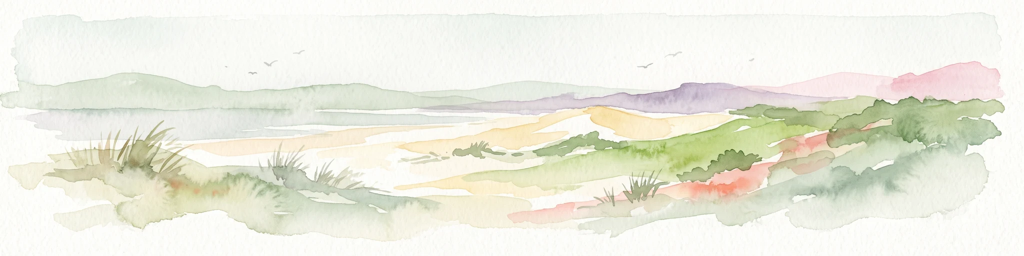
Watercolor painting showing a landscape with green and purple vegetation, a body of water, and distant hills.
National parkEngland
About 102 km away#5 closest

West

New Forest National Park: Historic Protected Landscape and Regional Geography in England

Mapped heathland, ancient woodlands, and pastoral traditions.

Explore New Forest National Park, a nationally significant protected area in England renowned for its unique blend of ancient royal forest history, traditional pastoral practices, and biologically rich lowland habitats. This page provides an atlas-focused view of its mapped boundaries, distinctive terrain, and geographic context within England, highlighting its value as a living landscape shaped by centuries of common grazing rights and supporting rare wildlife.

Area
566 km²
Established
2005
IUCN
V
Visitors
14.8M annual
A soft watercolor illustration showing a low-lying landscape with gentle rolling hills, grassy foreground vegetation, and light, hazy atmospheric tones.
Nature reserveHauts-de-France
About 110 km away#6 closest

East

Réserve naturelle régionale du marais de Condette: Wetland Geography and Protected Landscape

A vital ecological corridor within the Hauts-de-France region

Spanning 35 hectares, the Réserve naturelle régionale du marais de Condette protects a unique mosaic of marshland, peat-forming habitats, and forested massifs. This wetland reserve near the Opal Coast acts as an essential green infrastructure link, providing critical sanctuary for flora and fauna while maintaining hydrological balance in a heavily transformed northern French landscape.

Area
0.35 km²
Established
2009
IUCN
IV
Relief
Lowland
Watercolor painting of a coastal landscape with sand dunes, beach grasses, and distant hills under a light sky.
Nature reservePas-de-Calais
About 110 km away#7 closest

East

Réserve naturelle nationale de la baie de Canche Protected Area Map and Geography

Coastal dune ecosystems and tidal estuary landscapes in Pas-de-Calais

This protected area offers a look into the geomorphology of the Canche estuary, where longshore drift, salt marshes, and rare chalk-cliff dune systems create a distinct environment. Understand the landscape context of this French national nature reserve, serving as a sanctuary for migratory bird populations and a site for active coastal research along the English Channel.

Area
5.05 km²
Established
1987
IUCN
IV
Relief
Lowland
Nature reserveHauts-de-France
About 110 km away#8 closest

East

Réserve naturelle régionale du pré communal d'Ambleteuse: Regional Nature Reserve Geography

Coastal dune relics and protected marshland in Hauts-de-France.

This protected area provides an essential look at the coastal geography of the Opal Coast. Featuring a complex mosaic of ancient dune turf, dry heath, and wet meadows, the reserve stands as a landmark for biodiversity and traditional land management in northern France.

Area
0.605 km²
Established
1991
IUCN
IV
Relief
Lowland

Common questions about visiting, size, designation, and location context for Beachy Head West

Beachy Head West FAQs for park facts, access, geography, and protected area context

Find quick answers about Beachy Head West, including protected-area facts, park geography, trail and visitor context, and how the park fits into its surrounding country and regional landscape.
MoriAtlas Explorer

Continue Your Protected Areas Search Across the Global Atlas

Deepen your exploration by continuing the structured search for national parks and protected areas worldwide. Utilize the comprehensive filtering capabilities to compare different conservation landscapes and refine your understanding of global park geography. Discover more about the distribution and characteristics of protected natural areas.

Global natural geography