Mori Atlas logo
National parkBooti Booti National Park

Explore the mapped boundaries and regional context of this Australian national park.

Booti Booti National Park: New South Wales National Park Protected Landscape and Geography

Booti Booti National Park, situated within New South Wales, Australia, is a protected national park offering a unique lens for geographic and landscape exploration. This entry provides detailed atlas-style information, focusing on the park's mapped boundaries and its integral role within the broader regional geography. Understand the protected landscape identity of Booti Booti National Park as a key component of Australia's natural heritage.

coastal national parkNew South Walesrainforestsclerophyll forestbirdwatchingwhale watching

Booti Booti National Park

National park

Park overview

Structured park overview, official facts, and landscape profile for Booti Booti National Park

Booti Booti National Park park facts, protected area profile, and essential visitor context
Review the core facts for Booti Booti National Park, including designation, size, terrain, visitor scale, habitats, and operating context in one park-focused overview.

About Booti Booti National Park

Booti Booti National Park represents a significant protected area along the New South Wales coast, located immediately south of the popular holiday destination of Forster‑Tuncurry. The park's terrain is characterised by three distinct hill complexes of ancient granite that were once islands in their own right before natural sand accumulation connected them to the mainland. Cape Hawke dominates the northern section at 224 metres elevation and provides a popular walking track to a lookout offering expansive coastal views. The central and southern portions contain Booti Hill at 169 metres and Charlotte Head at 96 metres, with the camping area known as The Ruins situated in the Booti Hill vicinity. The land between these elevated features consists of low‑lying estuarine and aeolian sands that create a complex habitat mosaic of beaches, dunes, wetlands, and forest patches. Wallis Lake lies to the west of the park, separated from the Pacific Ocean by this narrow coastal landform. The park was declared a state recreation area in September 1977 before gaining full national park status in 1992, formalising protections for its coastal ecosystems and native biodiversity.

Quick facts and research context for Booti Booti National Park

Booti Booti National Park occupies a narrow coastal strip between Wallis Lake and the ocean on the mid‑north coast of New South Wales. The park's defining physical structure consists of three granitic hill complexes that were historically islands before becoming joined to the mainland through accumulated sand deposits. Cape Hawke rises to 224 metres and offers panoramic views from its summit, while Booti Hill reaches 169 metres and Charlotte Head stands at 96 metres. The park contains 17 percent rainforest coverage alongside wet and dry sclerophyll forests, supporting five plant species listed as threatened under New South Wales legislation. The area was historically used for mineral sand mining during the late 1960s and early 1970s before its protection status was elevated to national park designation.

Park context

Deeper park guide and search-rich context for Booti Booti National Park

Booti Booti National Park history, landscape, wildlife, and travel context
Explore Booti Booti National Park through its history, landscape character, ecosystems, wildlife, conservation priorities, cultural context, and seasonal travel timing in a structured park guide built for atlas discovery and search intent.

Why Booti Booti National Park stands out

Booti Booti is best known for its distinctive coastal landscape where remnant island peaks rise from a landscape of sand dunes and estuarine flats, creating a visually striking contrast between rocky headlands and sweeping beach environments. The park protects significant biodiversity on the mid‑north coast of New South Wales, with particular emphasis on its diverse plant communities spanning rainforest, wet sclerophyll, and dry sclerophyll forest types. The area serves as an important habitat for 210 recorded bird species and provides seasonal marine wildlife viewing opportunities through winter whale migrations. The park's proximity to Forster‑Tuncurry makes it a readily accessible nature escape for regional visitors.

Booti Booti National Park history and protected-area timeline

European interaction with the Booti Booti area began with Captain J. Gogerly, a timber trader who sailed from Forster to Sydney with loads of timber cut from the local forests. Gogerly and members of his family are buried within what is now the park, marking early European settlement of the area. During the late 1960s and early 1970s, the park's mineral sand deposits attracted commercial mining operations. Seven Mile Beach within the park was mined for mineral sands from 1969 until 1975, while a shorter operation occurred at Elizabeth Beach between 1969 and 1970. These mining activities left lasting scars on the landscape that the park management has worked to rehabilitate. On 30 September 1977, the area was declared a state recreation area, providing initial protected status. The formal establishment as Booti Booti National Park followed in 1992, elevating the conservation status and bringing the area under the management framework of the National Parks and Wildlife Service of New South Wales.

Booti Booti National Park landscape and geographic character

The physical landscape of Booti Booti National Park consists of a linear coastal strip approximately 10 kilometres in length, ranging between 400 metres and 3.25 kilometres in width, that separates Wallis Lake from the Pacific Ocean. Three granitic hill complexes form the backbone of the park's topography. Cape Hawke, the northernmost and highest point, rises abruptly to 224 metres and was historically an island that became connected to the mainland through accumulated sand deposits. Booti Hill reaches 169 metres elevation in the central portion of the park, while Charlotte Head at the southern end stands at 96 metres and was similarly once a separate island. These ancient volcanic and granitic remnants are connected by low‑lying terrain comprising estuarine sediments and wind‑blown aeolian sands. The park contains several sandy beaches including the named Seven Mile Beach, flanked by foredunes and backed by varying vegetation communities. The interaction between the rocky headlands, sandy beaches, estuarine wetlands, and forested slopes creates a visually diverse coastal landscape.

Booti Booti National Park ecosystems, habitats, and plant life

The ecological character of Booti Booti National Park reflects its position at the interface between coastal, wetland, and forest environments in northeastern New South Wales. The park supports 654 native plant species organised into 46 distinct plant communities, representing exceptional botanical diversity for its relatively modest area. Approximately 17 percent of the park is covered by rainforest, occurring particularly in sheltered gullies and on the southern aspects of the hill complexes where moisture accumulation supports this lush vegetation type. Beyond rainforest, the park contains seven distinct wet sclerophyll forest communities and ten dry sclerophyll forest communities, reflecting gradients from moisture‑laden slopes to more exposed and drier ridgelines. The Worimi language name for the area, Butibuti, reflects the indigenous connection to this landscape long before European settlement. Five plant species within the park are recognised as threatened under New South Wales legislation, including the sheoak species Allocasuarina defungens and Allocasuarina simulans, the vine Cynanchum elegans, and the shrub Senna acclinis.

Booti Booti National Park wildlife and species highlights

Booti Booti National Park supports notable wildlife diversity, particularly for avian species, with 210 bird species recorded within its boundaries. The variety of habitats—from rainforest canopies to sclerophyll woodlands, wetland edges, and beach environments—creates conditions suitable for diverse bird communities. The park's coastal position along the migration flyway contributes to its birdlife significance, supporting both resident species and seasonal visitors. Marine wildlife adds to the park's wildlife value during winter months when humpback whales migrate north along the coast, with whale watching identified as a popular park activity between June and November. The surrounding Wallis Lake estuary provides additional habitat for waterbirds and marine species, though the source material focuses primarily on bird records rather than detailed mammalian or reptilian inventories.

Booti Booti National Park conservation status and protection priorities

The conservation significance of Booti Booti National Park derives from its role in protecting a complex coastal ecosystem that includes significant rainforest remnants, diverse sclerophyll forest communities, and estuarine environments on the mid‑north coast of New South Wales. The park contains five threatened plant species protected under state legislation, highlighting its importance in regional biodiversity conservation. However, the park faces ongoing ecological challenges from invasive species. Bitou bush has colonised sand dunes and cliff areas, spreading from adjacent beach habitats and altering native plant communities. Lantana camara has invaded rainforest areas at Cape Hawke, particularly in disturbed habitats, while Madeira vine and coast morning glory smother native vegetation throughout the park. These invasive plants require ongoing management to protect the park's native biodiversity. The legacy of mineral sand mining at Seven Mile Beach and Elizabeth Beach from 1969 to 1975 also continues to require rehabilitation attention.

Booti Booti National Park cultural meaning and human context

The Booti Booti area holds significance in the cultural landscape of the Worimi people, whose language name for the park—Butibuti—preserves the indigenous connection to this coastal place. European settlement history is marked by the timber trade operations of Captain J. Gogerly, who was among the first European inhabitants and whose family burial site lies within the contemporary park boundaries. The landscape has also been shaped by commercial activities including mineral sand mining during the late 1960s and early 1970s, which altered portions of the coastal environment before formal protected area status was established.

Top sights and standout views in Booti Booti National Park

Booti Booti National Park offers several standout features that distinguish it as a protected area. The summit walk to Cape Hawke Lookout provides one of the most accessible panoramic coastal views in the region, with the trail ascending through diverse forest communities to a vantage point overlooking the convergence of Wallis Lake and the Pacific Ocean. The park's botanical diversity is exceptional for its size, with 654 native plant species supporting 46 distinct plant communities including significant rainforest and sclerophyll forest representations. The camping area at The Ruins, located in the Booti Hill southern section, provides a base for extended exploration of the park's walking tracks. The combination of coastal headlands, beach environments, wetland margins, and forested slopes creates a compact but varied landscape suitable for diverse recreational activities from birdwatching to whale watching during the winter migration season.

Best time to visit Booti Booti National Park

The best time to visit Booti Booti National Park depends on preferred activities, with different seasons offering distinct experiences. Winter months from June to November coincide with the humpback whale migration along the New South Wales coast, making this period optimal for whale watching from coastal vantage points within the park. The cooler months also offer comfortable conditions for hiking the park's walking tracks, including the Cape Hawke summit walk. Spring and summer months bring warmer conditions suitable for swimming at the park's beaches, though these periods coincide with higher visitor numbers given the park's accessibility from Forster‑Tuncurry. The shoulder seasons of autumn and early spring present moderate temperatures and potentially lower visitation, though the park remains a year‑round destination. Birdwatching can be productive throughout the year as the diverse habitats support resident species, though seasonal migrants may add to records during their passage periods.
Park location guide

Geography guide, regional context, and park location map for Booti Booti National Park

Booti Booti National Park park geography, regions, and map view in Australia
Understand where Booti Booti National Park sits in Australia through a broader geographic reading of the surrounding landscape, nearby location context, and its mapped position within the national park landscape.

How Booti Booti National Park fits into Australia

Australia is a constitutional monarchy and federal parliamentary democracy comprising six states and ten territories. With a population of nearly 28 million, it is one of the world's most urbanised countries, with most people concentrated on the eastern seaboard. The country has a high Human Development Index and is known for its cultural diversity, ancient Aboriginal heritage, and unique wildlife.

Wider geography shaping Booti Booti National Park in Australia

Australia occupies the entire Australian continent, the island of Tasmania, and numerous smaller islands. It is the world's flattest and driest inhabited continent, featuring vast deserts in the interior (the Outback), tropical rainforests along the eastern coast, and a coastline bordering the Indian and Pacific Oceans.

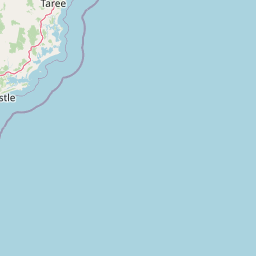
Map view of Booti Booti National Park

Use this park location map to pinpoint Booti Booti National Park in Australia, understand its exact geographic position, and read its mapped placement within the surrounding landscape more clearly.

Pigeon | © OpenStreetMap contributors

Location context for Booti Booti National Park

New South Wales
Park atlas

Discover the Regional Protected Landscapes and Coastal Geography Surrounding Booti Booti National Park in New South Wales, Australia

Explore Nearby National Parks and Protected Areas Beyond Booti Booti National Park
Browse national parks and protected areas located in the geographic vicinity of Booti Booti National Park, allowing for discovery of similar coastal landscapes and diverse forest ecosystems in New South Wales. Compare park features, trace regional conservation patterns, and understand the spread of protected coastal zones beyond this specific park view.
National parkNew South Wales

Wallingat National Park: Explore Protected Landscape and Regional Geography in New South Wales

Discover mapped park boundaries and terrain context.

Wallingat National Park in New South Wales is a protected landscape crucial for understanding Australia's natural geography. This canonical page detail provides essential information for atlas exploration, focusing on the park's protected status, mapped contours, and its place within the regional context. Discover the unique geographic features that distinguish this national park from others in the atlas.

Area
65.57 km²
Established
1999
IUCN
II
Relief
Lowland
National parkNew South Wales

Myall Lakes National Park National Park: Mapped Boundaries and Protected Landscape Exploration

Discover its regional geography and natural terrain context.

Delve into the specific protected landscape and geographic features of Myall Lakes National Park. As a national park located in New South Wales, it provides critical atlas context for understanding protected areas and their distribution. Explore its mapped terrain and boundaries to gain a deeper appreciation for this significant natural area within Australia's geography.

Area
448 km²
Established
1972
IUCN
II
Relief
Lowland
National parkNew South Wales

Crowdy Bay National Park: New South Wales Protected Coastal Landscape and Terrain Map

Explore mapped boundaries and diverse natural geography within this national park.

Crowdy Bay National Park offers a compelling example of coastal protected landscape in New South Wales, Australia. This page facilitates a detailed atlas exploration of its natural geography, focusing on the interaction between ocean beaches, headlands, and inland forested terrain. Understand the park's specific location and its characteristic ecosystems, providing a structured view of this significant national park for geographic discovery.

Area
102 km²
Established
1972
IUCN
II
Relief
Lowland
National parkNew South Wales

Coorabakh National Park: A Protected Volcanic Landscape in New South Wales

Discover unique terrain, mapped protected boundaries, and regional geography.

Coorabakh National Park in New South Wales, Australia, is characterized by its striking volcanic trio: Big Nellie, Flat Nellie, and Little Nellie. These peaks dominate the rugged escarpment terrain, offering a unique geographic vista. The park protects a rich mosaic of tall eucalypt forests and sheltered subtropical rainforest gullies, highlighting its ecological diversity. For those interested in atlas-style exploration, Coorabakh National Park provides a clear example of a protected landscape with significant geological and ecological features within the broader regional context of New South Wales.

Area
18 km²
Established
1999
IUCN
II
Relief
Highland
National parkNew South Wales

Middle Brother National Park: New South Wales Protected Area and Geographic Exploration

Mapped boundaries and regional landscape context for this national park.

Middle Brother National Park represents a distinct protected landscape within the state of New South Wales, Australia. This entry offers detailed geographic context, focusing on the park's mapped boundaries and its significance as a national park. Users can explore its place within the regional geography of New South Wales, gaining a structured understanding of this protected area through an atlas-focused perspective.

Area
18.3 km²
Established
1999
IUCN
II
Relief
Mountain
National parkNew South Wales

Tomaree National Park: New South Wales National Park with Defined Protected Boundaries

Explore its mapped geography and regional landscape context.

Tomaree National Park represents a significant protected landscape within New South Wales, Australia. This national park entry focuses on its distinct geographic features and mapped boundaries, offering a clear point of reference for atlas-based exploration. Understand its place in the regional geography of New South Wales and its identity as a conserved natural area. The detailed mapping and contextual data provide a solid foundation for appreciating this protected landscape.

Area
23.18 km²
Established
1984
IUCN
II
Relief
Lowland
National parkNew South Wales

Dooragan National Park: Coastal Mountain Protected Landscape and Old-Growth Forest Atlas

Explore the geography and mapped boundaries of this New South Wales national park.

Dooragan National Park is a significant protected area in New South Wales, renowned for the dramatic North Brother Mountain and its exceptional old-growth blackbutt forests. This park offers a rich exploration of coastal mountain geography, providing valuable mapped landscape context for the Mid North Coast region. Discover the park's unique ecological environment and its role as a protected natural asset.

Area
11 km²
Established
1997
IUCN
II
Relief
Mountain
National parkMid North Coast

Tapin Tops National Park: Protected Landscape in Mid North Coast, Australia

Mapped geographic context and natural terrain discovery.

Tapin Tops National Park is a designated national park offering rich opportunities for geographic and landscape exploration. This detail page provides a structured look at its protected area status and its location within the Mid North Coast region of Australia. Delve into the mapped boundaries and understand the park's specific natural terrain for comprehensive atlas-based discovery.

Area
110 km²
Established
1999
IUCN
II
Relief
Mountain

Common questions about visiting, size, designation, and location context for Booti Booti National Park

Booti Booti National Park FAQs for park facts, access, geography, and protected area context
Find quick answers about Booti Booti National Park, including protected-area facts, park geography, trail and visitor context, and how the park fits into its surrounding country and regional landscape.
MoriAtlas Explorer

Continue Your Protected Areas Search Across the Global Atlas

Deepen your exploration by continuing the structured search for national parks and protected areas worldwide. Utilize the comprehensive filtering capabilities to compare different conservation landscapes and refine your understanding of global park geography. Discover more about the distribution and characteristics of protected natural areas.

Global natural geography