

Mori Atlas logo
Nature reserveBorenore Karst Conservation Reserve

Mapping the interface between ancient Silurian reef systems and volcanic mountain terrain.

Borenore Karst Conservation Reserve: A Geological Protected Landscape in New South Wales

Borenore Karst Conservation Reserve represents a unique geological intersection in inland New South Wales, where ancient limestone cave systems meet younger volcanic rock from nearby Mount Canobolas. This protected area preserves a complex record of Silurian-era reef fossils, sink holes, and subterranean passages that offer insights into a former tropical marine environment. The reserve serves as a critical site for studying the regional geology and supporting habitats for colonies of Eastern bent-winged bats.

karst landscapelimestone cavesfossil heritageSilurian reefgeological reservebat habitat
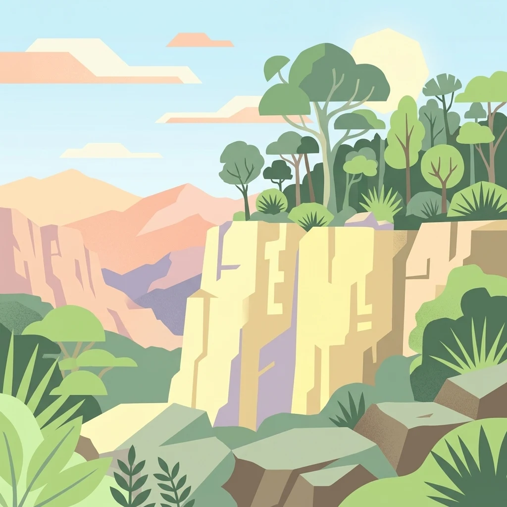
Digital illustration of vertical limestone cliffs surrounded by green trees and shrubs, with distant mountain ridges under a light sky.

Borenore Karst Conservation Reserve

Nature reserve

Park overview

Structured park overview, official facts, and landscape profile for Borenore Karst Conservation Reserve

Borenore Karst Conservation Reserve park facts, protected area profile, and essential visitor context

Review the core facts for Borenore Karst Conservation Reserve, including designation, size, terrain, visitor scale, habitats, and operating context in one park-focused overview.

About Borenore Karst Conservation Reserve

Borenore Karst Conservation Reserve is a small but scientifically valuable protected area in inland New South Wales, focused on the protection and interpretation of a limestone cave system and its surrounding karst landscape. Located near Orange in the state's Central West, the reserve preserves both geological heritage and ecological values in a setting where ancient marine sediments meet the legacy of more recent volcanic activity.

The defining feature of the reserve is its cave network, with more than forty named or documented caves developed in Silurian limestone. Several sites are accessible for self-guided visits and provide visitors with direct exposure to intricate karst formations, while others, such as the Tunnel Cave, are sensitive due to their use as bat habitat. The reserve has no installed lighting, reinforcing its character as a largely natural, uncommercialised cave experience in contrast to the larger, more developed show caves of the region.

Geologically, Borenore is significant because its limestones formed within a long-lived reef complex from the Silurian period and contain abundant, well-preserved marine fossils. This reef-derived limestone is surrounded by igneous rock associated with the volcanic field of nearby Mount Canobolas, giving the reserve an unusually crisp geological boundary between sedimentary and volcanic terrains. The site has been recognised as a natural heritage location for the diversity of its karst morphology and sedimentology, making it an important reference point for understanding inland Australian karst systems.

Culturally and historically, the reserve has connections both to long Indigenous knowledge of the caves and to early European exploration of the area during the nineteenth century. In the early twentieth century, the caves became a source of high-quality red marble that was used in notable buildings, leaving a human story that runs alongside the natural history. Today, Borenore remains valued as a small, accessible reserve that combines geology, fossil heritage, bat conservation, and landscape character in a single, compact natural area.

Quick facts and research context for Borenore Karst Conservation Reserve

Borenore Karst Conservation Reserve lies in the Central West of New South Wales, about 17 kilometres west of Orange, and covers roughly 136 hectares of karst terrain and associated bushland. It protects a network of more than forty limestone caves developed in Silurian-age reef rock that is surrounded by igneous material originating from the volcanic landscape of nearby Mount Canobolas.

The reserve was formally gazetted in December 1997 and is listed on the Register of the National Estate for its diverse karst forms and fossil-bearing sediments. It is managed through the Jenolan Caves Reserve Trust in conjunction with the NSW National Parks and Wildlife Service, and parts of the cave system are closed seasonally to protect a hibernating colony of Eastern bent-winged bats.

Protection and recognition

Review documented terrestrial protection scope and international recognition records

Borenore Karst Conservation Reserve Protection Status and Recognition Data

Borenore Karst Conservation Reserve maintains a recorded terrestrial protection scope within official conservation inventories. Structured records assemble available designation history, management frameworks, and international recognition details for geographic analysis.

Protection details

Protection scope
Terrestrial
Transboundary protection
No
Park context

Deeper park guide and search-rich context for Borenore Karst Conservation Reserve

Borenore Karst Conservation Reserve history, landscape, wildlife, and travel context

Explore Borenore Karst Conservation Reserve through its history, landscape character, ecosystems, wildlife, conservation priorities, cultural context, and seasonal travel timing in a structured park guide built for atlas discovery and search intent.

Why Borenore Karst Conservation Reserve stands out

Borenore is best known for its compact cluster of limestone caves containing richly fossiliferous reef deposits laid down during the Silurian period, when the region lay beneath a shallow tropical sea. The caves preserve corals, crinoids, brachiopods, gastropods, pentamerids, colonial tryplasmids, and trilobites embedded in the limestone walls, offering a vivid glimpse of an ancient marine ecosystem. The reserve is also recognised for the unusual geological setting in which its karst occurs: the Silurian limestone is ringed by younger igneous rocks from eruptions at Mount Canobolas, making Borenore an unusually clear example of reef-derived limestone enveloped by volcanic terrain. The site is further noted for the once-commercially important Borenore Red marble and for a significant colony of Eastern bent-winged bats that roost in one of the show caves.
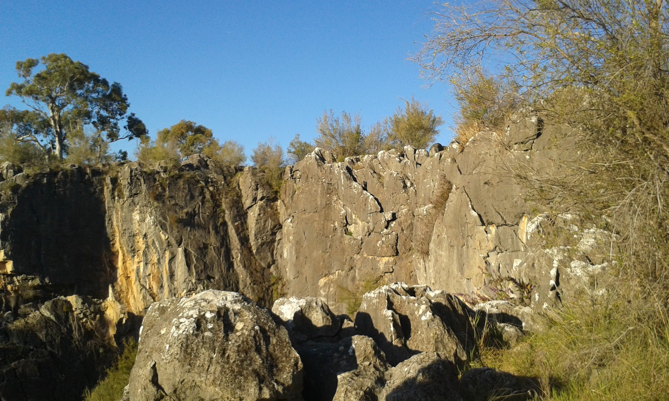
A steep, weathered limestone rock face rises above a rocky ground, surrounded by trees under a clear blue sky.
Limestone rock formations at Borenore Karst Conservation Reserve.

Borenore Karst Conservation Reserve history and protected-area timeline

The caves and surrounding karst of Borenore have been known for an exceptionally long time. Indigenous Wiradjuri people are recorded as having an association with the site stretching back roughly 9,000 years, prioritising the caves as an enduring part of Country in the Central West of New South Wales. European-era discovery is generally associated with John Henderson in 1830, marking the start of recorded colonial interest in the site.

The early twentieth century brought a new chapter to Borenore through the recognition of its ornamental stone. Around 1898, Italian-born stonemason Peter Rusconi and his sons Joe and Frank Rusconi, while picnicking at Borenore, identified marble of exceptional quality within the reserve. This led to decades of quarrying that extracted the now-famous Borenore Red marble, which was used in prominent public buildings including central railway stations in major Australian cities, post office interiors, banking chambers, arcades, and even overseas at Buckingham Palace. Marble extraction at Borenore continued until 1994, tying the site's modern history to a substantial period of small-scale industrial use.

The reserve's formal protection began in December 1997, when the area was gazetted as the Borenore Karst Conservation Reserve. It has subsequently been recognised through inclusion in the Register of the National Estate for its rich karst morphology and sedimentological diversity. Governance of the reserve reflects its connections to the broader NSW cave and karst management system, being administered through the Jenolan Caves Reserve Trust in conjunction with the NSW National Parks and Wildlife Service.

Borenore Karst Conservation Reserve landscape and geographic character

The landscape of Borenore is defined by a striking juxtaposition of two very different geological worlds. The core of the reserve sits on Silurian-age limestone, originally deposited within an ancient reef complex that has since been uplifted, eroded, and dissected by water to produce sink holes, dolines, dark cave passages, and exposed fossil-rich rock faces. Tunnel Cave, the most prominent passage in the reserve, exemplifies this: it is roughly 110 metres long, opening at the base of a substantial hill while the sink hole feeding it sits about 30 metres higher on the slopes above.

Ringed around this sedimentary core is much younger igneous terrain, derived from volcanic eruptions at nearby Mount Canobolas. The contact between dark volcanic rock and paler, fossil-rich limestone produces a visually distinctive landscape and gives Borenore an unusually clear geological setting in which the reef-derived limestones are preserved within an otherwise volcanic regional backdrop. The terrain is gently undulating, with wooded slopes and valleys carrying creeks and seasonal drainage that have helped shape both the surface karst and the underground passages below.

Above ground, the reserve is characterised by open woodland and scattered grassy clearings typical of the Central Tablelands of New South Wales, framing the entrances to the caves and the larger sink holes. The scale of the reserve is compact, around 136 hectares, but the combination of surface karst, cave systems, and volcanic-derived surroundings gives it a layered landscape identity that is unusually rich for such a small protected area.

Borenore Karst Conservation Reserve ecosystems, habitats, and plant life

Ecologically, Borenore sits firmly within the Central Tablelands environment of inland New South Wales, where eucalypt-dominated woodland and grassy understorey are the dominant vegetation types. The reserve's small footprint concentrates conservation attention less on extensive forest cover and more on the unusual microhabitats created by its karst geology, including shaded cave entrances, sheltered rock ledges, and seasonally moist hollows associated with sink holes.

The karst itself acts as a significant habitat feature. Caves provide stable, dark, temperature-buffered environments that host cave-adapted invertebrates and serve as seasonal roosting sites for bats. The combination of limestone outcrops, crevices, and variable soil depths across the reserve also supports a diversity of plant microhabitats, from skeletal soils on exposed rock to richer, moister pockets along drainage lines that pass through the system.

By enclosing a tract of woodland in an otherwise agricultural Central West region, the reserve also retains habitat connectivity for woodland birds and small mammals typical of the surrounding tablelands, even as its primary conservation purpose is the protection of karst landforms and the fossil record embedded within them.

Borenore Karst Conservation Reserve wildlife and species highlights

Wildlife interest at Borenore centres on the reserve's documented colony of Eastern bent-winged bats, which roost and hibernate within parts of the cave system, including the Tunnel Cave. The significance of this colony is reflected in the management decision to close the Tunnel Cave to visitors from May through October each year, shielding the bats from human disturbance during their most sensitive period. Outside of this protected window, visitors are advised not to handle bats due to general public health considerations around Australian bat species.

The reserve's woodland and rocky habitats also support the broader wildlife community typical of the Central Tablelands, including small woodland birds and other cave-using fauna. While detailed species inventories are limited in the source material, the combination of intact eucalypt woodland and sheltered karst environments makes the reserve a meaningful refuge for bat populations and typical tableland fauna within a region otherwise dominated by agricultural land use.

From a broader ecological perspective, the reserve's bat population places Borenore within the network of inland cave systems that contribute to the conservation of cave-roosting microbat species across New South Wales, linking it functionally to larger, more developed cave reserves elsewhere in the state.

Borenore Karst Conservation Reserve conservation status and protection priorities

Borenore Karst Conservation Reserve exists primarily to protect a compact but geologically and ecologically significant karst landscape from the impacts that have affected surrounding land in the Central West of New South Wales. Its establishment in December 1997 formalised long-standing recognition of the site's importance, and its inclusion on the Register of the National Estate underscores its standing as a natural heritage location.

The reserve's conservation value rests on several reinforcing elements. Geologically, it preserves a diverse suite of karst morphologies and sedimentological features, including caves, sink holes, and fossil-rich reef exposures that together provide an unusually complete record of Silurian reef development. Ecologically, the caves function as critical roosting habitat for Eastern bent-winged bats, and the seasonal closure of the Tunnel Cave demonstrates active management aimed at maintaining that habitat through sensitive periods of the bat life cycle. The surrounding woodland adds a further layer of habitat value in a largely cleared regional landscape.

Management responsibility for Borenore spans the Jenolan Caves Reserve Trust and the NSW National Parks and Wildlife Service, linking the reserve into the broader institutional framework that oversees cave conservation in New South Wales. Under international classifications, it is recognised as an IUCN Category III protected area, identifying it as a natural monument or feature. Camping is not permitted within the reserve, and access to the cave system is self-guided rather than commercially developed, reflecting a management approach that prioritises low-impact visitation and the long-term protection of the karst environment and its inhabitants.

Borenore Karst Conservation Reserve cultural meaning and human context

Borenore has a layered human story that runs alongside its natural values. The Wiradjuri people, the traditional custodians of the Central West of New South Wales, are associated with the caves across an extraordinarily long timeframe, with recorded connections stretching back approximately 9,000 years. This deep Indigenous presence gives the site a continuous cultural significance that long predates European exploration and remains part of the reserve's identity today.

European-era engagement with the site began with John Henderson's exploration in 1830, leading to the slow integration of the reserve into colonial-era records and regional travel. A distinctive chapter in Borenore's modern cultural history is tied to Italian immigrant stonemasons: around 1898, Peter Rusconi and his sons Joe and Frank recognised the exceptional quality of the local marble, launching decades of quarrying that produced the celebrated Borenore Red marble. The use of this marble in prominent buildings, including major Australian railway stations, post offices, banking chambers, an arcade, and Buckingham Palace overseas, ties a small inland cave reserve to a remarkable international architectural legacy and gives the site an unexpected place in built-heritage history.

Today, the reserve continues to be valued by visitors as an accessible and uncommercialised natural area within easy reach of Orange, contributing to regional identity for the Central West as a destination for geology, bat conservation, and quiet, self-guided cave exploration.

Top sights and standout views in Borenore Karst Conservation Reserve

A small inland reserve that combines over forty limestone caves, an internationally recognised Silurian reef fossil record, and a volcanic geological setting shaped by nearby Mount Canobolas. Notable caves include the long Tunnel Cave, which doubles as a seasonal refuge for Eastern bent-winged bats, and other accessible sites such as Arch Cave and Verandah Cave.

The reserve also carries a strong human story, from thousands of years of Wiradjuri association to early twentieth-century marble quarrying that produced Borenore Red marble for landmark buildings. Managed jointly through the Jenolan Caves Reserve Trust and the NSW National Parks and Wildlife Service, it offers a compact, low-impact cave experience that links geology, ecology, and regional heritage in a single site.

Best time to visit Borenore Karst Conservation Reserve

Borenore's cave network has distinct seasonal considerations that influence the experience on offer. Between May and October, the Tunnel Cave is closed to visitors to protect the hibernating Eastern bent-winged bats that roost there, so visitors during this period will be limited to the reserve's other caves such as Arch Cave and Verandah Cave. Outside of this seasonal closure, the reserve's caves are accessible with self-guided entry and no installed lighting, allowing visitors to experience the karst environment in a largely natural state.

The surrounding Central Tablelands landscape is generally most pleasant outside the cooler winter months, when milder temperatures make walking between cave entrances and enjoying the woodland setting more comfortable. Spring and autumn typically offer balanced conditions for both surface walking and cave exploration, while local weather can affect surface tracks after heavy rain. Visitors should anticipate that reserves near Orange can experience cool nights and warm days, and plan visits accordingly.
Monthly climate preview

Long-term representative temperature and precipitation rhythms across twelve recorded months

Borenore Karst Conservation Reserve Climate Normals and Annual Weather Patterns

Representative coordinate records show average temperatures ranging from cool winter minimums to warm summer maximums alongside consistent monthly precipitation rates. Detailed long-term climate normals provide complete monthly baseline data for analyzing annual environmental variation.
Annual mean16 °C
7 °C25 °C
Jan25°
Feb23°
Mar20°
Apr16°
May11°
Jun
Jul
Aug
Sep12°
Oct16°
Nov19°
Dec22°
Warmest month
January

24.5 °C

Coolest month
July

6.9 °C

Wettest month
February

2.1 mm/day

Driest month
April

1 mm/day

Park location guide

Geography guide, regional context, and park location map for Borenore Karst Conservation Reserve

Borenore Karst Conservation Reserve park geography, regions, and map view in Australia

Understand where Borenore Karst Conservation Reserve sits in Australia through a broader geographic reading of the surrounding landscape, nearby location context, and its mapped position within the national park landscape.

How Borenore Karst Conservation Reserve fits into Australia

Australia is a constitutional monarchy and federal parliamentary democracy comprising six states and ten territories. With a population of nearly 28 million, it is one of the world's most urbanised countries, with most people concentrated on the eastern seaboard. The country has a high Human Development Index and is known for its cultural diversity, ancient Aboriginal heritage, and unique wildlife.

Wider geography shaping Borenore Karst Conservation Reserve in Australia

Australia occupies the entire Australian continent, the island of Tasmania, and numerous smaller islands. It is the world's flattest and driest inhabited continent, featuring vast deserts in the interior (the Outback), tropical rainforests along the eastern coast, and a coastline bordering the Indian and Pacific Oceans.

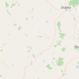
Map view of Borenore Karst Conservation Reserve

Use this park location map to pinpoint Borenore Karst Conservation Reserve in Australia, understand its exact geographic position, and read its mapped placement within the surrounding landscape more clearly.

Pigeon | © OpenStreetMap contributors

Location context for Borenore Karst Conservation Reserve

New South Wales

Visualizing limestone caves, fossil deposits, and volcanic terrain

Borenore Karst Conservation Reserve Photos and Landscapes

Photographic collections reveal the distinct geological contrast between ancient Silurian limestone formations and younger volcanic terrain across Borenore Karst Conservation Reserve. Visual records document surface sinkholes, subterranean cave environments, and woodland habitats that define the protected landscape.

A steep, weathered limestone rock face rises above a rocky ground, surrounded by trees under a clear blue sky.

Park atlas

Compare regional geology, limestone cave systems, and connected protected landscapes

Explore Parks Near Borenore Karst Conservation Reserve and Surrounding Protected Areas

Browsing other parks near Borenore Karst Conservation Reserve reveals connected geological formations and varied protected landscapes across the region. Expanding the geographic comparison helps trace wider patterns in regional terrain, woodland reserves, and natural monuments.
Nature reserveNew South Wales
About 29 km away#1 closest

Northwest

South West Woodland Nature Reserve: Geographic Overview and Protected Forest Boundaries

A fragmented network of conservation precincts in inland New South Wales

Examine the geographic structure of South West Woodland Nature Reserve, a nature reserve defined by its unusual patchwork of twenty-seven isolated woodland islands. Stretching across 400 kilometres, this protected area anchors crucial white cypress pine and eucalypt forest remnants, forming a transition zone between the South Western Slopes and the arid plains of the Murray Darling Depression.

Area
138.4 km²
Established
2011
IUCN
Ia
Relief
Lowland
National parkNew South Wales
About 36 km away#2 closest

Southwest

Nangar National Park: Australian National Park Geography and Mapped Boundaries

Explore the protected landscape within New South Wales.

Nangar National Park is a key protected area situated in New South Wales, Australia, offering a valuable point for geographic discovery. This page details its status as a national park, providing insight into its mapped boundaries and its role within the regional landscape. Users can utilize this information to understand the park's specific geographic context and its contribution to the broader atlas of Australia's protected lands.

Area
94 km²
Established
1983
IUCN
II
Relief
Mountain
National parkNew South Wales
About 41 km away#3 closest

Northwest

Goobang National Park: Detailed Geographic and Protected Landscape Exploration

Mapped Boundaries and Natural Terrain in New South Wales

Discover the specific geographic features and protected boundaries of Goobang National Park. This entry offers an atlas-focused perspective, highlighting its role as a national park within New South Wales and providing foundational data for understanding its natural landscape and regional setting. Dive into a structured exploration of its mapped terrain and protected status.

Area
421 km²
Established
1995
IUCN
II
Relief
Upland
National parkNew South Wales
About 65 km away#4 closest

Southwest

Conimbla National Park: Protected Landscape Atlas and Regional Geography

Mapped boundaries and terrain within New South Wales.

Examine the protected landscape of Conimbla National Park, a designated national park situated in New South Wales, Australia. This entry provides focused geographic context, detailing its mapped boundaries and the regional terrain. It serves as a valuable resource for understanding the park's identity within the national atlas and its specific place in the Australian landscape.

Area
84.71 km²
Established
1980
IUCN
II
Relief
Upland
Nature reserveNew South Wales
About 70 km away#5 closest

North

Wellington Caves Nature Reserve: Mapping Limestone Formations and Pleistocene Fossil Sites

Geological atlas of subterranean karst landscapes in New South Wales

The Wellington Caves reserve features a rich subterranean geography shaped by water working through Devonian limestone. Explore the site's mapped network of chambers, including Cathedral Cave and its massive Altar Rock, alongside historic fossil deposits that have shaped Australian paleontology since the 1830s. This protected landscape offers a unique look at karst evolution and subterranean lake systems within the Australian bush.

Established
1884
Visitors
35K annual
Relief
Upland
Scope
Terrestrial
Natural monumentNew South Wales
About 83 km away#6 closest

Southeast

Abercrombie Caves: Protected Karst Landscape and Geological Monument in New South Wales

Exploration of karst formations and cave morphology

Abercrombie Caves preserve a sophisticated limestone karst system within the Central West region of New South Wales. The reserve is anchored by The Archway, a massive natural bridge sculpted by water erosion, alongside various chambers including King Solomon's Temple and Bushranger's Cave. This natural monument highlights the interplay between rugged range geography, solutional cave development, and the site's enduring historical significance as a former gold-mining and bushranger landscape.

Area
14.34 km²
Established
1997
IUCN
III
Relief
Upland
National parkNew South Wales
About 90 km away#7 closest

East

Turon National Park National Park: Protected Landscape and Geographic Atlas Details

Mapped boundaries and regional context within New South Wales.

Turon National Park is a protected national park in New South Wales, Australia, offering a distinct geographic identity for atlas exploration. This entry focuses on its mapped boundaries, natural terrain, and its role as a conservation landscape. Users can discover its specific features and regional context, enhancing their understanding of Australia's protected areas.

Established
2002
IUCN
II
Relief
Mixed relief
Climate
Temperate
National parkNew South Wales
About 101 km away#8 closest

East

Gardens of Stone National Park: National Park Protected Landscape and Geographic Atlas

New South Wales protected area and mapped terrain exploration.

Delve into the protected landscape of Gardens of Stone National Park, an important national park situated in New South Wales, Australia. This page offers an atlas-centric view, focusing on the park's distinct geographic identity, its mapped protected boundaries, and its contribution to the regional context of protected lands. Understand the fundamental landscape character and terrain that define this significant natural area for structured geographic discovery.

Area
150.8 km²
Established
1994
IUCN
II
Relief
Highland

Common questions about visiting, size, designation, and location context for Borenore Karst Conservation Reserve

Borenore Karst Conservation Reserve FAQs for park facts, access, geography, and protected area context

Find quick answers about Borenore Karst Conservation Reserve, including protected-area facts, park geography, trail and visitor context, and how the park fits into its surrounding country and regional landscape.
MoriAtlas Explorer

Continue Your Protected Areas Search Across the Global Atlas

Deepen your exploration by continuing the structured search for national parks and protected areas worldwide. Utilize the comprehensive filtering capabilities to compare different conservation landscapes and refine your understanding of global park geography. Discover more about the distribution and characteristics of protected natural areas.

Global natural geography