
Mori Atlas logo
Nearby park discovery

Mapping the geographic distribution of nearby nature reserves and protected landscapes

Regional Protected Areas and Geographic Landscape Context Surrounding Bottendorfer Hügel

Identify the geographical context and protected land distribution in the vicinity of Bottendorfer Hügel within Kyffhäuserkreis. This overview provides a mapped perspective on surrounding nature reserves and regional conservation sites. Gain spatial awareness of how this unique gypsum-ridge landscape relates to neighboring protected terrain.

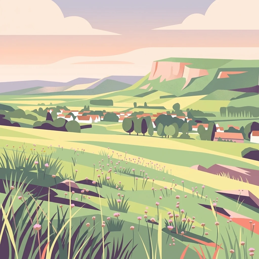
A flat-style digital illustration showing a rolling grassy landscape with wildflowers in the foreground, looking toward a small village and a large hill ridge under a soft sunset sky.

A small gypsum hill range in Thuringia protecting rare subcontinental steppe grasslands and a globally unique heavy-metal wildflower.

Bottendorfer Hügel

The Bottendorfer Hügel are a small hill range and nature reserve (Naturschutzgebiet) in the Kyffhäuserkreis district of northeastern Thuringia, Germany. They form a compact ridge roughly 2.5 kilometers long and 1 kilometer wide, oriented northwest to southeast, with their highest point reaching 206.5 meters above sea level on the Galgenberg. From a distance the hills stand out for their extensive open steppe grasslands and their almost complete lack of trees, giving them an unusually dry, exposed character for central Germany. Geologically, the Bottendorfer Hügel are a faulted cuesta-like ridge made up of gypsum and copper-bearing shale (Kupferschiefer) from the Permian Zechstein period. They rise roughly 82 meters above the floor of the nearby Unstrut valley, between the Ziegelrodaer Buntsandsteinplatte to the north and the Buntsandstein ridge of the Hohe Schrecke to the south. Their combination of gypsum-rich, metal-contaminated soils and dry microclimate has produced specialized plant communities including subcontinental brome swards and heavy-metal grasslands, the latter being the only place on Earth where the Bottendorf thrift (Armeria maritima var. bottendorfensis) occurs.

Location
Germany
Park type
Nature reserve
Area
1.3 km²
Highest point
207 m
Bottendorfer Hügel Nature Reserve Geography
Regional park map

See the ranked park cluster in its geographic setting

Nearby parks around Bottendorfer Hügel

This regional map shows the same 20 nearby parks ranked below around Bottendorfer Hügel. Select a ranked marker to highlight that park’s boundary where boundary data is available.
Reference park: Bottendorfer HügelRanked nearby parkSelected boundary: Bottendorfer Hügel20 nearby parks shown
20 nearby parks

Geographic proximity metrics and regional environmental comparisons across nearby protected landscapes

Ranked Protected Areas and Surrounding Parks Near Bottendorfer Hügel

Analyzing parks near Bottendorfer Hügel reveals a ranked sequence of geographic neighbors measured by straight-line separation rather than road routes. Evaluating these surrounding protected areas provides clear environmental comparison signals across regional conservation corridors.
A soft watercolor painting of layered green hills and forest under a pale sky, with a faded white background.
Protected landscapeThuringia
About 7.4 km away#1 closest

Southwest

Hohe Schrecke: Protected Landscape Map and Geographic Overview of Thuringian Woodlands

Mapped beech forest ridges and central German terrain.

Hohe Schrecke is a low mountain ridge in central Germany defined by expansive, unfragmented beech forests and sandstone-based topography. The area features a coherent mosaic of mature woodland, stream-cut valleys, and dry grasslands. This overview provides a structured look at the park boundaries and regional geographic context that define this protected landscape in Thuringia.

Area
42.5 km²
Established
2004
Relief
Mountain
Climate
Temperate
Nature reserveThuringia
About 24 km away#2 closest

West

Wipperdurchbruch Nature Reserve: Geographic Map and Protected Landscape Overview

Examining the Muschelkalk gorge and Hainleite ridge in Thuringia

Understand the protected geography of Wipperdurchbruch, a narrow breakthrough valley in the northern Thuringian hill country. This detailed entry maps the interplay between the meandering river, steep calcareous slopes, and ancient archaeological hilltops, defining its role within the wider regional conservation network of the Hainleite ridge.

Area
6.316 km²
Relief
Mountain
Climate
Temperate
Access
Access unknown
Watercolor painting of a green, rolling landscape with forested hills and a misty atmosphere.
Protected landscapeThuringia
About 26 km away#3 closest

West

Naturpark Kyffhäuser: Protected Landscape and Regional Geography in Thuringia

Explore ridges, gypsum karst, and wetland migration sites.

Naturpark Kyffhäuser stands as a unique protected landscape in Thuringia, bridging the gap between dramatic gypsum massifs and expansive agricultural lowlands. Its geography includes the notable Hainleite and Windleite ridges, alongside diverse habitats ranging from dry steppe slopes to the internationally recognized Kelbra reservoir. This detailed view examines the topographical and ecological features that define the park within the Unstrut catchment area.

Area
305 km²
Relief
Upland
Climate
Temperate
Access
Access unknown
A watercolor landscape painting showing a winding river flowing through a valley surrounded by gentle hills, trees, and fields.
Protected landscapeSachsen-Anhalt
About 32 km away#4 closest

Southeast

Naturpark Saale-Unstrut-Triasland Protected Landscape Geography and Regional Atlas

Mapping the geology and cultural terrain of Sachsen-Anhalt.

The Naturpark Saale-Unstrut-Triasland serves as a critical study in how river systems like the Saale and Unstrut shape central German terrain. Its status as a Geo-Naturpark reflects the area's visible Triassic rock layers, which anchor a landscape of vineyards, floodplain meadows, and historic medieval landmarks that stretch across the region.

Area
1,037 km²
Established
1991
Relief
Upland
Climate
Temperate
Nature reserveThuringia
About 34 km away#5 closest

South

Südhang Ettersberg Nature Reserve: Geographic Overview and Protected Area Boundaries

A prominent protected ridge landscape in central Thuringia

Südhang Ettersberg encompasses 408 hectares of south-facing slopes, creating a unique microclimate in the Weimarer Land district. This nature reserve serves as a benchmark for dry grassland and thermophilic woodland conservation in central Germany, offering a distinct mapped landscape that stands out from the surrounding agricultural lowlands.

Area
4.083 km²
Established
1997
IUCN
IV
Relief
Upland
Nature reserveThuringia
About 35 km away#6 closest

Southeast

Lohholz Nature Reserve: Protected Forest and Meadow Mosaic in Thuringia

Mapped deciduous woodlands and river valley meadow geography

Lohholz constitutes an isolated nature reserve in Thuringia, showcasing a distinct mosaic of broadleaf forest and traditional orchard meadows. The terrain slopes toward the Saale river valley, featuring varied grassland communities and a vital spring-fed brook. This protected area offers a look at forest preservation within a landscape predominantly utilized for agricultural purposes.

Area
0.304 km²
Established
1995
IUCN
IV
Relief
Upland
Nature reserveThuringia
About 41 km away#7 closest

South

Windknollen Nature Reserve: Mapping Protected Limestone Landscapes in Thuringia

Examining the plateau geography and former training site boundaries

The Windknollen nature reserve occupies a distinct position on the Muschelkalk limestone plateau near Jena. Its protected status reflects an evolution from historical battlefield use to a formal conservation area within the National Natural Heritage framework. The terrain is defined by exposed; dry-adapted vegetation across 185 hectares of highland geography.

Area
1.851 km²
Established
1997
IUCN
IV
A soft watercolor painting of a green landscape with trees, rolling hills, and a body of water under a light sky.
Nature reserveThuringia
42 km away#8 closest

South

Jenaer Forst Nature Reserve: Mapping the Protected Limestone Plateau and Forest Terrain

Protected nature reserve in Thuringia, Germany

Jenaer Forst is a 540 hectare nature reserve in Thuringia, characterized by dry calcareous woodland and active restoration work. The site is a study in landscape recovery, balancing forest management with the protection of orchid-rich habitats on its limestone plateau. This detailed atlas entry provides insights into the park boundaries, geological features, and ecological significance of this peri-urban forest zone.

Area
5.411 km²
Established
2008
IUCN
IV
A horizontal watercolor painting depicting rolling green hills and a dense forest canopy against a soft, light background.
Nature reserveThuringia
About 42 km away#9 closest

Northwest

Alter Stolberg Nature Reserve: Mapping the Karst Landscapes of the South Harz

A study of Zechstein geology and forested ridge geography in Thuringia

The Alter Stolberg serves as a primary example of karst topography within the South Harz Zechstein Belt, offering a compact and heavily wooded plateau landscape. This protected area includes distinct geological features like the Heimkehle gypsum cave and historical medieval ruins, illustrating the integration of natural processes and cultural history in central Germany. Explore the geographic boundaries and terrain characteristics that define this essential protected area.

Area
6.233 km²
Established
1961
IUCN
IV
Relief
Upland
Nature reserveThuringia
About 42 km away#10 closest

Southwest

Herbslebener Teiche Nature Reserve: Mapping the Wetland Mosaic and Floodplain Geography

A critical protected wetland and floodplain landscape in central Thuringia, Germany.

Herbslebener Teiche encompasses a varied landscape of reed beds, ponds, and riparian zones within the Unstrut river basin. This nature reserve provides essential habitat structure through its complex arrangement of fallow land, sedge meadows, and open water bodies, marking it as a significant protected entity in the Thuringia region.

Area
0.993 km²
Established
2000
Relief
Lowland
Climate
Temperate
Watercolor painting of a rolling landscape with green and muted red washes, depicting the Schwellenburg hill region.
Nature reserveThuringia
About 44 km away#11 closest

Southwest

Schwellenburg Nature Reserve: Mapping the Gypsum Karst Landscapes of Thuringia

A study of xerothermic grasslands and historical geological terraces.

The Schwellenburg is an elongated ridge of gypsum bedrock that creates a sharp topographic contrast to the surrounding agricultural plains of the Thuringian Basin. This nature reserve serves as an important botanical and entomological site, where historical quarrying has shaped a series of distinct, stepped terraces that host specialized, heat-loving vegetation typical of steppe environments.

Area
0.225 km²
Established
1939
Relief
Upland
Climate
Temperate
Nature reserveThuringia
About 45 km away#12 closest

West

Großer Horn Nature Reserve: Protected Forest Geography and Mapped Landscape Context

A vital woodland reference site in the Thuringian Basin.

Großer Horn is a long-standing nature reserve located in northern Thuringia, notable for its strict totalreservat core and diverse forest composition. The protected area features an intricate soil mosaic of loess loam and limestone, supporting distinct oak and beech forest communities. This isolated habitat island provides essential insight into the ecological character of the subcontinental forest transition zone.

Area
0.159 km²
Established
1961
Relief
Upland
Climate
Temperate
A soft watercolor illustration showing a panoramic view of rolling green hills, trees, and soft-toned landscape features on a plain white background.
Nature reserveThuringia
About 48 km away#13 closest

Northwest

Rüdigsdorfer Schweiz: Protected Gypsum Karst Nature Reserve in Thuringia, Germany

A rare mapped landscape of karst sinkholes and dry valleys.

Rüdigsdorfer Schweiz stands as a critical protected area in Thuringia, known for its intact gypsum karst terrain. This landscape of gentle hills, earth collapses, and soluble rock formations serves as a vital ecological anchor in the Harz foothills. Explore the geography of this nature reserve to understand its layered protection and the distinctive geological history carved into its irregular surface.

Area
3.006 km²
Established
1997
IUCN
IV
Nature reserveThuringia
About 49 km away#14 closest

West

Wöbelsburg Nature Reserve: Protected Plateau Landscapes and Geography in Thuringia, Germany

Mapped shell limestone escarpment and Iron Age hillfort site.

Wöbelsburg offers a focused look at the rugged Muschelkalk terrain characteristic of the northwestern Hainleite. As a protected nature reserve, the site features a prominent mountain spur that drops steeply toward the Wipper lowland, providing a clear example of geological undercutting and plateau formation in central Germany.

Area
0.659 km²
Established
1961
Relief
Upland
Water
Minor water
Nature reserveThuringia
About 49 km away#15 closest

South

Leutratal und Cospoth Nature Reserve: Mapping Calcareous Grasslands in Thuringia

A study of limestone slopes and orchid-rich habitats in central Germany

Leutratal und Cospoth serves as a prime example of protected Muschelkalk landscape in Thuringia. This reserve captures the complex transition between open grasslands, scrub, and beech forests within the middle Saale valley, offering deep insights into the region's unique geological and botanical heritage.

Area
5.829 km²
Established
1961
IUCN
IV
Relief
Upland
Protected landscapeThuringia
About 50 km away#16 closest

South

Landschaftsschutzgebiet Mittleres Ilmtal: Protected Landscape Geography and Map Discovery

Thuringia regional atlas and protected area profile

Gain insight into the diverse topography of Landschaftsschutzgebiet Mittleres Ilmtal, which spans roughly 150 square kilometers. This protected landscape is characterized by its dramatic shifts from Buntsandstein forests in the Tannrodaer Sattel to the elevated Muschelkalk escarpments, offering a detailed case study in German mid mountain geography.

Area
150 km²
Relief
Upland
Climate
Temperate
Access
Access unknown
Nature reserveWeimarer Land
About 50 km away#17 closest

South

Seeteich Blankenhain Nature Reserve: Geographic Map and Protected Area Context

Wetland landscape situated in the Weimarer Land district

Seeteich Blankenhain is a distinct nature reserve in Germany, characterized by its historic pond and surrounding moist lowland ecosystems. This site remains a focal point for ecological research and conservation, offering a layered landscape of reed zones and woodland that supports a diverse bird community. Its presence within the regional geography of Weimarer Land highlights the importance of small-scale wetland preservation in the Thuringian landscape.

Established
1991
Relief
Lowland
Access
Access unknown
Scope
Terrestrial
A horizontal watercolor illustration showing green rolling hills, distant light green ridges, and sparse trees against a white background.
Nature reserveThuringia
About 52 km away#18 closest

South

Spitzenberg-Schießplatz Rothenstein-Borntal Nature Reserve and Saale Valley Geography

Protected forest and grassland terrain in Thuringia

Spitzenberg-Schießplatz Rothenstein-Borntal is a protected nature reserve in Thuringia, covering hundreds of hectares of forest slopes, plateaus, and open clearings. This reserve is recognized for its unusual structural diversity, ranging from closed valley woodland to sun-exposed semi-dry grassland, providing essential habitat within the middle Saale valley region.

Area
5.542 km²
Established
1961
IUCN
IV
Nature reserveThuringia
About 52 km away#19 closest

West

Westliche Hainleite Nature Reserve: Mapping the Protected Ridgeline Landscapes of Northern Thuringia

A study of forest escarpments, erosional valleys, and Natura 2000 ecological connectivity

Westliche Hainleite is a protected nature reserve in Thuringia defined by its steep ridgeline escarpments and transitionary geography between the Hainleite range and the Dün hills. This area preserves a mosaic of woodland, cliff, and slope habitats, maintaining essential ecological continuity across the northern German hill country. Its topography is characterized by deep erosional gullies and named summits like Der Berg, which create a distinctive vertical profile within the regional landscape.

Area
9.459 km²
Established
2004
IUCN
IV
A horizontal watercolor illustration depicting soft green rolling hills and a forested ridge against a pale white background.
Protected landscapeThuringia
About 52 km away#20 closest

Southwest

Fahner Höhe Protected Landscape: Geography and Natural Terrain of the Thuringian Basin

Mapped limestone ridge and woodland protected area in central Germany

Fahner Höhe stands as a significant geological landmark in Thuringia, characterized by its long, narrow Muschelkalk ridge. The area features dense oak-hornbeam forests, deep erosional features like the Imtalgraben, and a rich variety of spring flora. As a designated protected landscape and Natura 2000 site, it offers a distinct contrast to the surrounding lowland basin, serving as a vital natural asset for the regional geography.

Area
26 km²
Relief
Upland
Climate
Temperate
Access
Easy access
Distance methodology

Geographic measurements, not driving distances

How nearby park distances are calculated

Distances use park boundaries whenever the available geometry allows it. When one or both boundaries are missing, the mapped park locations provide a clearly labelled estimate. Every value represents straight-line geographic separation and does not use roads or routing.

Boundary distance

Calculated between the nearest points of both park boundaries.

Location-to-boundary estimate

Estimated from one mapped park location to the nearest boundary of the other park.

Mapped-location estimate

Estimated between the mapped locations of both parks.

MoriAtlas Explorer

Continue Exploring the Bottendorfer Hügel Nature Reserve Landscape

Examine the mapped terrain and unique botanical characteristics of the Bottendorfer Hügel nature reserve. MoriAtlas provides a focused look at this protected ridge, allowing for deeper engagement with its geological significance, regional setting in Kyffhäuserkreis, and specialized steppe ecosystems.