
Mori Atlas logo
Nature reserveBottendorfer Hügel

Examining the unique heavy-metal grasslands and Zechstein-age topography of this protected German ridge.

Bottendorfer Hügel Nature Reserve: A Geological Cuesta Ridge and Protected Steppe Landscape

The Bottendorfer Hügel form a distinct cuesta-like ridge within the Kyffhäuserkreis district of Thuringia, Germany. Spanning a compact 2.5 kilometers in length, this nature reserve stands out for its exposed, treeless gypsum and copper-shale terrain that contrasts sharply with the surrounding forested highlands. Mapped as a rare botanical sanctuary, the area provides a vital look at subcontinental steppe vegetation and heavy-metal-adapted flora set within a structured geological corridor.

steppe grasslandheavy-metal grasslandnature reserveThuringiaKyffhäuserkreisgeology
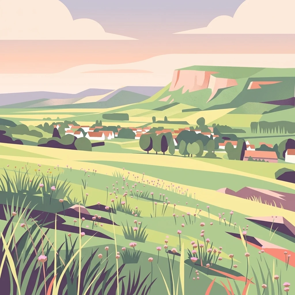
A flat-style digital illustration showing a rolling grassy landscape with wildflowers in the foreground, looking toward a small village and a large hill ridge under a soft sunset sky.

Bottendorfer Hügel

Nature reserve

Park overview

Structured park overview, official facts, and landscape profile for Bottendorfer Hügel

Bottendorfer Hügel park facts, protected area profile, and essential visitor context

Review the core facts for Bottendorfer Hügel, including designation, size, terrain, visitor scale, habitats, and operating context in one park-focused overview.

About Bottendorfer Hügel

The Bottendorfer Hügel are a small but ecologically distinctive protected area in northeastern Thuringia, occupying a low Zechstein-age ridge between two larger, forested sandstone highland blocks. Although the hills rise only modestly above the surrounding farmland and valley floors, their geological substrate, exposure, and historical land use have combined to produce a botanical landscape of unusually high scientific value.

The hills stretch for about 2.5 kilometers in length north of the village of Bottendorf and around 10 kilometers southeast of Artern, aligned on a north-west to south-east axis. Compared to nearby regions such as the Hohe Schrecke to the south and the Ziegelrodaer Forest to the north, the Bottendorfer Hügel appear strikingly bare: from a distance they are recognizable as broad, pale steppe swards almost without trees or shrubs. This openness is not incidental but reflects both edaphic conditions and centuries of grazing and other traditional land use.

What gives the Bottendorfer Hügel their particular scientific importance is the coexistence of two rare and very different dry-grassland types. On the more normal, calcium-rich substrates, subcontinental brome swards (Trespenrasen) have developed, while on the copper-rich spoil and outcrops associated with former Kupferschiefer mining, extremely species-poor heavy-metal grasslands (Schwermetallrasen) occur. These heavy-metal swards host the endemic Bottendorf thrift, a variety of the otherwise coastal strand thrift that has evolved in isolation here and is found nowhere else in the world. As a result, the reserve attracts botanists, geobotanists, and university excursions from across Germany and beyond, even though it is far smaller and less famous than many of Thuringia's larger national parks and forest reserves.

Quick facts and research context for Bottendorfer Hügel

The Bottendorfer Hügel is a designated nature reserve covering about 131.6 hectares in the Kyffhäuserkreis of Thuringia, Germany. It is a low hill ridge of Zechstein gypsum and Kupferschiefer that rises roughly 82 meters above the Unstrut valley floor, with its summit at about 206.5 meters on the Galgenberg. Since 2008 it has been one of 13 sites included in the EU LIFE project for the conservation and development of Thuringian steppe grasslands.

Protection and recognition

Documented terrestrial protection metrics and Natura 2000 designation history

Bottendorfer Hügel Protection Status and International Recognition Data

Bottendorfer Hügel maintains documented terrestrial protection status established in 2008 with associated Natura 2000 designation records. Structured metrics aggregate official administrative recognition sources and management scope for geographic analysis.

International recognition

Protection details

Protection scope
Terrestrial
Designated year
2008
Transboundary protection
No
Park context

Deeper park guide and search-rich context for Bottendorfer Hügel

Bottendorfer Hügel history, landscape, wildlife, and travel context

Explore Bottendorfer Hügel through its history, landscape character, ecosystems, wildlife, conservation priorities, cultural context, and seasonal travel timing in a structured park guide built for atlas discovery and search intent.

Why Bottendorfer Hügel stands out

The reserve is best known for harboring one of the rarest and most geographically restricted plant varieties in Germany, the Bottendorf thrift (Armeria maritima var. bottendorfensis), which grows only on the heavy-metal soils of this single ridge. Beyond that flagship species, the hills are also renowned among botanists for their unusual combination of subcontinental brome steppe and copper-shale heavy-metal grassland, set within a near-treeless, Gypsum-dominated ridge landscape that contrasts strongly with the surrounding forested highlands.
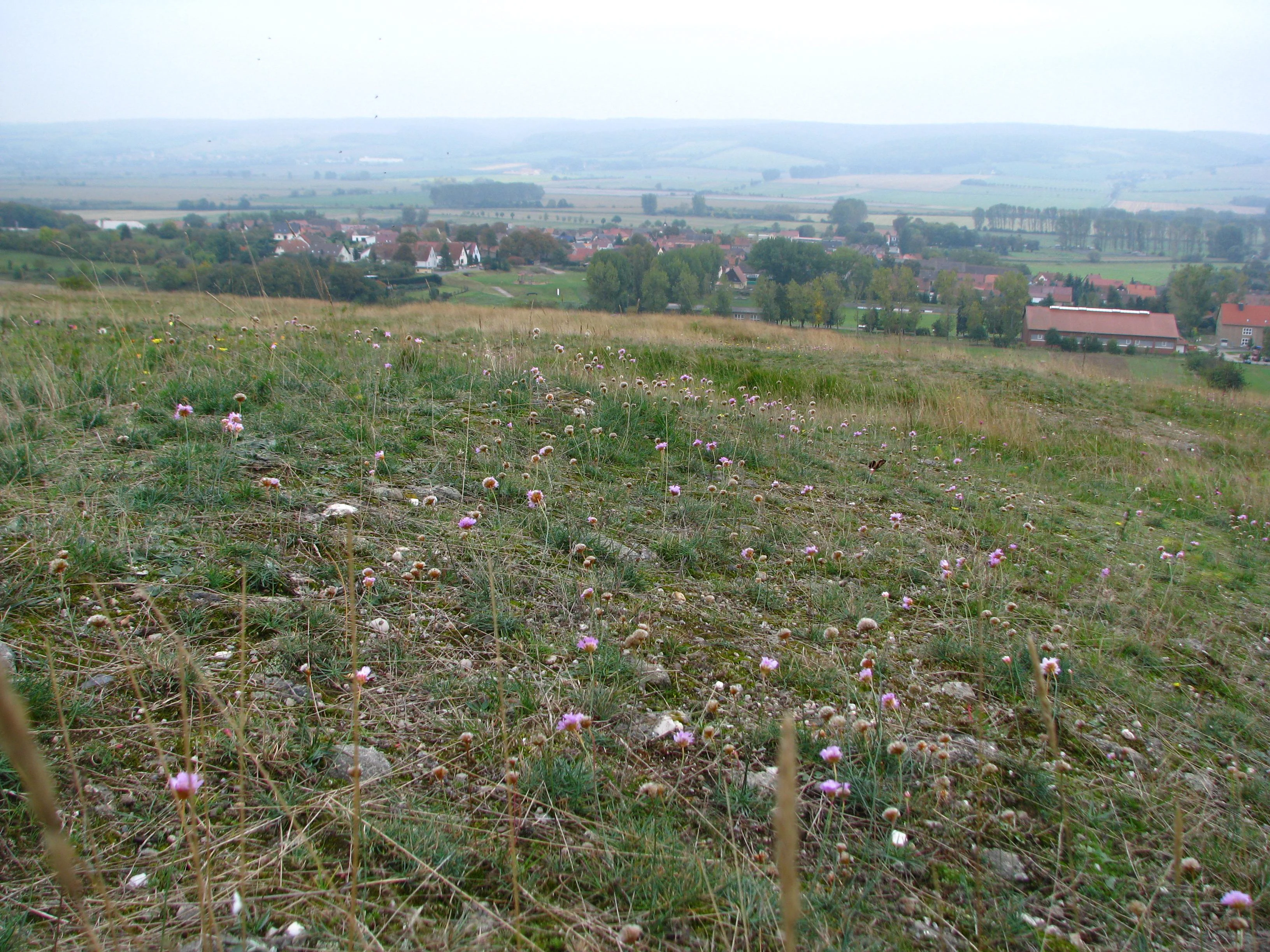
A wide angle view of grassy, stony terrain in the foreground with small pink wildflowers, leading down to a town with rooftops and rural landscape in the background under an overcast sky.
View from the Bottendorfer Hügel nature reserve overlooking the town of Bottendorf and the distant landscape of Hohe Schrecke.

Bottendorfer Hügel history and protected-area timeline

Human use of the Bottendorfer Hügel reaches back into prehistory. A burial mound on the ridge, preserved as a protected archaeological monument (Bodendenkmal), testifies to the presence of people during the Bronze Age Tumulus culture period. In the High Middle Ages, one prominent knoll was used as an execution site; the field name Galgenberg, still applied to the highest point of the ridge, preserves that function in the landscape.

The hills were also an early site of industrial mining. Kupferschiefer deposits were worked here and smelted at the Bottendorf copper smelter from 1473 until 1781, when the combination of complex geological conditions, highly variable ore grades, and low overall production led to the abandonment of the operation. Relics of this copper-shale era, including shaft collapse hollows (Einsturztrichter) and spoil heaps (Halden), are still visible within the protected area and form an important part of the present-day substrate mosaic.

During the Second World War, the commanding panoramic view from the Galgenberg made it a suitable location for a flak installation, and the remains of this wartime position were later converted into a public viewpoint. In modern times the reserve is used intensively as a teaching and excursion site for universities, and is also visited for recreation, walking, and appreciation of the open steppe-like scenery.

Bottendorfer Hügel landscape and geographic character

The Bottendorfer Hügel are a compact ridge in the Kyffhäuserkreis of northeastern Thuringia, oriented from the northwest to the southeast. The whole hill chain is around 2.5 kilometers long but only about 1 kilometer wide, with the summit Galgenberg reaching 206.5 meters above sea level. From the valley, the hills rise on average roughly 82 meters above the floor of the Unstrut; for comparison, the Unstrut dam at the western edge of Bottendorf lies near 124 meters.

Structurally, the Bottendorfer Hügel are a Schichtrippe or cuesta-like ridge that has been broken into several faulted blocks. They are built of Zechstein gypsum and Kupferschiefer, Permian rocks deposited in the vast inland sea that once covered central Germany. They sit in a clear geological corridor between two much larger and higher forested highlands: the Ziegelrodaer Buntsandsteinplatte to the north and the Buntsandstein ridge of the Hohe Schrecke to the south. This sandwich position between sandstone highlands gives the Bottendorfer Hügel a visually distinctive profile: low, pale, treeless, and conspicuously exposed against dark woodland.

Bottendorfer Hügel ecosystems, habitats, and plant life

What makes the Bottendorfer Hügel ecologically outstanding is the combination of unusual substrate and dry microclimate. Soils derived from gypsum and from metal-rich Kupferschiefer are chemically extreme; they are calcium- or sulfate-rich and, on former mining ground, contain elevated levels of heavy metals. Such soils are inhospitable to most plants, which is precisely why they support highly specialized floras that survive almost nowhere else in Germany.

Two dry grassland communities dominate. The first are subcontinental brome swards (Trespenrasen), a steppe-like vegetation type more typical of eastern European drylands than of central Germany. The second are heavy-metal grasslands (Schwermetallrasen), which appear especially where copper-bearing substrate is exposed or has been disturbed by mining. The heavy-metal swards are extremely open and low-growing, and consist almost entirely of spring sandwort (Minuartia verna) together with the locally endemic Bottendorf thrift. Together, the two grassland types give the ridge its open, almost semi-arid appearance, and the near-total absence of woody vegetation further reinforces this steppe character.

Bottendorfer Hügel wildlife and species highlights

The source material is primarily botanical, and detailed faunal information on the Bottendorfer Hügel is limited. The reserve is widely known as a botanical and geobotanical site rather than a major wildlife destination. In such small, dry, near-treeless steppe grasslands in central Germany, the typical fauna would include open-country insects such as grasshoppers and butterflies associated with thermophilic swards, as well as the usual small mammals and birds of dry farmland margins, but the available documentation focuses overwhelmingly on the flora rather than the animals.

Bottendorfer Hügel conservation status and protection priorities

The Bottendorfer Hügel has been protected as a Naturschutzgebiet covering 131.6 hectares, a designation that reflects its national-level value for dry grassland and endemic species. The heavy-metal grasslands in particular are treated as a conservation priority because they host the only known population of the Bottendorf thrift in the world; any change to substrate chemistry or land use here would directly affect a globally unique variety.

Since 2008, the reserve has been one of 13 sites included in the EU LIFE project "Conservation and Development of Thuringian Steppe Grasslands" (Erhaltung und Entwicklung der Steppenrasen Thüringens). The focus of this project, and of the reserve's broader management, is the long-term maintenance of the open steppe character: preventing encroachment by shrubs and trees, maintaining the bare and sparsely vegetated heavy-metal swards, and protecting the mineral substrate conditions that the endemic plants depend on.

Bottendorfer Hügel cultural meaning and human context

The Bottendorfer Hügel carry marks of human presence that stretch from the Bronze Age burial mound on the ridge through the High Medieval execution site on the Galgenberg to the early modern copper mining of 1473 to 1781, whose collapse hollows and spoil heaps still shape parts of the protected landscape. As a result, the reserve is not only a botanical site but also a small cultural landscape, where prehistoric funerary monuments, medieval judicial sites, and early industrial mining heritage overlap with present-day scientific and recreational use.

Top sights and standout views in Bottendorfer Hügel

The strongest features of the Bottendorfer Hügel are its globally unique heavy-metal grassland flora, especially the Bottendorf thrift; its regionally rare subcontinental brome steppe vegetation; its compact Zechstein-age gypsum and Kupferschiefer geology; and the working relics of more than three centuries of copper-shale mining. A converted wartime flak site on the Galgenberg now serves as a viewpoint, allowing visitors to see the full extent of the open ridge and its steppe-like swards against the forested Hohe Schrecke behind it.

Best time to visit Bottendorfer Hügel

Open dry grasslands and steppe swards are best appreciated in late spring and early summer, when the characteristic subcontinental grass and herb species are flowering and when the contrast between the pale, near-treeless Bottendorfer Hügel and the surrounding dark forests is sharpest. Heavy-metal grasslands tend to be visually subtle year-round because they are low-growing and sparse, so the broader scenic character of the ridge, rather than a single peak of color, is the main attraction in any season of open weather.


Monthly climate preview

Long-term temperature and precipitation averages across twelve recorded intervals

Bottendorfer Hügel Climate Normals and Monthly Weather Patterns

Representative coordinate records show average monthly temperatures ranging from sub-zero winter minimums to warm summer maximums alongside steady daily precipitation values. Detailed monthly breakdowns provide complete climatological normals for analyzing thermal and moisture variations across the landscape.
Annual mean9 °C
-1 °C19 °C
Jan-1°
Feb
Mar
Apr
May13°
Jun17°
Jul19°
Aug19°
Sep14°
Oct
Nov
Dec
Warmest month
July

18.9 °C

Coolest month
January

-0.9 °C

Wettest month
July

2.4 mm/day

Driest month
February

1.2 mm/day

Park location guide

Geography guide, regional context, and park location map for Bottendorfer Hügel

Bottendorfer Hügel park geography, regions, and map view in Germany

Understand where Bottendorfer Hügel sits in Germany through a broader geographic reading of the surrounding landscape, nearby location context, and its mapped position within the national park landscape.

How Bottendorfer Hügel fits into Germany

Germany is a federal republic in Western and Central Europe with a population of over 83 million across sixteen constituent states. It is Europe's largest economy by nominal GDP and a major global exporter and importer. The capital is Berlin, and the country borders Denmark, Poland, Czech Republic, Austria, Switzerland, France, Luxembourg, Belgium, and the Netherlands.

Wider geography shaping Bottendorfer Hügel in Germany

Germany is located in Western and Central Europe, spanning 357,022 km². It borders Denmark to the north, Poland and the Czech Republic to the east, Austria and Switzerland to the south, and France, Luxembourg, Belgium, and the Netherlands to the west. The country has coastlines on the Baltic Sea and North Sea to the north, with the Alps located in the southern region.

Map view of Bottendorfer Hügel

Use this park location map to pinpoint Bottendorfer Hügel in Germany, understand its exact geographic position, and read its mapped placement within the surrounding landscape more clearly.

Pigeon | © OpenStreetMap contributors

Location context for Bottendorfer Hügel

KyffhäuserkreisThüringen
Recorded earthquake history

Explore Historical Earthquake Records Associated with Bottendorfer Hügel

Review the documented history of seismic events recorded in the vicinity of this nature reserve. This catalogue from MoriAtlas presents specific event data and distance metrics to provide geographic context for seismic activity within the Kyffhäuserkreis landscape.

Bottendorfer Hügel Earthquake History

Catalogued events

2 events

Strongest magnitude

Magnitude 4.9

Most recent event

Sep 11, 1996

This history includes earthquakes recorded inside the park or within 50 km of its borders

Visualizing the rare steppe grasslands and gypsum ridge terrain

Bottendorfer Hügel Photos and Protected Area Scenery

Visual records capture the open steppe grasslands and unusual gypsum ridge terrain that define the protected landscape. Examining these field photographs reveals the distinctive habitats and sparse vegetation found across the nature reserve.

A wide angle view of grassy, stony terrain in the foreground with small pink wildflowers, leading down to a town with rooftops and rural landscape in the background under an overcast sky.

A close-up view of small pink, globe-shaped flowers of the Bottendorf thrift growing in a grassy field.

Park atlas

Compare adjacent regional reserves and connected geological landscapes

Parks Near Bottendorfer Hügel and Surrounding Protected Areas

Browse protected areas and natural reserves located near Bottendorfer Hügel in northeastern Thuringia. Examining surrounding regional geography provides a broader understanding of central German steppe flora and gypsum ridge terrain.
A soft watercolor painting of layered green hills and forest under a pale sky, with a faded white background.
Protected landscapeThuringia
About 7.4 km away#1 closest

Southwest

Hohe Schrecke: Protected Landscape Map and Geographic Overview of Thuringian Woodlands

Mapped beech forest ridges and central German terrain.

Hohe Schrecke is a low mountain ridge in central Germany defined by expansive, unfragmented beech forests and sandstone-based topography. The area features a coherent mosaic of mature woodland, stream-cut valleys, and dry grasslands. This overview provides a structured look at the park boundaries and regional geographic context that define this protected landscape in Thuringia.

Area
42.5 km²
Established
2004
Relief
Mountain
Climate
Temperate
Nature reserveThuringia
About 24 km away#2 closest

West

Wipperdurchbruch Nature Reserve: Geographic Map and Protected Landscape Overview

Examining the Muschelkalk gorge and Hainleite ridge in Thuringia

Understand the protected geography of Wipperdurchbruch, a narrow breakthrough valley in the northern Thuringian hill country. This detailed entry maps the interplay between the meandering river, steep calcareous slopes, and ancient archaeological hilltops, defining its role within the wider regional conservation network of the Hainleite ridge.

Area
6.316 km²
Relief
Mountain
Climate
Temperate
Access
Access unknown
Watercolor painting of a green, rolling landscape with forested hills and a misty atmosphere.
Protected landscapeThuringia
About 26 km away#3 closest

West

Naturpark Kyffhäuser: Protected Landscape and Regional Geography in Thuringia

Explore ridges, gypsum karst, and wetland migration sites.

Naturpark Kyffhäuser stands as a unique protected landscape in Thuringia, bridging the gap between dramatic gypsum massifs and expansive agricultural lowlands. Its geography includes the notable Hainleite and Windleite ridges, alongside diverse habitats ranging from dry steppe slopes to the internationally recognized Kelbra reservoir. This detailed view examines the topographical and ecological features that define the park within the Unstrut catchment area.

Area
305 km²
Relief
Upland
Climate
Temperate
Access
Access unknown
A watercolor landscape painting showing a winding river flowing through a valley surrounded by gentle hills, trees, and fields.
Protected landscapeSachsen-Anhalt
About 32 km away#4 closest

Southeast

Naturpark Saale-Unstrut-Triasland Protected Landscape Geography and Regional Atlas

Mapping the geology and cultural terrain of Sachsen-Anhalt.

The Naturpark Saale-Unstrut-Triasland serves as a critical study in how river systems like the Saale and Unstrut shape central German terrain. Its status as a Geo-Naturpark reflects the area's visible Triassic rock layers, which anchor a landscape of vineyards, floodplain meadows, and historic medieval landmarks that stretch across the region.

Area
1,037 km²
Established
1991
Relief
Upland
Climate
Temperate
Nature reserveThuringia
About 34 km away#5 closest

South

Südhang Ettersberg Nature Reserve: Geographic Overview and Protected Area Boundaries

A prominent protected ridge landscape in central Thuringia

Südhang Ettersberg encompasses 408 hectares of south-facing slopes, creating a unique microclimate in the Weimarer Land district. This nature reserve serves as a benchmark for dry grassland and thermophilic woodland conservation in central Germany, offering a distinct mapped landscape that stands out from the surrounding agricultural lowlands.

Area
4.083 km²
Established
1997
IUCN
IV
Relief
Upland
Nature reserveThuringia
About 35 km away#6 closest

Southeast

Lohholz Nature Reserve: Protected Forest and Meadow Mosaic in Thuringia

Mapped deciduous woodlands and river valley meadow geography

Lohholz constitutes an isolated nature reserve in Thuringia, showcasing a distinct mosaic of broadleaf forest and traditional orchard meadows. The terrain slopes toward the Saale river valley, featuring varied grassland communities and a vital spring-fed brook. This protected area offers a look at forest preservation within a landscape predominantly utilized for agricultural purposes.

Area
0.304 km²
Established
1995
IUCN
IV
Relief
Upland
Nature reserveThuringia
About 41 km away#7 closest

South

Windknollen Nature Reserve: Mapping Protected Limestone Landscapes in Thuringia

Examining the plateau geography and former training site boundaries

The Windknollen nature reserve occupies a distinct position on the Muschelkalk limestone plateau near Jena. Its protected status reflects an evolution from historical battlefield use to a formal conservation area within the National Natural Heritage framework. The terrain is defined by exposed; dry-adapted vegetation across 185 hectares of highland geography.

Area
1.851 km²
Established
1997
IUCN
IV
A soft watercolor painting of a green landscape with trees, rolling hills, and a body of water under a light sky.
Nature reserveThuringia
42 km away#8 closest

South

Jenaer Forst Nature Reserve: Mapping the Protected Limestone Plateau and Forest Terrain

Protected nature reserve in Thuringia, Germany

Jenaer Forst is a 540 hectare nature reserve in Thuringia, characterized by dry calcareous woodland and active restoration work. The site is a study in landscape recovery, balancing forest management with the protection of orchid-rich habitats on its limestone plateau. This detailed atlas entry provides insights into the park boundaries, geological features, and ecological significance of this peri-urban forest zone.

Area
5.411 km²
Established
2008
IUCN
IV

Common questions about visiting, size, designation, and location context for Bottendorfer Hügel

Bottendorfer Hügel FAQs for park facts, access, geography, and protected area context

Find quick answers about Bottendorfer Hügel, including protected-area facts, park geography, trail and visitor context, and how the park fits into its surrounding country and regional landscape.
MoriAtlas Explorer

Continue Your Protected Areas Search Across the Global Atlas

Deepen your exploration by continuing the structured search for national parks and protected areas worldwide. Utilize the comprehensive filtering capabilities to compare different conservation landscapes and refine your understanding of global park geography. Discover more about the distribution and characteristics of protected natural areas.

Global natural geography